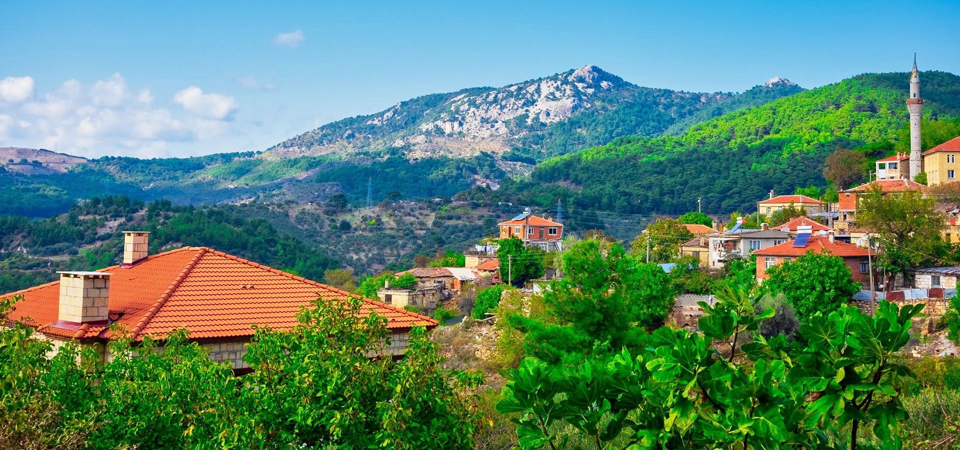
Private Kazdağı & Mount Ida Experience
Ask us about a tailor-made route combining Sütüven, Hasanboğuldu, Şahindere, Tahtakuşlar, Adatepe, olive culture and the best mountain viewpoints for your interests.
Request a Custom Tour





Rising directly behind the Gulf of Edremit in north-western Türkiye, Kazdağı is one of the country's most distinctive mountain landscapes: a place of dense forest, deep valleys, cold streams, waterfalls, rocky ridges, olive-covered foothills and stories that connect the modern mountain with ancient Mount Ida.
The protected heart of this landscape is Kazdağı National Park, declared in 1993 on the southern side of the mountain in Balıkesir Province. Official nature-conservation information gives the park an area of approximately 20,935 hectares and identifies Karataş Tepe at 1,774 metres as its highest point.
Its importance is much greater than scenery alone. Kazdağı contains exceptionally rich plant life, including species found nowhere else, and is especially associated with the Kazdağı fir. Mountain water, forest ecosystems, canyons and sharp changes in altitude create many different habitats within a relatively compact area.
For travellers, the region works on several levels at once: you can walk beside Sütüven Waterfall and Hasanboğuldu, look into Şahindere Canyon, follow permitted mountain routes with a local area guide, learn the story of Sarıkız, visit Tahtacı Türkmen villages, taste excellent olive oil, or continue north toward Adatepe, Yeşilyurt and the wider landscape traditionally identified with Mount Ida.
Walk among cold mountain streams, forest pools and rocky valleys at Sütüven, Hasanboğuldu and Şahindere.
Explore a landscape linked with Homeric tradition, the Trojan War cycle, Paris and the legendary judgement of the goddesses.
Discover a mountain famous for endemic plants, mixed forest ecosystems and the rare Kazdağı fir.
Combine nature with Tahtacı Türkmen heritage, stone villages, olive groves, regional food and the Edremit Gulf.
Essential information for planning a nature, mythology and village-focused visit to the protected southern slopes of Mount Ida.
Edremit District, Balıkesir Province, above the northern shore of the Gulf of Edremit in north-western Türkiye.
Kazdağı was declared a national park on 17 April 1993.
Current official nature-tourism information lists approximately 20,934.83 hectares within the national park.
Karataş Tepe reaches approximately 1,774 metres and forms the highest point of the protected park landscape.
The endemic Kazdağı fir is one of the mountain's most important botanical symbols.
Sütüven Waterfall, Hasanboğuldu and the streams descending from the mountain are among its defining visitor experiences.
The mountain is associated with ancient Mount Ida, repeatedly referenced in Greek mythology and the Trojan War tradition.
Some interior routes are visited with authorised area guides; access rules vary by gate, route, season and fire risk.
Balıkesir Koca Seyit Airport near Edremit is the closest airport to the southern Kazdağı area.
Allow at least 2 full days; 3–4 days gives a much better balance of waterfalls, mountain routes, villages and nearby heritage.
Kazdağı combines ecology, mythology, mountain water, rural culture and Aegean landscapes in a way few destinations in Türkiye can match.
The first reason to visit is the scale of the landscape. From the coast, Kazdağı rises dramatically behind the Gulf of Edremit. Once you enter the mountain, the sea quickly disappears behind forested slopes, deep-cut valleys and ridgelines crossed by streams. The visual change from olive groves and coastal settlements to high mountain forest can happen within a short drive.
The second reason is biodiversity. Official conservation sources describe Kazdağı as exceptionally rich in plant taxa, including dozens of species endemic to the mountain itself. Changes in elevation, moisture and exposure allow Mediterranean vegetation, oak, pine, beech and fir communities to exist within the wider mountain system.
The third reason is water. Kazdağı is famous locally for springs, creeks, pools and waterfalls. Sütüven and Hasanboğuldu are the most accessible names, but the mountain's larger ecological story is the network of valleys that carry cold water from forested heights toward the Gulf of Edremit.
Finally, Kazdağı has extraordinary cultural depth. Ancient Mount Ida belongs to the mythological geography surrounding Troy, while the modern mountain is also shaped by Sarıkız traditions, Tahtacı Türkmen culture, olive farming and stone villages. A good visit therefore includes not only scenery, but stories, people and the cultural landscape around the park.
Kazdağı National Park lies in Edremit District of Balıkesir Province, on the southern side of the Kazdağları massif. The protected slopes rise immediately behind settlements including Zeytinli, Güre, Akçay and Altınoluk, with the Gulf of Edremit stretching below.
This position explains much of the mountain's character. Moisture, altitude and topography interact across steep north-south valleys, while the lower southern slopes transition toward olive groves, villages and the Aegean coast. The result is a landscape in which mountain and sea feel unusually close together.
Travellers often use “Kazdağları” for the entire mountain region stretching across parts of Balıkesir and Çanakkale. The national park, however, is a specific legally protected area concentrated on the southern slopes in Edremit District.
This matters because many places strongly associated with a Mount Ida trip are outside the formal national park boundary. Adatepe, Yeşilyurt, the Zeus Altar area, Mıhlı, Küçükkuyu and several northern villages belong to the wider Kazdağları travel region rather than to Kazdağı National Park itself.
That is not a disadvantage. In fact, the best first visit often combines one or two protected-park experiences with nearby villages, olive culture, archaeology and the coast. Just avoid assuming that every attraction marketed as “Kazdağları” sits inside the national park.
Protected forests, approved walking routes, mountain viewpoints, Sarıkız-related highland routes, Şahindere access and official day-use areas.
Sütüven and Hasanboğuldu are closely integrated with the national-park visitor experience from the Zeytinli side.
Adatepe, Yeşilyurt, Zeus Altar, Küçükkuyu, Mıhlı and many village routes lie within the broader Mount Ida destination.
Entrance rules, guide requirements, road access and conservation regulations differ between protected park areas and ordinary villages or roads.
Kazdağı forms the highest mountain mass of the Biga Peninsula. Its terrain is cut by valleys and canyons descending from forested highlands toward the Gulf of Edremit, creating dramatic changes in elevation over relatively short distances.
Official park information describes the protected landscape as being surrounded by forest to the north, east and west, while settlements and the Gulf of Edremit lie to the south. The park's average elevation is given at approximately 885 metres, with terrain ranging from near sea level to the high ridge zone.
These height differences create very different micro-environments. Lower slopes can feel distinctly Aegean, with olive groves, maquis and warm coastal light, while interior valleys can be cool and humid even in summer. Higher forests and ridges can experience completely different weather from the coast below.
For visitors, this means that the mountain should not be treated as one uniform climate. A hot afternoon by the sea can coincide with shade, wind and much cooler temperatures on the mountain, especially at altitude or beside water.
Kazdağı is widely associated with Mount Ida of the ancient Troad, a mountain that appears repeatedly in the mythological world surrounding Troy. Its ancient reputation was tied to springs, forests, wildlife and commanding views over the surrounding landscape.
In the tradition of the Judgement of Paris, Paris was asked to choose the most beautiful among Hera, Athena and Aphrodite. His choice of Aphrodite, and her promise involving Helen, became one of the mythical chains of events leading toward the Trojan War. The story is traditionally connected with Mount Ida.
The mountain is also associated with the gods observing events around Troy, and with stories involving Zeus, Aphrodite and other figures of Greek mythology. This gives Kazdağı an unusual quality: the landscape is not merely a backdrop to ancient stories — the mountain itself is one of the characters in the mythological geography of the Troad.
Visitors should still distinguish mythology from archaeology. A mountain, viewpoint or local place name may be linked to a traditional story without being an excavated archaeological site proving that a specific mythological event occurred there. The value lies in understanding how ancient literature, local tradition and physical geography became connected over time.
Kazdağı's biological richness is one of the principal reasons for its protected status. Current official nature-tourism information states that around 1,000 plant taxa have been identified on Kazdağı and lists 32 taxa endemic specifically to the mountain.
The plant communities change with altitude and moisture. Across the wider mountain, visitors can encounter Mediterranean maquis, oak, pine, beech and other forest types, while specialised highland environments support plants adapted to the mountain's distinctive conditions.
The rugged terrain also provides habitat for wildlife. Official conservation information for the Kazdağı fir reserve lists animals including deer, roe deer, wild boar, bear, wolf and jackal within the broader protected mountain ecosystem. Wild animals should be treated as exactly that: wild, unpredictable and best observed from a respectful distance.
The mountain's combination of altitude, moisture, aspect and geology supports an unusually varied flora.
Several plants occur only on Kazdağı, making habitat protection far more important than simply protecting scenic forest.
Dense forest and difficult terrain provide refuge for mammals, birds and smaller species away from heavily visited areas.
Stay on permitted routes, do not collect plants, keep noise low and avoid disturbing wildlife or leaving food waste.
One of the most important trees associated with the mountain is the Kazdağı fir, scientifically known as Abies nordmanniana subsp. equi-trojani. Its highly restricted natural distribution makes it one of the region's most significant conservation species.
A dedicated Kazdağı Göknarı Nature Conservation Area protects a specialised forest ecosystem containing Kazdağı fir together with species such as black pine and oriental beech. Official conservation information describes the area as important for both the endemic fir and its wildlife potential.
For ordinary visitors, the important point is not to search for individual rare trees by leaving paths. The best way to appreciate the species is through guided botanical interpretation and by understanding how the fir fits into the mountain's larger elevation zones and forest ecology.
Water is one of the defining elements of the Kazdağı landscape. The mountain's valleys collect and channel rainfall and spring water, feeding streams, small cascades, waterfalls and pools that descend toward the Edremit Gulf.
This water shapes much more than visitor scenery. It supports forest ecosystems, creates humid valley habitats and has long influenced settlement and agriculture on the mountain's lower slopes. Many of the best-known recreational areas developed around places where clear mountain water is easily reached.
Water conditions are seasonal. Flows can change considerably through the year, and rock beside streams can be extremely slippery. Never assume that a calm-looking pool is safe for swimming: depth, temperature, current, submerged rocks and current local restrictions all matter.
Sütüven Waterfall is one of the best-known natural attractions associated with Kazdağı. Reached from the Zeytinli and Beyoba direction, the area combines forest, rocky stream scenery, cool air and organised day-use facilities.
Official regional tourism information describes the waterfall as dropping approximately 8 metres. The setting is especially attractive because visitors are not looking at an isolated waterfall: the surrounding creek, trees, rock formations and paths form part of the experience.
Sütüven is popular in hot weather and on weekends. For a calmer visit, arrive early, especially in summer, and combine the waterfall with the walk toward Hasanboğuldu rather than treating it as a quick roadside photo stop.
A forest waterfall and one of the most accessible introductions to the mountain's stream landscape.
Morning is generally quieter and gives more time to continue toward Hasanboğuldu before the busiest period.
Use shoes with reliable grip; wet stone, roots and polished surfaces can become slippery.
Hasanboğuldu, Zeytinli, Tahtakuşlar or a wider Edremit Gulf route.
From the Sütüven area, a walking route continues toward Hasanboğuldu, a rocky mountain pool and cascade surrounded by forest. Regional tourism information places it roughly 1 kilometre beyond Sütüven via a path following the creek.
The name is inseparable from the local Hasan and Emine legend, a tragic love story that has become one of the most widely told narratives of the Kazdağı region. Different retellings vary in detail, but the landscape itself — cold water, steep mountain paths and village-to-mountain movement — gives the story a powerful physical setting.
The pool can look inviting, especially in summer, but mountain water remains cold and natural pools can have hidden hazards. Respect current safety instructions, barriers and local rules, and avoid turning a protected stream environment into a crowded swimming site.
Explore the legend, walking access, landscape, practical advice and how to combine Hasanboğuldu with Sütüven and nearby villages.
Şahindere Canyon reveals a very different side of Kazdağı. Instead of gentle woodland recreation, the landscape opens into a deep, steep-sided valley with powerful topography and broad views over the surrounding mountain.
Current official national-park information identifies the Şahindere Canyon Glass Viewing Terrace as accessible from the park's Ayı Kapısı area, and notes that visitors can also use guided walking routes and authorised safari services in this part of the park.
The viewing terrace is useful for travellers who want to appreciate the scale of the canyon without undertaking a difficult technical route. It also demonstrates why the national park is protected for geomorphology as well as biodiversity.
Weather matters here. Strong wind, fog, rain or winter conditions can change the experience quickly, and roads within the mountain may not feel like ordinary coastal roads. Check current park access before travelling specifically for the terrace.
Sarıkız is one of the most important cultural names associated with Kazdağı. The legend exists in several local versions, but generally centres on a young woman, her father, false accusation, isolation on the mountain and a later revelation of her innocence or spiritual power.
Sarıkız Tepe became a place of memory, pilgrimage and seasonal tradition, showing how Kazdağı is not only a natural landscape but also a sacred and cultural one. The story has particular importance in the wider folk culture of the mountain and surrounding communities.
Access to the high mountain interior is not the same as visiting a normal roadside attraction. Current official park information indicates that routes from the Yalama entrance toward Sarıkız can be undertaken with an area guide. Conditions, fire restrictions, road status and seasonal management can affect access.
Do not plan Sarıkız Tepe as an improvised self-drive detour. Arrange current access, guide requirements and suitable transport in advance, especially if this is the main purpose of your visit.
Kazdağı offers excellent potential for trekking, botanical walks, landscape photography and mountain observation. Official national-park information lists nature walking, mountain activities, camping, flora-fauna observation and photography among the park's recreational possibilities.
However, visitors should not assume that every forest road or trail is open for independent wandering. Some internal routes are managed through official entrance points and authorised area guides, particularly routes extending deeper into protected mountain terrain.
This system is important for several reasons: fire prevention, visitor safety, wildlife protection, route management and reducing uncontrolled pressure on sensitive habitats. In summer, high fire risk can lead to temporary restrictions even when the weather appears suitable for hiking.
Focus on organised day-use areas, waterfall paths and clearly designated public-access routes.
Confirm whether an authorised area guide is required and arrange access before arriving at the gate.
Start early, carry water and check fire-risk restrictions; shade does not eliminate heat or dehydration risk.
Often the best balance for walking, with cooler temperatures, changing forest colour and fewer peak-season crowds.
Higher elevations can have snow, ice, fog and difficult roads even when the coast remains mild.
Do not rely only on phone signal or generic map apps for remote routes; use official route information and local guidance.
Current official park information describes three principal controlled entrance points. They serve different parts of the national park, so choosing the correct one is more important than simply navigating to “Kazdağı National Park” on a map.
Reached through Zeytinli and Mehmetalan; used for guided nature walks and access toward Sarıkız routes according to current park arrangements.
Reached through the Avcılar / Dedepınarı direction; associated with guided walks, authorised safari activities and access toward Şahindere.
Located on the Doyran / Şahindere side and associated with the glass viewing terrace, nature walks and authorised mountain activities.
An official visitor information point where travellers can learn about the national park, endemic plants and current visiting arrangements.
Road, gate and seasonal access can change. Before a mountain-focused day, check the current situation with Doğa Koruma ve Milli Parklar or your authorised local guide rather than depending on older online itineraries.
Pınarbaşı is one of the organised day-use areas associated with Kazdağı National Park. It offers a softer introduction to the mountain than a long interior trek, with forest shade, running water and a recreational atmosphere.
This type of stop works well for families, travellers with limited walking time or anyone combining several Kazdağı attractions in one day. It is also a useful reminder that not every visit needs to involve reaching a summit or completing a demanding hiking route.
Facilities, entrance arrangements and seasonal operating details can change, so check current information if you are planning around a picnic, restaurant or specific service.
The settlements around Kazdağı are essential to understanding the mountain. The national park protects natural systems, but the wider experience also includes olive-growing villages, Tahtacı Türkmen communities, stone architecture and long-established routes between coast and upland.
A practical southern gateway to the national park, the Sütüven–Hasanboğuldu route and the Yalama entrance direction.
A historic settlement between mountain and coast, useful for combining old village texture, thermal culture and Kazdağı excursions.
A village strongly associated with Tahtacı Türkmen culture and home to the well-known ethnography gallery.
A beautifully preserved stone village on the Çanakkale side of the wider Kazdağları region, close to olive heritage and the Zeus Altar route.
A mountain-foot village known for stone houses, cobbled lanes, olive trees and a quiet rural atmosphere near Küçükkuyu.
A settlement on one of the approaches into the protected park, useful as a geographic reference for the Yalama side.
Tahtakuşlar is one of the most culturally interesting villages in the Kazdağı area. The community is associated with Tahtacı Türkmen traditions, and the village ethnography gallery preserves objects connected with clothing, weaving, domestic life, belief, craft and migration memory.
Official provincial tourism information describes the gallery as having opened in 1991, with an art gallery added in 1992, and highlights its role in presenting cultural material associated with Turkish communities whose traditions reach back toward Central Asia.
The museum makes an excellent cultural counterpart to a nature-heavy itinerary. Visit it before or after the mountain and the stories, symbols and local traditions encountered in the collection give additional meaning to the wider Kazdağı landscape.
Learn about the collection, Tahtacı Türkmen culture, village context and how to include Tahtakuşlar in a Kazdağı day.
On the Çanakkale side of the wider Mount Ida region, Adatepe is one of the most atmospheric village additions to a Kazdağı itinerary. The village preserves stone houses, narrow streets and a strong relationship with the surrounding olive landscape.
GoTürkiye identifies Adatepe as a protected rural heritage settlement and highlights its olive-oil culture, restored architecture and proximity to the Zeus Altar. The nearby Adatepe Olive Oil Museum adds another layer, explaining traditional production methods and the importance of the olive economy.
The Zeus Altar area is connected through local and modern interpretation with the mythology of Mount Ida. Treat it as a scenic and cultural stop rather than as proof of a precisely identified Homeric event. Its strongest appeal is the combination of rock, olive landscape, mythological storytelling and views toward the Gulf of Edremit.
Adatepe is not inside Kazdağı National Park, but it belongs naturally in a wider two- or three-day Mount Ida itinerary.
Descend from Kazdağı toward the sea and the forest gradually gives way to one of the region's most important cultural landscapes: olive groves. The Edremit Gulf has a long-established olive-growing tradition, and olives, olive oil and seasonal harvest rhythms shape both local agriculture and cuisine.
This creates one of the best contrasts in a Kazdağı journey. In the morning you can walk beside cold mountain water under dense forest; by afternoon you can be among silver-leaved olive trees, village houses and small producers only a short distance away.
For visitors interested in food, consider an olive-oil tasting or a visit to an olive museum or producer in the wider Edremit–Adatepe–Ayvalık corridor. Autumn and early winter are particularly interesting because harvest activity makes the agricultural landscape more visible.
The food around Kazdağı belongs strongly to the North Aegean and Edremit Gulf tradition. Olive oil, wild and cultivated greens, vegetables, cheese, local olives and seasonal produce are more representative of the region than a single “mountain dish.”
Use the region as an opportunity to taste fresh extra-virgin olive oil and compare aroma, bitterness and peppery finish.
Local green and black olives appear throughout village breakfasts, markets and producer shops.
Aegean greens sautéed with olive oil are a simple but very characteristic expression of the region's plant-based cuisine.
A much-loved Aegean plant prepared in different ways according to household and season.
Cowpeas may appear as a salad, olive-oil dish or part of a broader vegetable-focused meal.
Wild fennel is used in regional cooking and can be served with meat or in herb-based preparations.
A Balıkesir-area speciality combining noodles and chicken, useful if you want something beyond Aegean greens.
One of Balıkesir's best-known desserts, traditionally made around fresh cheese and semolina-style ingredients.
Cool, green and often wet. Excellent for flowing water and fresh vegetation, but trails can be muddy and mountain weather unsettled.
One of the strongest periods for hiking, botanical interest, waterfalls and comfortable temperatures before peak summer heat.
Popular for escaping coastal heat, but weekends are busy and wildfire restrictions can affect forest access.
Excellent all-round conditions: warm coast, generally pleasant mountain weather and slightly calmer visitor numbers.
Beautiful for forest colour, photography, olive harvest culture and village stays; rain and shorter days become more important.
Quiet and dramatic, but higher routes may have snow, ice, fog or restricted access. Do not judge mountain conditions from the coast alone.
Balıkesir Koca Seyit Airport is the closest airport. Continue by private transfer, taxi or rental vehicle toward Edremit, Akçay, Güre, Zeytinli or Altınoluk.
The national park lies immediately north of the Edremit Gulf settlements. Official sources place the park roughly 16 km from Edremit, depending on the entrance used.
Drive north-east along the Gulf of Edremit toward Akçay and Zeytinli. Kazdağı works well as a full-day or overnight extension from Ayvalık.
Approach from the north via Ayvacık and Küçükkuyu. This route is especially good for combining Assos, Adatepe and the wider Mount Ida region.
Travel north through the coastal corridor toward Edremit. A private vehicle gives the greatest flexibility for combining waterfalls, villages and viewpoints.
Road conditions vary from ordinary asphalt to narrower mountain and forest roads. Use the correct entrance and follow current park guidance.
Excellent for combining mountain excursions with thermal hotels, easy road access and the Edremit Gulf coast.
Practical for restaurants, seaside walks and access toward Zeytinli, Sütüven and the southern park gateways.
A strong base for Şahindere, the western side of the national park and routes toward Adatepe and Küçükkuyu.
Best for travellers who want stone-village atmosphere, boutique accommodation and olive culture on the Çanakkale side.
A quieter village option with restored stone houses and easy access to the northern Mount Ida foothills.
The most practical urban base for transport and services, though less atmospheric than staying directly on the coast or in a village.
Choose one focused route: Sütüven + Hasanboğuldu + Tahtakuşlar, or Şahindere + Altınoluk + a village stop.
Ideal for a first visit: one day in the national park and one day for villages, olive culture and the wider Mount Ida landscape.
Best balance for guided mountain access, waterfalls, Şahindere, Tahtakuşlar and Adatepe or Yeşilyurt without rushing.
Excellent for walkers, photographers and travellers combining the mountain with Assos, Antandros, thermal experiences or the Edremit Gulf coast.
This route deliberately avoids forcing a high-mountain interior excursion into the same day. If your priority is Sarıkız, a guided trek or Şahindere, build the day around that one mountain objective instead.
Sütüven Waterfall and Hasanboğuldu, allowing enough time to walk slowly and enjoy the stream landscape.
Tahtakuşlar Ethnography Gallery, Güre and olive-country stops around the southern foothills.
Şahindere Canyon and the glass viewing terrace, subject to current park access and weather.
Continue toward Altınoluk, Adatepe and the Zeus Altar area for a broader Mount Ida mythology and village route.
If archaeology is a priority, replace part of Day 3 with Antandros Ancient City or extend the trip north toward Assos and Troy. If relaxation matters more, combine the mountain with Güre thermal facilities or an easy afternoon by the Edremit Gulf.
Overcast light or shade can be ideal for Sütüven and forest streams because it reduces harsh contrast on wet rock.
Use wider compositions to show the canyon's depth and include human scale only when it strengthens the sense of landscape.
Look beyond panoramas: bark, moss, leaves, roots, water reflections and changing forest layers tell the ecological story.
Late afternoon light reveals the silver-green texture of olive leaves on the lower slopes.
Stone walls, timber doors, narrow lanes and village life are best photographed respectfully without treating private homes as sets.
Mist and cloud can create extraordinary atmosphere, but protect equipment from sudden rain and condensation.
Kazdağı is not uniformly accessible. Natural attractions can involve uneven paths, rock, roots, slopes, steps and slippery surfaces. Some mountain routes require long walking distances or travel on rougher roads.
Travellers with reduced mobility may still enjoy parts of the region through viewpoints, village stops, lower day-use areas and vehicle-accessible scenic routes, but specific accessibility should be confirmed before travelling. The glass terrace, museum sites and individual recreation areas may each have different access conditions.
Heat is another factor. Even a short path can be tiring in summer, while cold water areas may have wet, polished rock. For travellers who need easier conditions, spring and autumn mornings are often more comfortable than peak summer afternoons.
Summer forest closures and access controls can be essential. Never bypass barriers or treat a closure as optional.
The mountain contains rare and endemic species. Leave flowers, herbs, bulbs, seeds and branches exactly where they grow.
Do not use soap, chemicals or litter in streams and pools, and avoid disturbing banks or aquatic habitats.
Shortcuts damage vegetation and can become unsafe in steep or eroded terrain.
Do not feed animals, approach young wildlife or leave food waste that changes natural behaviour.
Music and shouting carry far through valleys and reduce the experience for wildlife and other visitors.
Guide requirements, gate access and fire restrictions can change. Confirm the route before driving into the mountains.
Morning gives cooler conditions, easier parking and more flexibility if mountain plans take longer than expected.
Grip matters around waterfalls, wet rock and forest paths. Fashion sandals are a poor choice for nature routes.
The mountain can be noticeably cooler than the coast, especially in shade, wind, high elevations and after sunset.
Mountain roads and walking routes take time. Two well-chosen stops are often better than six rushed ones.
Download maps before entering remote areas, but follow official signs and guide instructions over generic route suggestions.
Do not depend on finding a café or safe drinking source at every mountain stop.
Sütüven and Hasanboğuldu can become busy in summer and on public holidays; early arrival makes a major difference.
A classic forest waterfall and one of the easiest ways to experience Kazdağı's cold mountain water.
A beautiful stream pool and cascade linked with one of the region's best-known love legends.
A dramatic canyon landscape revealing the scale, geology and steep relief of the national park.
A panoramic viewing platform providing a more accessible way to appreciate the canyon from above.
A high mountain destination associated with one of Kazdağı's most important legends and living traditions.
A forest day-use area suited to a gentler mountain stop, picnicking and cool-water surroundings.
A cultural stop associated with Tahtacı Türkmen heritage on the southern foothills.
A highly distinctive private collection presenting local and wider Türkmen cultural traditions.
A practical gateway settlement for Sütüven, Hasanboğuldu and one of the principal national-park approaches.
A village and thermal-tourism base between the mountain and the Gulf of Edremit.
A coastal base below the western Kazdağı slopes, useful for Şahindere and routes toward Çanakkale Province.
A protected stone village in the wider Kazdağları region, famous for olive heritage and atmospheric architecture.
A scenic, mythology-linked stop above the Gulf of Edremit near Adatepe.
A tranquil stone village surrounded by olive, almond and mountain-foot landscapes near Küçükkuyu.
An important archaeological site at the foot of Mount Ida, associated with the ancient Troad and the Aeneas tradition.
A stream and stone-bridge landscape in the wider Kazdağları region, useful on routes between Küçükkuyu and Assos.
Historic stone neighbourhoods, island atmosphere, olive-oil heritage, seafood and North Aegean coastal scenery.
Visit the Temple of Athena, ancient city, stone village and commanding Aegean views north of Mount Ida.
Connect the mythological landscape of Mount Ida with the archaeological site and museum that anchor the wider Trojan world.
A much closer archaeological extension with Roman houses, mosaics and strong connections to the ancient Troad.
Combine coastal settlements, thermal facilities, olive producers and seaside dining beneath the mountain.
Continue south around the gulf for beaches, coastal landscapes and another side of Balıkesir's North Aegean character.
Kazdağı National Park is in Edremit District of Balıkesir Province, on the southern side of the Kazdağları / Mount Ida massif above the Gulf of Edremit.
Kazdağı is widely associated with ancient Mount Ida of the Troad. The modern Kazdağları massif extends across a broader area than the national park itself.
It was declared a national park on 17 April 1993.
Current official nature-tourism information lists approximately 20,934.83 hectares. Different older official pages may show slightly different rounded figures.
Karataş Tepe is listed at approximately 1,774 metres.
It is especially known for forests, endemic plants, the Kazdağı fir, waterfalls, canyons, mountain streams, Sarıkız traditions and ancient Mount Ida mythology.
Not for every publicly accessible recreation area, but some interior routes are visited with authorised area guides. Always check the current requirement for your chosen entrance and route.
No. Protected-area access is controlled, and roads, gates and permitted routes vary. Use official entrance points and follow current park instructions.
Yes. Forest access can be restricted during periods of high fire danger. This is especially relevant in summer, so confirm access shortly before your visit.
Current official information identifies Yalama, Kışladağ and Ayı Kapısı as the three principal controlled entrances.
Sütüven is one of the best-known attractions associated with the Kazdağı National Park visitor area on the Zeytinli side and is commonly combined with Hasanboğuldu.
Regional tourism information describes Hasanboğuldu as approximately 1 kilometre beyond Sütüven along the creek-side route.
Do not assume swimming is safe or permitted. Mountain pools can be very cold, deep and slippery, and local safety rules may change. Follow current on-site instructions.
Şahindere is one of Kazdağı's most dramatic deep canyon landscapes, with a glass viewing terrace providing a panoramic overlook.
High-mountain access should be planned in advance. Official park information describes visits toward Sarıkız from the Yalama side with an area guide.
It is a rare fir taxon, Abies nordmanniana subsp. equi-trojani, strongly associated with the mountain and protected within a dedicated nature conservation area.
Current official park information identifies approximately 32 plant taxa endemic specifically to Kazdağı, within a flora of around 1,000 recorded taxa.
Yes. The broader protected ecosystem supports animals including deer, roe deer, wild boar, bears, wolves and jackals. Sightings are not guaranteed and wildlife should never be approached or fed.
May, June, September and October are especially good for combining walking, nature and comfortable temperatures. Spring is excellent for water flow and vegetation.
Yes. The mountain provides cooler forest conditions than the coast, but summer also brings larger crowds and greater wildfire restrictions. Start early and check access first.
Yes. Higher parts of the mountain can receive snow and experience winter road conditions even when coastal settlements remain relatively mild.
Two to three days is ideal for a first visit combining waterfalls, a national-park route, villages and the wider Mount Ida cultural landscape.
Yes. The southern Kazdağı area works well as a long day trip from Ayvalık, especially if you focus on Sütüven, Hasanboğuldu and one cultural stop.
No. Adatepe is part of the wider Kazdağları / Mount Ida travel region on the Çanakkale side, but it is not inside the formal national park.
No. The commonly visited Zeus Altar area is near Adatepe in the wider Mount Ida region rather than inside Kazdağı National Park.
Balıkesir Koca Seyit Airport near Edremit is the closest airport to the southern Kazdağı area.
A car or private transfer is extremely useful because attractions are spread across different villages, park gates and mountain roads. Guided transport is preferable for protected interior routes.
Yes, if you choose suitable routes. Waterfall areas, villages and gentle day-use sites can work well, while long mountain hikes and slippery stream paths require more caution.
Yes, but route planning must respect protected-area rules, guide requirements, fire restrictions and seasonal conditions. Do not treat every visible forest track as an unrestricted trail.
Bring good walking shoes, water, sun protection, a light layer, rain protection when appropriate and an offline map. For interior routes, follow any additional equipment advice from your guide.
Look for Edremit olives and olive oil, Aegean herbs, vegetable dishes, börülce, şevketibostan, saçaklı mantı and höşmerim, depending on season and restaurant.
Absolutely. Kazdağı, Adatepe, Küçükkuyu and Assos form one of the strongest North Aegean nature-and-history routes in western Türkiye.
Yes. A multi-day route linking Mount Ida, Assos and Troy is especially rewarding for travellers interested in the ancient geography of the Troad and Trojan mythology.
No. It is equally interesting for travellers focused on mythology, village culture, ethnography, olive heritage, photography, archaeology and regional food.
A private Kazdağı itinerary can focus on waterfalls, guided nature, mythology, villages, olive culture, photography, archaeology or a wider North Aegean route combining several themes.
Tell us whether your priority is nature, hiking, mythology, village culture, waterfalls, photography, food, archaeology or a combination, and we can shape the route around your available time and travel style.
Ask us about a tailor-made route combining Sütüven, Hasanboğuldu, Şahindere, Tahtakuşlar, Adatepe, olive culture and the best mountain viewpoints for your interests.
Request a Custom Tour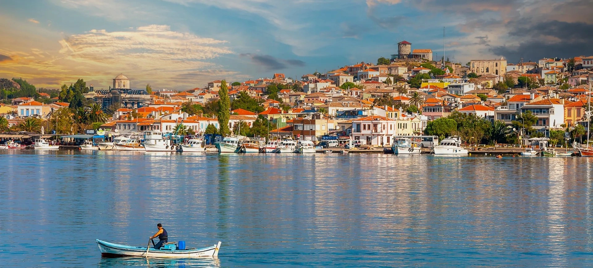
Continue through the province with Edremit Gulf, Ayvalık, Cunda, Burhaniye, Gömeç, thermal areas, olive landscapes and the wider North Aegean coast.
View Balıkesir Guide