Private Justinian Bridge & Sakarya Tour
Ask us about a tailor-made route focused on the Sangarius Bridge, Early Byzantine history, Roman engineering, archaeology and the cultural landscape around Adapazarı and Serdivan.
Request a Custom Tour





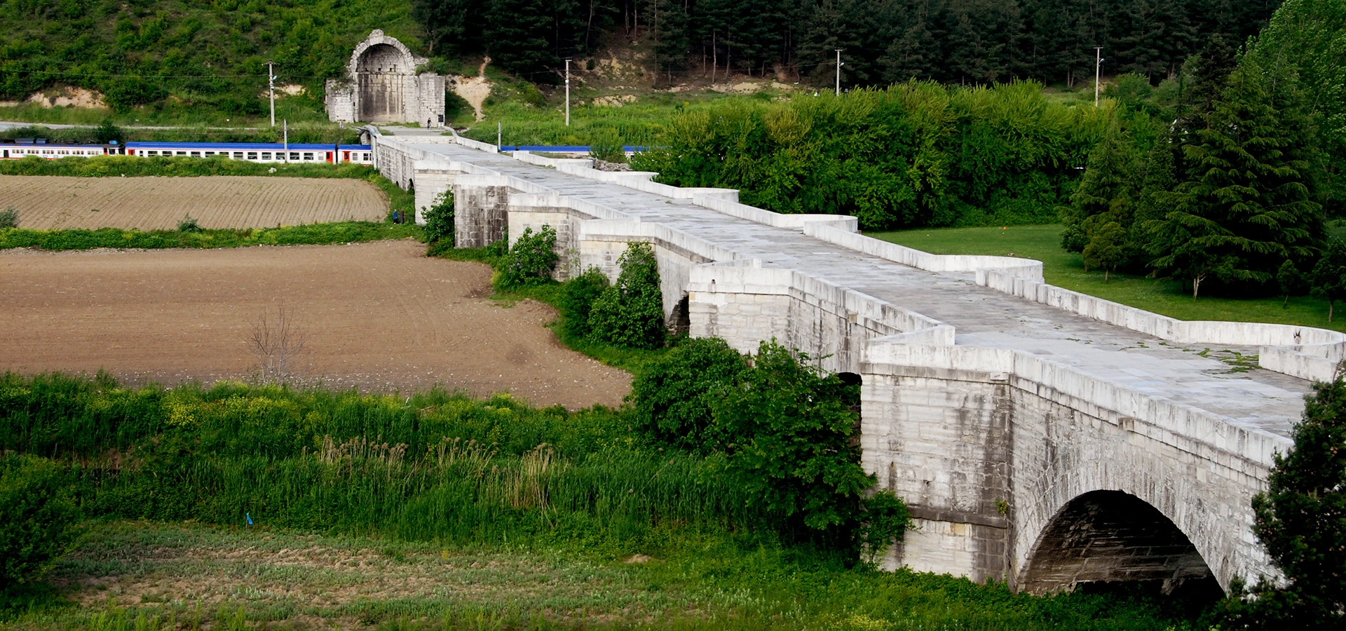
The Bridge of Justinian, also known as the Sangarius Bridge, Justinianus Bridge and locally as Beşköprü, is one of the most impressive surviving monuments of the Early Byzantine period in Anatolia. It stands in the Serdivan district of Sakarya, around 5 kilometres southwest of central Adapazarı.
The monumental limestone bridge was commissioned by Emperor Justinian I, who ruled the Eastern Roman Empire from 527 to 565. Construction began in the late 550s and the bridge was completed by AD 562, creating a permanent stone crossing on one of the empire's most important roads between Constantinople and the eastern provinces.
The bridge measures approximately 365 metres including its abutments, is about 9.85 metres wide and has 12 arches. Seven great central arches form the monumental core, while five smaller openings helped manage floodwater at the approaches.
Following a long restoration and archaeological program, the historic Sangarios Bridge was officially reopened in 2026. Today visitors can once again walk through a landscape that combines Roman engineering, Early Byzantine imperial ambition, archaeological remains and one of Sakarya's most important historic landmarks.
Built during the reign of Emperor Justinian I at the height of his imperial construction program.
Seven monumental central arches are complemented by five smaller flood-relief openings.
One of the largest and most impressive surviving Roman-period bridges in Anatolia.
The bridge was added to Türkiye's UNESCO World Heritage Tentative List in 2018.
Essential information for visiting Sakarya's extraordinary Early Byzantine bridge.
Beşköprü / Serdivan, approximately 5 km southwest of central Adapazarı in Sakarya Province.
Open on Google MapsLate Roman / Early Byzantine period, built during the reign of Emperor Justinian I.
Construction began in the late 550s and the bridge is known to have been completed by AD 562.
Approximately 365 m long including the abutments and about 9.85 m wide.
12 arches in total: seven monumental central arches and five smaller subsidiary openings.
Allow around 45–90 minutes for the bridge, archaeological remains and photography.
The bridge combines imperial strategy, monumental architecture and sophisticated Roman engineering.
The Bridge of Justinian was not built as an isolated local crossing. It formed part of the great transportation network that connected Constantinople with the Roman Empire's eastern territories. This route had military, administrative and commercial importance, especially at a time when the eastern frontier faced the powerful Sasanian Empire.
Before the stone bridge was constructed, ancient sources describe a less reliable timber or pontoon crossing that could be damaged or swept away during floods. Justinian's solution was characteristically ambitious: replace a vulnerable crossing with a massive permanent structure capable of carrying the imperial road across the floodplain.
The bridge is also important because so much of its original form survives. Its long masonry deck, great central arches, unusual pier shapes, supplementary hydraulic structures and archaeological remains preserve evidence of the technical knowledge available to late Roman engineers.
For travelers following our guide to places to visit in Sakarya, the Justinian Bridge is one of the province's most important historic sites and an excellent cultural counterpart to Sapanca Lake, Taraklı and Acarlar Floodplain Forest.
Justinian I ruled the Eastern Roman Empire from AD 527 to 565. His reign was marked by military campaigns, legal reform and an extraordinary program of monumental construction.
The same emperor responsible for rebuilding Hagia Sophia in Constantinople also invested heavily in fortifications, churches, roads, aqueducts and bridges across the empire. These projects were not merely decorative: they supported military movement, administration, trade and the projection of imperial authority.
The Sangarius crossing fitted directly into that strategy. A reliable bridge west of the Anatolian interior improved communication between the capital and the eastern provinces, turning a difficult river crossing into a permanent piece of imperial infrastructure.
The reign of Emperor Justinian I, one of the most important rulers of the Eastern Roman Empire.
Roads and bridges helped troops, officials, messengers and goods move across the empire.
The bridge belongs to the same remarkable age of imperial construction as Justinian's Hagia Sophia.
The crossing strengthened links between Constantinople and territories facing the empire's eastern frontier.
Justinian's building program combined architecture, logistics, military planning and civic infrastructure.
The bridge demonstrated both practical engineering skill and the power of the imperial state.
Modern sources sometimes give slightly different construction dates, usually ranging from AD 558 to 562. This is not unusual for a monument known through several ancient texts written at different stages of the work.
The historian Procopius, who recorded Justinian's building projects, described the bridge while construction was still in progress. Other writers, including Agathias and Paul the Silentiary, celebrated the completed monument. The surviving literary evidence places completion in AD 562.
For visitors, the simplest way to understand the chronology is that the bridge was built during the final years of Justinian's reign, with construction underway around 558–560 and the monumental crossing completed by 562.
The bridge is built predominantly from large blocks of limestone masonry. Its scale is immediately striking: the structure stretches for roughly 365 metres including the abutments and carries a roadway almost 10 metres wide.
At its center are seven large arches, each spanning roughly 23 metres. These are supplemented by five smaller arches positioned toward the approaches, creating a total of 12 openings. The smaller arches helped relieve water pressure during floods.
The bridge's piers are especially interesting. Their substantial projecting buttresses were shaped to interact with moving water and to reduce destructive pressure against the masonry. UNESCO documentation highlights the unusual combination of rounded and pointed forms as one of the structure's distinctive engineering features.
Approximate length including the abutments in the official heritage description.
An unusually broad deck for a surviving bridge of this period.
The monumental central arches form the visual and structural heart of the bridge.
Subsidiary openings helped accommodate overflow near the bridge approaches.
Large limestone blocks create the bridge's heavy, durable masonry construction.
Strong pier buttresses were designed to manage hydraulic pressure and protect the arches.
The bridge's twelve openings were not designed as twelve identical arches. Instead, the engineers created a hierarchy of spans that responded to the main water channel and the wider floodplain.
The seven great central arches are the most visually impressive. Their broad semicircular openings allowed the main body of water to pass between heavy stone piers. Toward the ends, the bridge transitions into smaller subsidiary arches.
This combination reduced the risk of floodwater becoming trapped behind a solid embankment. It also allowed the long approach structure to remain integrated with the river landscape.
Seven broad arches create the monumental central crossing.
The main arch spans are roughly 23 metres each according to UNESCO documentation.
Five smaller arches provided extra capacity when floodwater spread beyond the main channel.
The arches rise from substantial masonry supports designed for a powerful river environment.
The repeated openings give the bridge its extraordinary visual rhythm across the floodplain.
Step away from the deck where permitted to appreciate the sequence of arches as a complete structure.
One of the first things visitors notice is the apparent mismatch between the enormous bridge and the much smaller watercourse visible today. The bridge was constructed for the ancient Sangarius — the Sakarya River, yet the modern main river channel now lies several kilometres to the east.
Today the bridge crosses the smaller Çark Deresi, known in Antiquity as the Melas. This stream drains water from nearby Sapanca Lake toward the Sakarya basin.
Historical and geomorphological evidence indicates that the main river shifted eastward during the Middle Ages, probably reaching something close to its modern course by the 13th century. The bridge therefore survived even after the landscape around it changed dramatically.
The bridge originally carried the imperial road across the river known today as the Sakarya.
Only the smaller stream connected with Sapanca Lake now passes through part of the bridge system.
The main Sakarya River gradually changed course and now flows several kilometres farther east.
The bridge's long form and smaller relief arches reflect the broad hydrological landscape it once crossed.
The major river-course shift is generally associated with the medieval period, probably by the 13th century.
The bridge preserves evidence not only of history but also of long-term environmental change.
The Justinian Bridge was conceived as a monumental architectural complex, not simply a line of arches across a river. Ancient and early modern descriptions record additional structures at both ends of the crossing.
At the western side there was once a monumental entrance or triumphal arch. Although the complete arch no longer survives, historic drawings and archaeological remains help reconstruct the ceremonial character of the bridge approach.
At the eastern end are the remains of a large apsed structure. Its original function is uncertain. Because of its form and orientation, it has sometimes been interpreted as a ceremonial or religious feature, but no single explanation is universally accepted.
The bridge also had supplementary vaulted masonry and hydraulic structures that helped manage the flow of water around the crossing. Recent restoration and excavation have made the wider archaeological setting far easier to understand.
Remains survive from the monumental gateway that once emphasized the approach to the bridge.
A large apsed monument at the eastern side remains one of the site's architectural mysteries.
Additional masonry structures reveal that the crossing was more complex than the bridge deck alone.
Supplementary hydraulic elements helped protect the bridge from strong and changing currents.
19th-century documentation preserves evidence for architectural elements that no longer stand intact.
The surrounding remains help explain the bridge as part of a larger transport and service landscape.
The modern Turkish name Beşköprü literally means "Five Bridges," but this is misleading: the monument does not have five bridges and does not have only five arches.
The name appears to have developed through a long linguistic transformation. The bridge was once referred to simply with the Latin word pons, meaning "bridge." Later Greek-speaking communities treated the word as if it were a proper name and used forms such as Pontogephyra, effectively meaning "Pons Bridge."
Over time the name changed further into forms resembling Pentegephyra, which could be understood as "Five Bridges." The Turkish form Beşköprü continued that later interpretation.
The Bridge of Justinian was submitted to the UNESCO World Heritage Tentative List in 2018 under cultural criteria (iii) and (iv). The nomination highlights the bridge's historic, technological and architectural importance.
UNESCO documentation emphasizes its exceptional survival, its relationship with Justinian's imperial transportation network and the distinctive engineering of its pier buttresses. It also identifies the bridge as an outstanding example of late Roman architectural and technical knowledge.
A place on the Tentative List does not mean that the bridge is already inscribed on the World Heritage List. Rather, it identifies the site as a property Türkiye may consider for future nomination.
Türkiye submitted the Bridge of Justinian to the UNESCO World Heritage Tentative List.
The nomination recognizes the bridge as exceptional testimony to Justinian's imperial transport and military system.
The structure is presented as an outstanding example of late Roman engineering and public works.
The UNESCO property is identified within Sakarya Province's Serdivan district.
The site is a candidate on Türkiye's Tentative List rather than a fully inscribed World Heritage Site.
Its surviving masonry, arches and associated remains preserve much of the monument's original form.
A major conservation and archaeological program began around 2018. The project addressed the bridge's stone fabric, arches, piers, associated structures and the archaeological landscape around the monument.
During the works, archaeologists documented a range of finds and structures in the surrounding area. Reported discoveries included bronze coins, marble architectural fragments, inscriptions, small bronze objects and remains associated with baths, a cistern and vaulted buildings.
The restoration also improved the presentation of the site, with conservation of original stonework, strengthening where required, landscape organization, visitor circulation and architectural lighting.
The restored historic Sangarios Bridge was formally opened on 31 July 2026, bringing the monument back into active cultural and visitor use after years of restoration.
The long restoration and excavation phase began around the same period as the UNESCO Tentative List submission.
Work around the bridge revealed architectural remains and portable finds from the surrounding historic complex.
The bridge's piers, arches and masonry were repaired with emphasis on preserving original character.
Associated remains such as the entrance area, bath, cistern and other structures were incorporated into visitor interpretation.
New lighting was introduced to improve presentation while respecting the historic identity of the monument.
The restored Sangarios Bridge was officially reopened to visitors.
The recent excavations have strengthened the idea that this was more than a stand-alone river crossing. The landscape around the bridge supported infrastructure connected with travel, logistics and activity along the imperial route.
Among the reported architectural discoveries are remains of a bath complex, a cistern that supplied water, vaulted structures and additional spaces around the bridge approaches.
Portable finds recovered during the wider project include bronze coins, a marble capital decorated with a cross, marble columns and fragments, inscription pieces and small bronze objects. Together they help archaeologists reconstruct how the area functioned over time.
Excavated remains indicate services and activity around the strategic crossing.
A water-storage structure reflects the infrastructure required around a busy transport corridor.
Columns, fragments and a cross-decorated capital add to the architectural evidence from the site.
Coins recovered during excavation contribute chronological evidence for activity around the bridge.
Marble inscription pieces are among the discoveries documented during the restoration period.
New archaeological evidence continues to refine how historians understand the wider bridge complex.
The monument is best appreciated slowly. Rather than simply crossing from one side to the other, look at how the bridge's architecture changes along its length and how the archaeological remains relate to the approaches.
Stand back where possible to appreciate the monumental scale and rhythm of the central spans.
Notice how subsidiary openings extend the bridge across the broader floodplain.
Study the unusual rounded and pointed water-management forms projecting from the bridge piers.
Look for the surviving evidence of the monumental entrance that once marked the bridge approach.
Examine the remains at the eastern side and consider the still-debated original function.
Compare original masonry surfaces with carefully conserved and stabilized areas.
The surrounding remains help explain the crossing as a larger transport and service complex.
Observe the small modern watercourse and imagine the much greater ancient Sangarius River landscape.
The restored bridge reopened in 2026 after an extensive conservation and archaeological project. The site is now one of the most important historic stops within the greater Adapazarı–Serdivan urban area.
Because archaeological sites can occasionally be affected by maintenance, events or conservation work, travelers with a tightly timed itinerary should still check current local access arrangements before departure.
Begin from the visitor approach and first look for a side view that reveals the bridge's full horizontal scale. This is the best moment to understand why the structure was far more than an ordinary local crossing.
Continue toward the western end and examine the surviving entrance-area remains before walking onto the bridge. As you move across, watch how the seven great central arches transition toward smaller openings.
Pause above the major piers to study the projections and water-management forms. Then continue toward the eastern side, where the apsed and supplementary remains add another layer to the monument's architectural story.
Finish by looking back toward the full bridge profile and the archaeological landscape around it. If you are continuing through Sakarya, the site combines particularly well with Sapanca Lake or central Adapazarı.
The bridge can be visited throughout the year, but weather and light strongly affect the experience. Because much of the site is exposed, spring and autumn are especially comfortable.
Mild temperatures and green surroundings make this one of the most pleasant seasons for walking and photography.
Visit in the morning or later afternoon to avoid the strongest midday heat and glare.
Comfortable temperatures and softer light work well for long side views of the limestone structure.
The bridge remains atmospheric in cooler weather, but exposed stone surfaces can be wet and slippery.
Often best for quieter conditions and comfortable walking, especially in warm months.
Lower-angle light can reveal texture in the arches, piers and limestone masonry.
Enough for a quick walk, several photographs and a basic look at the arches and bridge deck.
A comfortable first visit with time to examine the pier forms and archaeological remains.
Best for history lovers, careful photography and reading the site as a complete archaeological complex.
Allow this if you enjoy architectural detail, slow photography or detailed historical interpretation.
Combine the bridge with central Sakarya, local museums, food and another nearby cultural stop.
Pair the Justinian Bridge with Sapanca Lake, Taraklı or another wider Sakarya destination.
The bridge is one of Sakarya's strongest architectural photography locations. Its long horizontal profile, repeating arches, massive piers and pale limestone create very different compositions depending on where you stand.
Move far enough away to show the bridge's extraordinary length and repeating arch rhythm.
Use perspective to emphasize the scale of the main central openings.
Photograph the rounded and angular buttress forms that distinguish the bridge's engineering.
Side light reveals weathering, tooling and joints in the limestone masonry.
The long bridge deck creates powerful perspective lines toward the opposite approach.
Do not climb on fragile remains or cross barriers simply to obtain a photograph.
The bridge is far easier to approach than a remote archaeological site, but visitors should remember that it is a 1,500-year-old stone monument with archaeological areas around it.
Restoration has improved visitor circulation, yet exact accessibility can vary between the bridge deck, approach areas and excavated remains. People with limited mobility should check current surface and access arrangements before a dedicated visit.
The bridge lies close to Adapazarı and Serdivan rather than in an isolated rural location.
Historic paving can be uneven and requires more care than a modern sidewalk.
Confirm the current accessible route between parking, the bridge deck and interpretive areas.
Possible in many areas, though uneven historic surfaces can make movement slower.
Stone paving can become slippery in wet weather; choose footwear with good grip.
Excavated remains may not provide the same level of step-free access as the principal visitor route.
The Justinian Bridge stands in the Beşköprü area of Serdivan, approximately 5 kilometres southwest of central Adapazarı. Its urban-edge location makes it one of Sakarya's easiest major historic monuments to add to a day itinerary.
The bridge is only a short drive from the city center, depending on traffic and your starting point.
Local roads provide direct access toward the Beşköprü / Maltepe area surrounding the monument.
The bridge can be combined easily with Sapanca Lake on a broader Sakarya sightseeing route.
A day trip is possible by private vehicle, especially when paired with Sapanca or another nearby stop.
The most flexible option if you plan to combine several Sakarya attractions in one day.
Because the bridge is close to the urban area, taxi access is generally more practical than at remote archaeological sites.
The bridge works well as part of a cultural-and-nature itinerary around Adapazarı, Serdivan and Sapanca. Use our complete Sakarya visitor guide to continue exploring the province.
Continue toward one of Sakarya's best-known landscapes for lake views, walking and forested mountain scenery.
Add a museum stop in Adapazarı for a broader introduction to the archaeology and history of the province.
Explore one of Adapazarı's historic religious landmarks and continue through the central city area.
Combine Byzantine engineering with a quieter lake-and-woodland landscape north of the city.
Continue deeper into Sakarya for Ottoman houses, historic streets and traditional small-town architecture.
See one of Sakarya's most important wetland ecosystems, with flooded woodland, lilies and birdlife.
Discover Roman and Byzantine remains, lakes, forests, Ottoman towns, Black Sea landscapes and local cuisine.
The bridge is in the Serdivan district of Sakarya Province, around 5 km southwest of central Adapazarı.
It is also known as the Sangarius Bridge, Justinianus Bridge and locally as Beşköprü.
It was commissioned by Eastern Roman Emperor Justinian I, who ruled from AD 527 to 565.
Construction took place in the late 550s and early 560s. Ancient literary evidence indicates that the bridge was completed by AD 562.
The official heritage description gives a length of approximately 365 metres including the abutments. Some sources round or measure the structure differently and may give figures closer to 350 or 370 metres.
It is approximately 9.85 metres wide, an impressive width for a surviving bridge of its period.
The bridge has 12 arches: seven monumental central arches and five smaller subsidiary openings.
The name developed through historical linguistic changes and does not describe the actual number of arches. "Beşköprü" is a traditional place-name rather than an architectural count.
It was built across the ancient Sangarius River, the river now known as the Sakarya.
The main river changed course over the centuries and now lies farther east. Today the bridge spans the much smaller Çark Deresi, the ancient Melas.
It improved transportation and communication on the strategic road linking Constantinople with the Eastern Roman Empire's eastern provinces.
Ancient accounts describe an earlier timber or pontoon crossing that was vulnerable to floods. Justinian's stone bridge created a far more permanent solution.
Not yet. It has been on Türkiye's UNESCO World Heritage Tentative List since 2018. Tentative List status is different from full World Heritage inscription.
Its nomination emphasizes its exceptional survival, late Roman engineering, monumental architecture and connection with Justinian's imperial transportation system.
Yes. The bridge was officially reopened in 2026 following a major restoration and archaeological project. Temporary site-management restrictions can still occur.
The restored Sangarios Bridge was officially opened on 31 July 2026 after years of conservation and excavation work.
Reported finds include bronze coins, marble architectural fragments, inscription pieces and small bronze objects, while excavated structures include a bath complex, cistern and vaulted remains.
The western side preserves evidence of a monumental entrance, while the eastern side includes remains of a large apsed structure and other associated masonry.
Its original function is uncertain. It may have had a ceremonial or religious role, but the interpretation remains debated.
Most travelers should allow around 45–90 minutes. History and architecture enthusiasts may prefer longer.
Morning and late afternoon are usually best for comfortable walking and more attractive light on the limestone masonry.
Yes. It is an easy historic stop close to the city, although children should be supervised around archaeological remains and any unprotected edges.
Parts of the restored visitor route may be accessible, but historic paving and archaeological areas can be uneven. Confirm current step-free access before a dedicated visit.
No. The historic bridge was closed to motor traffic decades ago and is preserved as a cultural monument rather than a modern road crossing.
Do not assume drone use is permitted at a protected archaeological site. Check current Turkish aviation and heritage-site rules before flying.
Yes. It works especially well as part of a private day trip combining Sakarya with Sapanca Lake.
Good combinations include Sapanca Lake, central Adapazarı, Poyrazlar Lake, Taraklı and other attractions in our Sakarya guide.
Avoid climbing on parapets, archaeological walls, piers or fragile masonry for photographs.
Restricted zones protect both visitors and archaeological remains; do not cross them.
Every fragment belongs to the archaeological context, even if it appears loose or insignificant.
Never carve names, symbols or marks into ancient or restored stone surfaces.
Use bins where provided and take all waste with you.
Access arrangements can change for conservation, archaeological work or special events.
Do not step onto unstable archaeological remains simply to improve a camera angle.
Treat the bridge as an archaeological monument rather than an ordinary recreational structure.
Combine the 6th-century Sangarius Bridge with Sapanca Lake, Adapazarı, Ottoman towns and Sakarya's wider cultural landscape through a private route shaped around your interests.
Choose a focused visit to the Justinian Bridge or a full-day private route combining Roman and Byzantine heritage, local history, lake scenery and traditional towns.
Ask us about a tailor-made route focused on the Sangarius Bridge, Early Byzantine history, Roman engineering, archaeology and the cultural landscape around Adapazarı and Serdivan.
Request a Custom Tour
Discover Roman and Byzantine monuments, lakes, wetlands, waterfalls, Ottoman towns, mountain landscapes, Black Sea scenery and local food across Sakarya Province.
View Sakarya GuideConnect the Justinian Bridge with Sakarya's best-known natural and historic destinations.
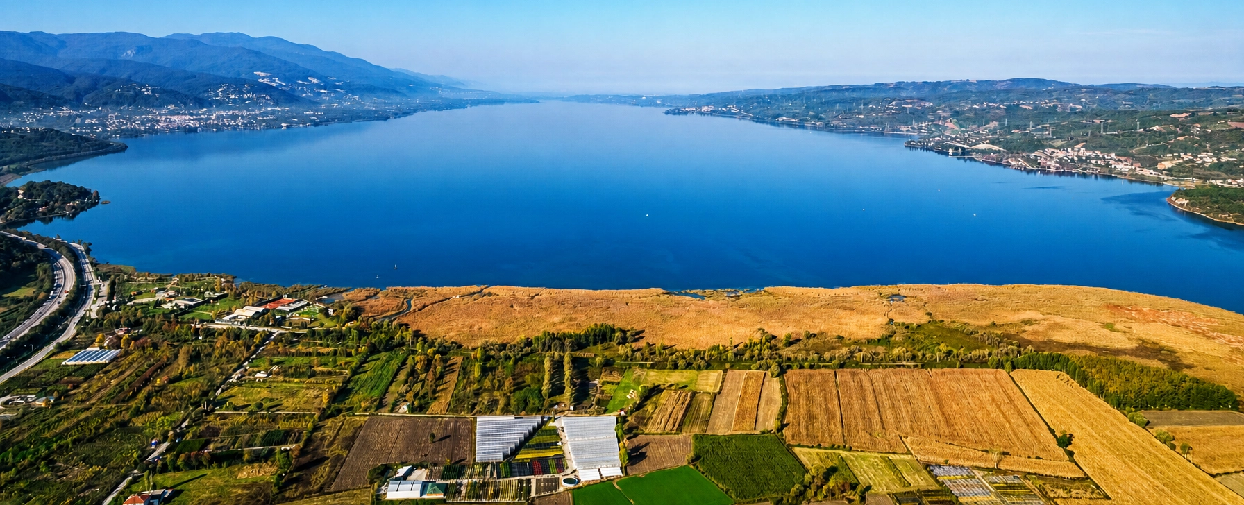
Continue west for freshwater scenery, forested mountains, lakeside walking and one of Sakarya's best-known landscapes.
Explore Sapanca Lake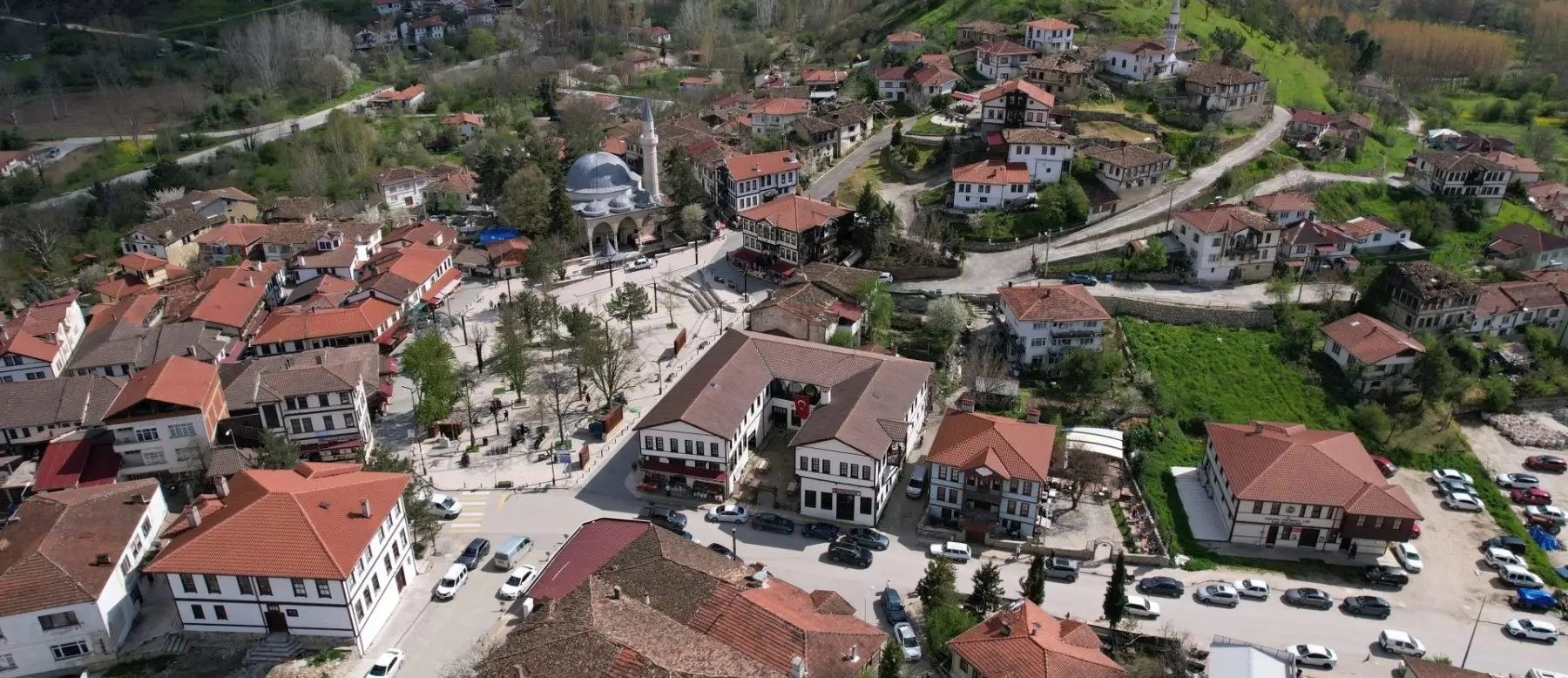
Continue inland for Ottoman houses, historic streets, Yunus Paşa Mosque and traditional small-town atmosphere.
Explore Taraklı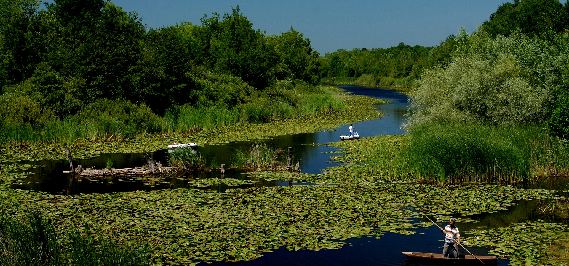
Contrast Sakarya's Byzantine heritage with flooded woodland, wetland ecology, water lilies and birdlife in the north.
Explore Acarlar