Private Kula–Salihli UNESCO Global Geopark Experience
Share your dates, group size and interests. We will propose a sensible route and confirm access before booking.
Request Your Private Programme





Kula–Salihli UNESCO Global Geopark is one of Türkiye's most extraordinary outdoor classrooms. Dark lava fields, volcanic cones, basalt columns and eroded fairy chimneys reveal how fire, water and tectonic movement reshaped western Anatolia.
The geopark is not a single fenced attraction. It stretches across the Kula and Salihli districts, joining geological features with villages, historic streets, craft traditions and archaeological landscapes.
UNESCO Global Geopark status recognizes geological heritage, education and sustainable local development. It is a different designation from the UNESCO World Heritage inscription of Sardis and Bin Tepe.
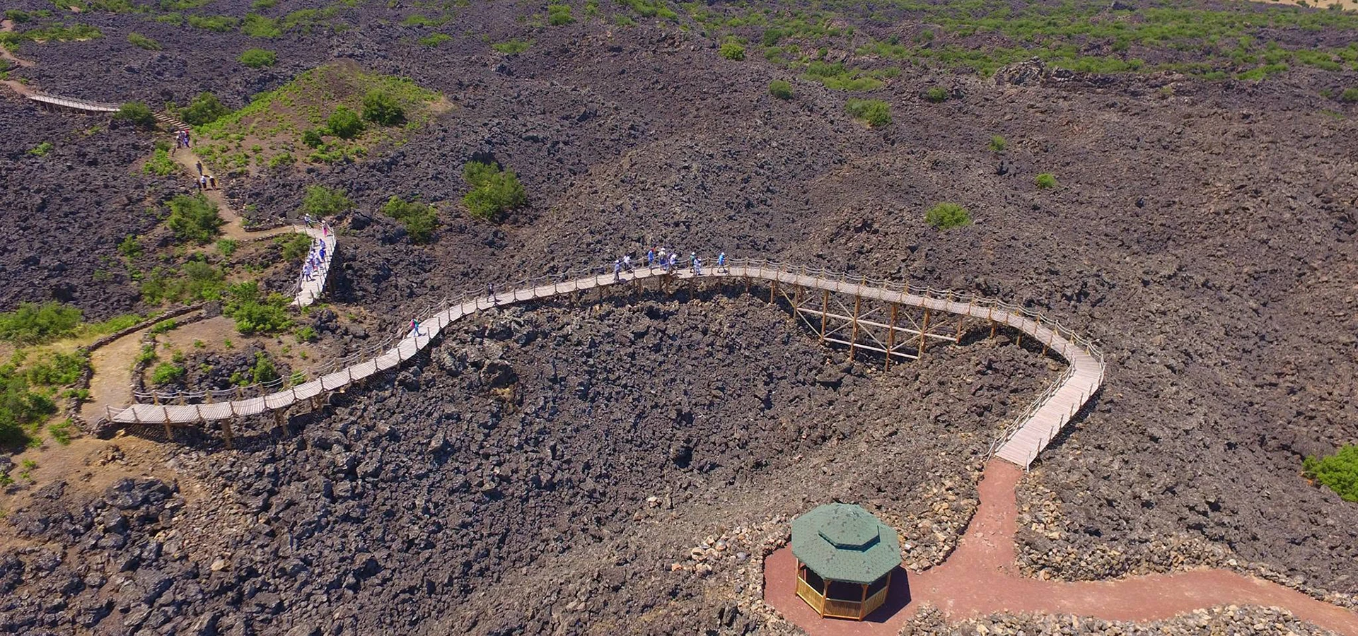
A young-looking volcanic landform surrounded by dark, rough lava surfaces. Follow designated routes rather than crossing unstable rock.
Geometric rock columns formed when cooling lava contracted and fractured. The Çakırca area is a notable example.
Erosion sculpted softer sediments beneath more resistant caps, producing pinnacles unlike Cappadocia’s in material and setting.
Fault-controlled basin landscapes and river incision show how tectonics and erosion continue the story after eruptions.
Useful orientation before planning a visit.
Kula and Salihli districts, Manisa
UNESCO Global Geopark
Geological history from ancient rocks to young volcanism
Volcanic plateau, Gediz Graben and Bozdağ slopes
Full day for selected geosites; longer for broad exploration
Confirm current entry and route conditions before travel
The geopark presents several geological processes in one region: eruption, cooling, fracturing, uplift, faulting and erosion.
Its cultural features help visitors see how people built homes, used clay and traveled across a landscape that looks severe but supports living communities.
The region’s volcanic story developed in several phases during the Quaternary period, leaving lava plateaus, cinder cones and different generations of volcanic rock.
Ancient geographer Strabo called the area Katakekaumene, commonly translated as the 'burned land', reflecting the striking black terrain visible even in antiquity.
The geopark combines this volcanic history with the active Gediz Graben and the Bozdağ mountains. The region’s human story includes old Kula houses, Gökeyüp pottery and the Lydian capital at Sardis.
The geopark’s many geosites are separated by significant distances. Choose a coherent route rather than treating the entire designation as a short roadside stop.
UNESCO describes marked geotrails and a visitor centre, but route maintenance and availability should be checked locally.
A young-looking volcanic landform surrounded by dark, rough lava surfaces. Follow designated routes rather than crossing unstable rock.
Look at this feature in relation to the broader setting rather than as an isolated photo opportunity.
Geometric rock columns formed when cooling lava contracted and fractured. The Çakırca area is a notable example.
Small construction or geological details can tell a different story from the broad panorama.
Erosion sculpted softer sediments beneath more resistant caps, producing pinnacles unlike Cappadocia’s in material and setting.
What is visible today may reflect more than one historical period or natural process.
Fault-controlled basin landscapes and river incision show how tectonics and erosion continue the story after eruptions.
Interpret this feature alongside the other highlights, while respecting current access limits.
Manisa brings together Lydian history, the Seven Churches of Revelation, Ottoman architecture, craft villages and volcanic geology. Kula–Salihli UNESCO Global Geopark offers a particular window into that varied region.
For a coherent itinerary, choose neighbouring sites by theme and geography rather than trying to cover the whole province in a single day.
At a lava field, identify flow textures and cooling cracks; at a fairy-chimney site, look for resistant caps; at Adala, focus on the river cutting through older material.
Do not confuse UNESCO Global Geopark designation with a UNESCO World Heritage Site: the programs have different purposes and boundaries.
A young-looking volcanic landform surrounded by dark, rough lava surfaces. Follow designated routes rather than crossing unstable rock.
Geometric rock columns formed when cooling lava contracted and fractured. The Çakırca area is a notable example.
Erosion sculpted softer sediments beneath more resistant caps, producing pinnacles unlike Cappadocia’s in material and setting.
Fault-controlled basin landscapes and river incision show how tectonics and erosion continue the story after eruptions.
Begin with the current geopark visitor information, select two or three geosites and allow time for rural roads. Carry water, sun protection and sturdy footwear.
Some volcanic ground is sharp and loose. Avoid leaving signed trails, especially near steep cinder slopes and fragile erosion features.
A Kula-focused day can combine the visitor centre, Divlit and a basalt or fairy-chimney viewpoint with the historic town.
A broader itinerary can add Adala, Gökeyüp pottery or Sardis, but this may be better split across two days.
Spring and autumn are comfortable for open rock landscapes. Summer heat can be intense on black lava, while winter rain may make trails slippery.
Include a person at a safe distance or a recognizable landscape feature to show the scale of lava fields and cones. Avoid drones without authorization.
Marked trails vary in length and surface. Ask the geopark visitor centre which viewpoints are suitable for reduced mobility.
Plan around the Kula and Salihli districts rather than a single geopark pin. Check the latest official trail maps and road access.
Explore Divlit Volcanic Park as a complementary stop. Check travel time and access before combining sites.
Explore Kula Basalt Columns as a complementary stop. Check travel time and access before combining sites.
Explore Kula Fairy Chimneys as a complementary stop. Check travel time and access before combining sites.
Explore Historic Kula Houses as a complementary stop. Check travel time and access before combining sites.
It is a designated geological landscape across Kula and Salihli, known for volcanic rocks, tectonic landforms and cultural heritage.
No. UNESCO Global Geopark and UNESCO World Heritage are separate designations; Sardis and Bin Tepe have the latter status.
Highlights include Divlit volcanic features, basalt columns, fairy chimneys, canyon landscapes and historic communities.
Allow at least a full day for selected geosites; a broader geological and cultural visit benefits from more time.
UNESCO describes marked geotrails, but current routes and conditions should be checked before visiting.
Ancient geographer Strabo used the name Katakekaumene in reference to its distinctive volcanic landscape.
Respect signs, barriers and any directions from site staff.
Do not remove volcanic rocks or fossils, damage formations, drive onto lava fields or create new tracks across fragile surfaces.
Keep entrances clear and ask before photographing residents or worshippers.
Carry away rubbish and avoid disturbing vegetation, rocks or historic material.
Wow Cappadocia / Venere Travel can plan a private, tailor-made route with a licensed guide and suitable vehicle, subject to confirmed access and without compulsory shopping stops.
Combine archaeology, living culture and natural landscapes at your preferred pace.
Share your dates, group size and interests. We will propose a sensible route and confirm access before booking.
Request Your Private Programme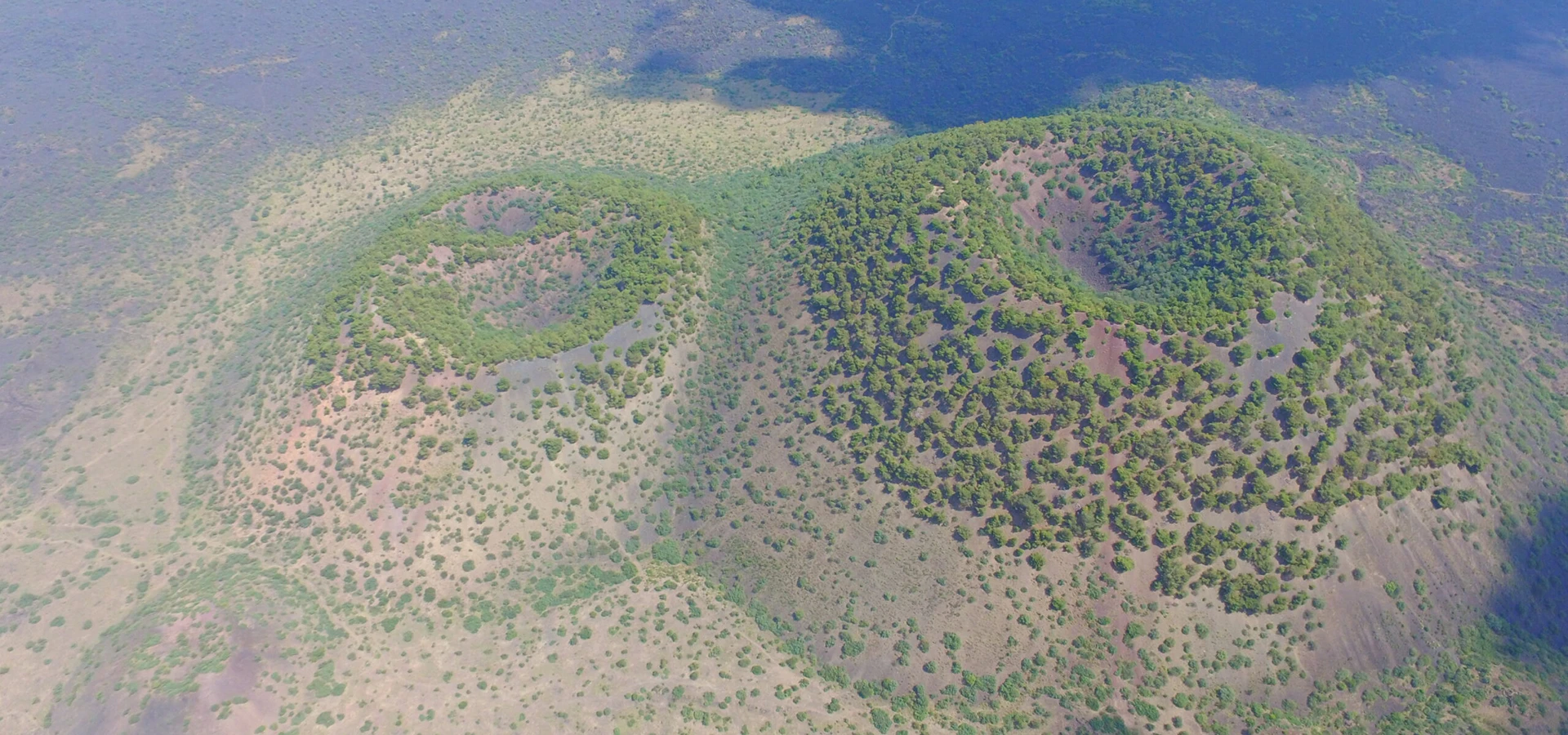
Discover a related destination and plan a route with realistic travel times.
Read the Nearby Guide