Private Cılandıras (Clandras) Bridge and Aqueduct Programme
Share your travel dates, group size and interests. We will check practical arrangements and propose a suitable route.
Request a Private Programme





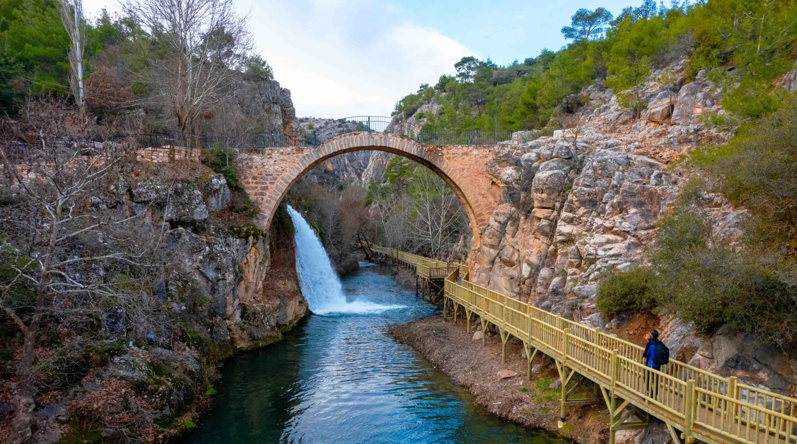
Cılandıras Bridge, also written Clandras, is one of Uşak’s most recognisable historic structures. Although commonly called a bridge, the stone arch is interpreted as part of an ancient water-supply system above Banaz Stream.
The bridge lies within the Banaz Stream corridor of Karahallı, part of the broader canyon-and-plateau landscape of southern Uşak.
The single arch spans a rocky gap.
The monument is better understood as water infrastructure than as a modern pedestrian bridge.
The watercourse and surrounding rocks help explain why a crossing was needed and why the structure is visually dramatic.
Local tourism sources describe a wooden walking path in the area.
Location, historical character and sensible visitor planning at a glance.
Banaz Stream, Karahallı district
Historic Aqueduct
Ancient water infrastructure; traditional Phrygian attribution
a stone arch over a rocky stream gorge
45–90 minutes
Check current access, operating conditions and any permissions; this guide does not guarantee prices or opening hours.
The most rewarding reason to explore Cılandıras (Clandras) Bridge and Aqueduct is the way stone arch relates to aqueduct function. Their significance becomes clearer in the context of ancient water infrastructure; traditional phrygian attribution and the surrounding a stone arch over a rocky stream gorge.
Pay attention also to banaz stream scenery and nearby walking routes. They help connect the main story to the less obvious details of the place.
The provincial culture directorate describes the structure as an aqueduct associated by local tradition with the Phrygian period. It gives approximate dimensions of 24 metres in length and 1.75 metres in width.
The dating of ancient hydraulic works can be complex. Popular descriptions also connect the crossing with Lydian routes; without a secure construction inscription, the precise phase should not be stated as settled fact.
Its location near Banaz Stream and the canyon environment makes the arch more than a standalone monument. The surviving masonry suggests the engineering effort required to carry water across broken terrain.
The bridge lies within the Banaz Stream corridor of Karahallı, part of the broader canyon-and-plateau landscape of southern Uşak.
In Banaz Stream, Karahallı district, the relationship between the built or natural features and their surroundings is an important part of the experience. Consider the wider Uşak region when deciding which places to combine on the same day.
The single arch spans a rocky gap. Observe how the masonry meets the natural rock rather than stepping onto fragile edges.
For visitors, the key is to connect this feature with the broader historic aqueduct and its ancient water infrastructure; traditional phrygian attribution context. Observe from permitted areas, and do not assume every surviving element has the same date or function.
The monument is better understood as water infrastructure than as a modern pedestrian bridge.
For visitors, the key is to connect this feature with the broader historic aqueduct and its ancient water infrastructure; traditional phrygian attribution context. Observe from permitted areas, and do not assume every surviving element has the same date or function.
The watercourse and surrounding rocks help explain why a crossing was needed and why the structure is visually dramatic.
For visitors, the key is to connect this feature with the broader historic aqueduct and its ancient water infrastructure; traditional phrygian attribution context. Observe from permitted areas, and do not assume every surviving element has the same date or function.
Local tourism sources describe a wooden walking path in the area. Its present condition and permitted access should be checked before relying on it.
For visitors, the key is to connect this feature with the broader historic aqueduct and its ancient water infrastructure; traditional phrygian attribution context. Observe from permitted areas, and do not assume every surviving element has the same date or function.
The historic aqueduct character of Cılandıras (Clandras) Bridge and Aqueduct is part of a much larger Uşak story that links town life, historic routes and the surrounding plateau. Its particular setting — a stone arch over a rocky stream gorge — gives the visit a perspective different from the province's other destinations.
For a balanced itinerary, compare this experience with Karahallı District, Uşak, Pepouza and Tymion: Early Christian Heritage. These stops reveal different chapters of Uşak’s history, geography or everyday culture; check actual routes rather than drawing straight lines between map markers.
Begin with stone arch and then compare it with aqueduct function. Ask which details are observable on site and which require an interpretation from historical research, local archives or conservation authorities.
The next useful question is how banaz stream scenery relates to nearby walking routes. Not every feature will be accessible or fully explained by a sign, so distinguish visible evidence from interpretation.
These four highlights provide a practical structure for your visit. Access to individual features may be restricted or seasonal.
The single arch spans a rocky gap.
The monument is better understood as water infrastructure than as a modern pedestrian bridge.
The watercourse and surrounding rocks help explain why a crossing was needed and why the structure is visually dramatic.
Local tourism sources describe a wooden walking path in the area.
Do not walk across the historic arch unless authorities explicitly permit it. Rock surfaces can be slippery and water levels may change quickly.
Suggested visit length: 45–90 minutes. This is a planning estimate, not a guaranteed activity duration. Allow extra time for parking, walking, interpretation and any queues.
Approach from a designated public access point, find a safe view of the arch and stream, then continue to Karahallı town or a prearranged Pepouza visit.
Do not try to fit every nearby stop into one short visit. A practical continuation is Karahallı District, Uşak, provided that its current access and the travel time make sense.
Spring and autumn often provide more comfortable outdoor conditions; summer heat and winter rain or frost can make exposed ground less forgiving.
For photography and walking, consider the day’s light, weather and return journey. Do not rely on an old opening-time listing or an unverified seasonal service.
Photograph the arch from a safe offset to show its curve against the rock and water. Avoid entering the stream or climbing masonry for a symmetrical view.
Drone flights may require permission under aviation, conservation or local restrictions. Do not use a drone without confirming the applicable rules.
The approach may involve steps, uneven ground and steep sections; ask locally about the safest viewpoint.
If travelling with young children or someone who cannot manage steps or uneven ground, ask about an appropriate shorter route before departure.
Cılandıras (Clandras) Bridge and Aqueduct is associated with Banaz Stream, Karahallı district. Check the exact destination and approach road before setting out; similarly named villages, historic stations or archaeological areas can appear on different map pins.
If using public transport, confirm that it serves the specific location rather than only the district centre. For remote heritage or nature sites, agree on a safe return plan before leaving.
Nearby options help turn a single stop into a well-paced Uşak itinerary. These are suggestions rather than a promise that every location is open on the same day.
Explore this related Uşak destination to compare different aspects of the province’s landscape and heritage. Confirm access and travel time before combining the stops.
Explore this related Uşak destination to compare different aspects of the province’s landscape and heritage. Confirm access and travel time before combining the stops.
Explore this related Uşak destination to compare different aspects of the province’s landscape and heritage. Confirm access and travel time before combining the stops.
Explore this related Uşak destination to compare different aspects of the province’s landscape and heritage. Confirm access and travel time before combining the stops.
Treat Cılandıras (Clandras) Bridge and Aqueduct as a living or protected place, not just a photo stop. The presence of residents, worshippers, workers, wildlife or archaeological material requires care appropriate to the location.
Stay on permitted routes, do not remove archaeological material or natural objects, take litter away, and ask before photographing people or entering private premises.
Cılandıras (Clandras) Bridge and Aqueduct is in Banaz Stream, Karahallı district, within Uşak Province in western Türkiye.
Cılandıras Bridge, also written Clandras, is one of Uşak’s most recognisable historic structures. Although commonly called a bridge, the stone arch is interpreted as part of an ancient water-supply system above Banaz Stream.
Focus on stone arch, aqueduct function, and banaz stream scenery. These details explain its distinctive heritage or landscape.
Plan approximately 45–90 minutes. This is a suggested visit length rather than a guaranteed duration.
Approach from a designated public access point, find a safe view of the arch and stream, then continue to Karahallı town or a prearranged Pepouza visit.
No current admission price or fixed timetable is guaranteed in this guide. Check the relevant local authority or site operator shortly before travelling; access, conservation works and seasonal arrangements may change.
The approach may involve steps, uneven ground and steep sections; ask locally about the safest viewpoint.
Consider Karahallı District, Uşak, Pepouza and Tymion: Early Christian Heritage. Check actual road distances, public access and available time before combining stops.
Wow Cappadocia / Venere Travel can help arrange tailor-made sightseeing with a licensed guide and suitable transport, subject to availability and confirmed access. No compulsory shopping stops.
Combine local heritage and natural landscapes at a comfortable pace.
Share your travel dates, group size and interests. We will check practical arrangements and propose a suitable route.
Request a Private Programme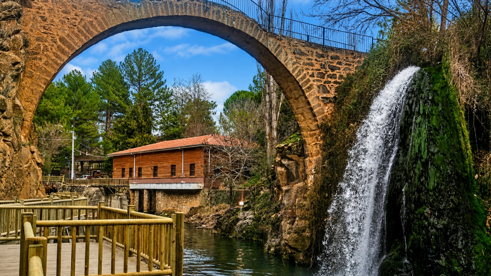
Continue your Uşak itinerary with a related destination.
Read the Nearby Guide