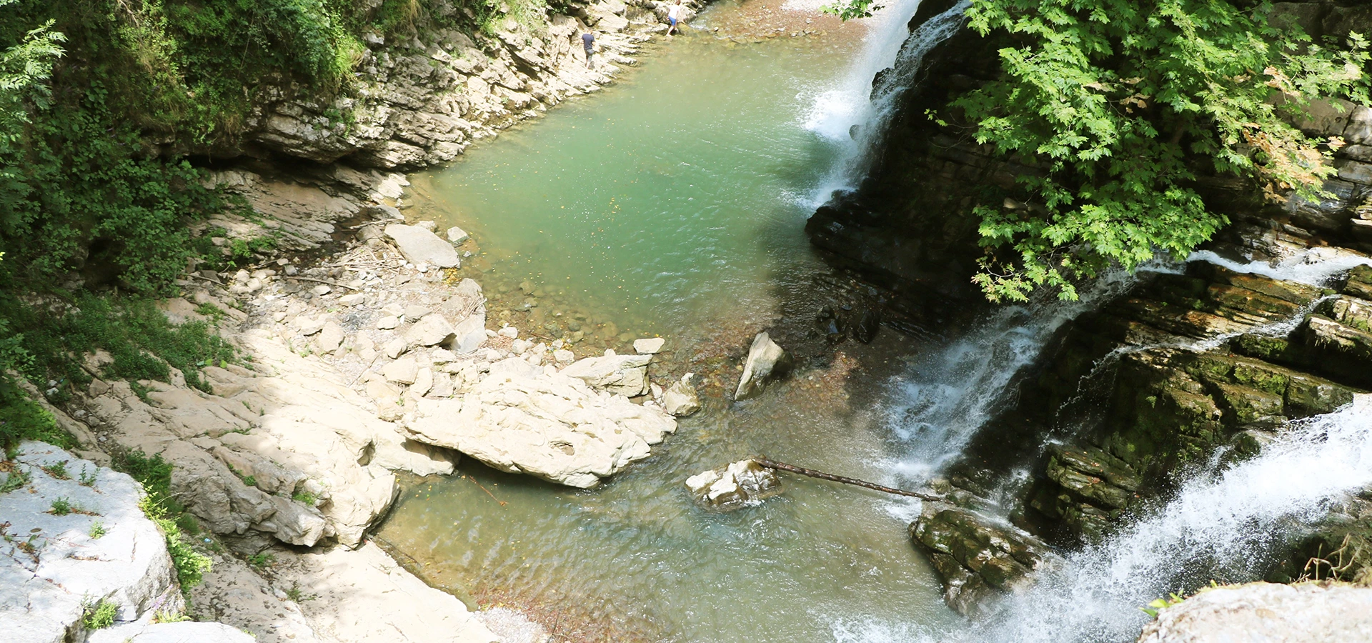
Private Maden Deresi & Northern Sakarya Tour
Ask us about a tailor-made nature route focused on Maden Deresi, forest landscapes, historic mining heritage, waterfalls and northern Sakarya's Black Sea environment.
Request a Custom Tour





Maden Deresi is one of the most atmospheric natural destinations in northern Sakarya Province. Flowing through the forested landscape between Karasu and Kocaali, the stream passes through a narrow green valley filled with rocky slopes, woodland paths, historic mining remains and waterfalls.
The destination is particularly famous for Maden Deresi Waterfall, but the waterfall is only one part of the experience. Visitors can follow the stream through dense Black Sea vegetation, walk beside old stone waterworks, see entrances connected with historic mining galleries and explore a landscape where industrial history has gradually been reclaimed by nature.
Maden Deresi is approximately 30 kilometres long and flows northward through forests of beech, hornbeam, chestnut, oak, plane and other moisture-loving vegetation before eventually reaching the Black Sea system near Karasu.
The waterfall itself has an unusual story. Official Sakarya tourism documentation records that a mining factory and dam were constructed here in 1888. As sediment accumulated and part of the old dam structure deteriorated, water began cascading through the damaged section, helping create the dramatic waterfall landscape visitors see today.
With its cool forest atmosphere, historic tunnels, stream crossings, picnic areas, waterfall and hiking opportunities, Maden Deresi offers a completely different side of Sakarya from the lake scenery of Sapanca or the Ottoman architecture of Taraklı.
Maden Deresi flows through the forested northern landscape of Sakarya toward the Black Sea.
Mine tunnels, stonework and industrial remains preserve traces of late Ottoman mining activity.
The waterfall landscape is closely connected with the remains of a historic mining-factory dam.
Maden Deresi was registered as a Qualified Natural Conservation Area in 2019.
Essential information for exploring one of northern Sakarya's most distinctive nature destinations.
Between the Karasu and Kocaali districts of northern Sakarya, close to the Akpınar and Kuyumcullu areas.
Open on Google MapsA forested stream valley with waterfalls, pools, rocky slopes and historic water-management structures.
Nature walking, waterfall visits, photography, picnicking and exploration of the historic mining landscape.
Late Ottoman mining tunnels and industrial remains survive throughout parts of the valley.
Registered as a Qualified Natural Conservation Area in 2019.
Allow around 2–4 hours for a relaxed waterfall walk, photographs and time beside the stream.
Maden Deresi combines forest ecology, flowing water and an unexpected industrial heritage landscape.
Many waterfall destinations are visited for a single viewpoint. Maden Deresi is different. Here, the journey through the valley is just as important as the final waterfall. The stream, forest paths, rock walls, historic tunnels and old masonry structures create a layered landscape that changes continuously as you walk.
The valley is also a remarkable example of how nature can reclaim an industrial landscape. Places once associated with mining, tunnels, water channels and processing facilities are now covered by moss, ferns and dense forest vegetation.
This mixture of natural and historical features has made Maden Deresi one of Sakarya's most recognizable nature-walking destinations. Municipal nature programs regularly include the valley, with longer hiking routes extending several kilometres through the surrounding countryside.
For travelers following our guide to places to visit in Sakarya, Maden Deresi offers an excellent northern counterpart to Acarlar Floodplain Forest, Sapanca Lake, Taraklı and the historic Bridge of Justinian.
Maden Deresi flows through one of the humid forest environments characteristic of northern Sakarya. The creek runs for approximately 30 kilometres before continuing toward the Black Sea coastal system.
The valley is surrounded by dense vegetation, with official local descriptions recording beech, hornbeam, chestnut, oak and plane trees among the characteristic woodland species. Hazelnut-growing landscapes are also common throughout the wider Karasu–Kocaali region.
Water has gradually cut into the rock, creating narrow sections, small pools, rock shelves and steep valley sides. The result is a cool microclimate that can feel noticeably different from the open Black Sea coast only a short distance away.
Dense woodland creates a shaded environment around much of the stream corridor.
The sound of the creek accompanies much of the walk toward the waterfall.
Moist Black Sea woodland species thrive along the slopes surrounding the valley.
Mature deciduous woodland gives the area particularly attractive spring and autumn scenery.
Erosion has created narrow rocky passages and dramatic sections along the stream.
Shade, flowing water and dense vegetation make the valley especially refreshing in warm weather.
One of the most fascinating details about Maden Deresi is that the best-known waterfall is closely connected with the valley's mining history.
Sakarya's official tourism documentation records that a mining factory was established in the area in 1888 and that a substantial stone dam formed part of the industrial complex. The surviving dam ruins are reported to reach approximately 30 metres in height.
Over time, sediment accumulated behind the structure and sections of the old dam deteriorated. Water began escaping through a broken part of the masonry, creating the cascade that became today's famous Maden Deresi Waterfall.
This means the scene visitors photograph today is neither purely natural nor simply industrial. It is a landscape created by water, forest succession, erosion and abandoned human engineering working together for more than a century.
The Turkish name Maden Deresi literally means "Mine Stream", and the name preserves the memory of an important chapter in the valley's history.
Official local accounts describe mining activity here during the later Ottoman period, when a French company worked deposits in the area. Different local records mention lead and other mineral resources, while Karasu Municipality specifically refers to a facility processing silver-bearing lead ore.
Tunnels were driven into the rock walls, and infrastructure was created to move and process material through the valley. Stonework, water channels, gallery entrances and the remains associated with the old dam still make the industrial history visible today.
Mining eventually ended and the facilities were abandoned. Over the decades, vegetation returned, trees grew around the stone structures and water transformed the old industrial works into part of the modern forest landscape.
The principal historic mining phase is associated with the final decades of the Ottoman Empire.
Official local histories record mining operations connected with a French enterprise.
Lead-bearing ores were among the materials associated with the historic mining operation.
Tunnels cut into the rocky valley sides remain one of Maden Deresi's most unusual features.
Historic masonry and channels reveal how water was incorporated into the industrial landscape.
Moss, forest vegetation and flowing water now dominate areas once shaped by mining activity.
The old mining galleries are among the features that distinguish Maden Deresi from an ordinary waterfall walk. Entrances can be seen in the rocky valley sides, and some historic routes pass close to or through sections associated with the tunnels.
Older local descriptions emphasize that the original paths around these galleries could be extremely narrow, with steep drops and slippery surfaces after rainfall. For this reason, tourism improvement projects have focused heavily on making parts of the historic route safer.
Projects coordinated by public authorities have included improved paths, steel stairways, walkway structures, guarding and viewing areas intended to reduce risks while allowing visitors to experience the valley's historic landscape.
Even where infrastructure has been improved, visitors should never assume that every tunnel entrance or old mining gallery is safe to enter. Barriers, warning signs and temporary closures should always be respected.
Historic mining tunnels were excavated directly into the valley's rocky slopes.
Some traditional routes historically passed along steep and confined sections of the valley.
Constant moisture can make stone, soil and wooden surfaces extremely slippery.
Newer visitor infrastructure has aimed to make previously dangerous sections easier to negotiate.
Never enter closed galleries or bypass railings to explore abandoned mine workings.
A small flashlight can be useful around dark permitted sections, even during daylight hours.
Maden Deresi was registered in 2019 as a Nitelikli Doğal Koruma Alanı, or Qualified Natural Conservation Area.
The designation reflects the importance of protecting the valley's forest, stream environment, rock formations and wider ecological landscape while managing its popularity as a recreation destination.
In subsequent years, public bodies developed eco-tourism projects designed to improve visitor safety, organize walking routes and make the mining heritage easier to experience without losing the area's natural character.
Maden Deresi received its Qualified Natural Conservation Area status.
The designation helps safeguard the dense woodland surrounding the stream corridor.
The creek, pools and wet valley environment form an important part of the protected landscape.
Visitor projects have aimed to combine nature tourism with conservation and controlled access.
Old tunnels and mining structures add cultural heritage to the natural significance of the valley.
Staying on established routes helps reduce erosion and damage to fragile streamside vegetation.
Because of its steep terrain and historically narrow trails, visitor safety has been an important issue at Maden Deresi.
A large eco-tourism project was therefore developed through cooperation between public authorities, with plans covering the waterfall route, historic mining areas, walking paths, observation points and recreation facilities.
The original project described approximately 1.8 kilometres of trail from the recreation area toward the waterfall. Later municipal works included steel stair structures, elevated walking sections and a large viewing terrace in difficult parts of the route.
The improvements make sections of the valley easier to explore, but Maden Deresi remains a genuine natural landscape. Visitors should still expect wet ground, steps, rocks, mud and changing trail conditions.
Visitor works have concentrated on the traditional route between the recreation area and waterfall.
Stair structures were introduced at steep sections where the older path presented greater risk.
Constructed walking sections help visitors negotiate difficult terrain more safely.
A viewing area was developed to improve both safety and landscape appreciation.
The project also aimed to make portions of the mining heritage easier to interpret.
Visitor infrastructure does not eliminate natural hazards such as mud, falling branches or high water.
The best way to experience Maden Deresi is not to rush directly to the waterfall. The valley rewards visitors who pay attention to its smaller details along the way.
The main cascade beside the historic dam remains the signature view of the valley.
Examine the substantial masonry structure connected with the area's late-19th-century mining works.
Look for gallery entrances and surviving traces of the industrial landscape along permitted routes.
Much of Maden Deresi's atmosphere comes from walking beneath the dense woodland canopy.
Depending on route and water levels, the walk brings visitors repeatedly close to the creek.
Historic masonry has gradually become integrated into the damp forest environment.
Look at the exposed rock walls and narrow valley sections created by long-term erosion.
Newer visitor infrastructure provides opportunities to see difficult sections from safer positions.
Maden Deresi is one of northern Sakarya's popular nature-walking destinations. A straightforward visitor route leads from the recreation area toward the waterfall, while longer hiking programs can extend several kilometres through the valley and surrounding countryside.
Official tourism information describes approximately a 1-kilometre walk along the stream corridor to reach the waterfall from the principal visitor area. Longer organized routes, however, have ranged from roughly 4 to 6 kilometres depending on the itinerary.
The important point is that "Maden Deresi hike" can refer to several different routes. Travelers who simply want to see the waterfall do not necessarily need to complete the longer trekking circuits used by organized walking groups.
The shorter visitor route focuses on reaching the waterfall from the main recreation area.
Extended nature routes can continue for several kilometres through the surrounding forest landscape.
Expect roots, rocks, mud, steps and naturally irregular surfaces.
Some sections remain damp even when the wider region has experienced dry weather.
Walking shoes or hiking footwear with strong grip are highly recommended.
Allow extra time because wet surfaces and high water can make the route significantly more difficult.
Maden Deresi is an outdoor nature destination rather than a conventional museum or archaeological site. Conditions can therefore change rapidly with weather, water levels, maintenance and seasonal visitor management.
Official tourism information indicates that recreation areas operate in the valley and that access to managed picnic facilities may be subject to a fee. Local trout facilities and restaurants have also historically operated in the wider visitor area.
Begin at the principal recreation area and spend a few minutes beside the creek before starting toward the waterfall. The lower valley immediately introduces the dense woodland and cool stream environment that define Maden Deresi.
Follow the established walking route upstream, watching for historic stonework and old mining features along the valley sides. Where permitted, look toward the tunnel entrances without leaving the designated visitor route.
As the valley narrows, the sound of flowing water becomes stronger. Continue toward the historic dam and the main waterfall, where masonry, rock and vegetation form the destination's most recognizable scene.
Spend time photographing the waterfall from safe viewpoints, then return slowly through the forest. The return walk often reveals details in the historic structures that are easy to miss on the way in.
Maden Deresi can look beautiful throughout the year, but every season creates a very different experience. Because stream flow and trail safety are strongly influenced by rainfall, weather conditions matter as much as the season itself.
Fresh leaves, active water flow and intense green vegetation make spring one of the valley's most photogenic periods.
The shaded forest and cool stream create a welcome escape from warmer temperatures, although weekends can be busy.
Beech, chestnut and other deciduous trees transform the valley with yellow, gold and copper tones.
The landscape becomes quieter and atmospheric, but rain, mud and slippery surfaces require much greater caution.
Usually one of the best periods for quieter trails and soft forest light.
Avoid treating stronger water flow as a reason to take risks; paths can become slippery or temporarily unsafe.
Suitable only for a fairly quick waterfall visit if conditions are good and you do not stop for long.
Enough for the main trail, waterfall, several photographs and a relaxed return walk.
A comfortable visit with time to examine historic mining features and enjoy the forest surroundings.
Ideal if you enjoy nature photography, slow walking and spending time beside the stream.
Combine the waterfall walk with a picnic or meal and a more complete exploration of the valley.
Combine Maden Deresi with the Karasu–Kocaali coast or Acarlar Floodplain Forest.
Maden Deresi is one of Sakarya's most rewarding forest photography locations. The combination of moving water, dark rock, historic masonry and bright green vegetation creates strong compositions throughout the valley.
Use surrounding rocks and foliage to frame the cascade and historic dam structure.
A tripod and slower shutter speed can create silky movement in the waterfall and smaller cascades.
Look for the contrast between dark historic masonry and vivid green moss.
Tunnel openings provide atmospheric compositions where permitted and safe.
Seasonal foliage creates excellent wide views and detailed woodland photographs.
Calmer pools can reflect the surrounding forest, particularly in softer morning light.
Maden Deresi is beautiful precisely because it remains a rugged stream valley. That also means visitors should treat it with more caution than a landscaped urban park.
Wet stone, mud, roots, steep slopes and changing water levels are normal features of the environment. Conditions can deteriorate quickly after heavy rain.
Choose footwear with strong grip rather than smooth-soled city shoes or sandals.
Moss-covered stone can be extremely slippery even when it does not look wet.
Do not attempt stream crossings if rainfall has raised water levels beyond safe conditions.
Leaving established paths can place you above steep drops or unstable slopes.
Never enter an abandoned mine gallery simply because an opening appears accessible.
Keep children close around water, rocks, stairs and exposed sections of the route.
Heavy rainfall can change stream and trail conditions dramatically in a short period.
Historic masonry and wet surfaces should be viewed from designated areas rather than climbed.
Visitors can sometimes be seen entering pools or cooling off in the water during summer, but this should not be interpreted as meaning that every pool is an officially supervised swimming area.
Water can be very cold, rocks can be slippery and depth or current can change after rainfall. There may also be underwater rocks and other hazards that are difficult to see from the surface.
Follow current local signs and instructions. If swimming or entering the water is restricted, respect the restriction. Never enter the water during high flow, immediately after severe rainfall or close to dangerous cascades.
Accessibility varies significantly between the principal recreation area and the trail leading deeper into the valley.
Visitor improvements have made several difficult sections safer, but the route toward the waterfall still includes natural terrain, steps, slopes and potentially wet or muddy surfaces.
The main visitor and picnic areas are generally easier to access than the upper waterfall trail.
Natural terrain and stair sections can make the complete route difficult for visitors with limited mobility.
Confirm the current extent of step-free access before making a dedicated trip to the waterfall.
A stroller may be manageable in easier lower sections but is not ideal for rough or stepped trail portions.
Light trekking poles can provide useful stability on wet or uneven terrain.
Take your time on stairways and steep sections rather than trying to maintain a fast pace.
Maden Deresi lies in northern Sakarya in the forested area between Karasu and Kocaali. Official sources sometimes describe the destination under Karasu and sometimes under Kocaali because the stream corridor extends through the wider boundary area.
For most independent visitors, a private vehicle is the most practical way to reach the recreation area. The principal road approach is paved, but local conditions can change after severe weather.
Approach toward the Akpınar area and follow local signs or navigation toward Maden Deresi.
The destination can also be approached from the Karasu / Kuyumcullu side of the valley.
Drive north toward the Black Sea districts before continuing toward the Maden Deresi access road.
The easiest option, particularly if combining the waterfall with Acarlar or the Black Sea coast.
Direct public transport to the waterfall is limited and may require a local minibus plus walking.
Confirm road and trail conditions locally because flooding or debris can temporarily affect access.
Maden Deresi works particularly well as part of a northern Sakarya nature itinerary. Use our complete Sakarya visitor guide to explore more of the province.
Explore flooded woodland, wetland habitats, water lilies and one of Sakarya's most distinctive ecosystems.
Continue toward the Black Sea for long sandy beaches, coastal scenery and the lively Karasu district.
See the coastal landscape near the mouth of the Sakarya River where the river reaches the Black Sea.
Combine the shaded forest valley with broad Black Sea beaches and the open coastal landscape.
Continue south toward one of Anatolia's most impressive surviving Early Byzantine bridges.
Discover lakes, forests, waterfalls, Byzantine monuments, Ottoman towns, wetlands and Black Sea scenery.
Maden Deresi is in northern Sakarya Province, in the forested area between the districts of Karasu and Kocaali.
The stream extends through the wider Karasu–Kocaali area, which is why official sources sometimes associate it with Karasu and others with Kocaali. The main visitor approaches are connected with both districts.
Maden Deresi means "Mine Stream" in Turkish. The name refers to the historic mining activity that once took place in the valley.
Official Sakarya sources describe the stream as approximately 30 kilometres long.
The stream runs northward through Sakarya's forested Black Sea hinterland and eventually drains toward the Black Sea near Karasu.
The waterfall is closely connected with a historic industrial structure. Official tourism documentation explains that water now cascades through a damaged section of an old mining-factory dam, creating the waterfall seen today.
Official Sakarya tourism documentation associates the mining factory and dam with 1888.
A figure of roughly 30 metres is sometimes associated with the site, but official documentation uses this measurement for the surviving historic dam structure. It should not automatically be treated as the exact vertical height of the waterfall.
The valley contained mineral resources that were exploited during the later Ottoman period. Official local accounts associate the operations with a French company and describe lead-bearing ores and other minerals.
Yes. Historic gallery entrances and mining-related structures remain visible in parts of the valley. Only enter areas that are clearly designated as safe and open.
Access depends on current visitor management and safety arrangements. Never enter a closed or unmarked abandoned gallery, and always respect barriers and warning signs.
Yes. The area was registered as a Qualified Natural Conservation Area in 2019.
Official tourism information describes approximately 1 kilometre of walking from the main visitor area toward the waterfall, although longer nature routes in the wider valley can extend several kilometres.
The standard visitor route is manageable for many reasonably active travelers, but wet rock, mud, stairs and uneven terrain can make it considerably more difficult after rainfall.
Wear walking or hiking shoes with good non-slip soles. Smooth city shoes and flip-flops are poor choices for wet streamside trails.
People sometimes enter the water in warm weather, but the pools should not be treated as supervised swimming areas. Water can be cold, rocks slippery and current conditions variable. Follow current local rules.
Families can enjoy the valley, but children require close supervision around the stream, waterfall, steps, rocks and any steep sections.
Yes. Recreation and picnic areas have long formed part of the Maden Deresi visitor experience. Managed areas may charge an entrance or parking fee.
Local tourism information mentions trout facilities and fish restaurants in the wider visitor area. Opening days and seasonal operation should be checked locally.
Camping has historically been available in parts of the wider recreation area, but current permissions, facilities and operating arrangements should be confirmed before arriving with camping equipment.
Official tourism information states that managed recreation areas may charge an entrance fee. Exact prices can change, so check current information locally.
Spring and autumn are excellent for walking and photography. Summer is attractive for its cool shade, while wet winter conditions require more caution.
Autumn is particularly beautiful, with deciduous forest changing to yellow, gold, orange and brown around the dark stream valley.
Allow approximately 2–4 hours for a comfortable waterfall walk, photography and time beside the stream.
Light rain can make the forest atmospheric, but heavy rainfall can create slippery trails, higher water and flood hazards. Avoid the route during or immediately after severe weather.
Visitors normally reach the principal recreation area by road and continue toward the waterfall on foot.
Direct public transport to the waterfall is limited. Official tourism information has historically described local minibus connections to nearby settlements followed by walking, so a private vehicle is usually more convenient.
The main recreation area may be easier to access, but the complete waterfall route includes natural terrain, slopes and stair sections. Confirm current step-free access before a dedicated visit.
Do not assume drone use is automatically permitted inside a protected natural area. Check current Turkish aviation regulations and any local conservation restrictions before flying.
Good combinations include Acarlar Floodplain Forest, the Karasu and Kocaali Black Sea coast and other destinations in our Sakarya visitor guide.
Use established walking routes to reduce erosion and protect streamside vegetation.
Railings and closures exist for safety and conservation; never bypass them.
Do not enter closed mine galleries or damage historic stonework.
Never leave plastic, food packaging or picnic waste in the forest.
Avoid soaps, chemicals or other pollutants in the stream and waterfall pools.
Do not scratch names into trees, rocks, tunnel walls or historic masonry.
Observe animals quietly and avoid disturbing nests or natural habitats.
Follow all seasonal fire restrictions and never light fires outside officially permitted areas.
Combine Maden Deresi's forest, waterfalls and historic mining landscape with wetlands, Black Sea scenery and Sakarya's wider natural heritage through a private route shaped around your interests.
Choose a focused Maden Deresi visit or create a full-day private route combining waterfalls, forest walking, wetlands and the Black Sea coast.
Ask us about a tailor-made nature route focused on Maden Deresi, forest landscapes, historic mining heritage, waterfalls and northern Sakarya's Black Sea environment.
Request a Custom Tour
Discover lakes, wetlands, waterfalls, Black Sea landscapes, Roman and Byzantine monuments, Ottoman towns and local food across Sakarya Province.
View Sakarya GuideConnect Maden Deresi with some of Sakarya's most memorable natural and cultural destinations.
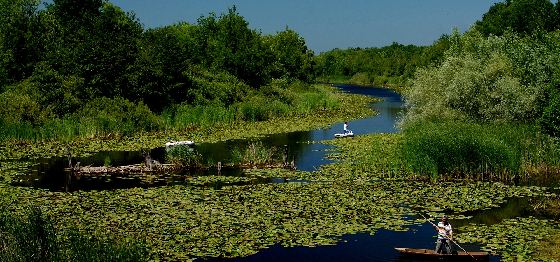
Continue through northern Sakarya to flooded woodland, wetland habitats, water lilies and one of Türkiye's most remarkable floodplain ecosystems.
Explore Acarlar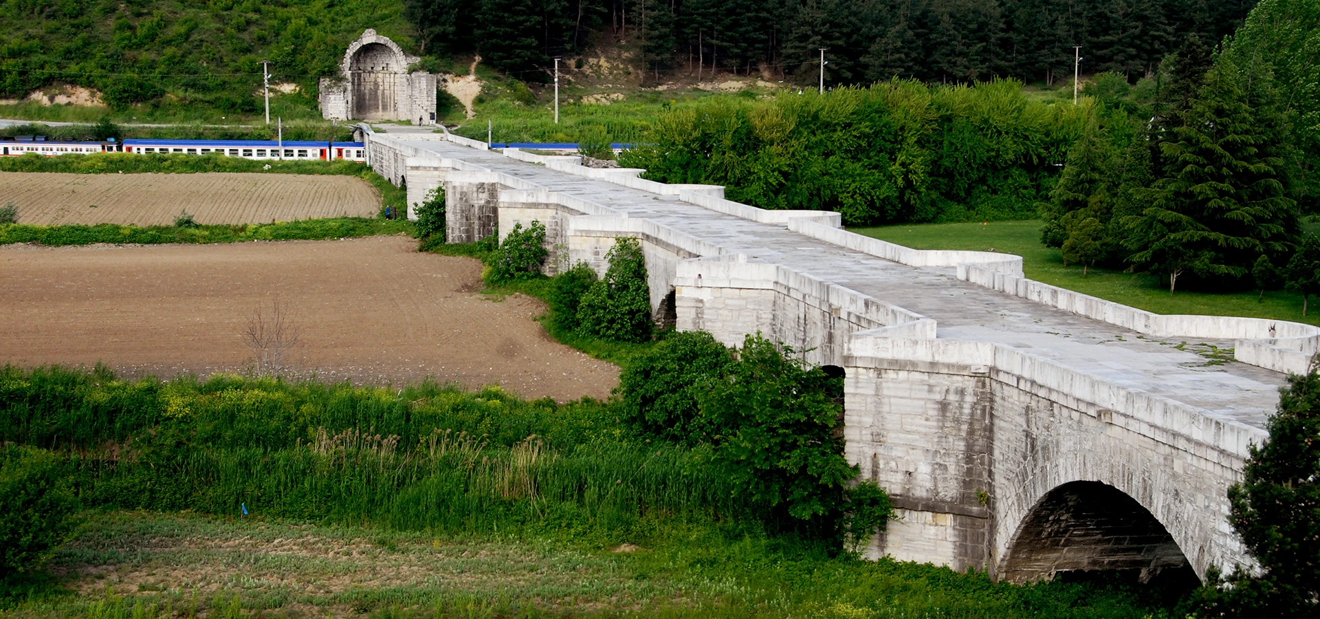
Contrast Sakarya's forest landscapes with one of Anatolia's greatest surviving Early Byzantine engineering monuments.
Explore the Justinian Bridge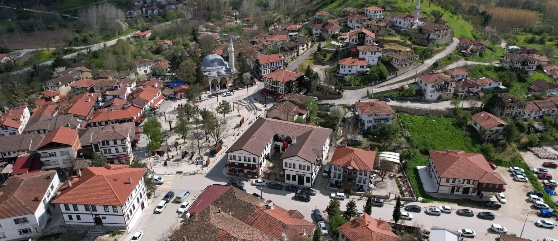
Continue inland to discover Ottoman houses, historic streets, traditional architecture and the peaceful atmosphere of one of Sakarya's most distinctive towns.
Explore Taraklı