Private Sapanca Lake Tour
Ask us about a tailor-made route focused on lake scenery, Kırkpınar, Maşukiye, mountain viewpoints, photography, local food and a relaxed pace.
Request a Custom Tour





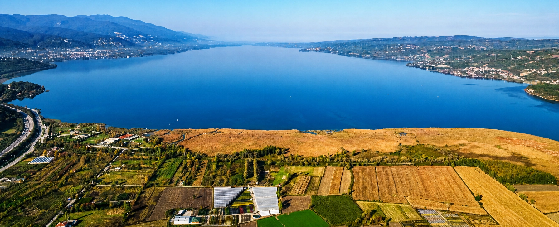
Sapanca Lake is one of the defining natural landscapes of Sakarya and one of the most popular countryside escapes in the eastern Marmara region. Set between the wooded foothills of the Samanlı Mountains and the lowlands leading toward Adapazarı, the lake combines broad freshwater views with forests, gardens, villages, cafés and mountain roads.
The lake stretches for roughly 17 kilometers from east to west, reaches about 5 kilometers from north to south and covers approximately 47 square kilometers. Its deepest point is around 61 meters, making Sapanca far more than a shallow recreational lake.
Sapanca is also a strategically important drinking-water resource. That makes its environmental condition important not only for tourism and wildlife, but for communities across the surrounding region. Visitors should therefore experience the lake as both a beautiful destination and a valuable freshwater ecosystem.
Today, travelers come for lakeside walks, long Turkish breakfasts, photography, cycling, romantic weekends, family time and easy access to places such as Kırkpınar, Maşukiye and Kartepe. Its position between Istanbul, Kocaeli and central Sakarya makes it especially attractive for short trips.
Explore one of the largest and most important freshwater landscapes in the region.
Discover very different views from the eastern, southern and western shores.
Understand why Sapanca is a substantial natural lake rather than a shallow pond.
Visit for spring greenery, summer evenings, autumn colors or misty winter landscapes.
Essential information for visiting one of Sakarya's most famous natural landmarks.
Between Sapanca, Arifiye and the Kocaeli border in northwestern Türkiye.
Open on Google MapsFreshwater tectonic lake within the İzmit Gulf–Sapanca–Adapazarı geological corridor.
Approximately 17 km long, 5 km wide and about 47 km² in surface area.
Approximately 61 meters at its deepest point.
There is no general lake entrance fee; individual parks, venues and activities may charge separately.
Allow 3–5 hours for the lake and town, or a full day with Kırkpınar, Maşukiye or mountain scenery.
Sapanca combines natural beauty, freshwater ecology, regional water security and one of Sakarya's strongest tourism identities.
The first thing most visitors notice is the scenery. The lake reflects changing skies, wooded slopes and the Samanlı Mountains, creating a landscape that can feel completely different in bright summer light, autumn mist or winter rain.
Its importance, however, extends much further. Sapanca is one of the region's major freshwater and drinking-water resources, so water quality, shoreline protection and careful management affect everyday life far beyond the tourism sector.
The lake is also a natural meeting point between several regional landscapes. To the east lie the urban areas of Sakarya; to the west are Kocaeli and the routes toward Istanbul; to the south rise forested mountain slopes, countryside settlements and the roads toward Maşukiye and Kartepe.
For travelers using our guide to places to visit in Sakarya, Sapanca is one of the best starting points for understanding how strongly the province is shaped by water, forests, mountains and fertile lowlands.
The Sapanca basin has been crossed and inhabited for centuries because it lies on a natural east–west route between the Gulf of İzmit, the Sakarya plain and the interior of northwestern Anatolia. The wider region belonged to the historical landscape of Bithynia and later the Roman and Eastern Roman worlds.
Historical sources preserve ancient and medieval names associated with the lake and surrounding settlement, including forms such as Sophon and Siphon. The exact usage of these names varies across periods and sources, but they underline the long history of human activity around the water.
During the Byzantine period, the corridor remained strategically important for movement between Constantinople, Nicomedia — modern İzmit — and inland Anatolia. The region later passed into Turkish control and became part of the expanding Ottoman state in the 14th century.
Sapanca developed as a settlement on the road linking Istanbul with Anatolia. The Ottoman traveler Evliya Çelebi passed through the area in the 17th century and recorded local traditions and impressions of the town.
In the modern period, improved road and railway connections transformed Sapanca again. Its closeness to Istanbul, Kocaeli and Adapazarı gradually turned the lake into a major destination for weekend travel, second homes, small hotels, restaurants and nature-based tourism.
The lake lay within a region closely connected with ancient routes across northwestern Anatolia.
The corridor between Nicomedia and the Anatolian interior remained strategically important.
The Sapanca region became part of the expanding Ottoman state.
Evliya Çelebi recorded Sapanca during his famous journeys through the Ottoman Empire.
Modern transport strengthened Sapanca's connection with Istanbul, İzmit and Adapazarı.
The lake developed into one of the Marmara region's best-known short-break destinations.
Sapanca Lake occupies a long depression within the geological corridor that runs from the Gulf of İzmit toward the Adapazarı Plain. The landscape is closely associated with active tectonic structures of northwestern Türkiye, including the wider North Anatolian Fault Zone.
The lake is generally classified as a tectonic freshwater lake. Faulting, subsidence and long-term landscape development helped create the basin, while streams and groundwater supplied the freshwater system that occupies it today.
The lake's elongated east–west shape is one of its most noticeable features. To the south, the land rises rapidly toward the wooded Samanlı Mountains, creating the green mountain backdrop visible from much of the northern and southern shoreline.
Numerous small streams descend from the surrounding highlands into the lake. When water levels are high, excess water leaves the eastern end through Çark Suyu, which ultimately connects with the Sakarya River system.
Sapanca formed within an active geological corridor shaped by faulting and subsidence.
Forested slopes south of the lake create its most dramatic natural backdrop.
Small mountain streams and rainfall help replenish the lake throughout the year.
The lake's natural outflow leaves the eastern side and joins the wider Sakarya River system.
Most of the lake lies in Sakarya, while its western end reaches into Kocaeli Province.
Rainfall, seasonal conditions and water demand influence the visible shoreline across the year.
Sapanca is not one single attraction. Different parts of the shoreline and surrounding countryside offer very different experiences, from lively promenades and restaurants to quieter gardens, village roads and mountain views.
The easiest first stop, with a public lakeside promenade, cafés, seating and broad water views.
A green southern-shore neighborhood known for gardens, restaurants, villas and relaxed accommodation.
A countryside area on the slopes above Sapanca with forests, streams, restaurants and hillside stays.
The eastern end of the lake connects with the wider Sakarya urban area and the Çark water system.
Just west of Sapanca, this forested Kocaeli destination is famous for streams, breakfast and mountain scenery.
Higher mountain roads offer panoramic perspectives over the lake and snowy landscapes in winter.
The strongest Sapanca experience comes from combining the lake itself with the surrounding green landscape. Rather than rushing between attractions, choose a few activities and allow time simply to enjoy the water and mountain views.
Walk the central Sapanca shoreline and stop for tea, coffee or photographs beside the water.
Explore one of the greenest and most relaxed residential areas on the southern shore.
Start the day with a long breakfast in a garden, countryside restaurant or lakeside setting.
Visit early for still water, soft reflections and occasional mist across the lake.
Return to the shoreline in late afternoon when warmer light spreads across the water.
Use suitable public routes and developing lakeside infrastructure to explore at a slower pace.
Add forests, streams and countryside restaurants west of the lake.
Climb higher for broad panoramas over the lake and surrounding Marmara landscape.
Sapanca Lake is surrounded by a mosaic of open water, reed beds, stream mouths, gardens, woodland and mountain slopes. These habitats support freshwater fish, birds and many smaller species that depend on the lake and its shoreline.
Reed beds and vegetated shoreline zones are particularly important. They help provide habitat, filter runoff and create transition areas between open water and developed land. Visitors should avoid entering or damaging these sensitive sections.
The lake's ecological importance is intensified by its role as a drinking-water source. Pollution, excessive water extraction, wastewater, shoreline development and prolonged drought can all place pressure on the system.
For that reason, Sapanca is closely monitored and managed as more than a recreational destination. Responsible tourism, wastewater control and careful use of the catchment are essential to protecting the lake over the long term.
Shoreline vegetation provides habitat and helps protect the edge of the lake.
The lake supports a variety of fish species within an ecosystem that depends on good water quality.
Quiet shoreline areas can reward patient visitors with water birds and woodland species.
Streams descending from the Samanlı Mountains help feed the lake and connect forest with freshwater habitats.
Regional water supply makes environmental protection especially important.
Avoid litter, shoreline damage, unauthorised fires and activities that may contaminate the water.
Sapanca is easy to reach, but its popularity means traffic and crowds can strongly affect the experience. A little planning is especially valuable on weekends, public holidays and warm-weather days.
Morning offers calmer roads, quieter promenades and better chances for reflections or mist.
Istanbul–Sapanca routes can become heavily congested on Friday evenings and Sunday return hours.
Combine central Sapanca with Kırkpınar or a mountain stop rather than trying to circle everything quickly.
Lakeside paths are easy, but countryside stops can include slopes, wet ground and uneven surfaces.
Weather beside the lake can change quickly, and mountain areas are often cooler than the shoreline.
Breakfast and dinner venues can fill quickly during weekends and holiday periods.
Not every attractive stretch of shoreline is public; use established access points and paths.
Remember that the lake is an important drinking-water source as well as a tourism destination.
Begin in the morning with breakfast in Sapanca or Kırkpınar. An early start gives you quieter roads and a calmer lakeside atmosphere before the busiest day-trip traffic arrives.
Continue to Sapanca Sahili for an easy walk beside the water. Take time for photographs, coffee and broad views toward the surrounding hills.
Travel west through Kırkpınar, where gardens and tree-lined streets give the southern shore a more residential and relaxed character. From here, continue toward Maşukiye for streams, forest scenery and lunch.
In the afternoon, either climb toward Kartepe for panoramic mountain views or return to the lake and explore another accessible shoreline section. Finish beside Sapanca Lake for sunset and dinner.
There is no single entrance gate, ticket office or opening schedule for Sapanca Lake. Public waterfront areas can generally be visited freely, while private restaurants, hotels, activity venues, parks and organised experiences operate independently.
The central Sapanca waterfront is the simplest starting point for a first visit. From there, travelers can continue toward Kırkpınar, the countryside south of the lake, Maşukiye or the higher roads toward Kartepe.
Swimming and water-based recreation should never be assumed to be permitted everywhere. Because Sapanca is a protected drinking-water basin, rules can vary according to location, environmental conditions and current administrative decisions. Use recognised operators or designated areas and follow local instructions.
Sapanca is a genuine four-season destination. The best period depends on whether you prefer green landscapes, warm evenings, autumn colors, quiet winter scenery or mountain snow.
Fresh greenery, mild weather and flowering gardens make this one of the best seasons for walking and countryside meals.
Long daylight and lively evenings suit outdoor dining and sunset visits, although weekends can be very busy.
Cooler temperatures, colorful forests and softer light make this an excellent photography season.
Mist, quiet waterfronts and snow on nearby Kartepe create a completely different Sapanca atmosphere.
Usually calmer than weekends, especially around the promenade, Kırkpınar and popular restaurants.
The best time for still water, reflections, light mist and a more peaceful lakeside experience.
Enough for a short walk, coffee and photographs along the central Sapanca waterfront.
Combine Sapanca Sahili with Kırkpınar or a long lakeside breakfast.
A comfortable first visit including the lake, southern shore and a relaxed meal.
Add Maşukiye, a forest stop or a mountain viewpoint without rushing.
Experience both sunset and the quiet early-morning lake without a long return journey.
Ideal for slow travel, countryside restaurants, forest walks and exploring wider Sakarya or Kocaeli.
Sapanca is highly photogenic because wind, cloud, mist and changing light can transform the water within minutes. The strongest images usually combine the lake with shoreline details or the surrounding mountains.
Calm early conditions can turn the lake into a mirror for trees, clouds and mountain silhouettes.
Cooler weather can bring soft fog across the water, creating atmospheric and minimalist landscapes.
Use shoreline vegetation to add depth and foreground interest without entering sensitive habitat.
Jetties, trees, boats and people can create strong silhouettes against warmer evening light.
Higher roads south and west of the lake reveal its elongated shape within the wider landscape.
Do not enter hotel gardens, private jetties or residential property simply to obtain a photograph.
Accessibility varies greatly because Sapanca is a large natural landscape rather than a single managed attraction. The central waterfront is the easiest area for visitors who want relatively level access, while mountain roads, forest venues and natural shoreline areas may be more difficult.
The main promenade is generally the most straightforward area for easy walking and family visits.
Check individual restaurants, parks and accommodation directly for ramps, accessible toilets and parking.
The main promenade suits strollers better than natural paths, steep gardens or forest areas.
A private vehicle can make it much easier to connect the lakefront, Kırkpınar and hillside destinations.
Expect mud, roots, gravel, slopes and wet surfaces at countryside or mountain stops.
Cafés, restaurants and public seating make it easy to divide the day into comfortable stages.
Sapanca lies directly along one of northwestern Türkiye's main east–west transport corridors, which is a major reason it has become such a popular short-break destination.
Travel east through Kocaeli toward Sapanca; allow extra time for heavy weekend and holiday traffic.
Sapanca lies west of Adapazarı and can be reached easily through Arifiye and the main regional road network.
Sapanca has a railway station on the historic Istanbul–Anatolia corridor; check current services for your travel date.
A comfortable option for travelers who want to combine the lake with Maşukiye, Kartepe or several countryside stops.
Istanbul-based excursions often combine Sapanca with Maşukiye and mountain or activity stops.
Central Sapanca is straightforward to reach, but a car or taxi is more practical for hillside and western-shore areas.
Sapanca sits between Sakarya's historical attractions and Kocaeli's forested mountain landscapes. Use our complete Sakarya visitor guide to combine the lake with nature, archaeology, traditional towns and countryside experiences.
Explore streams, forest restaurants and green countryside immediately west of the lake.
Climb into the mountains for panoramic views, winter snow and forest scenery above the lake.
Discover an extraordinary Early Byzantine bridge near the eastern side of the Sapanca basin.
Visit another peaceful freshwater landscape north of central Sakarya, surrounded by woodland and picnic areas.
Explore a historic Ottoman town known for traditional houses, narrow streets and slow-travel atmosphere.
Continue north toward one of Türkiye's remarkable longoz wetland and floodplain forest landscapes.
Continue west to castles, museums, beaches, forests, İzmit heritage and the Gulf of İzmit.
Discover the province's lakes, rivers, Black Sea coast, historic towns, bridges and highland landscapes.
Sapanca Lake is in northwestern Türkiye, mainly within Sakarya Province, with its western end extending into Kocaeli.
Yes. Most of the lake lies within Sakarya Province, and the town of Sapanca stands on its southern shore.
Sapanca is generally classified as a tectonic freshwater lake within the İzmit Gulf–Sapanca–Adapazarı geological corridor.
The lake covers approximately 47 square kilometers, stretches about 17 kilometers east–west and reaches around 5 kilometers north–south.
Its maximum depth is approximately 61 meters.
Yes. The lake is an important regional freshwater and drinking-water resource, which is why environmental protection is especially important.
There is not yet one uninterrupted public pedestrian route around the entire shoreline. Access varies because some sections are developed, private or environmentally sensitive.
Do not assume swimming is permitted everywhere. Because Sapanca is a protected drinking-water basin, use only areas where current rules clearly allow water access.
Water-based recreation has long been associated with Sapanca, but permitted activities can vary. Use recognised operators and follow current environmental and safety rules.
No general ticket is required to see the lake or use ordinary public waterfront areas. Private venues, parks, parking areas and organised activities may charge separately.
Sapanca Sahili is the easiest starting point for first-time visitors because it offers direct lake views, walking and nearby cafés.
Kırkpınar is a green neighborhood on the southern shore, west of central Sapanca, known for gardens, restaurants, accommodation and a quieter atmosphere.
Popular experiences include lakeside walking, photography, cycling, breakfast, sunset watching, countryside dining and trips toward Maşukiye or Kartepe.
Spring and autumn are especially comfortable, but Sapanca is attractive throughout the year. Weekdays are usually quieter than weekends.
Yes. Winter can bring quiet shorelines, atmospheric mist and snow on the nearby Kartepe mountains.
Yes. Early morning is often the best time for calm water, reflections, soft light and fewer visitors.
Yes. Late afternoon and sunset create warmer light across the lake and a lively atmosphere along the main waterfront.
Allow at least 3–5 hours for a relaxed first visit. A full day is better if you want to add Kırkpınar, Maşukiye or mountain scenery.
Yes. Sapanca is one of the most popular nature day trips from Istanbul, although weekend traffic can significantly increase travel time.
Yes. Sapanca has a railway station on the Istanbul–Anatolia corridor. Check current train services and schedules for your travel date.
Yes. The promenade, restaurants and countryside make Sapanca family-friendly, although children should always be supervised closely around open water.
It can be very busy on sunny weekends, public holidays and during popular breakfast hours. Weekdays and early mornings are much calmer.
Popular nearby destinations include Maşukiye, Kartepe, Justinianus Bridge, Poyrazlar Lake and central Sakarya.
Historical sources preserve names such as Sophon and Siphon in connection with the lake and surrounding area.
Excess water leaves the eastern side through Çark Suyu, which ultimately connects with the wider Sakarya River system.
Yes. It is one of Sakarya's signature natural destinations and works especially well for travelers interested in scenery, food, photography, easy walking and relaxed countryside experiences.
Take bottles, food packaging, cigarette waste and all other rubbish away from the shoreline.
Do not enter, cut or damage shoreline vegetation simply to reach the water or take photographs.
Respect private gardens, residences, hotels, jetties and areas closed for environmental reasons.
Never dispose of food waste, chemicals, oils or soaps in or near the lake and connecting streams.
Quiet behavior protects wildlife and respects the residential character of many shoreline neighborhoods.
Follow local restrictions and choose operators that treat the lake as a protected water resource.
Combine Sapanca Lake with Kırkpınar, Maşukiye, Kartepe, historical Sakarya and countryside scenery through a private route shaped around your interests and without compulsory shopping stops.
Choose a relaxed half-day visit or a full-day private route combining lake scenery, countryside, food and panoramic viewpoints.
Ask us about a tailor-made route focused on lake scenery, Kırkpınar, Maşukiye, mountain viewpoints, photography, local food and a relaxed pace.
Request a Custom Tour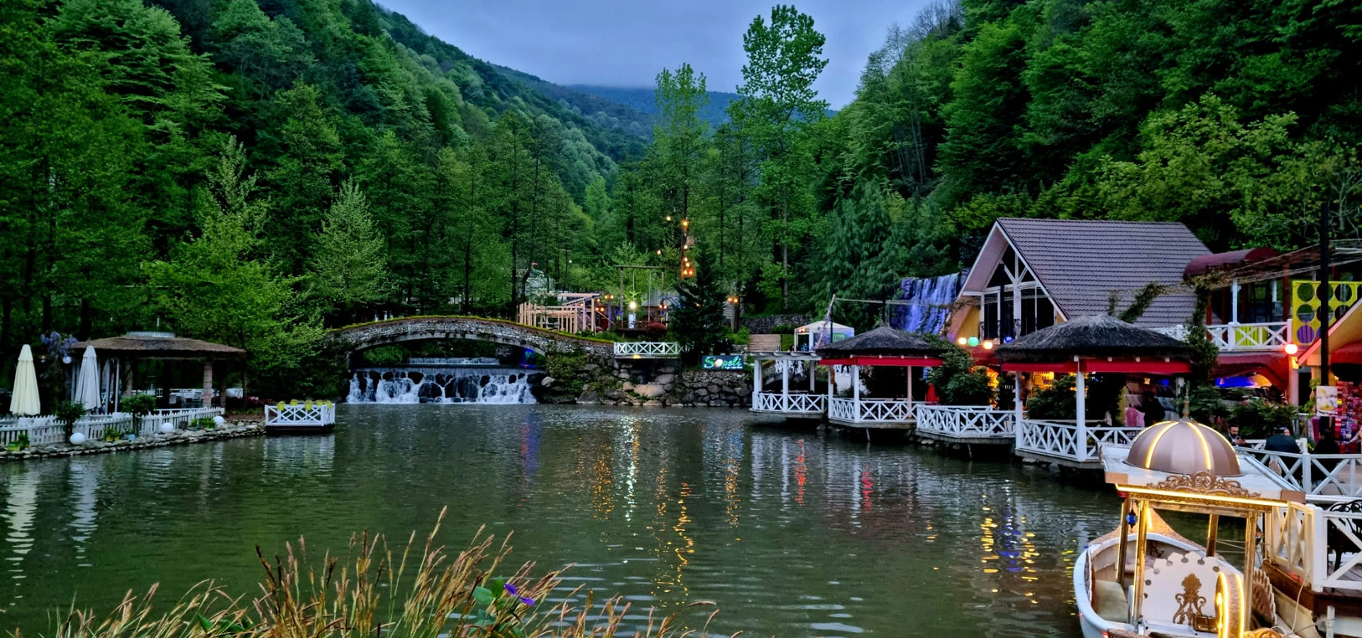
Discover lakes, Byzantine bridges, Ottoman towns, Black Sea landscapes, wetland forests, rivers, mountains and local food across Sakarya Province.
View Sakarya GuideConnect Sapanca with the mountain landscapes, historical monuments and natural attractions of Sakarya and Kocaeli.
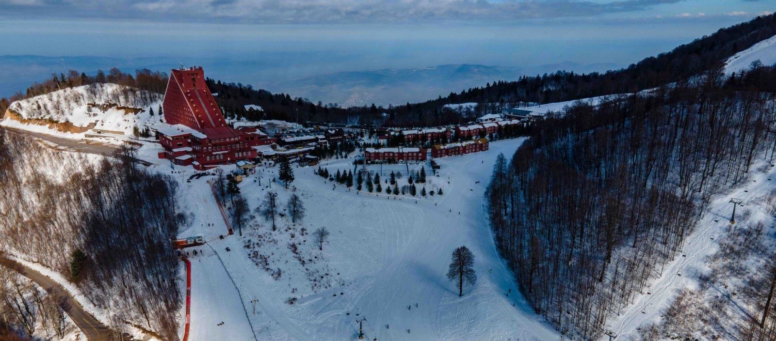
Climb above Sapanca for forest scenery, panoramic views and one of the Marmara region's best-known winter mountain destinations.
Explore Kartepe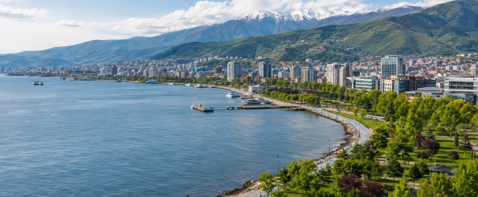
Continue west to discover İzmit, Hereke, Gebze, mountain landscapes, forests, Black Sea beaches and the Gulf of İzmit.
View Kocaeli Guide
Continue to historic bridges, lakes, traditional towns, floodplain forests, plateaus and the Black Sea coast.
Continue Exploring Sakarya