Bursa Teleferik
Ascend from Bursa through forests and mountain scenery on the famous gondola route toward Uludağ.
- Route: Approx. 9 km
- Upper area: Kurbağakaya / Oteller Bölgesi
- Experience: Panoramic mountain journey






Few cities in Türkiye possess a natural landmark as dramatic as Uludağ.
Rising immediately south of Bursa to 2,543 metres, the mountain dominates the skyline of the former Ottoman capital and forms the highest point of the Marmara Region.
For many travellers, Uludağ is best known as one of Türkiye's classic winter sports destinations, with ski slopes, mountain hotels, snow-covered forests and easy access from Bursa by cable car.
But Uludağ is far more than a ski resort.
Its protected mountain landscape includes dense forests, alpine meadows, rock formations, waterfalls, high-altitude plateaus, glacial landforms, rare plants, wildlife and a remarkable group of glacial lakes near the summit.
These natural values led to the establishment of Uludağ National Park in 1961, making it one of Türkiye's best-known protected mountain environments.
The mountain also has an extraordinary cultural history.
In antiquity, it was associated with Olympos and is often identified as Mysian Olympus. Ancient tradition connected the mountain with the legendary world of the gods and the Trojan War.
During the Byzantine period, its secluded forests and slopes became an important centre of Christian monastic life. Numerous churches, monasteries and hermit communities once occupied the mountain.
For centuries it therefore became known as Keşiş Dağı – the Mountain of the Monks.
After the Ottoman conquest of Bursa, Muslim dervishes also established spiritual associations with the mountain, creating another layer in Uludağ's remarkable religious landscape.
The modern name Uludağ – “Great Mountain” was officially adopted in 1925.
Today, visitors can travel from Bursa's urban neighbourhoods into the mountains by the famous Bursa Teleferik. The modern gondola route extends for roughly 9 kilometres, climbing through changing vegetation to Sarıalan and the Oteller Bölgesi hotel and ski area.
The experience can change completely with the season.
Winter brings skiing, snowboarding, snow-covered forests and busy mountain hotels. Spring reveals streams, wildflowers and melting snow. Summer is ideal for hiking, picnics, camping and escaping Bursa's heat, while autumn transforms the lower forests into a landscape of changing colours.
This complete guide explores Uludağ Mountain, Uludağ National Park, Bursa Teleferik, Sarıalan, Çobankaya, Bakacak, Oteller Bölgesi, skiing, snowboarding, hiking, the summit, glacial lakes, Softaboğan, forests, wildlife, endemic plants, camping, picnics, seasonal conditions, transport, photography, family visits, safety, visitor information and suggested Uludağ itineraries.
Stand beneath the highest mountain summit in the Marmara Region and experience a dramatic change in climate and landscape above Bursa.
Explore a protected mountain ecosystem containing forests, alpine habitats, streams, wildlife and rare endemic plants.
Ride one of Türkiye's most famous gondola systems from Bursa toward Sarıalan and the Uludağ hotel district.
Discover one of Türkiye's historic skiing destinations with numerous slopes, lifts, hotels and winter activities.
Explore the extraordinary high-altitude lake region containing Karagöl, Aynalıgöl, Kilimligöl and other glacial basins.
Visit for snow in winter, wildflowers and streams in spring, hiking in summer or colourful forests in autumn.
Essential information for visiting Bursa's great mountain in any season.
Immediately south of Bursa in northwestern Türkiye.
Open on Google MapsApproximately 2,543 metres above sea level.
Protected as Uludağ National Park since 1961.
Cable car, private vehicle, taxi, organised transport and mountain road.
Uludağ combines spectacular mountain scenery with history, wildlife, winter sports and exceptionally easy access from a major city.
Uludağ is unusual because visitors can move from Bursa's historic Ottoman centre to a genuine high-mountain landscape within a relatively short journey.
Below, Bursa spreads across the plain at the foot of the mountain. Above, forests gradually give way to conifers, mountain meadows, rocky slopes and exposed alpine terrain.
In winter, the same mountain becomes one of Türkiye's most celebrated snow destinations.
During warmer months, visitors discover an entirely different Uludağ: quiet forest roads, picnic areas, streams, wildflowers, mountain viewpoints and long hiking routes.
Uludağ is therefore valuable not because of one single attraction, but because many different mountain environments exist within the same protected landscape.
Your experience will depend heavily on the season and how high into the mountain you travel.
Ascend from Bursa through forests and mountain scenery on the famous gondola route toward Uludağ.
Stop among extensive mountain forests at one of Uludağ's best-known recreation and picnic areas.
Experience the mountain's principal hotel and winter-sports district surrounded by ski slopes and lifts.
Discover a quieter forest and recreation area beyond the main hotel zone with access to nature trails and picnic landscapes.
Enjoy one of Uludağ's classic viewpoints overlooking the Bursa landscape and surrounding mountain forests.
Explore the remote high-altitude landscape containing Uludağ's remarkable glacial lake basins.
Discover the exposed upper mountain where forests disappear and dramatic rocky alpine landscapes take over.
Watch vegetation change dramatically as the road or cable car climbs from Bursa toward the alpine zone.
The natural importance of Uludağ was formally recognised when the mountain became a national park on 20 September 1961.
The protected landscape today covers approximately 12,762 hectares.
Much of the park is forest, but its environmental value comes from the enormous variety of habitats created by changing elevation, climate, slope and geology.
Uludağ belongs to the early generation of Türkiye's nationally protected natural landscapes.
The protected park covers a substantial portion of the mountain above Bursa.
Approximately seventy percent of the protected landscape is covered by forest.
Higher elevations contain meadows, rocky terrain, shrub communities and exposed mountain ecosystems.
High areas preserve geological evidence created during colder periods of Earth's recent history.
Uludağ supports extraordinary plant diversity as well as mammals, birds, butterflies and other wildlife.
The national park should therefore not be understood simply as the area surrounding the ski hotels.
The developed winter-sports zone occupies only one part of a much larger protected mountain ecosystem.
Uludağ rises dramatically immediately south of the Bursa plain.
Its height, orientation and steep changes in elevation create a striking sequence of landscapes within a comparatively small geographical area.
The mountain reaches approximately 2,543 metres above sea level.
Uludağ is the highest mountain in the wider Marmara Region of northwestern Türkiye.
The massif extends for roughly forty kilometres across the Bursa landscape.
The mountain rises sharply above Bursa, producing impressive relief and extensive views.
Areas such as Sarıalan and Çobankaya create more open landscapes between forested slopes.
Above the upper tree line, exposed rock and mountain vegetation dominate the landscape.
The sudden rise of Uludağ is one reason Bursa possesses such a distinctive setting.
From many points in the city, the mountain appears almost like a vast natural wall rising behind the Ottoman capital.
Uludağ's present form was created through a complex combination of tectonic movement, uplift, erosion and ancient glacial activity.
Granite and other intrusive igneous rocks form important parts of the mountain's geological structure.
Movements of the Earth's crust played a major role in raising the mountain above the surrounding landscape.
Intrusive igneous rocks form an important component of Uludağ's geological structure.
Ice once shaped upper valleys and depressions during colder climatic periods.
Mountain basins created by glacial processes later collected water to form today's high-altitude lakes.
Erosion has created distinctive outcrops and rugged formations across the upper mountain.
Snowmelt and rainfall feed streams descending toward the Bursa plain and surrounding valleys.
For visitors interested in physical geography, Uludağ is one of the most rewarding mountain environments in northwestern Türkiye.
Long before the mountain received its modern name, Uludağ was connected with the ancient concept of Olympos.
It is commonly identified as Mysian Olympus – Olympos Misios, distinguishing it from other mountains in the ancient world carrying the Olympos name.
The ancient name connected the mountain with the sacred and mythological geography of the region.
The geographical description helped distinguish the Bursa mountain from other ancient Olympos mountains.
Ancient Bursa was described as Prusa beneath Olympus, directly connecting the city with the mountain.
Later cultural tradition associated the mountain with the gods observing events of the legendary Trojan War.
This connection survives indirectly in the ancient name of Bursa itself: Prusa ad Olympum.
The relationship between mountain and city has therefore defined Bursa's identity for more than two thousand years.
During the Byzantine era, Uludağ became an important landscape for Christian monasticism.
Its remote forests, springs, caves and secluded slopes provided ideal conditions for communities seeking isolation from urban life.
Provincial historical sources record that more than fifty churches and monasteries were established in different parts of the mountain from the Byzantine period onward.
Remote mountain valleys offered monks isolation while remaining relatively close to major Byzantine cities.
Religious communities once occupied numerous locations across the mountain.
The Turkish name means Mountain of the Monks and reflected this long religious association.
The mountain retained religious significance even as political control of Bursa changed.
Following the Ottoman conquest, some Christian communities remained for a period, while Muslim dervishes and holy men also became connected with different parts of the mountain.
Uludağ therefore contains an important, although often overlooked, history of retreat, spirituality and sacred landscape.
The modern Turkish name can be translated simply as “Great Mountain”.
It is an appropriate description for the enormous massif that has dominated Bursa's geography, history and imagination for centuries.
For many visitors, the most memorable way to reach Uludağ is aboard Bursa Teleferik.
Türkiye's pioneering Bursa cable-car service originally opened in 1963 and was later completely modernised.
The present gondola system climbs from Teferrüç through the mountain forests toward Uludağ.
The lower terminal is located in Bursa's Yıldırım district and forms the principal city departure point.
The route climbs through approximately 1,231 metres elevation as the urban landscape gives way to mountain forest.
At approximately 1,635 metres, this is one of Uludağ's principal forest recreation areas.
The upper station serves the Oteller Bölgesi at approximately 1,810 metres.
The complete cable route extends for roughly nine kilometres.
Under normal operation, the mountain journey takes roughly twenty-two minutes.
The experience is particularly impressive because the landscape can change dramatically during the ascent.
In winter, visitors sometimes begin in rainy or snow-free Bursa and arrive in a completely white mountain landscape.
Operating hours, ticket prices and service can change according to season, wind, weather, maintenance and demand.
Always check current cable-car conditions on the day of travel, especially during winter storms or strong winds.
Sarıalan is one of the best places to experience the forested side of Uludağ without attempting a difficult mountain hike.
Located at approximately 1,635 metres, the area can be reached by cable car as well as mountain road.
Tall mountain trees surround open recreation areas and walking routes.
Sarıalan has long been one of Bursa's classic mountain picnic destinations.
Forest paths allow visitors to experience Uludağ away from the busier ski slopes.
The gondola provides direct access from Bursa without requiring a car.
The landscape changes dramatically between snowy winter and green summer.
The altitude makes Sarıalan a popular escape from Bursa's summer heat.
For families or travellers who want mountain scenery without serious trekking, Sarıalan can be one of the most practical destinations on Uludağ.
Çobankaya offers another side of Uludağ, with forest, open recreation areas and access to walking routes away from the busiest parts of the hotel district.
Enjoy a quieter environment surrounded by characteristic Uludağ vegetation.
The wider area is traditionally associated with picnicking, camping and nature activities.
Walking routes connect the area with Sarıalan, hotel zones and other mountain landscapes.
Çobankaya generally feels more natural than the concentrated hotel and ski-resort areas.
Camping and fire regulations can change, particularly during periods of high wildfire risk. Visitors should always follow current National Park restrictions.
The Bakacak area is famous for broad views extending from the high mountain toward Bursa and the surrounding landscape.
On exceptionally clear days, the scale of the view explains the strategic geographical relationship between Uludağ, Bursa and the wider Marmara region.
See the city spreading across the plain far below the mountain.
Mountain ridges covered with trees create excellent layered landscape photographs.
Early light can be spectacular when weather and access conditions allow.
Under suitable atmospheric conditions, low cloud can collect beneath the mountain viewpoints.
Visibility changes rapidly on Uludağ. A completely clear panorama can disappear behind cloud, fog or snow within a short time.
Uludağ developed into one of Türkiye's pioneering winter-sports centres and remains among the country's most famous ski destinations.
The principal resort area is concentrated around Oteller Bölgesi, where hotels, ski facilities, equipment rental, restaurants and winter services are grouped together.
The older hotel district contains some of Uludağ's longest-established accommodation and ski facilities.
A newer concentration of hotels and ski infrastructure extends the mountain's resort facilities.
Different runs cater to varying ability levels, although conditions and openings change daily.
Chairlifts and surface lifts provide access to different ski sectors across the resort.
Skis, snowboards and other winter equipment can generally be rented in the resort area.
Lessons are available through local ski schools and instructors during the operating season.
Individual lifts are not always operated as one single unified system.
Visitors planning a serious ski day should therefore check which lifts and pistes are operating, which pass is required and current snow conditions before purchasing equipment or tickets.
The main ski season usually centres on December through March, although the beginning and end of reliable skiing vary significantly from year to year.
Snow can remain at higher elevations beyond the principal resort season, but temperature, wind and precipitation determine actual ski conditions.
Gentler slopes and instruction make parts of Uludağ suitable for first-time skiers.
A substantial part of the mountain's resort terrain appeals to recreational intermediate skiers.
More demanding slopes are available when snow and lift conditions permit.
Uludağ is also one of Türkiye's established snowboarding destinations.
Rental shops in the hotel district reduce the need for casual visitors to bring their own equipment.
Fog, wind and heavy snow can affect visibility and lift operation even when snow depth is excellent.
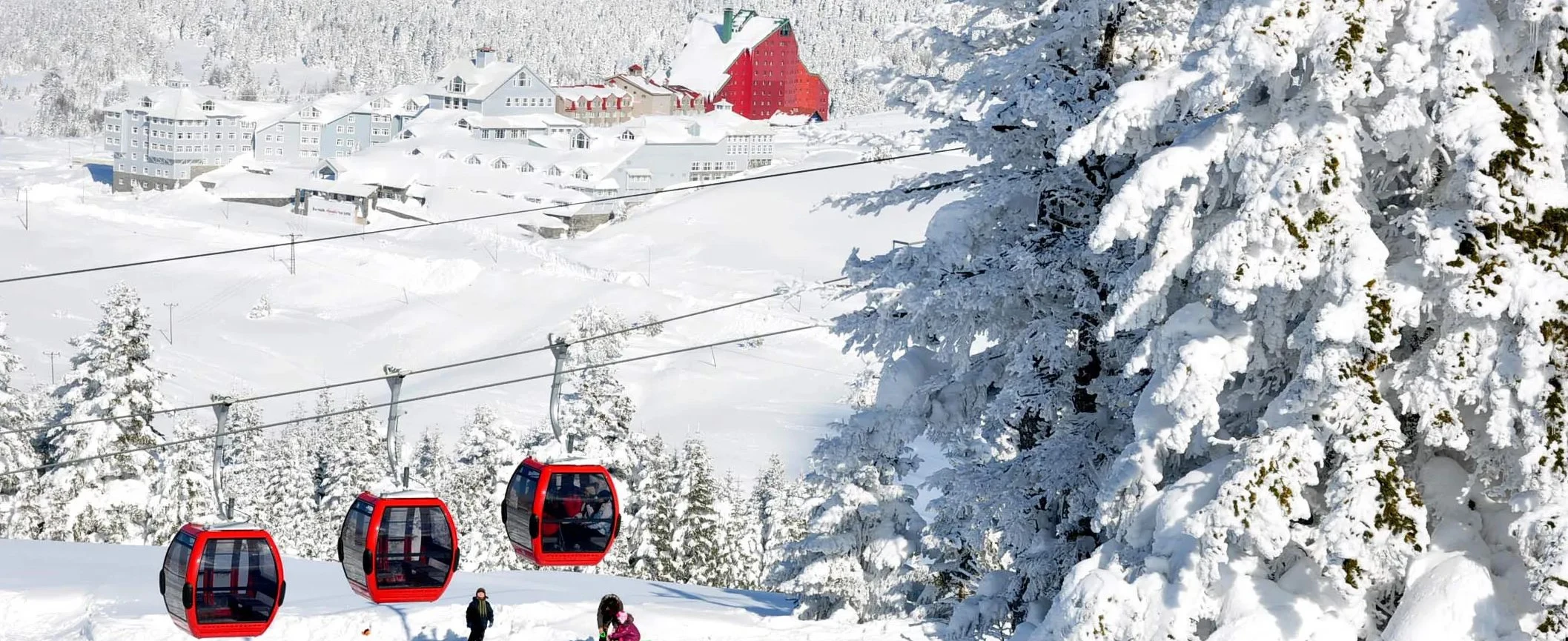
Winter transforms Uludağ into the landscape most visitors associate with the mountain: snow-covered conifers, ski slopes, gondolas and busy mountain hotels.
The principal reason many travellers visit between December and March.
You do not need to ski to enjoy the mountain's winter scenery.
The journey can provide extraordinary views across snow-covered forests.
Restaurants and hotels provide warm places to eat and rest between outdoor activities.
Winter weekends and school holidays can become extremely busy.
Snow tyres, chains or official winter-equipment requirements may apply according to conditions.
If your main goal is simply seeing snow, a cable-car trip and several hours around the upper stations may be enough.
If you plan to ski, stay overnight or explore several sections of the mountain, allow substantially more time.
Outside the ski season, Uludağ becomes a completely different destination.
Snow retreats from lower elevations, streams fill with meltwater and mountain meadows become increasingly colourful.
Warmer months open routes that are inaccessible or technically demanding during winter.
Mountain meadows support an impressive variety of flowering plants.
Sarıalan and other designated recreation zones become popular with Bursa residents.
Designated mountain areas can offer seasonal camping subject to current park regulations.
Higher elevations provide welcome relief during hot summer days in Bursa.
Summer gives hikers more time for extended mountain routes before darkness.
Late spring conditions can still resemble winter at the highest elevations. Always check snow cover before attempting summit or lake routes.
Autumn is one of the most underrated periods to visit Uludağ.
Deciduous forests at lower and middle elevations begin changing colour, while visitor numbers can be considerably lower than during peak winter weekends.
Changing foliage creates beautiful colour contrasts along the mountain road and cable-car route.
Cooler light, coloured leaves and occasional mist produce atmospheric landscapes.
Many lower trails remain comfortable before winter snow develops.
Cold rain, fog and even early snow can occur as the season progresses.
Uludağ contains routes ranging from easy forest walks to demanding high-altitude hikes.
Official Bursa tourism information has historically identified several marked routes beginning around the hotel district.
A relatively short mountain walk of approximately 2 km with broad views from the upper resort area.
An approximately 5.2 km forest route connecting important recreation areas.
An approximately 6 km route through forest, streams and waterfall landscapes.
A longer descent of roughly 7.5 km from the upper mountain toward rural settlements.
A high-altitude route of roughly 7.6 km historically described toward the summit region.
The long high-mountain route toward the glacial lakes requires considerably greater preparation.
Trail markings, closures and route conditions can change.
For serious hikes, especially toward the summit or glacial lakes, use current maps, offline navigation, proper mountain clothing and local route information.
The Softaboğan area demonstrates that Uludağ's attractions extend well beyond snow and skiing.
Mountain streams descend through forest terrain, forming small cascades, pools and waterfall-like sections.
The approach leads through attractive woodland rather than open ski terrain.
Streams are particularly impressive during periods of strong snowmelt and rainfall.
Moving water, rocks and forest create excellent long-exposure compositions.
Flow levels and trail accessibility vary considerably during the year.
Wet rocks, mud and snowmelt can make parts of the route slippery. Proper footwear is strongly recommended.
One of Uludağ's most extraordinary natural landscapes lies high beneath the summit.
Here, glacial erosion created depressions that later became a group of high-altitude mountain lakes.
The wider lake region includes seven named basins: Aynalı, Karagöl, Buzlu, Kilimli, Heybeli, Kovukdere and Çayırlıdere.
One of the best-known lakes in Uludağ's dramatic upper mountain landscape.
A high-altitude lake surrounded by rocky mountain terrain.
Another important glacial basin frequently included on hiking routes through the lake region.
Its name, meaning Icy Lake, reflects the severe climate of Uludağ's upper elevations.
A smaller seasonal mountain basin whose water level can vary significantly.
Additional lakes and seasonal basins complete the wider seven-lake landscape.
These lakes should not be approached as an easy roadside attraction.
Reaching them normally requires substantial hiking in exposed high-mountain terrain.
Fog, snow, storms and sudden temperature changes can make navigation difficult even when conditions in Bursa are warm and sunny.
Uludağ reaches approximately 2,543 metres, but the summit should not be confused with the easily accessible hotel area.
Reaching the highest sections requires a genuine mountain excursion.
The summit forms the highest point of the Marmara Region.
Vegetation becomes increasingly sparse as hikers climb beyond the forest line.
Fog can remove visible landmarks rapidly, making reliable navigation essential.
Conditions near the summit may be dramatically colder and windier than Bursa city centre.
Snowfields can persist after lower elevations have entered spring or summer.
Proper footwear, water, layers and route planning are essential for serious summit attempts.
In winter, the upper mountain becomes a mountaineering environment rather than an ordinary tourist walk.
Visitors without suitable experience should not attempt remote summit routes during severe conditions.
One of the most scientifically important aspects of Uludağ is its exceptional botanical diversity.
The rapid climb from low elevations to more than 2,500 metres creates a series of distinct vegetation zones.
Official conservation information records approximately 1,320 plant taxa within the wider protected landscape.
Uludağ contains remarkable botanical diversity within a relatively compact mountain area.
Dozens of plants are identified as endemic specifically to the Uludağ environment.
Many additional species found here occur naturally only within Türkiye.
Different tree communities appear as altitude, temperature and exposure change.
Shrubs and mountain meadows replace dense forest at higher elevations.
Short growing seasons produce specialised flowering plants near the upper mountain.
Wildflowers should never be collected.
Many mountain species are rare, slow-growing or restricted to very small ecological zones.
The changing forest is one of the most interesting things to observe while travelling up Uludağ.
Different tree communities dominate at different elevations, creating an almost vertical journey through ecological zones.
Deciduous woodland dominates many of the lower slopes above Bursa.
Beech becomes an important element of the cooler middle mountain environment.
Conifers increasingly dominate as elevation rises.
Trees become smaller and eventually disappear as climatic conditions become increasingly severe.
Mixed vegetation produces beautiful seasonal colour at lower and middle elevations.
Snow-covered conifers create the classic winter imagery associated with Uludağ.
Despite the busy resort zones, large sections of Uludağ remain important wildlife habitat.
Uludağ belongs to the broader range of brown bear populations in northwestern Anatolia.
Wolves are among the larger mammals recorded within the protected mountain ecosystem.
Forest habitats support roe deer and other woodland mammals.
Wild boar are widespread in suitable forest habitats.
Eagles, vultures, falcons and other raptors are associated with the mountain.
Uludağ's botanical diversity supports an unusually rich butterfly population.
Wildlife sightings are never guaranteed, and animals should never be approached, fed or deliberately disturbed.
Food waste should be removed carefully, particularly from remote picnic and camping areas.
Uludağ has a long tradition of camping and outdoor recreation, particularly around areas such as Sarıalan, Çobankaya and Kirazlıyayla.
One of the mountain's best-known organised recreation and camping landscapes.
A high forest environment traditionally associated with camping and nature activities.
A lower mountain recreation area reached from the National Park road.
Temperatures can fall sharply after sunset even when Bursa is hot.
Seasonal wildfire regulations may restrict barbecues, fires or camping activities.
Camp only where permitted and remove everything you bring into the park.
Because regulations can change quickly, especially during summer fire danger, confirm current camping and fire rules before travelling.
For Bursa residents, Uludağ has long been much more than a tourist destination.
Families have travelled into the mountain forests for generations to enjoy fresh air, picnics and cooler summer temperatures.
A classic choice for a convenient mountain picnic with cable-car access.
Combine lunch with an easy walk away from the busiest recreation zones.
Generally quieter than sunny weekends and public holidays.
Remove food packaging, bottles and all other waste from natural areas.
There is no single best season for everyone.
Choose winter for snow, late spring and summer for hiking, and autumn for forest colour and photography.
Never judge Uludağ's conditions entirely from the weather in central Bursa.
A difference of well over 1,500–2,000 metres in elevation can produce dramatically colder temperatures, stronger wind, cloud and snow on the mountain.
Expect the upper mountain to be considerably cooler than Bursa throughout the year.
Cloud can cover the mountain rapidly and reduce visibility to only a short distance.
Strong winds can affect cable-car and ski-lift operation.
Heavy winter snowfall can alter roads, trails and access within hours.
High-altitude hikers should remain alert for sudden weather changes even in summer.
UV exposure can be strong at altitude, particularly when reflected by snow.
Waterproof footwear, warm layers, gloves, hat and weather-resistant outer clothing are strongly recommended.
Bring layers, waterproof shoes and protection against both rain and remaining snow.
Use comfortable hiking footwear, sun protection and carry an extra warm layer for altitude.
Prepare for cool wind, rain, mud and rapidly falling temperatures toward evening.
Visitors taking only the cable car sometimes underestimate how cold the upper station can feel.
Even for a short sightseeing visit, carry at least one additional warm layer.
Uludağ can be reached by cable car or mountain road. The best option depends on the season, weather and what you plan to do.
Travel from Teferrüç through Sarıalan toward Kurbağakaya and the hotel district.
Drive from Bursa through the forest road and National Park entrance toward the upper mountain.
A taxi can be useful for travellers wanting direct access to a specific hotel or recreation area.
A private vehicle makes it easier to combine Uludağ with several historic Bursa attractions in one day.
The National Park's Karabelen entrance lies approximately 22 km by road from Bursa, with the hotel region continuing higher into the mountain.
Depending on the exact starting point and destination, the complete road journey from central Bursa to the ski district is approximately 34–36 km.
Driving allows considerably greater freedom than the cable car, especially if you want to visit several areas of the National Park.
The ascent winds through impressive mountain woodland above Bursa.
Road visitors normally enter the protected area through the Karabelen sector.
Snow tyres, chains or other precautions may be essential or required during winter conditions.
Heavy congestion can occur during popular snowy weekends and holidays.
Parking pressure increases significantly around the hotel and ski zones during peak periods.
Road conditions can deteriorate rapidly during snowfall, freezing temperatures or fog.
Strong wind or maintenance can temporarily interrupt cable-car operation.
Winter weekends, school holidays and snowy days can attract very large crowds.
Confirm the day's final downhill service rather than assuming evening operation.
The upper mountain may be dramatically colder than Teferrüç station.
Choose your destination according to whether you want forest recreation or the ski-resort environment.
The journey can pass directly through cloud, making visibility very different on the ascent and descent.
Restaurants, cafés and hotel dining facilities are concentrated mainly around the developed recreation and ski zones.
The resort area provides the widest selection of restaurants, cafés and hotel dining.
Seasonal facilities support visitors using the recreation and picnic areas.
Grilled meat, soups, hot drinks and simple mountain dishes are particularly popular in snowy weather.
Consider returning to central Bursa for İskender kebab, cantık, tahini pide or local desserts.
For longer hikes, carry sufficient water and food. Do not assume cafés or shops will be available outside the main developed areas.
Yes. Uludağ can be one of the most enjoyable family excursions from Bursa, particularly if the day is planned around accessible areas.
The gondola journey itself can be one of the highlights for children.
A good option for relaxed forest time without demanding high-altitude hiking.
Families do not need to ski to enjoy a winter visit.
Choose simple recreation areas rather than remote summit or lake routes.
Children require particularly careful clothing in winter. Wet gloves, shoes and clothing can become uncomfortable very quickly in freezing conditions.
Accessibility varies considerably depending on which part of Uludağ you intend to visit.
The modern transport infrastructure is considerably easier to use than remote natural trails.
Paved areas and hotel facilities can provide more manageable access than forest and alpine terrain.
Some recreation areas may be accessible with assistance, although natural surfaces can be uneven.
Snow and ice can create substantial additional barriers even on otherwise accessible surfaces.
Most hiking routes are unsuitable for conventional wheelchair access.
Direct transport to upper areas may simplify a visit for travellers with limited mobility.
Visitors requiring guaranteed step-free access should confirm current conditions directly with cable-car operators, hotels or individual facilities before travelling.
Uludağ is easily accessible, but accessibility should never be confused with the absence of mountain hazards.
Mountain forecasts are more relevant than conditions in central Bursa.
Essential when hiking away from developed recreation areas.
Do not depend entirely on mobile reception or online maps in remote terrain.
Natural water should not automatically be assumed safe for drinking.
Leaving recognised routes increases the risk of becoming lost, especially in fog.
Changing weather is a valid reason to abandon a summit or lake hike.
In winter, additional hazards include deep snow, ice, whiteout conditions, avalanche-prone terrain and severe cold.
Remote winter routes require appropriate mountaineering experience and equipment.
Millions of people can reach Uludağ from densely populated northwestern Türkiye, making responsible visitor behaviour especially important.
Never leave food packaging, bottles or picnic waste in forest or alpine areas.
Uludağ contains rare and endemic species that may occur nowhere else.
Never feed, chase or attempt close photographs of wild animals.
Staying on established routes reduces erosion and damage to fragile vegetation.
Wildfire restrictions must be respected even when traditional picnic practices differ.
Do not leave litter, use detergents or damage vegetation around high-altitude water bodies.
This route works particularly well for first-time visitors who want the mountain experience without committing to a demanding hike.
One of the great advantages of Uludağ is its proximity to Bursa's historic centre.
A mountain excursion can therefore be combined with major Ottoman monuments, markets and neighbourhoods.
Visit the tombs of Osman Gazi and Orhan Gazi and look back toward Uludağ from Bursa's ancient citadel.
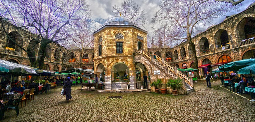
Explore Bursa's historic silk market after returning from the mountain.
Discover some of Bursa's finest early Ottoman architecture and tile decoration.
Visit one of Bursa's most important spiritual complexes on the lower slopes of Uludağ.
Explore the imperial külliye overlooking Bursa beneath the mountain.
Combine mountain landscapes with the UNESCO-listed early Ottoman village at the foot of Uludağ.
Uludağ can easily become part of a much broader Bursa itinerary covering nature, Ottoman history, traditional villages, thermal culture and local cuisine.
Walk through one of Bursa's best-preserved early Ottoman villages on the lower slopes of Uludağ.
Discover one of Bursa's most important religious and pilgrimage landmarks.
Explore the mosque, madrasa, hospital and royal tomb associated with Sultan Bayezid I.
See Bursa's celebrated turquoise tiles and early fifteenth-century imperial architecture.
Relax in the courtyard of Bursa's historic Ottoman silk caravanserai.
Continue west toward Çekirge and the unusual imperial foundation of Sultan Murad I.
Visit the graves of the dynasty's founders and enjoy sweeping views toward the Bursa plain.
Plan your full stay covering Ottoman monuments, bazaars, thermal baths, museums, villages, cuisine and Uludağ.
Uludağ is the large mountain rising immediately south of Bursa in northwestern Türkiye. It contains Uludağ National Park, a major ski resort, forests, alpine habitats and glacial landscapes.
The mountain reaches approximately 2,543 metres above sea level.
No. Türkiye contains many considerably higher mountains. Uludağ is, however, the highest mountain in the Marmara Region.
Yes. Uludağ was declared a National Park in 1961 because of its natural, geological, botanical and recreational importance.
Current official conservation information describes the protected park as approximately 12,762 hectares.
The mountain was associated with Olympos and is commonly identified as Mysian Olympus or Olympos Misios.
Keşiş Dağı means Mountain of the Monks. The name developed because numerous Christian monasteries and religious communities existed across the mountain during the Byzantine period.
The modern name Uludağ was officially adopted in 1925.
Uludağ can be translated as Great Mountain.
Yes. The Bursa Teleferik climbs from Teferrüç toward Sarıalan and the upper hotel district.
The modern gondola route extends for approximately 9 kilometres.
Under normal operating conditions, the journey toward the upper mountain takes approximately 22 minutes. Queueing time is additional.
The lower terminal is located at Teferrüç in Bursa's Yıldırım district.
The upper route reaches Kurbağakaya, also known as the Oteller Bölgesi or Hotels Area, at approximately 1,810 metres.
Yes. Sarıalan, at approximately 1,635 metres, is an important recreation stop along the mountain route.
Yes. Strong wind, severe weather or maintenance can temporarily suspend service. Always check current operating conditions before travelling.
Yes. A mountain road climbs from Bursa through the National Park entrance to the upper hotel and recreation areas.
The exact distance depends on your destination, but the upper resort district is roughly 34–36 km by road from central Bursa.
They may be required or strongly advisable according to winter road conditions. Visitors should check current official requirements and weather before beginning the ascent.
The main ski period usually runs from approximately December through March, but snow conditions vary significantly from year to year.
Yes. There are beginner-friendly areas, equipment rental services and ski instruction within the resort.
Absolutely. Many visitors come simply for snow, the cable-car journey, forest scenery, restaurants, photography or mountain walks.
Yes. Summer is excellent for hiking, forest walks, picnics, camping, wildflowers and escaping the heat of Bursa.
Yes. Routes range from relatively easy forest walks to long, demanding high-altitude hikes toward the summit and glacial lakes.
Yes. The upper mountain contains a remarkable lake region created by ancient glacial erosion.
The best-known include Karagöl, Aynalıgöl, Kilimligöl and Buzlu Göl, with several additional seasonal or smaller basins in the wider high-mountain region.
The wider high-altitude landscape is commonly described as containing seven named glacial or glacially formed lake basins.
Visitors should be physically prepared and capable of navigating exposed mountain terrain. The route is not comparable to an ordinary city-park walk.
Yes, but reaching the upper summit region requires proper route planning, fitness, suitable equipment and appropriate weather.
Winter summit terrain can involve deep snow, ice, strong wind, poor visibility and other serious mountain hazards. It should only be attempted with suitable experience and equipment.
Sarıalan is a major forest recreation area at approximately 1,635 metres, accessible by both cable car and road.
Çobankaya is another high forest and recreation area, popular for nature activities, walking and seasonal outdoor use.
Bakacak is one of Uludağ's famous panoramic areas, known for views toward Bursa and the surrounding landscape when visibility is clear.
Softaboğan is a forest and stream landscape reached by one of Uludağ's recognised hiking routes, with cascades and waterfall-like sections.
Camping has traditionally been available in designated areas such as Sarıalan, Çobankaya and Kirazlıyayla, subject to current National Park regulations and seasonal restrictions.
Only where currently permitted. Fire regulations can become particularly strict during periods of high wildfire danger. Always follow current National Park instructions.
Yes. Brown bears are among the wild mammals recorded within the Uludağ ecosystem, although ordinary visitors are unlikely to encounter them in busy recreation areas.
Wildlife includes wolves, foxes, roe deer, wild boar, smaller mammals and numerous bird species.
Its great variation in elevation and habitat supports more than a thousand plant taxa, including numerous species endemic to Uludağ or Türkiye.
No. Visitors should leave wild plants untouched, especially because the National Park contains rare and endemic species.
Yes. Cable-car rides, Sarıalan, snow activities and short forest walks can all work very well for families.
Some modern developed areas are more manageable, but snow, slopes, uneven natural surfaces and mountain trails create significant limitations. Check individual facilities before travelling.
No. Uludağ National Park itself is not a UNESCO World Heritage property. Nearby historic Bursa and Cumalıkızık, however, form the UNESCO site “Bursa and Cumalıkızık: the Birth of the Ottoman Empire.”
Yes. A private vehicle makes it relatively easy to combine Cumalıkızık with selected areas of Uludağ in one day.
Yes. Uludağ can be combined with Tophane, Ulu Camii, Koza Han, Yeşil, Emir Sultan or other historic districts depending on how much time you spend on the mountain.
Allow at least 3–4 hours for a simple cable-car and sightseeing excursion. A full day is better for skiing, long walks or visiting several National Park areas.
It is possible, but the journey becomes considerably more enjoyable if combined with Bursa and planned carefully. A private itinerary gives greater flexibility than trying to fit several transport connections into one day.
Dress for the mountain rather than Bursa city centre. Even in warmer months, carry layers, proper shoes and protection from wind or rain.
For cable-car sightseeing they are not essential, but sturdy footwear is strongly recommended for forest trails, waterfall routes and high-altitude hiking.
Yes. Restaurants, cafés and hotel dining are available primarily around the developed recreation and resort areas. Remote hiking routes have few or no facilities.
Every season offers something different: snow-covered forests in winter, wildflowers in spring, clear high-country landscapes in summer and colourful woodland in autumn.
Absolutely. It combines mountain scenery, National Park landscapes, wildlife, glacial geology, ancient and Byzantine history, skiing, hiking and one of Türkiye's most memorable cable-car journeys within easy reach of Bursa.
Uludağ is one of Bursa's most varied photography destinations because altitude, weather and season continually transform the landscape.
Photograph gondola cabins crossing dense mountain forest during the ascent from Bursa.
Fresh snowfall creates classic compositions of cabins floating above snow-covered conifers.
Use tall trees and forest paths for intimate landscape photography away from the ski resort.
Capture Bursa and the plains below from one of the mountain's best-known viewpoints.
When conditions cooperate, clouds below the mountain can create spectacular elevated landscapes.
Snow, ski lifts, hotels and winter activity create energetic resort photographs.
High-altitude lakes surrounded by bare rock create Uludağ's most dramatic summer hiking images.
Use close-up photography to document the remarkable botanical diversity without disturbing plants.
Streams, rocks and forest provide beautiful long-exposure possibilities.
Changing foliage along the mountain road creates striking colour and depth.
After fresh snowfall, quieter forest areas can appear almost completely monochrome.
Wide-angle compositions reveal the transition from green forest to exposed alpine terrain.
For the strongest visual story, combine a cable-car image, forest detail, wide mountain panorama, seasonal landscape and one high-altitude geological feature.
Uludağ can be incorporated into private Bursa itineraries combining mountain scenery, cable-car experiences, Ottoman heritage, local cuisine, traditional villages and the UNESCO cultural landscape.
Flexible private routes with transportation and professionally licensed guiding.
Combine Bursa's historic centre with Uludağ, mountain viewpoints, forest landscapes, seasonal snow and the famous cable-car experience in a flexible private itinerary.
Request This Tour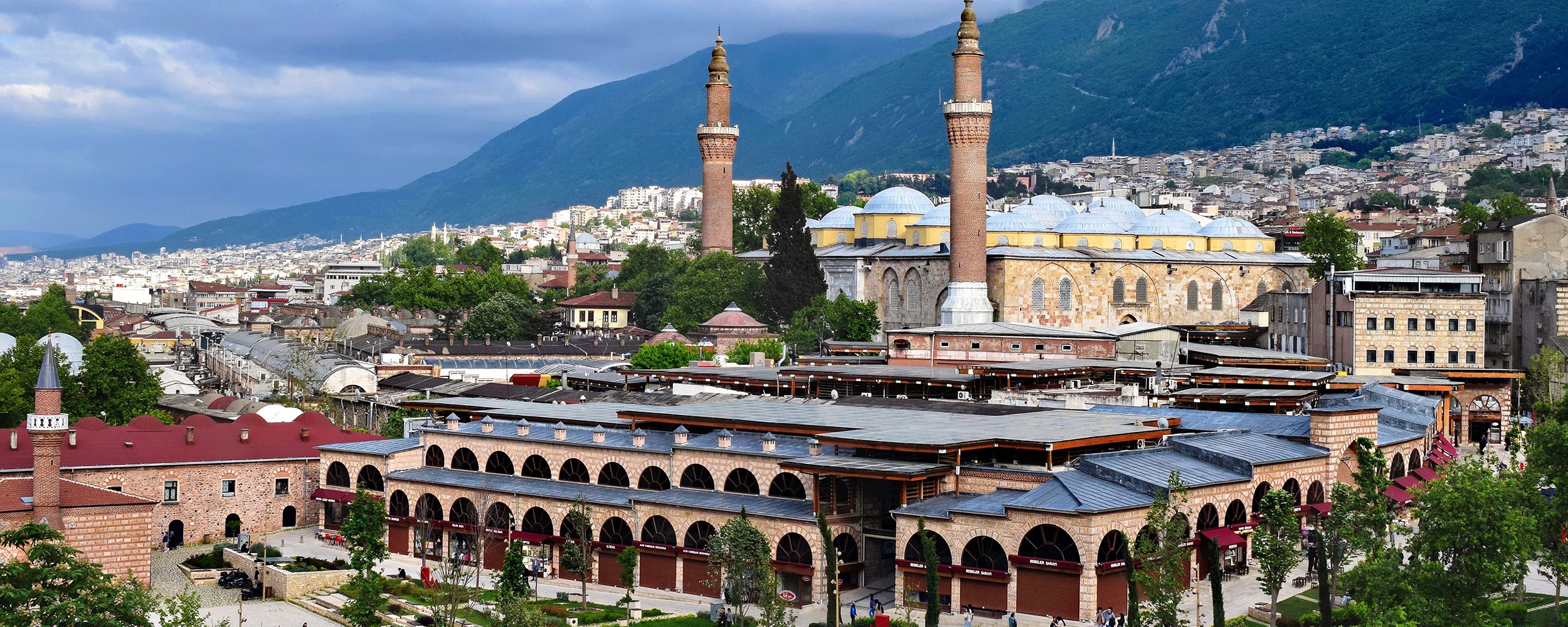
Experience three contrasting landscapes in one journey: Ottoman Bursa, the traditional village of Cumalıkızık and the forests and high mountain scenery of Uludağ.
Design Your JourneyConnect Bursa's historic landscape with the wider cultural and natural heritage of Türkiye.
Travel through Istanbul, Bursa, Safranbolu, Hattusha, Cappadocia, Mount Nemrut, Şanlıurfa, Ephesus, Pamukkale, Pergamon, Troy and Gallipoli.
View Tour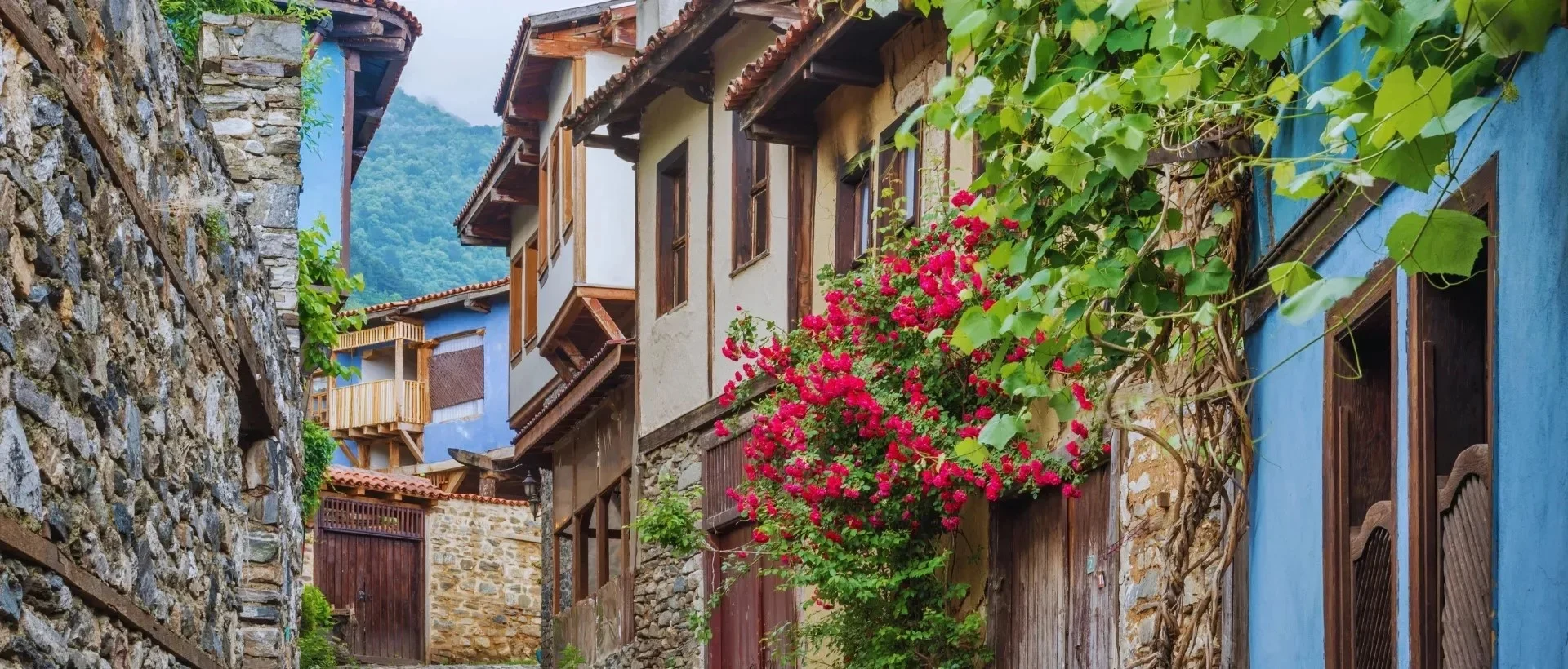
Build a private programme combining Uludağ, Cumalıkızık, Bursa's imperial külliyes, historic bazaars, thermal heritage and traditional local cuisine.
Design Your Journey