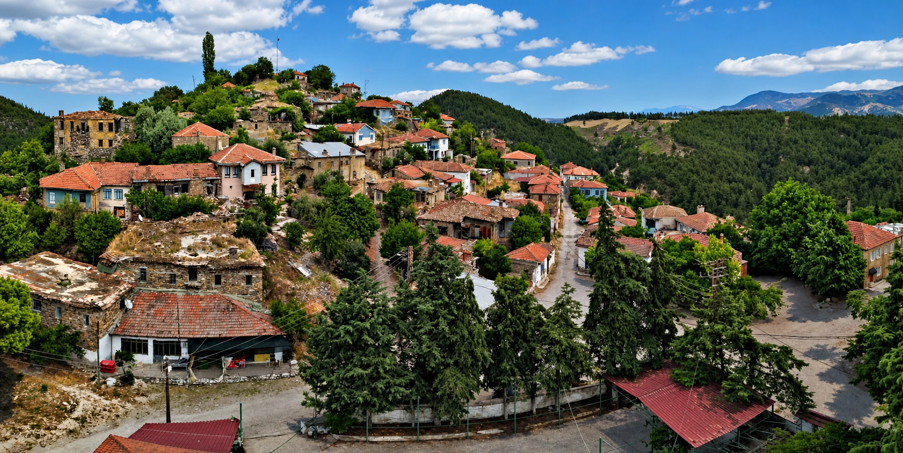
Attuda Ancient City
Explore a hilltop settlement tied to the region’s Phrygian–Carian frontier and the cult of Men Karou.
Discover Attuda





Long before thermal hotels and geothermal power stations transformed western Denizli, Karura—also written Carura or Karoura—stood in the great Büyük Menderes (ancient Maeander) Valley. This modest settlement mattered because of its position on a travelled route, its naturally hot springs, and its location near the border between Phrygia and Caria.
The Greek geographer Strabo, writing around the transition from the first century BC to the first century AD, describes Karura as a village with inns and outlets of extremely hot water, some in the Maeander River and some along its banks. The same account evokes the region’s powerful earthquakes and unstable subterranean landscape.
Karura is closely associated with the modern Tekke / Tekkeköy thermal area of Sarayköy district, as recognised by the Denizli Provincial Directorate of Culture and Tourism. However, the historical identification does not mean that a fully excavated, ticketed archaeological park exists today. Much of the settlement’s physical form is still uncertain to ordinary visitors.
This detailed guide separates what ancient texts actually say from modern interpretation. Explore Karura’s location, hot springs, borderland identity, medical connections, the sanctuary of Men Karou, practical visiting advice and excellent nearby archaeological destinations.
An ancient settlement recorded with inns and extraordinarily hot springs.
A meeting point of Phrygia and Caria in the Maeander Valley.
A renowned nearby sanctuary linked to the region’s medical tradition.
Understand an ancient site without expecting excavated monuments or unrestricted access.
Essential historical and practical information for exploring one of western Denizli’s lesser-known ancient places.
Tekkeköy / Tekke thermal area, Sarayköy district, Denizli Province, Türkiye.
Karura; also spelled Carura, Karoura and Greek ta Karoura.
Strabo, Geography, Book XII, sections 8.17 and 8.20.
A settlement at or near the frontier of Phrygia and Caria.
Very hot natural springs near the Maeander River.
Strabo mentions inns, indicating accommodation for travellers.
Temple of Men Karou, described between Laodiceia and Karura.
An important Herophileian medical school in the wider area.
No verified standalone staffed Karura attraction with fixed tickets or hours.
Road journey via Sarayköy toward the Tekke area; verify precise access.
Do not expect a monumental excavated city or signed visitor route.
Do not enter raw thermal outlets, geothermal installations or private land.
Karura is compelling not because of a surviving amphitheatre or colonnaded avenue, but because a specific ancient author describes daily life at a remarkable place. Strabo’s picture of inns beside extremely hot springs captures a bustling and sometimes hazardous travel corridor.
Its geographical position connects several larger stories: east–west trade and travel along the Maeander, the shifting frontier between Phrygia and Caria, early approaches to thermal water, and the connection between religion and medical knowledge in Roman Anatolia.
For visitors already interested in Laodicea, Attuda or Tripolis, Karura provides an excellent historical lens through which to understand the entire valley. Approach it as a research-led heritage landscape, rather than as a guaranteed major sightseeing stop.
Strabo records the name, roadside inns and scalding hot springs.
A meeting place between two important ancient geographical regions.
A setting for travellers moving through western Asia Minor.
Historic uses of local hot-water sources.
The wider region was associated with Men Karou and physicians.
Rewarding context for curious travellers, even where ruins are limited.
Official Denizli cultural information places Karura in the Tekke / Tekkeköy area of Sarayköy district, within the thermal-spring landscape of western Denizli. The settlement belonged to the wider Maeander valley, where fertile lowlands meet faulted foothills.
Ancient geographical references identify a place on the important route connecting the region of Laodiceia with cities farther west. Strabo expressly describes Karura as situated on the Phrygia–Caria boundary; modern provincial boundaries do not reproduce those ancient geographical divisions.
The name should not be mistaken for the central streets of Sarayköy town or for an obvious archaeological entrance. Some modern directories show an approximate archaeological location, while the precise, safely accessible remains and visitor boundaries require on-the-ground verification.
Türkiye.
Denizli, in the Aegean region.
Sarayköy.
Tekke / Tekkeköy thermal district.
Maeander; modern Büyük Menderes.
Laodiceia to the east and the wider road network toward Caria.
Ancient and modern publications use several spellings, including Karura, Carura and Karoura. These generally refer to the same historical place; spelling differences reflect Greek, Latin, Turkish and scholarly transliteration.
You may also see the Greek-style form ta Karoura. Because classical writers sometimes use a regional or plural-looking place name, modern authors do not always treat the term in exactly the same way.
A definitive etymology should not be presented as settled. Popular explanations have linked Karura with pre-Greek Anatolian languages, but without stronger philological evidence, an attractive suggested meaning remains a hypothesis rather than a proven translation.
Common modern Turkish and English spelling.
Traditional Latinised spelling in English classics.
Transliteration reflecting Greek spelling.
Ancient Greek place-name form found in scholarly discussion.
Present-day locality associated with ancient Karura.
The linguistic derivation is not securely established.
The Greek geographer Strabo provides the clearest surviving literary description of Karura. In Geography XII.8.17 he identifies the settlement as a boundary between Caria and Phrygia, says that it had inns, and describes very hot water emerging both within the Maeander River and beside it.
His description is strikingly practical. The inns tell us that Karura served people in transit; the springs made the stop notable, while also revealing geological heat near the surface. The combination helps explain why even a relatively modest village could appear in a major geographical work.
Strabo also tells a dramatic earthquake story. It should be read as a reported anecdote within an ancient text, not as an independently established archaeological incident. His broader observations about seismic activity are nevertheless consistent with the faulted geography of the Menderes region.
Geography, Book XII, Chapter 8.
Karura, the boundary, inns and boiling-hot waters.
Some outlets in or along the ancient Maeander.
The presence of inns suggests a road-serving function.
An ancient account of seismic activity and an anecdote about a disaster.
Use Strabo as testimony, not as a modern archaeological site plan.
In antiquity, Phrygia occupied much of inland western Anatolia, while Caria was associated with territory farther southwest. Their boundaries shifted in meaning with political change, and authors could use cultural geography rather than a fixed modern-style border.
Karura’s importance as a frontier settlement is explicit in Strabo. A boundary was not necessarily a fortified wall. It might instead be recognised by roads, rivers, local traditions, market activity and administrative changes over time.
This is a valuable way to understand the region: nearby Attuda was also connected to the Phrygia–Caria border world, while Laodicea became a major city in the neighbouring Lycus Valley.
Historic region extending southwest into Anatolia.
Historic region centred farther inland.
Described by Strabo, rather than marked today by a visible monument.
Movement of people and religious practices across regions.
The Maeander helped organise settlement and routes.
Ancient borderlines cannot simply be drawn from present provinces.
Karura’s roadside inns are an unusually vivid detail in the ancient record. They suggest that travellers needed places to rest, find provisions and possibly arrange onward transport through the fertile Maeander corridor.
Classical historical geography identifies Carura on an important overland route between Laodiceia and western destinations. Roads helped inland Anatolian products reach market centres and, farther west, the Aegean world. It would be too strong, however, to assert that a particular modern road exactly follows the ancient alignment.
The Tabula Peutingeriana, preserved through later manuscript transmission, also preserves information about ancient routes and places. Karura’s place in that road geography supports its broader identity as a travel stop, although reconstructed itineraries are not modern turn-by-turn directions.
Explicitly mentioned by Strabo.
Connected by the broader Lycus–Maeander route network.
Likely regional movement of people and goods along the valley.
Recorded in ancient geographical and itinerary traditions.
Agriculture and roads have reshaped the valley floor.
Do not search for an intact Roman road unless a site is specifically confirmed.
Karura’s thermal setting is not simply an inference drawn from a modern spa map. Strabo specifically notes very hot-water outlets in the Maeander and above its banks, placing geothermal water at the centre of the settlement’s historical identity.
The Denizli Provincial Directorate of Culture and Tourism associates ancient Karura with today’s Sarayköy–Tekke thermal springs and explains that ancient sources connect the waters with bathing and therapeutic traditions.
That background does not prove any surviving bath is directly the same structure used by Strabo’s contemporaries. Nor does it mean every historic outlet can safely be approached today. Geothermal source water may be extremely hot, while facilities, land use and water channels have changed over many centuries.
Hot water in and beside the Maeander.
Tekke / Tekkeköy thermal area.
Local history of bathing and health-oriented water use.
Modern operators must be checked individually.
Natural spring discharge can burn skin.
No bathing in unattended sources or geothermal channels.
The Büyük Menderes graben is a fault-bounded valley in a tectonically active part of western Anatolia. Groundwater can circulate through fractures, gain heat at depth and return to the surface as mineral-rich hot water.
Strabo recognised a connection between the region’s unusual ground conditions, hot springs and earthquakes, although his explanation used the language and concepts of his own era. His observations remind us that ancient people took notice of the same dramatic processes still studied by earth scientists.
Today, nearby geothermal fields may include wells, pipes or industrial installations. These are separate from an ancient visitor experience, and steam or mineral deposits must never be treated as evidence of a safe walking or bathing area.
The Maeander region lies in an actively extended landscape.
Flows through fractures to greater depths.
Heat produces geothermal waters.
Ancient writers recognised earthquakes as a recurring hazard.
Geothermal power infrastructure exists in parts of the wider area.
Keep clear of wells, vents, raw water and unstable ground.
Strabo recounts an incident in which people staying at a lodging establishment at Karura were said to have vanished during a nighttime earthquake. The tale appears within his discussion of the extraordinary seismic environment of the Maeander valley.
The crucial words are that the story was said to have happened. We do not have grounds to describe it as a precisely dated disaster, verify the number of people involved, or identify a particular collapsed inn at the modern thermal site.
Ancient authors often combined first-hand geography, reports from informants and memorable local stories. Karura’s account is valuable because it reveals how a community understood the risks of a living geological landscape, not because every detail can be reconstructed archaeologically.
Strabo, Geography XII.8.17.
Roadside lodgings at Karura.
Reported nighttime earthquake and disappearance.
Ancient anecdote; not a confirmed excavated event.
Shows awareness of local seismic danger.
No identified “collapsed inn” attraction is established.
In Geography XII.8.20, Strabo describes a much-respected sanctuary of Men Karou somewhere between Laodiceia and Karura. Men was an Anatolian deity commonly associated with lunar imagery and worshipped in several regional forms.
This sanctuary has often been discussed in connection with the religious landscape of Attuda. Scholarly studies of Attuda’s coinage show representations of Men Karou; such images are evidence of religious importance, but do not by themselves identify a standing sanctuary in Karura.
The temple’s exact archaeological location remains debated in published scholarship. The safest historical interpretation is therefore that Karura belonged to a wider sacred landscape, not that a visitor can walk today to a verified, excavated Temple of Men Karou.
Strabo XII.8.20.
Somewhere between Laodiceia and Carura.
Men, connected to local Anatolian lunar cult traditions.
Relevant depictions of Men Karou survive in numismatic scholarship.
Exact sanctuary site not securely established for visitors.
Do not advertise a confirmed standing Men temple at Karura.
Ancient coins can preserve names, iconography and civic religious identities long after temples have disappeared from the landscape. Research into the civic coinage of Attouda documents depictions of Men Karou associated with the district’s religious traditions.
These representations may include lunar symbolism and a Phrygian-style cap, features frequently discussed in scholarship on Men. They enrich the historical picture of a god venerated beyond a single settlement.
Coins must be interpreted carefully. Attuda’s coinage is not the same as a verified coin issue minted by Karura, and an image on a coin cannot independently reveal the full architecture or exact site of a sanctuary.
Attouda’s civic issues are studied in academic catalogues.
Appears in scholarship on regional religious imagery.
Crescent symbolism can accompany the god.
The cult connected multiple communities.
Coins do not produce an exact temple floor plan.
See the academic article in the source section below.
Strabo’s passage about Men Karou is especially important because he next refers to a distinguished Herophileian medical school associated with this wider region. He identifies Zeuxis and, subsequently, Alexander Philalethes as leading figures.
The Herophileian tradition was linked to the teachings of Herophilus, an influential Hellenistic physician. Ancient Anatolia contained important centres of medical discussion and practice; Denizli’s own tourism directorate places the Laodiceia–Attuda–Karura corridor within this history.
Care is needed with the exact map location. The sanctuary and medical school should be discussed as part of the regional ancient medical landscape. Neither Strabo’s account nor modern visitor information establishes a fully excavated “Karura Medical School” building open for touring.
Strabo XII.8.20.
Herophileian medicine.
Named by Strabo as a leading figure.
Named as a successor in the school’s history.
The region of Laodiceia and the Men Karou sanctuary.
No confirmed ticketed medical-school building at Karura.
The link between hot springs and health practices is well documented in Denizli’s history. Provincial cultural authorities expressly associate Karura with ancient use of thermal waters for therapeutic purposes. This helps explain why the locality remained notable in regional memory.
Ancient medicine combined several approaches to treatment and understood the human body differently from today’s scientific practice. It is reasonable to describe thermal-bathing traditions, but not to promise that ancient or modern water cures a particular illness.
Visitors who wish to enjoy a bath today should book a regulated, operating facility separately and follow its guidance. A trip to see Karura’s historical locality is not a medical appointment or automatic access to mineral-water pools.
Hot water and therapeutic traditions in official historical descriptions.
Distinct approaches and evolving understanding of the body.
Relaxation may be the relevant visitor experience.
Do not present thermal water as a proven cure.
Choose licensed, monitored pools where available.
Untreated spring outlets can be dangerously hot.
Modern tourist materials sometimes call Karura an ancient city. Strabo, however, uses a word translated as village in his description. These labels are not necessarily a contradiction: ancient places could change in status over time, and modern regional inventories often group ancient settlements under a broad “ancient cities” heading.
What can be said securely is that Karura was a named settlement famous enough for a classical geographer to record, and that it offered accommodation to travellers beside distinctive hot springs.
What remains unclear is its complete urban plan, civic institutions, population, exact foundation date and the arrangement of any buildings across the valley. Rather than invent a theatre, agora, city gate or extensive bath complex, a reliable guide distinguishes recorded facts from possibilities.
Strabo describes a village.
Often listed as an ancient city/site.
Inns and hot springs in the ancient account.
No complete excavated street grid is established here.
Not securely dated in the consulted sources.
Explore the story more than monumental remains.
Karura should not be presented like Hierapolis, Tripolis or Laodicea. The modern historical identification is well attested, but a large public archaeological park, reconstructed monuments, interpretive museum and formal self-guided circuit have not been confirmed for this location.
Published cultural inventories describe the settlement as largely unexposed or beneath the ground. Occasional descriptions of scattered architectural material are not evidence of a protected, publicly accessible excavation with visitor services.
If you encounter ancient-looking stones or structural fragments near the locality, do not move them, climb on them, or assume they belong to Karura without archaeological identification. Contact local heritage authorities for information about any active research or accessible remains.
Not confirmed.
Not verified at Karura.
Not confirmed at the location.
No reliable standard route established.
May be buried, dispersed or on restricted land.
Laodicea, Tripolis and Hierapolis.
The existence of very hot natural springs makes ancient bathing at Karura historically plausible, and official tourism material connects the locality with thermal-water use. There are also historical descriptions of Roman-period bathing remains in the wider Tekke area.
Those statements should not be turned into a claim that visitors can enter an intact public Roman bath at Karura today. The dates, exact footprints and public accessibility of individual remains need specialist confirmation.
For travellers interested specifically in the architecture of ancient bathing, Hierapolis Archaeology Museum, housed in buildings associated with the city’s Roman bath complex, offers a much clearer physical interpretation.
Directly described by Strabo.
Part of the area’s longstanding thermal tradition.
Older reports mention Roman-period structures in the broader area.
Not independently verified as a tourist attraction.
Historical evidence must be distinguished from later spa buildings.
Visit Hierapolis for more visible Roman bath architecture.
Strabo’s reference to hot water in the Maeander itself and above the riverbanks makes the watercourse inseparable from Karura’s identity. Rivers were routes, obstacles, agricultural resources and markers of settlement in ancient Anatolia.
The Maeander became famous for its winding course. Sediment transport, floodplain processes, changing channels and human land use mean that a classical description should not be used as a precise modern map for locating ancient spring mouths.
Present-day geothermal water outlets and the modern river should therefore be treated as separate practical realities from the ancient text. Do not wade into the river or follow hot-water channels in an attempt to reproduce Strabo’s observations.
Maiandros / Maeander.
Büyük Menderes.
Hot water in or near the river.
Channels and banks can change across centuries.
Water supported agriculture and movement.
Use public viewpoints and authorised paths only.
Attuda (Attouda) and Karura are separate ancient places associated with the Sarayköy region. Attuda is linked to Hisar Village and a defensible hilltop landscape; Karura is associated with Tekke and its thermal waters in the Maeander corridor.
The overlap in their cultural worlds is important. Academic research into Attuda’s coins and the Men Karou cult suggests strong religious links across the wider area. It does not mean the two settlements had the same city centre or that Karura’s sanctuary can simply be plotted inside Attuda’s modern village.
On a private history tour, the contrast is fascinating: Attuda introduces settlement and regional religious imagery, while Karura illustrates the extraordinary hot springs, inns and frontier geography described in classical texts.
Thermal area and roadside settlement.
Hilltop ancient town associated with Hisar Village.
Sarayköy and the broader Phrygia–Caria frontier.
Men Karou appears in scholarship on Attuda’s coinage.
A visit to one site does not imply access to the other.
Frontier towns and sacred geography of inland Caria.
Laodicea was one of the major cities of the Lycus Valley, remembered for its civic development, trade and religious history. Karura was farther along the road corridor, noted by Strabo primarily for its frontier position and thermal springs.
The most direct ancient connection is Strabo’s statement that the sanctuary of Men Karou lay between Laodicea and Karura. The associated medical school therefore belongs to the wider historical geography shared by these places.
For an archaeology-focused visitor, Laodicea’s excavated remains offer the monumental experience, while Karura adds a complementary story about roads, local water resources and scholarly medicine. Neither site should be presented as an exact substitute for the other.
Large urban centre of the Lycus Valley.
Smaller roadside settlement in the Maeander region.
Men Karou was described in the intervening area.
Herophileian school associated with the wider corridor.
Laodicea provides much more visible excavation.
Pair them for context when routes and permissions allow.
Hot water helped shape several settlements of ancient Denizli. Tripolis lay near the Büyük Menderes and is connected in regional tourism history with the Yenicekent thermal waters. Hierapolis was associated with the mineral waters of Pamukkale.
Karura brings a distinctive detail: Strabo directly describes hot springs and inns in a border village. That makes it particularly valuable for discussing an ancient traveller’s experience.
These places offer different modern experiences. Tripolis and Hierapolis are better choices for visible excavated remains, while Karura is primarily a historically documented locality whose ancient architecture is far less accessible.
Thermal springs and roadside inns in Strabo.
Archaeological ruins near Yenicekent.
Extensive ancient city beside Pamukkale travertines.
Major excavated city of the Lycus Valley.
Distinct ancient settlement at historic Hisar.
Water, roads, religion and urban life shaped each place differently.
The modern Sarayköy Thermal Springs guide explains the geographically separate hot-spring localities around Tekke, İnaltı, Babacık and Kızıldere. They are not one single public pool or ticketed attraction.
If your goal is bathing, select a verified operating thermal establishment and check its day-use policy, opening times, water management, pricing and accessibility before travelling. The ancient historical name Karura is not a hotel reservation.
Other facilities in the wider area may be industrial or private. Kızıldere geothermal power facilities are not public swimming locations, and untreated high-temperature outlets can be extremely dangerous.
Historical place associated with thermal waters.
Modern thermal locality.
Separate thermal source area.
Additional thermal locality near Kabaağaç.
Major geothermal field with industrial installations.
Confirm the exact licensed spa, not just the neighbourhood name.
Karura is a recognised historical locality, but a publicly staffed archaeological attraction with a standard entrance gate, excavation trail, formal ticket price and fixed opening hours has not been verified for this guide.
A sensible visit is one that begins with up-to-date local information. Ask a licensed guide or relevant local authority whether there are approved places to view any ancient remains and whether access crosses private, protected or industrial property.
If you simply drive to a map pin, the view may be countryside, a modern neighbourhood or thermal infrastructure rather than impressive classical ruins. Travellers primarily seeking monumental archaeology should choose an established site instead.
No confirmed staffed Karura entry point.
No verified standalone admission tariff.
Not established for the ancient locality.
Possible as historical interpretation, subject to authorised access.
Landscape and context rather than reconstructed monuments.
Laodicea, Tripolis and Hierapolis.
As of the preparation of this guide, no reliable, current standalone ticket price or official daily opening schedule has been established for “Karura Ancient Site.” The fact that Karura appears in an official ancient-settlements inventory does not automatically mean it is a ticketed museum.
Do not confuse Karura archaeological access with separate charges at a thermal hotel in Tekke. Every operating spa sets its own rates, services and reservations; it is not a pass to an ancient city.
If a commercial tour advertises Karura as a stop, request a clear description of what the guest can actually see. Ask whether it is a historical driving stop, a safely accessible viewpoint, or a permitted visit to documented remains.
Not verified.
Not verified.
Acceptance not established for this locality.
Separate, property-specific pricing.
Tour-service charges depend on itinerary.
Ask for the precise accessible experience.
The historical location is associated with Sarayköy district, west of Denizli. Travellers normally orient themselves along the main Denizli–Aydın road corridor and then navigate locally toward the Tekke / Tekkeköy area, subject to a confirmed destination.
Sarayköy town is approximately 22 km from Denizli city in provincial tourism information. That is the distance to the district centre, not a confirmed mileage to an exact Karura archaeological entrance. Routes to thermal facilities can require additional local driving.
From Pamukkale, allow for a separate road trip, preferably with a driver familiar with the area. Public transport may reach Sarayköy, but an onward service directly to a specific authorised heritage location should not be assumed.
Travel west toward Sarayköy, then follow confirmed local directions.
A separate car journey; plan by actual destination.
Sarayköy is around 22 km from Denizli city.
Research before departure; no verified visitor gate.
May reach Sarayköy; onward travel needs confirmation.
Most practical for combining approved regional stops.
An old settlement within a living modern landscape presents different issues from a managed archaeological park. Private gardens, agricultural fields, geothermal equipment and archaeological protection zones must all be respected.
Do not remove potsherds, coins or architectural fragments. Avoid climbing unstable masonry or entering caves, old baths or thermal vents. If you discover possible antiquities, leave them in place and notify the appropriate museum authority.
For photography, stay on public or clearly permitted paths. Do not cross industrial barriers for steam pictures, and do not fly drones without the necessary permissions or near sensitive facilities.
Leave artefacts exactly where they are.
Ask before entering private areas.
Stay away from untreated water and steam.
No unauthorised entry to power installations.
Use safe, permitted viewpoints.
Contact local museum authorities, not social media treasure-hunting groups.
The low-lying Büyük Menderes Valley can be hot in summer. Spring and autumn are often more comfortable for combining a short historical orientation stop with archaeology elsewhere in Denizli.
In summer, plan outdoor time for cooler hours, carry safe drinking water and avoid exposed ground during peak heat. In winter, rain and muddy terrain can affect rural paths, and safety takes priority over approaching possible remains.
The main constraint is not a seasonal ticket schedule for Karura but whether any specific place is lawfully accessible. Reconfirm site conditions before organising a stop in any season.
Pleasant conditions for a regional cultural outing.
Often hot; choose cooler hours and hydrate.
Comfortable for combining multiple historical sites.
Watch for wet or slippery rural ground.
Confirm before departure throughout the year.
Pair the area with a confirmed visitor-ready ancient city.
The Karura story is one of the broad Maeander plain, thermal geology and a historic travel corridor. Landscape photography can help communicate this context when taken from safe public locations.
Be careful with captions: a photo of the modern Tekke region is not automatically a picture of a documented Roman bath, and a steam plume may originate from a working geothermal system rather than an untouched ancient spring.
If your website needs a hero image, choose a licensed photograph of the actual region or a clearly labelled artistic reconstruction. Do not represent unrelated ancient ruins as excavated monuments of Karura.
Show the scale of the Maeander corridor.
Photograph from safe public ground.
Caption identifiable structures correctly.
Avoid farms and power stations.
Permissions may be necessary.
Prefer a verifiable local view over generic ancient-city photos.
Short heritage orientation: travel from Denizli to the Sarayköy–Tekke area with a knowledgeable local guide, discuss Strabo’s account from a permitted viewpoint, then return without treating restricted or unexcavated land as a tourist trail.
Frontier history day: combine a visit to Attuda / Hisar, where permitted, with a Karura historical overview. The contrast between Attuda’s hilltop settlement and Karura’s river-valley thermal setting is especially illuminating.
Archaeology-focused full day: prioritise a fully accessible archaeological site such as Laodicea or Tripolis; include Karura only if geography, access and available touring time permit. Do not promise a long list of distant stops in a single short visit.
Sarayköy / Tekke historical geography and safe viewpoints.
Attuda and Karura: two contrasting borderland settings.
Laodicea and the history of Men Karou.
Tripolis and the broader ancient thermal landscape.
Focus on primary sources, sacred geography and regional history.
Private touring arranged around culture, not sales visits.
A journey motivated by Karura is best enhanced with well-documented attractions across the Denizli region. They are not all next door to one another; choose based on your starting point and available day.
These Wow Cappadocia guides provide more concrete sightseeing ideas, from excavated Roman cities to traditional mountain settlements and the dramatic thermal geography of Pamukkale.
Background on Tekke and the district’s modern geothermal areas.
Ancient hilltop community within historic Hisar Village.
Excavated settlement associated with the Menderes region.
Major Lycus Valley ruins and monumental ancient streets.
Travertines and an important ancient healing city.
Historic architecture, weaving and local culture.
The region’s textile traditions and workshops.
Roman bath architecture and archaeological collections.
Regional history and local heritage displays.
Karura’s past is documented mainly through literary geography and regional historical research. A precise foundation date or uninterrupted occupation sequence cannot be securely derived from the available visitor-facing sources.
The milestones below identify literary evidence and later scholarly context rather than inventing an excavation chronology.
Exact date is not securely established.
Strabo’s lifetime and the broad period of his geographical writings.
Strabo identifies Karura as a frontier village with inns and hot springs.
Strabo mentions Men Karou and Herophileian physicians in the wider area.
Scholars compare classical texts and ancient road itineraries.
Public cultural inventories identify Karura around Tekkeköy.
Academic work explores Men Karou and Attuda’s numismatic evidence.
Historic locality; visitor-ready excavated park not confirmed.
Karura is identified with the Tekke / Tekkeköy thermal area of Sarayköy district in Denizli Province, western Türkiye.
Yes. Carura and Karoura are alternate spellings of the ancient place-name Karura.
Its extremely hot natural springs, roadside inns and position on the historic frontier between Phrygia and Caria.
The Greek geographer Strabo describes Karura in Geography XII.8.17.
In the key passage he describes it as a village; modern site directories sometimes use the general term ancient city.
Strabo places it at the boundary between the two regions.
Official cultural information associates it with Tekkeköy near Sarayköy. A clearly marked modern visitor entrance has not been established.
A maintained, fully excavated archaeological park or official walking circuit has not been confirmed. Seek local guidance before visiting.
No verified standalone ticket price is available for a staffed Karura archaeological attraction.
No confirmed official daily opening schedule has been established for the ancient locality.
MuseumPass acceptance is not verified; do not assume there is a ticketed entrance.
The ancient place is associated with the modern Tekke thermal region, but current sources, facilities and safe public access require separate checks.
Do not enter natural geothermal outlets. Bathing, if desired, should be arranged at a verified operating thermal facility.
A revered sanctuary mentioned by Strabo between Laodiceia and Karura, associated with a regional Anatolian deity.
Its precise modern location is not securely established as a public, excavated temple site.
Men is frequently associated with lunar iconography in Anatolian religious traditions; his regional form was known as Men Karou.
Academic studies describe Men Karou imagery on Attuda’s civic coinage, indicating the cult’s regional importance.
Strabo describes a Herophileian medical school associated with the wider sanctuary and Laodiceia–Karura region, not a confirmed surviving school building at Karura.
Physicians named by Strabo in connection with the Herophileian medical school.
He records a local tale about people disappearing during a nighttime earthquake. The anecdote is not independently verified archaeology.
Yes. The ancient site is historically associated with the district’s Tekke thermal area.
No. Attuda is associated with Hisar Village; Karura with the Tekke thermal area.
No. They were separate settlements linked within a broader regional road and religious landscape.
Attuda, Tripolis, Laodicea, Buldan and Pamukkale are possible regional additions, subject to travel time and opening conditions.
No publicly verified, excavated theatre or agora should be promised to visitors.
It is best approached as a short, guide-interpreted historical context stop where authorised access exists, rather than a developed family attraction.
Travel west toward Sarayköy and arrange onward travel toward Tekke only after confirming a specific, permitted destination.
A custom regional itinerary can include historical interpretation of Karura where access and logistics permit, without compulsory shopping stops.
Karura is a place where primary texts matter particularly strongly, because much of the modern archaeological landscape is not presented as a conventional visitor attraction. The references below explain what can responsibly be said about its name, geography, hot springs, religion and medical setting.
Strabo should be used for what an ancient author actually recorded; Denizli’s official tourism pages for the modern geographical association; and modern scholarly publications for discussion of the sanctuary’s unresolved location and connections with Attuda.
Sources about the antiquity of a place are not live confirmations of opening times, safety, tickets or operating thermal hotels. Confirm those separately before travel.
Primary ancient source for Karura, earthquakes, Men Karou and physicians.
Official account of regional ancient medicine and Karura’s thermal setting.
Official Turkish-language information on ancient medicine and thermal use.
Academic reference for Carura in the historical road network.
Peer-reviewed study of civic coinage and local cult traditions.
Belleten scholarship discussing the location of the sanctuary.
Modern entry for Karoura; treat coordinates and access claims cautiously.
Wow Cappadocia practical guide to the separate modern thermal zones.
Explore ancient roads, extraordinary cities, historic villages and the geothermal landscapes of western Anatolia on a flexible private itinerary—with no compulsory shopping stops.
Discover impressive excavated sites that bring Karura’s wider historical world to life.
Explore a hilltop settlement tied to the region’s Phrygian–Carian frontier and the cult of Men Karou.
Discover Attuda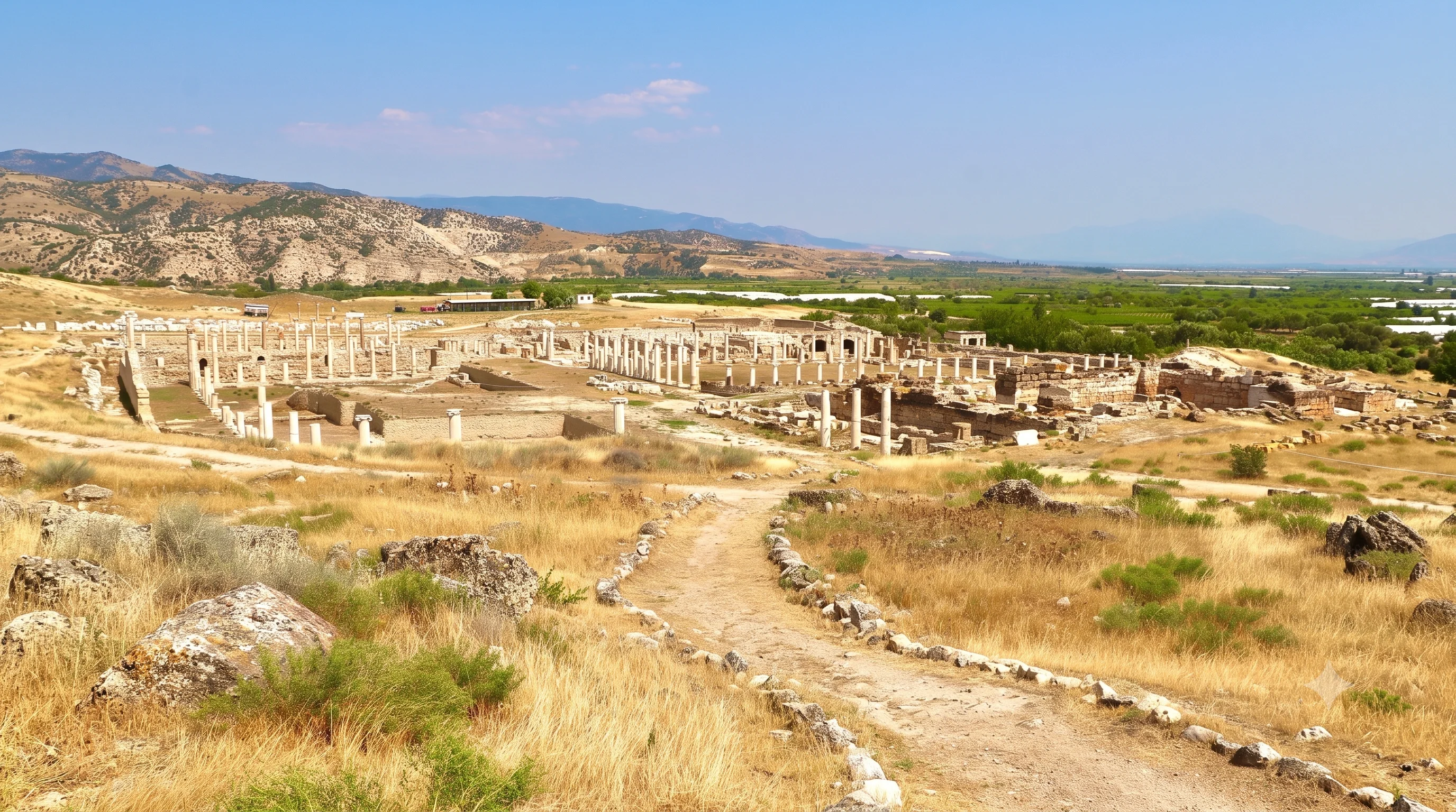
See the ancient world of the Büyük Menderes through substantial archaeological remains.
Explore Tripolis
Visit the major ancient city linked to Karura by regional roads, sacred geography and medicine.
Discover LaodiceaCombine well-known landmarks with authentic local heritage and thoughtfully paced travel.
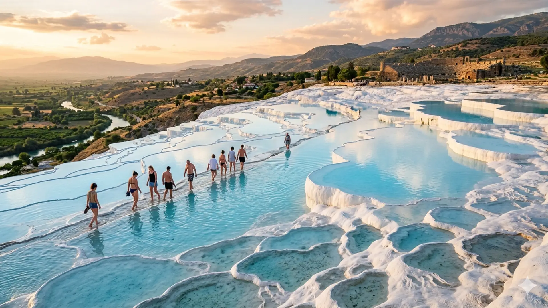
Discover magnificent ancient ruins and a world-famous geothermal landscape at your own pace.
Explore Private Tour
Discover traditional streets, textile heritage and the character of inland Aegean Türkiye.
Discover Buldan
Plan a flexible trip combining celebrated ruins, thermal landscapes and local discoveries.
Plan Your Journey