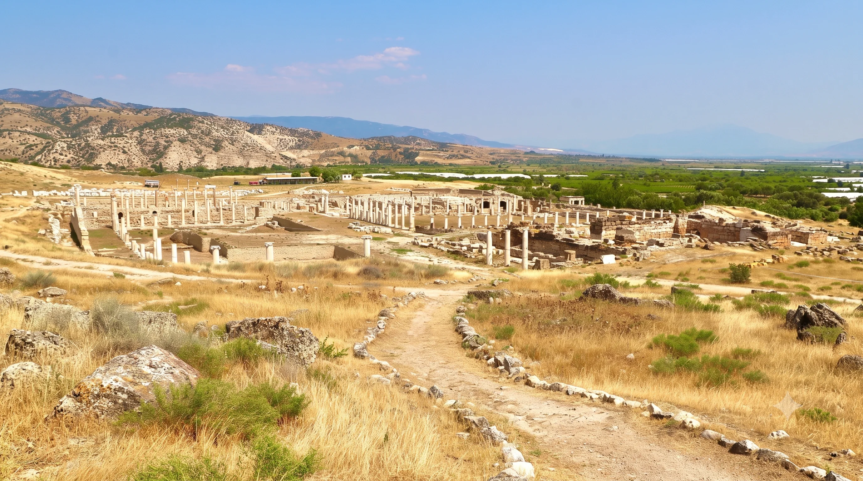
Tripolis Ancient City
Walk through the excavated monuments of a city once linked to Attuda by ancient regional routes.
Discover Tripolis





In the hills above Sarayköy in Denizli Province, the ancient city of Attuda—also written Attouda—occupies a naturally defended ridge where ancient Caria and Phrygia met. Its strategic location helped connect the Lycus Valley cities with Aphrodisias across the slopes of Mount Salbakos, today known as Babadağ.
Unlike the excavated streets of Laodicea or Tripolis, much of ancient Attuda lies beneath the much later Hisar (Hisarköy) settlement. Ancient inscriptions, column capitals and carved masonry survive among stone houses and village courtyards. Some historic buildings remain inhabited; others are vacant and fragile.
Attuda's story is older and more complex than many older travel descriptions suggest. Research identifies traces going back to the seventh–sixth centuries BCE, a flourishing Hellenistic and Roman city, successive Byzantine and Turkish-period communities, and a major Phrygian Mother Goddess Matar sanctuary reported in 2025. Excavation and conservation work have continued into 2026.
This detailed visitor guide covers the location, ancient history, sanctuary discoveries, coinage, surviving architecture, Hisar Village, visiting arrangements, respectful photography and the best nearby places to explore. Attuda is an archaeological landscape, not a fully developed open-air museum with guaranteed access to every ruin.
Explore a settlement between the ancient regions of Caria and Phrygia.
Find ancient stonework among protected village houses and historic lanes.
Learn about Men, Matar and the city's unusually rich religious history.
Understand what recent archaeology has revealed—and what remains inaccessible.
The essential details for exploring ancient Attouda and its historic hilltop village.
Hisar (Hisarköy), Sarayköy district, Denizli Province, Türkiye.
Approximately 17 km southwest of Sarayköy town, according to provincial tourism information.
The historic meeting point of Caria and Phrygia.
Naturally fortified hill on the northern side of Mount Salbakos (Babadağ).
Research reports traces from the seventh–sixth centuries BCE; the city later developed strongly.
Architectural pieces, inscriptions and locally minted coins attest to the city’s importance.
Ancient Attouda underlies Hisar Village, with 143 registered historic buildings in official descriptions.
Modern archaeological fieldwork, excavation and heritage documentation; some areas may be restricted.
The historic settlement is described as freely visitable; project zones may have separate restrictions.
Allow roughly 45–90 minutes for a careful village walk; more with an approved specialist visit.
Attuda is one of Denizli's most intriguing multilayered heritage sites. The attraction is not a reconstructed amphitheatre or a neatly exposed colonnaded street. It is the relationship between ancient archaeology, centuries of village life, carved blocks reused in later buildings and the dramatic mountain setting.
A visit can reveal how a once-important city changed across successive periods without disappearing entirely from the landscape. Roman architectural fragments stand near later houses, while traditional lanes and buildings preserve traces of the settlement's more recent social history.
For travellers interested in archaeology, architecture, historic routes, religious traditions and places beyond the busiest destinations, this is a rewarding cultural stop—provided expectations are realistic and private or protected areas are respected.
Antiquity and later settlements overlap in one hilltop location.
Stone-built village streets occupy a naturally defended ancient site.
Column elements, inscriptions and sculptural masonry inform the city’s story.
Religious evidence includes Men and the newly reported Matar sanctuary.
New findings have challenged older simplified accounts of the site.
A reflective alternative to the region’s more developed archaeological parks.
Attuda occupies Hisar neighbourhood in Sarayköy district, about 17 km southwest of Sarayköy town. The ancient hill settlement lies on the northern side of Salbakos (Babadağ) Mountain, above the lower valleys of western Denizli.
The ridge is steep on several sides, creating a naturally defensive setting. Pamukkale University's research description identifies Arap Deresi to the north and Bakla Deresi to the south, waterways that frame the settlement before joining toward the Büyük Menderes drainage.
The rugged site offered more than protection. Passes across the mountain connected valley communities to western and southern routes, making the settlement an intermediary between landscapes, cultural regions and trading partners.
Hisar / Hisarköy, Sarayköy, Denizli.
Northern slopes of ancient Salbakos, modern Babadağ.
At the regional frontier of Caria and Phrygia.
Steep-sided hill with naturally protected approaches.
Arap Deresi helps define the local landscape.
Bakla Deresi forms another natural boundary.
Travel guides may describe the location as Attuda, Attouda, Attuta or Attuda (Hisarköy). These spellings point to the same ancient settlement. Academic publications frequently use the form Attouda, while Turkish tourism information also uses Attuda.
Hisar is the name of the later settlement occupying the ancient site. Older references often say Hisarköy, literally 'fortress village'. Online maps and local signs may use either version, so include Sarayköy, Denizli in your search to avoid confusion with other places called Hisar.
Do not confuse Attuda with Aphrodisias, Tripolis or Laodicea. The cities were connected, but each has a separate archaeological location and historical development.
Common modern Turkish-language spelling.
Widely used in academic publications and archaeology.
Another occasional alternative transliteration.
The modern village or neighbourhood name.
A traditional designation still used in heritage descriptions.
Add Sarayköy and Denizli to map or travel searches.
Some earlier official descriptions estimated that the city was founded in the Hellenistic period, as with several settlements in the Lycus Valley. However, archaeological research has identified material indicating activity or settlement as early as the seventh–sixth centuries BCE.
That distinction matters. Evidence of early occupation is not the same as proof that the fully developed later city already existed in its Roman form. The architectural and epigraphic record becomes clearer in subsequent centuries, particularly during the Hellenistic and Roman periods.
The growing archaeological record continues to refine the chronology of the hill, especially following recent surveys and excavations. For an accurate visitor guide, the city's origin should be described as an evolving research question rather than one unchangeable founding date.
Early archaeological evidence cited by recent research.
A major phase in the formation of the identifiable ancient city.
More abundant monumental architectural evidence.
Later communities reused and reshaped the same settlement.
Early occupation and formal city foundation are separate questions.
New excavations can refine chronological conclusions.
During the Hellenistic era, Attuda developed a stronger civic identity within a region influenced by the kingdoms and cities of western Anatolia. Archaeological and historical studies associate important changes in the settlement with the second century BCE and the Pergamene political sphere.
Its position on the north side of Salbakos offered access between the Lycus Valley and communities toward Aphrodisias. Traffic across these routes helped circulate people, goods, architectural styles and religious customs.
The later emergence of its own civic coinage demonstrates an organised community participating in the wider political and economic world of the region. Surviving evidence provides insights, but the complete layout of Hellenistic Attuda remains largely hidden.
Linked with the wider Hellenistic history of western Anatolia.
An important phase discussed in archaeological research.
Routes over Salbakos connected regional centres.
Coinage begins in the later Hellenistic period.
Original building footprints remain incompletely known.
Avoid claiming a fully mapped Hellenistic street plan.
Attuda prospered particularly during the Roman Imperial period. Surviving carved architectural elements and sculpture show that the mountain city supported richly decorated buildings despite the steep topography and relatively limited farming land.
Research on the site's architecture reports the use of marble from around the first century CE, with increasing evidence in the second century CE. Column capitals, decorated blocks and inscriptions help specialists understand the city's monumental architecture even when original buildings are no longer exposed.
The combination of religious gathering, connections to surrounding settlements and commerce helps explain how the hilltop city could sustain civic life. Still, specific identifications of a surviving theatre, stadium or intact agora should not be assumed without archaeological support.
Important early Roman building and marble evidence.
A notably active period of monumental construction.
Fragments reveal skilled carving and substantial structures.
A regional role greater than the town’s size may suggest.
Sanctuaries and cults mattered to local public life.
The entire Roman street plan is not on open display.
Ancient Attuda stood between important centres. Provincial tourism authorities identify the route through Attuda as one of the shortest links connecting Tripolis and Laodicea with Aphrodisias over Salbakos.
Attuda therefore belongs to a wider story of economic exchange, sculpture, religion and mobility. The fame of Aphrodisias as a marble-working and sculptural centre makes artistic connections particularly interesting, while the Lycus Valley's urban centres provide an important regional comparison.
Modern driving roads do not necessarily follow the exact line of ancient mountain paths. These historical links explain the city's importance; they are not a recommendation to walk an unmarked ancient route without local guidance and appropriate permissions.
Important Lycus Valley centre connected to regional routes.
Roman city associated with valley networks.
Major Carian city beyond the mountain corridor.
Mountain transit shaped the city’s strategic position.
Artistic, political and commercial links extended beyond Attuda.
Ancient road descriptions are not hiking instructions.
Attuda's history can be reconstructed partly through the coins that it minted. A major scholarly study by İnci Türkoğlu examined more than 300 documented coins held or published across museum collections and catalogues.
The research places civic minting from the Late Hellenistic period into the middle of the third century CE, with interruptions or differences across issues. Coin designs record deities, officials and institutions, helping scholars reconstruct religious and political life in a city that has left relatively few exposed buildings.
The Carminii family appears prominently in the coin evidence. These are research findings, not an indication that loose ancient coins can or should be searched for at Hisar Village; archaeological objects and metal detecting are subject to strict cultural-heritage controls.
Coins compiled for a scholarly numismatic study.
Late Hellenistic issues documented.
Issues extend into the mid-third century CE.
Names on coins help identify civic administration.
A prominent family in numismatic evidence.
Do not search for, remove or purchase undocumented finds.
Provincial tourism sources associate Attuda with the cult of Men, an Anatolian deity widely represented in parts of ancient Asia Minor. Ancient accounts describe a sanctuary and an image of Men on horseback associated with the city.
Other recorded religious figures include Zeus, Apollo, Dionysos and Asklepios, while Artemis Anaitis also appears in ancient descriptions. Their presence illustrates the plural religious traditions of the region rather than a single exclusive city cult.
It is important to distinguish historical or numismatic testimony from the remains currently visible at the site. A written reference to a temple is not a guarantee of an accessible standing temple or identified reconstruction in the modern village.
Prominent Anatolian deity in the city’s documented religious landscape.
Described in ancient accounts associated with the sanctuary.
Among the Greek deities mentioned in historical records.
Appears within the city’s wider religious context.
Healing deity named in provincial summaries.
Another cult associated with the settlement.
One of the most important recent developments at Attuda was the 2025 announcement of a sanctuary dedicated to the Phrygian Mother Goddess Matar, often associated with Cybele or Kybele in wider Anatolian religious traditions.
The excavation team identified a Phrygian rock monument, a sacred cave and paired rock forms at Asar Tepesi, described as the ancient city's acropolis. The official report dates elements of the sacred landscape to approximately the eighth–sixth centuries BCE and discusses offering-related rock-cut features.
These discoveries are vital to the site's interpretation, but an archaeological discovery does not automatically become a publicly accessible tourist stop. Visitors should not attempt to enter caves, cross barriers or seek out research areas without explicit authorisation.
The Phrygian Mother Goddess represented at the sanctuary.
Location of the reported sacred complex.
Part of the sanctuary evidence described in 2025.
Archaeological feature, not guaranteed visitor access.
Eighth–sixth century BCE material reported.
Research areas may be closed or controlled.
At Attuda, much of the surviving ancient architecture appears as detached, reused or displaced architectural elements rather than intact buildings. Studies describe fragments in village squares, courtyards, walls and around the mosque area.
Look for stone blocks with mouldings, carved ornament, inscriptions or column details. Some have been incorporated into later structures, a widespread practice known as spolia. Their secondary locations can preserve valuable evidence even when they no longer indicate the precise position of their original buildings.
Research published on Doric capitals documented ancient pieces found reused in the village, including around former homes and outdoor spaces. Treat each block as protected heritage: do not climb on it, move it, take rubbings or attempt to clear vegetation yourself.
A recorded category of significant ancient stonework.
Decorative pieces indicate former monumental buildings.
Provide names, institutions and religious information.
Ancient material reused within later structures.
Academic studies note architectural fragments around the area.
Observe only from safe, permitted public spaces.
Scholars studying Attouda have documented Doric column capitals, among the types of architectural material embedded in or distributed around later village buildings. A 2022 academic study examined eleven examples identified during the 2021 research season.
These architectural details help clarify ancient building practice and stylistic influences. The presence of capitals suggests structures with carefully designed column systems, but a capital lying in a wall or garden cannot by itself establish the purpose or complete plan of its original building.
For a visitor, these fragments reward careful observation and interpretation. They should never be described as the remains of a particular named temple unless the identification has been established by the researchers.
Documented in a 2022 study of the ancient city.
A recognisable family of classical column capitals.
Some ancient pieces entered later village architecture.
Supports architectural dating and reconstruction studies.
A detached capital does not prove a standing temple.
Photograph from public space without handling the stone.
Hisar Village is central to what makes Attuda remarkable. Its traditional houses, terraces, narrow lanes and reused stones preserve a later settlement above the ancient city. Official heritage information associates the village's history with the Seljuk period and later Ottoman and Republican eras.
Government cultural sources describe 143 registered religious and civil architectural structures in the historic settlement. The whole area has heritage protections: it is not simply an abandoned film set or an unrestricted ruin field.
As families moved and the village changed, some buildings became vacant or deteriorated. Others remain connected to local life. Visitors should approach with care and avoid entering houses, courtyards, outbuildings or ruins—even where doors stand open—without the appropriate consent.
Part of the village’s long post-antique history.
Stone-paved lanes and vernacular dwellings.
Figure given in official cultural-heritage descriptions.
Some residents and local activities continue.
Historic but not necessarily safe to enter.
Village homes and land are not automatically public.
Hisar's historic architecture deserves attention in its own right. Traditional buildings use local stone, timber and tiled roof elements, often adapted to the hillside with compact courtyards, narrow passages and layered terraces.
Architectural recording is an important component of Attuda research because damage to the village's historic houses would also damage the cultural context surrounding the ancient city. These buildings help explain how people continued to live on the same difficult but defensible terrain long after classical antiquity.
A good photograph may show ancient spolia incorporated into a later wall or a historic street with the mountain landscape behind it. For safety and privacy, view fragile houses from established public ways and do not attempt to enter or climb onto roofs and terraces.
Traditional construction tied to the mountain setting.
Doors, window frames and structural elements.
Part of the older village silhouette.
A close-scale street pattern suited to the hillside.
Weathering and abandonment affect old buildings.
Photograph without stepping into private property.
The Hisar landscape also includes stories of traditional village livelihoods. Government heritage imagery documents a weaving loom and a historic village mill, reflecting an economy built around household work, local resources and connections with surrounding districts.
Weaving has played an important role throughout Denizli Province, although the techniques and commercial histories of Hisar, Buldan and other textile centres should not be treated as identical. For travellers who enjoy this heritage, our Buldan weaving guide offers a more extensive introduction to the region's textile culture.
Do not assume that a functioning loom demonstration or public visit inside the old mill is available. These are documented heritage features; any special access needs current confirmation.
Historic household textile work in the rural landscape.
Part of the documented village heritage.
Agriculture and household crafts shaped daily life.
A separate regional textile destination.
The village’s later history is as important as the Roman past.
Never presume an active workshop or mill visit.
Attuda's story did not end when Roman civic institutions changed. The wider archaeological record and the centuries of continued occupation indicate later Late Antique and Byzantine phases, followed by medieval and early modern settlement.
Provincial museum and tourism descriptions identify material attributed to several periods, while Pamukkale University's historical overview includes Byzantine occupation among the layers of Attuda–Hisar. The details of specific churches, ecclesiastical institutions and settlement phases require careful examination of the archaeological record.
For visiting purposes, do not expect a fully excavated Byzantine church or an accessible mosaic complex on the model of other well-presented Anatolian ancient cities. The value here lies in the long continuity of the place and in fragments that scholars continue to interpret.
An important transition after Roman civic prosperity.
Part of the documented multi-period record.
Later communities reused the hill and its resources.
Urban life and beliefs evolved over the centuries.
Often scattered or built into later surroundings.
Avoid assuming complete church buildings on display.
Ancient inscriptions are especially valuable at a site where the urban plan is mostly hidden. They can record personal names, honours, religious dedications, civic institutions and public activities that architecture alone cannot explain.
Attuda inscriptions found or documented around the settlement and wider region have informed research into its civic and religious life. Combined with coinage, they help reconstruct the identities and networks of its inhabitants.
Some inscription-bearing blocks are built into walls or found among architectural fragments. Visitors should never apply chalk, water, cleaning products or paper rubbings to make lettering clearer. Read and photograph without touching, and let researchers interpret uncertain texts.
Individuals and local families may be recorded.
Official public life revealed through writing.
Dedications and recognition of notable figures.
Epigraphy can illuminate local religious practices.
Many surviving inscriptions use ancient Greek.
No chalking, rubbing or surface cleaning.
Burial evidence from Attuda adds another dimension to its history. In a study published on 12 October 2026, archaeologist Bilge Yılmaz Kolancı examined a cylindrical terracotta sarcophagus with a high-relief Silenos head, identified during surveys in 2023.
Silenos is associated with the Dionysian world. The study interprets the image as potentially protective within the burial context. Its exact date cannot be fixed from associated grave goods, but comparison with other pieces suggests a possible date in the first–second centuries CE.
The piece was found in a disturbed archaeological setting. Its publication provides historical information but does not establish a public display in Hisar Village. Never enter burial areas or search for grave objects.
The find was documented during field research.
A scholarly study released 12 October 2026.
An unusual cylindrical burial container.
A high-relief bearded figure.
First–second centuries CE, cautiously proposed.
A public museum display is not verified.
Attuda has become a focus of interdisciplinary archaeological investigation. Pamukkale University's Attouda and Surroundings Survey documented the area's settlement history, architecture, inscriptions, cultural heritage and surrounding landscape, including work begun in 2021.
The 2025 sanctuary announcement brought national attention to early Phrygian religion on the hill. In 2026, publicly reported excavation activity continued, with local authorities and the archaeological team discussing conservation and future visitor potential.
This work is exciting, but conditions may change from season to season. Excavation trenches, conservation areas, newly identified features and fragile buildings may be off limits even if public village streets remain approachable.
Start of a major organised surface-survey programme.
Research documented burial and settlement material.
Phrygian Matar sanctuary publicly announced.
Excavation and documentation activity reported.
Protecting ancient remains and village structures is a priority.
Access may change with the work programme.
A self-guided visit is mainly a historic settlement walk rather than a tour of a single excavated monument. From accessible public areas you may be able to observe traditional streets, stone-built houses, reused ancient architectural elements and scenic views of the ridge.
The condition, visibility and location of individual inscriptions, capitals and carved blocks can change. Some may lie within private properties or conservation areas, and the archaeological team may temporarily restrict movement.
Think of Attuda as an opportunity to understand how an ancient city survives inside a later landscape. It is not accurate to promise a standing theatre, restored agora, accessible Men temple or visitor-ready Matar cave.
Explore public lanes and the historic urban fabric.
Appreciate vernacular architecture from the street.
Observe visible fragments without handling them.
Some historic texts survive on reusable masonry.
Appreciate the strategic natural setting.
Excavation zones and fragile structures may not be accessible.
Begin at the safest available public approach to Hisar neighbourhood. Take time to orient yourself rather than immediately leaving the main path to look for ruins. The village's natural topography explains much of Attuda's history.
Follow existing public lanes through the historic settlement. Observe house construction, any ancient blocks visible from the road, and village viewpoints where access is permitted. Avoid wandering into courtyards, abandoned buildings, farm plots or active excavation areas.
Plan to turn back along a known route. If you are especially interested in inscriptions or archaeology, a locally authorised specialist guide or prearranged visit may offer more interpretation than an unguided wander.
Use a safe parking or drop-off location.
Notice the steep sides of the protected hill.
Observe the traditional stone streets.
Look for documented stonework from public areas.
Take photographs without climbing unstable structures.
Leave enough daylight for the journey out.
Official provincial tourism information places Attuda approximately 17 km southwest of Sarayköy district centre. The correct map destination is Hisar / Hisarköy, Sarayköy, Denizli, not simply the municipality of Sarayköy or the unrelated village names elsewhere in Türkiye.
Most visitors will find a private vehicle or prearranged driver the simplest approach. The final road is in a mountain-village setting; expect narrow sections, bends or differing road conditions, and check your route against current navigation information before travelling.
From Denizli city or Pamukkale, allow for the drive to Sarayköy and the additional rural approach. This is not a short walking detour from Pamukkale's travertines. Public-transport connections should not be assumed without verifying the day's service and the final distance from a stop.
Sarayköy is about 17 km from the site in tourism descriptions.
Use “Attouda Hisar Sarayköy Denizli”.
Travel by road, with time for the rural approach.
A separate excursion rather than a short walk.
Useful for combining several regional attractions.
Verify current routes and last-mile connections.
Attuda, the present Hisar settlement and its archaeological research zones overlap but are not identical to a single ticket-gate location. The links below are map searches to help with broad orientation, not invitations to enter restricted archaeological sites.
Nearby destinations are spread across different parts of Denizli and neighbouring Aydın Province. Check actual road routes and site opening arrangements before planning a multi-stop day.
Find the historic village and archaeological area.
Locate the district centre and regional services.
Locate the archaeological park near Buldan.
Find the major excavated city near Denizli.
Locate the ancient city toward Karacasu.
Find the travertines and Hierapolis entrance.
Türkiye's official cultural-heritage portal describes the Hisar historic settlement as freely visitable on any day. However, that does not make every ancient remain, residential property, building or active archaeological workspace open to the public.
An educational site directory lists 09:00–17:00 daily as a suggested visiting window. This should not be treated as proof that Attuda operates a staffed ticket gate or that all conservation areas are open at those times. For ordinary visitors, daylight hours are the sensible choice.
No separate museum-style Attuda ticket was confirmed for general access to village public areas in the sources checked for this guide. Guided specialist visits, excavation access or future visitor arrangements may be governed by different rules.
Public historic village areas described as free to visit.
Recommended for safety and heritage viewing.
Listed by an educational directory; not a guaranteed ticket-office schedule.
Not open without consent or authorised access.
Entry may be restricted by current research activity.
Recheck official announcements before a dedicated journey.
The terrain around Hisar is steep and uneven, with old stone-paved or irregular village lanes. That makes Attuda a more demanding visit than a level modern museum, especially during wet weather or for people with mobility limitations.
Dedicated visitor facilities, a staffed information office, accessible bathrooms, step-free routes and guaranteed parking have not been independently established for every arrival point. Plan conservatively and confirm the exact drop-off and walking arrangements if anyone in your party uses a wheelchair or has limited balance.
Carry drinking water, suitable shoes, sun protection and a charged phone. Avoid remote paths and fragile abandoned buildings, and keep children away from drops and unattended masonry.
Uneven stone and sloping paths.
Not guaranteed; check before travel.
Confirm a safe space without blocking local lanes.
Do not assume dedicated facilities are available.
Supervise near steep drops and unstable structures.
Choose supportive shoes with good grip.
Spring and autumn are often comfortable for an outdoor heritage walk in the Denizli countryside. A morning or later-afternoon visit can provide softer light on the historic houses and landscape, subject to weather and the local access situation.
Summer may be hot on exposed sections of the hill. Winter brings shorter days and can leave stone paths wet or slippery. Because Attuda is not a typical ticketed outdoor museum with extensive visitor services, practical weather and daylight matter more than a published attraction timetable.
Research seasons or conservation work can change which areas are accessible. Always prioritise current instructions and site conditions over a plan to reach a particular viewpoint or ruin.
Often pleasant for landscapes and walking.
Allow for heat and exposed areas.
Good light and generally comfortable walking days.
Check rain, road conditions and shorter daylight.
Early or late daylight can reveal stone textures.
Follow current restrictions regardless of month.
Attuda offers powerful compositions: stone-built houses along a narrow lane, a weathered ancient capital reused in later masonry, the fortified hill profile and layers of rural architecture against the Babadağ landscape.
Use soft side lighting to reveal carved stone texture. Wider shots can explain how the village sits above the ancient city, while close framing helps document historic doorways or visible architectural detail. Keep a respectful distance from homes and residents.
Drone flights, photography inside excavations and commercial filming may require permissions. Never move archaeological fragments to create a cleaner image or step onto walls, roofs or closed areas to improve an angle.
Show the hillside settlement in its landscape.
Use gentle angled light for surface detail.
Show fragments in their present architectural context.
Contrast ancient carving and later building styles.
Ask permission before photographing residents.
Check legal restrictions and location-specific permissions.
Short heritage stop: allow approximately 45–90 minutes to appreciate the historical village, its accessible lanes and the natural topography. This is an orientation walk, not a promise of access to specific newly excavated monuments.
Half-day experience: combine the drive, a thoughtful village visit and time for a relaxed regional stop. For a specialist archaeology visit, arrange guidance or any special permission in advance.
Full-day heritage route: pair Attuda with Tripolis, Laodicea or the wider Pamukkale region depending on road distances and opening times. Avoid attempting to cover every ancient city in one rushed day.
Explore the ancient village landscape and documented features.
Allow extra time for rural roads and safe parking.
A complementary excavated Roman city.
An extensive ancient city with visible urban remains.
Stop for meals and facilities in a suitable town.
Private itineraries can focus entirely on culture and archaeology.
Attuda makes most sense when placed within the broader Denizli–Aydın archaeological landscape. Other ancient cities in this region offer more extensive excavated architecture, while traditional towns and scenic areas reveal different aspects of the area's history.
Distances between these attractions are meaningful, and they are not all adjacent to Hisar Village. Plan according to your point of departure, road connections, interests and the operating hours of each location.
Explore Roman streets and monumental remains near Buldan.
Discover excavated urban heritage near Denizli.
Traditional streets and the region’s textile heritage.
Understand living regional craft traditions.
Travertines and a UNESCO-listed archaeological landscape.
Discover archaeological collections and historical context.
Explore the province’s broader cultural heritage.
A major regional partner in Attuda’s ancient road networks.
Attuda's chronology is built from a combination of surface evidence, material culture, inscriptions, coins and recent excavation. Some early dates concern activity at the site, while other entries concern the clearly documented later city or the modern study of its remains.
The milestones below keep these categories distinct, avoiding the misleading idea that every discovery can be assigned to one fixed founding period.
Early sacred material identified in the Matar sanctuary area.
Early occupation evidence cited by modern field research.
Growth of the city and its regional identity.
Earliest documented civic coin issues.
Extensive Roman architectural development.
Later phases of civic minting evidenced by coin studies.
Continued settlement and reuse in the later ancient period.
Development of Hisar’s later village heritage.
Major modern archaeological survey and documentation.
Announcement of the early Phrygian Matar sanctuary.
Excavation activity and new scholarly publications.
Attuda is in Hisar (Hisarköy), Sarayköy district, Denizli Province, southwest Türkiye.
Yes. Attuda and Attouda are spelling variants for the same ancient settlement; Hisar is the later village on the site.
Provincial tourism information places the settlement approximately 17 km southwest of Sarayköy town.
It is a separate rural Denizli destination reached by road, not within walking distance of the Pamukkale travertines.
Its strategic position between Caria and Phrygia, mountain routes, religion, civic coinage and regional economic connections.
Recent archaeological research identifies material going back to the seventh–sixth centuries BCE. The later city flourished in Hellenistic and Roman times.
Older summaries estimated a Hellenistic foundation, but more recent fieldwork indicates earlier occupation. The exact phases of urban development remain under study.
It lay between the ancient regions of Caria and Phrygia on important routes across the Salbakos mountain range.
You may see reused architectural blocks, inscriptions and carved fragments, but it is not a fully excavated Roman city park.
An accessible, standing ancient theatre is not established in the visitor information reviewed for this page; do not plan around one.
Ancient sources associate Men and a sanctuary with the city, but a freely accessible intact temple should not be assumed.
A Phrygian Mother Goddess sacred complex reported at Asar Tepesi in 2025, including rock-cut and cave features under archaeological study.
Public visitor access has not been confirmed. Do not enter research areas or caves without authorisation.
Yes. Academic coin studies document minting from the Late Hellenistic period into the mid-third century CE.
The historic hilltop community built over ancient Attuda, with later Seljuk, Ottoman and modern architectural layers.
Some village life continues, while other older buildings are vacant or fragile. Private property must be respected.
Recent projects include surveys, excavations and conservation. Access to specific areas may change with the work programme.
The official cultural portal describes public visits to the historic village as free, but this does not include automatic entry into excavation zones or private buildings.
An educational directory lists 09:00–17:00, but this is not a confirmed staffed museum timetable. Visit public areas in daylight and check local restrictions.
Allow about 45–90 minutes for a careful village walk, plus road travel and more time if a specialist visit is arranged.
Step-free access cannot be guaranteed; the historic hilltop streets and terrain can be steep and uneven.
Generally from public spaces, while respecting people, private property and any excavation photography restrictions.
Dedicated visitor facilities have not been consistently confirmed, so plan meals and rest breaks in a nearby service town.
Yes, with a suitable private road itinerary, enough time between locations and confirmed current access for each site.
Do not confuse it with UNESCO-listed Pamukkale–Hierapolis. No UNESCO World Heritage inscription for Attuda has been established here.
We can help design a customised Denizli archaeological itinerary around interests and practical access, without compulsory shopping stops.
Attuda is both an archaeological site and a historic community. Its stones, lanes, houses, vegetation and research areas contain information that can be damaged by seemingly small actions. Leave everything exactly where you find it.
Never dig, collect coins or sherds, clear architectural fragments, climb unstable walls, enter burial areas or attempt to reach caves and archaeological trenches without permission. Metal detecting and removal of antiquities can have serious legal and conservation consequences.
Respect residents' privacy and historic houses. Support informed, low-impact cultural visits rather than treating the place as an abandoned playground. Thoughtful tourism helps preserve the important connection between the ancient city and the later village.
Do not take potsherds, coins or stones.
Never enter unstable or vacant houses.
Keep out of all closed or marked research zones.
Ask before photographing residents or private interiors.
Do not enter farmland, courtyards or private houses.
Distinguish known finds from hypothetical reconstructions.
Attuda is a research-active destination, so good visitor information should be checked against government heritage records and published archaeological studies. The references below are useful for the site's identity, chronology, architecture, local religious traditions and ongoing investigation.
This guide intentionally separates modern archaeological findings from features that a visitor can reliably enter or observe. Research papers are evidence for history, not published guarantees of public access.
Official background on the ancient city and route.
Hisar Village, heritage status and general visiting information.
Attouda and Surroundings research project.
Academic analysis of the ancient city and its architectural finds.
Peer-reviewed study of Attuda civic coinage.
Government-published report on the Phrygian discovery.
Peer-reviewed research on a Roman-period burial find.
Local information on heritage and natural attractions.
Discover Attuda’s layers of history, the monuments of the Lycus Valley and the traditions of Denizli on a flexible private itinerary with no compulsory shopping stops.
Pair the hidden history of Attuda with some of the region’s best-documented archaeological landmarks.
Walk through the excavated monuments of a city once linked to Attuda by ancient regional routes.
Discover Tripolis
Discover one of the Lycus Valley’s major ancient centres, with impressive urban archaeology.
Explore Laodicea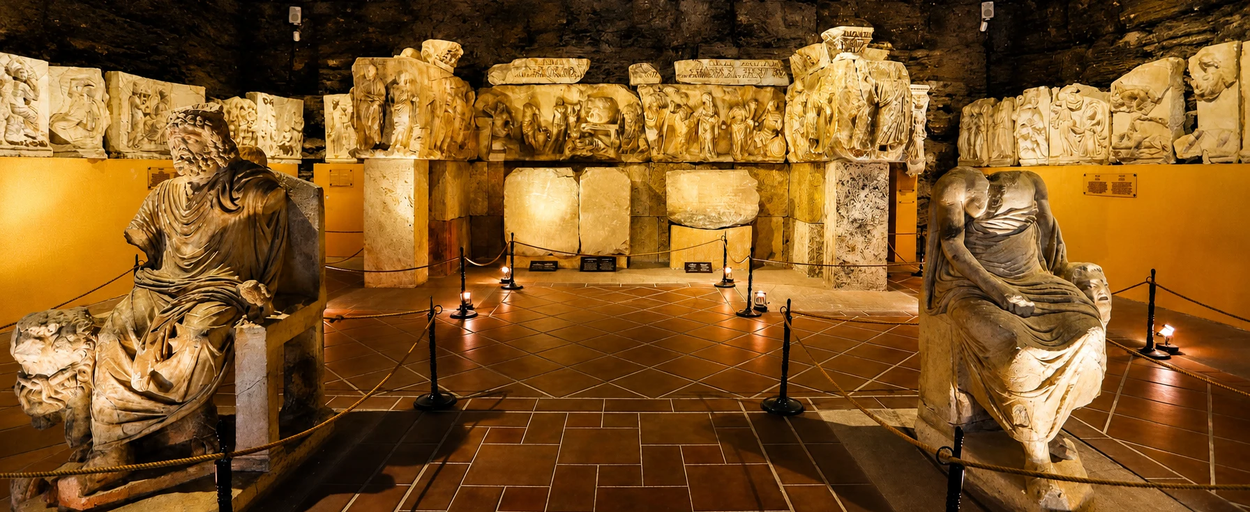
Place Attuda’s archaeological finds in the wider context of Roman and ancient Anatolian history.
Explore the MuseumExtend your journey with signature landscapes, textile culture and flexible private touring.

Explore the remarkable travertines and ancient monuments on a comfortably paced private visit.
Explore Private Tour
Discover traditional buildings, textile history and the local culture of this fascinating town.
Explore Buldan
Plan a wider route combining archaeology, historic towns and spectacular landscapes.
Explore the Region