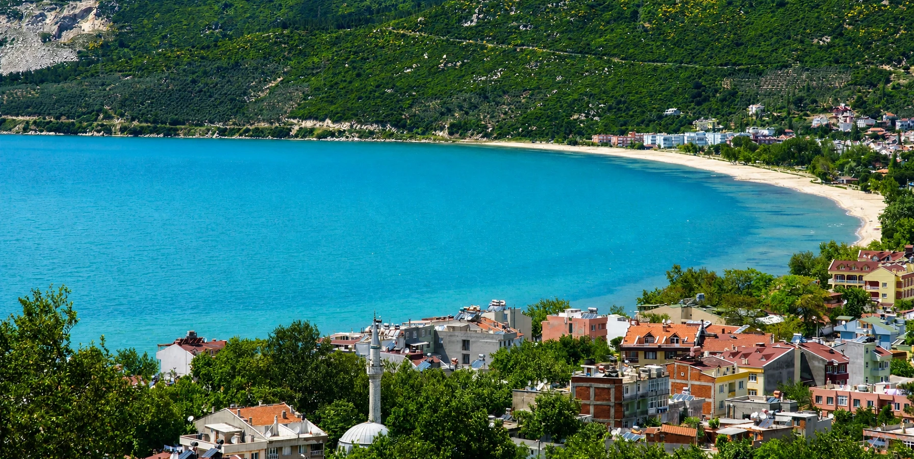
Erdek
Use the historic seaside town as the easiest base for beaches, restaurants, ferries and day trips around Kapıdağ.
View Erdek Guide





Beyond the beaches of Erdek and the monumental remains of Kyzikos, the Kapıdağ Peninsula opens into a surprisingly rural landscape of wooded slopes, olive groves, fishing villages, agricultural fields, coves and winding coastal roads. The distances are modest, but the character changes repeatedly as you move from the sheltered Erdek Gulf toward the peninsula's exposed northern coast and then back toward Bandırma Gulf.
Kapıdağ was an island in antiquity before coastal sediment connected it to the mainland. That geological history still explains much of what travellers see today: steep hills rising directly from the sea, narrow strips of settlement beside bays, isolated coves and a mountainous interior that can feel far removed from the nearby cities of South Marmara.
The villages are not interchangeable. Ocaklar has a developed beach-resort atmosphere; Narlı combines a small harbour with a village coast; İlhanlar, Doğanlar and Turan feel more strongly shaped by the road, sea and agricultural slopes; Ormanlı and Ballıpınar bring travellers closer to the northern landscape and local farming traditions; while the eastern side continues through settlements such as Çayağzı, Çakıl, Karşıyaka and Tatlısu toward the Bandırma side.
This page is designed for travellers who want to explore Kapıdağ as a landscape rather than a checklist. The best days here are rarely about racing between attractions. They are about choosing a direction, stopping when the coastline opens, drinking tea in a village, walking a forest track, buying seasonal produce and leaving enough time for the road itself.
Move through Ocaklar, Narlı, İlhanlar, Doğanlar, Turan, Ormanlı, Ballıpınar and the quieter settlements of eastern Kapıdağ.
Leave the summer coastline for wooded slopes, chestnut and broadleaf landscapes, mountain roads and cooler interior air.
Discover broad village beaches, small rocky inlets and changing sea conditions on different sides of the peninsula.
Look for olives, olive oil, seasonal produce, fish and the geographically registered Kapıdağ Mor Soğanı.
Essential information for exploring the rural and natural side of the Kapıdağ Peninsula.
Erdek District, Balıkesir Province, projecting into the Sea of Marmara between Erdek Gulf and Bandırma Gulf.
The highest part of Kapıdağ reaches approximately 803 metres, creating a surprisingly mountainous interior for a compact peninsula.
Kapıdağ was once an island and became connected to the mainland through coastal deposition, forming the peninsula seen today.
Forest, broadleaf woodland, scrub, olive groves, agricultural plots, rocky headlands, streams, beaches and village bays.
Expect a mixture of beach settlements, fishing communities, agricultural villages and small neighbourhoods spread around the coast.
Kapıdağ Mor Soğanı is a geographically registered local onion closely associated with the peninsula's agricultural identity.
Kapıdağ forms part of the wider Misya walking-route landscape; route condition and waymarking should always be checked locally.
Narlı, Ocaklar, Bakraç, Dalyan, Turan and Tatlısu public beaches were reported with Blue Flag status for the 2026 season.
A car or private vehicle gives the greatest freedom because villages, viewpoints and forest roads are spread across the peninsula.
April–June and September–October are ideal for road trips and walking; summer is best for swimming but much busier.
Allow at least one full day for a village route; two days gives enough time to add beaches, walking and the interior.
Erdek, Kyzikos, Kirazlı Monastery and the Marmara islands.
The strongest reason to explore Kapıdağ is the contrast between a compact map and a remarkably varied journey. Within a single day you can move from a developed beach village into quiet fishing settlements, climb through dense woodland, look across to Marmara Island and return to the opposite side of the peninsula where the coast feels different again.
The peninsula also offers an alternative to sightseeing built around monuments. Here, the landscape itself becomes the subject: how villages fit into bays, where olive cultivation gives way to forest, how roads follow steep slopes, and how livelihoods have long depended on agriculture, fishing and access to the sea.
Travellers who already know Türkiye's better-known Aegean and Mediterranean coastal drives may find Kapıdağ especially interesting because it remains strongly connected to everyday regional life. Tourism is important, particularly around Erdek and Ocaklar, but many northern and eastern settlements still feel primarily like places where people live and work.
Kapıdağ is therefore best enjoyed with curiosity rather than a rigid list. Leave room for a roadside viewpoint, a village bakery, a produce stand, an unexpected swimming stop or a short walk that was never part of the original plan.
Kapıdağ projects into the southern Sea of Marmara as a broad, roughly triangular peninsula. Official regional geography sources record a highest elevation of about 803 metres, enough to create a true upland interior rather than a simple low coastal strip.
In antiquity the landform was an island. Over time, sediment and coastal processes connected it to the mainland. The low land at the southern entrance contrasts sharply with the mountainous mass that rises behind it, helping explain why the ruins of Kyzikos occupied such a strategically important position beside natural harbours.
For modern travellers, the geography creates two important effects. First, the coast is deeply indented, so direct distances can be misleading. Second, weather and sea conditions may differ noticeably between the Erdek-facing west coast, the northern shore and the Bandırma-facing east side.
This is why a Kapıdağ drive feels longer and more varied than the map suggests. Roads repeatedly climb away from the water, cross wooded slopes and descend into another village or bay, often revealing a completely different view of the Marmara Sea.
Begin with Ocaklar and Narlı, then continue toward smaller bays and the northwestern villages. This side is the easiest transition from resort coast to rural Kapıdağ.
İlhanlar, Doğanlar and Turan sit along a more dramatic sequence of bays, open sea views and agricultural slopes.
Ormanlı and Ballıpınar bring the journey deeper into the peninsula's rural identity, with stronger connections to farming, forest and the open Marmara.
The route continues through settlements such as Çayağzı, Çakıl, Karşıyaka and Tatlısu before turning back toward the southern mainland connection.
Mountain and forest roads link the coast with higher ground, water sources, agricultural areas and cultural sites such as Kirazlı Monastery.
Narrow roads, village traffic, photo stops and changing surfaces mean a complete circuit takes much longer than a quick map calculation suggests.
Just beyond Erdek, Ocaklar is the most developed of the peninsula's western village destinations. Its broad beach, accommodation, restaurants and summer services make it a comfortable first stop for travellers who want Kapıdağ scenery without immediately leaving tourism infrastructure behind.
The settlement sits between the sea and cultivated slopes. Looking inland from the beach, the olive landscape and rising hills offer an immediate reminder that even Kapıdağ's busier resorts are attached to a much larger rural environment.
Ocaklar works well as a base if your priorities are swimming and easy evening access to restaurants, but it is equally useful as the first point on a longer drive. From here the road continues toward Narlı and the increasingly quieter western and northern coast.
Ocaklar Public Beach was among the municipal beaches reported with Blue Flag status in 2026. As always, annual certification should be checked for the specific season of travel.
Narlı marks an important transition in the Kapıdağ journey. It is still close enough to Erdek and Ocaklar to feel accessible, yet the road beyond it begins to reveal a quieter sequence of coastal landscapes, small coves and villages.
The village has a local maritime character shaped by its coast and harbour. Rather than treating Narlı only as a swimming stop, spend a little time walking near the waterfront and looking back toward the slopes, where cultivation and settlement occupy the narrow space between mountain and sea.
Narlı is also a practical decision point. Travellers with limited time can return toward Erdek after a relaxed beach day, while those continuing north can move on toward İlhanlar, Doğanlar and Turan for the more rural side of the peninsula.
Narlı Public Beach was also part of the 2026 Blue Flag list reported by Balıkesir Metropolitan Municipality.
Beyond Narlı, the coastline becomes one of the most enjoyable parts of Kapıdağ for travellers who prefer scenery over resort infrastructure. İlhanlar and the nearby Küçükova and Büyükova areas are associated with wider sea views, less continuous development and beaches that feel more embedded in the natural coast.
These names are sometimes used differently in local conversation, mapping apps and travel writing, so it is better to navigate by both village names and coastline rather than expecting every bay to have prominent road signage.
This stretch rewards slow driving. Stop only where it is safe to pull completely off the road, avoid blocking agricultural access, and remember that a quiet-looking beach may have no lifeguard, toilets, shade or other formal services.
For photographers, the elevated road sections can be more memorable than the beaches themselves, especially when the line of the bay, offshore water and the green-brown slopes can all be seen in one frame.
Doğanlar is one of the settlements that makes the northern route feel distinctly different from central Erdek. The village sits within a broad coastal setting where the beach, agricultural land and rising hills create a spacious landscape rather than a dense resort strip.
The attraction is simplicity. Travellers come for the sea, the view, the road and the sense of being away from the busier tourism centres. Services can be limited compared with Ocaklar, so it is sensible to carry water and basic supplies when travelling outside the main summer period.
Doğanlar also belongs to the agricultural geography associated with Kapıdağ's famous purple onion. The product's character is tied to the peninsula's soil and climate, making village farming part of the travel story rather than simply background scenery.
Turan is an especially rewarding stop for travellers making the full western and northern coastal drive. The settlement occupies a long bay backed by steep green slopes, giving it the classic Kapıdağ combination of mountain, village and sea.
The beach can work as a swimming break, but the approach road and elevated viewpoints are equally important. When conditions are clear, the landscape opens dramatically toward the Sea of Marmara and the islands beyond.
In 2026, Turan Public Beach received Blue Flag recognition in the municipal list. The award indicates standards for that season, but travellers should still assess daily wind, water and beach conditions on arrival.
Turan is a good place to slow the itinerary. A rushed visitor sees only another beach; a patient visitor notices the farmland, local streets, boats, changing light and the way the hills enclose the bay.
As the road continues around northern Kapıdağ, Ormanlı introduces an even quieter atmosphere. The settlement is associated with beach and forest landscapes rather than intensive resort development, and it can feel very different from Erdek during weekdays outside the height of summer.
The name itself fits the setting: wooded slopes dominate the inland view, while the coast remains open to the northern Marmara. Travellers interested in nature should pay as much attention to the road approaches and forest margins as to the village centre.
Official cultural inventories also record a monastery ruin near Ormanlı, one of several reminders that Kapıdağ's village landscape contains layers of Greek Orthodox and Ottoman-period history in addition to natural scenery.
Do not expect every historical or natural feature to be formally signposted or prepared as a visitor attraction. This is precisely why local guidance and respectful exploration matter on this part of the peninsula.
Ballıpınar is one of the most culturally distinctive stops on the peninsula because agriculture is immediately visible in the identity of the village. The best-known product is Kapıdağ Mor Soğanı, registered by the Turkish Patent and Trademark Office as a protected geographical indication in 2018.
The registration is not simply a marketing label. It links the onion's physical characteristics to the specific geography of Kapıdağ. Local production is particularly associated with villages including Ballıpınar and neighbouring parts of the northern peninsula.
For visitors, this creates a useful reason to look beyond restaurants and beaches. Seasonal produce, village markets, farm activity and small-scale food culture are part of the landscape. If you find locally grown onions, olives, olive oil, fruit or other seasonal goods for sale, buying directly can be a simple way to support the local economy.
Ballıpınar also sits near routes leading toward the forested interior and the wider Kirazlı Monastery landscape. Road and trail conditions can vary, so a village stop is a good place to ask locally before taking minor roads into the mountains.
The eastern side of Kapıdağ receives less attention in many short travel guides, yet it completes the peninsula's story. Here the road moves through a sequence of working settlements where fishing, agriculture, residential life and summer beach activity overlap.
Çayağzı and Çakıl belong to a coast with strong maritime traditions, while Karşıyaka sits on the southeastern side of the peninsula. Continuing toward Tatlısu, the landscape gradually reconnects with the more populated Bandırma-facing corridor.
Tatlısu is particularly useful for travellers completing a full circuit because it provides a final beach and rest stop before returning toward the main road network. Tatlısu Public Beach was one of the municipal beaches holding Blue Flag status in 2026.
A full west-to-east circuit also shows how unevenly tourism has developed around Kapıdağ. Some places have beach infrastructure and seasonal businesses, while others still feel primarily like working coastal neighbourhoods.
Best for travellers who want a developed beach, accommodation and easy services close to Erdek.
Best for a shorter coastal drive, harbour atmosphere and a convenient transition into quieter Kapıdağ.
Best for travellers who value scenery, less development and flexible roadside beach stops.
Best for a broad village-bay atmosphere and a slower northern Marmara road trip.
Best for a scenic beach backed by high green slopes and a strong mountain-to-sea landscape.
Best for quieter surroundings, forest atmosphere and travellers comfortable with fewer formal tourism services.
Best for rural identity, local agriculture and understanding the story of Kapıdağ Mor Soğanı.
Best as an eastern-side beach stop or the final coastal pause on a complete peninsula circuit.
Kapıdağ's interior is one of the peninsula's biggest surprises. Official Balıkesir flora information describes the peninsula as particularly rich in tree species, while regional sources note broadleaf woodland at higher elevations and the visible presence of chestnut and olive landscapes.
The result is not a single uniform forest. Depending on elevation and exposure, travellers encounter dense woodland, scrub, cultivated clearings, olive groves and wetter stream valleys. In spring the contrast with the coast can be striking, especially after winter rainfall has refreshed the vegetation.
Higher roads are generally cooler than the beaches and can provide relief during warm weather, but summer heat and fire risk still require caution. Never park on dry vegetation, never light an unauthorized fire and follow any temporary forestry access restrictions.
The forest is also where navigation becomes more serious. Mobile reception may weaken, minor roads can deteriorate and signage is inconsistent. Download an offline map before leaving the coast and turn back early if a road becomes unsuitable for your vehicle.
Kapıdağ's coast is more varied than the classic image of one long sandy beach. Some villages sit behind broad natural beaches; elsewhere the road passes small coves, rockier shores, narrow strips of sand or pebble and steep headlands where access to the water may be limited.
This variety is part of the attraction, but it also means you should choose swimming places according to conditions. A beach that is calm on the Erdek-facing side can experience very different wind and wave exposure from a northern shore on the same day.
Formal facilities are uneven. Managed public beaches may provide showers, changing areas, accessibility features or lifeguard services in season, while an isolated cove may provide nothing at all. Carry water, sun protection and a bag for every item you bring with you.
In 2026, the municipal Blue Flag list for Erdek district included Narlı, Ocaklar, Bakraç, Dalyan, Turan and Tatlısu. Blue Flag status is annual and should always be checked for the current season.
Kapıdağ has long attracted walkers because the peninsula compresses sea views, forest, villages and cultural sites into a relatively small area. In 2017, an official tourism-week event marked the opening of an Erdek–Kapıdağ walking route as part of the wider Misya walking-route project.
That history is useful, but walkers should not assume every old route remains continuously waymarked or maintained to the same standard today. Forestry works, vegetation, erosion and local road changes can alter trail conditions.
For casual visitors, the safest introduction is a short out-and-back walk from a known village or a locally confirmed forest track. More ambitious hikers should use recent GPS data, carry offline mapping, take enough water and tell someone the planned route.
The most rewarding walks often combine several landscape types: an agricultural lane leaving a village, a shaded forest section, a historical ruin or monastery area, then an open viewpoint toward the Marmara Sea.
Kapıdağ is highly attractive to cyclists, motorcyclists and road-trip travellers because the route constantly changes elevation and orientation. The reward is a succession of sea views, village entries, forest corridors and open ridgelines.
The same geography creates hazards. Roads can be narrow, bends can hide oncoming traffic, village streets may tighten suddenly and surfaces can vary. Drivers should resist the temptation to treat the peninsula as a fast scenic circuit.
Cyclists need particular caution in summer when traffic, heat and limited shoulders combine. Bright clothing, lights, repair equipment and plenty of water are sensible even for experienced riders.
If your goal is photography or sightseeing rather than distance, plan a route with fewer villages and longer stops. Kapıdağ becomes much more enjoyable when the journey is allowed to take most of the day.
The ruined Kirazlı Monastery is one of the most important cultural reasons to leave the coast. Near Yukarı Yapıcı in the Kapıdağ interior, the complex includes the remains of a church and associated monastic structures used by the local Greek Orthodox community in the nineteenth century.
Its setting matters as much as the architecture. Forest, mountain roads and the isolation of the site create a completely different atmosphere from the beaches below and help explain why religious communities valued secluded places within the peninsula.
The ruins are not a polished visitor attraction. Surfaces can be uneven, access can change and fragile masonry should never be climbed. Read the dedicated guide before travelling and ask locally about the most suitable current access route.
Combining the monastery with Ballıpınar or another northern village creates one of the best one-day themes on Kapıdağ: rural food culture, forest, religious heritage and changing views of the sea.
Kapıdağ's steep slopes channel winter and spring rainfall through short streams and wooded valleys. These watercourses help create greener micro-landscapes in parts of the interior and have long influenced agriculture and settlement.
Small waterfalls and pools are mentioned in local travel information around the northern interior, particularly near the Ballıpınar–Ormanlı side. Their appearance can change dramatically with rainfall, and informal access paths may be slippery or poorly marked.
Treat such places as seasonal natural features rather than guaranteed swimming attractions. Never jump into unfamiliar pools, avoid entering fast water after heavy rain and do not rely on social-media directions if the route crosses private land or unstable ground.
Spring generally gives the best chance of seeing streams and forest vegetation at their liveliest, while late summer can be considerably drier.
Official Balıkesir flora sources identify Kapıdağ as especially rich in tree diversity. Across the wider region, oak, beech, hornbeam, pine, plane and other species occur alongside scrub vegetation, while Kapıdağ is also strongly associated with chestnut and olive landscapes.
For the traveller, the key idea is diversity rather than a botanical checklist. One slope may be densely wooded; another may be broken into olive plots, orchards or vegetable fields; a coastal headland may carry lower scrub shaped by wind and salt exposure.
Agriculture is not separate from nature here. Terraces, field boundaries, olive groves and village gardens are part of the visual identity of the peninsula and record generations of adaptation to steep terrain and limited flat land.
Respect cultivated areas as working property. Photograph from public roads and paths unless invited onto private land, and never pick fruit or crops without permission.
Kapıdağ's village food culture makes the most sense when viewed through landscape: fish from the Marmara, olives and olive oil from cultivated slopes, vegetables from small fields and gardens, and seasonal fruit from the rural interior.
The most distinctive named product is Kapıdağ Mor Soğanı. Its protected geographical indication was registered in 2018, and production is closely associated with northern villages including Ballıpınar and nearby settlements.
Seafood is another natural part of the journey, particularly in villages with fishing traditions. Ask what is genuinely fresh and seasonal rather than expecting the same fish throughout the year.
Village bakeries, simple breakfast places, tea gardens and produce stands can be just as memorable as a formal restaurant. Keep expectations realistic outside the summer season, when some businesses may reduce hours or close entirely.
Use safe pull-offs to photograph a whole bay with the village, beach and mountain slope in one composition.
Early light gives quieter streets, softer contrast and less summer traffic around harbours and beaches.
Look beyond wide views: chestnut leaves, olive trunks, field walls, water channels and road textures tell the rural story.
Northern and northwestern viewpoints can reveal the relationship between Kapıdağ and the islands across the sea.
Small boats, nets and harbour infrastructure show how village life remains connected to fishing and maritime travel.
Always request permission before making residents, farmers or fishermen the identifiable main subject of an image.
Green landscapes, wild vegetation and flowing streams can be at their most vivid, but rain and muddy tracks remain possible.
One of the strongest periods for village drives, walking and photography, with long daylight before peak summer crowds.
Best for swimming and full beach services, but roads, beaches and accommodation are busiest and midday heat limits walking.
Excellent for combining warm sea conditions with a quieter road trip as the main summer rush begins to ease.
A rewarding period for rural travel and softer light, although beach services decline and weather becomes less predictable.
The peninsula becomes quiet and atmospheric, but strong wind, rain, limited services and forest-road conditions require flexibility.
Choose only Ocaklar–Narlı or one village-and-beach combination. A full peninsula circuit would be too rushed.
Enough for a west-and-north village drive with several stops, or a themed day combining Ballıpınar, forest and Kirazlı Monastery.
The best balance: one coastal circuit day and one slower day for hiking, beaches, cultural stops or photography.
Ideal for travellers who want to stay in a village, repeat favourite beaches, walk longer routes and experience evenings away from Erdek.
Erdek → Ocaklar → Narlı → İlhanlar area → return. Best for first-time visitors and a relaxed swimming-focused day.
Narlı → Doğanlar → Turan → Ormanlı → Ballıpınar. Best for scenery, quiet villages and rural landscapes.
Ballıpınar → interior roads → Kirazlı Monastery → forest viewpoints. Best for history and nature together.
Erdek → west coast → northern villages → eastern villages → Tatlısu → southern connection. Best only if you start early and accept a long day.
Kapıdağ's appeal depends on the survival of exactly the things visitors come to see: clean village beaches, intact forest, productive agricultural land, quiet coves and communities that are not overwhelmed by tourism.
Take every piece of rubbish back with you from informal beaches and forest stops. Avoid disposable picnic materials when possible, and never leave food waste that can attract animals or create fire risk.
Do not drive onto beaches, agricultural land or forest tracks simply because a map shows a line. Some routes are private, seasonally restricted, washed out or unsuitable for ordinary vehicles.
Summer fire risk is serious across western Türkiye. Never light a fire outside officially permitted areas, never discard cigarette ends and follow any temporary bans announced by forestry or local authorities.
Finally, remember that the villages are homes rather than open-air attractions. Park without blocking gates, keep noise low late in the evening and ask before photographing people or entering working spaces.
Two villages, one beach and one scenic break usually work better than a complete circuit with young children.
Depth, wind, waves, shade and lifeguard provision vary from one bay to another and from day to day.
Northern villages may have limited open services outside peak summer or between meal times.
Use mornings for nature and later afternoon for beach time when summer temperatures are high.
Short photo stops, village bakeries and ice-cream breaks make the journey more enjoyable for children.
Many scenic road edges are not formal viewing platforms and may have no barrier.
Accessibility differs significantly from place to place. Developed beaches such as those around Ocaklar, Narlı, Turan or Tatlısu may provide more formal facilities in season, while small coves and rural shorelines can involve sand, gravel, steps or uneven access.
Village centres are generally flatter near the immediate coast but can become steep quickly as roads rise toward houses and agricultural slopes. Pavement continuity is inconsistent.
Forest tracks, monastery ruins, informal viewpoints and many nature walks are not suitable for standard wheelchairs. Travellers with reduced mobility can still experience much of Kapıdağ through a vehicle-based scenic route with carefully selected waterfront stops.
If a specific accessible beach or facility is important, confirm current conditions locally before departure because infrastructure and seasonal operation can change.
The most natural starting point. Follow the western coast toward Ocaklar and Narlı or use interior/eastern roads for other villages.
Approach the peninsula from the south and east. Bandırma is the main regional transport hub for travellers arriving by road or sea.
Many visitors reach Bandırma first by current sea or road connections, then continue to Erdek and Kapıdağ.
The best option for viewpoints, beaches and flexible stops because public transport does not serve every rural point conveniently.
Some settlements have local services, especially in summer, but frequency and seasonal operation should be confirmed on the day.
Possible for experienced cyclists, but steep sections, narrow roads, summer traffic and limited shoulders require careful planning.
Best for the widest choice of hotels, restaurants and evening activity while using a car for daytime village exploration.
Best for travellers who want a beach-village base with more developed accommodation and services.
A good compromise between easy access and a quieter local atmosphere.
Choose Turan, Doğanlar or another smaller settlement if rural quiet matters more than nightlife or a large hotel selection.
Use established, legal sites rather than assuming wild camping is permitted anywhere in forest or coastal land.
A night in Erdek plus a night farther around the peninsula can reduce backtracking and create a more immersive route.
Use the historic seaside town as your main base, dining centre and introduction to the peninsula.
Add the monumental archaeological landscape at Kapıdağ's southern entrance to understand the peninsula in antiquity.
Explore a ruined Greek Orthodox monastic complex in the wooded interior.
See finds from Kyzikos and the wider region after travelling through the landscapes where they originated.
Add Ottoman houses, old streets and olive culture to a broader South Marmara road trip.
Continue the journey across the Sea of Marmara into ancient Prokonnesos and its marble landscape.
Add a more developed island-beach experience if seasonal ferry connections fit your route.
Move inland from the sea for wetlands and birdlife after exploring Kapıdağ's forests and coast.
The constant sequence of bays, villages, bends and viewpoints is ideal for travellers who enjoy slow scenic driving.
Forest, coastal scrub, agricultural landscapes, streams and mountain-to-sea views create strong variety.
Village bays, working harbours, olive groves and changing Marmara light provide subjects throughout the day.
Multiple coasts make it possible to choose between developed beaches and quieter village shores according to conditions.
The relief and rural roads are rewarding for active travellers who prepare for navigation, heat and traffic.
Kapıdağ is at its best when you are comfortable sitting in a village café, changing plans and letting one road fill the day.
Fill the tank before committing to a long circuit rather than assuming every village has a convenient station.
Mobile reception can weaken in forested and remote parts of the peninsula.
Small villages may have limited open shops outside summer, and hiking routes can be exposed.
Narrow bends, animals, poor lighting and unfamiliar surfaces are easier to manage in daylight.
Never stop on a blind bend for a photograph, even when the view is exceptional.
Village residents often have the most current information about road surfaces, trail access and seasonal conditions.
Forestry access and picnic rules can change during high-risk summer periods.
Cards are common in larger settlements, but small seasonal businesses and village stalls may still prefer cash.
Kapıdağ matters because it preserves a type of landscape that is becoming harder to find close to major urban regions: a mountainous peninsula where beaches, fishing villages, cultivated slopes, forest and archaeological heritage still exist within one connected geography.
Its value is not limited to scenery. The villages contain living agricultural knowledge, fishing traditions, food products and memories shaped by population movements and the multicultural history of the Sea of Marmara. The geographically registered Kapıdağ Mor Soğanı is one visible example of how local ecology and culture become inseparable.
The peninsula also broadens the story of Erdek. Without Kapıdağ, Erdek can be understood simply as an old seaside resort. With the peninsula, it becomes the gateway to a larger cultural landscape stretching from ancient Kyzikos through forest monasteries, rural settlements and maritime connections toward the Marmara islands.
That richness also creates responsibility. Coastal construction, summer crowding, litter, wildfire, road pressure and unmanaged recreation can damage the very qualities that make Kapıdağ attractive. The best form of tourism here is slow, local and careful.
Kapıdağ is in Erdek district of Balıkesir Province, extending into the southern Sea of Marmara between Erdek Gulf and Bandırma Gulf.
Yes. Official regional geography sources describe Kapıdağ as a former island that became connected to the mainland through coastal deposition.
The highest point is approximately 803 metres above sea level.
Yes. Forest roads, village life, agriculture, walking routes, viewpoints and sites such as Kirazlı Monastery make the peninsula worthwhile beyond swimming.
Popular stops include Ocaklar, Narlı, İlhanlar, Doğanlar, Turan, Ormanlı and Ballıpınar, with additional eastern settlements such as Çayağzı, Çakıl, Karşıyaka and Tatlısu.
Ocaklar and Narlı are the easiest introduction because they are close to Erdek and have more visitor services.
Doğanlar, Turan, Ormanlı, Ballıpınar and other northern settlements generally feel more rural than Erdek or Ocaklar, especially outside summer weekends.
A peninsula circuit is possible using the local road network, but route surfaces and conditions can vary. Start early and confirm current local road information.
It can fill most of a day once village stops, beaches and viewpoints are included. Do not estimate the trip only from map distance.
A car is strongly recommended for a broad exploration because many beaches, viewpoints and villages are spread out and public transport is uneven.
Yes, experienced cyclists use the peninsula, but steep gradients, narrow roads, summer heat and vehicle traffic require preparation.
Yes. Kapıdağ has been included in the wider Misya walking-route landscape, but current waymarking and maintenance should be checked locally.
Yes. The ruined Kirazlı Monastery lies in the forested interior near Yukarı Yapıcı.
It is a distinctive purple onion associated with the peninsula and protected as a geographical indication registered in 2018.
Production is associated especially with northern villages including Ballıpınar and nearby agricultural areas. What is visible depends on the growing and harvest season.
Yes. The peninsula has extensive wooded slopes and is noted in official regional sources for its rich tree diversity.
The landscape includes broadleaf woodland and regional species such as oak, beech and hornbeam, together with chestnut and extensive olive cultivation. Exact composition varies by elevation and exposure.
Small seasonal waterfalls and stream features are locally known in the interior. Water volume and access vary greatly with rainfall, so confirm conditions before visiting.
The municipal 2026 list included Narlı, Ocaklar, Bakraç, Dalyan, Turan and Tatlısu public beaches.
No. Wind exposure differs around the peninsula, so one coast may be calmer than another on the same day.
Yes, especially if you keep the route simple and combine one or two villages with a suitable beach rather than driving the entire circuit.
Do not assume so. Forestry, fire-safety, private-land and local rules can restrict camping. Use established legal camping areas or confirm current permission.
Never assume fires are permitted. Summer wildfire restrictions can be strict and change by season; follow current forestry and local authority rules.
May, June, September and early October are particularly good for scenery, walking and lighter traffic. July and August are best for full beach season but much busier.
Yes, but expect fewer open tourism businesses, stronger weather and more variable road or trail conditions.
Erdek has the widest choice. Ocaklar and some northern villages are better if you want a quieter beach or rural base.
Yes. Kyzikos Ancient City lies at the southern entrance to the peninsula and makes an excellent historical complement.
Yes when ferry connections work with your schedule. See our Marmara Island guide and verify current ferry times.
Carry water, sun protection, swimwear, a light layer, offline maps, a power bank, cash and footwear suitable for uneven ground.
Choose at least one western village, one quieter northern village, one elevated coastal viewpoint and one forest or agricultural stop. The variety is more important than the number of places.
Connect the peninsula's villages and forests with ancient cities, monasteries, museums, historic towns and the islands of the Sea of Marmara.
Build a route that moves naturally between Kapıdağ's rural landscapes, Erdek's coast, Kyzikos and the wider Marmara region.
Use the historic seaside town as the easiest base for beaches, restaurants, ferries and day trips around Kapıdağ.
View Erdek Guide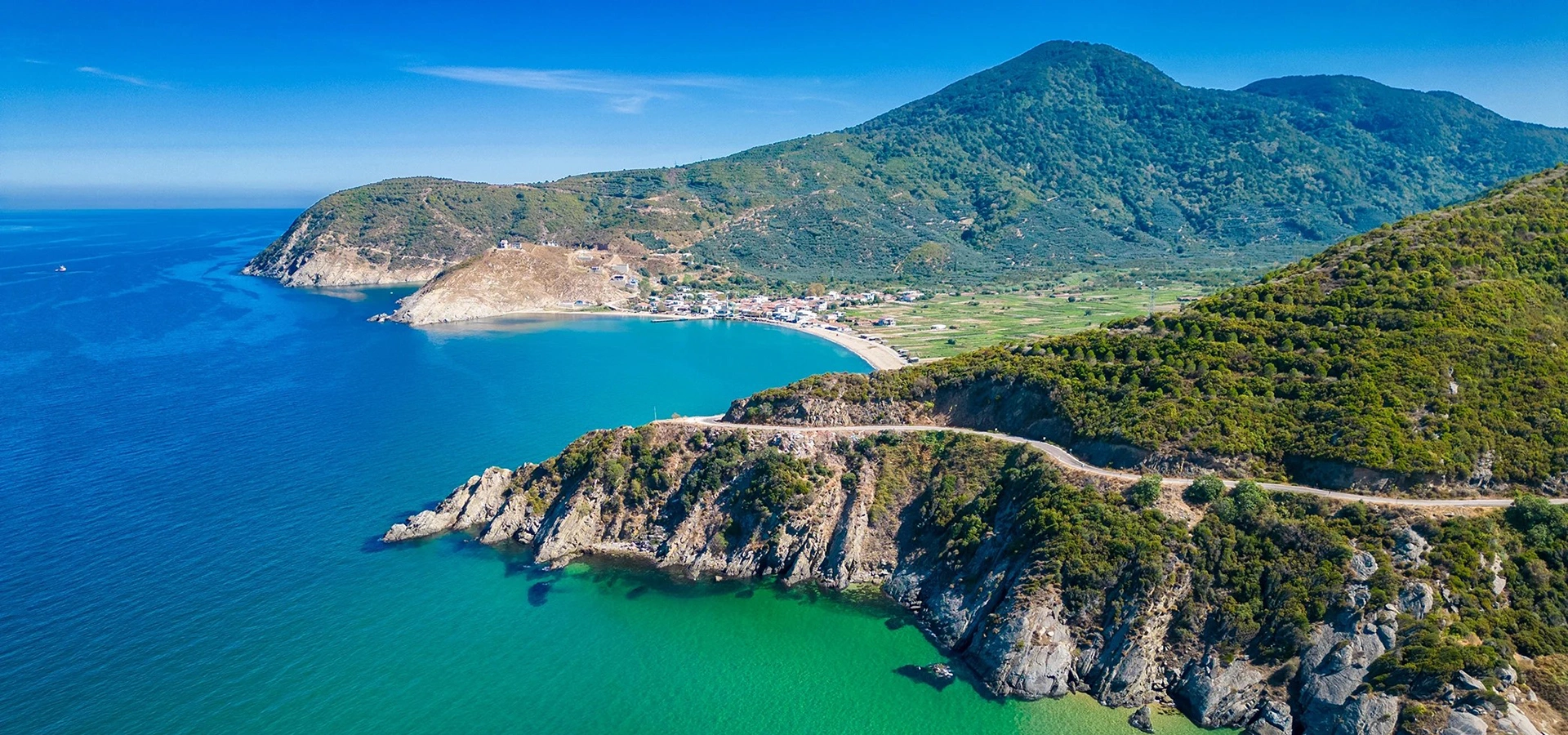
Understand the ancient city that once dominated the southern entrance to the peninsula and its maritime landscape.
View Kyzikos & Kapıdağ Guide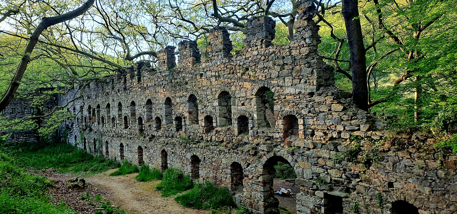
Travel into the wooded interior for a ruined monastic complex that reveals another cultural layer of Kapıdağ.
View Kirazlı Monastery Guide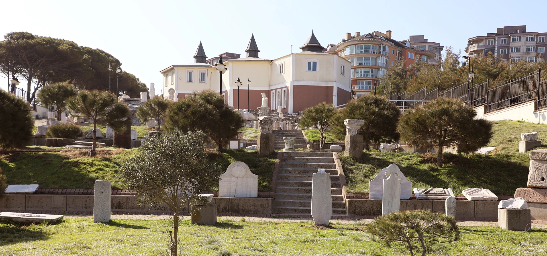
See archaeological material from Kyzikos and the wider region after travelling through the landscapes where these communities developed.
View Bandırma Museum Guide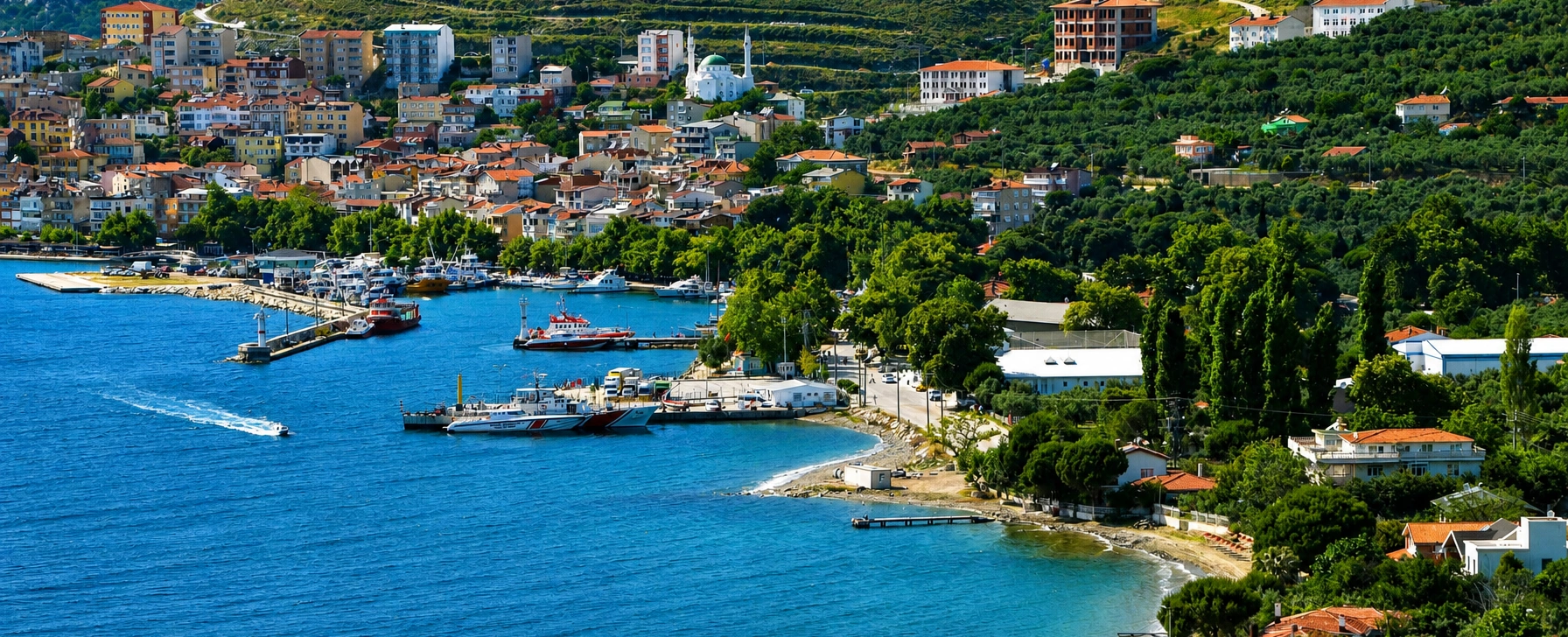
Continue across the water from Kapıdağ into the marble landscape of Prokonnesos and the villages of Marmara Island.
View Marmara Island Guide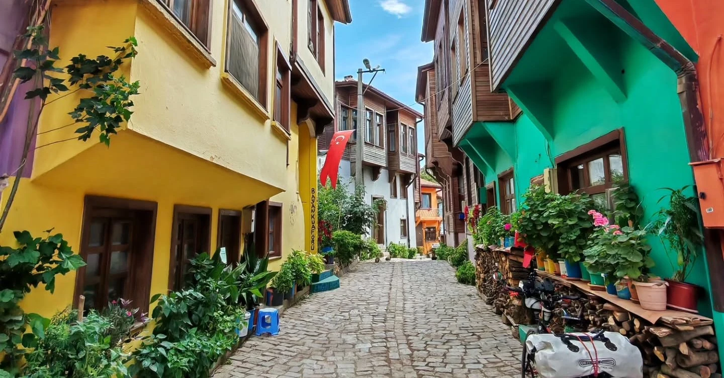
Add Ottoman streets, traditional houses and another important South Marmara olive landscape to your route.
View Edincik Guide