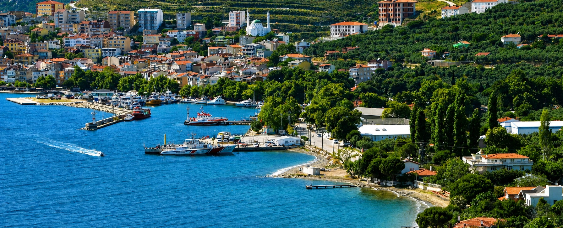
Private Marmara Island & Prokonnesos Heritage Experience
Ask us about a tailor-made programme combining Saraylar, ancient marble production, island villages and the wider history of Prokonnesos.
Request a Custom Tour





Most travellers know the Sea of Marmara. Far fewer realise that its modern name is closely tied to a mountainous island of white stone rising from its southwestern waters. Marmara Island — ancient Prokonnesos — was one of the Mediterranean world's great marble-producing centres, and the northern settlement of Saraylar still sits among quarry landscapes that have shaped the island for centuries.
The story is much larger than a single archaeological site. Prokonnesian marble was quarried, roughed out, loaded onto ships and distributed across the Roman and Byzantine worlds. Columns, capitals, architectural blocks, sarcophagi and church furnishings could leave the island partly finished, allowing final carving to take place near the building site. By the Roman Imperial and Late Antique periods, this system had made Prokonnesian marble one of the most widely circulated architectural stones of the Mediterranean.
At Saraylar, archaeology preserves the manufacturing side of that trade. Rescue excavations beginning in the 1970s revealed a Roman-period necropolis, while surveys of the ancient quarry zones documented large numbers of unfinished and semi-finished marble objects. Many were gathered into an open-air archaeological display, allowing visitors to see pieces that were abandoned before they ever reached an imperial building, church or tomb.
The island is also a living place rather than an archaeological reserve. Modern marble extraction continues on a dramatic scale, ferries connect the island with the mainland, fishing and olive cultivation remain important, and villages such as Marmara, Çınarlı, Gündoğdu, Topağaç and Asmalı reveal a quieter side of island life beyond the quarries.
That combination makes Marmara Island one of Türkiye's most unusual cultural landscapes. You can stand beside ancient quarry products in Saraylar, look toward modern cutting yards, cross the island through mountain scenery, swim from small beaches and then remember that stone from this same island helped shape monuments hundreds or even thousands of kilometres away.
Marmara Island was known in antiquity as Prokonnesos, a strategically placed island settlement in the Propontis.
White and grey-veined Prokonnesian marble became one of the Roman and Byzantine worlds' most important architectural stones.
Unfinished capitals, sarcophagi, columns and other quarry products reveal how ancient marble was prepared for export.
Ancient extraction zones and a major modern marble industry exist side by side on the island's northern coast.
Essential information for understanding the island's extraordinary combination of archaeology, marble production and coastal life.
Marmara Sea, Balıkesir Province, between the Kapıdağ Peninsula and the Thracian coast.
Marmara is the largest island in the Marmara Archipelago and one of Türkiye's largest islands.
Prokonnesos / Proconnesus, the name encountered in Greek, Roman and Byzantine sources.
Medium- to coarse-grained white marble, frequently marked by distinctive grey bands or streaks.
Large-scale quarrying and export became especially important during the Roman Imperial and Byzantine periods.
A Roman necropolis, ancient quarry zones and unfinished marble products document life and work around Prokonnesos.
Saraylar preserves unfinished capitals, columns, sarcophagi and other objects recovered from the quarry landscape.
Prokonnesian marble became a major building material for Constantinople and was used extensively in Hagia Sophia.
The island is reached by sea only; ferry and Ro-Ro schedules vary by season, route and weather.
Modern quarrying continues around Saraylar. Never enter industrial quarry areas without authorised access.
Allow at least one full day; two nights are better if combining Saraylar, villages, beaches and island scenery.
Archaeology, industrial heritage, Byzantine history, geology, coastal road trips, photography and slower island travel.
Marmara Island is worth visiting because it lets you follow the complete story of monumental stone — from mountain bedrock to quarry, workshop, harbour and imperial architecture.
The first reason is historical scale. Prokonnesian marble was not a small local material used only around the island. From the Roman Imperial period onward it travelled through Mediterranean and Black Sea trade networks and became one of the dominant architectural marbles of Late Antiquity.
The second reason is manufacturing archaeology. At many ancient cities, visitors see finished columns or decorated capitals without knowing where they came from. Saraylar reverses that experience. Here you encounter rough blocks, half-carved capitals, sarcophagi and other products close to the quarries where the work began.
The third reason is the island's connection with Constantinople. The expansion of the imperial capital created enormous demand for stone. Marmara Island's proximity by sea, abundant deposits and capacity for semi-finished production made it exceptionally important for monumental building programmes, especially in the Late Roman and Byzantine periods.
Finally, Marmara Island is visually unforgettable because the ancient industry never became a dead landscape. Modern marble extraction still cuts brilliant pale terraces into the hills around Saraylar. For travellers interested in the relationship between archaeology, geology, labour and modern industry, very few destinations are comparable.
Marmara Island lies in the southwestern Sea of Marmara, north of the Kapıdağ Peninsula and roughly between the Balıkesir coast and the Thracian shore. Together with Avşa, Paşalimanı, Ekinlik and smaller islands, it forms part of the Marmara island group.
The island belongs administratively to Balıkesir Province. Its principal settlement and district centre is usually simply called Marmara, while Saraylar lies on the northern coast in the heart of the marble-producing landscape.
The geography explains much of the island's history. Marble could be extracted from slopes close to sheltered coastal loading points, placed aboard ships and moved directly into major sea routes. That maritime advantage was one of the reasons Prokonnesian stone could circulate so widely in antiquity.
The modern island as a whole: villages, beaches, roads, olive groves, mountains, ports and marble industry.
The ancient name of the island and ancient settlement, used when discussing Classical, Roman and Byzantine history and the famous marble trade.
The northern harbour settlement most closely associated today with the ancient quarry landscape, open-air archaeological display and modern marble production.
The archaeological and art-historical name for the distinctive white and grey-banded marble quarried on the island.
These terms overlap but are not interchangeable in every context. A Roman sarcophagus found abroad may be described as made of Prokonnesian marble; the quarry from which its stone came may lie near modern Saraylar; and the modern traveller reaches all of this on Marmara Island.
Long before the marble industry reached its imperial peak, Prokonnesos occupied a useful position in the Propontis — the ancient Sea of Marmara — along maritime routes linking the Aegean, Hellespont, Bosporus and Black Sea.
Ancient and modern historical sources associate the island with Ionian / Milesian colonisation. By the Classical period, Prokonnesos belonged to the dense network of Greek communities, ports and trading centres around the Propontis and was connected politically and economically with the larger regional world that included nearby Cyzicus.
The island's marble deposits gradually transformed its significance. Evidence and ancient references indicate that Prokonnesian stone was known before the Roman period, but the great expansion in production and long-distance distribution came under Roman rule, when quarrying could be integrated into the enormous demand for imperial architecture, urban building and sarcophagus production.
In Late Antiquity, the foundation and growth of Constantinople changed the island's future again. The new capital lay only a sea voyage away. Prokonnesos possessed the raw material, coastal access and skilled labour needed to feed one of the largest building programmes in the ancient Mediterranean.
The modern name Marmara is associated with the Greek word marmaron, meaning marble or shining stone. The connection is entirely appropriate: for centuries the island's pale crystalline rock was its most famous natural resource.
The name eventually became attached not only to the island but also to the surrounding Sea of Marmara. This creates one of the most memorable geographical relationships in Türkiye: a major inland sea whose modern name is linked with the stone quarried from one of its islands.
Ancient sources, however, generally knew the island as Prokonnesos or in Latinised form Proconnesus. Both spellings are common in modern scholarship, and travellers researching museum labels or archaeological literature will encounter several transliterations.
Prokonnesian marble is usually described as a medium- to coarse-grained white marble with grey streaks, bands or layers that can range from subtle lines to strongly contrasting patterns.
Those grey bands are useful for travellers because they make many architectural pieces visually recognisable. In polished slabs the veining can become dramatic; in ancient columns or capitals weathered outdoors, the contrast may be softer but still visible.
The stone could be extracted in very large blocks, an enormous advantage for monumental architecture. Columns, bases, capitals, architraves, wall revetment and sarcophagi all demanded substantial pieces of dependable stone, and Marmara Island could supply them in quantity.
Predominantly white to pale grey.
Often crossed by grey veins, streaks or parallel bands.
Generally medium to coarse crystalline grain.
Columns, capitals, bases, paving, wall revetment, liturgical furniture, sarcophagi and other architectural elements.
The quarry districts around northern Marmara Island covered a vast working landscape. Ancient extraction did not consist of a single picturesque pit. It involved quarry faces, cutting areas, roughing-out zones, transport routes, storage points, harbour facilities and communities of workers organised around the stone industry.
Archaeological surveys around Saraylar have identified unfinished pieces directly in or near quarry zones, together with evidence for different stages of stoneworking. Tool marks, abandoned blocks and partly shaped architectural elements allow archaeologists to reconstruct how stone moved from geological deposit toward finished object.
Some items were abandoned because faults became visible during carving; others may have been damaged, surplus or unsuitable for the intended commission. Whatever the reason, these failures are exceptionally valuable today because a finished column in Constantinople tells us what succeeded, while an unfinished capital in Saraylar reveals how the manufacturing process worked.
This is why Prokonnesos matters far beyond local history. It preserves evidence for the organisation of one of antiquity's most important building-material industries.
Quarry workers selected workable marble beds while watching for fractures, unwanted inclusions and structural weaknesses.
Channels, wedges, iron tools and controlled splitting separated large masses of marble from the living rock.
Much unnecessary weight could be removed at the quarry by shaping a block into the approximate form of a capital, column, basin or sarcophagus.
If a crack or weakness appeared, the piece might be rejected — leaving behind exactly the type of unfinished object visible around Saraylar today.
Heavy stone was transported downhill toward coastal loading points, where maritime transport made long-distance export practical.
Many pieces travelled semi-finished and received final carving in workshops at Constantinople or another importing city.
This system was economically intelligent. Removing excess stone before shipment reduced weight, while delaying the finest carving gave destination workshops flexibility to adapt pieces to local measurements and decorative programmes.
Saraylar is a settlement on Marmara Island's northern coast where the ancient and modern marble industries are most visible. Quarry terraces rise behind the built-up area, stone yards and industrial infrastructure occupy parts of the landscape, and archaeological finds connect the modern community directly with ancient Prokonnesos.
Historical and archaeological research suggests that the ancient settlement itself lay beneath or very close to modern Saraylar. The Roman necropolis was excavated just outside the settlement, while traces connected with water supply, buildings and quarry activity have been documented across the surrounding area.
For travellers, Saraylar is therefore not simply the nearest village to a ruin. The settlement is part of the archaeological landscape. Its harbour, roads, quarries and continuing stone economy help explain why people have lived and worked here for so long.
Do not expect a polished resort atmosphere. Saraylar is a working marble town. That industrial reality is part of its interest, but it also means visitors must respect truck traffic, restricted zones and active quarry operations.
The Saraylar open-air archaeological display grew out of systematic work undertaken around the ancient quarries and Roman necropolis. Rescue excavations during the 1970s documented sarcophagi and burial areas, while subsequent quarry surveys recorded hundreds of unfinished or semi-finished marble objects.
Rather than treating these pieces as meaningless industrial waste, archaeologists recognised that they preserve evidence for stoneworking methods. Many were gathered into protected outdoor displays near Saraylar and at selected quarry areas.
Partly carved capitals can show the progression from rough block to architectural ornament and preserve visible tool marks.
Drums, shafts, bases and other structural pieces demonstrate the scale of architectural production.
Rough and unfinished coffins connect the quarries with the enormous Roman market for marble burial monuments.
Rejected or incomplete elements preserve dimensions, working stages and traces of ancient tools.
The site should be approached as an archaeological working archive rather than a conventional indoor museum. Visitor arrangements, supervision and access can change, especially because the surrounding landscape remains industrial. Do not rely on a fixed timetable unless it has been confirmed shortly before your visit.
One of the most important archaeological discoveries at Saraylar was a Roman-period necropolis containing marble sarcophagi. Rescue excavations beginning in the early 1970s recovered and documented a substantial burial area just outside the modern settlement.
The necropolis is especially interesting because it connects exported products with the community that lived beside the quarries. Many sarcophagi were only roughly shaped. Some may have been unsuitable for export because of faults in the stone; others may have been produced specifically for local use.
This creates an unusually human perspective on the industry. Prokonnesos was not merely a source of anonymous building material. It was home to quarry workers, craftsmen, administrators, sailors, merchants and families who lived beside one of the ancient world's largest stone-producing zones.
During the Roman Imperial period, Prokonnesian marble became one of the most important white marbles in long-distance trade. By the 2nd century AD, its architectural use expanded dramatically, and research into marble distribution shows that Prokonnesos increasingly occupied a leading position in the Mediterranean market.
The island exported both raw blocks and prefabricated or semi-finished products. Architectural elements and sarcophagi could be roughed out to standard forms before shipment, creating something close to an ancient production line.
Prokonnesian stone has been identified in major centres across the eastern Mediterranean, Italy, the Adriatic, North Africa and the Black Sea. Its success depended on more than appearance: the quarries could supply large quantities, and maritime transport from an island quarry was far more efficient than moving comparable stone over long land routes.
For travellers standing at Saraylar, this means the harbour should be imagined as part of a vast commercial network. Ancient ships did not simply arrive for local trade — they carried pieces of Marmara Island into some of the Roman world's most ambitious buildings and funerary monuments.
Roman demand for monumental stone coffins created an enormous market, and Prokonnesos became particularly successful at supplying semi-finished sarcophagi.
A basic sarcophagus could be quarried and roughed into shape on the island, reducing shipping weight while leaving enough uncarved surface for the final purchaser to commission local decoration. Garland sarcophagi and related types travelled widely through coastal trade networks.
This method also helps explain why unfinished sarcophagi are so informative. They preserve stages normally removed by final carving. A rough coffin at Saraylar can therefore teach us more about quarry organisation than a spectacular finished example in a distant museum.
The creation and expansion of Constantinople gave Marmara Island an extraordinary logistical advantage. The capital needed immense quantities of columns, capitals, wall revetment, paving, church furniture and structural stone, and Prokonnesos could supply them by sea from relatively nearby quarries.
Late Antique quarry production became increasingly standardised. Archaeological research has shown that capitals and other architectural forms could be worked through several recognisable stages before leaving the island. Final decorative cutting might then be completed in specialised workshops closer to the building project.
Prokonnesian marble appears throughout the architectural vocabulary of the Early Byzantine world. Columns, carved capitals, parapet slabs, ambons, ciboria and liturgical furnishings made from this stone were distributed through cities and churches around the Mediterranean.
Saraylar therefore belongs not only to the industrial history of stone but to the history of Byzantine architecture itself. Many forms associated visually with Constantinople began as blocks of marble extracted from the hills of this island.
The best-known monument connected with Marmara Island's stone is Hagia Sophia in Istanbul. Studies of its building materials identify Prokonnesian marble among the principal local and regional stones used in the sixth-century church.
The connection is important because Hagia Sophia required material on an enormous scale. The ability to obtain major architectural elements from quarries linked directly to the sea made Prokonnesos a logical supplier for Justinian's capital.
When visiting Saraylar, it is useful to imagine the contrast between the two ends of the production chain. Here: rough quarry faces, half-carved capitals and blocks waiting for shipment. In Constantinople: polished columns, finished carving and monumental interiors designed to overwhelm the viewer.
That relationship turns a visit to Marmara Island into an excellent companion to Byzantine sightseeing in Istanbul. After seeing Prokonnesos, architectural marble in the capital becomes much easier to read as the result of quarrying, transport and specialised labour rather than simply decoration.
Archaeological research has long suggested that the ancient settlement of Prokonnesos lies beneath or around modern Saraylar. Among the most significant clues are remains associated with a large sixth-century Byzantine church documented within the settlement area.
The existence of substantial religious architecture supports the idea of a permanent community with institutions extending beyond quarry production. Prokonnesos required workers and workshops, but also housing, water supply, burial grounds, religious buildings and administrative structures.
Because modern Saraylar occupies the same landscape, ancient remains do not survive as one completely excavated city plan. The archaeology is fragmented by later building and ongoing industrial activity. This is why the site feels different from a conventional ancient city such as Ephesus: the ancient settlement is embedded within a living town.
The importance of Marmara Island's quarries did not disappear with the Byzantine Empire. Official regional histories record continued use of island marble for Ottoman mosques, palaces and other major buildings.
The reason was simple: the geological resource remained, the island retained maritime access to Istanbul, and generations of quarrying had already created a landscape and labour tradition organised around stone.
Modern technology transformed extraction enormously. Diamond wire, heavy machinery, trucks, cranes and industrial cutting facilities replaced ancient tools and labour systems, allowing blocks to be removed at a scale Roman quarry workers could never have imagined.
Yet the basic economic logic is remarkably familiar: valuable marble is extracted near the coast, processed to different stages and shipped to markets far beyond the island.
Modern quarrying around Saraylar is impossible to ignore. Vast pale terraces cut through the hills, stacks of blocks occupy industrial yards and heavy vehicles move between quarry zones and the coast.
This can be visually dramatic, but visitors should remember that an active quarry is a workplace with real industrial hazards. Unauthorised access is not appropriate. Loose rock, blasting, cutting equipment, machinery and truck traffic make quarry zones fundamentally different from archaeological parks.
The safest and most meaningful approach is to experience the modern industry from public roads, harbour areas and authorised viewpoints, then use the archaeological displays to understand the ancient production process.
Marmara Island's later history was shaped by its position on the maritime routes of the Ottoman world, its quarry economy and a mixed island population that included long-established Greek Orthodox communities alongside Muslim residents.
Following the population exchange between Greece and Türkiye, much of the island's Greek population departed. Official local histories record that emigrants from Marmara Island were among those who established Neos Marmaras in Halkidiki, while new residents from different regions of Türkiye and exchange communities settled in villages across the island.
A destructive earthquake in 1935 caused major damage across the region and affected the island's historic built environment. Combined with population movement and later redevelopment, this helps explain why ancient and Ottoman-period remains are often fragmentary rather than forming a single preserved historic townscape.
Today each village has a slightly different character, reflecting fishing, agriculture, tourism, migration histories and varying relationships with the marble industry.
Marmara town is the island's administrative and practical centre. Ferries, accommodation, restaurants, shops and local transport make it the easiest base for many independent travellers.
The waterfront atmosphere is very different from Saraylar. Instead of quarry terraces dominating the view, the focus is on harbour life, fishing boats, summer visitors and the rhythm of a small island town.
Staying here works particularly well if you want to divide your time between archaeology and relaxation. Saraylar can be explored as a dedicated excursion, while the remainder of your stay can focus on swimming, village drives and coastal evenings.
A west-coast village associated with seaside stays, tree-shaded streets and a quieter holiday atmosphere.
A village in the island's eastern sector, useful for understanding the transition between coastal settlement, agriculture and the wider marble landscape.
Known for more productive agricultural land and village farming, offering a strong contrast with the stone-dominated north.
A small settlement with fishing traditions and surviving traces of the island's older architectural character.
The essential stop for archaeology, marble history, industrial heritage and the ancient Prokonnesos quarry story.
The most practical base for accommodation, restaurants, transport and evening walks along the waterfront.
Although the island's history is dominated by marble, most summer visitors also come for the sea, coves and village beaches. The coastline alternates between inhabited bays, rocky headlands and working industrial shores.
The best swimming areas are generally those away from active port and quarry operations. Çınarlı and other village coastlines can provide a much more relaxed beach atmosphere than Saraylar, whose identity is primarily industrial and archaeological.
The mountainous interior is equally important. Roads climb through rugged terrain with broad views over the Sea of Marmara, and the contrast between dark vegetation and pale exposed stone can be striking.
Conditions can change quickly with wind. Always treat local advice seriously, especially if swimming from exposed shores, travelling by small boat or driving narrow mountain roads in poor weather.
Base your day around Saraylar, the open-air display, the Roman necropolis story and public viewpoints across the ancient quarry landscape.
Study Prokonnesian production on the island, then connect it mentally with Hagia Sophia and other monuments in Istanbul.
Compare ancient quarry methods with today's large-scale extraction while remaining strictly within public or authorised areas.
Spend one day on marble history and the remaining time in Marmara town, Çınarlı and quieter coastal villages.
Combine quarry geometry, abandoned ancient marble, harbour scenes, village streets and elevated coastal views.
Link the island with Erdek, Kapıdağ and Cyzicus for a regional itinerary built around archaeology and maritime landscapes.
Official regional tourism information continues to identify an open-air museum at Saraylar, and archaeological publications describe outdoor displays created from objects recovered during the Prokonnesos excavations and quarry surveys.
However, a dependable public source for fixed year-round opening hours, admission policy and staffing is not consistently available. This matters because Saraylar is a living industrial settlement rather than a large ticketed archaeological park.
For that reason, visitors should confirm current access locally before travelling solely for museum entry. If the archaeological display is your principal reason for visiting, ask the local municipality, tourism authority, accommodation provider or ferry-side contacts shortly before arrival.
Even when individual archaeological areas are not accessible, Saraylar remains valuable for understanding the wider quarry landscape from public spaces and authorised routes.
Quiet and green, but sea crossings and weather can still be changeable. Good for travellers focused more on history than swimming.
One of the best periods for archaeology, village drives and walking before peak summer heat and crowds.
The liveliest beach season. Expect hotter midday conditions and greater pressure on accommodation and transport.
An excellent balance of warm sea, softer light, easier sightseeing and generally calmer island atmosphere after the summer peak.
Good for cultural travel when weather cooperates, but seasonal services may begin to reduce.
Very quiet and authentic, but storms, reduced tourism services and ferry disruption can make planning less predictable.
For most archaeology-oriented travellers, May, June and September offer the strongest combination of comfortable temperatures and practical island travel.
Only practical if transport lines up perfectly and you are already staying nearby; suitable for a focused Saraylar visit.
Enough for Saraylar, Marmara town and one or two scenic stops if you have private transport or a well-organised local route.
A much better minimum, allowing a relaxed evening and avoiding the need to fit both ferries and sightseeing into one tight day.
Ideal for most first visits: dedicate one day to Prokonnesos and Saraylar, another to villages, beaches and island scenery.
Best for slow travel, photography, swimming and deeper exploration without treating every ferry connection as a deadline.
Suitable for a genuine island holiday combining archaeology with long beach days and village life.
Marmara Island is reached only by sea. Ferry and Ro-Ro services connect the archipelago with mainland ports, but routes and frequencies change seasonally and can be affected by weather.
One of the most practical gateways from the Balıkesir side and especially useful if combining the island with Kapıdağ and Cyzicus.
Useful for travellers approaching from Thrace; confirm whether the current sailing serves Marmara town, Saraylar or another island stop.
Some regional ferry operations include Bandırma within the wider Marmara route network; check the current timetable before planning.
Direct or seasonal options can vary significantly from year to year. Verify the operating route rather than assuming a daily direct service.
A vehicle-carrying ferry can make island exploration much easier, especially for reaching Saraylar and several villages in one stay.
Stay flexible and confirm local minibuses, taxis or arranged transfers in advance if Saraylar is a priority.
Current ferry operators serving the region publish routes involving Erdek, Bandırma, Tekirdağ, Marmara, Saraylar and Avşa, but the exact combination changes with the timetable. Always recheck shortly before travel.
The easiest way to combine Saraylar, Marmara town, Çınarlı and interior viewpoints on your own schedule.
Services may link principal settlements, but frequency can be seasonal. Ask locally rather than building a tight itinerary around assumed departures.
Useful for focused archaeological visits when you arrive without a vehicle and want to reach Saraylar efficiently.
Possible for experienced riders, but steep climbs, heat, wind and industrial traffic around quarry zones require caution.
Excellent within individual settlements but not a realistic way to connect all major villages in a short visit.
Seasonal local boat trips can reveal the island's coastline from the sea, but routes depend heavily on wind and demand.
Accessibility varies greatly across the island. Ferry terminals and newer accommodation may provide relatively straightforward access, while archaeological displays and quarry-side terrain can be uneven.
At Saraylar, visitors should expect a working settlement with sloping streets, stone surfaces, industrial traffic and outdoor archaeological material rather than the fully engineered route of a modern museum.
Wheelchair users and travellers with significant mobility requirements should confirm vehicle access, step-free routes, museum conditions and ferry boarding procedures before travelling.
A private vehicle or arranged transfer can make a major difference because many of the island's most interesting landscapes are spread across mountainous terrain.
Photograph tool marks, rough surfaces and the transition from raw block to recognisable architectural form.
Close-up images of the characteristic bands help explain why Prokonnesian marble is visually distinctive.
Use public viewpoints to show the astonishing scale at which pale stone has been cut from the hills.
Images combining marble blocks with the sea communicate the importance of maritime transport better than isolated quarry photographs.
Balance industrial Saraylar with fishing boats, olive trees, old houses and quieter coastal villages elsewhere on the island.
Low light can add texture to white stone and soften the harsh contrasts of quarry landscapes.
Never enter restricted industrial areas for a photograph, and do not photograph workers closely without permission. Quarry machinery and haul roads must always be treated as active workplace infrastructure.
Marmara Island can be surprisingly engaging for children if the archaeology is explained as a production story: How does a mountain become a column?
At Saraylar, look for unfinished shapes and ask younger visitors to identify what each block was becoming. A partly carved capital or sarcophagus makes ancient craftsmanship much easier to understand than a technical museum label alone.
The modern quarries can also be fascinating from a safe distance because children can compare ancient hand tools with today's enormous machinery. Safety boundaries, however, are essential — active quarry and truck zones are not playgrounds.
For a balanced family day, combine the archaeology with a beach stop, lunch in a village and time around Marmara town's waterfront rather than spending the entire day in the industrial north.
Unfinished marble may look robust, but archaeological surfaces and tool marks can be damaged by repeated contact.
Even an apparently ordinary chip of marble may belong to a protected archaeological or geological context.
Active extraction areas are industrial workplaces. Enter only where public access or explicit permission exists.
Roads around Saraylar may carry large quarry trucks; drive conservatively and avoid stopping in unsafe locations for photographs.
Eat locally, stay overnight where possible and buy island products rather than treating Marmara as a quick quarry photo stop.
Use designated beaches and carry litter out, especially from quieter bays without regular cleaning services.
Do this shortly before travel because weather, season and operational changes can affect routes.
If the open-air museum is your main goal, verify current visitor conditions before committing to a special journey.
Useful for uneven archaeological ground, quarry-side roads and stone surfaces.
Summer heat, exposed quarry terrain and village drives can make dehydration easy to underestimate.
White marble reflects light strongly. Hat, sunglasses and sunscreen are especially useful around Saraylar.
Ferry timing, mountain roads and village stops make an overnight stay far more rewarding than a tightly compressed visit.
Do not assume every village provides the same services as Marmara town; prepare before exploring remote parts of the island.
Strong Marmara winds can affect ferries, swimming conditions and the comfort of exposed archaeological visits.
Dedicate the day to ancient quarrying, the open-air museum, the Roman necropolis story, public quarry viewpoints and Saraylar harbour. Return slowly through the island interior.
Explore Marmara town, Çınarlı and one or two eastern or southern villages, allowing time for swimming, seafood and scenic stops before your ferry.
Two days create a much better rhythm because they separate industrial archaeology from island leisure. Trying to understand Prokonnesos, explore several villages and catch a mainland ferry on the same day can make the destination feel unnecessarily rushed.
A practical mainland gateway with beaches, accommodation and onward connections around the Kapıdağ Peninsula.
One of the region's most important ancient urban landscapes and an ideal archaeological counterpart to Prokonnesos.
Mountain roads, coastal villages and forest scenery directly opposite the Marmara island group.
A livelier holiday island with beaches and summer tourism, often linked into the same regional ferry network.
A quieter island option for travellers interested in village life and a slower maritime landscape.
A major South Marmara transport centre useful for onward rail, road and ferry connections.
Add wetland ecology and birdlife to an itinerary otherwise dominated by archaeology and coastal history.
Continue inland for Roman thermal history, Byzantine mosaics and a living spa tradition.
Marmara Island's food is best approached through its coastal and agricultural setting rather than by searching for one famous signature dish.
Ask what is genuinely seasonal and locally available rather than ordering by habit.
Cold and warm meze work naturally with an island dinner beside the harbour.
Olive cultivation remains part of the island economy and local olive products are worth seeking out.
Topağaç and other agricultural areas contribute fresh produce to island kitchens during the growing season.
Cheese, olives, tomatoes, eggs, bread and preserves suit a slower morning before a day of exploration.
Look for regional cheeses, yoghurt and other dairy products connected with Balıkesir's strong food culture.
It lies in the southwestern Sea of Marmara and belongs to Balıkesir Province, north of the Kapıdağ Peninsula.
The island was known as Prokonnesos, also written Proconnesus in Latinised form.
It is especially famous for its ancient and modern marble quarries, Prokonnesian marble, the archaeology of Saraylar and its coastal island landscape.
The modern sea name is associated with Marmara Island, whose name is connected with the Greek word for marble.
A white to pale-grey crystalline marble from Marmara Island, often marked by characteristic grey bands or streaks.
Prokonnesian marble was known in antiquity well before the Roman Imperial peak. Large-scale quarrying and export became especially important under Roman and Byzantine rule.
The principal ancient quarry landscape is associated with northern Marmara Island around modern Saraylar and neighbouring quarry zones.
Depending on current access, you can see the open-air archaeological display, unfinished marble products, the context of the Roman necropolis and public views across the modern quarry landscape.
Archaeological displays include unfinished or semi-finished marble objects such as capitals, columns, architectural blocks and sarcophagi recovered from the ancient quarry landscape.
They preserve tool marks and intermediate working stages that show how ancient craftsmen transformed quarried blocks into export products.
Yes. Rescue excavations at Saraylar beginning in the 1970s documented a Roman-period burial area containing marble sarcophagi.
Extensively. It became one of the major architectural marbles of the Roman and Late Antique Mediterranean and travelled through both Mediterranean and Black Sea networks.
Yes. Studies of Hagia Sophia's materials identify Prokonnesian marble as an important component of the sixth-century building.
Some were worked substantially on the island, but many architectural elements and sarcophagi were exported in semi-finished form and completed nearer their destination.
Yes. Modern marble extraction remains a major activity around Saraylar and other parts of northern Marmara Island.
Do not enter active quarry areas independently. They are industrial workplaces and access should be limited to public or specifically authorised areas.
A dependable fixed year-round public schedule is not consistently published. Confirm current access locally before travelling specifically for museum entry.
Current visitor arrangements are not consistently published. Verify locally together with opening and access information.
By ferry or Ro-Ro. Mainland connections can involve Erdek, Tekirdağ and Bandırma, while seasonal routes may also change. Check the current operator timetable before travel.
Vehicle-carrying ferry services operate within the regional network, but you should confirm the exact route and vehicle reservation requirements for your travel date.
Yes, but direct passenger options can be seasonal or change over time. Another practical route is to travel overland to a mainland ferry gateway and continue by sea.
One night is a sensible minimum for most visitors; two nights are better if you want both Saraylar archaeology and relaxed village or beach time.
May, June and September are excellent for combining archaeology with comfortable island weather. July and August are livelier and better for a classic beach holiday.
Yes. Choose village and beach areas away from industrial harbour activity and always consider local wind and sea conditions.
Yes, especially if you combine the archaeology with beaches and villages. Keep children well away from active quarry roads and industrial areas.
Closed walking shoes, sun protection and comfortable clothing are sensible because the ground can be uneven and the white stone reflects strong sunlight.
Yes. Erdek, Kapıdağ Peninsula and Cyzicus make an excellent mainland extension because they continue the same South Marmara story of ancient ports, trade and regional archaeology.
Absolutely. The island is one of Türkiye's strongest destinations for travellers interested in ancient industry, Roman trade, Byzantine architecture, geology and the history of stone.
Its greatest archaeological importance lies not in monumental ruins but in the production landscape — quarries, unfinished objects, sarcophagi and evidence for how marble was prepared and exported across the ancient world.
A private route can connect the marble heritage of Prokonnesos with Erdek, Cyzicus, Kapıdağ and other South Marmara sites, creating an itinerary centred on archaeology, coastal history and landscapes rarely included in standard Türkiye programmes.
Tell us whether your priority is Roman archaeology, Byzantine architecture, ancient marble production, photography, island scenery or a multi-day regional route, and we can shape the programme around your interests.
Ask us about a tailor-made programme combining Saraylar, ancient marble production, island villages and the wider history of Prokonnesos.
Request a Custom Tour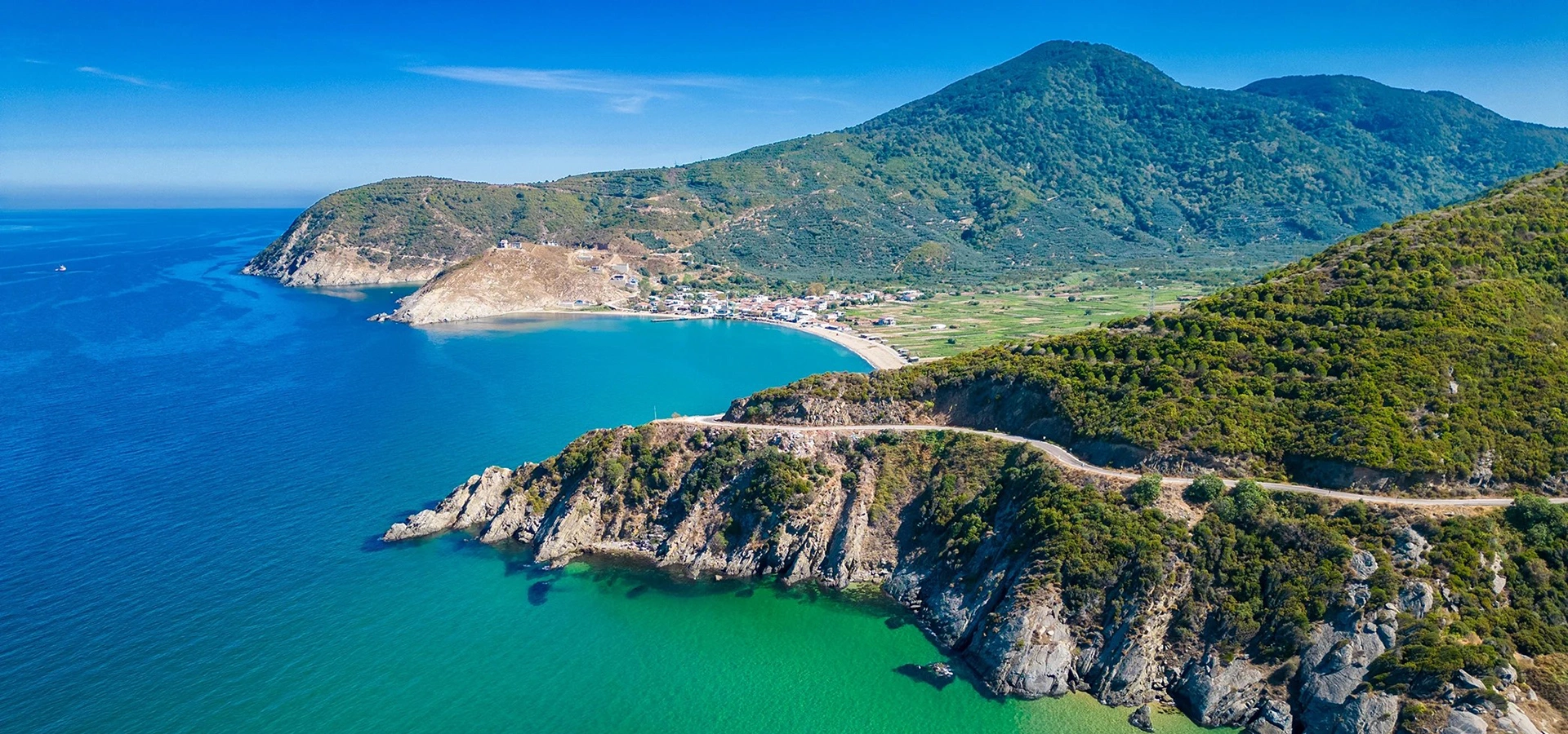
Continue from Prokonnesos to one of the most important ancient cities controlling the southern shores of the Propontis.
View Kapıdağ & Cyzicus Guide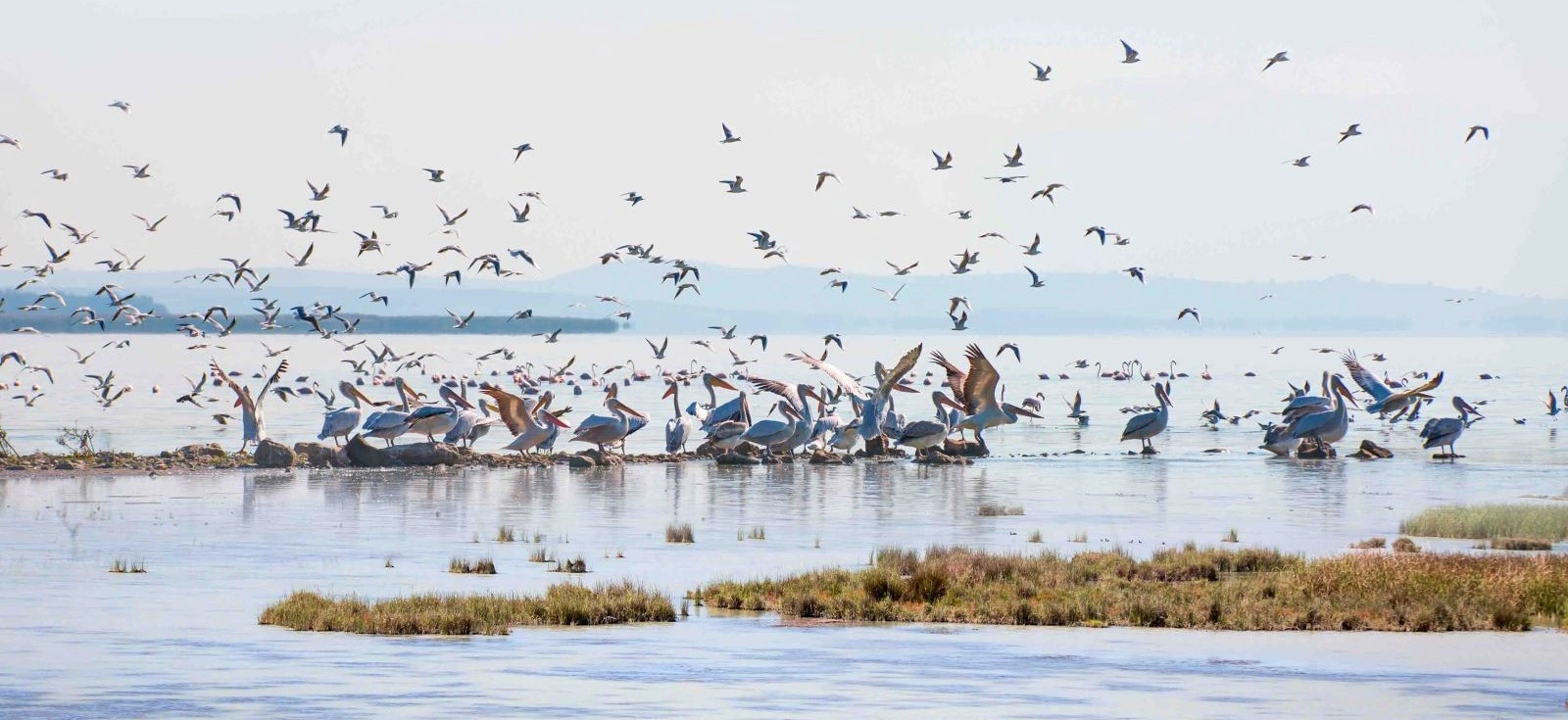
Add one of Türkiye's best-known wetland ecosystems to a South Marmara route dominated by archaeology and island landscapes.
View Lake Manyas Guide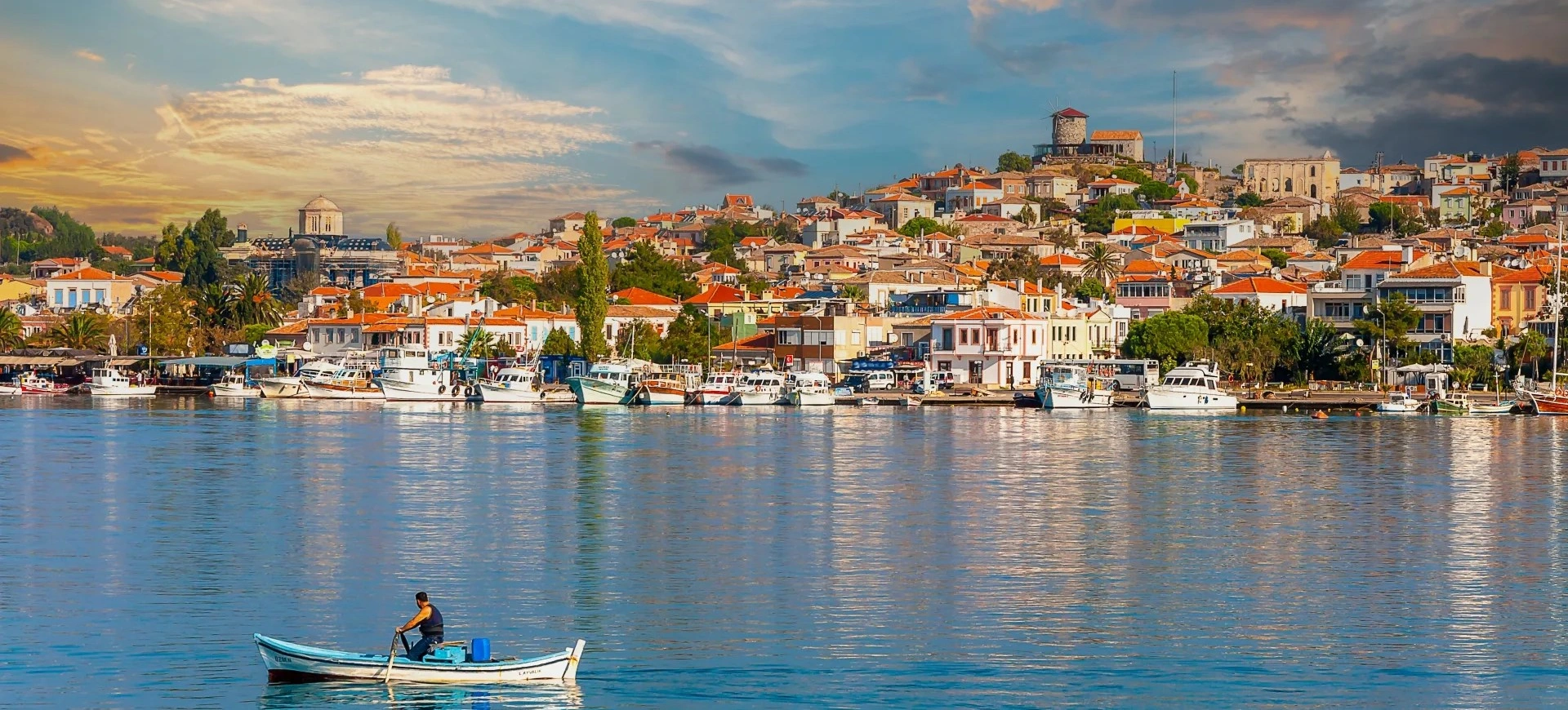
Combine Marmara Island, Cyzicus, Gönen, Manyas and other rarely visited Balıkesir sites in a private multi-day programme.
Plan a Private Route