Private Avşa Island & Marmara Islands Experience
Ask us about a tailor-made route combining Avşa's beaches and vineyards with island-hopping, local history and regional ferry logistics.
Request a Custom Tour





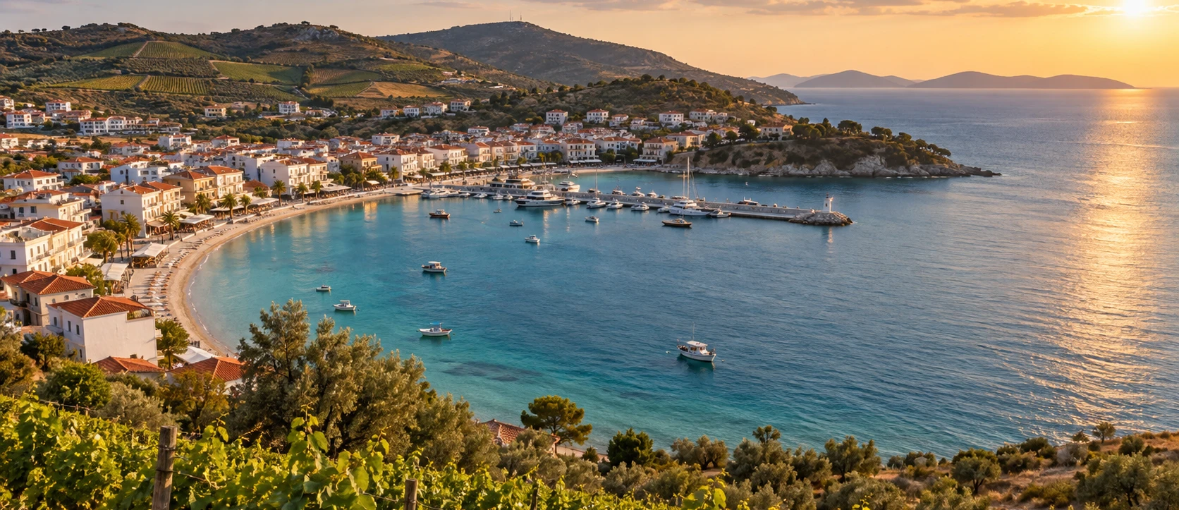
In the southern Sea of Marmara, between the Kapıdağ Peninsula and Marmara Island, Avşa Island is best known as an easy summer escape from Istanbul. Ferries deliver visitors directly to a waterfront lined with hotels, pensions, cafés and a long town beach, while roads crossing the island lead to quieter coves, vineyards and the second main settlement of Yiğitler.
Yet Avşa is much more than a beach resort. Its approximately 20.6-square-kilometre landscape preserves evidence of settlement reaching far back into prehistory, a Byzantine identity associated with Aphousia / Afousia, a strong monastic tradition and the remains of the Agios Georgios — Aya Yorgi — Monastery. Archaeological work on and around the island has also documented ancient material both on land and below today's shoreline.
Avşa's most distinctive living heritage, however, is its vineyard culture. The island is the home territory of Avşa Ada Karası, a dark-skinned grape whose geographical identity is officially protected in Türkiye. The grape received geographical-indication protection in 2023, while Avşa Adakarası wine received its own registration in 2025. Vineyards, local wineries and late-summer harvest traditions give Avşa a character unlike any other major Marmara Sea holiday island.
The coast is equally varied. Altınkum, Çınar, Karadut, Tavşanlı, Manastır, Yiğitler and the central Avşa shoreline offer different combinations of sand, clear water, facilities and atmosphere. Small excursion boats add another layer, reaching coves that are more enjoyable from the sea than by road.
Avşa changes dramatically with the seasons. In July and August it is energetic, crowded and strongly oriented toward swimming and nightlife. In late spring and September it becomes much easier to appreciate the vineyards, island roads and quieter beaches. Outside the main season, Avşa returns to the scale of a small Marmara community where ferry schedules and tourism services become far more limited.
Choose between the long central shore, Yiğitler and famous bays such as Altınkum, Çınar, Karadut and Tavşanlı.
Discover the grape that defines Avşa's agricultural identity and the wine tradition that has survived alongside mass summer tourism.
Look beyond the resort landscape to Aphousia, archaeological traces and the 17th-century Agios Georgios monastery site.
Seasonal ferries from Istanbul and regular connections from the southern Marmara coast make Avşa especially accessible in summer.
Essential information for planning a visit to one of the best-known holiday islands in the Sea of Marmara.
Marmara District, Balıkesir Province, in the southwestern Sea of Marmara.
Approximately 20.62 km², making Avşa smaller than neighbouring Marmara Island but large enough for several distinct beach zones.
By sea from Istanbul, Erdek, Tekirdağ and other Marmara routes depending on season and operator schedules.
Avşa on the main arrival waterfront and Yiğitler on the eastern side are the island's two principal visitor bases.
Avşa Ada Karası grape, a protected local variety traditionally associated with island vineyards and winemaking.
Avşa Adakarası wine received Turkish geographical-indication registration in 2025.
The archaeological remains of the Agios Georgios / Aya Yorgi Monastery, founded in its documented form in 1638.
Altınkum, Çınar, Karadut, Tavşanlı, Manastır, Yiğitler and the long central Avşa beach.
June and September for a strong balance of swimming, ferry connections and more manageable crowds.
July–August, when the island is busiest and nightlife, beach facilities and tourism services operate at full intensity.
2 nights for a first visit; 3 nights if you want beaches, vineyards and a relaxed island circuit.
Swimming, short island breaks, vineyards, wine culture, family holidays, nightlife, boat trips and Marmara island-hopping.
Avşa is worth visiting because it brings together easy ferry access, sandy beaches, vineyard culture, summer nightlife and a surprisingly complex archaeological and Byzantine past on a compact island that can be explored without a long road journey.
The most obvious reason is the sea. Unlike many rocky Marmara coastlines, Avşa has several sandy or sand-and-pebble bays. The central beach is immediately accessible from the ferry pier, while a short island drive opens up a chain of coves with very different exposure, facilities and atmosphere.
The second reason is Ada Karası. Vineyards are not simply decorative scenery here. They belong to the island's agricultural identity, and the official geographical registrations for both the grape and the wine confirm that Avşa's viticulture has a recognisable local character. Travellers interested in Turkish wine regions can experience an island terroir that remains much less internationally known than Thrace or Cappadocia.
The third reason is the island's hidden history. Avşa does not possess a monumental archaeological park comparable to Ephesus or Pergamon, but evidence from surface study, underwater work and historic sources shows a far longer story than its modern resort image suggests. The Agios Georgios monastery site is particularly important for understanding Avşa's Byzantine and post-Byzantine religious landscape.
Finally, Avşa is a useful base for Marmara island-hopping. Marmara Island, Ekinlik, Paşalimanı and the Kapıdağ Peninsula lie within the same maritime geography, allowing visitors to understand the region as an archipelago rather than as a collection of isolated beach destinations.
Avşa lies in the southwestern Sea of Marmara, north-west of the Kapıdağ Peninsula and south of Marmara Island. Administratively it belongs to Marmara District in Balıkesir Province. Nearby islands include Paşalimanı to the east, Ekinlik to the north-west and the much larger Marmara Island farther north.
The island covers roughly 20.62 square kilometres. Its coastline is deeply indented by small bays and headlands, while the interior is formed by low, dry hills crossed by local roads, vineyards and patches of Mediterranean-type scrub. This geography explains why two beaches only a short distance apart can have very different wind and water conditions.
The main ferry arrival is at Avşa settlement on the western-southern side of the island. Yiğitler, the second important settlement, occupies the eastern side and provides easier access to Altınkum, Tavşanlı, Karadut and several quieter coves.
The modern Turkish name used today for the island, settlement and tourism destination.
The name most strongly associated with the island in Byzantine historical and ecclesiastical sources.
A later Greek form used by the Orthodox community before the population exchange of the early 20th century.
A Republican-period official name formerly used for the principal settlement and still encountered in older publications and heritage records.
Some local histories also connect Avşa with classical names such as Ophiussa. That identification is frequently repeated but is not universally accepted by researchers. For travellers, the safest historical sequence is to recognise Aphousia / Afousia as the secure Byzantine name, Afissia as a later Greek form and Avşa as the modern Turkish name.
Avşa's history is difficult to tell through monuments alone because many ancient and medieval structures have disappeared. Archaeological surface finds and underwater investigations nevertheless indicate that human activity on and around the island reaches back into prehistoric periods. Obsidian, flint and other material documented around the coast has encouraged researchers to examine changing shorelines and possible submerged settlement areas.
In Late Antiquity and the Byzantine period, the island known as Aphousia belonged to the maritime world of Propontis — the ancient Sea of Marmara. Religious sources associate the island with monastic life and ecclesiastical exile. Its position offered both isolation and relatively easy sea access from Constantinople, making the Marmara islands suitable locations for monasteries, retreats and banishment.
By the Ottoman period, Avşa supported a predominantly Greek Orthodox island community alongside other population elements in the archipelago. Viticulture, wine production, fishing and small-scale agriculture shaped local life. The best documented religious complex to survive archaeologically is the Agios Georgios Monastery, whose 17th-century building phase is recorded by inscription.
The early 20th century brought fundamental demographic change. The island's Orthodox Greek population left in the period surrounding the 1923 compulsory population exchange, while Muslim families settled on the island. Older religious and domestic structures lost their original functions, and many archaeological fragments became scattered or incorporated into later building fabric.
From the later 20th century onward, Avşa developed rapidly as a domestic tourism island. Its proximity to Istanbul, extensive accommodation stock and sandy beaches transformed the local economy. Tourism became dominant, but vineyards survived, and the recent geographical-indication registrations for Ada Karası have renewed attention to the island's agricultural identity.
Visitors expecting a fenced ancient city may initially think Avşa has little archaeology. The reality is more complicated. Research has documented prehistoric stone tools, ceramics from multiple periods, architectural fragments and submerged features, but much of this material does not form a conventional excavated visitor site.
Underwater archaeological studies around the Manastır area used visual survey and sonar to investigate stone alignments and traces below the modern shoreline. Researchers have also recorded obsidian and flint objects associated with prehistoric technologies. These studies are important because sea level and shoreline changes have altered the relationship between settlement areas and the coast.
Material from Hellenistic, Roman, Late Antique and Byzantine periods has also been reported across the island. The picture that emerges is not of one single ancient city, but of long-term occupation across a maritime landscape whose remains were repeatedly reused, eroded, submerged or built over.
For responsible visitors, archaeological fragments should always be left where they are found. Removing pottery, stones or objects from a beach or ruin is both damaging and potentially illegal. Avşa's archaeological value depends precisely on preserving the context that earlier generations often lost.
The Sea of Marmara islands occupied a distinctive place in Byzantine geography. Close enough to Constantinople to remain within the capital's maritime orbit, yet isolated by water, they could support monasteries and also function as places of political or ecclesiastical exile.
Avşa appears in Byzantine sources as Aphousia / Afousia. Religious tradition connects the island with monks and church figures, while later evidence suggests that several monastic establishments once existed. The precise location and chronology of every institution are not equally secure, so modern travellers should be cautious about treating every local ruin as a firmly identified Byzantine monastery.
The strongest surviving archaeological reference point is the later Agios Georgios Monastery. Although its present documented foundation belongs to the post-Byzantine Ottoman period, it preserves the broader monastic character for which Avşa was remembered.
This historical layer gives Avşa a different identity from a purpose-built resort island. The same coast used today for swimming and ferries once formed part of a religious and maritime network connecting communities across the Propontis.
The remains of Agios Georgios Monastery stand near Manastır Burnu, close to the sea south-west of the main Avşa settlement. Heritage research identifies the documented construction of the complex with the year 1638, when a church and monastic buildings were established under a community of monks.
A historical inscription recorded by 19th-century researchers named monks associated with the foundation and later repair. The monastery became known not only as a religious house but also for its educational and manuscript tradition. Historical accounts record major damage, including a destructive fire in the late 18th century and later rebuilding.
Archaeological work in the early 2000s exposed and documented the surviving plan. What visitors encounter today is therefore an archaeological ruin rather than a restored monastery church. Walls and foundations allow the scale of the complex to be understood, but the site requires imagination and respect for fragile remains.
The landscape is part of the experience. The monastery stood beside one of the island's important coastal zones, linking worship, seclusion and maritime movement. Its position also helps explain why the surrounding district is still known as Manastır — “monastery.”
Like many communities around the Marmara and Aegean seas, Avşa was transformed by the wars and compulsory population movements of the early 20th century. The island's historic Greek Orthodox population departed, and Muslim families from elsewhere settled in the vacated landscape.
This change affected the physical island as well as its population. Churches and monasteries lost their congregations, houses changed ownership and agricultural land was reorganised. Some historic structures deteriorated, while stones and architectural pieces were reused in later construction.
The modern island therefore contains a layered cultural landscape: Greek Orthodox religious heritage, Ottoman-period agricultural traditions, population-exchange memory and later Turkish resort development. Understanding these layers helps explain why Avşa can look extremely modern in one street and reveal archaeological fragments only a short distance away.
Travellers interested in population-exchange history will find more visibly preserved architecture in places such as Cunda, Ayvalık or some Marmara Island villages. Avşa's story is more fragmentary, but that makes careful interpretation even more important.
For most visitors, Avşa begins at the main ferry pier. The town spreads along both sides of the harbour and beach, with accommodation, restaurants, bakeries, markets, cafés, bars and everyday services concentrated within walking distance.
The central waterfront is highly seasonal. On a summer evening it can be one of the liveliest places in the Marmara islands, while an early morning walk reveals a much quieter working settlement before beach traffic and nightlife begin.
The main town beach is extremely convenient because no transport is required. Families and short-stay visitors can step off the ferry, check into accommodation and be swimming within minutes. The trade-off is that the central shore is also the island's busiest urban beach.
Use Avşa town as the practical base for ferries, dinner and evening life, but do not let the centre become your entire island experience. The roads toward Manastır, Çınar, Yiğitler and the vineyards show a much more varied side of Avşa.
Yiğitler lies on Avşa's eastern side and forms the island's second important settlement. Historically the area is also encountered under the name Araplar in local sources. Today it functions as a calmer alternative to the main Avşa waterfront and an excellent base for exploring the eastern and southern coves.
The settlement has its own beach, small harbour, accommodation and everyday services. It feels more residential than central Avşa, particularly outside the peak evening hours, and is often preferred by visitors who want a beach holiday without being directly inside the island's nightlife zone.
Yiğitler is also strategically placed for Altınkum, Tavşanlı, Karadut and other bays. Travellers with a car, scooter or taxi can move between these areas easily, while seasonal minibuses may serve the most popular beaches.
If your priority is nightlife and immediate ferry access, stay in Avşa centre. If your priority is a quieter evening, beach access and an easier start toward the island's eastern coves, Yiğitler is worth considering.
The most distinctive agricultural product of Avşa is Ada Karası, a dark grape historically cultivated on the island and strongly associated with local wine production. Its importance is now officially recognised: Avşa Ada Karası Üzümü was registered in Türkiye as a protected geographical indication — a designation of origin — in January 2023.
The registration defines Avşa Island itself as the geographical area of production. This matters because Ada Karası is not simply a grape marketed with an island name; its identity is legally tied to the island's growing conditions, including its dry summer vegetation period and windy maritime climate.
Vineyards occupy parts of the island interior and slopes around the road network. They are particularly attractive in late summer when bunches ripen toward harvest. The visual contrast between dry hills, green vines and blue Marmara water is one of Avşa's most characteristic landscapes.
Visitors should remember that vineyards are working agricultural properties. Do not enter rows, pick grapes or photograph workers at close range without permission. The best way to experience the wine culture is through an organised producer visit, a tasting where offered or an island event built around the harvest.
Avşa's wine tradition received another important recognition in May 2025, when Avşa Adakarası Şarabı was registered as a Turkish geographical indication. The official specification links the wine to the island's Ada Karası grape and identifies characteristic chemical ranges associated with the variety and local growing conditions.
For travellers, the significance is cultural rather than technical. Wine is one of the few products that directly connects Avşa's historical agriculture with its contemporary tourism economy. Even as hotels and beach businesses expanded, vineyard plots and local producers preserved a link with an older island landscape.
The island's signature dark grape and the foundation of its best-known local wine tradition.
Avşa Ada Karası grape received geographical-indication registration in 2023.
Avşa Adakarası wine received its geographical-indication registration in 2025.
Late summer into early autumn is the most meaningful period for seeing vineyard activity, though exact timing depends on the year.
Some island wineries and producers may offer tastings or sales, but opening arrangements change; contact them before planning a dedicated visit.
If tasting wine, use a taxi, transfer or designated driver rather than combining alcohol with driving around the island.
Harvest celebrations and vineyard-focused events have been organised on Avşa in recent years, helping extend the island's season beyond the classic July–August beach period. Event dates are not fixed, so check the municipality's current programme if you are travelling in September.
Avşa's beach variety is one of its strongest advantages. The Balıkesir tourism authorities describe the island as a natural beach landscape with golden-coloured sands and numerous coves, while local tourism sources identify dozens of named swimming spots around the coast.
The long, convenient urban beach beside the main settlement and ferry pier. Best for visitors who want to swim without using transport.
A broad beach directly in front of Yiğitler, with accommodation and everyday services close by.
One of Avşa's most famous swimming areas, known for pale sand and clear water on the southern-eastern side of the island.
A popular bay with a greener, more enclosed feeling than the central waterfront and seasonal beach facilities.
A smaller coastal stop often chosen by visitors looking for a different atmosphere from the large central beaches.
One of the coves on the Yiğitler side, useful as part of a beach-hopping day around the island's southern coast.
A coastal area associated with the historic monastery district, combining swimming with one of Avşa's most important heritage landscapes.
Useful alternatives close to the main settlement when you want to leave the busiest central stretch without crossing the whole island.
Beach conditions change with wind direction. If one side of Avşa is rough, another bay may be much calmer. Ask locally each morning rather than committing to the same beach regardless of weather.
Altınkum — “golden sand” — is one of the names most strongly associated with Avşa's summer identity. Located beyond Yiğitler on the island's southern side, it attracts visitors for its sand, open sea view and clear-water appearance in favourable conditions.
During peak summer the beach can be busy and seasonal facilities operate along the shore. The atmosphere is therefore not necessarily secluded, but Altınkum remains a good choice for travellers who want a classic beach day with food and basic services nearby.
Because exposure to wind and waves varies, the water can look completely different from one day to another. Visit earlier in the day for easier parking and a calmer experience, and always follow local swimming advice.
Çınar Koyu is another of Avşa's best-known bays and is commonly reached by local road from the main settlement. It offers a more self-contained cove atmosphere than the long central town beach and is frequently included in island beach-hopping routes.
Seasonal businesses provide food, drinks and beach services in summer, while quieter shoulder-season days reveal the natural shape of the bay more clearly. As elsewhere on Avşa, operating businesses and transport frequency can change outside July and August.
Çınar works especially well as part of a day combining beach time with vineyard roads. Rather than driving directly there and back, allow time to stop at viewpoints and appreciate the agricultural interior of the island.
Daily excursion boats are one of the easiest ways to experience Avşa's smaller coves and the broader Marmara archipelago. Routes vary with weather, operator and season, but typically focus on swimming stops rather than historical guiding.
A boat day is particularly valuable if you are staying without a car. Instead of trying to reach multiple bays by taxi or minibus, you can see long stretches of coast and swim in places that may be awkward to access from land.
Before booking, ask about departure time, expected return, number of swimming stops, lunch, drinks, music level, shade and passenger capacity. Avşa has boats ranging from relaxed family-oriented excursions to much livelier summer party trips.
Wind is the final decision-maker. In strong conditions, routes can change or departures may be cancelled. Keep a flexible beach alternative for the same day.
Avşa has long been known for a much livelier summer evening scene than most islands in the Sea of Marmara. In July and August, the main settlement fills with bars, music venues, cafés and late-night crowds, making the island attractive to younger travellers and groups as well as families.
The busiest nightlife is concentrated around Avşa centre. If you want to walk back to your hotel after a late evening, staying near the main waterfront is practical. If you want quiet nights, choose accommodation toward Yiğitler, Manastır or the edges of the centre and check reviews specifically for noise.
The season matters enormously. Outside the peak summer period, nightlife contracts quickly and Avşa becomes a very different island. Travellers arriving in May, late September or winter should not assume that every venue listed online will be operating.
Avşa works best when nightlife is treated as one layer of the island rather than its entire identity. A late evening becomes more memorable after a day spent in the vineyards, coves and historic landscape.
Avşa does not have a single famous dish comparable to some Turkish regional food destinations. Its strongest culinary identity comes from the combination of fresh fish, seafood, meze, seasonal produce, grapes and local wine.
Ask what is fresh rather than ordering only by species name. Marmara fish availability changes through the year.
Cold and warm small plates suit the island's long summer evenings and pair naturally with a fish dinner.
When harvest season arrives, the island's signature grape is worth tasting as a local agricultural product in its own right.
The island's protected wine identity is the clearest food-and-drink product connected specifically with Avşa.
Vegetable dishes and meze prepared with olive oil connect Avşa with the broader culinary culture of the Marmara and North Aegean coasts.
A simple breakfast of tomatoes, cheese, olives, bread and fruit is ideal before a beach or boat day.
For the best experience, avoid choosing a restaurant only because it is closest to the ferry. Walk through the centre, look at what local diners are ordering and ask about the day's fish and meze before sitting down.
For adults who drink wine, a bottle from a reputable island producer is Avşa's most distinctive edible souvenir.
Depending on season and producer, grape-based products can provide an alcohol-free connection with the island's vineyard heritage.
Available around the island and connected with the wider agricultural traditions of the Marmara region.
Choose items with clear producer and ingredient information rather than generic resort souvenirs.
Small design products, prints and handmade items can be more meaningful than mass-produced beach souvenirs.
Where possible, purchase directly from vineyards, producers or independent local shops.
Avşa has no airport and no bridge. Every visitor arrives by sea. The exact mix of routes changes through the year, with the broadest choice during the summer season.
Seasonal fast-ferry services connect Istanbul directly with Avşa. Departure ports and operating days vary, so check the current İDO timetable before booking accommodation.
Erdek is one of the most important mainland gateways to the Marmara islands, with regular seasonal sea connections to Avşa.
Sea services link the Thracian side of the Marmara region with Avşa and neighbouring islands on selected routes.
Vehicle-capable ferry services operate on some Erdek / Tekirdağ routes. Confirm the exact vessel, reservation requirements and vehicle capacity before travelling.
For a short summer break, travelling without a car is easy if you stay centrally and use local transport, taxis or boat excursions for beaches.
Strong wind can affect island transport. Keep ferry operator contact details and avoid building an extremely tight onward flight connection.
Excellent within Avşa centre and along the main waterfront. Less practical for linking distant beaches in summer heat.
Seasonal local minibuses serve popular beaches and settlements. Frequency can change through the year.
The easiest flexible option for a beach transfer, winery visit or evening movement between Avşa and Yiğitler.
Useful for a full island circuit and multiple coves, but central parking can be inconvenient during peak season.
Potentially enjoyable for experienced riders, but wind, summer traffic, road surfaces and steep sections require caution.
The simplest way to turn transport into sightseeing and reach several swimming areas in one day.
Quiet and green by island standards, good for walking and landscape photography, but the sea is cool and many seasonal businesses remain closed.
One of the best months overall. Swimming conditions improve, ferry options expand and the island has not yet reached maximum summer density.
Peak beach and nightlife season. Best for maximum activity, but expect crowds, higher accommodation demand and busy ferries.
Excellent for warm sea, vineyard atmosphere and reduced crowds. Harvest-related activities may add another reason to visit.
Peaceful and atmospheric in good weather, though swimming becomes less reliable and seasonal transport / businesses begin closing.
Very quiet. Best only for travellers specifically interested in local island life; ferry frequency, restaurants and accommodation choices are much more limited.
For a first visit that combines the sea with vineyards and exploration, June or the first half of September usually offers the strongest balance.
Possible from some nearby Marmara ports, but ferry timing leaves little room for beaches, vineyards and exploration together.
Enough for the main town, one beach and an evening out, but you will still experience Avşa mainly as a short resort break.
The best minimum for first-time visitors: one day for beaches and one for an island circuit, vineyards or a boat trip.
Ideal for a balanced stay with multiple beaches, wine culture, Yiğitler and time to adapt to wind conditions.
Good for families and slow travel, especially if you want repeated beach days rather than continuous sightseeing.
Best if Avşa is primarily a swimming holiday or if you plan to combine it with boat trips and neighbouring Marmara islands.
Avşa is popular with families because accommodation, food shops and beaches are concentrated close together. Staying near the central beach can remove the need for daily transport, while Yiğitler provides a calmer alternative.
For younger children, choose a sheltered beach based on the day's wind rather than selecting only by reputation. Sea conditions around an island can change quickly between exposures.
A boat trip can be an excellent family activity if the vessel has shade, easy boarding, life jackets and a moderate music level. Ask about these details before buying tickets.
The busiest nightlife streets can be noisy well into the night in July and August. Families with light sleepers should prioritise accommodation location over being directly beside the ferry pier.
The central Avşa waterfront is relatively level and contains most daily services, making it the easiest base for travellers with reduced mobility. Conditions become more variable on side streets, beach entrances and rural roads.
Some smaller coves have uneven paths, steps, sand, gravel or steep vehicle approaches. Do not assume that a popular beach is automatically step-free from parking area to water.
Ferry boarding conditions can also vary by vessel and pier. Travellers using wheelchairs or requiring boarding assistance should contact the operator before travel and request specific information for the sailing they intend to use.
For the easiest stay, choose accommodation close to the main pier with confirmed lift or ground-floor access, then use taxis for longer island movements.
Late summer brings the strongest contrast between ripening grapes, dry hills and the blue sea.
The waterfront is most photogenic early in the morning before crowds and beach equipment dominate the scene.
Elevated approaches can reveal the shape and colour of the bay better than beach-level photography alone.
Fishing boats, harbour details and a quieter waterfront create a different visual mood from Avşa centre.
Historic remains, coastline and low island vegetation offer a more archaeological landscape.
From the water, Avşa's coves, headlands and dry rolling interior become much easier to understand.
Do not enter working vineyards or archaeological areas simply for a better angle. Ask permission where property is private and avoid climbing fragile masonry.
Leave pottery, stones and fragments where they are. Do not climb or disturb the Agios Georgios monastery remains.
Vines are agricultural property, not public photo installations. Enter only with permission.
Carry reusable water containers and remove rubbish from smaller coves where collection is limited.
Fresh water is a precious island resource, especially during the high-demand summer season.
Vineyards, food producers, fishermen and independent businesses help preserve an economy beyond seasonal accommodation.
Remember that Avşa remains a year-round community even when summer visitor numbers dominate the streets.
Summer weekends can fill quickly, especially for popular Istanbul departures and vehicle spaces.
Wind and operational changes can affect island services. Confirm close to departure.
In July and August, accommodation location matters greatly if you want an early night.
Choose the day's swimming bay according to actual sea conditions rather than following a fixed beach list.
Cards are widely useful, but small beach businesses, taxis or temporary technical problems can make cash convenient.
Avşa's dry hills and open beaches offer little shade in many places.
Accommodation demand rises sharply in midsummer, especially around Friday and Saturday nights.
Do not schedule a critical flight or long-distance connection immediately after an island sailing.
A half day is enough to see that Avşa has multiple identities, but it is too short for a winery visit, long beach session and historical exploration together.
Settle into the main town, spend the afternoon at the central beach or Çınar Bay, then enjoy dinner and the summer evening atmosphere.
Visit Manastır and Agios Georgios, cross the vineyard interior, stop in Yiğitler and spend the afternoon at Altınkum, Karadut or Tavşanlı before your ferry.
Two days provide the strongest short introduction because they allow one day to feel like a holiday and another to reveal the island behind the beach resort.
Three days also provide insurance against wind. If a boat trip is cancelled or one coast is rough, you still have enough time to reorganise the stay without losing the island experience.
The largest island in the Sea of Marmara, with ancient marble quarries, Saraylar, mountain scenery, villages and a very different scale from Avşa.
A much smaller neighbouring island with a quiet settlement and strong maritime character, ideal for travellers interested in the archipelago beyond major resorts.
East of Avşa, a rural island of small villages, agriculture and quieter coastal landscapes.
The classic mainland gateway to the Marmara islands and a useful base for beaches, ferries and exploring the Kapıdağ Peninsula.
An important ancient city on the Kapıdağ Peninsula, historically connected with the maritime world that included the Marmara islands.
A forested Byzantine monastic site on the Kapıdağ Peninsula for travellers who want to continue the region's Christian heritage theme.
The marble-working settlement on Marmara Island where ancient quarrying and modern stone production occupy the same landscape.
For a wider Balıkesir journey, combine the islands with Türkiye's important Bird Paradise wetland landscape inland.
Best for ferry access, restaurants, nightlife and visitors without a car. Expect the busiest atmosphere in midsummer.
Ideal for families wanting immediate swimming access, but ask about evening noise and room orientation.
A useful compromise for quieter accommodation while remaining relatively close to the main settlement.
Best for a calmer base and easier access to Altınkum, Tavşanlı, Karadut and the island's eastern side.
Choose these for peace and beach focus, but expect greater dependence on taxis, a vehicle or your accommodation's transport.
Balıkesir's official 2026 accommodation list includes a range of hotels and pensions on Avşa. For peak summer, verify current licensing, cancellation terms and exact location before booking.
Avşa is in the southwestern Sea of Marmara and belongs to Marmara District in Balıkesir Province.
Marmara Municipality gives the island an area of approximately 20.62 square kilometres.
Only by sea. Seasonal direct fast ferries operate from Istanbul, while regional ferry services connect Avşa with Erdek, Tekirdağ and other Marmara routes depending on operator and season.
Yes on vehicle-capable ferry services, but not every sailing carries cars. Check the specific operator and reserve early in summer.
No. The final part of every journey to Avşa is by ferry.
Beaches, summer nightlife, Ada Karası vineyards and wine, easy ferry access from Istanbul and the island's lesser-known Byzantine / monastic heritage.
A dark grape strongly associated with Avşa. Avşa Ada Karası Üzümü received Turkish geographical-indication registration in 2023.
Yes. Avşa Adakarası Şarabı was registered as a Turkish geographical indication in May 2025.
Some producers may offer visits, tastings or direct sales, but arrangements change. Contact the producer before travelling rather than assuming walk-in access.
Popular choices include Altınkum, Çınar, Karadut, Tavşanlı, Yiğitler, Manastır and the central Avşa beach.
Avşa centre is better for ferry access, restaurants and nightlife. Yiğitler is generally better for a quieter base and access to eastern / southern coves.
Yes. It is one of Avşa's best-known beaches and is especially attractive in calm weather, though it can be busy during peak summer.
Yes, particularly in July and August. The main settlement has one of the liveliest summer evening scenes among the Marmara islands.
Yes. Easy beach access and a large accommodation choice make it practical, but families should choose quieter lodging if travelling during peak nightlife season.
It is Avşa's most important surviving monastic archaeological site. Heritage research records a documented foundation in 1638 near Manastır Burnu.
Yes. The island appears in Byzantine sources as Aphousia / Afousia and is associated with monastic life and ecclesiastical exile.
There are archaeological remains and scattered material from multiple periods, but Avşa does not have a large reconstructed ancient-city site. Some important evidence is fragmentary or underwater.
Yes. Stay in the centre, use local minibuses or taxis for beaches and consider a boat excursion for a full coastal day.
No for a short beach break. A car becomes useful if you want to visit several bays, vineyards and Yiğitler independently.
Two nights are a good minimum. Three nights allow a beach day, island circuit and boat or vineyard day without rushing.
June and September offer an excellent balance of swimming weather, ferry access and more manageable crowds. July and August are best for full summer nightlife.
Yes. July–August weekends can be extremely busy, especially around the pier, central beach, accommodation areas and ferry departures.
Yes. September is one of the best periods for warm sea, vineyards and a calmer atmosphere after the strongest summer rush.
Only if you specifically want quiet island life. Ferry frequency and tourism services are much more limited, and many seasonal businesses close.
Yes. Strong wind and sea conditions can affect Marmara crossings, so always check the operator before departure.
Yes in the summer season. Excursion boats usually include several swimming stops, but routes depend on weather.
Yes, and the two islands complement each other well. Avşa is more resort-oriented, while Marmara Island adds villages, mountains and the ancient marble landscape of Saraylar.
Ada Karası wine from a reputable producer is the most distinctive adult souvenir, while grape products and local food items are good alternatives.
Yes for travellers looking for an accessible Marmara Sea island with beaches, lively summer evenings and a genuine vineyard identity. Its history makes the island especially rewarding once you look beyond the main waterfront.
A tailor-made route can connect Avşa's beaches, Ada Karası vineyards and monastic archaeology with Marmara Island, Saraylar, the Kapıdağ Peninsula and the ancient world of Cyzicus.
Tell us whether your priority is beaches, vineyards and wine, Byzantine heritage, archaeology, island-hopping, photography or a complete multi-day Marmara itinerary, and we can shape the programme around your interests.
Ask us about a tailor-made route combining Avşa's beaches and vineyards with island-hopping, local history and regional ferry logistics.
Request a Custom Tour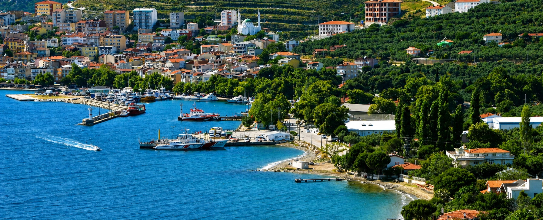
Continue north to the archipelago's largest island for ancient marble quarries, Saraylar, mountain landscapes and quieter village life.
View Marmara Island Guide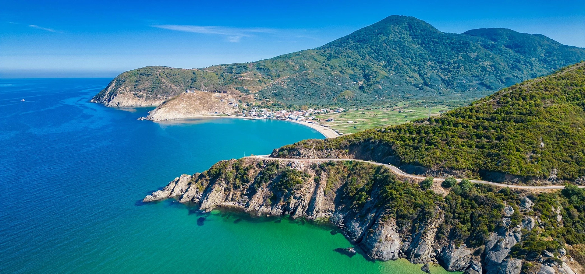
Return to the mainland for ancient Mysian history, the ruins of Cyzicus and the mountainous peninsula that frames the southern Marmara islands.
View Kapıdağ & Cyzicus Guide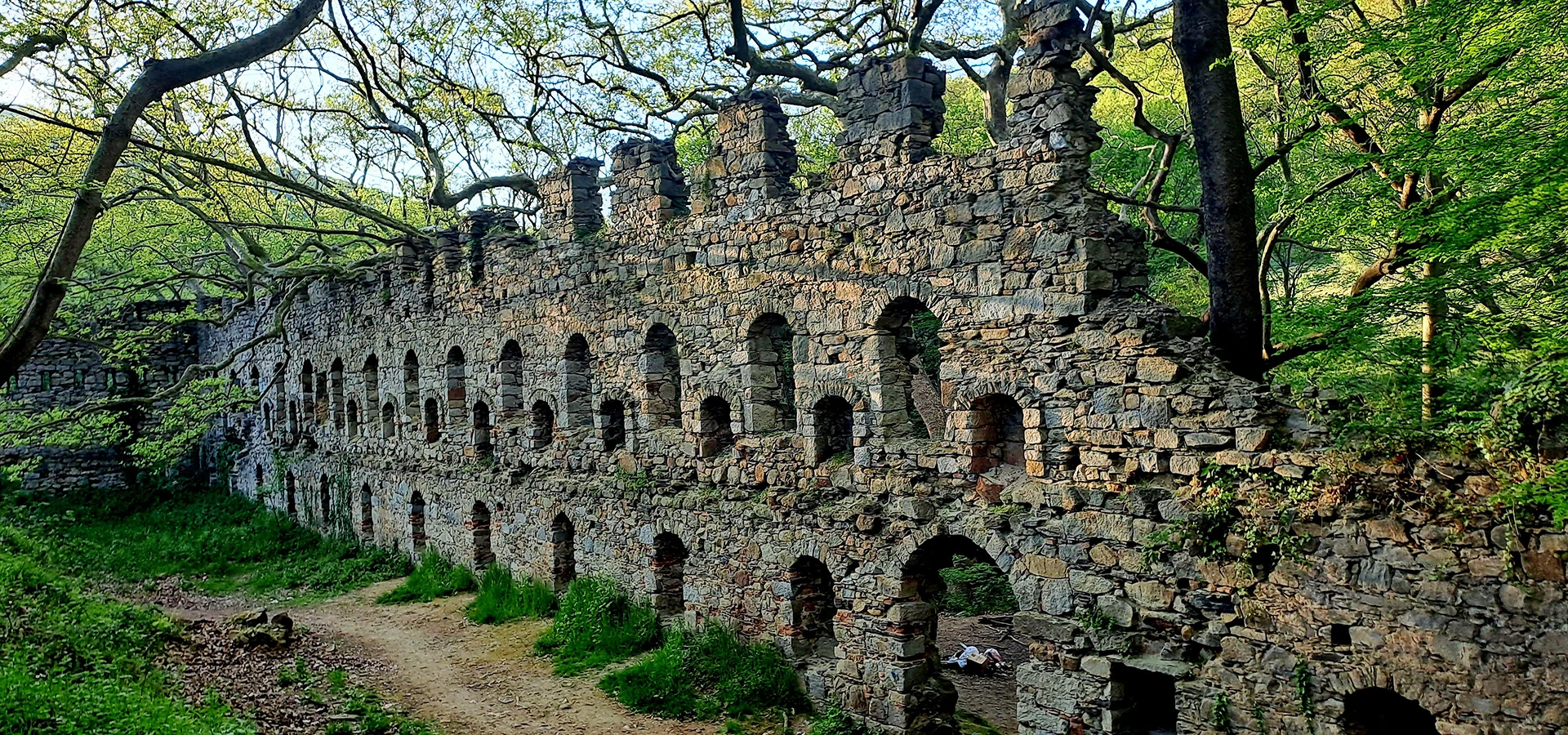
Continue the Byzantine monastic theme on the Kapıdağ Peninsula at one of the region's most atmospheric forested monastery sites.
View Kirazlı Monastery Guide