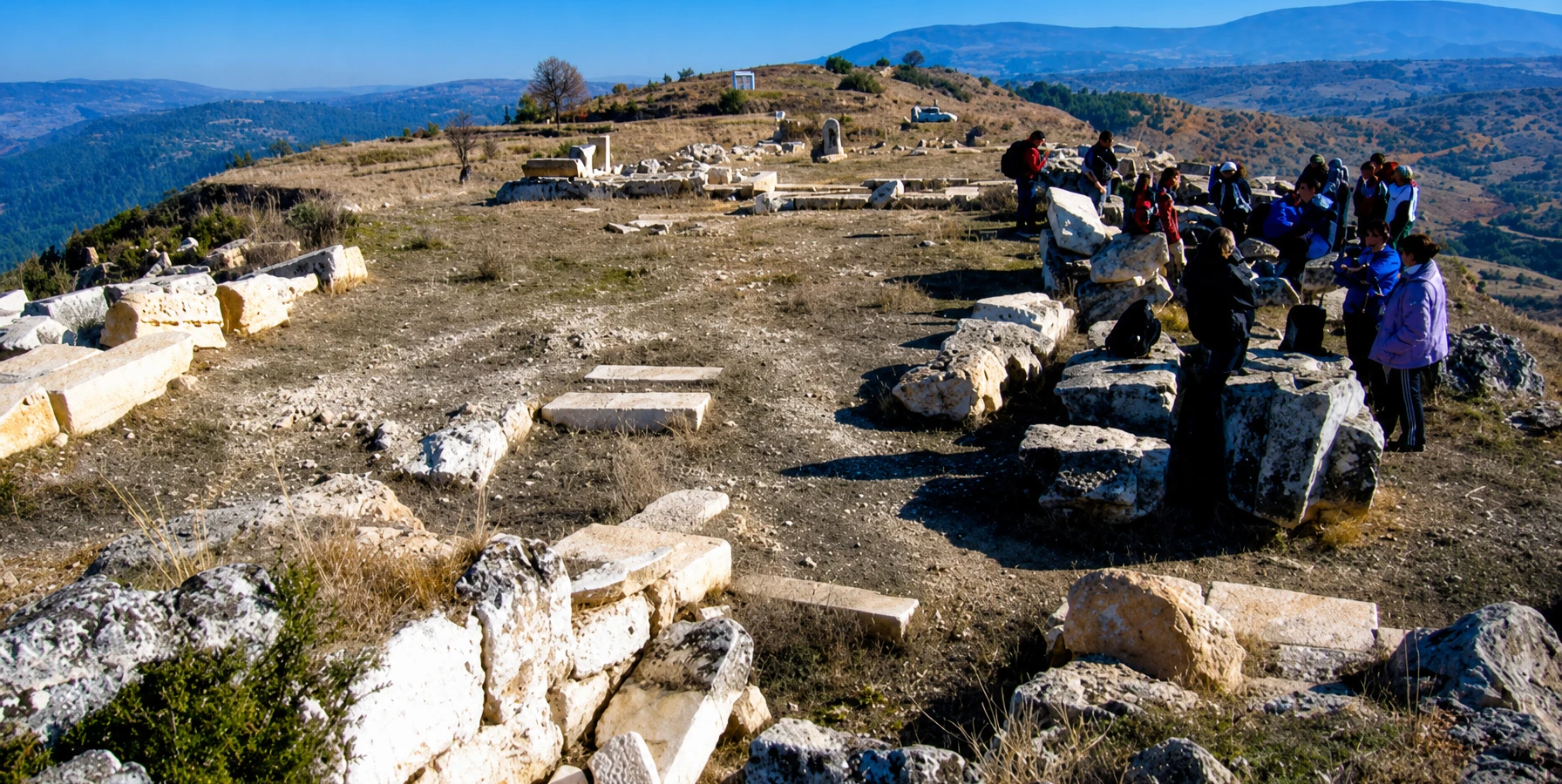
Dionysopolis Ancient City
Discover the ancient city of Dionysus in the upper Maeander countryside.
Discover Dionysopolis





In the northern part of Denizli Province, the district of Çal reveals a different side of inland western Türkiye. Deep valleys cut by the Büyük Menderes River meet cultivated plateaus, villages, historic bridges and vineyards known for Çal Karası grapes. It is a wonderful region to explore thoughtfully, well beyond the familiar travertines of Pamukkale.
Its heritage stretches from the Neolithic settlement of Ekşi Höyük to the ancient city of Dionysopolis and the Sanctuary of Apollon Lairbenos. The best-known outdoor attraction is Çal Kısık Canyon, where a published walking route follows an impressive river gorge; access and trail condition should always be checked before a visit.
Çal also keeps its living traditions close: vineyards, seasonal harvest celebrations and the Sudan Koyun Geçirme shepherding event near Aşağıseyit. This complete guide brings together the district’s leading attractions, historical background, realistic route planning and suggestions for a private, no-shopping-stops cultural experience.
River gorge and dramatic rock walls.
Local grape and vineyard heritage.
Ekşi Höyük, Dionysopolis and sanctuaries.
Shepherding culture and seasonal festivals.
Where it is, what to see and how to plan a realistic visit.
Çal district, Denizli Province, western Türkiye.
Upper Büyük Menderes basin, northeast of Denizli city.
Approximately 60–65 km by the commonly published road route.
District centre about 850 m above sea level.
Kısık Canyon near Kumral.
Büyük Menderes (ancient Maeander).
Denizli Çalkarası / Çal Karası.
Ekşi Höyük near Dayılar.
Dionysopolis near Ortaköy–Develler.
Apollon Lairbenos near Bahadınlar.
Sheep-crossing celebrations at Aşağıseyit.
Use a car; check individual site conditions.
Çal brings together three experiences rarely found so close to one another: river-carved canyon scenery, early Anatolian archaeology and a working vineyard culture. Unlike the busy Pamukkale corridor, much of the district feels like everyday rural life rather than a conventional resort or archaeological park.
Its appeal is in the contrasts. A morning can begin beside the rock walls of Kısık Canyon, continue through historical villages and end among grape-growing landscapes. Archaeology enthusiasts can explore the stories of Ekşi Höyük, Dionysopolis and regional sanctuaries—even where actual site access remains limited.
The best way to enjoy Çal is to choose two or three compatible stops, leave time for the countryside and avoid treating every listed heritage locality as a ticketed attraction.
Kısık Canyon and Büyük Menderes landscapes.
From prehistoric farming to ancient Phrygia.
Grapes, regional dishes and local produce.
Cliffs, river bends, vineyards and villages.
Quiet countryside away from mass tourism.
Flexible guiding without compulsory shopping stops.
Çal is a district and town in Denizli Province, northeast of Denizli city in the upper reaches of the Büyük Menderes basin. The provincial culture directorate describes Çal as approximately 63 kilometres from Denizli and its district centre at about 850 metres elevation. Actual distances depend on the precise starting point and road used.
Approaches commonly travel from Denizli towards Kaklık and then north towards Çal. Once in the district, attractions are scattered: Kısık Canyon is outside the town centre, Ekşi Höyük lies near Dayılar, and Dionysopolis is associated with the Ortaköy–Develler area.
For navigation, enter the specific attraction rather than only “Çal”. A town-centre pin cannot substitute for verified access to a canyon, archaeological mound or rural sanctuary.
Denizli.
Çal town.
About 63 km from Denizli.
Approximately 850 m.
Büyük Menderes.
Use destination-specific maps and current road conditions.
Çal’s history is best understood as a regional sequence rather than the uninterrupted history of one present-day town. Excavations at Ekşi Höyük show the area was inhabited by early farming communities during the Neolithic period, thousands of years before Greek and Roman cities appeared.
In antiquity the wider upper Maeander landscape formed part of the changing cultural geography of Phrygia. The site of Dionysopolis is connected in official heritage descriptions with Seleucid and Pergamene rule, while inscriptions from the Apollon Lairbenos sanctuary illuminate regional religious relationships.
Later settlement, agriculture and village culture reshaped the landscape through the Byzantine, medieval and Ottoman periods. Ancient sites and standing village buildings belong to different eras and should not be presented as one single archaeological complex.
Neolithic settlement at Ekşi Höyük.
Upper Maeander and Phrygia.
Dionysopolis in a changing political region.
Inscriptions and coins reveal civic and religious identities.
Rural communities and layered settlement.
Distinguish separate sites and time periods.
Ekşi Höyük, near Dayılar in Çal district, is one of the most important archaeological discoveries in the upper Büyük Menderes basin. Denizli’s culture authority describes occupation layers extending back approximately 8,700 years, making the mound especially important for research into early settled life in western Anatolia.
Excavations have documented building phases, pottery, stone tools and evidence of daily activities connected with early farming communities. The material helps archaeologists investigate domestic architecture, food production and exchanges between regions during the Neolithic and Chalcolithic periods.
Ekşi Höyük is a scientific excavation area, not automatically an open visitor park. Ask relevant heritage authorities about any permitted public viewing arrangements; do not enter excavation trenches or disturb the site.
Near Dayılar neighbourhood, Çal.
Neolithic; later phases also documented.
Occupation extending back about 8,700 years.
Architecture, tools and early farming.
Protected archaeological mound.
Excavation access must be checked.
One of Çal’s most fascinating historical names is Dionysopolis Ancient City. Official heritage descriptions place it near Ortaköy, in the countryside between Ortaköy and Develler, and connect its origin with the Seleucid period and subsequent Pergamene rule.
The city’s identity is especially well preserved through Roman provincial coins bearing Dionysus, grapes, ritual symbols and Greek civic legends. These motifs provide an evocative link to the region’s modern vineyard culture without proving that ancient wine-making installations survive at this particular site.
Only very limited visible archaeological remains are reported. It is best approached as a specialist historical locality, with access confirmed in advance—not a monumental city full of restored streets and temples.
Dionysopolis – “City of Dionysus”.
Ortaköy–Develler countryside.
Phrygia.
Seleucid and Pergamene periods.
Roman civic bronze coins.
Few visible remains; confirm access.
The Sanctuary of Apollon Lairbenos, associated with Asartepe near Bahadınlar, opens a different window on the district’s ancient past. Its religious history is known particularly through inscriptions that illuminate worship, dedications and the participation of people from communities across the upper Maeander region.
Ancient religious sanctuaries could serve wider territories rather than one town alone. That makes this site a useful companion to the story of Dionysopolis, although the two are separate archaeological locations and should not be merged into a single claimed temple complex.
Because the sanctuary is a remote historical locality, visitors should verify current roads, permitted entry and the visibility of remains before promising a stop on a private tour.
Apollon Lairbenos.
Asartepe near Bahadınlar.
Ancient inscriptions and dedications.
Regional sacred networks.
Separate from Dionysopolis.
Confirm legal access and road conditions.
Çal Kısık Canyon is the district’s best-known natural sight. Türkiye’s Culture Portal and the Denizli Provincial Directorate describe it near Kumral, roughly 7 km from the Çal district centre and about 60 km from Denizli. The gorge was opened to tourism in 2011.
The official description mentions rock walls approximately 80 metres high and a constructed walking route of about 650 metres, including a suspended section beside the gorge. The river scenery, narrow stone corridors and greenery make it particularly appealing to photographers and walkers.
Important: these are published site characteristics, not confirmation of the walkway’s present-day condition. Before a 2026 visit, check whether the path is open, maintained and safe after weather or seasonal river changes. Do not enter the water or attempt unmarked routes.
Kumral area, Çal.
Approximately 7 km from Çal.
Around 80 m high.
Around 650 m long.
Büyük Menderes river gorge.
Verify current opening and path safety.
Kısık Canyon’s attraction lies in its narrow rock setting and riverside viewpoints. The documented walkway was designed to help visitors experience part of the gorge, but wet surfaces, damaged railings, loose rock and changes in river level can alter what is safely accessible.
If the route is confirmed open, wear grippy closed shoes, carry water and give priority to posted restrictions. Children should be closely supervised and anyone uncomfortable with heights should assess the suspended sections before proceeding.
Do not assume the canyon is suitable for swimming, unsupervised rafting, canyoning or wheelchair access. Specialised activities need an authorised provider, correct equipment and up-to-date conditions.
Closed shoes with good grip.
Check the current state of the walkway.
Suspended or cliffside sections possible.
Do not assume access or safety.
Close supervision beside water and edges.
Obtain current step-free access details.
The Büyük Menderes—known in classical sources as the Maeander—gives Çal much of its geographical character. Water and erosion have shaped valleys, rocky slopes and fertile agricultural landscapes that contrast with the district’s higher ground.
The river is also woven into ancient local identity. Coins of Dionysopolis depict Maiandros as a personified river deity, a reminder that waterways held both practical and symbolic importance in the ancient world.
For present-day travellers, riverside views are rewarding, but conditions vary widely with seasonal flow and water management. Follow authorised access points and do not cross channels or approach unstable banks for photographs.
Büyük Menderes.
Maeander / Maiandros.
Gorges and agricultural valleys.
River-god imagery at Dionysopolis.
Choose safe public viewpoints.
River levels and banks can change.
Çökelez Mountain features in Çal’s published visitor attractions and forms part of the striking higher terrain around the district. Together with the cultivated plateau and river corridors, it helps explain why Çal offers more varied scenery than a flat agricultural landscape.
The mountain and its foothills are appropriate subjects for landscape photography, local ecological interpretation and carefully planned rural drives. A specific public hiking trail, summit route or 2026 vehicle approach should not be assumed without locally verified information.
If a walk is planned, use suitable mapping and a knowledgeable local guide. Seasonal weather, livestock, farm boundaries and uneven tracks can all affect a safe route.
Elevated hills and mountain scenery.
Çal and the upper Maeander basin.
Scenic stops and local viewpoints.
Verify the route before setting out.
Wind, heat and wet ground.
Working farmland and grazing areas.
The Kumral Mesirelik Alanı is listed by Çal Municipality among the district’s attractions. Its association with nearby Kısık Canyon makes it a natural reference point for a countryside outing.
For travellers, a picnic-style stop can break up a day of sightseeing, especially if the canyon section is accessible. However, food service, picnic facilities, parking arrangements and operating times should be checked rather than assumed.
Pack away litter, respect local fire restrictions and keep plans flexible in dry or windy weather.
Kumral.
Kısık Canyon.
Countryside and picnic scenery.
Çal Municipality.
Confirm availability beforehand.
Leave no litter or fire damage.
Çal’s local heritage is not limited to excavation sites. Official district descriptions name Hançalar Bridge, while Çal Municipality also lists Tozlukara Bridge and other heritage points among places of interest.
Historic crossings are reminders of how roads, streams and agricultural communities interacted long before modern transport. Depending on preservation and location, an old bridge may be best appreciated from a respectful public viewpoint rather than walked or driven across.
Do not assume that every named bridge is safe for pedestrians or vehicles, nor that each has formal interpretive signage. Confirm the exact site and current access before adding it to an itinerary.
Hançalar Bridge.
Tozlukara Bridge.
Village routes and river crossings.
View from permitted safe locations.
Open pedestrian or vehicle crossing.
Useful for rural heritage stops.
Çal’s official cultural overview lists a range of historic buildings and rural landmarks, including a historic minaret at Kayı Pazarı, heritage structures at Ortaköy and Dayılar, and older mills and fountains in the Yukarıseyit area.
These places tell the story of daily life in medieval and Ottoman-era Anatolia as much as they tell the story of classical antiquity. Their value is often in the setting and surviving craftsmanship, not a large formal museum display.
Historic villages remain living communities. Photography should respect private homes, places of worship and residents, and visitors should check which structures are publicly accessible.
Historic minaret named by cultural authorities.
Traditional mills and fountains.
Listed historic buildings.
Rural heritage alongside Ekşi Höyük.
Architecture within working settlements.
Respect privacy and local worship.
Viticulture is central to Çal’s identity. Vineyards spread across parts of the district, and grape growing has shaped its rural economy and seasonal rhythms. This is not simply a decorative tourism theme: the region has producers, growers and a developing Çal Bağ Yolu vineyard route.
The countryside is particularly expressive during the growing and harvest seasons, when the changing colour of vines gives the plateau a distinctive appearance. Visitors interested in agriculture can learn about local cultivation, food traditions and the relationship between climate and grapes.
Very importantly, a private cultural tour never requires a commercial tasting or shopping stop. Visits to vineyards should be by invitation or prior arrangement, and travellers may choose a scenery-and-history itinerary instead.
Grapes and vineyards.
Çal vineyard landscape.
Summer growing season and autumn harvest.
Çal Bağ Yolu.
Arrange with hosts beforehand.
No compulsory shopping or tasting stops.
Çal Karası, also written Çalkarası, is a grape associated with this Denizli district. The product name “Denizli Çalkarası Üzümü” has a Turkish geographical-indication registration, an important recognition of the grape’s relationship with its place of origin.
The fruit is commonly described as dark-coloured and is used in the local grape and wine economy. The Çal Karası Symposium held in June 2026 brought together specialists, growers and regional stakeholders to discuss the variety, viticulture and local development.
Visitors can enjoy the landscape and learn about the agricultural heritage without needing to participate in alcoholic beverage tastings. An organised producer visit should always be confirmed in advance.
Çal Karası / Çalkarası.
Denizli Çalkarası Üzümü.
Çal district, Denizli.
Dark purple to black grapes.
First Çal Karası Symposium.
Agricultural interpretation or arranged producer visit.
Çal Bağ Yolu is a regional vineyard-tourism initiative that presents the district’s grapes, local history and natural attractions as a connected cultural experience. It is particularly relevant for travellers wanting to understand where local produce comes from rather than visiting only the main canyon.
The route should not be mistaken for a single, permanently open public walking trail. Participating businesses, appointment requirements, tour formats and opening arrangements can change. Check the organisers’ current information and contact individual venues directly before travelling.
A non-tasting itinerary can still focus on scenery, agricultural heritage and food. If an adult-only tasting is requested, that would be a separate optional arrangement, never an obligatory stop on a private tour.
Çal Bağ Yolu.
Vineyard heritage and regional tourism.
Producer stories and rural landscapes.
Confirm individual venues.
Scenic and agricultural visit.
Entirely optional; no compulsory sales visits.
Çal belongs to the inland Denizli culinary landscape, where home-style dishes, fresh produce, grains, meat and seasonal vegetables all have a place. Local tables can be an appealing part of a countryside day, especially when combined with vineyard scenery.
Grapes are the natural signature of the district, alongside other regional produce. Look for authentic local kitchens or a prearranged village-style meal rather than assuming every small settlement has a restaurant open throughout the day.
Food traditions vary by household and neighbourhood. Ask about ingredients, dietary restrictions and availability in advance, and avoid confusing the food culture of Çal with a specific dish name that may belong to another district.
Grapes and seasonal agricultural products.
Home-style inland Aegean cooking.
Confirm eateries and opening times.
Arrange in advance.
Seasonal grape-related food culture.
Carry water and light snacks for rural routes.
One of Çal’s best-known living traditions is Sudan Koyun Geçirme, the sheep-crossing celebration associated with Aşağıseyit. The custom involves shepherds and their animals entering or crossing water and is locally celebrated as a symbol of pastoral skill, community memory and identity.
Local accounts trace the custom back many centuries, but traditional founding dates and legends should be treated as cultural heritage narratives rather than precise independently proven chronology. Organisers also use the festival to celebrate rural music, crafts and community life.
Events are not guaranteed every year: authorities cancelled the 2025 programme because of animal-health concerns, while a 2026 edition was organised in August. Always use the current municipality’s announcement for future dates, access and animal-welfare rules.
Sudan Koyun Geçirme / Çoban Bayramı.
Aşağıseyit, Çal.
Traditional shepherding practice.
Local shepherds and flocks.
Varies; official annual confirmation needed.
Animal-health and river conditions can affect the event.
Another seasonal expression of Çal’s character is the Çal Bağ Bozumu Kültür ve Sanat Festivali, celebrating the grape harvest and regional culture. The 29th edition was scheduled for 4–6 September 2026, according to contemporary local reporting.
Harvest celebrations can feature concerts and community events, but programmes and dates change. No future year should be treated as fixed simply because a previous festival took place in early September.
If your dates do not overlap with an official festival, the vineyards and countryside still make a rewarding seasonal outing. Respect ongoing agricultural work and never enter producing vineyards without permission.
Çal Bağ Bozumu.
Grape harvest and local culture.
29th festival in early September.
Await official announcements.
Countryside and grape heritage.
Events and vineyard visits are separate.
Çal Municipality’s list of attractions also includes Hançalar Stream, Ağlayan Kaya Waterfall, Kaplanlar Pond and Çökelez Mountain. The provincial culture directorate also mentions Sakızcılar Waterfall among the district’s natural points of interest.
These are useful starting points for discovering the wider district, but information about precise parking, trail conditions, seasonal water levels and public facilities is less uniform than for Kısık Canyon.
For a realistic day, pick the attractions that are open, legally reachable and compatible with your route. A place appearing on an official tourism list does not guarantee maintained tourist infrastructure.
Stream scenery and locality.
Waterfall listed by municipality.
Local pond landscape.
Waterfall named in district overview.
Mountain views.
Water levels, access and road surfaces.
Photographers can find a wide range of subject matter across Çal: tight canyon compositions, river bends, vineyard textures, hilltop light and the details of rural architecture. These scenes are authentic to the district without the need to portray unrelated ancient ruins.
The proposed hero image for this page is assets/images/cal-denizli.webp. Ideally it should show an authentic Çal landscape—perhaps the Kısık Canyon setting or vineyards—with the main subject near the horizontal centre so it remains visible on mobile devices.
Use photographs you own or have permission to publish. Avoid private courtyards, photographing villagers without consent, disturbing animals during festivals and entering restricted excavation areas for a better angle.
cal-denizli.webp.
Kısık Canyon and river gorge.
Vineyards and regional architecture.
Keep the visual subject centred.
Morning or late afternoon.
Licensed images and respectful access.
Morning: travel from Denizli toward Çal and start with Kısık Canyon, provided its public walkway and approach are confirmed safe and open. Enjoy the gorge at a relaxed pace instead of racing through it.
Midday: continue to Çal town or a convenient nearby village for lunch, with time to look at the agricultural landscape and learn about the district’s traditional way of life.
Afternoon: choose between a vineyard-country scenic drive or the historical theme of Ekşi Höyük / Dionysopolis / Apollon Lairbenos. For protected archaeology, the experience may be an interpretation of the surrounding locality rather than entrance to the excavations. The final route depends on verified road and access conditions.
Denizli or a pre-agreed pick-up point.
Kısık Canyon, only if open and safe.
Flexible local stop.
Vineyards or ancient heritage.
Private driver and licensed guide on request.
No compulsory shopping stops.
Travellers who prefer slower exploration can separate nature and countryside from archaeology and cultural history. This allows time for a canyon outing without trying to fit every village and historical locality into the same day.
Day 1: focus on Kısık Canyon, Çal town and vineyard landscapes; include a prearranged local food or agricultural visit if desired. Day 2: explore the area’s archaeological context through Ekşi Höyük, Dionysopolis and Apollon Lairbenos, subject to separate access arrangements.
An overnight stay in the area should be chosen based on confirmed accommodation options rather than an assumption that each rural attraction has hotels or restaurants nearby.
Canyon, countryside and vineyards.
Archaeology and ancient religion.
Verify each historic place separately.
Allow time for rural road conditions.
Book in a suitable confirmed location.
Fully adaptable private programme.
A commonly published route from Denizli follows the road towards Kaklık, then turns north to Çal. The Denizli Provincial Directorate places the district roughly 63 km from the city. This is a geographical guide rather than a live driving distance from your particular hotel.
Private car or prearranged transfer is the most flexible way to visit outlying destinations, especially when combining Kısık Canyon with archaeological localities or vineyards. Allow additional driving time for small roads and for stops in villages.
Use up-to-date mapping and obtain local advice for the final approach to heritage areas. A point on the route may be a working farm, closed conservation area or unsuitable road rather than a formal visitor entrance.
Denizli city or your accommodation.
Towards Kaklık, then Çal.
Around 60–65 km to the district centre.
Private vehicle for multiple stops.
Check current access.
Depend on traffic, stops and final destination.
Denizli’s official tourism material describes minibus transport between Denizli and Çal. This can be useful for reaching the district town, particularly for visitors who wish to explore the centre rather than remote attractions.
However, a district bus or minibus does not necessarily take you to Kısık Canyon, the archaeological mounds or a remote sanctuary. Departure times, return options and weekend services require direct verification with current operators.
If you want to combine multiple rural points in one day, private transport or a locally arranged driver is typically the more practical choice. Never rely on an unverified late return from an isolated heritage site.
Minibus links described in official guides.
Check the live timetable.
Do not assume a direct service.
Last-mile transport may be difficult.
Confirm before leaving Denizli.
Private vehicle with confirmed itinerary.
Spring and autumn are often the most comfortable seasons for walking and scenic drives in inland Denizli. Spring can bring fresh greenery to the canyon area, while autumn adds changing vineyard colours and the atmosphere of the grape harvest.
Summer can be hot and exposed on the plateau; take water, sun protection and time breaks. Winter can bring wet roads and slippery walking surfaces, especially in river valleys and mountain foothills.
For a canyon trip, safe access and river conditions matter more than the season alone. Festivals and harvest activities follow their own schedules and should always be checked separately.
Greenery and generally pleasant walking weather.
Heat and strong sun.
Vineyard colour and harvest atmosphere.
Potentially wet or slippery rural tracks.
Date varies by event and year.
Check forecast and site access.
Çal is a district, not one ticketed attraction. There is no single entry fee or set of visiting hours covering the town, vineyards, historic bridges, Kısık Canyon and protected archaeological locations.
The public tourism descriptions consulted establish Kısık Canyon’s setting and historic walkway dimensions, but do not independently confirm a universal 2026 ticket price or daily opening schedule. The same applies to specialist archaeological sites: some may be under excavation, private ownership or conservation restrictions.
Before departure, contact the relevant Çal Municipality, district authorities or Denizli Provincial Directorate of Culture and Tourism for current access rules. Where permission is required, organise it beforehand.
None; Çal is an ordinary district.
Check current local arrangements.
Confirm whether walkway is open.
Do not assume public access.
Private appointments may be required.
Ask the responsible operator or authority.
Rural areas around Çal can include uneven paths, steep drop-offs, working farms, river crossings and historic stonework. Canyon walks and archaeological visits require different precautions; neither should be presented as automatically suitable for all ages or mobility levels.
Bring closed walking shoes, drinking water, sun protection and a charged phone. Ask about step-free routes, toilets, railings and parking at the specific attraction, especially when travelling with children or anyone with reduced mobility.
Respect archaeological restrictions: never remove stones, pottery, coins or other finds, and never enter active excavations or private vineyards without permission. Respect animals and instructions during pastoral events.
Comfortable, protective footwear.
Carry sufficient drinking water.
Verify individual attractions.
Stay on authorised secure paths.
Never remove archaeological objects.
Ask before entering or photographing.
For visitors interested in history, Dionysopolis and Apollon Lairbenos are both connected to the Çal region. Their lesser-known status makes them very different from excavated visitor sites such as Laodicea and the Pamukkale–Hierapolis area.
For a broader nature journey, explore the stories of Işıklı Lake in Çivril, Güney Waterfall or Honaz Mountain National Park. These destinations are regional additions, not necessarily short walks or quick detours from Çal.
Choose a route based on actual travel time and attraction availability. Keeping the itinerary focused usually creates a more rewarding day than attempting to cover every corner of Denizli.
Ancient city in Çal.
Ancient regional sanctuary.
Large excavated Roman city.
Famous travertines and ancient ruins.
Wetland scenery in Çivril.
Waterfall in the wider region.
Wow Cappadocia can help discuss a flexible private day around Çal’s most interesting themes: canyon scenery, vineyards, traditional villages or the district’s layered ancient history.
A private programme can include licensed cultural guiding, a suitable vehicle and an itinerary adapted to your interests. Because some archaeological localities are not standard visitor parks, all visits to protected sites depend on confirmed legal access, road suitability and guide availability.
Our approach is personalised sightseeing with no compulsory shopping stops. Optional vineyard or food experiences are included only when you want them and when the host can accommodate the visit.
Kısık Canyon and countryside.
Ancient Phrygia and Çal villages.
Vineyard culture and local gastronomy.
Private vehicle on request.
Licensed guide subject to availability.
No compulsory shopping stops.
Çal is a district of Denizli Province in western Türkiye, in the upper Büyük Menderes basin northeast of Denizli city.
Denizli’s provincial tourism authority gives approximately 63 km to the district; your exact route and starting point may change the distance.
Both are in Denizli Province, but Çal is not part of the Pamukkale travertine site. Allow separate driving time for a combined trip.
Kısık Canyon, the Çal Karası grape, vineyard culture, Ekşi Höyük, ancient heritage and the traditional sheep-crossing festival.
Kısık Canyon is one of the best-known nature attractions, provided the visitor walkway is currently open and safe.
Government tourism information places the canyon roughly 7 km from the district centre near the Kumral area.
Its current path condition, admission arrangements and access should be verified with local authorities before travel.
Official descriptions give a constructed walkway of approximately 650 metres, but do not guarantee that the full route is always accessible.
Only if the walkway is open, conditions are safe and adults can supervise them closely around cliffs, railings and water.
Do not assume so. Check the current route and accessibility arrangements directly with local authorities.
Do not assume swimming is permitted or safe. River conditions and local restrictions must be checked.
An important archaeological mound near Dayılar, with Neolithic occupation documented by scientific excavations.
It is an archaeological excavation area, not a guaranteed open-air museum. Request current visitor-access information from the relevant authorities.
Near Ortaköy and Develler in Çal district. Very few visible remains are reported today.
An ancient sanctuary near Bahadınlar, known particularly through inscriptions from the wider upper Maeander region.
A dark-coloured grape associated with Çal, also known as Çalkarası; the name Denizli Çalkarası Üzümü has a geographical-indication registration.
A local vineyard-tourism initiative that connects the area’s grape-growing heritage with cultural and natural attractions. Individual venue arrangements vary.
No. A tour can focus exclusively on the landscape, grapes, agricultural culture and local food.
Harvest timing depends on weather, the vineyard and the variety, generally around late summer and autumn. Check with local growers.
Sudan Koyun Geçirme is a traditional shepherding celebration held around Aşağıseyit when local conditions and official arrangements permit.
It is a recurring tradition, but some editions have been cancelled. Check official announcements for the specific year.
The date is announced for each edition. In 2026 the 29th festival was scheduled for 4–6 September; future dates need confirmation.
Yes. Official tourism listings mention Hançalar Bridge and Tozlukara Bridge among the local heritage attractions.
Spring and autumn are generally comfortable for sightseeing; accessibility and seasonal weather should guide canyon and rural trips.
Denizli–Çal minibus services are described in official visitor information, but schedules and onward connections require checking.
Yes, particularly if you focus on Kısık Canyon and one countryside or heritage theme, rather than all attractions.
There is no district-wide entrance fee. Individual canyon, museum, commercial or heritage attractions may have separate rules.
Yes. The canyon, vineyards, rivers and villages offer distinctive compositions, with the usual access and privacy precautions.
We can discuss a customised private itinerary with transport, licensed guiding on request and no compulsory shopping stops, subject to access and availability.
This guide uses published information from the Denizli Provincial Directorate of Culture and Tourism, Çal Municipality, the Türkiye Culture Portal and specialist archaeological and geographical-indication references. Dates, access rules and commercial offers can change; for actual travel always recheck the relevant operator or authority.
Research note: Official descriptions provide published canyon dimensions and archaeological context but do not certify the real-time condition of routes or opening hours. Likewise, local festival dates are year-specific and should not be reproduced as future schedules.
Official district location, historical and natural sites, and local traditions.
Local visitor listing including Kısık Canyon, Ekşi Höyük and bridges.
Canyon location, published walkway details and visitor background.
Official archaeological overview and findings from Ekşi Höyük.
English-language background on Kısık Canyon.
Official vineyard-route project and its local grape heritage.
Geographical-indication record for the regional grape.
June 2026 report on grape heritage and regional development.
Official regional itinerary context including Çal Kısık Canyon.
Example showing that annual traditional events can be cancelled.
Explore Çal’s ancient surroundings and the wider Denizli region at your own pace, with private cultural itineraries and no compulsory shopping stops.
Explore the region’s extraordinary archaeology and sacred landscapes.
Discover the ancient city of Dionysus in the upper Maeander countryside.
Discover Dionysopolis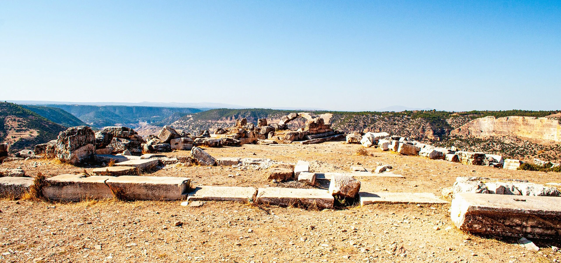
Explore the wider region’s inscriptions and sacred history.
Explore the Sanctuary
Visit one of Denizli’s most impressive excavated ancient cities.
Explore LaodiceaContinue your journey through landscapes and fascinating history.

Discover lush waterfall scenery in the wider Menderes region.
Discover Güney Waterfall
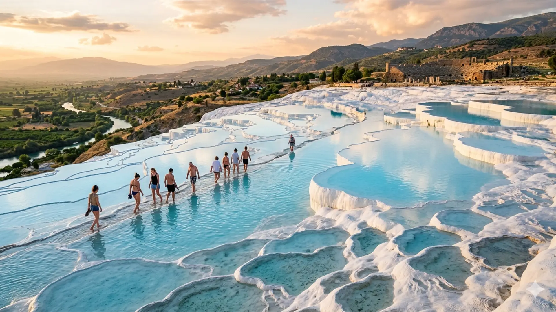
Enjoy an iconic archaeology-and-nature day with private guiding.
Explore the Private Tour