
Custom Güney Waterfall Experience
Visit the scenic Cindere waterfall and discover the Büyük Menderes landscape by private vehicle, subject to site access.
Request a Custom Visit





Güney Waterfall (Güney Şelalesi) is a striking natural attraction in the Güney district of Denizli Province, southwestern Türkiye. Fed by springs emerging from the Cindere hillside, its mineral-rich water flows over limestone ledges and green vegetation toward the Büyük Menderes River. The traditionally described drop is approximately 20 metres, although the waterfall consists of a series of cascading sections rather than one uninterrupted vertical plunge.
The waterfall is especially memorable for its terraced calcium-carbonate formations, mossy surfaces and delicate ribbons of water. It is also part of a protected natural landscape adjoining the wider Cindere reservoir and river valley. The combination of flowing water, pale mineral rock and greenery makes this one of the area’s most atmospheric nature-photography stops.
There is a significant chapter in its modern history: a rock-and-soil landslide on 13 May 2013 severely damaged the waterfall and its associated natural cave features. Restoration and watercourse-management work followed; official district sources confirm that the site continues to receive visitors. Older photographs may show formations that no longer look exactly the same.
This guide explains where Güney Waterfall is, how it formed, what happened in 2013, conservation, access, opening-hour references, facilities, photography, safety, seasonal visits, nearby attractions and how to include it in a flexible private Denizli itinerary. Practical details should be reconfirmed before travelling.
Spring-fed water descends a series of limestone ledges.
Calcium-rich water, calcite deposits and mossy terraces.
A documented natural conservation area beside the Menderes Valley.
Discover the story of the 2013 landslide and restoration.
Essential information for visiting Güney Şelalesi in northern Denizli.
Cindere area, Güney district, Denizli Province.
Open on Google MapsApproximately 20 m in official regional descriptions.
Mineral terraces, flowing springs and moss-covered rock.
Cindere hillside overlooking the Büyük Menderes valley.
Historically designated a first-degree protected natural site.
Major landslide on 13 May 2013; restoration followed.
An asphalt road is described by Güney District Governorate.
Allow roughly 45–90 minutes on site, if accessible.
Unlike the broad white travertine terraces at Pamukkale, Güney Waterfall presents moving, lace-like cascades against green vegetation. Water follows separate channels over a steep rock face, so the scene changes subtly with flow conditions, sun angle and the season.
It is an appealing stop for travellers interested in karst geology, waterways, landscape photography and quiet regional excursions. The surrounding Büyük Menderes valley provides an impressive geographical setting, not simply an isolated waterfall.
Because the waterfall was altered by the 2013 landslide, a visit also shows how natural processes can reshape even familiar landmarks. Come for the landscape as it exists today, rather than expecting every historic promotional photograph to match the present view.
Watch spring water divide into fine cascades.
See ledges built by dissolved calcium carbonate.
Appreciate the broader Büyük Menderes landscape.
Enjoy contrasts of water, limestone and green moss.
Understand the effects of the 2013 landslide.
Explore a quieter destination north of Denizli.
Güney Şelalesi lies in the Güney district, in the northern part of Denizli Province. The official Türkiye Culture Portal places it in Cindere Mahallesi; some older descriptions use the place-name Cinlere Köyü. Both refer to the waterfall’s general locality rather than separate tourist attractions.
The district governorate places the waterfall about 5 km southwest of Güney town centre, overlooking the reservoir area of the Cindere Dam and Hydroelectric Power Plant on the Büyük Menderes system. It describes an asphalt approach road. Exact road mileage varies according to the starting point and navigation route.
For a visit from Denizli city, official district descriptions commonly refer to about 70–75 km to Güney district. Allow additional local driving as needed, and select Güney Şelalesi itself in your navigation app—not just the town named Güney.
Denizli, Aegean region of Türkiye.
Güney, north of Denizli city.
Cindere / older Cinlere local descriptions.
Büyük Menderes valley and Cindere slopes.
Reported around 5 km southwest of Güney centre.
Search the full Turkish name Güney Şelalesi.
The Denizli Provincial Directorate of Culture and Tourism describes a waterfall dropping approximately 20 metres toward the Büyük Menderes. Its distinctive appearance is created by water spreading over multiple uneven shelves, rather than falling in one straight curtain.
Because flows descend along mineral ledges and small channels, the waterfall can appear wider, narrower, heavier or more delicate depending on current discharge. The height figure is a useful published guide, not a survey of every individual cascade.
The rock-and-soil slide in 2013 altered part of the original formation; comparisons with pre-2013 photographs should take this into account.
Approximately 20 m.
Multiple descending tiers.
Springs from the Cindere hillside.
Büyük Menderes river landscape.
Water flow changes with conditions.
2013 collapse reshaped parts of the site.
The waterfall is described by the Ministry of Culture and Tourism as being fed by springs emerging from the slopes of Cindere Mountain. These waters gather into channels and flow downslope toward the Büyük Menderes valley.
The district governorate additionally describes sources roughly 200 metres behind the cascade. That is a local description of the source area, not a precise mapped walking route or an invitation to follow a watercourse into private or protected land.
The Cindere reservoir is part of the wider river setting. It is important not to confuse the spring-fed waterfall itself with the controlled discharge of the nearby dam or power station.
Natural sources feeding the cascade.
Calcium-rich water supports limestone deposits.
Water gathers above the waterfall.
The wider river valley and drainage system.
Separate infrastructure in the adjacent landscape.
Recent rainfall can affect the overall scene.
Güney Waterfall is a vivid example of calcium-carbonate deposition. As dissolved carbonate-rich spring water reaches the open air, changes in dissolved carbon dioxide and water chemistry can encourage calcium carbonate to precipitate as calcite or related carbonate deposits.
Over long periods, accumulated mineral material forms steps, ledges, overhangs and flowstone-like surfaces. Water then follows these new contours, sometimes creating smaller hanging drips and delicate mineral shapes.
The process resembles the chemistry responsible for travertine at Pamukkale, but the sites differ greatly in landscape, water conditions, scale and appearance. Never touch or walk on active mineral ledges, which may be fragile, wet or unstable.
The principal material behind the pale deposits.
Minerals accumulate over time.
Water finds paths between rock ledges.
Some deposits develop delicate hanging textures.
Carbonate-rich rock and groundwater interaction.
Do not climb, scratch or remove deposits.
The waterfall’s signature colour comes largely from mosses and other moisture-loving plants on rocks around the cascading water. Constant spray, shady niches and wet surfaces can support lush green growth, setting off the bright, mineral-rich water.
Official tourist descriptions famously liken the site to green velvet, a veil and a fan of delicate water threads. These are visual comparisons, not official names for separate attractions.
Vegetation and water levels vary, so do not expect the same emerald intensity in every month. Refrain from stepping onto mossy ledges: they are slippery living surfaces and may conceal unstable rock.
Green surfaces alongside active cascades.
Moisture supports damp habitats.
Sheltered areas can stay greener.
Changes the visual colour throughout the day.
Vegetation can be damaged by climbing.
Different flows produce different photographs.
On 13 May 2013, the site suffered a major rock-and-soil landslide. The Güney District Governorate records significant damage to the natural waterfall landscape. Contemporary reporting describes the collapse of rock and part of the waterfall’s cave-related structures.
The landslide was more than a small cosmetic change. It damaged mineral formations and disrupted the arrangement of the watercourse, prompting public authorities and specialists to organise a response.
Visitors should know this history because numerous widely circulated Güney Waterfall images were taken before 2013. Today’s cascades and rock profile may differ from those older pictures. The original destruction should not be concealed or exaggerated into a claim that the whole attraction remains closed.
Following the landslide, provincial authorities and specialists from Pamukkale University were involved in a rehabilitation effort reported by local news media. Work included managing the course of the spring water and making visitor-area improvements.
A 24 July 2014 report in Denizli Haber states that the water was directed back toward the original waterfall location following reconstruction of the channel, and that visitor areas had been tidied. That historic report does not establish the condition or safety of every path in 2026.
The Güney District Governorate’s official visitor description states that, after works and improvements, the waterfall continues to be enjoyed by local residents and visitors. Restoration did not instantaneously recreate centuries of geological formations; mineral deposition is an ongoing natural process.
Public authorities coordinated recovery measures.
Contemporary reporting cites Pamukkale University.
The spring flow was guided toward the falls.
Rest areas were addressed during rehabilitation.
Deposits and vegetation change gradually.
Access and facilities still warrant confirmation.
The Denizli tourism authority and Güney District Governorate describe Güney Waterfall as a first-degree natural protected site (birinci derece doğal sit alanı). An environmental inventory documents a 14 February 1986 protection decision, number 1904, for a wider designated area.
Legal conservation classifications and boundaries may be updated through later decisions. The historical designation establishes the importance of protecting the site, but it should not be used to infer that every path is always open or that all recreation is permitted.
Enjoy the waterfall from designated public areas. Avoid littering, disturbing habitats, removing plants or rock, building fires in unapproved areas or entering restricted zones.
First-degree protected natural site in official records.
14 February 1986, decision 1904 in the inventory.
Protect water, rock and natural habitats.
Leave moss, rocks and plants undisturbed.
Use approved visitor areas and posted signs.
Check later protection and access decisions.
Older Denizli tourism descriptions refer to Damlataş Mağarası, a natural cavity associated with the waterfall’s mineral deposits, including hanging calcite shapes and a pool. Historic promotional texts sometimes mention a pool deep enough for swimming.
Those descriptions predate or do not clearly account for the major 2013 landslide, which damaged cave-related formations. They must not be read as a guarantee that the original cave, underground pool or an entry route is present, safe or publicly accessible today.
For modern visitors, the responsible interpretation is to appreciate the waterfall’s visible rock and mineral textures from permitted viewpoints. Do not enter cavities or approach the base of damaged rock unless on-site authorities have explicitly authorised a safe route.
Damlataş Mağarası.
Cavity associated with water and carbonate deposits.
Reported stalactite-like features and a pool.
Landslide affected the cave area.
Not independently confirmed for cave entry.
No exploration beyond authorised visitor paths.
Güney Waterfall lies alongside a dramatic part of the Büyük Menderes river system. Nearby is Cindere Dam and its hydroelectric power facility, which the district governorate uses as a geographical reference for the waterfall.
The river valley contains steep slopes and infrastructure associated with water management. The spring-fed cascade is the natural attraction; the dam is an operational structure with separate access and safety requirements.
Visitors may enjoy river or reservoir views from public roads and authorised observation areas. Do not enter hydroelectric compounds, restricted dam access roads or unprotected riverbanks for photographs.
The defining river of the broader valley.
Nearby water-management infrastructure.
Operational facility; not a guaranteed tourist visit.
Dramatic scenery with potential hazards.
Remain in designated public areas.
Natural hillside springs versus dam operations.
The combination of spray, trickling water and rock crevices supports mosses and moisture-loving vegetation. Trees and shrubs across the valley add shade and texture, but the specific flora present can vary across the site and over time.
Birds and insects may be observed in the broader river corridor. No dependable official species checklist was verified for this guide, so it would be misleading to advertise a guaranteed sighting of a particular rare species.
Keep noise low, avoid feeding wildlife and stay out of nesting areas or soft wet ground. A short, careful nature stop can be more rewarding than leaving the established path in search of a better image.
Distinctive green growth on damp rocks.
Vegetation adapted to moist conditions.
Shade and shelter around the watercourse.
Possible in the wider valley; sightings vary.
Part of the natural freshwater ecosystem.
Observe without collecting or disturbing.
The most recognizable photographic subject is water falling in multiple silky threads over green mineral terraces. A wider frame can show the waterfall within the slope, while a tighter composition can reveal patterns of moss and calcite.
Conditions change across the day: front light emphasizes bright water, while shade can preserve detail in rock textures. Some visitors use a slow shutter speed to create soft-looking water; ensure any equipment complies with posted rules and does not block paths.
Never step onto slick terraces or behind barriers to recreate an old photograph. The landform has changed since 2013 and unstable rock may persist. Drone photography may require relevant permissions for airspace, conservation land and nearby infrastructure.
Include greenery, slope and river setting.
Focus on falling droplets and rock textures.
Use long exposure only from a safe position.
May create subtle highlights and softer contrast.
Avoid ledges, cliffs and wet overhangs.
Verify protected-area and airspace restrictions.
If the official visitor route and facilities are operating, a comfortable visit can often be planned around 45–90 minutes on site. This is an editorial planning estimate, not a published official minimum or maximum visit duration.
Allow extra time for photography, a rest at a local facility if open, and a safe walk from the parking area. If someone has mobility limitations or there are wet surfaces, a slower pace may be appropriate.
The road journey from Denizli, Pamukkale or Buldan needs to be calculated separately. Güney Waterfall is best approached as a distinct nature stop rather than assumed to be within the walking area of the town of Güney.
A brief safe viewpoint stop when time is limited.
About 45–90 minutes is a useful estimate.
Allow extra time for composition and light.
Facilities depend on current operation.
Calculate from your exact hotel and route.
Heavy rain or maintenance may change plans.
The Turkish Ministry of National Education’s outdoor-learning listing publishes 09:00–17:00 daily as visiting hours for Güney Waterfall. This is a directory schedule, not confirmation that every visitor facility or viewpoint is staffed and accessible on a particular day.
Nature-site access can also be affected by weather, road maintenance, rockfall inspections, conservation decisions, holidays or temporary management changes. A planned visit should include a quick check with local authorities or the current operator.
For the best natural light and a safer arrival, favour daylight hours. Do not assume that paths are suitable for visits in darkness simply because the waterfall lies outdoors.
No up-to-date, operator-confirmed 2026 entrance tariff was verified in the official information reviewed for this guide. As a result, we do not publish an unsupported ticket price or confidently promise that every entrance is free.
Ask whether there is a site entry fee, parking fee, separate charge for facilities or any group charge. Payment arrangements and seasonal concessions can change independently of the natural site itself.
For a private tour, clarify whether access charges, parking, lunch and any guide service are included in the quotation. MuseumPass Türkiye should not be assumed to cover the waterfall.
A waterfall environment can be deceptively hazardous. Wet steps, mineral-encrusted rocks, moss-covered ledges and steep slopes can be slippery even on a dry day. The site’s landslide history makes it particularly important to respect any barrier, warning sign or route closure.
Stay on established visitor paths and viewing platforms, if operating. Never stand directly below loose-looking rock, enter cavities, walk behind the falling water or approach the edge of the adjacent river or reservoir.
Choose shoes with a reliable grip and keep children close. After intense rain, water flow and slope stability can change quickly, and access restrictions should be followed without exception.
Essential on damp or uneven ground.
Respect signs and closed sectors.
Never bypass ropes or railings.
Keep away from edges and fast-moving water.
Supervise closely near steps and slopes.
Consider postponing if access is uncertain.
The Ministry of Education entry includes general accessibility metadata, but that does not guarantee an uninterrupted step-free route to every waterfall viewpoint. Natural terrain and potentially damp or steep paths may present challenges.
Visitors using wheelchairs, walking aids or strollers should ask about the parking-to-viewpoint distance, gradients, steps, railings, restroom accessibility and nearby drop-off options. Some may be able to enjoy part of the site without using the full trail.
Because facilities and routes may have changed since the 2013 rehabilitation, do not rely on photographs or a generic accessibility symbol alone when making arrangements.
Continuous step-free access is not confirmed.
Ask where a vehicle may safely stop.
May limit some visitor routes.
Confirm on-site conditions.
Check whether the route is suitable.
A shorter viewpoint may be possible.
Children can enjoy the visual contrast of white falling water and green rock while learning how springs, rivers and mineral terraces help shape landscapes. The waterfall is an excellent opportunity to discuss erosion, deposition and environmental protection.
However, a short walk on a nature site is not the same as a playground. Supervise children at every step, especially near wet stone, slippery ground, the river and uneven edges. If a route is closed or looks unstable, do not try to reach the base.
Carry drinking water, suitable shoes and a light layer for spray. Plan the visit according to actual weather and facilities available on the day.
Water cycle and carbonate deposition.
Keep children within reach.
Avoid slippery sandals.
Ledges and rocks are not playgrounds.
Keep away from riverbanks and deep water.
Shorten the visit whenever necessary.
Older tourism descriptions mention a cave pool near the falls that was historically deep enough to swim in. But the 2013 landslide substantially changed the cave and waterfall formations, and those older statements should not be treated as a current swimming recommendation.
No verified present-day swimming zone, water-quality clearance, lifeguard provision or authorised access to such a pool has been established for this guide. The area is protected and lies near steep wet rocks and the Büyük Menderes river system.
Do not plan to swim, wade or enter a cave pool. Follow local restrictions and enjoy the waterfall from designated safe viewpoints.
Not verified as permitted.
Older literature only; access not established.
Geology changed significantly in 2013.
River and waterfall currents can be dangerous.
Respect applicable conservation rules.
Viewing and photography from safe areas.
The Güney District Governorate states that the waterfall area has historically included two restaurants, toilets and a small prayer room (mescit). These are valuable planning references, but an official site description does not prove that each service is open on the exact date of your visit.
If you hope to eat there, confirm restaurant opening, meal options, card payment, toilet access and parking before leaving. Take drinking water and any essentials you may need for a rural nature stop.
A packed snack can be convenient where permitted, but picnicking, open fires, barbecue use and waste disposal must follow current protected-site rules. Leave no litter in the valley.
Two restaurants are listed by the district governorate.
Facilities are mentioned; confirm availability.
A mescit is listed in official descriptions.
Check current spaces and charges.
Bring essentials if outlets are closed.
Observe all conservation and fire restrictions.
The usual road approach is via Güney district and the local route toward Cindere / Güney Şelalesi. The district governorate describes the final road as asphalt, but drivers should rely on updated road signs and current navigation rather than an old printed turn-by-turn description.
Official publications give about 70–75 km between Denizli city and Güney district. Reaching the waterfall adds local routing depending on where you turn and where you begin. If starting from Pamukkale, Buldan or another town, calculate the journey separately.
The national Culture Portal mentions minibus transport to Güney district and Cindere. However, frequency and the last stretch to the waterfall are not verified. A private vehicle or pre-arranged driver provides the most flexibility for a rural nature visit.
Drive north toward Güney; verify the final waterfall turn.
Follow signs/navigation toward Güney Şelalesi.
Allow a separate cross-district drive.
Possible by regional roads; check routing.
Services to Güney/Cindere mentioned; verify schedules.
Useful for flexible pickup and return.
The governorate describes paved access, and regional travel accounts indicate that the final approach includes rural and valley roads. Conditions may nevertheless change after heavy rain, slope works or local maintenance.
Check that your chosen vehicle can use the current road and that suitable visitor parking is available. Do not block the public road, emergency access or entrances to operational reservoir facilities.
Allow a daylight arrival if unfamiliar with the area. Use the precise waterfall destination in your map application, and do not drive down a track simply because an app suggests it as a shortcut.
Described by official district sources.
Use current maps and road signage.
Some sections may be narrow or winding.
Availability and charges need confirmation.
Stay away from dam and plant compounds.
Rain may change road and path conditions.
Spring can be particularly attractive for green scenery and potentially stronger water flow following seasonal rain. Autumn may offer comfortable conditions and varied foliage, although the amount of flowing water will depend on recent weather.
Summer offers long daylight and can make the shaded waterfall appealing, but the wider Denizli countryside can be hot. Winter brings a greater need to assess rain, cold, road access and slippery terrain.
No reliable site-specific flow forecast has been established. The most important advice is to check recent conditions and any path restrictions rather than select a month on the assumption of guaranteed water volume.
Fresh greenery and potentially lively flow.
Longer days; protect against heat on the drive.
Comfortable sightseeing is often possible.
Check rain, road conditions and safe access.
Flexible timing and potentially softer light.
Extra caution due to slippery ground and slopes.
Comfortable walking shoes with a non-slip tread are more important than fashion footwear. Bring drinking water, a charged phone, and light weather protection for spray, wind or seasonal rain.
If photography is a priority, consider a protective cover for your camera or phone and a cloth for water droplets. Bring only equipment that can be used without blocking paths or damaging the site.
Keep luggage and unnecessary valuables in your vehicle if secure and appropriate. If planning a guided regional excursion, share any mobility needs in advance so a realistic route can be selected.
Grip for wet surfaces.
Bring a refillable bottle.
Prepare for spray or wind.
Keep navigation and communications ready.
Safeguard equipment from moisture.
Carry out all rubbish.
Güney town and the surrounding countryside offer the chance to see an upland Denizli district shaped by farming, vineyards and the Büyük Menderes valley. The waterfall is one notable part of a much wider landscape.
Local travel descriptions commonly highlight grape cultivation and viticulture in the Güney area. Actual winery access, tastings or vineyard visits should be arranged independently; simply passing through vine-growing country does not guarantee a public cellar or tasting service.
A relaxed regional trip might include a short town stop or a lunch break. Enjoy private farmland from public roads, obtain permission before visiting a working property and leave agricultural areas undisturbed.
A practical local stop for services.
Grapes are associated with the district.
Experience rural Denizli scenery.
See how topography shapes settlement.
Choose a suitable restaurant if available.
Do not enter fields or wineries without permission.
For a fuller day in the region, the logical starting point is Güney district and its nearby Büyük Menderes landscape. More distant heritage attractions, including Buldan and Tripolis, may be included if there is sufficient driving time.
Cindere Dam is part of the immediate regional setting, but visitors should not treat the power station as an automatically accessible recreational facility. Other well-known sites such as Pamukkale, Hierapolis and Laodicea belong to broader Denizli itineraries rather than a short walk from the waterfall.
Choose stops that match your available time and interests; a comfortable itinerary is better than trying to reach every destination in the province in one afternoon.
Nearby river and dam landscape; observe restrictions.
Town and agricultural scenery.
Historic weaving town with traditional houses.
Excavated Roman city in the Buldan district.
Roman and early Christian site near Denizli.
Major landscape and archaeological destination.
Both Güney Waterfall and Pamukkale illustrate how mineral-rich water can create unusual carbonate landscapes, but their visitor experiences are very different. Güney is a green, spring-fed cascade on a river-valley slope; Pamukkale is famous for extensive white travertine terraces and the nearby ruins of Hierapolis.
Pamukkale is a major, managed archaeological and natural attraction with formal ticketing and designated visitor zones. Güney Waterfall is smaller and rural, with historical landslide damage and different arrangements for access and facilities.
Guests interested in geology may find both worthwhile across a well-planned regional programme. Treat them as separate locations with independent driving and visitor requirements.
Güney Waterfall works best as a nature-focused stop or a component of a private northern Denizli excursion. The following ideas are flexible planning examples, not fixed scheduled departures or promises of opening.
Where possible, combine the waterfall with a complementary nearby experience—rather than adding distant attractions that consume most of the day in the vehicle.
Always check present visitor access and local road conditions first, especially because of the site’s protected status and landslide history.
At Wow Cappadocia / Venere Travel, we can discuss a tailored trip based on your starting point, available time, mobility requirements and preference for nature, archaeology or traditional towns. A private arrangement may be convenient where public transport schedules are uncertain.
Suggested regional combinations include Güney Waterfall, Buldan, Tripolis, Laodicea and Pamukkale, but the practical programme depends on realistic driving times, access conditions and how long you want at each attraction.
Our private itineraries are designed around guests’ interests, with no compulsory shopping stops. Transportation, guiding, entrance fees and meals should always be itemised and confirmed in a personalised quotation.
Flexible pickup and drop-off on request.
A short visit or larger regional itinerary.
Available subject to confirmation.
Focus on springs, rocks and landscapes.
Combine with ancient Denizli landmarks.
Sightseeing remains the priority.
Güney Waterfall is in the Cindere area of Güney district, Denizli Province, Türkiye.
Güney Şelalesi.
Yes. Güney is a district in the northern part of Denizli Province.
Official accounts describe Güney district as approximately 70–75 km from Denizli city; the waterfall requires its own local road approach.
The District Governorate describes the waterfall as about 5 km southwest of the town centre; routes may differ.
Regional tourism authorities describe the cascade as approximately 20 metres high.
Its springs cascade down the Cindere hillside into the Büyük Menderes valley system.
From springs on the Cindere hillside, according to official tourist descriptions.
Moisture-loving mosses and vegetation cover parts of its wet limestone surfaces.
Yes. Calcium-rich water has built limestone and carbonate deposits on the cascade.
No. Both involve mineral deposition, but they are separate attractions with very different landscapes.
A major rock-and-soil landslide on 13 May 2013 damaged the waterfall and associated formations.
Yes. The District Governorate states that improvements followed the landslide and the waterfall continues to welcome visitors.
Not always. Some historic photographs show rock and cave formations changed by the 2013 landslide.
Official records describe a first-degree protected natural site; specific modern restrictions should be checked locally.
Older official tourism accounts describe a Damlataş cave, but the 2013 landslide damaged the area. Current cave access is not verified.
Do not assume swimming is permitted or safe. No current authorised swimming area was verified.
Do not enter the rock face or pass behind the water unless an officially maintained and open route clearly permits it.
District authorities describe ongoing visits after restoration, but the opening status of particular facilities and paths must be confirmed for your date.
A Ministry of Education directory lists 09:00–17:00 daily; verify the current operating schedule.
A reliable current 2026 official tariff was not independently verified. Confirm any entrance or parking charge locally.
The site is approached by road; check current parking availability and any fees before visiting.
The District Governorate describes two restaurants, but actual operating hours should be confirmed.
Yes, district descriptions mention toilets, although up-to-date operation and accessibility should be checked.
About 45–90 minutes is a flexible planning estimate when visitor access is available.
Spring can offer lush greenery and potentially stronger flow; conditions vary with rainfall and access.
Yes. The cascading water, mossy limestone and valley scenery provide excellent photographic subjects.
Check airspace restrictions, protected-area rules and permissions before operating a drone.
A supervised nature visit may be enjoyable, but wet paths and steep edges require caution.
Continuous step-free access has not been confirmed. Ask about current parking, gradients and available viewpoints.
They can be. Water, moss, steps and uneven stone make grip-soled shoes important.
Official information mentions minibuses to Güney and Cindere, but the final connection and current timetable require checking.
Yes. The district governorate describes its position near the Cindere reservoir and hydroelectric plant landscape.
The dam is operational infrastructure; do not assume public access beyond designated areas.
Yes, with a separate road journey and enough time for both destinations.
Tripolis is a separate archaeological destination in the Buldan district; allow driving time.
A day excursion can be planned by private vehicle, allowing time for travel and current site access.
You can request a personalised Denizli itinerary, subject to route conditions and service availability.
Call 112 for emergencies.
This guide draws on Güney District Governorate, Türkiye Culture Portal, the Denizli Provincial Directorate of Culture and Tourism and the Ministry of National Education’s outdoor-learning directory. A contemporaneous local-news report is used specifically for the 2014 restoration account.
Official sources agree that the waterfall is spring-fed, has limestone formations and suffered a major landslide in May 2013. Some regional descriptions differ on the precise distance from the town centre; current navigation and local access notices take priority. Older accounts of a cave pool cannot establish modern swimming or cave-entry rights.
Published hours, restaurants, fees and path descriptions can become outdated. Confirm current access and services for your chosen day before travelling.
Location, 2013 landslide, rehabilitation and listed facilities.
Water sources, limestone formations, protection and transport.
Historic 20-metre drop, mineral terraces and local descriptions.
Published directory hours and location background.
Historic 1986 conservation registration reference.
Contemporaneous coverage of the post-landslide recovery works.
Combine a beautiful nature stop with traditional towns, archaeology and the wider landscapes of Denizli on a personalised private itinerary, without compulsory shopping stops.
Nature photography and relaxed travel at your preferred pace.
Visit the scenic Cindere waterfall and discover the Büyük Menderes landscape by private vehicle, subject to site access.
Request a Custom Visit
Pair the historic weaving town of Buldan with a separate scenic drive to Güney Waterfall in a custom regional itinerary.
Customise Your DayArchaeology, travertine landscapes and distinctive towns.

Explore the UNESCO-listed travertine terraces and the monumental ancient city of Hierapolis.
View Private Tour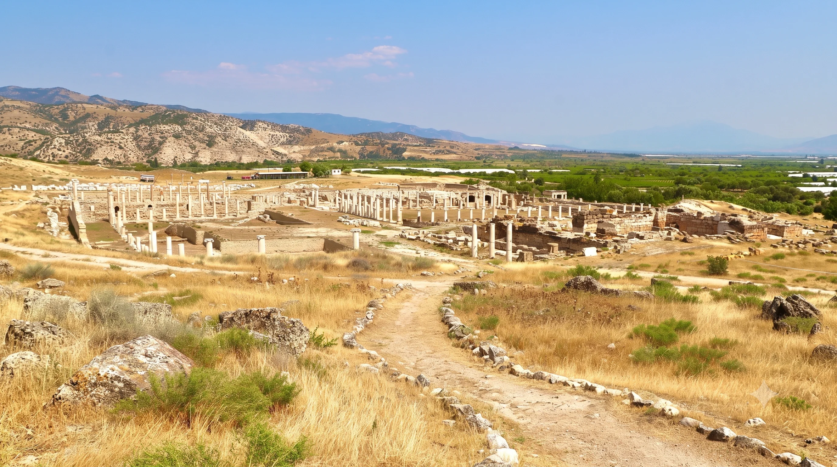
Discover a remarkable Roman city near Yenicekent in the Büyük Menderes region.
Explore Tripolis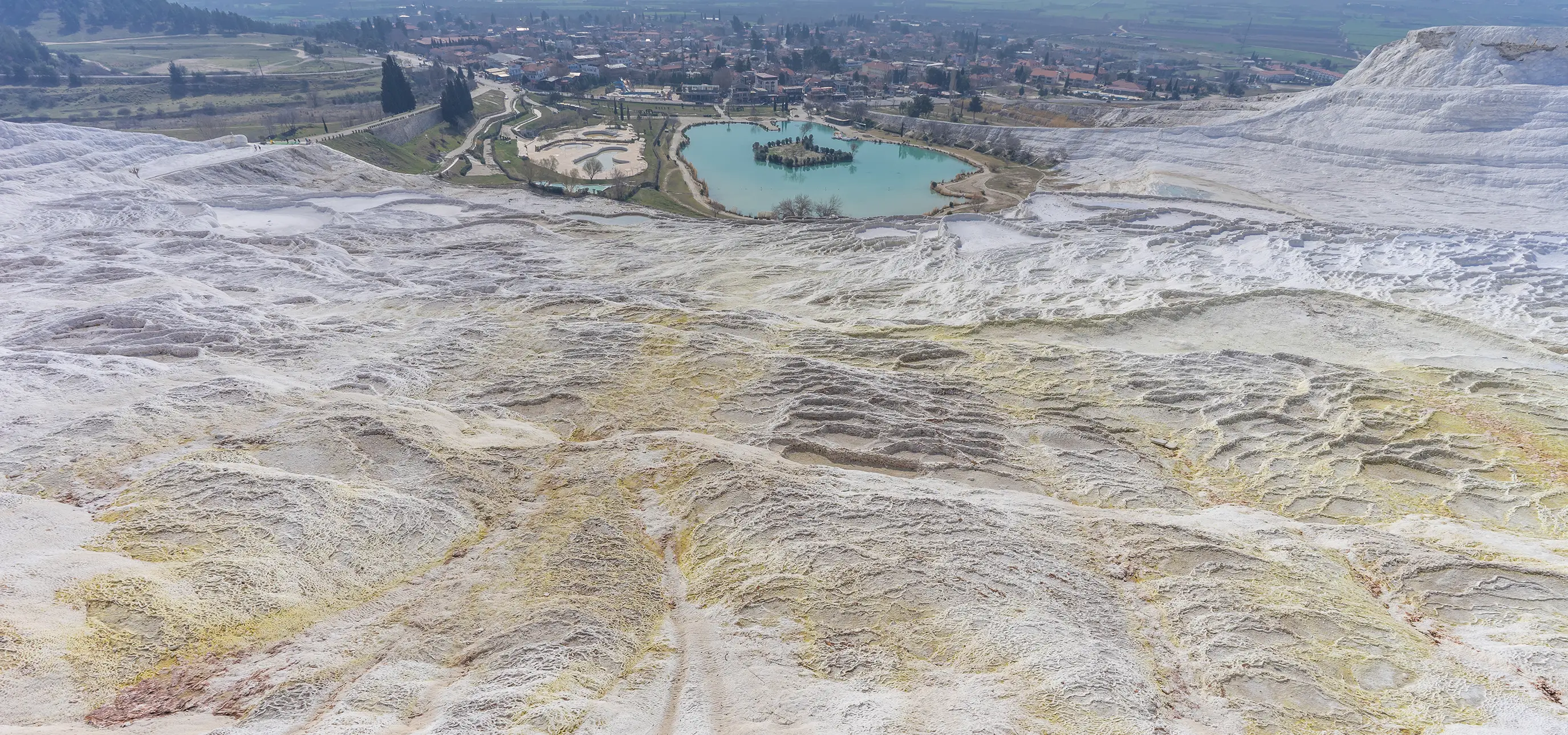
Build a comfortable itinerary around waterfalls, historic towns, classical archaeology and natural wonders.
Explore Regional Tours