
Custom Honaz Mountain Nature Experience
Enjoy forest scenery, photography and a suitable managed park visit with private transport. Hiking difficulty and open areas are confirmed in advance.
Request a Custom Visit





Honaz Mountain National Park (Honaz Dağı Millî Parkı) protects a dramatic mountain landscape southeast of Denizli in southwestern Türkiye. Its highest point is listed at 2,571 metres by the Türkiye Culture Portal, making Mount Honaz the highest mountain in the Aegean Region. From foothill scrub and woodland to steep limestone outcrops and exposed high ridges, this is a very different side of Denizli from the white travertines of Pamukkale.
Declared a national park in 1995 and later enlarged, the area is celebrated for its unusual mix of Mediterranean and inland flora, notably rare endemic wildflowers. An official nature-tourism inventory cites 964 recorded plant taxa, including 122 endemic to Türkiye; the figures reflect the inventory used and should not be confused with a new botanical survey.
The park also has a fascinating cultural setting. At the foot of the mountain lie ancient Colossae and the historical town of Honaz, associated with the later Byzantine settlement of Chonae. Nature visitors can enjoy scenic viewpoints, suitable forest walks and designated day-use areas; experienced mountain walkers may consider more demanding high-elevation routes with proper planning.
This detailed guide explains where the park is, its entrance routes, summit elevation, botanical highlights, wildlife, hiking difficulty, family day trips, seasons, park hours and fees, conservation rules and how to combine the mountain with Denizli’s cultural sites. Wherever operational details or published measurements differ, the guide explains the uncertainty rather than presenting guesses as facts.
Mountain scenery reaching an officially cited 2,571 metres.
Botanical richness across very different elevation zones.
Picnics and walking in suitable, authorised areas.
Connect the national park with centuries of local history.
Important official figures, access points and practical mountain-visiting information.
Denizli Province, around Honaz, Pamukkale and Serinhisar districts.
Open on Google Maps2,571 m in the official Türkiye Culture Portal; some older references quote 2,528 m.
1995; boundaries expanded in 1998.
9,429 hectares in the current nature-tourism catalogue; older sources give 9,616 ha.
Official inventory reports 964 plant taxa, including 122 Turkish endemics.
Nature walks, picnics, photography, botany and strenuous hiking.
Honaz/Kale side or the Cankurtaran side; road conditions vary.
2–4 hours for a relaxed day-use visit; a full day or more for serious hikes.
Honaz is among the most distinctive landscapes in Denizli: a steep mountain massif rising abruptly above a settled agricultural plain. The contrast between green lower forests, rocky gullies and sometimes snow-covered high ground creates superb views and strong seasonal changes.
Nature enthusiasts come for plants and mountain habitats; day visitors for fresh air, forest scenery, picnics and photographs in suitable managed areas. The mountain’s reputation as the Aegean Region’s highest point also makes it an important destination for experienced hikers.
For travellers interested in both nature and antiquity, the nearby site of Colossae Ancient City adds an uncommon historical dimension: this is a landscape where the physical geography helps explain ancient settlement patterns.
Steep slopes and shifting views across the Denizli basin.
Plant communities that change with height and aspect.
Natural shade in appropriate lower-elevation forest areas.
Designated day-use opportunities, subject to park rules.
Forest, valley and high-ridge compositions.
Colossae and historical Honaz lie near the foothills.
Honaz Dağı Milli Parkı is southeast of Denizli city and spreads across the mountain associated with Honaz, Pamukkale and Serinhisar districts. The most familiar northern approach is through Honaz town. A southern/southwestern approach is associated with Cankurtaran on the Denizli–Antalya/Muğla-connected road network.
The park is not a single compact garden with one universal ticket booth or a single trailhead. Its boundary covers many kilometres of steep countryside, while approved day-use facilities and summit approaches can be in very different places.
When using navigation, specify the entrance, picnic area or trailhead recommended by park management instead of relying only on a general mountain pin. A route displayed on a map can reach an unpaved forest road rather than a suitable visitor access point.
Denizli, southwestern Türkiye.
Honaz town and Kale Mevkii vicinity.
Cankurtaran area and associated access road.
Ovacık and Aydınlar roads are described by official sources as less-developed.
Foothills, forest, steep mountain slopes and high rock.
Use a confirmed entrance location and current road conditions.
Honaz Mountain was declared a national park in 1995 and its limits were expanded in 1998. The protected area is managed as an important natural landscape rather than just a recreational picnic ground.
Published area values are not perfectly consistent across government documents. The national Nature Tourism Catalogue currently displays 9,429 hectares, while historic governmental material describes 9,616 hectares following the boundary extension. These should be attributed to the source, not presented as if both were simultaneously precise surveys.
A park’s mapped boundary, visitor zone and physically accessible hiking terrain are different concepts. Visitors should follow posted management rules even when a path or road appears to pass through open land.
The Türkiye Culture Portal states that Honaz Mountain reaches 2,571 metres and identifies it as the Aegean Region’s highest mountain. Some other official and historical texts state 2,528 metres, illustrating why a precise summit measurement should always carry a source attribution.
The difference between the lower plains and the summit is especially striking. Visitors can see foothill woodland and then, much higher up, open rocky mountain terrain subject to sudden weather changes.
A summit expedition is not equivalent to a picnic-park visit. High routes can involve extensive climbs, route-finding and exposure; the summit and nearby installations may also be subject to restricted access, which should be checked before planning.
Honaz is celebrated for the dramatic structure of its slopes. Regional nature-conservation descriptions discuss fault-related uplift, steep valley walls and a horst-like mountain form, with a mix of metamorphic rocks and crystalline limestone in the broader massif.
Official descriptions also highlight periglacial geomorphology: features formed or reshaped by very cold conditions and freeze–thaw processes. That does not mean the national park is covered by a present-day glacier, and visitors should not expect an accessible ice cave or permanent glacier.
Its northern and southern exposures differ in slope, sunlight and vegetation. This range of microclimates is a major reason the mountain supports unusually varied botanical communities.
Large elevation differences over comparatively short distances.
Natural corridors with erosion-prone slopes.
Cold-climate landforms documented in official park descriptions.
Geological variation contributes to habitat diversity.
Wind and weather risks increase outside woodland.
Avoid loose rock, unstable slopes and unverified shortcuts.
Plant diversity is one of the park’s strongest conservation values. The official DKMP nature-tourism material reports 964 plant taxa, including 122 Turkish endemics. A botanical inventory is a dated scientific record rather than a promise that all those plants will be visible on any one walk.
Several plants are described as particularly restricted to Honaz Mountain, including Lamium microphyllum (a dead-nettle relative), Verbascum chrysorhacos (a mullein) and Crocus baytopiorum (a crocus). Published sources show occasional spelling variants for scientific names; visitors should rely on current botanical identification rather than collecting specimens.
Spring and early summer can be especially interesting for flower enthusiasts, with flowering times shifting as snow melts and elevations warm. Do not pick, dig out or trample wildflowers, and keep to established visitor routes.
964 taxa in the referenced official inventory.
122 recorded taxa endemic to Türkiye.
Lamium, Verbascum and Crocus species highlighted by DKMP.
Vegetation changes from low scrub to forest and upland plants.
Use close-up photos without uprooting or picking plants.
Flowering depends on elevation, precipitation and the year.
Honaz brings together plant communities associated with the Mediterranean and the drier inland highlands. The official nature-tourism description explains that lower northern slopes can feature kermes oak and Turkish red pine, with black pine becoming more important at higher forest elevations.
Still higher, junipers and more open mountain vegetation characterise parts of the landscape. Changes are not perfectly uniform; valley exposure, soil, shade and disturbance create local variation.
Old and large black pines are another natural highlight noted in park literature. Resist the temptation to leave approved paths to reach an unusual tree, and do not attach hammocks, nails or ropes to protected vegetation without specific permission.
Scrub oak, red pine and Mediterranean vegetation.
Black pine woodland in suitable areas.
Juniper and increasingly open mountain habitat.
More sheltered microhabitats and occasionally distinct plant communities.
Mature trees documented in official nature accounts.
Protect tree roots and avoid off-path plant damage.
Government tourism descriptions identify wild goats, wild boar, badgers, foxes and hares among animals associated with the mountain. Historic descriptions also mention many bird species, including an inventory figure of 64 bird species. These are published records, not an up-to-date census or guaranteed sightings.
Wild animals are often secretive, and most visitors will be more likely to hear birds or notice tracks than see mammals at close range. Dawn and quieter woodland locations can be rewarding, but never enter restricted wildlife zones or pursue an animal for a photograph.
A respectful visit means keeping food secured, not feeding animals, supervising pets according to park rules and taking photographs from a distance. Binoculars are especially useful when observing birds against the high ridges.
Reported on rugged mountain slopes.
A naturally occurring species; keep a sensible distance.
Recorded mammals, usually not easy to see.
Official visitor material cites 64 bird species historically.
Recommended for quiet, non-invasive observation.
Never feed, bait, chase or approach wildlife.
Spring can be rewarding for wildflowers and refreshing forest scenery, while early summer and autumn are often appealing for suitable lower and mid-elevation walks. The exact best timing depends on altitude, recent rain, snow cover and how much climbing you intend to do.
Summer may be hot and dry at low elevations, although the mountain is often cooler higher up; strong sun and forest-fire precautions still matter. Winter can create beautiful snow scenery but also ice, reduced visibility and difficult or closed access.
The experience can change sharply between the Honaz town foothills and the upper mountain on the same day. Check the specific elevation forecast, daylight, park advisories and road condition before leaving.
New growth and flower interest; mud and lingering snow possible.
Popular day-use period; heat and fire risk at lower elevations.
Often pleasant light and walking conditions, weather permitting.
Cold, wind, snow or ice may require advanced equipment.
Comfortable light and more time to manage unexpected delays.
Review local forecast, restrictions, entry access and trail condition.
Official sources describe several ways into the national park, but these are not all equivalent paved visitor gateways. The route through Honaz town and Kale Mevkii is a common northern approach; it is often quoted as approximately 3 km south of the town centre to a park entry area.
The Cankurtaran approach is associated with the Denizli–Antalya/Muğla-connected highway and is described as having a paved access road in the national catalogue. Other approaches through Ovacık and Aydınlar are described in official material as stabilised or rough forest roads, not ordinary tourist drives.
Visitors should confirm which access is appropriate for their vehicle, intended facility and weather. Navigation apps do not always distinguish a publicly usable visitor road from a rugged maintenance track.
The official nature-tourism catalogue lists nature walking and trekking among Honaz’s recreational opportunities and mentions existing paths in the park. A short woodland walk near an authorised picnic or day-use area can be a relaxing visit when conditions allow.
However, no single official continuously maintained, easy visitor trail covering the entire park can be assumed. Path quality, signage, shade and water availability can vary significantly, and some routes become steep or remote quickly.
For a self-guided outing, choose an established open trail, start early enough to return by the permitted time, carry offline navigation and avoid making a loop from an unverified social-media track. A guide is sensible for unfamiliar or more demanding mountain terrain.
Best for casual visitors using established public routes.
Look for shade and gradual climbs where accessible.
Requires route planning, supplies and suitable fitness.
Do not assume consistent markings everywhere.
Carry offline map and a charged phone.
Plan a conservative turnaround and return in daylight.
Experienced hikers can find routes towards Honaz’s upper slopes, but a summit trip is strenuous mountain hiking rather than a routine family nature walk. Several independently recorded tracks show substantial altitude gain, which should not be taken as proof that any particular route is currently approved, open or safely marked.
The summit environment may involve steep ground, exposure, rapidly changing wind, cold temperatures and snow or ice in colder months. A normal summer sightseeing outfit is not suitable for uncertain high-altitude conditions.
Check access restrictions in advance, including any zones around communications or military installations near the highest points. A local mountaineering club or qualified mountain leader can help determine whether your intended route is appropriate for the season and your group.
Strenuous to very demanding, depending on the route.
Can be considerable from ordinary starting points.
Possible well outside the mildest months on upper slopes.
Confirm permitted trail and summit zones.
Mountain footwear, layers, food, water and navigation.
Avoid solo attempts or unfamiliar routes in poor conditions.
The DKMP national tourism listing describes a day-use area with a kiosk, refreshments and a children’s play area, and lists picnicking among appropriate recreational activities. Availability, maintenance and operator arrangements can change, so treat these as recorded facilities rather than a guaranteed service on your chosen date.
A pleasant family visit can consist of forest views, a short approved walk and time outdoors without attempting the mountain’s difficult upper trails. Bring water and snacks even when a refreshment point is listed, especially outside popular periods.
Picnic permissions do not mean charcoal barbecues, open flames or gatherings are allowed everywhere. Follow current forest-fire rules, use designated areas and remove all rubbish.
Officially mentioned in DKMP visitor information.
Kiosk/refreshment facilities listed, subject to current operation.
Mentioned by official nature-tourism information.
Use only permitted, established locations.
Verify current seasonal prohibitions before bringing equipment.
Respect other visitors and the mountain habitat.
The national Culture Portal describes the wider mountain as suitable for walking and camping in appropriate places, but this does not establish permission to pitch a tent anywhere. Protected-area overnight stays, use of designated facilities and any commercial camping operations can be controlled by separate current rules.
Some official directory information refers to visitor capacity and camping-related fields, but it does not provide enough verified detail to promise a usable tent pitch, electrical hookup, showers or a campsite reservation today.
Contact the park administration before bringing camping equipment, and confirm whether overnight stays are allowed at your intended location, what fees apply, whether fires are banned and how to handle emergencies.
Never assume free camping is permitted in protected areas.
Ask officials which, if any, are currently open.
Do not assume toilets, showers or waste disposal at a campsite.
Especially important during dry months.
Temperatures can fall rapidly after sunset.
Seek current park-management permission and facility details.
The official DKMP nature-tourism entry displays a 08:00–20:00 visit window. Another government-linked education page displays 09:00–17:00. These may refer to different operational contexts or publication dates; the times should not be treated as a promise that every gate and trail is open throughout that span.
Entrance charges may depend on current protected-area regulations, entry mode and the particular managed facility. This guide does not claim a confirmed official park-specific 2026 ticket price. Ask the gate or DKMP administration for the current visitor and vehicle tariff before travelling.
Weather, fire precautions, conservation work and safety restrictions can change access at short notice. Day visitors should also allow enough travel time to leave before any applicable gate closure.
The difference in elevation across Honaz Mountain is a major safety factor. While Denizli city can feel warm, the upper mountain may be much colder and windier, and cloud can reduce visibility quickly. A calm picnic area tells you little about summit conditions.
Carry a fully charged phone, offline maps, ample drinking water, sun protection, a warm layer and footwear suitable for uneven ground. Let someone know your hiking plan, and avoid entering ravines, exposed ridges or steep slopes beyond your experience.
In case of a serious emergency in Türkiye, call 112. But mountain mobile coverage can be unreliable; prevention and conservative route choices matter more than depending on a phone call from a remote valley.
Sun exposure can be substantial on open slopes.
Stronger than visitors may expect at 2,000 m and above.
Rain, loose stones, snow or frost increase risk.
Carry an offline map rather than relying on phone signal.
Keep children close and agree on a return time.
Dial 112 in Türkiye if emergency assistance is needed.
Families can plan a relaxed visit centred on a confirmed day-use area, woodland scenery and a brief accessible walk. This is very different from committing children or less mobile guests to an unfamiliar ascent.
Paths and facilities may include gradients, uneven gravel, steps or limited handrails. Wheelchair or stroller access should not be assumed without contacting the site about the specific area to be visited. Bring layers, water and appropriate shoes for everyone.
When travelling with children, pay particular attention to cliff edges, steep banks and vehicles on mountain roads. Stay in designated recreation zones where possible and supervise children even if a play area is available.
Choose a managed and currently open day-use location.
Ask about access gradients and surfaces in advance.
Recorded in official descriptions but not guaranteed operational.
Avoid exposed edges and unsupervised wandering.
Pack layers for differing altitudes.
Allow extra time for breaks and the drive back.
Honaz offers a wide range of compositions: pine branches against limestone slopes, green valleys, hazy agricultural plains and dramatic upper ridges. On clear days, low-angle morning or late-afternoon light can bring out textures in the rock and forest.
For botanical photography, take close-ups without stepping onto sensitive vegetation. A telephoto lens is useful for animals or distant ridge patterns. Plan carefully in wind or snow, where equipment handling and footing demand more attention.
Before flying a drone, verify Türkiye’s aviation requirements and any protected-area restrictions. Do not fly over wildlife, crowds or sensitive facilities without all necessary permissions.
Include contrasting valley, forest and mountain layers.
Great for distant ridges and wildlife.
Work from the path; never pick or relocate plants.
Check shadows and cloud movement before committing to a climb.
Aviation and national park rules may apply simultaneously.
A safe viewpoint matters more than the perfect shot.
The town of Honaz occupies a strategic setting below the mountain. The area’s history links ancient settlements, later Byzantine Chonae (Chonai) and Ottoman-period structures, adding cultural interest to a natural-park excursion.
According to the district governorate, medieval Honaz is associated with a church of Saint Michael in historical written sources. However, the presence of a documented historical sanctuary does not mean a fully preserved church building remains ready for a standard tourist visit.
The district also describes surviving traces of Honaz Castle and local historic religious sites. Visitors interested in archaeology should arrange suitable guidance, check access and avoid assuming that every monument is excavated or formally open.
Useful orientation point for the northern side of the mountain.
Medieval history connected to the modern town.
A church known from historic accounts, not a promised visitable monument.
Partially surviving historical fortification traces.
A meeting point of ancient, Byzantine and later histories.
Respect local neighbourhoods and monument conditions.
Colossae (Colossai/Kolossai) was a major settlement of ancient Phrygia in the upper Lycus/Çürüksu region. Today its archaeological landscape lies near Honaz, beneath the northern side of the mountain.
The city is also well known through early Christian history, particularly the New Testament Epistle to the Colossians. For history enthusiasts this association makes the area a meaningful addition to a Denizli itinerary focused on Laodicea and Hierapolis.
Archaeological access and the visibility of structures can change, and visitors should not expect a monumental, fully excavated site like Ephesus. See our dedicated Colossae Ancient City visitor guide for a fuller overview.
Phrygia and the Lycus/Çürüksu valley.
Connected with regional trade and settlement.
Known internationally through the Epistle to the Colossians.
Archaeological landscape rather than a fully developed museum.
Laodicea and Hierapolis can be toured separately.
Read the dedicated Colossae page on Wow Cappadocia.
A visit to Honaz Mountain works naturally with Honaz town and ancient Colossae. With additional time, travellers may consider the archaeological and natural sites of Denizli Province, although some require a separate half or full day.
The following suggestions are for itinerary planning, not a claim that every site is adjacent to the same park entrance. Travel times vary with your starting point, road conditions and the specific archaeological area you want to visit.
The strongest approach is to choose one main nature experience and one or two nearby historical stops, rather than rushing through the entire province.
The most geographically relevant archaeological companion to the mountain.
Historic town landscape and surviving fortification traces.
Unusual travertine formations on a separate Denizli nature excursion.
Major Roman and early Christian site in the Denizli region.
World-famous white terraces, ancient city and thermal heritage.
More history, nature and regional discoveries.
Honaz National Park is best enjoyed at a pace that matches your fitness and interests. The examples below are flexible ideas, not fixed commercial departures or confirmed park programmes. Check the actual entrance and opening rules before choosing a route.
A relaxed day focuses on established recreation zones. A history-oriented day links the foothills with Colossae. Only hikers already comfortable with substantial ascent should consider a high-mountain route.
When travelling from Pamukkale or elsewhere in Denizli, budget for driving between the attractions and a possible return through city traffic; do not promise exact transfer durations without a live route check.
From Denizli city, many visitors first navigate toward Honaz town and then continue toward an authorised northern park entrance. The national Culture Portal describes the Honaz side as approximately 3 km from the town centre to the entry approach.
Another recognised route is via Cankurtaran along the Denizli–Antalya road network. The correct choice depends on whether you want a day-use area, a walk, a photography stop or a mountain-club route; the two sides are not interchangeable when estimating travel.
From Pamukkale, a private car or arranged transfer usually offers flexibility, because public transport does not necessarily continue to the exact picnic zone or trailhead. Reconfirm road conditions and parking with the park office, especially after rain or snow.
Drive toward Honaz town or your chosen Cankurtaran access.
Follow the verified park gateway toward the south.
Allow a separate road journey and adequate sightseeing time.
Use the park road described in official access information.
May reach nearby towns but not the intended park area.
Use the exact entry or day-use destination, not just the summit pin.
The national park’s day-use area has been officially described as having refreshments and a play area. Nevertheless, staffing, opening dates, water supply, toilets and other services are not guaranteed across the entire large mountain park or at every entrance.
A sensible visitor brings drinking water, a picnic or snacks if needed, extra clothing, any medication and enough cash for incidental expenses. Use established parking and never block a forestry or emergency access road.
Honaz town and Denizli offer broader facilities than remote mountain roads. Ask the administration in advance about accessible toilets, parking charges and the operational status of the specific day-use zone.
Carry enough for the planned walk and any unexpected delay.
Kiosk noted in official documents; check opening.
Check at your chosen day-use site or gate.
Use authorised spaces and respect fire-access routes.
Consider lunch in Honaz/Denizli or a packed picnic.
Carry a backup payment method and verify entry charge.
Honaz’s extraordinary biodiversity is the reason for its protection. Stay on approved paths, do not pick or transplant rare flowers, and do not disturb wildlife. Even an apparently harmless short cut can damage sensitive plants growing in shallow mountain soil.
Fires are particularly dangerous during dry weather. Do not light a barbecue or campfire unless it is specifically permitted in an authorised place under current rules. Carry all waste home, keep music low and respect any closed routes or restricted conservation areas.
Drone flights, commercial photography, organised events, mountain biking, overnight camping and off-road vehicle use may each be subject to different permissions. Ask first rather than assuming the activity is automatically legal because it is outdoors.
Do not harvest flowers, seeds, bulbs or cuttings.
Avoid trampling young plants and eroding slopes.
Observe rather than feed or chase animals.
Take all waste, including cigarette ends.
Follow posted restrictions and seasonal bans.
Especially for drones, group events, camping and vehicles.
In Denizli Province, southwestern Türkiye, around Honaz, Pamukkale and Serinhisar districts.
Honaz Dağı; the national park is Honaz Dağı Millî Parkı.
Yes. The Türkiye Culture Portal identifies it as the highest mountain in the Aegean Region.
The Türkiye Culture Portal gives 2,571 metres. Some older governmental sources cite 2,528 metres.
In 1995. Its boundary was expanded in 1998.
The current national nature-tourism catalogue states 9,429 hectares; some older official references state 9,616 hectares.
The Aegean’s highest mountain, rare endemic plants, forest scenery, wildlife and dramatic geological features.
An official inventory cited by DKMP lists 964 plant taxa, including 122 endemic to Türkiye. It is a published survey figure, not a live count.
Official sources highlight Lamium microphyllum, Verbascum chrysorhacos and Crocus baytopiorum, among many other endemic plants.
Government tourism materials mention wild goats, wild boar, foxes, badgers, hares and various birds. Wildlife is never guaranteed.
Yes, on suitable established paths. Difficulty ranges from gentle day-use walks to demanding mountain routes.
The summit should not be treated as a beginner route. Seek advice from experienced local mountain guides and confirm access.
There may be suitable short walks from authorised recreation areas, but verify trail conditions and gradients first.
Spring and autumn often appeal to nature walkers; summer is common for day-use visits. Snow or ice can complicate high routes.
Yes, colder high elevations can receive snow and experience ice; check conditions before travelling.
Protected-area tariffs may apply, but a current official park-specific price was not verified for this guide. Confirm with the gate or DKMP office.
The DKMP nature-tourism listing shows 08:00–20:00; another government directory shows 09:00–17:00. Confirm the actual gate and facility hours.
Officially described approaches include Honaz/Kale Mevkii and Cankurtaran; additional rougher roads reach other sides.
Do not assume ordinary visitor access. Mountain roads and any summit installations can have restrictions; confirm with officials.
Only where current national park management permits it. General tourism descriptions do not establish unrestricted wild camping.
Only if current forest-fire rules and the exact designated area permit it. Never assume open fires are allowed.
A day-use area with kiosk/refreshments is described in official material, but facility availability must be confirmed for your chosen visit.
Yes, on suitable managed day-use areas with supervision. Summit routes are a different level of challenge.
Accessibility varies by entrance and site. Ask the administration for current details on the specific facility.
Only after checking aviation and protected-area permissions. Do not fly near sensitive wildlife or restricted installations.
Yes, as a separate drive. Plan enough time for the chosen park entrance and the return journey.
Colossae is an ancient settlement near the mountain foothills, famous in early Christian history and the New Testament.
No. Colossae refers to an ancient city near Honaz, while Chonae is the name associated with a later Byzantine settlement in the Honaz area.
Yes, subject to current site access and sensible scheduling; they make a meaningful nature-and-history pairing.
You can request a customised Denizli outing with suitable transport and licensed guiding. Entry, hiking permissions and any specialist leader are checked before confirmation.
Call 112 for emergencies, although signal can be poor in remote mountain areas.
The information above uses national park management records, the Türkiye Culture Portal, the Denizli Provincial Culture and Tourism Directorate, and the Honaz District Governorate. Some published measurements and opening hours differ between government references, so the relevant source and year have been distinguished instead of presenting an unqualified number.
These resources are useful for background, but live entrance charges, road closures, camping permissions and visitor-facility opening times still require confirmation with the park administration before travel.
Official nature-tourism record, park area, habitats, activities, access roads and contact details.
Summit altitude, district location, recreation and basic directions.
Endemic species and the mountain’s value for botanical tourism.
Historical context and older mountain boundary and summit figures.
Local description of Colossae and other historical locations.
Historical park summary and geomorphological reference with older published figures.
Combine scenic mountain landscapes with the archaeology of ancient Colossae or other Denizli highlights. Private transport and licensed cultural guiding can be discussed upon request; any mountain-specialist guiding and site access are confirmed separately. No compulsory shopping stops.
Slow-paced, tailor-made excursions with flexible sightseeing.
Enjoy forest scenery, photography and a suitable managed park visit with private transport. Hiking difficulty and open areas are confirmed in advance.
Request a Custom Visit
Discover the landscape behind one of the Lycus Valley’s most significant ancient cities, with scenic stops and historical context.
Customise Your DayNatural beauty and ancient civilisations across southwestern Türkiye.

Explore the region’s remarkable white travertines, Roman archaeology and thermal history.
View Private Tour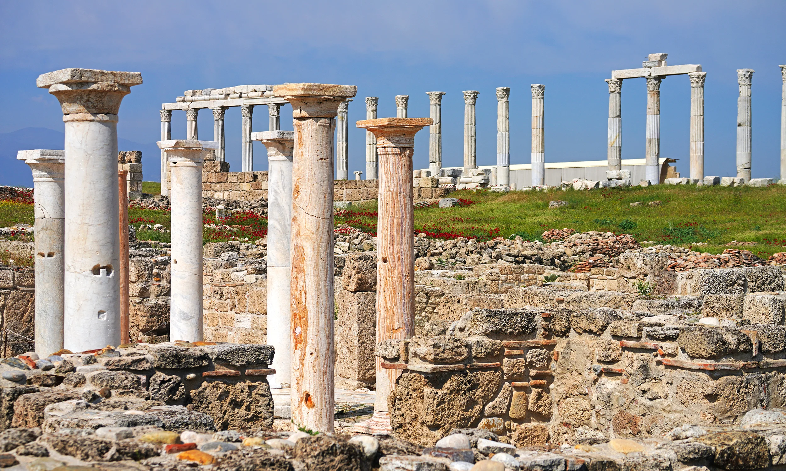
Visit one of the great Roman and early Christian centres of the Lycus Valley.
Explore Laodicea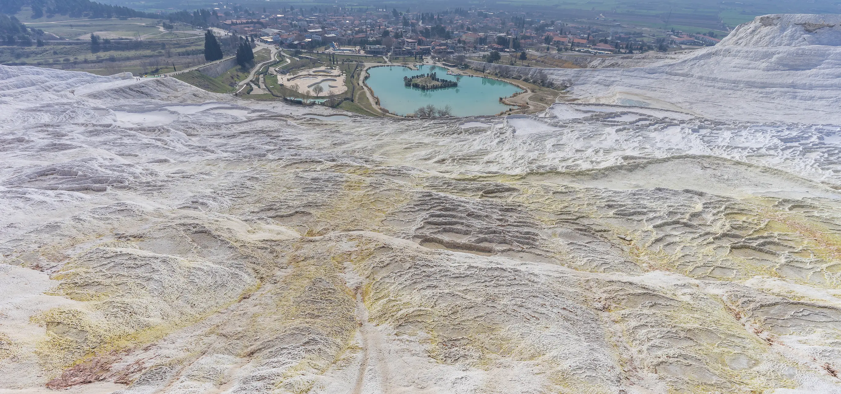
Design a thoughtful itinerary combining mountain nature, archaeology and traditional villages.
Explore Regional Tours