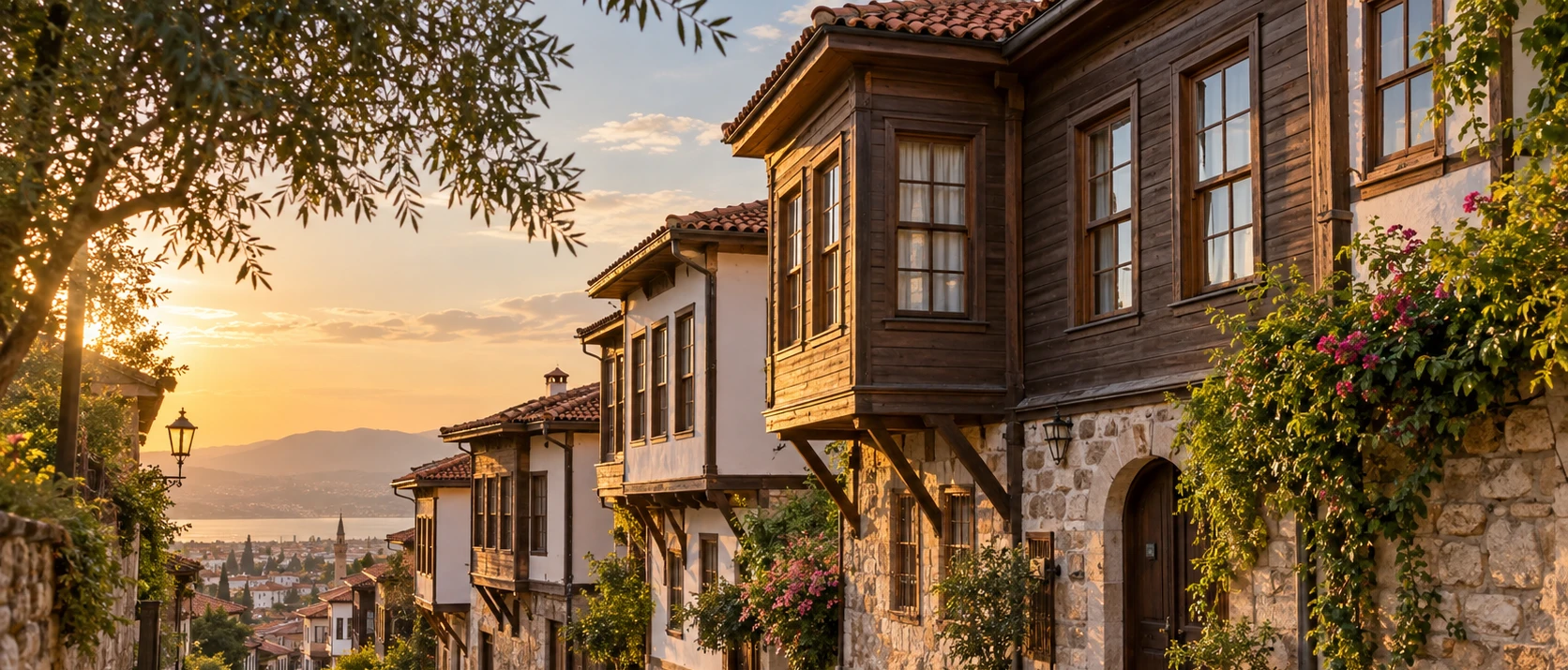
Balıkesir Historic Houses
Explore traditional urban architecture and restored historic character in the provincial capital.
View Balıkesir Historic Houses Guide





Sındırgı lies in the southeastern interior of Balıkesir Province, where the landscapes of the Marmara and inner Aegean worlds begin to overlap. The district is very different from Balıkesir's better-known coastal destinations. Instead of beaches and island harbours, visitors find forested mountains, geothermal springs, reservoir scenery, old stone bridges, village roads and a strong Yörük cultural identity.
The district is especially famous for two traditions that seem very different but belong to the same landscape. The first is Yağcıbedir carpet weaving, an internationally recognised hand-weaving tradition built around dark red, deep blue and geometric motifs. The second is geothermal culture, centred on Hisaralan and Emendere, where hot mineral water has shaped local bathing, tourism and even the physical landscape.
Sındırgı is also a rewarding destination for travellers who like places that are still closely tied to everyday regional life. In the town centre, restored Ottoman-era buildings, markets and cultural spaces sit beside modern streets. Outside the centre, the scenery changes quickly into pine forest, agricultural valleys and mountain roads leading toward Cüneyt Valley, Çaygören Reservoir and Ulus Mountain.
The municipality has long promoted Sındırgı with the identity "Doğal Şehir" – Natural City, and the phrase suits the district well. This is a destination to experience through several connected themes rather than one single monument: thermal water, geology, weaving, village culture, walking, food and landscape.
Discover one of western Türkiye's most distinctive Yörük weaving traditions, recognised for dense Turkish knots, deep colours and symbolic geometric motifs.
See hot springs, mineral deposits and unusual travertine formations created by active geothermal water rising through the landscape.
Explore Cüneyt Valley, Çaygören Reservoir and the high landscapes around Ulus Mountain for walking, photography and quiet rural scenery.
Experience a district where village traditions, weaving, markets, festivals and local food remain part of contemporary community life.
Essential information for planning a cultural, thermal and nature-focused visit to southeastern Balıkesir.
Southeastern Balıkesir Province, inland between Balıkesir, Manisa and the Simav area of Kütahya.
The district centre is approximately 63 km from Balıkesir city by the traditional road connection.
A predominantly mountainous and forested district with agricultural plains following river valleys.
More than half of the district is described locally as forested, giving Sındırgı a much greener identity than many inland Aegean towns.
Hisaralan and Emendere are the district's best-known geothermal and thermal-tourism areas.
Yağcıbedir hand carpets, woven with wool and the Turkish double-knot tradition.
Ulus Mountain rises to roughly 1,769 metres and forms one of the district's strongest natural landmarks.
Hisaralan is known for active geothermal springs, travertine deposits and unusual spring-tower formations.
The restored Sındırgı Redif Barracks, completed in 1899, is one of the town's best-known heritage buildings.
Cüneyt Valley combines forest, stream scenery and a historic stone bridge on a short marked walking route.
April–June and September–November are especially good for mixed cultural and nature trips; thermal stays work year-round.
Combine town heritage + Yağcıbedir culture + one thermal area + one nature stop rather than visiting only the centre.
Sındırgı deserves attention because it brings together several parts of Balıkesir's identity that are easy to miss if you stay only on the coast. It is simultaneously a thermal district, weaving centre, mountain region, agricultural landscape and small historic town. None of these themes overwhelms the others, and that balance gives the destination its character.
The district is particularly strong for travellers interested in living traditions. Yağcıbedir carpets are not simply museum objects; their motifs, colours and techniques are connected with Yörük communities that continue to identify strongly with the weaving tradition. Likewise, geothermal water is not limited to a spa experience. It appears in the landscape, local heating systems, tourism investment and the story of Hisaralan itself.
Nature is another reason to come. Cüneyt Valley offers an easy introduction to Sındırgı's green side, while Çaygören Reservoir opens wider views and Ulus Mountain reveals the district's higher, wilder geography. The transitions are part of the pleasure: town streets become village roads, then forest, then open mountain scenery.
Sındırgı works best for visitors who are curious rather than hurried. It rewards stopping to watch a carpet being woven, asking about a motif, following steam rising from a thermal source, walking across a stone bridge or spending an evening in a town that still feels primarily local.
Sındırgı occupies the southeastern corner of Balıkesir Province. The district borders areas of Manisa to the south and southwest and the Simav side of Kütahya to the east, placing it in a transitional zone between the Marmara hinterland and inner Aegean mountain country.
The municipal geography profile describes the district centre at roughly 250 metres above sea level, while the surrounding terrain rises dramatically. The landscape includes forested uplands, cultivated valleys and the drainage system of the Simav Çayı and smaller streams.
The most impressive elevation is Ulus Mountain, whose summit area approaches 1,769 metres. This vertical range means weather can differ significantly between the town centre, thermal valleys and mountain roads on the same day.
The district's geology also explains its geothermal identity. Sındırgı lies within a tectonically active western Anatolian setting, and hot water reaches the surface in several places. At Hisaralan, long-term mineral deposition has created a landscape that is both geological and cultural.
Your practical base for markets, local restaurants, restored heritage buildings, cultural spaces and roads leading toward the rural districts.
The most dramatic geothermal landscape, known for very hot springs, mineral formations and thermal accommodation.
A greener thermal area where warm mineral water, trees and quieter surroundings create a softer spa-and-nature atmosphere.
Rural settlements associated with the weaving tradition, including Karakaya, Eğridere, Alakır, Çakıllı, Eşmedere and Gölcük.
Easy nature excursions combining valley walking, historic stone architecture and broad reservoir scenery.
The high-country option for visitors who want forest, seasonal colour, mountain air and longer landscape drives.
The wider Sındırgı region has a much older history than the modern town itself. In antiquity this part of northwestern Anatolia belonged broadly to the cultural geography known as Mysia, later passing through Persian, Hellenistic, Roman and Byzantine political worlds.
Turkish settlement strengthened during the medieval and beylik periods. The region became associated with Türkmen and Yörük groups, including communities identified in local histories with Çavdarlı and Avşar traditions. After the Karesi Beylik period, the area became part of the Ottoman state.
According to the municipality's local history, the present urban centre developed relatively late. The settlement was known as Koruköy in the nineteenth century, and Şerif Paşa is associated with construction that helped establish the town around a mosque, bath and commercial structures. Municipal organisation began in 1884, and Sındırgı became a district in 1913.
Sındırgı was occupied during the Greco-Turkish War and was retaken on 3 September 1922, a date remembered locally as the district's liberation day. Modern Sındırgı developed around agriculture, weaving, forestry, local trade and later thermal tourism.
For many travellers, Yağcıbedir weaving is the cultural heart of Sındırgı. These hand-knotted carpets are associated with Yörük communities of the wider Balıkesir region, but Sındırgı is one of the tradition's most important centres and the name has become inseparable from the district.
The carpets are immediately recognisable by their dense construction, strong geometric organisation and dark colour palette. Deep navy or dark blue, rich red, brown and limited white accents create compositions that feel dramatically different from lighter commercial rugs made for the modern decorative market.
Traditional motifs can carry ideas connected with protection, family, fertility, movement, belief and everyday Yörük life. Their meaning should not be reduced to one universal dictionary: names and interpretations can vary between weavers, villages and families.
The best way to understand a Yağcıbedir carpet is therefore to see one with a knowledgeable local weaver or seller who can explain how pattern, knotting, wool preparation and colour work together.
The registered characteristics of the Yağcıbedir hand carpet describe a wool-based weaving tradition using the Turkish double knot. Dense knotting gives the surface durability and allows motifs to remain visually strong even at relatively small scale.
A classic composition often centres on a double-sided mihrab-like geometric arrangement filled with stylised plant and geometric forms. Borders are not simply frames; they create rhythm and can include repeated motifs with names and associations transmitted through the weaving tradition.
Colour is one of the strongest identifying features. Dark navy, deep blue, red and red tones, brown and limited white produce a visual language that is sober, powerful and immediately recognisable. Natural-dye traditions, including the use of madder for red tones, remain an important part of the cultural story even when contemporary production methods vary.
If buying a carpet, ask who wove it, where it was woven, what materials were used and whether the design follows a local Yağcıbedir pattern. A meaningful purchase should connect you with the craft rather than only with the finished object.
Official cultural sources associate the Sındırgı weaving tradition with villages including Karakaya, Eğridere, Alakır, Çakıllı, Eşmedere and Gölcük. The level of active weaving changes over time, and not every village should be approached as an open-air demonstration centre.
The important point is that the carpet belongs to a rural cultural landscape. Wool, domestic space, family knowledge, marriage traditions and seasonal village life all contributed to the conditions in which the craft developed.
Travellers interested in visiting a weaving household should arrange the experience through a local cultural contact, workshop or guide rather than simply arriving at a private home. This produces a more respectful visit and gives the weaver time to explain the process properly.
If your schedule is short, you can still learn a great deal in Sındırgı town through cultural centres, festival exhibitions and workshops where finished carpets and demonstrations are presented.
Hisaralan is the place where Sındırgı's geothermal identity becomes visible. Hot mineral water reaches the surface naturally, producing steam, mineral crusts, flowing channels and travertine deposits that make the area feel very different from a conventional spa resort.
Official regional sources record Hisaralan waters reaching temperatures up to approximately 98°C at source. That figure matters for safety as much as tourism: natural outlets can be dangerously hot, so visitors should stay on designated paths and never test source water casually with hands or feet.
The geothermal field includes accommodation and bathing facilities, but the outdoor landscape is equally interesting. The most unusual features are mineral-built formations sometimes described locally as travertine towers or living spring towers, created by long-term deposition around active outlets.
Hisaralan is therefore best understood as both a thermal destination and a geological site. Come for the landscape as well as the bath experience, and allow time to observe how water, minerals, vegetation and human use overlap.
Travertine forms when mineral-rich water reaches the surface and releases dissolved carbon dioxide, allowing calcium carbonate and other minerals to accumulate. Over long periods, this can build terraces, crusts, mounds and unusual vertical forms.
At Hisaralan, researchers have documented several different depositional shapes, including spring mounds, slope deposits, waterfall-like travertine, fissure ridges and spring towers. Some formations remain connected with active geothermal flow.
The area is included in the wider İda Madra Geopark initiative, which links geological, cultural and natural heritage across a broad regional landscape. The Sındırgı section is especially valuable because geothermal activity can be understood visually rather than only through technical explanation.
Do not climb mineral formations or walk across wet travertine unless a marked visitor route specifically permits it. These surfaces can be fragile, slippery and dangerously close to very hot water.
Emendere offers a different thermal atmosphere from Hisaralan. Instead of focusing primarily on extreme source temperatures and striking mineral formations, the area is valued for a calmer combination of warm thermal water, greenery, streamside scenery and accommodation.
Official tourism sources have historically recorded Emendere water at around 33°C. Facilities and operating arrangements can change, so travellers should check current opening conditions before building a day around a specific pool or hotel.
Thermal bathing is part of Sındırgı's long-running wellness identity, but visitors should treat health claims carefully. Use thermal pools for relaxation only within facility guidelines, particularly if you are pregnant or have cardiovascular, blood-pressure or other medical concerns.
Emendere works well with a half-day nature plan because it is closer to the district centre than the higher Hisaralan geothermal field.
Çaygören Reservoir gives Sındırgı one of its broadest open landscapes. The long body of water sits among hills and agricultural land, creating a dramatic visual contrast with the enclosed forest roads found elsewhere in the district.
Local tourism promotion has highlighted the reservoir for picnics, camping, photography and selected water-sport activities. Conditions, access points and permitted activities can change, so use designated recreational areas and follow current local rules.
The reservoir is particularly attractive in early morning and late afternoon when wind is lower and reflections are strongest. In spring the surrounding slopes are greener; in late summer the landscape becomes more golden and open.
Do not treat every shoreline track as public access. Some sections border agricultural land, infrastructure or steep banks. Choose obvious public approaches and avoid informal swimming where depth, currents or access are uncertain.
Cüneyt Valley is one of the easiest nature excursions from Sındırgı. The valley lies only a few kilometres from the district centre and combines stream scenery, pine forest, rural paths and a historic single-arch stone bridge.
The bridge has no surviving inscription, but local heritage information dates it stylistically to around the 15th century. It is built of carefully cut stone with a single rounded arch and an inclined roadway that follows the form of the crossing.
The bridge sits on a short walking route of roughly 4 km associated with the Misya walking network. Recent local hiking events have also highlighted the Cüneyt waterfall and surrounding woodland.
Spring and autumn are the best seasons for walking here. After heavy rain, streams and paths can change quickly, so good footwear is more useful than attempting the route in ordinary city shoes.
Rising to about 1,769 metres, Ulus Mountain gives Sındırgı its strongest highland landscape. The mountain is especially beautiful when autumn colours spread through mixed forest or when cool spring weather keeps the slopes green.
This is not a single formal attraction with one entrance gate. The experience depends on mountain roads, forest routes, weather and the exact viewpoint or trail you choose. Local guidance is useful if you want to go beyond an easy scenic drive.
Temperatures can be significantly lower than in Sındırgı town. Carry a layer even when the valley is warm, and avoid assuming that mobile coverage, road surfaces or services will remain consistent at higher elevations.
Photographers should consider late October and November for colour, while walkers may prefer late spring and early autumn. Winter visits require proper mountain preparation.
Sındırgı town is compact enough to explore on foot and works well as the cultural base for the wider district. The centre contains a mixture of modern commercial streets, market activity, restored heritage buildings and public spaces developed around the district's "Natural City" identity.
Rather than expecting a perfectly preserved Ottoman townscape, look for individual structures and fragments. Sındırgı's story is one of gradual growth, rebuilding and adaptation, so historic buildings sit within an active contemporary town rather than a protected museum quarter.
The most important cultural stops include the Redif Barracks, restored bath-related heritage, local craft areas and places where Yağcıbedir weaving is presented. Market days are especially useful for seeing the district's rural connections because villagers come into town for trade and supplies.
Allow at least an hour for an unhurried centre walk even if your main purpose is thermal tourism. The town provides the context that makes the rural attractions easier to understand.
One of Sındırgı's most recognisable historic buildings is the former Redif Barracks. Construction began in 1897 and was completed in 1899, during the late Ottoman period when local reserve-military organisation created similar buildings in several Anatolian towns.
The structure was restored and adapted as Kışla Müze Han, combining heritage presentation with hospitality use. Its restoration has been recognised in heritage-conservation programmes, making it an important example of adaptive reuse in the district.
Even if you are not staying here, the building is worth seeing for its scale, masonry and role in Sındırgı's late nineteenth-century urban history.
Because building use and access can change, especially after restoration work or local events, check whether interior museum or accommodation sections are open before travelling specifically for an indoor visit.
Yağcıbedir carpets are the most visible symbol of Sındırgı's Yörük heritage, but the culture is broader than weaving. Village settlement patterns, livestock traditions, food, wedding customs, music, equestrian activities and oral history all belong to the same cultural landscape.
Modern life has changed rural communities considerably, and visitors should avoid treating villages as frozen folklore. Sındırgı's cultural value lies precisely in the way traditions are adapted, remembered and sometimes revived within contemporary life.
Festivals and cultural days provide the easiest public setting for experiencing this heritage. Carpet exhibitions, folk dances, craft stands, keşkek ceremonies and local performance traditions bring together elements that might otherwise be dispersed across many villages.
When visiting outside festival periods, local workshops and markets offer a quieter, more authentic way to engage with the same cultural story.
The best-known cultural event is the International Sındırgı Yağcıbedir Carpet, Culture and Art Days. The festival typically brings together carpet exhibitions, traditional crafts, music, folk dance, local food and public events in the district centre.
In 2026 the municipality held the 24th edition, showing how firmly the event has become part of Sındırgı's cultural identity. Exact dates change from year to year, so do not plan a trip from an old poster.
Another important tradition is the Kocakonak Panayırı, a long-running regional fair combining trade, entertainment and community gathering. Such fairs help explain how inland districts maintained social and commercial connections before modern transport and shopping patterns.
If your trip coincides with a festival, expect the town centre to be much busier than usual and book accommodation early.
Sındırgı's food culture is rural Balıkesir rather than destination dining. The most satisfying meals are often simple: soup, meat dishes, seasonal vegetables, yoghurt, village breads and dishes associated with communal celebrations.
Keşkek has a particularly strong ceremonial presence and appears in festival programmes and community events. Its importance is social as much as culinary because preparing and serving it traditionally brings people together.
Balıkesir is one of Türkiye's major dairy regions, so local cheeses, yoghurt and butter are worth trying when genuinely sourced from nearby producers. In village areas, seasonal preserves, herbs and home-style dishes may also appear.
Ask what is local that day rather than searching for one "must-eat" restaurant. Sındırgı's culinary experience is strongest when connected to season and place.
Sındırgı offers a useful range of walking experiences. Cüneyt Valley is suitable for a short nature outing, reservoir-side areas provide easy scenic stops, and the higher landscapes around Ulus Mountain can support more demanding routes.
Local tourism projects have promoted several walking tracks and Misya-route connections. Trail marking and maintenance can change, however, so download a map and ask locally before relying on a route you found in an old article.
Spring brings greener scenery and wildflowers, while autumn is excellent for cooler temperatures and forest colour. Mid-summer walking is best limited to early morning or higher elevations.
Forest-fire restrictions can affect access during dry periods. Respect barriers and official closures even when a track appears physically passable.
Cooler morning air can make geothermal steam more visible while lower light adds texture to mineral formations.
Close compositions of knots, borders, wool and hands at the loom often communicate Yağcıbedir culture better than a distant room view.
Include the valley and vegetation so the stone arch reads as part of a landscape rather than an isolated object.
Wind can flatten or disturb reflections quickly. Early and late light usually produces the strongest reservoir photography.
Seasonal colour can transform the forested slopes and gives the high country a completely different character.
A carpet workshop is still a workplace. Request permission before making identifiable portraits or close photographs in private homes.
Cool, green and often wet. Good for thermal stays and early-season landscape photography, but trails may be muddy.
Excellent overall balance for walking, village drives, carpets, geothermal sightseeing and long daylight hours.
Hot in the valleys. Plan nature activities early, use shaded forest areas and leave thermal bathing for cooler parts of the day.
A strong month for cultural events and comfortable travel, with warm days and gradually cooler evenings.
One of the best periods for Ulus Mountain, forest colour, photography and quieter road trips.
Best suited to thermal-focused visits. Mountain roads can experience winter conditions even when the town remains accessible.
Enough only for the town centre and one focused stop such as a carpet workshop or nearby thermal area.
Combine town heritage, Yağcıbedir culture, Cüneyt Valley and either Emendere or Hisaralan.
Ideal for most travellers: one culture-and-thermal day plus one reservoir, village or mountain nature day.
Best for slow travellers, hikers or anyone who wants a genuine thermal stay without rushing between attractions.
Town centre, Redif Barracks, Yağcıbedir weaving, local market and a relaxed lunch with regional food.
Hisaralan geothermal landscape, a thermal facility and a scenic return through rural Sındırgı.
Cüneyt Valley, Çaygören Reservoir and a forest drive toward the Ulus Mountain area.
Combine carpets, town heritage and thermal bathing on day one, then spend day two in valleys, villages and highland scenery.
Sındırgı's most valuable attractions are living or fragile rather than monumental. Carpet weaving depends on skilled people and sustainable demand. Geothermal formations grow slowly and can be damaged by careless walking. Forest routes depend on fire safety and responsible use.
When buying textiles, prioritise transparent local production and ask who made the piece. Avoid pushing weavers for intrusive demonstrations inside private homes unless a visit has been arranged.
At Hisaralan, stay on designated paths, keep away from uncontrolled hot-water outlets and never scratch, break or collect mineral deposits.
In valleys and mountain areas, carry out rubbish, avoid lighting fires outside authorised areas and respect seasonal forest restrictions. Small communities notice visitor behaviour quickly, so responsible travel has an immediate local effect.
Children can enjoy identifying colours and repeating geometric motifs more than listening to a long technical explanation.
The valley is a better family introduction than a long mountain route, provided paths are dry and conditions are suitable.
Natural geothermal outlets can be extremely hot. Keep children close and use only managed bathing areas.
Combine one cultural stop with one outdoor stop rather than turning the day into continuous rural driving.
Services become limited quickly once you leave the district centre.
Pool ages, temperatures and family sections differ between properties.
Parts of Sındırgı town centre can be explored with relatively limited walking, but historical buildings may include steps, uneven thresholds or altered access conditions.
Thermal hotels are generally the most practical option for travellers who need elevators, accessible rooms or managed pool access, but these facilities should be confirmed directly before booking.
Hisaralan's natural geothermal terrain can be uneven, wet and slippery. Cüneyt Valley and mountain routes are not consistently step-free and should be treated as outdoor landscapes rather than fully accessible visitor attractions.
A rewarding low-mobility visit can still focus on the town centre, a carpet workshop, scenic driving and a suitable thermal property without requiring rough trail access.
Sındırgı lies roughly 63 km from Balıkesir city. Driving is the most flexible option, especially if you plan rural stops.
Approach from the south through the Manisa–Akhisar/Kırkağaç side depending on your route and current road conditions.
The eastern road connection makes Sındırgı easy to combine with the Simav area for an inland thermal route.
Regional buses and minibuses serve the district, but schedules are less useful for visitors planning multiple rural attractions in one day.
The best option for Hisaralan, Cüneyt, Çaygören, carpet villages and Ulus Mountain because the attractions are geographically dispersed.
Mountain weather, road works and local recovery projects can affect rural routes, so confirm conditions before a long detour.
Walking is enough for the central urban area, but almost every major natural attraction lies outside town. A car is therefore strongly recommended if your visit includes more than one rural destination.
Do not underestimate distances simply because all attractions fall within the same district. Forest roads, mountain gradients and village routes can make short map distances take longer than expected.
Fuel up before a long rural loop, especially if you plan to combine Hisaralan with mountain areas. Mobile coverage and navigation can also become inconsistent in valleys.
If you do not want to drive, arrange a local taxi or private vehicle for a fixed itinerary rather than depending on spontaneous transport between remote stops.
Best for travellers who want restaurants, markets and easy access to cultural attractions before driving outward each day.
Choose this if the geothermal landscape and thermal bathing are the main purpose of your visit.
A good option for travellers who prefer a greener, quieter thermal setting closer to the district centre.
A heritage-style option connected with the restored Redif Barracks; verify current operation and room availability directly.
Larger properties around the district can offer pools, spa facilities and easier all-day stays in colder months.
Festival dates, long weekends and winter thermal demand can tighten availability even when the town feels quiet.
Sındırgı was affected by two major Mw 6.1 earthquakes in August and October 2025. The events damaged a number of buildings and led to demolition, repair and reconstruction work across parts of the district.
By 2026, local cultural events, tourism activities and municipal projects were operating again, while repair and resilience work continued. Visitors should therefore avoid assuming that every older building, rural road or heritage interior has exactly the same access status shown in pre-2025 photographs.
This does not mean the district should be treated as closed to visitors. It means current local information matters. Follow municipal signs, respect fenced buildings and ask before entering historic structures that appear under repair.
For mountain and geothermal travel, ordinary natural-hazard awareness remains important as well. Stay on established routes and follow official instructions if local conditions change.
Continue with the provincial capital's traditional urban architecture and restored historic neighbourhood character.
Add one of central Balıkesir's most important Ottoman religious landmarks to your inland route.
Place Sındırgı's 1922 liberation history within the wider regional story of the Turkish War of Independence.
Combine Sındırgı's mountain landscapes with an easy forest-and-picnic stop near Balıkesir city.
Compare Sındırgı's geothermal landscapes with another historic thermal centre in Balıkesir Province.
Extend the nature theme toward Balıkesir's most famous mountain landscape if you are building a longer provincial journey.
Yağcıbedir weaving alone can justify a visit for anyone interested in carpets, natural dyes and traditional design.
Hisaralan and Emendere provide two distinct approaches to Sındırgı's geothermal resources.
Hisaralan's active springs and unusual travertine formations make the district much more than a conventional spa destination.
Cüneyt Valley, Çaygören and Ulus Mountain create a varied set of natural landscapes within one district.
Sındırgı works beautifully as an inland stop between Balıkesir, Manisa and Kütahya routes.
Travellers who already know the famous coastal and archaeological routes will find a quieter, more locally rooted side of western Anatolia here.
The best attractions are spread across a large rural district and cannot be combined efficiently on foot or by casual public transport.
Hisaralan water can emerge at extremely high temperatures. Use only managed bathing areas.
If buying a Yağcıbedir carpet, ask where it was woven and by whom rather than choosing only by colour or price.
Once outside town, services can be sparse and summer heat can be stronger than expected.
Ulus Mountain and shaded valleys can feel much cooler than the district centre.
Useful for forest roads and rural loops where mobile data can become unreliable.
Summer fire-risk restrictions can affect access even when a road or picnic area appears open on an old map.
Following the 2025 earthquakes, some older structures may have changed opening or restoration status.
Opening hours, day-use access and pool rules vary between properties.
Wet geothermal surfaces, forest trails and old stone paths can all be slippery.
Village businesses and small workshops may not always support every electronic payment method.
Sındırgı is better when you can stop for a workshop conversation, landscape view or unplanned village break.
Sındırgı matters because its strongest stories are not separate attractions. Geothermal water, forest, Yörük culture, weaving and settlement history all belong to the same rural landscape.
Yağcıbedir carpets preserve a visual language carried through generations of hand weaving. Their importance is not only aesthetic; they represent knowledge about wool, colour, household labour, symbolism and community identity.
Hisaralan adds an entirely different dimension by exposing active geological processes at the surface. Few destinations allow visitors to move in the same day from a loom and historic town street to steam, travertine and mineral-built spring towers.
For travellers exploring Balıkesir in depth, Sındırgı provides the inland chapter that completes the province's better-known stories of coast, islands, ancient cities and olive landscapes.
Sındırgı is a district in southeastern Balıkesir Province in western Türkiye, close to the borders of Manisa and Kütahya.
The district centre is roughly 63 km from Balıkesir city by the traditional road route.
It is best known for Yağcıbedir carpets, geothermal springs, Hisaralan, Emendere and forested mountain landscapes.
Sındırgı is widely promoted locally as Doğal Şehir – Natural City. Do not confuse that local tourism identity with membership in the international Cittaslow network.
They are dense hand-knotted wool carpets associated with Yörük communities of Balıkesir, especially Sındırgı and nearby districts.
Dark navy, deep blue, red, brown and limited white are among the most characteristic colours.
Traditional weaving is associated with Sındırgı villages including Karakaya, Eğridere, Alakır, Çakıllı, Eşmedere and Gölcük.
Yes, but it is best to arrange a workshop or cultural-centre visit in advance, especially if you hope to meet a weaver personally.
Hisaralan is Sındırgı's best-known geothermal area, with hot springs, mineral deposits, travertine formations and thermal accommodation.
Official regional tourism sources record source temperatures reaching approximately 98°C.
No. Natural outlets may be dangerously hot. Use marked visitor routes and managed thermal facilities.
They are unusual mineral-deposition forms created around geothermal spring outlets over long periods.
Yes. It is included in the wider İda Madra Geopark initiative highlighting regional geological and cultural heritage.
Emendere is another Sındırgı thermal area, known for warm mineral water and a greener, quieter setting.
Yes. Cüneyt Valley offers an easy introduction, while Ulus Mountain and forest roads provide more demanding options.
The local route associated with the historic bridge is approximately 4 km.
It has no surviving inscription, but local heritage information dates the structure stylistically to around the 15th century.
Its summit area reaches roughly 1,769 metres.
Enjoy scenery, photography and designated recreation areas; permitted activities should be checked locally.
It is a late Ottoman military building begun in 1897 and completed in 1899, later restored as Kışla Müze Han.
It is generally held around late summer or early September, but exact dates vary each year.
Yes for an introduction. Two days are better if you want to combine carpets, thermal water, walking and mountain scenery.
A car is strongly recommended because Hisaralan, Cüneyt Valley, Çaygören and Ulus Mountain are spread across the district.
May–June and September–November are excellent for mixed sightseeing. Winter is particularly suitable for thermal stays.
Midday can be hot in lower areas. Plan nature activities early and use higher forest zones later in the day.
Yes, especially for thermal tourism, but check mountain-road conditions before driving to higher areas.
Yes. Two Mw 6.1 earthquakes affected the district in August and October 2025, and repair and resilience work continued through 2026.
Yes. Tourism and cultural activity continue, although access to individual older buildings or worksites can change and should be checked locally.
Bring water, comfortable shoes, sun protection, a light layer, offline maps, some cash and swimwear if using a thermal facility.
For a first visit, combine a Yağcıbedir carpet experience, Hisaralan or Emendere, and one nature stop such as Cüneyt Valley.
Build a wider Balıkesir journey that connects Sındırgı's carpets and geothermal landscapes with historic architecture, museums, forests and other thermal traditions.
Continue from inland Sındırgı toward Balıkesir city, forest parks, thermal towns and the great mountain landscapes of the province.
Explore traditional urban architecture and restored historic character in the provincial capital.
View Balıkesir Historic Houses Guide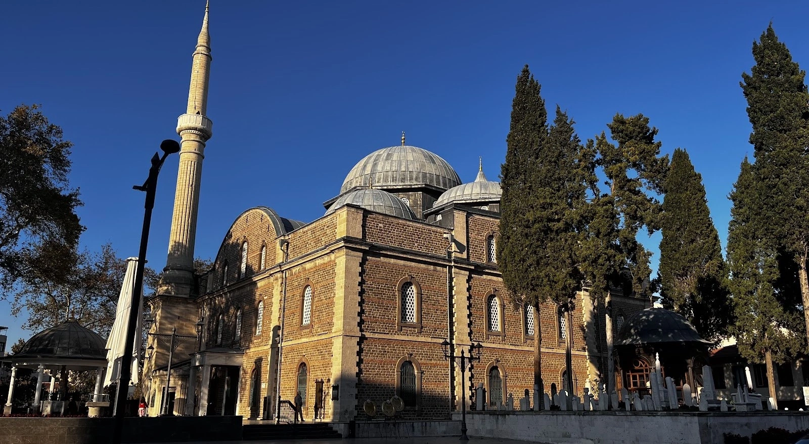
Continue the Ottoman story with one of Balıkesir city's most important historic religious landmarks.
View Zağnos Paşa Mosque Guide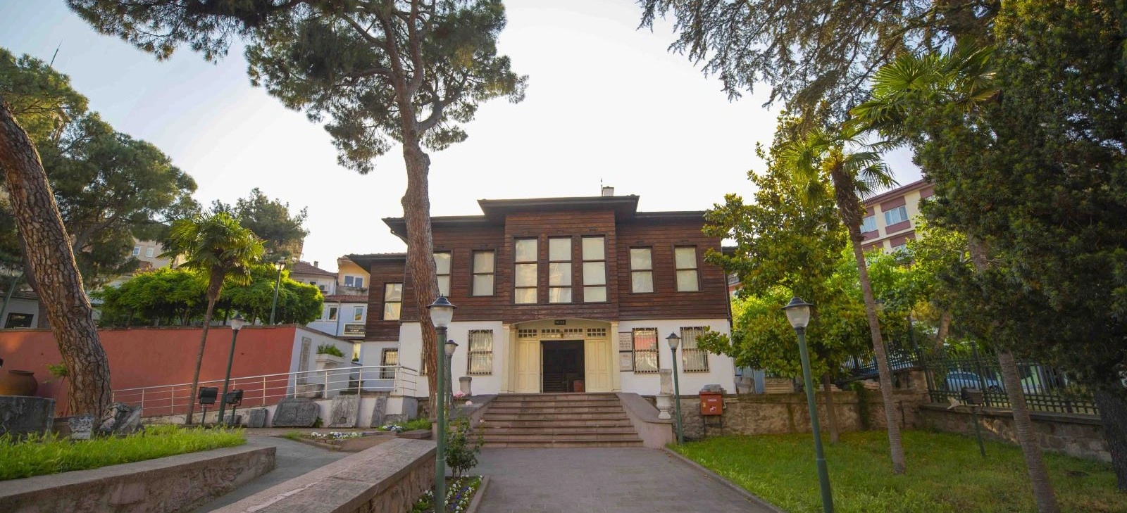
Understand the wider regional context of the War of Independence and Balıkesir's local resistance history.
View Kuvayi Milliye Museum Guide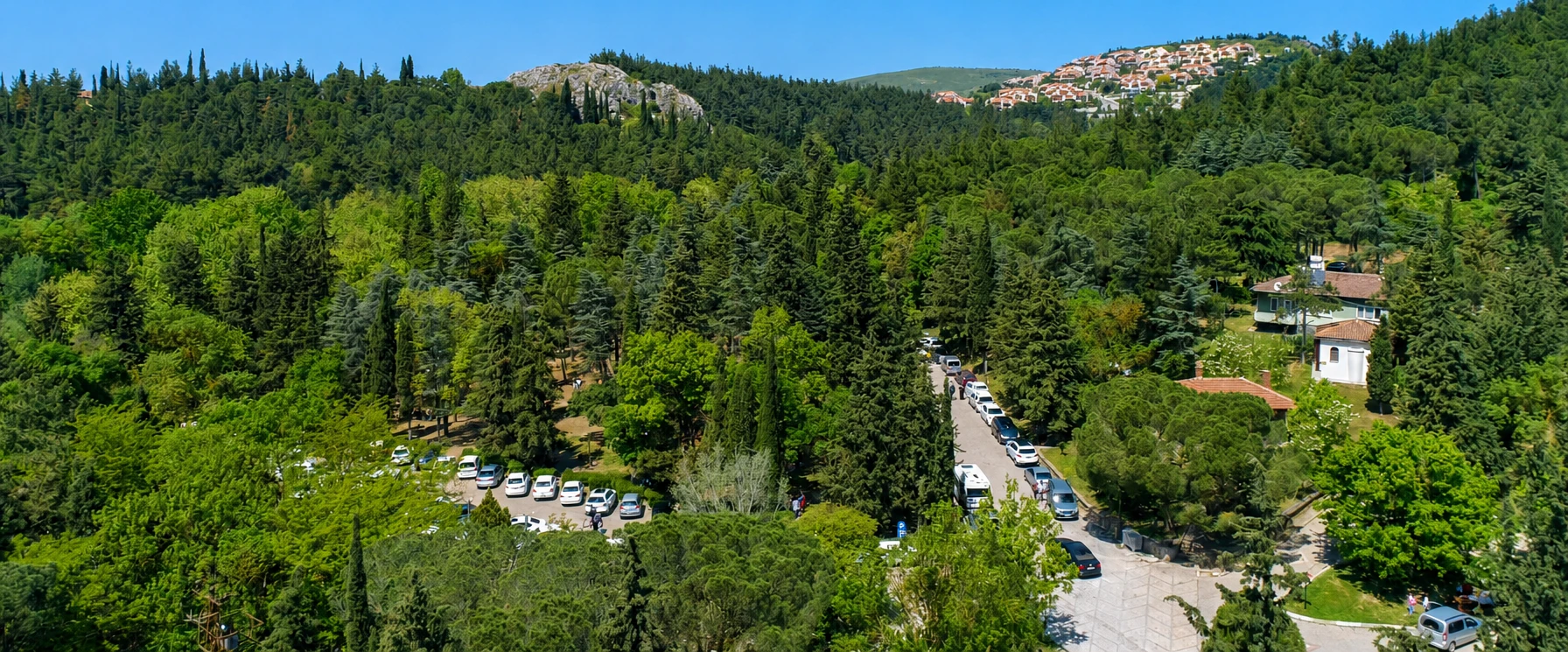
Add another easy forest landscape to your inland Balıkesir route before or after Sındırgı.
View Değirmen Boğazı Guide
Compare Sındırgı's geothermal identity with another long-established thermal destination in Balıkesir Province.
View Gönen Guide
Extend your mountain journey toward Balıkesir's most famous forested highland landscape.
View Mount Ida Guide