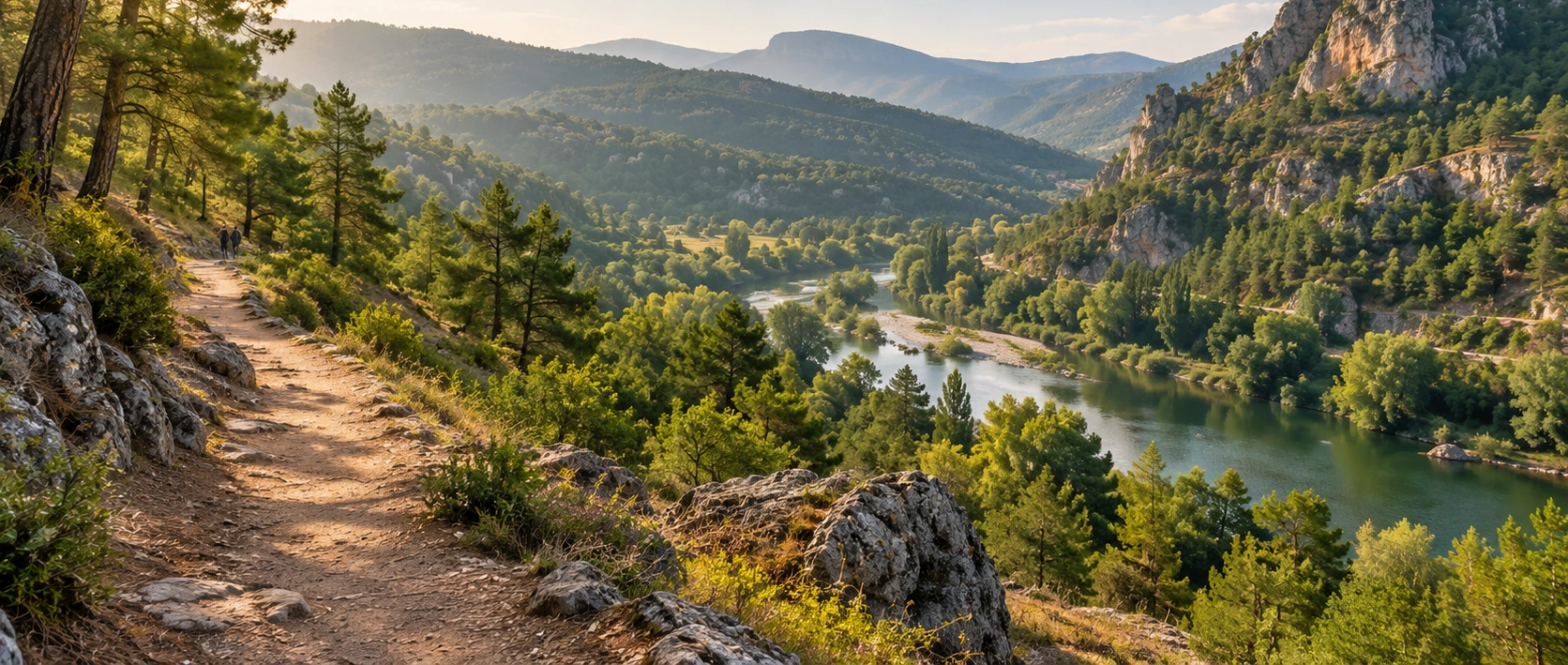
Private Osmaneli Nature & Heritage Experience
Ask us about a tailor-made Osmaneli day combining a suitable countryside walk, the Sakarya landscape, historic streets and cultural monuments.
Request a Custom Experience





Osmaneli is usually introduced through its historic houses, Ottoman monuments and the old town once known as Lefke. Yet the district also has a second identity: it is one of the most interesting areas of Bilecik Province for nature walking and trekking.
The landscape changes quickly outside the town centre. The broad valley of the Sakarya River gives way to cultivated land, wooded slopes, rocky ridges, small stream valleys and rural settlements. This mixture allows travelers to choose between easy riverside walks, short countryside outings and longer forest treks.
The best documented trekking area is Göksü Çayı. Türkiye’s Culture Portal describes a route that passes almost entirely through forest paths, with an average walking time of four to five hours. The landscape is dominated by pine woodland, but sections of harder, rockier terrain give the walk a character that differs from many softer forest routes elsewhere in the Marmara Region.
Official tourism information places the walking terrain across a broad elevation range, from approximately 900 metres down toward 300 metres. That variation means a day in Osmaneli can involve considerably more ascent and descent than the green river valley first suggests.
Other possibilities are equally attractive. A documented organized walk between Belenalan and Dereyörük villages covered about 8 kilometres, while the Prof. Dr. Yunus Söylet İçmeler facility, around 8 kilometres from the district centre, includes forest walking routes and recreation areas. Closer to town, the Sakarya River offers a much gentler setting for short walks.
The important thing is to understand that Osmaneli is not one single marked hiking trail. It is a wider walking landscape. Some routes are described by official tourism sources, some have been used for organized local walks, and others are rural or community-recorded tracks whose condition can change. For longer routes, travelers should confirm current access, weather, forest conditions and navigation before setting out.
Nature walking also combines naturally with Osmaneli’s cultural heritage. A day can begin among pine-covered hills and finish among the historic houses of Osmaneli, Rüstem Pasha Mosque and Hagios Georgios Church.
A four- to five-hour walking area known for forest paths, pine woodland, elevation changes and rocky terrain.
Gentler riverside scenery close to Osmaneli, ideal for relaxed walking, photography and slower exploration.
Walking country extends between villages, valleys, ridges and old rural paths throughout the district.
Combine outdoor walking with the historic streets, Ottoman architecture and multicultural heritage of old Lefke.
Essential information for planning a walk or trekking day around Osmaneli.
Osmaneli District, Bilecik Province, northwestern Türkiye.
Open Osmaneli on Google MapsNature walking, trekking, forest walking and riverside exploration.
Pine woodland, valleys, rocky slopes, rural tracks, streams and the Sakarya River corridor.
Göksü Çayı, where official tourism material describes a substantial forest trekking route.
Approximately 4–5 hours according to Türkiye’s official Culture Portal.
Official descriptions place the Göksü walking landscape roughly between 900 m and 300 m.
Forest paths are combined with harder rocky sections and changing gradients.
Shorter walks around the Sakarya River and central Osmaneli.
İçmeler, where the municipal facility includes forest walking routes and recreation areas.
Longer rural routes should not be assumed to be continuously waymarked; confirm the route before departure.
Spring and autumn are generally the most comfortable periods for longer walks.
112 in Türkiye. Carry a charged phone and share your planned route before longer walks.
Osmaneli offers something increasingly rare: genuine countryside begins only a short distance from an important historic town.
The district sits within a landscape shaped by river valleys, wooded uplands, rocky formations and agricultural land. The Sakarya River is the dominant geographical feature, but the walking experience changes rapidly as routes rise away from the valley floor.
This creates a strong contrast. One moment you may be beside water, orchards and flat agricultural fields; later the same day you can be walking through pine forest or rougher rocky country at considerably higher elevation.
Official provincial material has long promoted Osmaneli for trekking and nature tourism. Organized walks have been used to introduce local paths, vegetation, village connections and landscapes that were historically used as routes by rural communities.
For travelers, the greatest advantage is variety. You do not need to be a specialist trekker to enjoy the district. A visitor can choose a short river walk, a half-day forest route, a longer rural trek, or a combined heritage-and-nature day.
Osmaneli is therefore particularly attractive for travelers who want to experience northwestern Anatolia at walking pace rather than seeing only monuments from a vehicle.
Osmaneli’s walking character begins with the Sakarya River. The river crosses the district within a broad, fertile valley and has shaped settlement, agriculture and movement through the region for centuries.
Away from the river, the ground becomes more varied. Provincial descriptions emphasize pine forests, heath-covered areas, green hills, rocky textures and valleys created by smaller streams.
These landscape types often appear close together. That is why a route that begins gently can become much more demanding once it climbs into the surrounding hills.
The contrast also creates excellent photography. River reflections, cultivated fields, wooded slopes, exposed rock and traditional villages can all appear within the same wider landscape.
Broad, greener and generally gentler terrain around the main river corridor.
A defining element of the longer Göksü trekking landscape.
Harder exposed sections create a more rugged walking character than a simple woodland stroll.
Smaller waterways cut through the district and create changing terrain and vegetation.
Village-to-village walking reveals agricultural landscapes and older local travel routes.
Nature and heritage meet unusually closely around Osmaneli, making mixed walking itineraries easy to design.
For a traveler looking for the most clearly documented trekking experience in Osmaneli, Göksü Çayı is the most important place to know.
Türkiye’s official Culture Portal describes the route as passing almost entirely through forest paths, with pine woodland forming the dominant vegetation. The average walking time is given as approximately four to five hours.
The route is not simply a level forest walk. The same official description places walking areas between roughly 900 metres and 300 metres in elevation, indicating substantial changes in height across the wider terrain.
Another distinctive feature is the rocky character of the landscape. The Culture Portal specifically notes that hard rocky ground is unusually prominent alongside woodland, giving the Göksü area a different feel from many typical Marmara forest walks.
This combination makes the area especially suitable for walkers who enjoy changing surfaces, forest shade, open rocky sections and a stronger sense of terrain.
The Göksü landscape is also interesting because walking here can intersect with traces of earlier settlement and communication.
Türkiye’s cultural inventory records Göksu Towers near Düzmeşe Village, on the road toward Çiftlik Mevkii and close to the Göksu watercourse.
The presence of these structures is a reminder that the valleys around Osmaneli were not empty wilderness. They were working landscapes crossed by routes, watched from elevated points and connected with settlements over long periods.
Walkers who explore the wider Göksü area should treat archaeological remains carefully. Do not climb unstable masonry, move stones, remove material or leave the established route simply to reach a ruin.
Another useful example of Osmaneli’s walking potential is the route between Belenalan and Dereyörük villages.
In November 2019, a nature walk organized with the participation of local institutions covered approximately 8 kilometres between the two villages. The activity formed part of a wider effort to identify and promote Bilecik’s walking landscapes.
The significance of this route is not that every traveler should expect a formally maintained, signposted 8-kilometre recreational trail today. Rather, it demonstrates that the rural road and path network between Osmaneli’s villages has genuine walking potential.
Village-to-village routes are especially rewarding for visitors interested in agricultural landscapes, local topography, seasonal color and the transition between settlement and forest.
Not every nature walk in Osmaneli needs to be a four-hour trek. For a slower and more accessible outdoor experience, the Sakarya River is the natural place to begin.
The river runs directly beside the town’s wider settlement area, creating a landscape of water, riparian trees, fields, bridges and views toward the surrounding hills.
Short walks around the river corridor are useful for travelers who have limited time, families who do not want a demanding trail, or photographers waiting for softer morning or evening light.
The riverside should be treated as a landscape zone rather than a single guaranteed continuous hiking path. Some sections are developed or easily walked, while others may be agricultural, private, muddy, overgrown or affected by changing river conditions.
Stay on obvious public access routes, respect cultivated land and avoid approaching steep or unstable banks.
Easy walking, river photography, relaxed exploration and combining nature with the historic town.
Short out-and-back or local loop walks rather than a single standardized long-distance trail.
Early morning and late afternoon often give the river valley its most atmospheric appearance.
Expect muddy edges, slippery ground and potentially changing access beside smaller tracks.
The Prof. Dr. Yunus Söylet İçmeler facility is approximately 8 kilometres from Osmaneli town centre according to Osmaneli Municipality.
The modern facility includes forest walking routes, picnic areas, recreation facilities and outdoor activity spaces. This makes İçmeler useful for visitors who want to experience woodland without committing immediately to a more demanding rural trek.
Because it is a managed recreation area, İçmeler can also work well as part of a broader day: a forest walk can be followed by lunch, a rest stop or a return to the historic centre.
Do not confuse the facility’s recreation infrastructure with a promise that every surrounding forest track is a formally marked hiking route. If extending beyond the immediate visitor area, confirm which paths are public and suitable for walking.
About 8 km from the district centre according to the municipality.
Woodland and recreation landscape outside the urban centre.
Municipal information lists forest walking routes, picnic areas and other outdoor recreation spaces.
Travelers looking for an easier introduction to Osmaneli’s forest environment.
Stay near the Sakarya River and town edge for a shorter, flatter outing with easy access back to Osmaneli.
Combine old Lefke, the river corridor and nearby viewpoints for a mixed cultural and outdoor walk.
Use İçmeler as a base for a more relaxed woodland experience with nearby facilities.
Choose the Göksü landscape for a more substantial four- to five-hour walking experience.
Explore rural connections such as the documented Belenalan–Dereyörük walking area after confirming access and route details.
Higher routes recorded by local walkers can offer wide views, but require stronger navigation and current local information.
The answer depends entirely on the route. Osmaneli includes everything from short, nearly level riverside walking to longer routes involving major elevation change and rocky ground.
A walk beside the Sakarya can be gentle, while the official description of Göksü shows why longer routes should be treated more seriously: the walking area ranges through hundreds of metres of elevation and includes harder rocky terrain.
Distance alone can therefore be misleading. An 8-kilometre rural route on open tracks may feel easier than a shorter route involving steep, loose or rocky slopes.
Before setting out, consider distance, total ascent, surface, shade, water availability, temperature, navigation and return transport together.
Osmaneli can be explored throughout the year, but the character of the landscape changes dramatically by season.
One of the best periods for longer walks. Vegetation is fresh, streams may be livelier and temperatures are usually more comfortable than midsummer.
Start early, carry ample water and avoid exposed routes during the hottest part of the day. Forest-fire restrictions may also affect access.
Excellent for walking and photography, with softer temperatures and strong seasonal color across riverbanks, woodland and agricultural land.
Shorter days, wet ground, frost, mud or occasional snow can make rural trails slower and more difficult than expected.
For most recreational hikers, April–May and October–November are often especially attractive, but conditions vary from year to year. Always check the current forecast and local trail access immediately before a longer walk.
Spring reveals why the district is so closely associated with green valleys and outdoor activity. The river corridor becomes more vivid, forest vegetation renews and the countryside can feel very different from its dry late-summer appearance.
The season is especially good for longer daylight walks without the strongest summer heat. It is also a rewarding period for observing wildflowers and changing vegetation, although walkers should avoid identifying or collecting plants unless they know local conservation rules.
Rain can make clay, forest soil and exposed rock slippery. Even on a pleasant day, waterproof footwear and a light rain layer can be useful.
Autumn is one of the strongest seasons for combining comfortable walking, photography and historic sightseeing.
Trees along waterways and in mixed woodland introduce yellow, gold and brown tones, while lower sun creates stronger texture on fields, rocky slopes and old buildings.
A particularly satisfying autumn day can combine a morning rural walk with an afternoon return to historic Osmaneli. The contrast between seasonal landscape and traditional architecture is one of the district’s great visual strengths.
Late autumn also brings shorter daylight. Do not begin a remote route simply because the midday weather feels mild; calculate the time needed to return before dark.
Summer can still be rewarding, especially in shaded woodland, but route planning becomes more important.
Begin longer walks early in the morning, carry more water than you expect to use and reduce exposure during the hottest hours. Open rocky slopes can feel significantly hotter than the temperature measured in shaded areas.
Dry-season forest conditions also mean walkers must be extremely careful with fire. Never light an unauthorized fire, discard cigarettes, use portable flames where prohibited or ignore temporary forest-entry restrictions.
If official authorities close forest areas because of fire danger, do not attempt to bypass the restriction. Choose the historic town, riverfront or another open visitor area instead.
Winter brings a quieter atmosphere, clearer long-distance views on some days and a very different mood to the countryside.
However, mud, wet leaves, frost, short daylight and occasional snow can transform an otherwise moderate route. Forest roads may also be affected by vehicles, erosion or water after heavy rain.
For casual visitors, winter is often better suited to shorter flexible walks close to Osmaneli rather than committing to a long isolated route without local knowledge.
Use footwear with reliable grip for forest soil, loose stone and rocky surfaces.
Carry your own supply. Never rely on finding a safe drinking-water source along a rural route.
Download maps or GPX data before departure when attempting a longer or unfamiliar route.
Keep enough battery for navigation and emergency communication; a power bank is useful on longer days.
Hat, sunscreen and sunglasses matter even when much of the route passes through forest.
Useful in spring, autumn and changeable weather when conditions can shift during a four- to five-hour trek.
Carry basic supplies appropriate to your group and the remoteness of the route.
Bring simple snacks for longer walks and enough energy for unexpected delays.
Most nature walking is straightforward when approached responsibly, but longer routes can take travelers away from immediate services.
The main risks are usually practical rather than dramatic: heat, dehydration, slippery rock, mud, navigation mistakes, unexpectedly steep terrain, short winter daylight and changing forest access.
Walk within the ability of the slowest person in your group. Do not separate, especially where the path is unclear.
After heavy rain, avoid entering fast-flowing stream channels or attempting crossings that appear unsafe. River and stream conditions can change far more quickly than photographs suggest.
In an emergency in Türkiye, call 112. A charged mobile phone is essential, but remember that signal can be weaker in valleys and forested terrain.
Tell your hotel, companion or another contact which route you intend to walk.
Allow a generous margin before sunset, especially in autumn and winter.
Changing weather, unclear navigation or fatigue are all valid reasons to shorten the walk.
Forest or rural access restrictions may be introduced temporarily for fire danger, works or safety.
Do not attempt dangerous stream or river crossings after heavy rainfall.
112 for emergency assistance in Türkiye.
Official provincial accounts of organized walking in the district emphasize the richness of the local vegetation and note observations of endemic plants along some routes.
For most visitors, the most obvious botanical contrast is between pine-dominated upland forest, riverbank vegetation, heath-covered areas, cultivated fields and seasonal wild growth.
The ecological value of a walk does not depend on knowing every species name. Move quietly, remain on established paths where possible and allow plants, wildlife and agricultural land to remain undisturbed.
Do not pick unusual flowers, dig up bulbs, collect plants or remove natural material from protected or sensitive areas.
Forest, river and agricultural landscapes naturally support wildlife, but nature walking should never become a search to approach or disturb animals.
You may also encounter village dogs, livestock or working animals on rural routes. Stay calm, give animals space and do not enter fenced or clearly private agricultural areas.
Avoid feeding wildlife. Food changes animal behavior, creates dependence and can cause conflict between animals and people.
If walking in warm months, check clothing and exposed skin after time in long grass or woodland and use ordinary outdoor precautions appropriate to the season.
Osmaneli is especially rewarding for photographers because the landscape provides multiple visual scales: wide river valleys, layered hills, narrow forest paths, rock formations, agricultural textures and historic architecture.
Around the Sakarya, look for reflections, tree lines and the relationship between the river and the town. In the forest, use paths and trunks to create leading lines. Higher terrain can provide broader views back toward the valley.
Spring offers fresh greens, while autumn introduces strong warm tones and lower-angle light. After rain, colors may become richer, but paths and rocks will also be more slippery.
When photographing villages, farms or people, remember that this is a living rural landscape rather than an outdoor film set. Ask permission before photographing people at close range or entering private property.
Use early or late light for reflections, riverbank trees and softer atmosphere.
Photograph along the path to create depth rather than pointing only into dense vegetation.
Side light emphasizes the texture and rugged character of exposed ground.
Include fields, roads and settlement patterns to tell a broader story of rural Osmaneli.
Excellent for warm foliage tones and visual contrast between woodland and rock.
Finish the day among old houses and monuments for a complete nature-and-culture photo story.
One of the strongest reasons to choose Osmaneli over a more isolated hiking destination is the ability to combine nature with a genuine historic town.
After a forest or river walk, return to the old centre and continue through Osmaneli’s historic houses. These streets preserve the domestic architecture and urban character of old Lefke.
Visit Rüstem Pasha Mosque for one of the district’s most important Ottoman monuments, then continue to Hagios Georgios Church for another layer of the town’s architectural history.
This combination gives Osmaneli unusual depth: river, forest, rural landscape, Ottoman heritage and Orthodox architectural heritage can all be experienced in one day.
If you have only a few hours, do not rush toward a remote trekking route. Osmaneli is rewarding even at a slower pace.
Begin in the historic centre around Rüstem Pasha Mosque, continue through the old residential streets and then move toward the wider Sakarya River corridor.
This route allows you to understand the relationship between settlement and landscape: historic Lefke developed beside a river system that supported agriculture, movement and everyday life.
Finish with a local food or tea stop rather than treating the walk as a race between attractions.
For active travelers, a particularly strong itinerary is to dedicate the morning to nature and the afternoon to architecture.
Choose a locally confirmed Göksü or forest route and begin early enough to complete the walk comfortably. Carry water, food and navigation, and keep the route conservative if conditions are uncertain.
After returning to Osmaneli, take a proper break before visiting the old town. Then explore Rüstem Pasha Mosque, the historic houses and Hagios Georgios Church.
This creates a much fuller understanding of the district than either hiking or monument sightseeing alone.
There is no single admission gate or universal opening time for “Osmaneli Nature Walks,” because this page covers a wider outdoor landscape rather than one enclosed attraction.
Some walks begin from public streets or rural routes, while managed places such as İçmeler may have their own operating arrangements. Longer trekking routes can also be affected by weather, forestry activity, fire-season restrictions or temporary access changes.
For that reason, the most important visitor habit is to verify the specific route you intend to walk rather than assuming general information applies everywhere.
Because the page covers many different environments, there is no single accessibility rating for Osmaneli’s nature walks.
Some developed riverside or recreation areas may be much easier to use than forest paths, rocky trails, muddy tracks or routes with significant elevation change.
The Göksü trekking landscape should not be assumed suitable for wheelchairs, pushchairs or travelers who require consistently level surfaces.
Anyone needing step-free, wheelchair-suitable or low-gradient access should confirm the exact surface and facilities at the chosen location before traveling.
Osmaneli is in northern Bilecik Province and is connected by major road and rail corridors through northwestern Türkiye.
The Bilecik Governorate lists the town at approximately 34 kilometres from Bilecik, 72 kilometres from Adapazarı, 104 kilometres from Bursa, 106 kilometres from Eskişehir and 202 kilometres from Istanbul. Road distance and travel time can vary according to the exact route and traffic.
For nature walking, a private vehicle is useful because many forest, village and recreation areas lie outside the historic centre.
Once in Osmaneli, the old town itself is compact enough to explore on foot, making it easy to combine a countryside excursion with cultural sightseeing.
Use the district centre as the base point for navigation before continuing to a confirmed walking area.
Approximately 34 km according to Bilecik Governorate information.
The most flexible option for reaching rural trailheads and combining several sites in one day.
Useful if you plan a point-to-point village walk and do not want to return on foot to the starting point.
Best explored on foot after returning from the countryside.
Confirm the exact trailhead rather than relying only on a generic “Osmaneli” map pin.
For a simple taste of the landscape, allow one to two hours for a town-and-river walk.
For a forest recreation outing, allow around half a day, especially once transport, breaks and photography are included.
The officially described Göksü trekking experience requires approximately four to five hours of walking before transport and rest time are added.
A complete nature-and-heritage day in Osmaneli can easily fill six to eight hours.
Short river or town-edge walk.
Historic centre combined with nearby natural scenery.
Forest recreation or a moderate locally confirmed countryside route.
The approximate walking duration published for the Göksü trekking landscape.
Nature walk plus historic Osmaneli, Rüstem Pasha Mosque and Hagios Georgios Church.
A walking day becomes even more rewarding when combined with the wider cultural and natural landscape of Bilecik Province.
Walk through old Lefke and discover timber-framed houses, narrow streets and the traditional urban landscape of Osmaneli.
Visit Osmaneli’s historic Ulu Cami and its remarkable painted timber ceiling after your outdoor walk.
Explore the town’s surviving Orthodox architectural heritage and the multicultural history of old Lefke.
Continue exploring Bilecik’s greener side with another nature-focused destination in the province.
Add an easy waterside recreation stop near Bilecik city to a broader nature itinerary.
Experience another side of rural Bilecik through village landscapes and locally rooted tourism.
Discover historic towns, Ottoman monuments, museums, natural landscapes and village routes across the province.
For travelers who prefer forests, rivers and rural scenery to conventional sightseeing alone.
Especially suitable for walkers looking for substantial half-day terrain without a multi-day expedition.
River valleys, forest paths, rocky ground and historic architecture create diverse visual material.
Walking reveals the relationship between Osmaneli’s landscape, villages and historic town far better than a quick drive-through.
Few districts make it this easy to combine a genuine outdoor walk with important Ottoman and Orthodox monuments.
Choose shorter developed river or recreation walks rather than remote trekking routes with uncertain terrain.
Osmaneli is a district in Bilecik Province in northwestern Türkiye, situated within the Sakarya River landscape.
Yes. Official provincial and national tourism sources specifically promote nature walking and trekking around Osmaneli, especially in the Göksü Çayı area.
The best-documented trekking area is Göksü Çayı, where the official Culture Portal describes a forest route of approximately four to five hours.
The official tourism description gives an average walking time of approximately 4–5 hours.
The route is described as passing largely through pine-dominated forest paths with significant rocky terrain.
Yes. Official tourism information describes walking areas ranging approximately from 900 metres down toward 300 metres.
It should not be treated as a simple flat woodland stroll. The combination of four to five hours of walking, elevation variation and rocky ground requires appropriate fitness and footwear.
Do not assume so. Some walking areas are officially documented, but the district also includes rural tracks, village routes and locally used paths. Confirm the specific route before departure.
Yes, the river corridor offers opportunities for shorter, gentler walks, but access is not necessarily continuous along every bank. Use clear public routes and respect agricultural land.
Shorter routes close to the Sakarya River, town centre or managed recreation areas are generally more suitable than remote forest trekking.
A documented organized nature walk in 2019 covered approximately 8 kilometres between Belenalan and Dereyörük villages. Current independent access should still be confirmed before attempting a similar route.
Yes. Osmaneli Municipality describes the Prof. Dr. Yunus Söylet İçmeler facility as including forest walking routes and recreation areas.
Municipal information places the facility approximately 8 kilometres from the district centre.
Spring and autumn are generally the most comfortable for longer walks, with cooler temperatures and attractive seasonal landscapes.
Yes, but begin early, carry plenty of water and respect any temporary forest restrictions or fire-danger closures.
Yes, but mud, frost, short daylight, wet rock and occasional snow can make rural routes significantly more difficult.
For longer forest or Göksü routes, sturdy walking shoes or hiking footwear with good grip are strongly recommended.
Yes. Carry enough water for the full route and do not rely on finding a safe drinking-water source along rural trails.
For longer or unfamiliar rural routes, offline navigation is strongly recommended. Mobile signal can be less reliable in valleys and forested terrain.
There is no universal admission fee for the wider outdoor landscape. However, individual managed facilities or services may have their own current charges or operating rules.
Do not assume unrestricted camping is permitted. Use designated or explicitly permitted areas and check current forestry, municipal and fire-season rules before camping.
Never light a fire unless it is explicitly permitted in a designated area. During dry periods, forest-fire rules may be especially strict.
Call 112 for emergency assistance in Türkiye.
Yes. Osmaneli is particularly well suited to combining nature with historic houses, Rüstem Pasha Mosque and Hagios Georgios Church.
A complete day can comfortably take 6–8 hours, especially if you choose a substantial morning walk and explore the historic centre afterward.
Absolutely. The district offers short river walks, forest recreation, historic streets and cultural monuments as well as more demanding trekking.
Carry out everything you carry in, including food packaging and tissues.
Never light unauthorized fires and follow all temporary forest restrictions.
Avoid creating new shortcuts that damage vegetation or accelerate erosion.
Do not cross fenced land, damage crops or disturb irrigation infrastructure.
Do not climb, move stones from or remove objects around rural archaeological remains.
Leave flowers, bulbs and other natural material where you find them.
Quiet walking is better for wildlife, residents and other visitors.
Use local cafés, shops and services when possible so outdoor tourism contributes to the community.
Combine the forests, river landscapes and rural scenery of Osmaneli with old Lefke, historic houses and important monuments through a private tailor-made itinerary.
A flexible private experience can combine an appropriate nature walk with the historic centre, depending on season, weather, fitness and current route conditions.
Ask us about a tailor-made Osmaneli day combining a suitable countryside walk, the Sakarya landscape, historic streets and cultural monuments.
Request a Custom Experience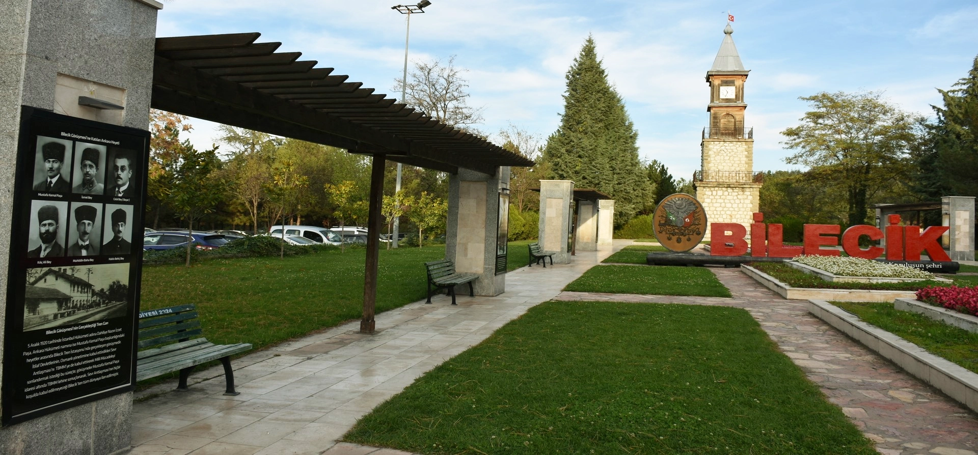
Discover Osmaneli, Bilecik city, Söğüt, Bozüyük, waterfalls, ponds, historic villages, Ottoman monuments and natural landscapes across the province.
View Bilecik GuidePair Osmaneli’s walking landscapes with nearby cultural and nature-focused pages across the province.
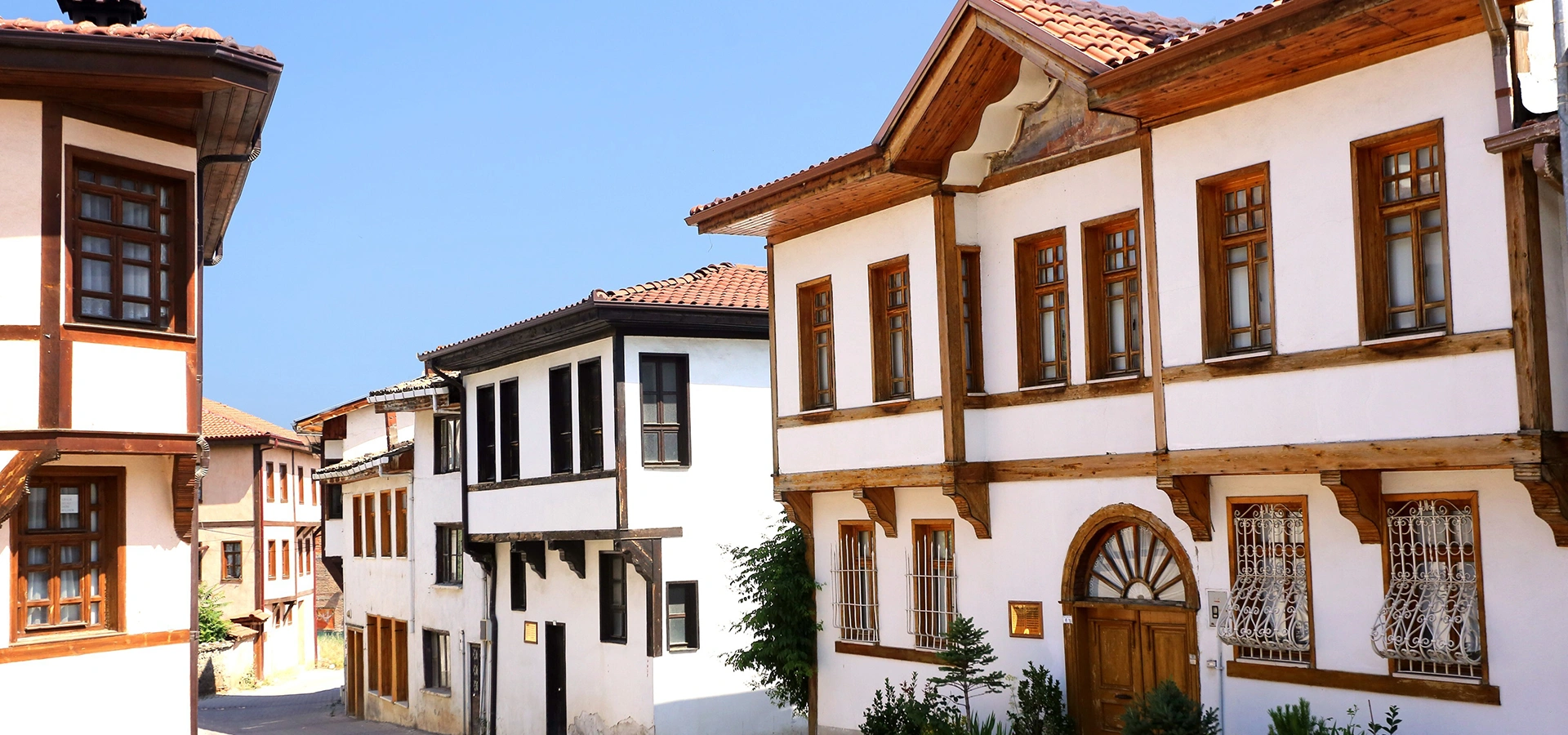
Return from the countryside and walk through old Lefke’s timber-framed houses, traditional streets and historic urban fabric.
Explore Historic Osmaneli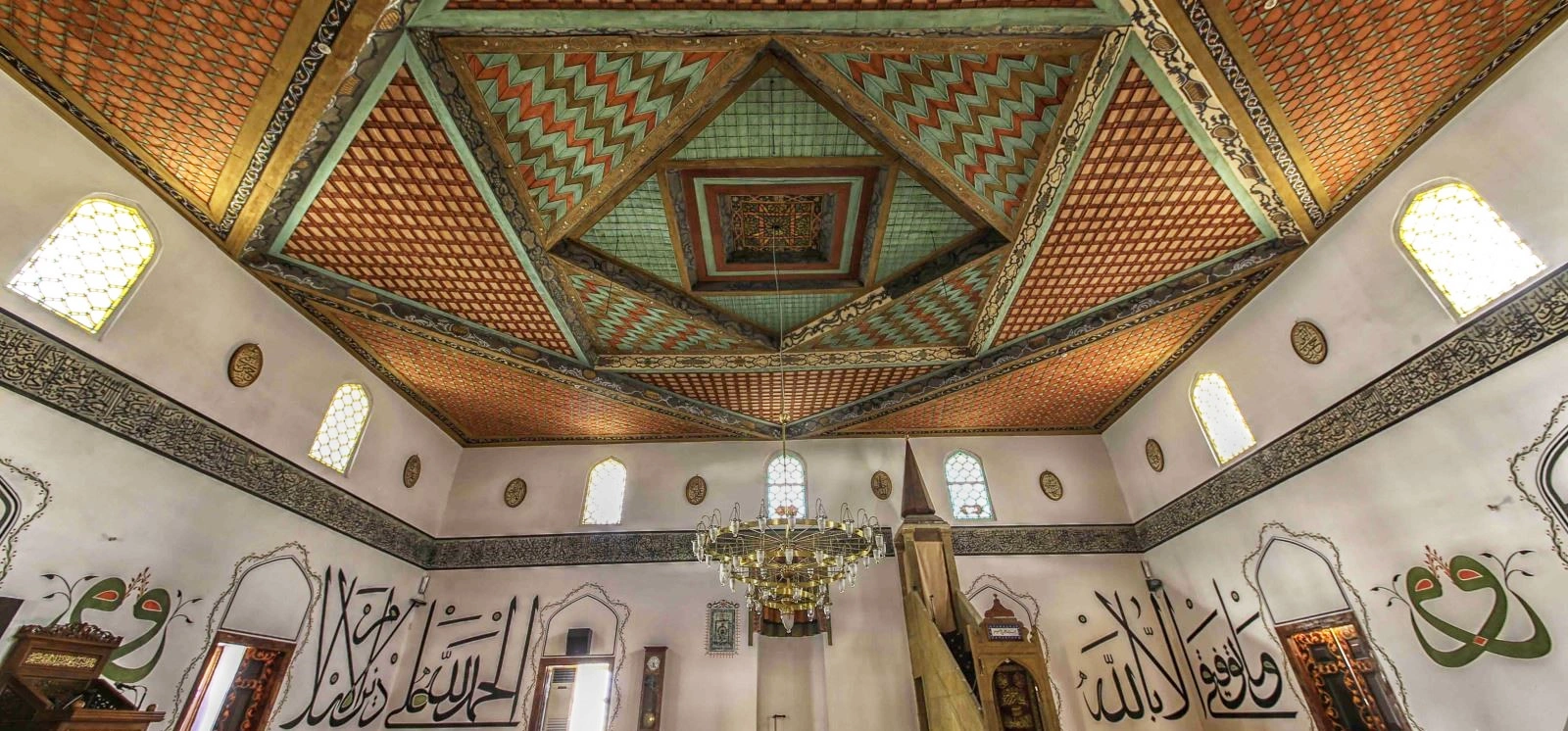
Discover Osmaneli’s historic Ulu Cami, its Lefke stone, calligraphy and extraordinary painted timber ceiling.
Explore Rüstem Pasha Mosque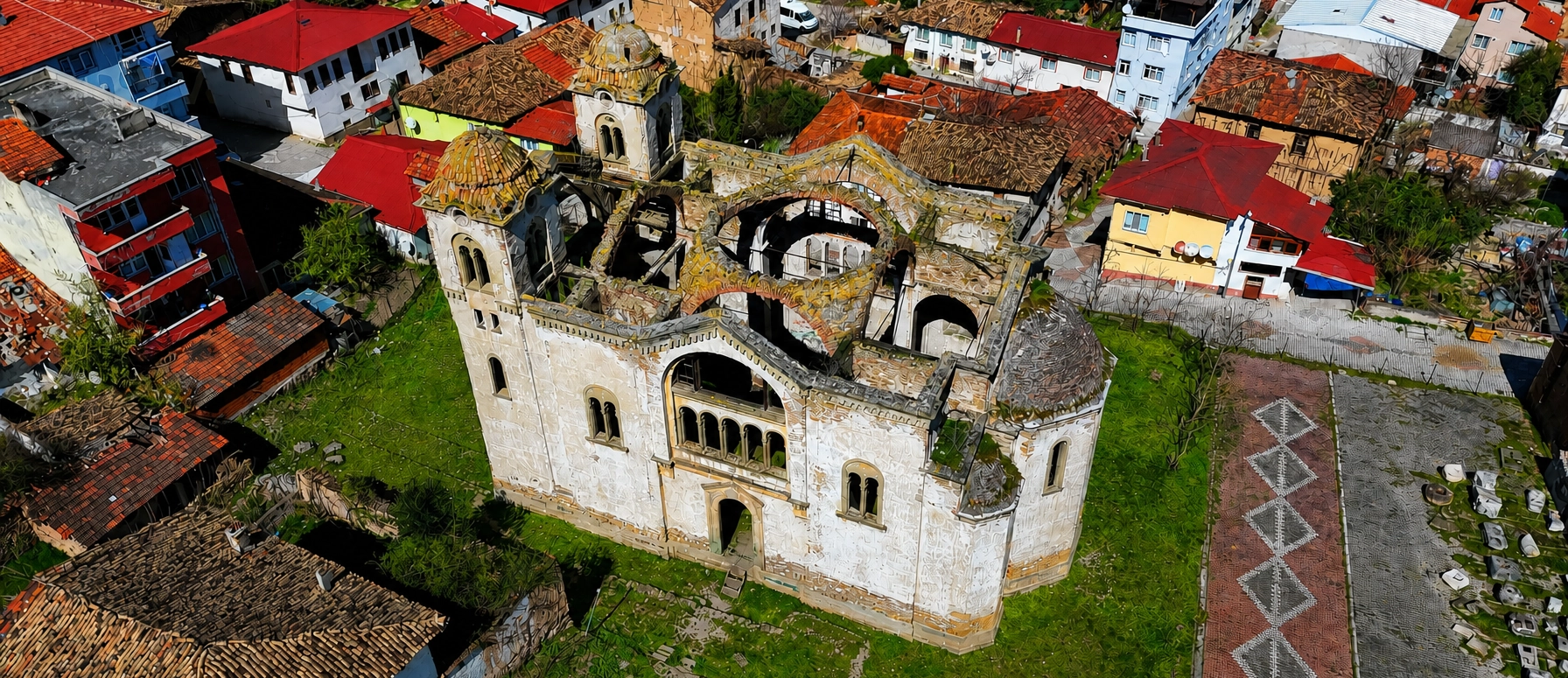
Add the surviving Orthodox church of Osmaneli to understand another layer of the town’s architectural history.
Explore Hagios Georgios Church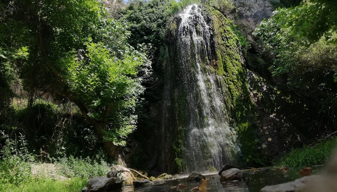
Continue your Bilecik nature journey with forest scenery, waterfall landscapes and another outdoor stop in the province.
Explore Kınık Waterfall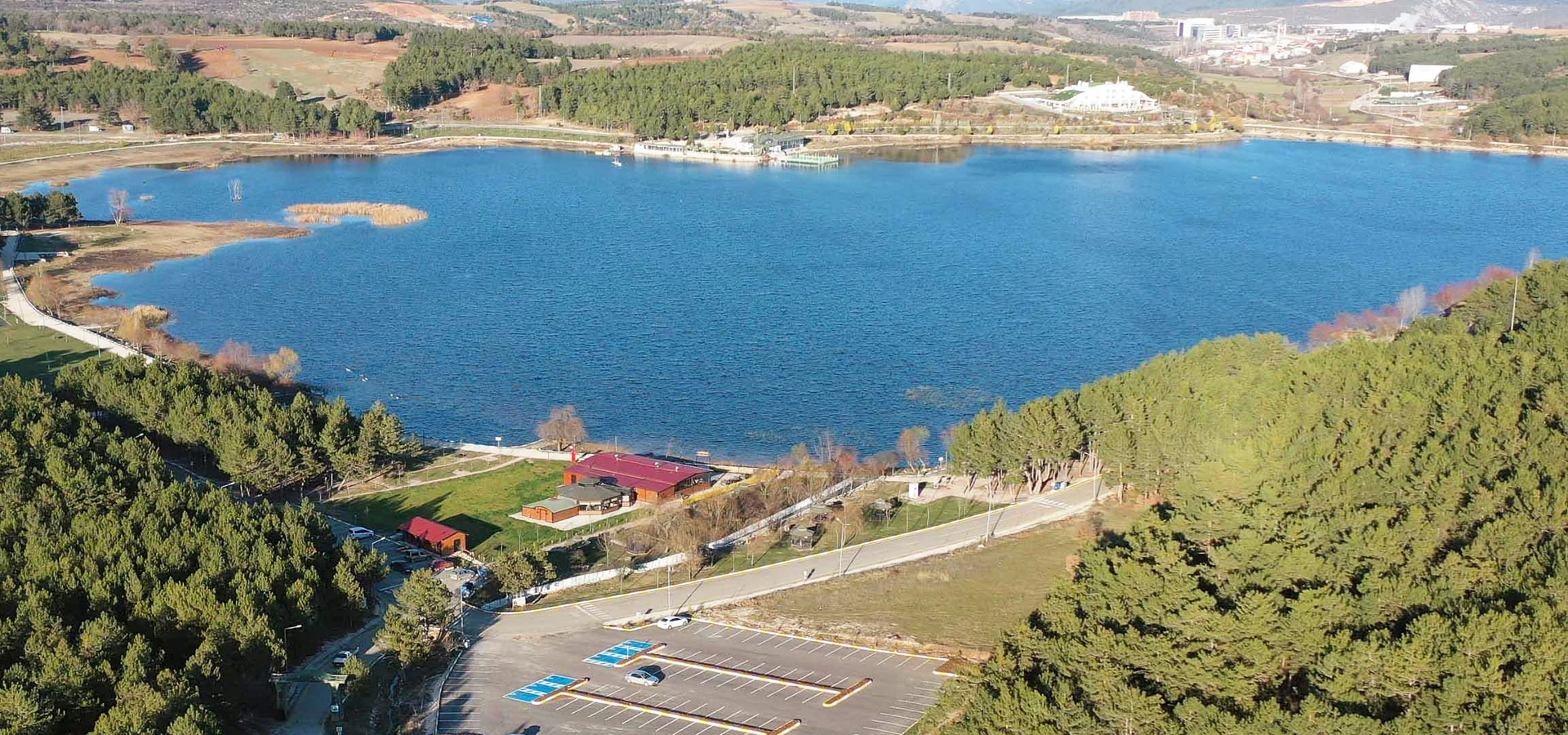
Add an easy waterside stop near Bilecik city for a gentler contrast to Osmaneli’s forest and rocky walking terrain.
Explore Pelitozu Pond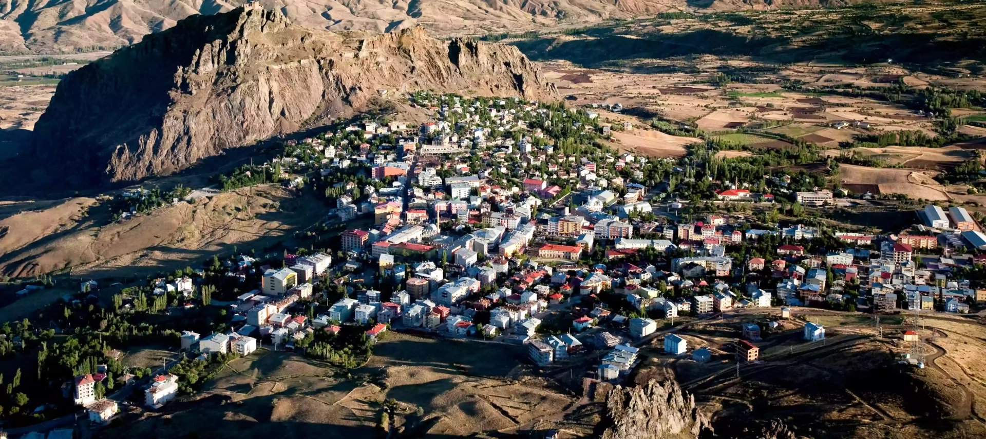
Experience rural Bilecik through village life, local landscapes and a slower countryside travel style.
Explore Kurşunlu