Private Kınık Waterfall & Countryside Experience
Ask us about a tailor-made Bilecik route combining Kınık Waterfall with nature, local culture and selected heritage sites.
Request a Custom Tour





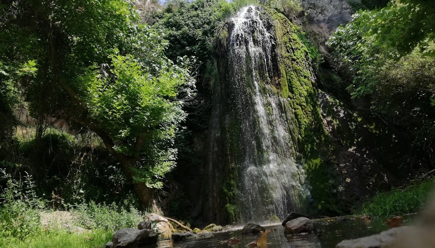
Kınık Waterfall Nature Park is a protected forest landscape in Kınık village, Bilecik Merkez district, Türkiye. Its defining feature is Kınık Waterfall, where water carried through the deeply cut terrain of Çoklum Stream reaches the northern part of the park and drops over a rocky face surrounded by dense vegetation.
The protected area covers 111.1 hectares and was declared a nature park on 4 June 2018. The Ministry of Agriculture and Forestry identifies the site's forest structure, topography, waterfall, clean air and distance from urban noise as the qualities that give it both conservation value and recreational potential.
This is not a manicured city park. Kınık Waterfall Nature Park is best understood as a natural forest-and-valley destination where the experience depends on terrain, weather and seasonal water flow. The official regional park page states that visitors reach the nature park from Kınık village by an unpaved road, and that walking and landscape viewing are the principal activities.
The waterfall is described by the regional nature-conservation authority as dropping from approximately 15 metres. Its setting is shaped by Çoklum Stream, Karşıyaka Hill and Börekbaşı Hill, with the stream passing through deep valleys and fissures before reaching the waterfall area. During exceptionally dry summers, parts of the stream can dry, so the appearance and strength of the waterfall can vary considerably through the year.
The ecosystem is overwhelmingly wooded. Official information describes approximately 98% of the park as forest ecosystem and 2% as aquatic ecosystem. Black pine, oak and juniper occur across the area, while stream corridors support species including hazel, fig, walnut, maple, plane and boxwood.
For a wider journey through the province, continue with our Bilecik visitor guide, Bilecik Museum, Sheikh Edebali Tomb and Küçükelmalı Nature Park.
A protected forest, valley and waterfall landscape in Bilecik Merkez district.
The park's central natural feature drops over a rock face in the northern part of the protected area.
Black pine, oak and juniper dominate a landscape shaped by woodland and stream corridors.
The official park authority lists nature walking and landscape viewing among the principal activities.
Essential information for planning a visit to this forested waterfall landscape near Bilecik.
Kınık village, Bilecik Merkez district, Bilecik Province, Türkiye.
Open on Google Maps111.1 hectares of predominantly forest ecosystem with stream valleys and a waterfall.
Designated as a nature park on 4 June 2018.
Official regional information describes a waterfall drop of approximately 15 metres.
Nature walking, landscape viewing and nature photography in a rugged forest setting.
The official park page states that access from Kınık village continues on an unpaved road.
Kınık offers a quieter nature experience built around forest, flowing water, steep valley forms and seasonal change.
Bilecik is widely associated with early Ottoman history, monuments and War of Independence landscapes, but the province also contains extensive forests, valleys and protected natural areas. Kınık Waterfall Nature Park is one of the clearest examples of this less familiar side of the destination.
Its appeal lies in the transition from village countryside to deeply wooded terrain. Rather than arriving at a heavily urbanized recreation complex, visitors move into a landscape where the waterfall, stream bed, slopes and forest remain the principal attractions.
The park is particularly rewarding for travelers interested in short nature walks, photography and scenic exploration. The waterfall provides the obvious focal point, but the wider setting matters just as much: the approach through the forest, the narrowing valley, the sound of running water and the changing vegetation all contribute to the experience.
Because Çoklum Stream can weaken or dry in very dry periods, the park also has a distinctly seasonal character. A spring visit after winter precipitation can look very different from a late-summer visit after prolonged dry weather.
Kınık is therefore best visited with realistic expectations. Come for the landscape and the walk rather than for extensive commercial facilities, and allow weather, road conditions and water flow to determine the pace of your day.
The main waterfall lies in the northern part of the nature park and forms the site's strongest visual landmark. According to the Ministry of Agriculture and Forestry's regional nature-conservation page, the water falls from roughly 15 metres.
The waterfall is connected with Çoklum Stream, which passes between the hills and through deeply cut valleys and rocky fissures before continuing toward the cascade. This relationship between moving water and steep terrain gives the park a more enclosed, dramatic character than Bilecik's pond-centered recreation areas.
The appearance of the cascade changes with water availability. Official information notes that Çoklum Stream can dry during very dry summer periods. For visitors hoping to see the waterfall at its strongest, this makes rainfall history and season more important than a fixed calendar date.
Around the cascade, moisture encourages a greener streamside environment. Plane, fig, hazel, walnut, maple and boxwood are among the plants recorded in watercourse areas, producing a visual contrast with the broader black pine, oak and juniper forest.
The official regional park description gives an approximate waterfall height of fifteen metres.
The stream moves through deep valley forms before reaching the waterfall in the north of the park.
Very dry summer conditions can reduce water dramatically, so waterfall strength varies through the year.
Moist corridors support plane, fig, hazel, walnut, maple and other vegetation.
The cascade is most photogenic where falling water, dark rock and dense foliage meet.
Expect wet rock, mud and slippery surfaces close to the waterfall, especially after rain.
Kınık Waterfall Nature Park is not defined by one flat recreation zone. Its character comes from the interaction of hills, wooded slopes, stream channels, ravines and the waterfall. The relief creates a compact but visually varied landscape.
Official park information identifies Karşıyaka Hill and Börekbaşı Hill within the protected area, with Çoklum Stream running through the terrain between them. The stream's route through narrow valleys and fractures helps explain the secluded position of the waterfall.
The park is entirely within the state forest regime. Its dominant ecological character is therefore woodland rather than open meadow or developed picnic landscape. Agricultural land lies beyond parts of the protected area, creating a transition between village countryside and denser forest.
For visitors, this topography means that seemingly short distances can require more time than expected. Uneven ground, slopes, mud and fallen leaves can all slow walking, especially after rain or during colder months.
One of the named topographic features shaping the park's northern and central terrain.
Another major hill within the protected area, helping form the valley system around Çoklum Stream.
The stream follows broken terrain and narrow valley forms before reaching the waterfall.
The entire protected area lies within state forest land managed under nature-park status.
Official information identifies one entrance to the nature park from its northern side.
The park sits beyond Kınık village in a quiet landscape away from city noise and dense development.
Official ecological information describes Kınık Waterfall Nature Park as approximately 98% forest ecosystem and 2% aquatic ecosystem. That ratio explains the park's strong woodland identity and the importance of shaded stream corridors.
Across the broader forest, black pine, oak and juniper are among the species specifically recorded by the nature-conservation authority. These trees give the landscape a mixture of evergreen structure and seasonal deciduous change.
Vegetation becomes more varied around watercourses. Species recorded in stream corridors include hazel, sandal, fig, walnut, maple, plane and boxwood. The difference between drier slopes and moist streamside vegetation is one of the most interesting details for attentive walkers.
The forest also changes strongly through the seasons. Spring emphasizes fresh leaves and stronger water flow; summer brings deeper shade but potentially weaker streams; autumn adds warm woodland tones; and winter can expose the structure of the valley and rock more clearly.
A major forest species contributing to the park's year-round green structure.
Deciduous oak adds seasonal color and leaf litter to the woodland floor.
Juniper contributes to the drier woodland and slope vegetation recorded in the protected area.
Plane trees are associated with wetter stream corridors and help create a greener waterside atmosphere.
Both are among the species recorded in the park's stream environments.
These species add further variety to the vegetation around moist valley bottoms.
The official regional park page keeps the activity list simple: nature walking and landscape viewing. That is a useful description of what Kınık does best. The park rewards visitors who are comfortable moving slowly through a natural setting rather than expecting a long menu of built attractions.
Follow the approach through the forest and valley landscape toward the park's main natural feature.
Look across forested slopes, ravines and the waterfall zone from safe natural viewpoints.
Photograph moving water, rock textures, woodland, stream vegetation and changing seasonal light.
Notice how tree species and moisture levels change between ridges, slopes and stream corridors.
The park's distance from urban noise makes it suitable for a slower, low-impact outdoor visit.
Return in different seasons to see how stream flow, foliage and ground conditions transform the same landscape.
Nature walking is one of the park's officially listed activities, but visitors should distinguish natural walking terrain from a fully engineered urban promenade. Conditions can include dirt, leaves, loose stones, mud, roots and changes in elevation.
Approach the waterfall at a comfortable pace and avoid rushing on wet surfaces. The combination of shaded forest, moving water and rocky ground can make some sections slippery even when the weather feels dry elsewhere.
After rainfall, mud and runoff can make the approach more difficult. In winter, snow or ice can affect both the access road and walking surfaces. During hot, dry periods, heat and reduced water flow can change the experience in the opposite direction.
Wear shoes with reliable grip, carry drinking water and keep both hands free when moving over uneven ground. A light rain layer and insect protection can also be useful in warmer months.
Choose walking shoes with grip rather than smooth-soled city footwear.
Expect mud, damp leaves, runoff and more slippery rock near the waterfall.
Do not assume that drinking water or commercial services will be available on site.
Wet rocks and steep natural terrain require conservative route choices.
Short distances can take longer when the ground is muddy or uneven.
Daylight makes both the natural trail and the rural access road easier to manage.
One of the most important facts for trip planning is that Kınık Waterfall is not visually identical throughout the year. The official park description notes that Çoklum Stream can dry during very dry summer periods.
This means water flow should be treated as a natural, weather-dependent condition rather than a guaranteed fixed spectacle. Recent rainfall, winter precipitation, prolonged summer heat and drought can all influence what you see.
For stronger water and greener vegetation, spring is generally the most promising period. Late winter into spring can also make the ground wetter and more difficult, so better waterfall conditions may come with more demanding walking conditions.
By late summer, especially after a dry season, the cascade may be much weaker. Autumn rain can restore flow, while winter conditions may add cold, ice or snow to the access challenge.
Kınık offers a compact set of strong photographic subjects: falling water, mossy or wet rock, deep green foliage, stream corridors, forest roads and layered valley slopes. The best images often combine the waterfall with enough surrounding vegetation to show its hidden forest setting.
Cloudy weather can be excellent for waterfall photography because softer light reduces harsh contrast between bright water and shaded forest. After rain, leaves and rock surfaces may appear richer, although walking conditions will be more slippery.
If you use a tripod, place it where it does not block other visitors or damage vegetation. Never climb onto wet rock simply to find a more dramatic angle. The safest viewpoint is always more valuable than a risky photograph.
Spring offers fuller water and fresh foliage, while autumn can add warmer woodland tones. In drier periods, concentrate on the wider forest and valley landscape rather than expecting the waterfall alone to carry every composition.
Use a vertical composition to emphasize the height of the cascade and surrounding forest.
Step back where safe to include the valley, trees and rock around the falling water.
Soft cloud cover can help preserve detail in both white water and dark woodland.
Look for leaves, bark, stream plants, wet stone and small natural textures along the approach.
Higher seasonal water can create the strongest waterfall images, weather permitting.
Do not stand on slippery edges or enter unstable terrain for a camera angle.
Visitors should not approach Kınık with the same expectations as a heavily developed recreation park. The official regional page states that there is currently no concessionaire and does not publish a detailed list of food, restaurant or commercial visitor services.
For practical planning, it is therefore wise to bring the essentials you need for a short nature visit: drinking water, suitable footwear, weather protection and a charged phone. Do not make your visit dependent on finding a café, shop or staffed service point at the waterfall.
Infrastructure and operating arrangements can change as management plans are implemented. The park's development plan was approved in 2019 and architectural / current-condition projects were approved in 2020, but visitors should confirm what is actually operating rather than assuming every planned element is available.
The official regional park page states that no concessionaire is present.
Carry sufficient water rather than relying on a commercial outlet at the site.
A small packed snack can be useful, but remove all packaging and food waste.
Expect dirt and forest terrain rather than uniformly paved visitor routes.
Ask the Bilecik branch office about current access, works or restrictions.
Carry out everything you bring if waste facilities are not available where you stop.
Camping information for Kınık requires more caution than many online guides suggest. Recent protected-area data are reported as listing tented camping among the site's recreational values, but the official regional visitor page does not provide a current campsite layout, operating schedule or detailed overnight-use instructions.
For that reason, do not interpret a general recreation classification as permission to pitch a tent anywhere in the forest. Protected areas in Türkiye can apply designated-zone, fire-season, fee and temporary-closure rules.
If you specifically want to camp, contact the Bilecik Nature Conservation and National Parks office before departure and ask whether overnight use is currently open, where camping is permitted and whether any booking or fee applies.
The Ministry's regional visitor page does not publish a fixed daily opening-hours table for Kınık Waterfall Nature Park. For practical safety, plan your visit during daylight and verify current access if weather, forest-fire restrictions or maintenance could affect the route.
The same page states that the park is reached from Kınık village by an unpaved road. Road condition can vary after heavy rain, snow, forestry activity or seasonal wear, so a route that is straightforward in dry weather may be more demanding at another time.
Published distances are approximately 27 km from Bilecik, 26 km from Yenişehir and 80 km from Bursa. These figures are useful for orientation, but actual driving distance and time will depend on your exact starting point and the road selected by your navigation app.
For most visitors, spring is the strongest all-round season because the forest is fresh and water flow is generally more promising after winter precipitation. The trade-off is wetter ground and a greater chance of mud.
Early summer can still provide green woodland and comfortable shade, but water levels may begin to decline as the season becomes hotter and drier.
Late summer requires the most realistic expectations. Official information specifically notes that Çoklum Stream can dry in very dry summer periods, so the waterfall may be reduced considerably.
Autumn can be excellent for woodland photography, particularly after seasonal rain returns. Fallen leaves, however, may hide uneven ground and become slippery when wet.
Winter brings a quieter landscape but also the greatest possibility of difficult road and trail conditions. Snow, ice and short daylight hours should all be considered before setting out.
Best chance of stronger water, fresh greenery and cool walking temperatures.
Good forest shade and greenery, with water conditions depending on rainfall.
Potentially much lower water flow during dry years; check conditions first.
Good for woodland color, especially after rain, but expect slippery leaf-covered ground.
Atmospheric but potentially difficult because of snow, ice, mud and shorter daylight.
A sensible time for cooler temperatures, softer light and a comfortable daylight margin.
The most important hazards at Kınık are typical of a natural waterfall environment: slippery rock, uneven trails, mud, steep slopes and changing weather. The official regional page also places responsibility on visitors for conditions encountered during access and use of the area.
Stay on obvious routes, avoid unstable edges and never climb wet rock around the cascade. Children should be closely supervised near water, slopes and any exposed ground.
Because the final approach is rural and partly unpaved, tell someone your plan if travelling alone and avoid beginning a walk late in the day. Keep enough phone battery for navigation and emergencies, but do not rely on mobile coverage as your only safety measure.
Assume rock near the waterfall is slippery even when it looks stable.
Roots, stones, mud and leaf litter can make footing unpredictable.
Heavy rain can change both road and trail conditions quickly.
Keep children close around water, slopes and rocky sections.
Plan enough time to return to your vehicle before dark.
Call 112 for emergency assistance in Türkiye.
Kınık should be considered a natural and potentially uneven landscape rather than a fully step-free visitor attraction. The official access description includes an unpaved road, and the waterfall setting involves forest and valley terrain.
Visitors with limited mobility should contact the park authority before travelling and ask specifically about vehicle approach, parking position, path surface, gradient and how close a vehicle can reach to the waterfall route.
Conditions after rain or snow can change accessibility substantially. Even a route manageable in dry weather may become muddy, soft or slippery after poor weather.
Kınık Waterfall Nature Park lies within Kınık village in Bilecik Merkez district. This is an important distinction because Bilecik also has another Kınık village in Pazaryeri district that is famous for pottery. The waterfall nature park is associated with the Merkez-district Kınık near the Yenişehir direction.
The official regional nature-park page gives distances of approximately 27 km from Bilecik, 26 km from Yenişehir and 80 km from Bursa. From Kınık village, the final approach continues on an unpaved road.
For independent visitors, a private vehicle is the most practical option. Before leaving paved roads, check fuel, weather and the route shown by your navigation app. After prolonged rain or winter weather, ask locally about the condition of the final road.
Search your navigation app for “Kınık Şelalesi Tabiat Parkı, Bilecik” and verify that the destination is in Bilecik Merkez district rather than the Kınık village near Pazaryeri.
Approximately 27 km according to the official regional park information.
Approximately 26 km, making the park relevant to travelers approaching from the Bursa side.
Approximately 80 km according to the official park description.
Access from Kınık village continues on an unpaved road.
The simplest option for reaching this rural protected area.
Use the Kınık in Bilecik Merkez district, not the pottery village in Pazaryeri.
There is no single fixed visit duration because the final road and walking conditions can affect how quickly you move. For most first-time visitors, 1.5 to 3 hours on site is a sensible planning range for a relaxed approach, waterfall viewing, photography and return.
Only for a very brief visit when access and ground conditions are straightforward.
A comfortable minimum for the waterfall, short nature walking and photographs.
Better for slow walking, photography and time to observe the forest and stream landscape.
Useful if you want a very relaxed nature visit and are combining several walking sections.
Allow extra time for the rural approach and slower travel on the unpaved final road.
Leave enough daylight for both your return walk and the rural drive out.
Begin by reaching Kınık village in Bilecik Merkez district and confirming the correct road toward the nature park. If recent weather has been poor, local advice on the road condition can be valuable before continuing.
Drive the final unpaved section conservatively and park only where you can do so without blocking the road, forest access or other vehicles. Take your water and essential items with you before beginning the walk.
Follow the natural approach toward the waterfall, using the forest and stream corridor as part of the experience rather than rushing straight to the cascade. Watch how vegetation becomes denser and more moisture-loving near the watercourse.
At the waterfall, stay on safe ground and allow time simply to observe the water, rock and surrounding trees. Photograph from stable positions rather than climbing closer to the falling water.
On the return, look back across the valley and forest rather than following exactly the same visual rhythm. Aim to reach your vehicle with a comfortable daylight margin, particularly outside summer.
Kınık Waterfall works especially well as a nature-focused stop in a broader Bilecik itinerary. For province-wide planning, see our complete Bilecik visitor guide.
Explore archaeology, ethnography and the history of a building that once served as courthouse and prison.
Visit one of Bilecik's most important places connected with the spiritual and political world of the early Ottomans.
Compare Kınık's rugged waterfall landscape with a more developed pond-and-forest nature park in Pazaryeri.
Add one of Bilecik's most significant Turkish War of Independence memorial landscapes to your road trip.
Continue to Söğüt for one of the most symbolic stops in the Ottoman foundation story.
Explore local archaeology, ethnography and Yörük culture in historic Söğüt.
It is located in Kınık village, Bilecik Merkez district, Bilecik Province, Türkiye.
No. The pottery-famous Kınık is in Pazaryeri district. Kınık Waterfall Nature Park is associated with a different Kınık village in Bilecik Merkez district.
The protected area covers 111.1 hectares.
It was designated as a nature park on 4 June 2018.
The official regional nature-park page describes the waterfall as dropping from approximately 15 metres.
Çoklum Stream passes through deep valleys and fissures before reaching the waterfall in the northern part of the park.
Not necessarily. Official information notes that Çoklum Stream can dry during very dry summer periods, so waterfall flow is seasonal.
Spring is generally the most promising period after winter precipitation, although exact flow depends on recent weather.
Official information describes approximately 98% forest ecosystem and 2% aquatic ecosystem.
Black pine, oak and juniper are recorded in the broader forest, while stream corridors include hazel, fig, walnut, maple, plane and boxwood.
Yes. Nature walking is specifically listed by the official regional park authority as an activity.
Conditions vary. Expect natural forest terrain, uneven ground, mud, wet rock and slopes rather than a completely paved urban path.
The official regional page states that the nature park is reached from Kınık village by an unpaved road.
The official park information gives a distance of approximately 27 km from Bilecik.
It is listed at approximately 26 km from Yenişehir.
The official regional page gives an approximate distance of 80 km from Bursa.
Do not assume direct vehicle access to the cascade itself. The final approach is rural and unpaved, and walking is part of the visit. Follow current signs and local instructions.
The official regional park page states that no concessionaire is present. Bring your own water and do not rely on finding commercial food service at the site.
The official regional visitor page does not publish a fixed daily hours table. Visit in daylight and check current access before travelling.
Protected-area tariffs and local operating arrangements can change. Confirm any current entrance or vehicle fee with the Bilecik DKMP office before travelling.
Recent protected-area data are reported as including tented camping among recreational values, but current zones and operating rules should be confirmed directly before planning an overnight stay.
A simple packed break may be possible where current park rules permit, but do not assume built picnic infrastructure. Protect the forest, follow fire restrictions and remove all waste.
Never assume open fire is permitted. Forest-fire restrictions can change seasonally and may prohibit fire completely. Follow current official notices.
Families can enjoy the nature setting, but children need close supervision because of water, slippery rock, uneven ground and slopes.
The site should be treated as a rugged natural destination. Visitors needing step-free access should contact the park authority for current road, parking and path information.
Wear walking shoes with good grip and clothing suitable for forest conditions. A light rain layer can be useful outside the driest months.
Bring drinking water, a charged phone, suitable footwear, sun or rain protection and any small snack you need. Do not rely on commercial services.
Yes. The combination of falling water, rock, forest and streamside vegetation makes Kınık especially attractive for nature photography.
For most visitors, allow around 1.5–3 hours on site, plus driving time. Poor ground conditions may increase the time required.
You can consider it, but heavy rain may improve waterfall flow while simultaneously making the unpaved road and walking terrain muddier and more slippery. Check conditions first.
Yes in suitable conditions, but snow, ice, mud and short daylight can make both the road and walking route more difficult.
The official regional page lists 0 (228) 212 16 33 for the Bilecik branch office.
It combines a roughly 15-metre waterfall, forested hills, stream valleys and a quiet rural setting in one of Bilecik's less-developed protected landscapes.
Carry out all packaging, food waste and other rubbish if suitable disposal is not available.
Never light fires unless explicitly permitted in a designated place under current rules.
Avoid widening paths or damaging streamside vegetation to create shortcuts.
Do not throw food, plastic, soap or any other waste into the stream or waterfall pool.
Leave flowers, branches and streamside vegetation where they belong.
A quieter visit protects the natural atmosphere and reduces disturbance to wildlife.
Do not create new routes on steep ground simply to reach a closer waterfall angle.
Do not block tracks, gates or routes used for forest management and emergency access.
Only camp if current park rules explicitly allow it and use designated areas where required.
Avoid trampling mossy or delicate streamside surfaces unnecessarily.
Keep children close around water, slippery surfaces and steeper terrain.
On-site instructions and temporary official restrictions take priority over older travel information.
Combine Kınık Waterfall with Bilecik's Ottoman heritage, museums and protected landscapes through a private itinerary designed around your interests and travel pace.
Build a flexible day around nature walking, waterfall photography, local landscapes and selected historic sites.
Ask us about a tailor-made Bilecik route combining Kınık Waterfall with nature, local culture and selected heritage sites.
Request a Custom Tour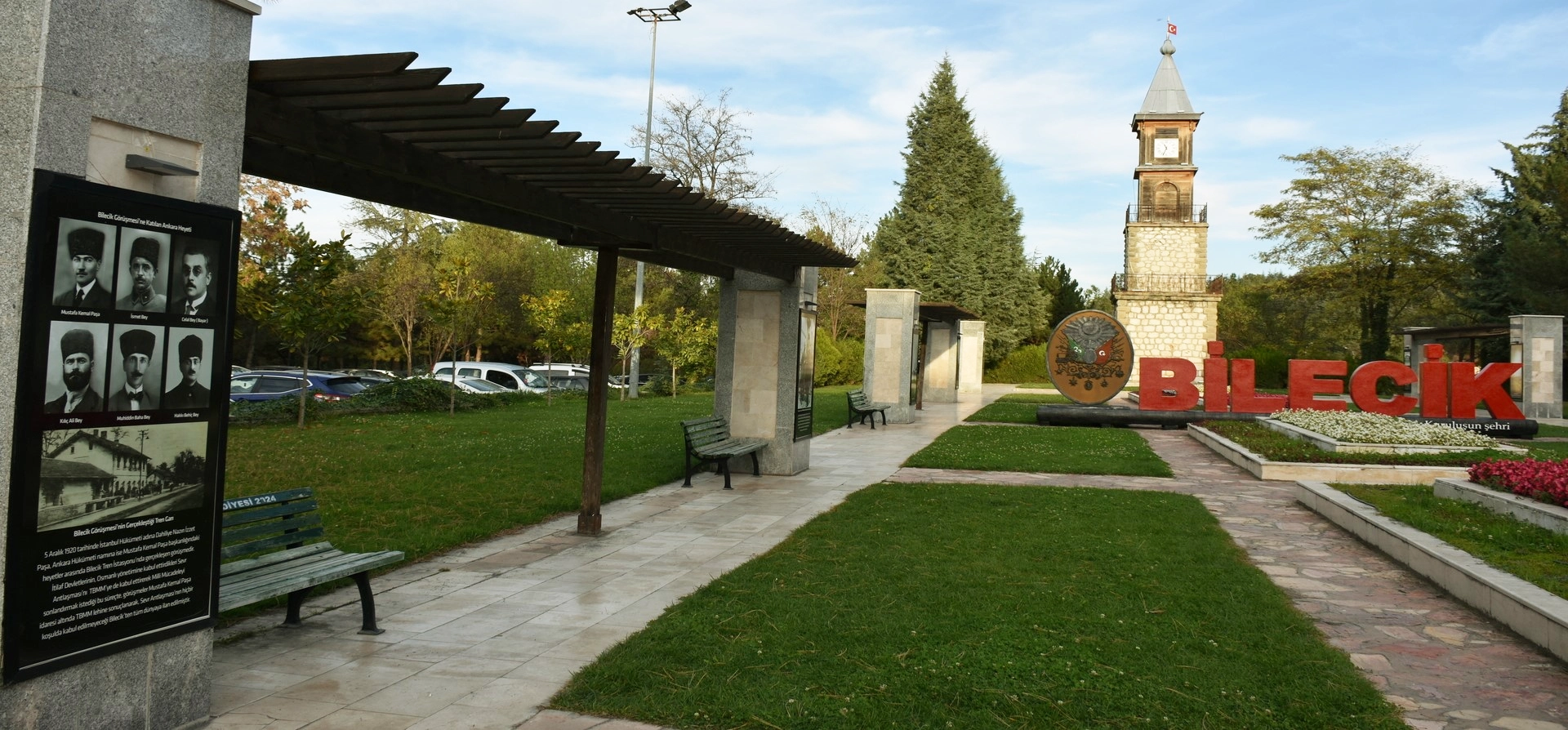
Discover early Ottoman heritage, traditional towns, museums, waterfalls, forests and nature parks across Bilecik Province.
View Bilecik GuideBalance a nature visit at Kınık Waterfall with museums, Ottoman heritage and memorial landscapes elsewhere in the province.
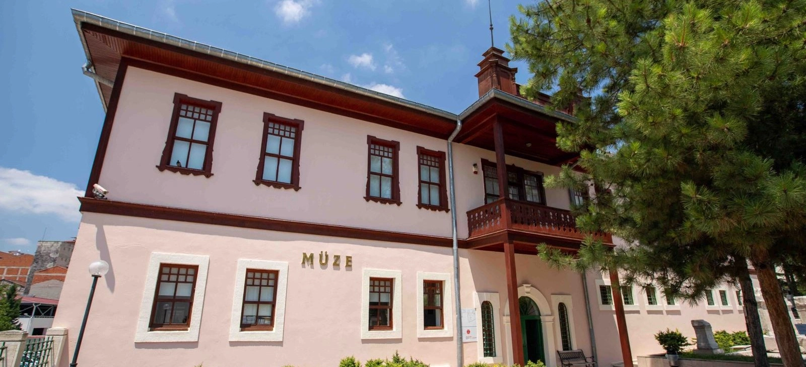
Explore archaeology, ethnography and the extraordinary history of a former courthouse and prison.
Explore Bilecik Museum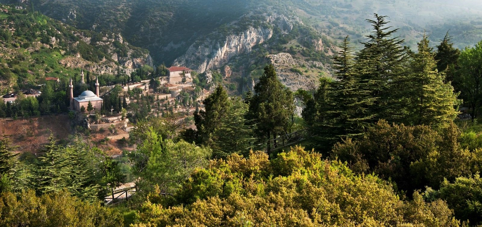
Discover one of Bilecik's most important spiritual landmarks connected with the birth of the Ottoman state.
Explore Sheikh Edebali Tomb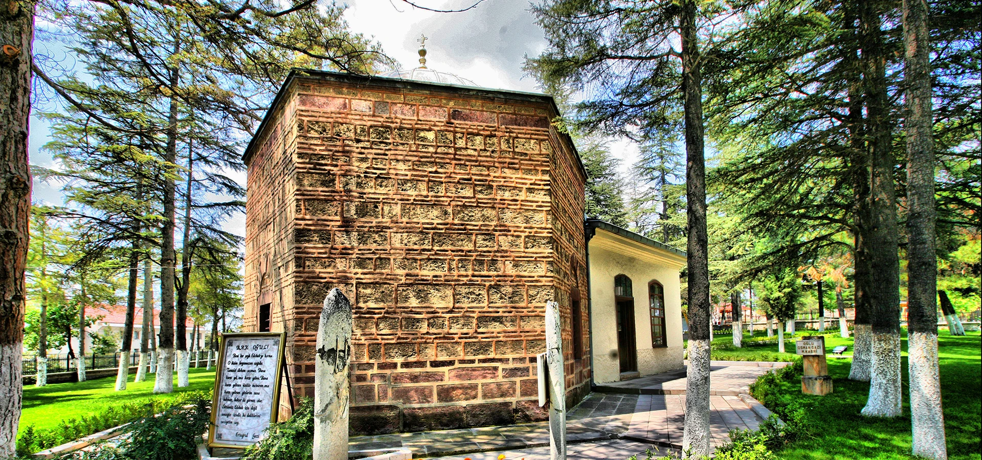
Continue to Söğüt and discover one of the most symbolic places in the Ottoman foundation story.
Explore Ertuğrul Gazi Tomb