Private İnhisar Nature Experience
Ask us about a tailor-made route combining İnhisar Waterfall, Sakarya Valley landscapes, Harmankaya Canyon surroundings and selected historical places in the district.
Request a Custom Tour





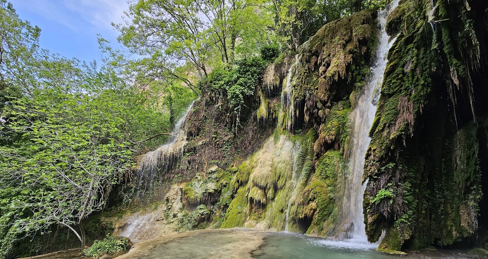
İnhisar Waterfall, also known as Çalkara Waterfall or İnhisar (Çalkara) Şelalesi, is a secluded natural waterfall in the İnhisar district of Bilecik Province, close to Çalkara. Rather than appearing beside the road, the waterfall is concealed in a valley and only becomes visible after visitors descend toward the valley floor.
The setting is one of the waterfall’s greatest attractions. Official tourism information places the cascade on the slopes of the Sündiken Mountains at approximately 520 metres above sea level. Water falls from roughly 8 metres, surrounded by vegetation, mossy rock and a distinctly sheltered valley atmosphere.
The journey is part of the experience. From İnhisar, travelers continue south toward Çalkara and then leave the vehicle before the final approach. The commonly described route involves a steep path of roughly 300 metres, so this is not a simple roadside viewpoint and visitors should come prepared for uneven natural terrain.
The waterfall is also connected to the wider drainage of the Sakarya Valley. After the main drop, the water continues through a sequence of smaller cascades before eventually joining the Sakarya River system. Fruit trees and dense vegetation on the valley slopes add another layer of character to the landscape.
For travelers exploring the province, İnhisar Waterfall fits naturally into a route through Bilecik’s valleys, waterfalls, canyons and Ottoman heritage. It can also be combined with Harmankaya Canyon and historical places around Harmanköy and İnhisar.
The main waterfall drops from approximately eight metres.
Official tourism information places the waterfall at about 520 metres elevation.
The waterfall lies roughly nine kilometres from İnhisar near Çalkara.
The cascade remains concealed until visitors descend toward the valley floor.
Essential information for planning a visit to this secluded waterfall near Çalkara in Bilecik.
Near Çalkara, İnhisar district, Bilecik Province.
Open on Google MapsApproximately 8–9 km by the commonly described approach toward Çalkara.
Approximately 520 metres above sea level.
Approximately 8 metres.
A steep natural path of roughly 300 metres is commonly described.
A shaded valley with rock, dense vegetation, fruit trees and flowing water.
Nature photography, short hiking, waterfall scenery and quiet outdoor visits.
Steep, uneven and potentially slippery natural ground.
Approx. 40.011528, 30.378739.
The flow continues through smaller cascades toward the Sakarya River system.
A waterfall hidden below the road, a green valley setting and a steep approach create a very different experience from developed roadside attractions.
The defining feature of İnhisar Waterfall is its hidden position within the valley. Visitors can hear the water from higher ground, yet the main cascade remains screened by the terrain and vegetation until the descent brings it into view.
This creates a strong sense of discovery. Instead of arriving directly at a viewpoint, travelers move from open mountain-road scenery into a cooler, more enclosed environment of rock walls, shade, foliage and flowing water.
The waterfall’s relatively modest height is only one part of the landscape. After the main drop, water continues through smaller cascades along the valley, giving the site the character of a natural watercourse rather than a single isolated fall.
İnhisar Waterfall is also important within the district’s broader nature-tourism identity. İnhisar sits within the Sakarya Valley landscape and is closely associated with Harmankaya Canyon, mountain slopes, caves, rural villages and historical sites.
İnhisar Waterfall lies in a sheltered valley environment on the slopes of the Sündiken Mountains. The surrounding terrain limits long-distance views and gives the site a more intimate character than open plateau or reservoir landscapes.
The main visual elements are falling water, dark rock, moss, hanging vegetation and dense greenery. Depending on season and recent rainfall, the surrounding plants can create a richly layered frame around the cascade.
One of the most distinctive features is that the waterfall cannot normally be appreciated from the road itself. The valley must be approached on foot, and the view changes considerably as visitors descend toward the water.
The terrain also explains why the waterfall retains a comparatively wild atmosphere. Natural slopes, loose material, exposed roots and wet rock remain part of the experience and should be treated with caution.
Official tourism descriptions place the principal fall at approximately 8 metres high. The water drops into the shaded valley below, where rock and vegetation create the classic appearance associated with İnhisar Waterfall photographs.
The watercourse does not end at the main drop. It continues downhill through a sequence of smaller natural cascades, gradually moving toward the wider Sakarya River drainage.
This layered structure means visitors should look beyond the most obvious waterfall view. Smaller channels, wet rock surfaces and vegetation along the watercourse can be just as photogenic as the main cascade.
Waterfall appearance can vary with rainfall, seasonal conditions and the wider hydrological cycle. A visit should therefore be planned for the landscape as a whole rather than expecting exactly the same water volume seen in a particular photograph.
Approximately eight metres according to official tourism information.
The water continues through a series of smaller falls below the main cascade.
Rock walls and vegetation create a cooler, enclosed atmosphere.
Water volume and vegetation can change with rainfall and season.
The waterfall is frequently described as being hidden among greenery, and this vegetation is a major part of its visual identity. Plants soften the rock walls, while shaded surfaces can support moss and moisture-loving growth close to the water.
Descriptions of the valley also note fruit trees on the slopes, reflecting the agricultural character of the wider Sakarya Valley around İnhisar. The district’s milder microclimatic conditions support productive orchards and cultivated landscapes in lower areas.
Visitors should avoid damaging branches, gathering plants or leaving the established line of the path unnecessarily. Steep slopes can be vulnerable to erosion, especially when the ground is wet.
Dense vegetation helps conceal the waterfall from higher ground.
Damp shaded surfaces add texture and colour around the cascade.
Fruit trees are noted on slopes around the waterfall valley.
Avoid creating shortcuts that can accelerate erosion on steep ground.
The final approach is one of the most important things to understand before visiting. Common route descriptions refer to a roughly 300-metre steep path leading from the roadside area toward the valley and waterfall.
Although the horizontal distance is not long, the gradient and natural ground can make the walk more demanding than the number alone suggests. Loose stones, dry soil, leaves, roots, mud and wet rock may all be present.
The return journey is uphill. Visitors should keep enough energy and daylight for the climb back to the vehicle and should not descend if conditions look unsafe.
Good walking or hiking shoes with grip are strongly preferable to smooth-soled urban footwear. A walking pole can also be useful for visitors comfortable using one on steep natural ground.
The final approach is short but noticeably steep.
Expect loose soil, rock, leaves, roots and uneven ground.
Remember that the route back to the road is uphill.
Wear shoes with strong grip, especially after rain.
İnhisar Waterfall is particularly suited to waterfall, forest and detail photography. The relatively enclosed valley means compositions tend to focus on the cascade and its immediate surroundings rather than broad panoramic views.
The main fall can be photographed together with mossy rock and surrounding vegetation. Smaller cascades, wet stone textures, leaves and tree roots also offer strong close-range subjects.
Overcast conditions can work very well at waterfalls because softer light reduces harsh contrast between bright water and dark valley walls. A tripod can be useful for longer exposures, but only where it can be positioned safely without obstructing the path.
Photographers should avoid stepping onto unstable edges or slick rock simply to improve an angle. The best photograph is never worth a fall on steep, wet ground.
Frame the eight-metre fall together with surrounding rock and foliage.
Cloudy conditions can be excellent for controlling contrast.
Look for moss, water channels, leaves and textured rock.
Do not climb wet rock or unstable slopes for a photograph.
The experience at İnhisar Waterfall changes with rainfall, vegetation and ground conditions. Because access involves a steep natural path, the safest practical conditions may matter as much as the amount of water in the cascade.
Spring can bring fresh vegetation and stronger seasonal water flow, but wet soil and mud may also make the descent more slippery. Check recent weather before traveling.
Summer generally offers drier ground and easier outdoor planning. The shaded valley can feel pleasantly cooler than exposed roads and open slopes, although visitors should still carry sufficient drinking water.
Autumn brings changing foliage and softer light, creating attractive conditions for photography. Fallen leaves, however, can hide loose stones and make steep ground slippery.
Winter should be approached with particular caution. Rain, frost, snow or ice can turn the path into a much more difficult route and may make a descent inappropriate.
İnhisar Waterfall lies near Çalkara in the İnhisar district of Bilecik Province. Official and regional tourism sources generally place it at roughly 9 km from İnhisar district centre.
The waterfall is located at approximately 520 metres above sea level, with the commonly published coordinates 40°00'41.50"N, 30°22'43.46"E, equivalent to approximately 40.011528, 30.378739.
This should be treated as a natural outdoor destination rather than a fully developed visitor attraction. Do not assume that toilets, drinking-water points, staffed services, safety railings or a maintained paved trail will be available.
Bring water, suitable footwear, sun protection, a light layer and a charged phone. Because the waterfall is below road level in a valley, allow enough daylight for both descent and return.
For emergency assistance in Türkiye, call 112.
İnhisar Waterfall is a beautiful natural destination, but it should not be treated like a landscaped urban park. The final approach involves steep, uneven terrain, and the environment around moving water can be slippery throughout the year.
Use footwear with reliable grip for loose and wet ground.
The path is steep enough to require careful footing in both directions.
Moss-covered and water-polished stone can be extremely slippery.
Heavy rain can change path and water conditions quickly.
Young visitors need close supervision on slopes and near the water.
Avoid scrambling on wet cliff faces or attempting to stand beneath unstable rock.
Allow enough time for the uphill walk back to the road.
Call 112 for emergency assistance in Türkiye.
İnhisar Waterfall has significant accessibility limitations because the main view requires a steep descent on natural ground.
Visitors should not assume the presence of paved paths, handrails, steps, ramps, wheelchair-accessible viewing platforms or accessible toilets. The commonly described route is not suitable for every traveler.
People with limited mobility, balance concerns, knee problems or difficulty on steep slopes should assess the route very carefully before attempting the descent.
Even visitors who remain near the road should park safely and avoid standing in traffic or forestry access routes.
From İnhisar district centre, travel south in the direction of Çalkara. Regional route descriptions indicate that the roadside approach is reached after approximately 7.8 km, while official tourism summaries generally describe the waterfall as about 9 km from İnhisar.
Near the final approach, visitors leave the vehicle and continue on foot. The waterfall itself remains hidden below the road and cannot simply be viewed from the parking point.
The commonly published walking description involves a steep path of roughly 300 metres toward the valley floor. Take your time and turn back if the surface is wet, unstable or uncomfortable for your group.
For navigation, save the coordinates 40.011528, 30.378739 before traveling. Mobile reception and map accuracy can vary in rural mountain areas, so offline navigation is useful.
Leave İnhisar heading south toward Çalkara.
Follow the rural approach for roughly 8–9 km.
Park safely without blocking the road or local access.
Continue on foot down the steep natural path toward the valley.
Use coordinates 40.011528, 30.378739 as a backup.
Avoid the descent when heavy rain, frost or unstable ground makes the path unsafe.
A quick visit should still allow at least 1–1.5 hours for parking, the careful descent, time beside the waterfall and the return climb.
A more relaxed 2-hour visit gives photographers and nature travelers time to explore safe viewpoints, observe the smaller cascades and enjoy the valley without rushing.
A half day works well if the waterfall is combined with a slow countryside drive, a picnic away from sensitive water-edge areas or another attraction within İnhisar district.
A full-day route can combine İnhisar Waterfall with Harmankaya Canyon, Harmanköy and selected historical places in the district, provided road and daylight conditions are suitable.
Descent, main waterfall view, photographs and return climb.
A slower visit with more photography and time beside the water.
Combine the waterfall with countryside scenery around İnhisar.
Build a wider İnhisar nature-and-heritage itinerary.
Begin in İnhisar and continue south toward Çalkara, enjoying the transition from the cultivated Sakarya Valley landscape toward the more enclosed mountain slopes.
At the roadside approach, park only where the vehicle is fully clear of traffic and local access. Before descending, check the ground, weather and remaining daylight.
Follow the established path carefully toward the valley. The sound of the water may be noticeable before the main waterfall becomes visible through the vegetation.
Once below, spend time at safe viewpoints rather than climbing wet rock. Photograph the main cascade, mossy surfaces, foliage and smaller downstream falls.
Return to the road with enough daylight for an unhurried uphill climb. If you are continuing through İnhisar, Harmankaya Canyon and Harmanköy provide a natural extension to the district’s outdoor and historical story.
The waterfall works especially well as part of an İnhisar nature-and-heritage route, combining secluded valley scenery with canyon landscapes, rural villages and early Ottoman history.
Explore the dramatic canyon between Yenipazar and İnhisar, known for high canyon walls and multiple waterfalls along its approximately three-kilometre canyon route.
Visit the village associated with the İnhisar end of Harmankaya Canyon and with the tomb of Abdullah Mihal Gazi.
Discover a site connected with Köse Mihal, an important figure in the early history of the Ottoman frontier and a close associate of Osman Gazi.
Add another natural feature of the district to a wider exploration of İnhisar’s mountain and valley landscape.
Continue through the province for Ottoman heritage, waterfalls, forests, ponds, villages and historic towns.
Compare İnhisar’s hidden valley cascade with another of Bilecik Province’s distinctive waterfall landscapes.
İnhisar’s geography creates a strong contrast between mountain terrain and the fertile Sakarya Valley. The district is known not only for natural attractions but also for agricultural landscapes supported by comparatively mild local conditions.
The waterfall sits within this broader environment of slopes, valleys, cultivated land and rural settlements. Its fruit trees and hidden watercourse connect the visitor experience directly to the landscape that shapes daily life in the district.
Nearby Harmankaya Canyon adds a more dramatic geological dimension. The canyon extends between Yenipazar and İnhisar and contains major waterfalls within a protected nature-park landscape.
Together, these places make İnhisar especially rewarding for travelers interested in destinations where nature, rural life and early Ottoman history overlap within a relatively compact area.
Carry out bottles, food packaging, tissues and every other item you bring in.
Do not throw food, chemicals, cigarette ends or rubbish into the stream.
Avoid creating shortcuts on erosion-prone slopes.
Do not cut branches, damage fruit trees or remove plants and moss.
Allow other visitors to experience the natural sound of the valley and waterfall.
Do not light fires or barbecues in vegetation unless explicitly permitted by current local rules.
Park without blocking farm, forestry, village or emergency routes.
Leave stones and natural surfaces in place rather than rearranging the valley floor.
It is near Çalkara in the İnhisar district of Bilecik Province, northwestern Türkiye.
It is called İnhisar Şelalesi and is also widely known as Çalkara Şelalesi.
Official tourism material places it at approximately 9 km from the district, while commonly published route descriptions give roughly 7.8 km to the roadside approach.
The main waterfall is described as dropping from approximately 8 metres.
The waterfall is located at approximately 520 metres above sea level.
The commonly published coordinates are approximately 40.011528, 30.378739.
No. The waterfall is hidden in the valley and normally becomes visible only after descending toward the valley floor.
Route descriptions commonly refer to a steep path of roughly 300 metres for the final approach. The gradient makes it more demanding than the short distance may suggest.
It can be challenging because the route is steep and natural. Loose soil, rock, roots, mud and wet surfaces may be present.
Shoes with strong grip are highly recommended because the descent and return climb can be slippery or uneven.
Only with close adult supervision and only when the child is comfortable on steep natural terrain. The route is not comparable to a flat city-park walk.
The main waterfall route should not be considered wheelchair accessible. A steep natural descent is required to reach the principal view.
Visitors should not assume that the waterfall is a designated or supervised swimming area. Natural pools, slippery rock and changing water conditions can present risks.
The official tourism sources used for this guide do not publish a standard museum-style admission fee for the natural waterfall area. Local arrangements can change.
The waterfall is a natural outdoor destination rather than a conventional ticketed attraction. Visitors should plan around daylight and safe conditions.
Do not assume full visitor facilities beside the waterfall. Bring water and basic supplies and arrive prepared for a rural natural setting.
Yes. The combination of falling water, mossy rock, greenery, shade and smaller cascades makes it an excellent nature-photography location.
Soft overcast light can work particularly well in the shaded valley, reducing harsh contrast around bright water and dark rock.
Spring through autumn can all be rewarding. The most important factor is that the steep path is dry and safe enough for your group.
Waterfall appearance and flow can vary with rainfall and seasonal conditions. Travelers should not expect identical water volume on every visit.
Allow at least 1–1.5 hours for a straightforward visit and longer if you want to photograph the valley without rushing.
Search for “İnhisar Şelalesi” or “Çalkara Şelalesi”, and save coordinates 40.011528, 30.378739 as a backup.
Consider combining the waterfall with Harmankaya Canyon Nature Park, Harmanköy, Abdullah Mihal Gazi Tomb and other natural or historical places around İnhisar.
It is particularly appealing for travelers who enjoy secluded waterfalls, natural walking routes, photography and less-developed countryside destinations.
Combine İnhisar Waterfall with canyon scenery, rural landscapes and selected historical attractions around Bilecik through a private itinerary designed around your interests and pace.
Enjoy a tailor-made day combining the hidden waterfall, Sakarya Valley scenery and selected nature and heritage stops around İnhisar.
Ask us about a tailor-made route combining İnhisar Waterfall, Sakarya Valley landscapes, Harmankaya Canyon surroundings and selected historical places in the district.
Request a Custom Tour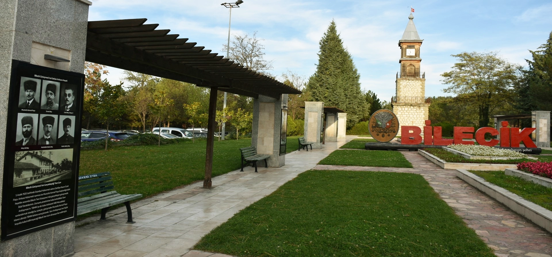
Discover Ottoman foundation history, waterfalls, canyons, forests, ponds, villages and historic towns throughout Bilecik Province.
View Bilecik GuidePair İnhisar’s hidden valley cascade with other natural landscapes across Bilecik Province.
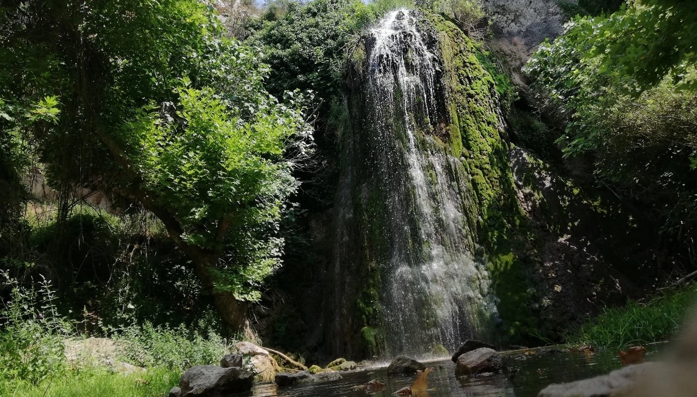
Explore another Bilecik waterfall landscape surrounded by vegetation, rock formations and peaceful countryside.
Explore Kınık Waterfall
Discover the dramatic canyon landscape between Yenipazar and İnhisar, with high walls, flowing water and protected nature scenery.
Explore Bilecik Nature
Continue exploring Ottoman heritage, museums, historic towns, forests, waterfalls and countryside across Bilecik Province.
Explore Bilecik