
Işıklı Lake, Çivril
Explore the freshwater scenery and seasonal landscapes near ancient Işıklı.
Discover Işıklı Lake





Beyond the world-famous terraces of Pamukkale, Denizli Province is full of quieter natural attractions. One of these is Gümüşsu Waterfall, also known as Homa Waterfall (Homa Şelalesi), on the northern edge of Gümüşsu neighbourhood in the Çivril district. Surrounded by leafy vegetation and a landscape shaped by freshwater springs, this roughly 30-metre waterfall offers a very different side of the region.
The main attraction is the movement of water down a steep, green-sided rock face. Official heritage descriptions emphasise its unusually cold freshwater and the waterfall's position near the former settlement known as Homa. The area has also been landscaped for recreation, creating places where visitors may be able to enjoy the scenery, pause for photographs and spend some time outdoors.
Gümüşsu is especially interesting when combined with nearby Işıklı Lake, the ancient landscape of Eumeneia, or the wider Çivril countryside. Unlike a major museum, however, the waterfall does not have a verified, consistently published ticket schedule or year-round facilities list, so practical details should be confirmed before your journey.
A spring-fed waterfall descending through a green rock landscape.
A traditional local name for the waterfall and settlement.
Approximately 30 km from Çivril district centre.
Pair the falls with Işıklı Lake and the region's ancient sites.
Names, location, natural features, access and practical planning for Homa Waterfall in Çivril.
Gümüşsu Mahallesi, Çivril, Denizli Province, Türkiye.
Approximately 30 metres in official tourism descriptions.
Homa Waterfall / Homa Şelalesi.
Approximately 30 km by the Çivril–Dinar corridor.
Spring water associated with the local Pınarbaşı source.
Tree-lined waterfall setting and rural recreation area.
Steep natural drops shaped by geological breaks.
Nature photography, relaxed stops and scenic sightseeing.
Picnic and landscaped areas documented; check access today.
Connections via Çivril are described; check schedules locally.
Do not assume the cascade or pools are suitable for swimming.
No consistently verified current tariff or operating schedule.
Gümüşsu is a refreshing contrast to the crowded monumental attractions for which Denizli is best known. Its appeal lies in moving water, a green setting and a peaceful rural atmosphere rather than a long checklist of buildings or activities.
Visitors can appreciate a natural waterfall, pause to enjoy the cooler air around the flowing water and photograph the different textures of moss, rock and cascading streams. The surrounding Çivril region makes a good choice for travellers curious about lesser-known corners of western Anatolia.
The waterfall is best treated as a scenic nature stop. It is not necessary to promise a full-day adventure, a swimming session or guaranteed access to a particular café to make a visit worthwhile.
Approximately 30 metres of spring-fed cascade.
A nature-focused change from major tourist centres.
Flowing water, rock textures and trees.
Good for travellers who enjoy unhurried stops.
Explore a lesser-known part of Denizli.
Combine with lakeside scenery or local heritage.
Gümüşsu Waterfall is in Gümüşsu Mahallesi, east of the district centre of Çivril in Denizli Province. The official Turkish Culture Portal places the waterfall immediately north of Gümüşsu settlement and describes access using the Çivril–Dinar road corridor.
Official regional tourism summaries place Gümüşsu approximately 30 kilometres from Çivril. The locality is inland, away from Pamukkale and Denizli city centre; it should not be mistaken for a waterfall inside the Pamukkale thermal complex.
When navigating, search for either “Gümüşsu Şelalesi” or “Homa Şelalesi” and check that the selected map result is in Çivril, Denizli, rather than relying only on an English-language name.
Denizli, Türkiye.
Çivril.
Gümüşsu / historically Homa.
North of the Gümüşsu settlement.
Çivril–Dinar corridor.
Confirm the place name and current entrance route.
Both names refer to the same waterfall. “Homa” is the traditional name associated with the settlement, while “Gümüşsu” is the name used for the present-day neighbourhood and in contemporary local tourism listings.
The national Culture Portal explains the name Gümüşsu by reference to the quality of the water found here. The Turkish words literally suggest “silver water,” an evocative name for the bright appearance of the cascade, although the official etymological explanation centres on water quality.
Visitors will encounter combinations such as Homa (Gümüşsu) Şelalesi on government and municipal websites. For international travel planning, “Gümüşsu Waterfall, Çivril” is especially useful.
Gümüşsu.
Homa.
Gümüşsu Şelalesi.
Homa Şelalesi.
Gümüşsu / Homa Waterfall.
This is not Güney Waterfall in Denizli.
According to the Denizli Provincial Directorate of Culture and Tourism, Homa Waterfall falls from a height of approximately 30 metres. Its white, flowing water contrasts with dark rock and green vegetation, creating the picturesque scene most closely associated with the place.
Rather than a broad sheet of water resembling a giant dam spillway, the waterfall’s appearance is influenced by the rock face, water volume and several levels of falling or flowing water. From some angles, visitors see separate streaks of water descending alongside each other.
The natural cascade should be distinguished from constructed ornamental cascades that appear in the later landscaped leisure complex. Both may feature in photographs, but they are not the same geographical feature.
Approximately 30 m.
Natural, steep water drop.
Rock, spray, shade and green vegetation.
Appearance varies with natural and managed flows.
Use designated or safely accessible viewing positions.
Natural falls are distinct from landscaping features.
Local geographical accounts associate the waterfall with water issuing from Pınarbaşı Spring. The spring-fed stream travels a relatively short distance before crossing abrupt changes in elevation and forming the falls.
An educational-site description from Türkiye’s Ministry of National Education refers to roughly 150 metres of flow from the source before the water reaches two breaks in slope. This is an explanation of the waterfall’s formation, not a marked 150-metre walking trail open to visitors.
The long-standing reputation of the spring water should not be read as a guarantee of modern drinking-water safety. Water quality and local supply arrangements can change; use designated drinking sources only when clearly approved.
Pınarbaşı Spring.
Traditionally described as cold and fresh.
About 150 m in an educational geography account.
Historically significant for nearby settlement.
Bring your own bottled or verified potable water.
Do not contaminate channels or springs.
The waterfall offers more than an attractive photograph. Geography-focused educational material describes it as connected with a tectono-karstic spring, whose emerging water flows across fault-related changes in slope. These abrupt changes create the waterfall’s characteristic drops.
The same material discusses drops of approximately 15 and 30 metres along geological breaks. This does not mean that a tourist can identify two separately accessible or named waterfalls; it describes a geomorphological interpretation of the cascade system.
The site is a useful example of how water, bedrock and tectonic movement influence landscapes in inland western Anatolia. Looking at it from established viewpoints is far safer than attempting to inspect the wet rock face itself.
Spring-fed stream crossing steep rock features.
Karstic groundwater emergence and tectonic structure.
Marked changes of slope.
Water follows the natural landform.
See the rock-and-water relationship from a distance.
Never climb wet ledges or the waterfall face.
One of Gümüşsu’s most welcoming qualities is the contrast between cool water and leafy greenery. The waterfall setting has been described in municipal and local accounts as a recreational area among trees, with seasonal changes influencing the way the site looks and feels.
Older descriptions mention trees such as plane trees, poplars and willows around the broader picnic setting. These are indicative of the local waterside environment, not a botanical inventory or a promise that every species will be visible at every viewpoint.
Observe plant life without breaking branches or leaving the designated areas. In a place where people live and water supports the local landscape, small choices about litter and noise make a real difference.
Waterfall, trees and village outskirts.
Plane, poplar and willow noted in descriptions.
Greenery and shade vary through the year.
Calm rural nature stop.
Observe from a respectful distance.
Carry away all rubbish.
Spring and early summer are attractive periods for waterfall sightseeing in the Çivril area. Local descriptions of the Pınarbaşı source report stronger flow around late spring and early summer, while autumn can bring lower levels.
Summer makes the shaded, watery landscape especially appealing, although the surrounding countryside can be warm. Autumn brings softer light and changing foliage, and winter may bring cold temperatures, wet surfaces and changes to on-site services.
Flow rates are not constant and there is no reliable daily waterfall-flow forecast in the sources used here. If the amount of water is critical for photography, check recent local information shortly before travelling.
Fresh colours and potentially stronger spring flow.
Popular for cool, shady scenery.
Warm weather; bring drinking water and sun protection.
Possible lower flow and seasonal foliage.
Cold and slippery conditions possible.
Verify recent conditions when flow matters.
The best time depends on the experience you want. Morning can be pleasant for a quiet nature stop, while a visit later in the day may give softer light on the surrounding vegetation, depending on the angle of the sun and tree cover.
Keep in mind that the waterfall lies in a shaded landscape where some sections may be dark even on sunny days. Photographers should be prepared for bright white water, deep green shadows and wet surfaces.
Because current visitor hours are not independently established, do not plan a pre-dawn or late-evening arrival on the assumption that gates or facilities will be open. A daytime visit is the most sensible starting point.
Good for a calm, comfortable visit.
Strong contrast between sunlight and shaded water.
Potentially gentler outdoor light.
Not recommended without verified access and lighting.
Protect camera equipment from spray.
Check any gate, lighting or facility hours.
The Turkish Culture Portal describes a road journey from Denizli via Kaklık and Çivril, continuing towards Işıklı and eastwards to Gümüşsu. It also describes a possible approach from Dinar via the Uşak road.
From Çivril, the locality is approximately 30 km away. Travellers starting in Denizli city or Pamukkale need a substantially longer journey, so this waterfall works better as an intentional regional excursion than a quick walk from a Pamukkale hotel.
With a private vehicle, search for the waterfall name and check the final turning and road condition locally. Leave time for finding legal parking and reaching the viewpoint rather than assuming the car can stop immediately beside the falls.
Around 30 km by road.
Travel toward Çivril using regional roads.
Plan as a separate Çivril-area outing.
Alternative road approach described officially.
Search Gümüşsu Şelalesi or Homa Şelalesi.
Check current road, parking and entrance arrangements.
The Türkiye Culture Portal describes a connection from Denizli bus station to Çivril, followed by local minibus transport toward Gümüşsu Mahallesi. This is useful as general route guidance, but it is not a current timetable.
If travelling without a car, check departure times, return services, the distance from the village stop to the waterfall and the availability of a local taxi. Rural public transport may be less frequent on weekends and holidays.
For travellers with a limited schedule, a pre-arranged transfer or private car may be more practical, especially when planning more than one stop in the Çivril region.
Denizli to Çivril.
Çivril to Gümüşsu when services operate.
Verify before travelling.
Confirm last minibus and taxi availability.
Private vehicle may save time.
Do not rely on old online schedules.
Denizli Metropolitan Municipality carried out a substantial landscaping project around Gümüşsu Waterfall in the late 2010s. Official project updates mention a restaurant building, tea house, prayer room, picnic spaces, children’s play areas, stone paths and ornamental cascades.
The municipality’s later activity reporting describes the landscape works as completed. These records confirm investment in the area, but they do not verify which businesses, toilets, picnic facilities or paths are operating today.
Bring essentials for a short nature outing and check whether services are available before relying on them for meals, accessible toilets or a special event. Keep any picnicking within permitted areas and follow fire restrictions.
Major landscape improvements in the late 2010s.
Picnic and leisure areas documented.
Restaurant and tea-house structures reported.
Play areas included in the historical project.
Must be confirmed locally.
Take water, suitable footwear and personal essentials.
Gümüşsu Waterfall is listed as a natural attraction on official culture and tourism websites, but the sources consulted for this guide do not establish a reliable, current entrance fee, opening-hours policy or parking tariff for the landscaped site.
Online travel directories may describe the area as open at all hours or list informal prices, but these claims are not a substitute for an up-to-date notice from the site operator or municipality. Facilities may have different hours from the surrounding outdoor landscape.
Before planning a late visit, a paid group outing or a photography session, contact the Çivril Municipality or other responsible local authority to check admission and access. Do not assume that an absence of a published fee automatically means entry is free.
No independently verified current tariff.
No verified site-wide schedule.
Check whether fees or restrictions apply.
Hours and operation unconfirmed.
Not advertised as a conventional museum site.
Current local or municipal confirmation.
A typical visit can focus on the waterfall viewpoint and the areas that are clearly open to the public. Municipal photographs document landscaped terraces, paved paths and bridges, but the exact condition and availability of individual routes can change.
Wear shoes with good grip. Rock near flowing water, damp steps and moss-covered edges can be deceptively slippery. Keep children close and use railings where provided.
This is not the place to improvise a scramble up the falls or down the stream. If a route is closed, eroded, flooded or beyond a barrier, choose a safe alternative.
Short sightseeing rather than technical trekking.
Potentially wet paths, steps and bridges.
Firm, non-slip footwear.
Supervise beside water and drops.
Use permitted established areas.
Steep banks and unmarked waterfall approaches.
The landscaped setting can make Gümüşsu appealing to families and mixed-age groups, particularly for those looking for a leisurely stop rather than a challenging hike. Published project photographs show paths, paved terraces and recreation features.
However, a photograph of a paved surface does not establish step-free access all the way to the best view. Slopes, stairs, wet bridges and maintenance conditions need to be checked before promising wheelchair or stroller suitability.
Anyone who needs accessible parking, a step-free approach or an adapted toilet should contact the facility operator or municipality in advance. With children, prioritise the safest available viewpoints over getting close to the water.
Good potential for a short supervised nature stop.
Route suitability not verified.
Step-free waterfall access not confirmed.
Plan a gentle pace and possible rest stops.
Check current availability.
Ask about accessibility before departure.
Official descriptions emphasise the cold freshwater of Homa Waterfall, but this is not the same as an officially designated swimming pool or safe bathing area. There is no reliable information in the consulted sources confirming lifeguards, tested swimming zones or supervised access to waterfall pools.
Cold temperatures, hidden rocks, slippery surfaces and changing flow create risks even in places that look calm in photographs. For this reason, we recommend visiting for scenery and photography rather than swimming.
Never jump from the rocks, enter the water directly beneath the falling cascade or allow children to paddle in potentially hazardous channels. Follow any warnings on site.
No verified official designated swimming area.
Traditionally described as very cold.
Slips, currents and hidden obstacles.
No confirmed supervised swimming service.
Enjoy the waterfall from secure viewpoints.
Keep children out of fast-flowing channels.
The most distinctive compositions include the natural fall, textured dark rock and green vegetation. Wider shots can place the cascade in its setting, while closer images of permitted sections can highlight the movement of water across individual stone levels.
To preserve detail in the white water, avoid overexposing the brightest areas. A longer exposure can create a silky appearance, while a faster shutter speed freezes droplets; both approaches can work if your camera or phone remains steady.
Choose safe surfaces for tripods and do not step into channels, block paths or cross safety barriers for a particular angle. If using a drone, check current aviation rules and any restrictions around the site or surrounding property.
Natural 30-metre waterfall with green framing.
Rock, moss, water texture and spray.
Balance bright water with deep shadows.
A cloth for spray and a secure camera grip.
Check legal flight and site permissions.
Stay on public paths and respect other visitors.
For a travel guide, it is important that the main image show the actual Gümüşsu / Homa Waterfall in Çivril. Official Turkish tourism and Çivril Municipality pages include identifiable photographs of the multi-level natural falls.
Do not substitute a photograph of Güney Waterfall or a generic tropical cascade: both would misrepresent the destination. Also distinguish the natural waterfall from the landscaped ornamental water features built nearby.
The expected local hero file for this page is assets/images/gumussu-waterfall-civril.webp. A correctly identified, licensed, high-quality photograph should be saved at that path before publication.
assets/images/gumussu-waterfall-civril.webp
Real Gümüşsu / Homa Waterfall.
Natural cascade prominent at centre.
Generic waterfalls or the wrong Denizli waterfall.
Obtain permission for commercial website reuse.
Keep the waterfall centred in wide images.
Gümüşsu has a history as a local leisure and picnic destination. Recreational landscaping expanded the visitor setting, but that does not mean every open space is available for barbecues, camping, parking or large gatherings.
Choose designated tables or recreation areas where these remain open, and observe current rules for fires and food preparation. Avoid leaving food or plastic packaging near water channels.
Keep music at a considerate level, respect people living in Gümüşsu and leave the area as clean as you found it. A peaceful atmosphere is part of what makes smaller natural attractions appealing.
Use permitted designated areas.
Never assume they are allowed.
Take away all rubbish.
Keep the setting peaceful.
Do not contaminate the stream.
Respect local homes, land and facilities.
Municipal announcements documented a restaurant and tea-house building as part of the waterfall improvement project. This is useful historical information, but it does not establish that either venue is operating on the day you plan to visit.
If you hope to have lunch at the waterfall, check food service and opening arrangements directly with local operators. Otherwise, consider arranging your main meal in Çivril or along the wider route and bringing drinking water for your stop.
A relaxed visit often works best with flexible expectations: enjoy the waterfall first, then decide on food and drinks according to what is genuinely available.
Building included in municipal redevelopment.
Also mentioned in historical project reports.
Not independently confirmed.
Arrange a meal along the Çivril route.
Carry drinking water.
Use bins or pack out litter.
Işıklı Lake is one of the most appealing natural companions to a trip to Gümüşsu. Both places reveal how freshwater shapes the landscape of the Çivril region, but they offer different experiences: moving water at the waterfall and a broad lake-and-wetland setting around Işıklı.
Travellers interested in leisurely scenery can plan a route that combines the waterfall with permitted lakeside viewpoints. Water levels, seasonal boating activities and wildlife vary; do not promise water-lily blooms or boat departures on a specific date without checking.
This combination is well suited to a private nature-focused excursion where stops can be adjusted to light, weather and local access.
A relatively compact cascade stop.
Expansive water and wetland scenery.
Half-day or longer depending on departure point.
Expect changes in water levels and vegetation.
Confirm boat or shore access locally.
Near modern Işıklı lies the ancient site of Eumeneia, associated with the Phrygian, Hellenistic, Roman and Byzantine history of the area. The ancient city’s connection with abundant springs makes it a fascinating historical counterpart to the freshwater landscape around Gümüşsu.
Eumeneia is not a fully restored archaeological park with a guaranteed conventional route. Remains are spread across the village and Sarıbaba Hill, so access to specific archaeological zones must be checked and protected areas respected.
Combining an authorised historical orientation with Gümüşsu Waterfall gives visitors two very different perspectives on the Çivril region: human history and natural landscape.
Eumeneia in Işıklı.
Phrygia.
Pergamene, Roman and early Christian evidence.
Freshwater shaped regional settlement.
Archaeological entry may be restricted.
Beycesultan Höyük is another important place in the wider Çivril area. Unlike Gümüşsu Waterfall, which is primarily a nature destination, Beycesultan is known for its prehistoric and Bronze Age archaeological sequence.
A specialist sightseeing day can use these contrasting places to tell a story of long-term human life in the Upper Büyük Menderes region, from early settlements and agriculture to present-day landscapes.
Before including the mound in a public itinerary, check whether any visitor access is permitted, and never promise entry to excavation trenches or research areas.
Gümüşsu Waterfall.
Beycesultan Höyük.
Prehistoric and Bronze Age occupation.
Çivril / Upper Maeander area.
Verify access before departing.
Tokalı Canyon is another dramatic natural feature associated with the Akdağ–Gümüşsu area. Çivril Municipality describes a long, rugged canyon system with extremely narrow sections, high rock walls and difficult water-filled passages.
It is crucial to distinguish a casual visit to Gümüşsu Waterfall from a traverse of Tokalı Canyon. The canyon is not a short, paved riverside stroll. Municipal descriptions mention passages requiring difficult climbing or movement through water.
Anyone interested in the canyon should use specialist local expertise and assess legal access, conditions and equipment. Do not combine a challenging canyon descent into an ordinary waterfall tour by default.
Tokalı Canyon / Akdağ canyon system.
Narrow, steep and physically demanding.
Cold water, rock and access challenges.
Not a casual extension of a waterfall stop.
Separate specialist excursion.
The locality surrounding the waterfall has its own history, reflected in the alternative name Homa and in regional heritage listings. Water sources and routes helped shape settlement in this part of the Çivril district.
The official Türkiye Culture Portal also lists a Gümüşsu Hamamı, an old bath structure in the locality, noting surviving walls and the loss of its roof. Such listed historic remains should not be assumed to form a restored or publicly accessible tourist attraction.
If you are interested in local history, a knowledgeable guide can provide cultural context during a waterfall outing without making unsupported promises about entry to historic buildings.
Homa / Gümüşsu.
Springs associated with regional settlement.
Gümüşsu Hamamı in the culture inventory.
Historic bath described as roofless.
Check protection and property status.
Combine local history with the natural attraction.
Local tourism descriptions mention the 1176 Battle of Myriokephalon in connection with places in the wider Çivril region. The battle is a major event in Byzantine–Seljuk history and has prompted long-running debate about its precise location.
This regional association is interesting, but the waterfall itself must not be presented as a proven battlefield, and a historical association with a nearby village should not be mistaken for an established, universally accepted archaeological identification.
For a nature itinerary, Myriokephalon is best included as carefully framed background history, rather than a promise of a battlefield monument immediately beside Gümüşsu Waterfall.
Battle of Myriokephalon, 1176.
Byzantine–Seljuk Anatolia.
Discussed in Çivril-area tourism sources.
Location remains debated.
No proven battlefield claim.
Keep nature and history clearly distinguished.
Denizli contains several waterfalls that are sometimes confused in online photo collections. Gümüşsu (Homa) Waterfall lies in Çivril, near the Dinar road. Güney Waterfall is a different attraction in Güney district near the Büyük Menderes River.
The landscapes have different geological settings and forms of water movement. Official Denizli tourism pages describe Güney Waterfall’s calcareous formations and mossy cascades, while Gümüşsu is known for its cold, spring-fed fall of approximately 30 metres.
If you are preparing a photographic tour, verify the location of each image and the driving route. The shared word “waterfall” does not make these places interchangeable.
Çivril district.
Homa Waterfall.
Güney district.
Spring-fed 30-metre cascade.
Calcareous formations by the Büyük Menderes.
Option 1 – The waterfall and Çivril: enjoy a relaxed Gümüşsu waterfall stop, then spend time in the district centre or nearby countryside, adjusting the route to current access and conditions.
Option 2 – Water landscapes: pair the falls with Işıklı Lake for a day focused on beautiful natural scenery and peaceful viewpoints.
Option 3 – Nature and archaeology: combine Gümüşsu with a carefully planned historical visit to the Eumeneia area or context about Beycesultan, subject to lawful access. Wow Cappadocia can discuss private transport and licensed guiding with no compulsory shopping stops.
Gümüşsu plus Çivril countryside.
Gümüşsu plus Işıklı Lake.
Gümüşsu plus authorised Eumeneia viewpoints.
Include Beycesultan where access permits.
Private vehicle and flexible stops.
No compulsory shopping stops.
The waterfall is an outdoor location where comfort depends on the season, access route and current weather. Comfortable shoes with good traction are more useful than formal footwear or smooth-soled sandals.
Carry water, a light layer for shade or wind, sun protection for the road and a phone with the navigation location saved in advance. A small towel or lens cloth is helpful if you plan to take photographs near spray.
Families should bring anything children need rather than assuming a shop or café is open. Leave room in your bag for rubbish and keep valuable equipment away from water edges.
Non-slip walking shoes.
Layers appropriate to the season.
Bring your own supply.
Phone or camera with water protection.
Offline pin and return route.
Bag for all litter.
Natural waterfall landscapes are vulnerable to litter, trampling, water contamination and disturbance of plant life. Gümüşsu also lies beside an inhabited settlement, making respect for the local community especially important.
Stay on available designated routes, avoid moving stones or entering channels, and never carve names into trees or infrastructure. Do not use soap or detergents in flowing water. In hot or dry weather, pay close attention to restrictions on flames and smoking.
The goal of a good visit is to leave behind nothing but appreciation. Quiet, low-impact sightseeing protects both the landscape and the experience of everyone who comes after.
Respect signs, railings and closures.
Do not pick or damage vegetation.
Keep all contaminants out of channels.
Follow local bans and conditions.
Respect neighbouring land and residents.
Pack out what you bring.
It lies just north of Gümüşsu Mahallesi in Çivril district, Denizli Province, Türkiye.
Yes. Gümüşsu Waterfall and Homa Waterfall are alternative names for the same natural attraction.
Official cultural tourism descriptions put the height at approximately 30 metres.
Official regional sources place it approximately 30 km from Çivril district centre.
Travel toward Çivril, continue in the direction of Işıklı and Gümüşsu, and confirm the final approach locally.
Yes, by road, but it is a separate regional excursion rather than a short walk or nearby city stop.
Official heritage guidance describes minibuses via Çivril to Gümüşsu; actual schedules should be checked locally.
A current verified admission tariff was not established from the available official sources.
There is no reliably confirmed site-wide schedule in the sources used here. Check before travelling.
The natural feature is present year-round, but access, water flow and the operation of facilities can vary.
Spring and early summer are attractive for greenery and potentially stronger water flow; conditions vary.
Flow varies seasonally, and local accounts report lower water levels in autumn. Verify recent conditions before a photography-focused visit.
There is no verified official supervised swimming area. The cold water, slippery rock and flow can be hazardous.
Municipal landscaping documents describe picnic areas; confirm present-day access and any restrictions.
A restaurant and tea-house were included in municipal works, but their current operation is not confirmed.
A continuous step-free route has not been verified. Ask local operators about slopes, stairs and accessible facilities.
A short supervised nature stop may suit families, but children must stay away from slippery edges and flowing water.
Check current Turkish aviation regulations, site restrictions and any required permissions before flying.
They belong to the same wider regional landscape, but a visit to the waterfall is not equivalent to a demanding canyon traverse.
Consider Işıklı Lake, the area of ancient Eumeneia and regional archaeological sites such as Beycesultan, subject to access.
No. Gümüşsu is in Çivril district, while Güney Waterfall is in a different district of Denizli.
We can discuss a tailor-made route with private transport and licensed guiding where appropriate, without compulsory shopping stops.
This guide draws on official national tourism listings, Denizli and Çivril municipal information and an educational geography resource. The location, alternative Homa name and approximate 30-metre height are well documented; specific current fees, opening times and facility operation are not.
Some background sources date to the late 2010s. They are useful for understanding landscape works, but visitors should confirm present-day services, transport schedules, accessibility and rules locally.
Official site identification, Homa name, approximate waterfall height and directions.
Government overview distinguishing Homa/Gümüşsu from other Denizli waterfalls.
Local description of the waterfall and development of visitor facilities.
November 2018 municipal report describing new recreation spaces and buildings.
Educational explanation of Pınarbaşı Spring and waterfall formation.
Official description of the nearby canyon and why it is a separate, challenging activity.
Local cultural inventory listing a historic bath structure in Gümüşsu.
Explore extraordinary landscapes and historic places across Denizli at your own pace. We can discuss private travel with licensed guides, flexible sightseeing and no compulsory shopping stops.
Find the most beautiful nature stops in the Denizli region.
Explore the freshwater scenery and seasonal landscapes near ancient Işıklı.
Discover Işıklı Lake
See Denizli’s other remarkable waterfall, in a different district.
Explore Güney Waterfall
Discover more of Denizli’s dramatic mountains and natural heritage.
Explore Honaz MountainPair peaceful nature with the long human story of western Anatolia.
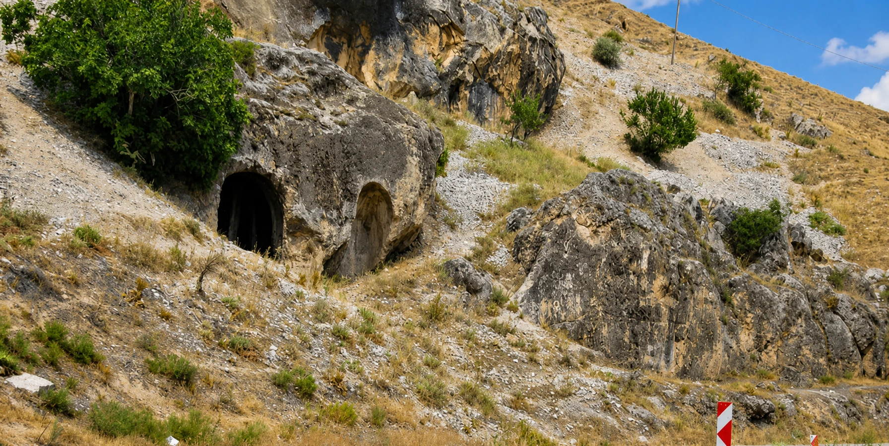
Uncover the Phrygian, Roman and early Christian story of Işıklı.
Discover Eumeneia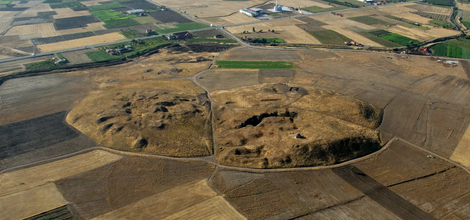
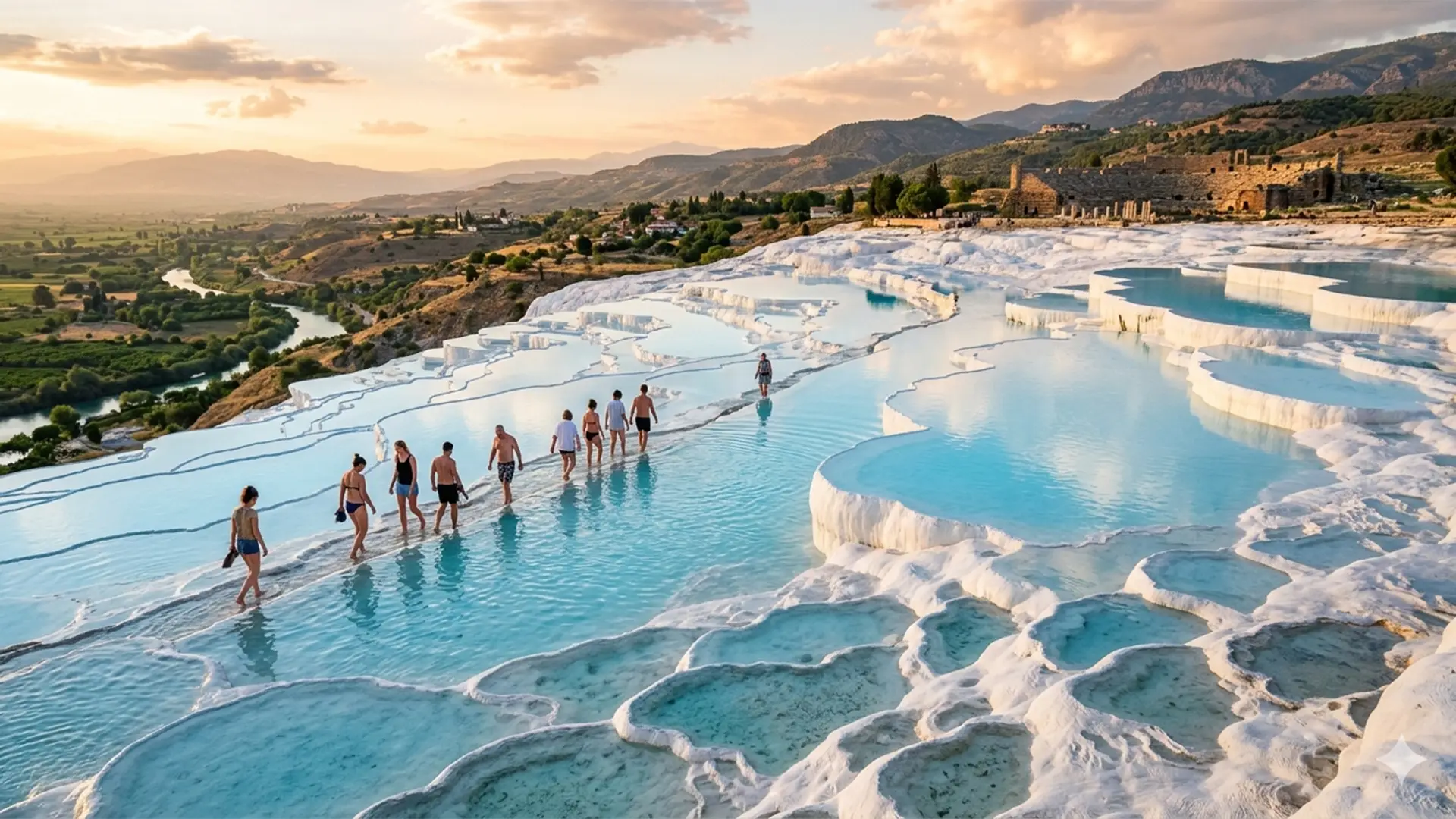
Enjoy an individually arranged visit to Denizli’s iconic heritage.
Explore Private Tour