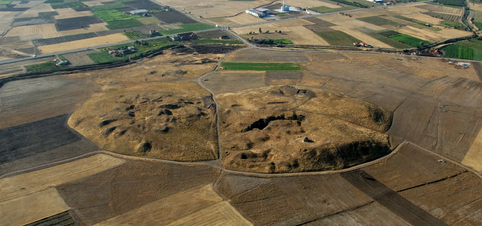
Beycesultan Höyük
Discover the prehistoric and Bronze Age archaeology of the Upper Maeander Basin.
Explore Beycesultan





In the northeastern part of Denizli Province, near Çivril, the village landscape of Işıklı preserves the scattered remains of Eumeneia, an important Hellenistic and Roman settlement of ancient Phrygia. The city stood at a strategic meeting point of roads, a fertile plain and abundant freshwater springs.
Its Hellenistic identity is linked with the kings of Pergamon. Archaeological scholarship associates the city’s second-century-BC name with King Eumenes II, honoured by his brother Attalos II. The surviving landscape includes Sarıbaba Hill, traces of fortifications and terracing, a wide necropolis and the spring areas around which Roman and Byzantine settlement developed.
Eumeneia is also known through extraordinary ancient coins, a short-lived association with Fulvia, the wife of Mark Antony, and distinctive third-century Christian funerary inscriptions known to historians as the Eumeneian formula. More recently, an elaborately carved Roman Amazon sarcophagus from the city’s territory has attracted attention at the Denizli City Museum.
Unlike a fully excavated archaeological park, Eumeneia is not a compact collection of reconstructed monuments with a guaranteed visitor route. This guide separates well-documented history from scholarly interpretation and explains what travellers should check before visiting the archaeological areas.
A crossroads city where Greek, Anatolian and Roman traditions met.
Named in honour of King Eumenes II in the Hellenistic era.
Rock-cut tombs, built graves and Roman funerary heritage.
A remarkable group of third-century inscribed gravestones.
Location, historical periods, archaeological highlights and visitor planning for Işıklı and Çivril.
Işıklı Mahallesi, Çivril District, Denizli Province, Türkiye.
Phrygia; connected to the Roman province of Asia.
King Eumenes II of Pergamon (reigned 197–159 BC).
Especially significant from the second century BC through Roman times.
Sarıbaba Hill, adjacent slopes, springs and the present-day settlement.
Terraces, defensive walls and traces of ancient buildings.
Işıklı springs and the ancient Kloudros watercourse.
Rock-cut tombs, masonry graves, vaulted tombs and sarcophagi.
Bronze civic issues, including the brief Fulvia series around 41–40 BC.
Third-century funerary inscriptions using the Eumeneian formula.
Byzantine defensive use of Sarıbaba Hill; Turkish-period Işıklı.
Confirm public access and admission locally; no verified unified tariff.
Eumeneia tells a different story from the grand Roman ruins of Pamukkale. It was a crossroads settlement in ancient Phrygia, where control of roads, fertile land and plentiful water helped shape urban life. Its history is visible not only in foundations and rock-cut monuments but also in names preserved in inscriptions and coins.
The city offers unusually rich evidence for Pergamene political influence, Roman civic identity, funerary customs and the emergence of Christian communities. Its ancient coins are particularly useful because they display local deities, personifications and the names of the people who issued them.
Eumeneia rewards travellers who enjoy interpreting a historical landscape. It does not promise the same experience as entering an extensively excavated theatre, agora or museum complex.
Pergamene rule and important regional routes.
Coins and inscriptions document civic institutions.
Unusually varied ancient burial structures.
Cybele, Apollo, Artemis and river imagery.
Third-century gravestones with distinctive formulas.
A town, hill and springs preserving traces of past cities.
Eumeneia is identified with modern Işıklı, in Çivril District of Denizli Province. The locality lies along the historical corridor between Çivril and Dinar, known in antiquity as Apameia. Official Turkish heritage descriptions place the remains around the settlement, the Işıklı water source and Sarıbaba Hill.
Archaeological research distinguishes the higher Hellenistic city, built into the slopes of Sarıbaba Hill, from later habitation that extended downward toward the springs and plain in Roman and Byzantine periods. This means that a modern map marker cannot represent every part of the ancient urban area.
Işıklı remains a living community rather than an unoccupied historical reserve. Visitors should respect homes, farmland, water infrastructure and any protected archaeological areas.
Işıklı Mahallesi, Çivril, Denizli.
Sarıbaba Hill overlooking the plain.
Upper Büyük Menderes / Phrygian landscape.
Çivril.
Historic route toward Apameia (Dinar).
Use Işıklı locality and verify the lawful viewing route.
Eumeneia is a standard scholarly transcription of the ancient city’s name. Visitors may also find Eumenia, Eumania and Turkish Eumeneia Antik Kenti / Eumania Antik Kenti in tourism listings. These spellings generally refer to the same site at Işıklı.
The name commemorates Eumenes II of Pergamon. The historical details matter: scholarly studies identify Attalos II, Eumenes’ brother and successor, as the ruler who bestowed or established the honorific city name in the second century BC. The surviving settlement landscape also contains evidence of earlier occupation and defensive activity.
The modern name Işıklı refers to the inhabited village area, not a separate ancient city to be confused with Eumeneia. For SEO and wayfinding, both Eumeneia and Işıklı Ancient City are useful.
Eumeneia Ancient City.
Eumenia; Eumania.
Eumeneia / Eumania Antik Kenti.
Eumenes II of Pergamon.
Linked in scholarship with Attalos II.
Işıklı in Çivril District.
Eumeneia’s best-defined urban identity belongs to the Hellenistic period, yet the surrounding landscape was significant long before a Pergamene royal name appeared. Archaeologists have interpreted older hilltop defences and ritual features near the springs as indications of earlier activity.
The abundance of water was especially important. Archaeological research discusses rock-cut niches and ritual places associated with an Anatolian mother-goddess tradition, often described through the cult of Cybele (Kybele). Such interpretations concern a sacred landscape rather than a completely excavated, securely dated prehistoric city plan.
The broader Çivril Plain also contains Beycesultan Höyük, with a much earlier archaeological record. These are different sites and historical sequences; a prehistoric date established at Beycesultan must not be automatically attributed to the surviving Eumeneia monuments.
Possible pre-Hellenistic occupation and cult activity.
Natural springs attracted long-term settlement.
Features investigated as ritual evidence.
Anatolian mother-goddess tradition.
Earlier remains are not a complete mapped prehistoric city.
Beycesultan provides a separate Bronze Age sequence.
Following the Battle of Magnesia in 190 BC and the Peace of Apameia in 188 BC, the balance of power in western Anatolia shifted. The Attalid kingdom of Pergamon gained influence across territories previously dominated by Seleucid power.
In this political setting, a strategic city overlooking the routes of the Upper Maeander Basin was associated with the royal name Eumeneia. Archaeologist Celal Şimşek’s study identifies Attalos II (159–138 BC) as honouring his brother Eumenes II. Scholarly discussion also allows for pre-existing settlement and earlier fortification on the hill.
Eumeneia’s location was not accidental. From the hillside, an authority could observe movement between the rich plain and the important road toward Apameia, while participating in Pergamene networks stretching westward.
Hellenistic competition in western Anatolia.
Battle of Magnesia.
Peace of Apameia.
Pergamene control and influence.
Royal namesake.
Ruler associated with the honorary naming.
The slopes of Sarıbaba Hill formed the defended high ground of the ancient settlement. Published topographical research describes terraces arranged along the slope, with building traces adapting to the hillside in a way reminiscent of Pergamene planning.
The study records remains of a northeastern approach, traces interpreted as entrance towers and stretches of Hellenistic defensive wall, especially where the ancient city faced the springs and lower settlement. Only parts of the original structures survive as visible foundations or stonework.
The hillside is not a reconstructed acropolis. Vegetation, erosion, modern paths and conservation concerns affect what can be recognised today. A specialist site plan and permission to enter relevant areas are far more useful than attempting an unmarked climb.
Hellenistic occupation on Sarıbaba Hill.
Terraces adapting to steep topography.
Northeastern access and possible flanking towers.
Surviving traces of Hellenistic fortifications.
Views over the Işıklı Plain.
Historical entrance traces do not establish a public route.
Ancient Eumeneia stood at a natural bottleneck between upland approaches and the plain. Its defended height made sense in a political landscape where roads, trade and military movement mattered.
Archaeological surface study describes masonry with irregular stone blocks and polygonal-looking arrangements, as well as possible gate-related structures. The appearance of masonry helps scholars propose dates, but it cannot replace secure stratigraphic excavation or prove every wall was built in a single campaign.
Official heritage summaries also identify a Byzantine-era castle or fortress use on Sarıbaba Hill. A wall visible in a photograph should therefore not be casually labelled “Pergamene” or “Byzantine” without checking the specific structure.
Control important hill and road approaches.
Early defensive masonry described in survey.
Traces near the ancient northeastern approach.
Later defensive use of the hill.
Date each feature individually where possible.
Never use fortification remains as a hiking shortcut.
The settlement changed as Roman power reshaped the region. In antiquity Eumeneia belonged to Phrygia and was connected administratively to the conventus of Apameia within the Roman province of Asia. These jurisdictions are not equivalent to today’s provincial borders.
As urban life developed, habitation spread toward the springs and lower plain. Archaeological research links this change to the accessible water supply, fertile land and the decreasing need for a strictly defended hilltop position.
The city’s importance is documented by coins, inscriptions, burial monuments and scattered architectural traces. This evidence reveals prosperous civic life without suggesting that a standing Roman theatre, bath complex or columned agora has been fully exposed for visitors.
Asia.
Phrygia.
Connected to Apameia’s conventus.
Expansion from high hill toward springs.
Inscriptions, coinage and funerary monuments.
Scattered remains rather than a continuous park.
Eumeneia’s prosperity was grounded in its position between inland Phrygia and western Anatolia. Ancient roads linked the settlement with Apameia (Dinar) to the east and with other Maeander-basin communities toward the west.
Archaeological scholarship discusses connections involving Peltai, Laodicea, Sardis and Ephesus through wider regional road networks. These are reconstructed historical routes, not a promise that each road can be followed as a preserved Roman pavement today.
The same movement of people brought goods, soldiers, travellers, religious ideas and administrative relationships. Roads help explain why Eumeneia appears in coin studies, inscriptions and accounts of the late antique region.
Apameia / modern Dinar.
Settlements leading toward the Aegean.
Peltai in the Çivril area.
Participation in the Apameia district.
Agricultural resources and passing traffic.
Ancient routes are not marked walking itineraries.
The water sources at Işıklı are essential to Eumeneia’s story. Research identifies a local watercourse known as the Kloudros, and associates the ancient Glaukos river with the water system of the wider Kufi basin.
Water shaped both settlement and beliefs. The hillside city required engineering to carry water uphill, while the later lowland town could grow near abundant springs. Archaeological descriptions mention cut channels and terracotta water pipes linked with the upper city.
A Roman civic coin portraying Glaukos as a reclining river god demonstrates that water was more than a practical resource: it also formed part of the city’s visual identity. Today’s reservoir and managed waterways should not be mistaken for an unchanged ancient lake.
Işıklı freshwater springs.
Kloudros associated with the source.
Glaukos in local ancient geography.
Channels and ceramic pipes recorded in surveys.
River god with reed, cornucopia and water urn.
Modern lakes and water management differ from antiquity.
Sarıbaba Hill preserves enough architecture to inspire interpretation but not to justify a grand, complete reconstruction. In a published archaeological study, remains on terraces were discussed as a possible Hellenistic temple with a nearby level area that may have functioned as an agora.
The proposed temple plan was inferred from wall lines and a partially legible rectangular inner space; the hypothesis was explicitly dependent on further excavation. Nearby foundation traces could represent other buildings, but their functions are not certain.
It is particularly important not to market Eumeneia as having a confirmed, well-preserved classical theatre. Researchers did not securely locate a theatre in the surveyed upper city; its possible location remains speculative.
Architectural interpretation requiring excavation.
Level terrace considered a civic area.
Some foundations visible in published surveys.
Not securely located in the referenced research.
Do not assume all visible masonry is contemporary.
Read reconstruction hypotheses as hypotheses.
The ancient religious world of Eumeneia was complex. Archaeological interpretations of rock-cut features near the spring have been linked to Cybele, the Anatolian mother goddess, while civic coins depict other deities and divine figures from Greek and local traditions.
Coin types documented in scholarly research include Apollo, Artemis, Athena, Dionysus, Tyche and a distinctive rider with a double axe. These motifs reveal the city’s religious imagination and civic identity; they do not necessarily prove that a surviving physical sanctuary existed for every image.
The proposed relationship between these cults and nearby regional sanctuaries is an active field of interpretation. Visitors should distinguish securely documented coins and inscriptions from reconstructed temples or festivals.
Local mother-goddess landscape.
Appears in civic religious imagery.
Included in Roman-era coin types.
Personification of civic fortune.
Double-axe iconography in Phrygian traditions.
Coins do not map every shrine on the ground.
Coins are among Eumeneia’s most informative historical documents. The city issued bronze civic coinage during the Hellenistic and Roman periods, displaying names of the city and sometimes local magistrates together with mythological, religious or political imagery.
Erdal Ünal’s research on Eumeneia’s history and coinage examines published and unpublished examples, officials, coin types and minting policies. The Roman Provincial Coinage database also records precise types from Eumeneia in Roman Asia.
Coins help reconstruct municipal identity when large monuments are scarce. They should be studied through documented museum and numismatic collections, never hunted for at the archaeological site.
Mainly bronze civic denominations.
Hellenistic to Roman provincial issues.
City names and issuing officials.
Deities, imperial portraits and civic symbols.
Erdal Ünal and Roman Provincial Coinage.
Metal detecting and removal are not tourist activities.
One of Eumeneia’s most unusual numismatic episodes occurred during the Roman civil wars. Coins dated to approximately 41–40 BC use a city name associated with Fulvia, the wife of Mark Antony, and show a portrait interpreted as Fulvia in the guise of Nike (Victory).
The Roman Provincial Coinage catalogue documents these issues under Eumeneia, including the official Zmertorix, son of Philonides. Political changes were swift; some surviving pieces show erasures or countermarks, illustrating how civic coinage could become entangled in wider Roman loyalties.
The evidence is especially strong for a Fulvia-named coin issue. Discussions of the precise legal process, timing and scope of a complete civic renaming can be more nuanced; readers should avoid treating every popular retelling as settled fact.
41–40 BC.
Fulvia, wife of Mark Antony.
Fulvia represented as Nike.
Zmertorix appears on recorded issues.
Final years of the Roman Republic.
Documented coin legends and surviving specimens.
An especially revealing Roman coin type pairs the turreted figure of Eumeneia’s Tyche with the reclining river god Glaukos, who holds a reed and cornucopia beside a water urn. The imagery reflects both the city and the fertile waters that sustained it.
Other issues feature divine figures and sanctuary-like structures. A coin is not a literal photograph of a building, but it may suggest which cults or civic stories the issuing community wanted viewers to recognise.
For travellers, such details open a fascinating alternative to standing ruins: ancient Eumeneia can be understood through portable objects that preserve its own representations of identity.
Protective city personification.
River god featured on civic coinage.
Symbol of abundance.
Visual connection with flowing water.
Roman Provincial Coinage.
Coin designs do not guarantee surviving temples.
The ancient necropolis extends across the slopes of Sarıbaba Hill, especially those looking toward the settlement and its springs. The official Denizli heritage description identifies these hillside burial grounds as one of the clearest features of the ancient city.
Celal Şimşek’s archaeological survey describes a wide range of forms: rock-cut chambers, graves cut into stone, built tomb boxes, vaulted graves, monuments partly hewn from bedrock and decorated sarcophagi. This variety reflects changing practice and differences in social resources across generations.
A necropolis is not a public climbing or exploration zone. Graves may lie on steep, disturbed or privately bounded ground. It is important to observe all protection rules and not enter chambers or cross walls without explicit authorisation.
Slopes of Sarıbaba Hill.
Chambers and grave beds carved in stone.
Built burial boxes and coverings.
Architectural tomb structures.
Stone coffins, some with relief decoration.
Some areas may be protected or difficult to reach.
Ancient gravestones are historical texts. They can preserve the names of individuals, families, status relationships and the language people used to protect a burial from disturbance. Eumeneia is especially noted for a large corpus of inscribed funerary monuments.
Scholars have identified a set of particularly characteristic expressions on some third-century Christian gravestones, commonly called the Eumeneian formula. Historical research published by Cambridge University Press discusses more than one hundred examples, including dated texts from approximately AD 246–274.
These stones illuminate individual lives and the changing religious identity of the city. Their presence in publications or collections does not imply that every text remains outdoors or readable at its original location today.
Greek-language funerary inscriptions.
Eumeneian formula.
AD 246–274 in published research.
Over 100 formula stones discussed by scholars.
Social and religious identities.
Stones may be dispersed or moved to collections.
Eumeneia occupies a distinctive place in studies of pre-Constantinian Christianity in Asia Minor. Certain gravestones express recognisably Christian identity at a time when public religious life remained diverse and imperial treatment of Christian communities was not uniform.
Historian Paul McKechnie examines these inscriptions in the chapter Eumeneia (Işıklı) and the Eumeneian Formula in Christianizing Asia Minor (2019). The study emphasises that dated examples were set up during the third century, including the period around Emperor Decius.
The inscriptions are evidence for real people, not proof of an excavated third-century basilica or a complete surviving Christian quarter. For religious-history itineraries, the strongest route to understanding the city is through historical context, epigraphy and carefully documented monuments.
Early Christianity in Roman Asia Minor.
Recognisably Christian gravestones.
Third century AD.
Paul McKechnie.
Christian and polytheist communities overlapped.
No fully preserved early church is promised onsite.
Scholarly study of Eumeneia records Roman military associations and inscriptions naming soldiers. Its location on an important inland route helps explain why imperial authorities might have maintained a garrison or administrative presence.
Research also discusses damage to a military installation associated with an earthquake in AD 196 and subsequent work under Septimius Severus. Such details should be attributed to the historical and archaeological literature rather than presented as a fully excavated barracks open to visitors.
The military evidence adds another perspective to the city: Eumeneia was not merely a town of merchants and farmers but part of a Roman network linking communications, governance and security.
An inland corridor between settlements.
Inscriptions connected with soldiers.
Imperial administrative and military presence.
Earthquake episode discussed in scholarship.
Rebuilding context in historical literature.
No guaranteed publicly viewable barracks.
Eumeneia continued to belong to the complex historical landscape of late antique and medieval Anatolia. Official heritage descriptions point to the Byzantine defensive use of Sarıbaba Hill, where a castle or fortified position occupied the high ground.
Settlement and control of the wider Çivril and Dinar region changed repeatedly across medieval centuries. Ancient roads and the availability of water continued to matter, even as political and religious institutions evolved.
Today, evidence of Byzantine activity must be distinguished from older Hellenistic walls and Roman funerary structures. The best interpretation treats the hill as a multi-period site, rather than assigning every stone to a single golden age.
Byzantine occupation and defensive use.
Sarıbaba fortified position.
Continued strategic importance.
Christian institutions in late antiquity.
Multiple periods can overlap.
Denizli Provincial Culture & Tourism.
Işıklı’s history did not end with antiquity. Çivril Municipality describes the locality as a long-lived settlement whose role changed through Seljuk, Ottoman and modern periods. Water, road access and agriculture sustained its importance.
The centuries of Byzantine–Turkish contest in the Upper Maeander area are historically complex. Historians discuss the region in connection with major twelfth-century campaigns, including the events surrounding Myriokephalon in 1176, but the exact battle location remains debated and must not be asserted as the Eumeneia archaeological site.
Exploring present-day Işıklı respectfully offers a way to understand how old roads, water sources and settlements can remain important while the languages, governments and built environment change.
Byzantine and Turkish political change.
Seljuk-era and later regional history.
Işıklı developed as a local administrative centre.
Myriokephalon belongs to wider regional history.
Long-lived inhabited landscape.
A living community, not just archaeological terrain.
One of the region’s most striking Roman artefacts is a carved Amazon sarcophagus originating from the territory of ancient Eumeneia. According to local reporting published in October 2026, the monument is displayed in the garden of the Denizli City Museum.
Museum information reported in the coverage dates it to the late second or early third century AD. The stone reliefs depict a dramatic Amazonomachy—the mythical battle between Amazons and Greek fighters—rather than an actual documented war at Eumeneia.
Because the original burial occupant and precise archaeological context are not established by the reports, avoid assigning it to a named individual. Travellers interested in its sculpture should confirm the museum’s current display and hours before making a dedicated visit.
Decorated Roman stone sarcophagus.
Territory of ancient Eumeneia.
Late second–early third century AD.
Mythological Amazon battle scenes.
Denizli City Museum garden, October 2026.
Confirm current museum arrangements.
The experience is different from an established ticketed archaeological park. Official records identify the Sarıbaba hillside, the old settlement area, springs and the necropolis. Specialist surveys record fortification masonry, terracing and scattered foundations in particular places.
These features are distributed across a large landscape. Visitors may be able to observe some from public areas, but the existence of a published photograph or site plan does not guarantee safe or authorised access to that feature today.
Eumeneia is best suited to travellers seeking historical landscape interpretation. If you expect large, clearly labelled standing monuments and a staffed site circuit, consider combining the day with another established ancient city.
Prominent hill associated with the upper city.
The water system behind settlement history.
Some remains described in field surveys.
Hillside burial areas; access may be controlled.
Do not assume ticket offices or visitor facilities.
Verify access and use a knowledgeable local guide.
Eumeneia appears in official Turkish cultural tourism listings as a historic place, but a currently reliable, unified public ticket tariff, staffed entrance schedule and MuseumPass acceptance policy have not been established by the sources used for this page.
Some archaeological locations can be recognised from roads or public settlement areas even where protected ruins are not open for unrestricted walking. Do not assume that the absence of a ticket booth means all areas are legally accessible.
Before travelling specifically to the hillside or tombs, ask the Denizli Provincial Directorate of Culture and Tourism or relevant local authorities about access, restrictions, guiding and any changing conservation work.
No independently verified current fee.
No verified unified public schedule.
Acceptance not confirmed.
Check locally for authorised areas.
Access may be restricted.
Confirm with cultural authorities in advance.
To reach the historical locality, travel toward Çivril and then Işıklı Mahallesi along the road corridor toward Dinar. The official Culture Portal lists transport from Denizli bus station to Çivril and onward local minibus services to Işıklı; service times and routes should be verified before departure.
A private car offers flexibility for combining Işıklı with regional nature and archaeology. Since the ancient remains are spread across the village and surrounding slopes, agree on an appropriate public meeting point rather than asking a driver to enter an archaeological zone.
For travellers staying in Pamukkale, Işıklı belongs to a separate Çivril-focused excursion, not a brief stroll from the travertine terraces. Exact drive times vary with routes, traffic and departure address.
Işıklı, Çivril, Denizli.
Travel via Çivril; verify onward transport.
A separate road trip toward northeastern Denizli.
Approach via the Çivril–Dinar corridor.
Bus to Çivril and local connections when operating.
Useful for combining history, scenery and flexible stops.
Spring and autumn are generally attractive seasons for this part of the Upper Maeander region. Moderate conditions make outdoor exploration of public areas around Işıklı more comfortable than intense summer heat.
Summer brings bright light and possible high temperatures; winter rain can make rural paths slippery. A typical visit may involve exposed areas with limited shade and no onsite visitor facilities at the archaeological remains.
The key distinction is between enjoying the landscape from permitted areas and entering archaeological ground, which may require separate authorisation regardless of weather.
Comfortable conditions for cultural sightseeing.
Sun protection and water recommended.
Often pleasant for history and landscape visits.
Wet or muddy rural surfaces possible.
Sturdy shoes and appropriate layers.
Permission matters more than the season.
A responsible hero image should show actual Eumeneia or the Işıklı–Sarıbaba landscape, preferably including the hill, springs and ancient stone traces where photography is permitted. This makes the page distinctive without inventing a grand classical monument that has not been excavated.
Be particularly cautious with photographs of generic Roman theatres, temples and column streets. A genuine close-up of the Amazon sarcophagus should be captioned as a museum artefact from the territory of Eumeneia, not a tomb currently standing at the archaeological site.
Respect private property, graves and local religious places. For website use, retain photo credits and permissions and check drone restrictions before any aerial work.
Verified Eumeneia / Sarıbaba landscape.
Hill and spring valley where practical.
Real masonry or tombs with proper permission.
Identify original findspot versus display site.
Check copyright and reproduction rights.
assets/images/eumeneia-ancient-city-denizli.webp
The wider Işıklı Lake landscape gives visitors a natural complement to the ancient city. Water has shaped settlement and agriculture throughout this region, although the lake, channels and managed waterways seen today are not unchanged replicas of the ancient environment.
After a short authorised historical orientation near Işıklı, travellers may enjoy the seasonal landscape and scenery around Işıklı Lake. The experience is especially appealing for people who prefer quiet cultural travel instead of rushing between famous sites.
Water levels, seasonal boat activity and wildlife observations vary. Consult local providers before promising a particular boat experience, lotus or water-lily bloom, or unrestricted lakeside access.
Işıklı Lake in the Çivril area.
Springs underpinned ancient Eumeneia.
Water, wetlands and agricultural land.
A relaxed archaeology-and-nature outing.
Water levels and activities can change.
Beycesultan Höyük and Eumeneia both belong to the Çivril region, but their principal archaeological identities are strikingly different. Beycesultan is a prehistoric and Bronze Age settlement mound famed for stratigraphy and monumental building remains.
Eumeneia is primarily associated with a Hellenistic, Roman and Byzantine city whose identity is documented through topography, coins, fortifications, burials and inscriptions. They should never be combined into an imaginary single city history.
A specialised regional day can tell both stories if access conditions permit, but the route should not promise entry to active excavation zones or tomb chambers.
Phrygian, Hellenistic and Roman urban heritage.
Prehistoric and Bronze Age excavation mound.
Coins, hill architecture and funerary inscriptions.
Long stratigraphy, houses and palace remains.
Upper Büyük Menderes Basin.
Archaeological access may be limited.
The classical monuments around Denizli vary greatly in appearance and public access. Laodicea, Tripolis and Hierapolis are well-known for excavated architectural remains and more conventional sightseeing experiences.
Eumeneia’s particular attraction is historical depth documented through scholarship and objects: Pergamene politics, Roman coins, the Phrygian necropolis and early Christian inscriptions in the Işıklı landscape.
For first-time visitors focused on a photogenic ancient city with a clear walking circuit, the other sites may be better priorities. For repeat travellers with a special interest in Phrygia, numismatics or Christian epigraphy, Eumeneia is a rewarding research-led subject.
Scattered remains and extensive historical records.
Excavated streets, churches and Roman monuments.
Monumental city beside Pamukkale terraces.
Excavated classical city north of Denizli.
Eumeneia’s coins and inscribed gravestones.
Established ticketed archaeological parks.
Option 1 – History and landscape: travel to Işıklı and explore public areas that help explain the ancient city’s setting. Where authorities approve the route, include a guided interpretation of Sarıbaba Hill and its historical significance without entering restricted remains.
Option 2 – Eumeneia and Işıklı Lake: combine an authorised historical orientation with Işıklı Lake. This brings together the region’s ancient dependence on freshwater and its present-day scenic landscape.
Option 3 – Wider Denizli archaeology: travellers based in Pamukkale may prefer an established ancient city such as Laodicea or Tripolis. Wow Cappadocia can discuss tailored private transport and licensed guiding with no compulsory shopping stops, subject to arrangements and verified access.
Işıklı orientation and authorised archaeological viewpoints.
Eumeneia region plus Işıklı Lake.
Çivril heritage with Beycesultan context.
Established archaeology at Laodicea or Tripolis.
Private vehicle and licensed guide by arrangement.
Historical focus, relaxed pace, no shopping stops.
Sarıbaba’s hillside contains fragile historical material, including tomb architecture and old stone foundations. Weather, vegetation and unregulated movement can damage these remains over time.
Never enter burial chambers, remove pottery, disturb carved stones or climb vulnerable masonry. If a feature lies beyond a fence, on private land or along an uncertain path, remain outside and seek appropriate guidance.
Researchers rely on the original placement and context of objects as much as on the objects themselves. A respectful visit protects the historical record and preserves future opportunities for conservation and investigation.
Leave all artefacts and fragments untouched.
Do not open, enter or disturb burials.
Respect fences, fields and local directions.
Check heritage and flight permissions.
Işıklı is a living settlement.
Learn from archaeology without causing damage.
The following dates are useful historical reference points rather than a claim that every period is represented by equally visible buildings. Some early phases and proposed monuments remain matters for archaeological interpretation.
Earlier occupation and possible sacred landscape.
Magnesia and Peace of Apameia change regional power.
Pergamene name Eumeneia associated with Eumenes II.
Coins referring to Fulvia appear.
Roman civic coinage and inscriptions flourish.
Dated examples of the Eumeneian Christian formula.
Sarıbaba Hill continues in defensive use.
Political and settlement transformations in Çivril.
Işıklı remains an important inhabited locality.
Major scholarly synthesis on Eumeneian Christian inscriptions.
Local reporting highlights the Eumeneia Amazon sarcophagus.
Işıklı preserves a living historical landscape.
The ancient city is identified with Işıklı Mahallesi in Çivril District, Denizli Province, on the road corridor toward Dinar.
Yes. These spellings commonly refer to the ancient settlement at Işıklı; Eumeneia is a standard academic spelling.
Eumeneia belonged to ancient Phrygia and later formed part of the Roman provincial administrative landscape of Asia.
The Hellenistic name honours King Eumenes II of Pergamon; archaeological scholarship links its naming with his brother Attalos II.
Its Hellenistic civic identity is associated with the second century BC, although the site and surrounding landscape show earlier activity.
The prominent hill associated with Eumeneia’s upper Hellenistic city, fortifications and adjacent necropolis.
Roman and Byzantine occupation extended toward the springs and lower settlement area around today’s Işıklı.
The historical landscape includes Sarıbaba Hill, springs and archaeological areas, but the public accessibility of individual ancient remains must be checked.
A classical theatre has not been securely located in the published archaeological survey referenced by this guide.
Yes. The Sarıbaba slopes include different ancient tomb forms documented in archaeological research.
They preserve the city’s name, officials, deities and symbols across Hellenistic and Roman periods.
Coins around 41–40 BC used the Fulvia name and depicted the wife of Mark Antony, reflecting a short-lived political episode.
Glaukos was represented on Eumeneia coinage as a reclining river deity associated with the city’s fertile water landscape.
A characteristic funerary wording found on numerous third-century gravestones studied as evidence for local Christian communities.
Early Christian funerary inscriptions are documented, alongside a wider religious landscape that included traditional cults.
Official descriptions refer to Byzantine defensive use of Sarıbaba Hill; do not assume the remains form an accessible, restored castle.
October 2026 reporting places the Roman Amazon sarcophagus from Eumeneia’s territory in the garden of Denizli City Museum.
A current, reliably verified site-wide ticket fee has not been established for this guide.
A confirmed unified public opening schedule is not available here; contact local culture authorities before entering archaeological areas.
MuseumPass arrangements have not been independently verified for this locality.
Never assume that tombs may be entered. Protected, unsafe or privately bounded areas require permission and should be respected.
The Turkish Culture Portal indicates travel via Denizli–Çivril buses and onward local minibuses to Işıklı; verify current services.
Yes, an Işıklı-focused history and nature day is a sensible concept when routes and opening arrangements are confirmed.
Eumeneia is principally a classical-period city; Beycesultan is best known as a prehistoric and Bronze Age settlement mound.
We can discuss a tailor-made Çivril itinerary with private transport and licensed guiding; any protected archaeological entry depends on permissions.
This page is informed by official Denizli heritage descriptions, published topographical archaeology, studies of the city’s coinage and research on the Eumeneian funerary formula. Interpretations of individual buildings or cult sites are distinguished from secure archaeological identification.
Academic research explains what a place was; it does not automatically verify its current opening hours, excavation access or ticket policy. Please confirm the practical details locally.
Official English overview of Işıklı, the hill, Byzantine fortification and necropolis.
Site classification, address and public-transport guidance.
Local account of the ancient city and the long history of Işıklı.
Academic topography, fortifications, necropolis, religion and regional roads (PDF).
Doctoral research on Eumeneia’s minting and historical identity.
Catalogued Fulvia issue of c. 41–40 BC, including city and official inscriptions.
Documented Eumeneia coin featuring Tyche and the river god.
Paul McKechnie’s scholarly chapter on third-century Christian gravestones.
Local report on the Roman Eumeneia-territory sarcophagus at Denizli City Museum.
A nearby natural destination to pair with regional cultural sightseeing.
Explore the layers of Denizli’s heritage, from overlooked Phrygian cities to monumental Roman sites and beautiful lakes. Tailored private transport and licensed guiding can be discussed, without compulsory shopping stops.
From Bronze Age mounds to the urban centres of Roman Anatolia.
Discover the prehistoric and Bronze Age archaeology of the Upper Maeander Basin.
Explore Beycesultan
Walk through one of the region’s major excavated Roman cities.
Discover Laodicea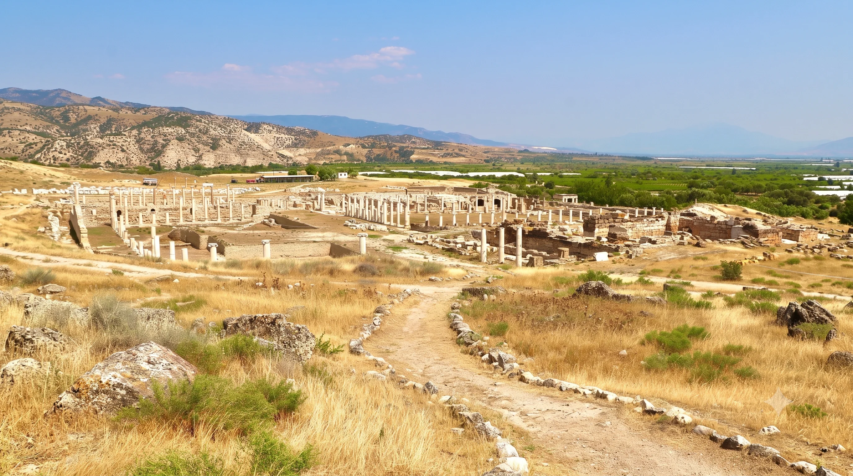
Explore the history and architecture of a classical city in the Maeander region.
Visit TripolisCombine history with memorable landscapes and comfortable private travel.

Experience water and nature beside the area of ancient Eumeneia.
Explore Işıklı Lake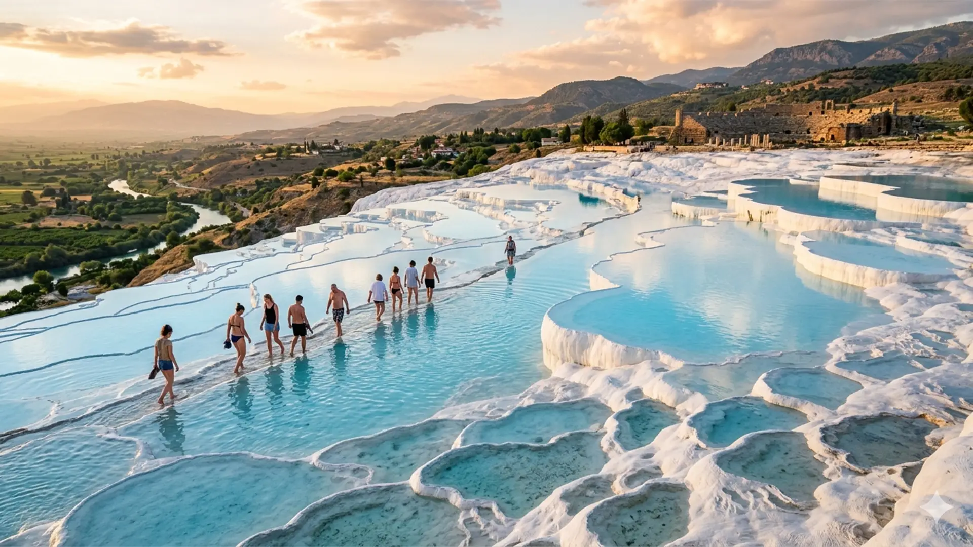
Enjoy the famous thermal terraces and the ancient city of Hierapolis.
Explore Private Tour
Discover historical objects and displays connected with Denizli’s wider past.
Explore the Museum