Private Sakarya & Adapazarı Heritage Tour
Ask us about a tailor-made journey combining Sakarya Bridge, historic Adapazarı, Sakarya Museum, Ottoman landmarks and selected Byzantine or natural sites across the province.
Request a Custom Tour





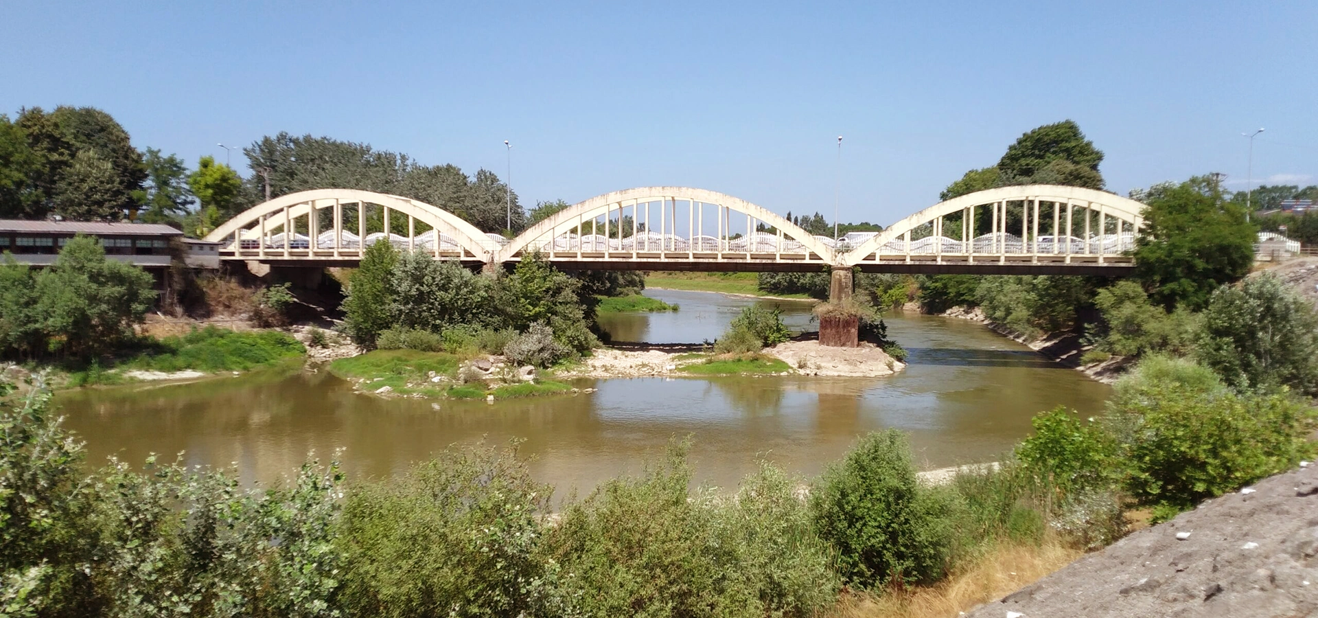
Spanning the Sakarya River near Adapazarı, the historic Sakarya Bridge is one of the most recognizable examples of early Republican-era transport engineering in northwestern Türkiye.
The bridge was constructed in 1936–1937 as a modern reinforced-concrete crossing on an important route linking Adapazarı with the road toward Hendek, Bolu and inner Anatolia.
Official regional accounts connect the project with Mustafa Kemal Atatürk. During a 1934 journey through the area, Atatürk is said to have observed the inadequacy of an older wooden crossing and called for a stronger and safer concrete bridge. The historical sources present this episode as the likely origin of the project rather than as a precisely documented construction order.
The completed bridge measures approximately 108.60 meters long and 4.80 meters wide. Its distinctive reinforced-concrete bowstring arches form three principal sections of roughly 35 meters each.
Today, the historic bridge is protected as a registered cultural structure and is one of the visual symbols associated with Sakarya. A newer bridge now carries modern road traffic, allowing the older structure to be preserved primarily for its historical and architectural value.
The bridge belongs to the formative decades of the Turkish Republic and reflects the period's investment in modern roads and infrastructure.
The historic crossing stretches more than one hundred meters across the Sakarya River.
Three reinforced-concrete arch sections create the bridge's distinctive and easily recognizable silhouette.
The bridge became one of the city's best-known visual landmarks and has been used in local institutional imagery.
Essential information about one of Adapazarı's most recognizable early Republican landmarks.
On the Sakarya River near the Rüstemler / Köprübaşı area, approximately 6 km from central Adapazarı.
Open on Google MapsHistoric reinforced-concrete bowstring arch road bridge.
Constructed in 1936–1937 during the early Republican period.
Approximately 108.60 meters long and 4.80 meters wide.
Registered historic structure and one of the architectural symbols of Sakarya.
Republican history, engineering heritage, river scenery, architecture and photography.
Sakarya Bridge represents the transformation of regional transport during the first decades of the Turkish Republic.
The historic Sakarya Bridge is important not because it is the oldest bridge in the province, but because it belongs to a period when modern transport infrastructure became a visible symbol of the new Republic.
During the 1930s, reliable road connections were essential for linking towns, agricultural areas and regional markets. The Sakarya River could be a serious obstacle, especially when older wooden crossings were vulnerable to wear, flooding and heavy use.
The new reinforced-concrete bridge offered a stronger, more permanent solution. Its bowstring design combined structural efficiency with a distinctive architectural form, making it both practical and visually memorable.
The bridge also became closely associated with Adapazarı's identity. Over time, its repeating arches became a familiar image of the city and one of the structures most often used to represent Sakarya visually.
For visitors today, the bridge provides a compact but meaningful introduction to Republican-era engineering, regional transport history and the changing relationship between Adapazarı and the Sakarya River.
Long before the present bridge was built, the Sakarya River shaped movement through the Adapazarı plain. Roads approaching the river depended on bridges, ferries and other crossings that could be affected by changing water levels and floods.
By the early Republican period, the route connecting Adapazarı with Hendek, Bolu and routes farther into Anatolia was becoming increasingly important. A permanent modern bridge was therefore a major infrastructure priority.
Official regional sources associate the bridge project with a journey made by Mustafa Kemal Atatürk in July 1934. According to this account, Atatürk crossed an older wooden bridge in the wider area, recognized that the crossing was inadequate and is believed to have requested the construction of a strong, safe concrete bridge.
The present Sakarya Bridge was subsequently constructed in 1936–1937. Contemporary accounts associate the project with the Ministry of Public Works during the period of Ali Çetinkaya. The recorded construction cost was approximately 93,000 Turkish lira.
The bridge then carried road traffic for decades and proved especially notable for its resistance to the floods that historically affected the Sakarya River basin. As roads expanded and traffic increased, a newer crossing was eventually constructed beside it.
The historic bridge was later taken out of regular vehicle service in order to protect its architectural character. Today, its importance lies primarily in heritage, urban memory and early Republican engineering history.
Official accounts connect the project with Atatürk's observation that an older wooden crossing was inadequate.
The present reinforced-concrete bridge was built during the early Republican period.
The bridge formed part of the period's effort to improve dependable road transport across Türkiye.
Historical records give an approximate construction cost of 93,000 Turkish lira.
The crossing helped connect Adapazarı with Hendek, Bolu and routes toward inner Anatolia.
The bridge later became a registered historic structure valued for its original character.
One reason the bridge occupies a special place in local memory is its association with Mustafa Kemal Atatürk.
Regional cultural authorities record that, during a road journey toward Adapazarı in July 1934, Atatürk crossed an older wooden bridge near the wider Kumköy area. The wooden structure was considered inadequate for the needs of modern road transport.
The traditional account states that Atatürk, after seeing the condition of the crossing, called for the construction of a solid and safe concrete bridge.
Because official sources themselves describe this sequence as probable, the most accurate way to understand the story is as a well-established regional historical tradition connected with the bridge's construction, rather than as a surviving verbatim project order with a precisely documented date and text.
What is certain is that the new bridge was built soon afterward, in 1936–1937, during a period when the Republic was investing heavily in roads, bridges, railways and public infrastructure.
The structure is most widely known today as Sakarya Bridge or Old Sakarya Bridge.
Historical and local sources also record the name Trabzanlar Bridge, derived from the name of a nearby settlement that appears in older records.
Another traditional name is Güneşler Bridge, referring to the neighborhood on the Adapazarı side of the crossing.
These different names reflect how the bridge has been understood at several scales: as a crossing serving nearby communities, as a structure associated with the Güneşler side of the city, and ultimately as a landmark representing Sakarya as a whole.
The best-known and most widely used name of the historic structure.
A modern name that distinguishes the heritage bridge from newer road crossings nearby.
A local name connected with the Güneşler side of Adapazarı.
An older place-based name associated with the nearby historic settlement.
The arch profile eventually became closely associated with Sakarya's visual identity.
All of the names ultimately refer to the same historic crossing of the Sakarya River.
The most distinctive feature of Sakarya Bridge is its reinforced-concrete bowstring arch design.
A bowstring bridge uses an arch rising above the deck while a lower horizontal member acts structurally like the string of a bow. Vertical elements connect the arch to the bridge deck, creating the repeating geometric pattern visible from the riverbanks.
Sakarya Bridge is approximately 108.60 meters long and 4.80 meters wide. Its crossing is divided into three principal arch sections of about 35 meters each.
The relatively narrow deck reflects the traffic conditions of the 1930s. What was sufficient for early motor vehicles eventually became less suitable for the much heavier traffic volumes of later decades.
Visually, the bridge is defined by the rhythm of its curved concrete arches, vertical hangers, straight deck line and the broad horizontal surface of the river below. This clear geometry is one reason the structure became such a strong city emblem.
Curved reinforced-concrete arches rise above the road deck and are connected by vertical structural members.
The bridge crosses more than one hundred meters of the Sakarya River corridor.
The narrow deck reflects the road standards and traffic needs of the 1930s.
The bridge is organized into three principal arch spans of approximately 35 meters each.
The use of modern concrete construction distinguished the bridge from the older wooden crossings it replaced.
The bridge's memorable appearance comes directly from its structural engineering rather than added decoration.
Building across the Sakarya River required more than simply creating a road connection. The structure also had to survive a river historically known for seasonal flooding and changing water conditions.
Official accounts specifically note the bridge's durability during the period when floods were still common in the region, particularly before large-scale river regulation and modern infrastructure changed conditions along the basin.
The reinforced-concrete arch system provided a far more permanent crossing than the wooden bridges that had previously served parts of the regional road network.
The bridge's long service life is therefore part of its historical significance. For decades, it was not simply an architectural landmark; it was working infrastructure carrying people, vehicles and goods across one of northwestern Anatolia's major rivers.
Today, the structure can be appreciated as a surviving example of how engineering, transport policy and regional geography came together during the 1930s.
The bridge cannot be understood separately from the Sakarya River. The river is one of the defining geographic features of the province and has shaped settlement, agriculture, transport and local identity for centuries.
At the historic bridge, visitors can see how the structure was designed to cross a broad, dynamic river corridor rather than a narrow urban canal. The open riverbanks and long views emphasize the bridge's horizontal form.
The river also explains why reliable bridge construction was so important. Flooding, erosion and changing channels could make older crossings difficult to maintain. A reinforced-concrete bridge represented a major improvement in reliability.
Modern river-management works have changed parts of the surrounding landscape, but the historic crossing still provides one of the clearest places to connect Sakarya's natural geography with its twentieth-century transport history.
Because Sakarya Bridge is a registered historic structure, maintenance work must balance practical conservation with protection of the bridge's original appearance.
In 2019, Sakarya Metropolitan Municipality carried out renewal work that included vegetation removal, replacement of deteriorated railings in the same form, concrete repairs and treatment of surface deterioration.
Further municipal work in 2022 included cleaning, painting, maintenance of the bridge surface and renewal of decorative railing elements with attention to the historic character of the structure.
These interventions are important because reinforced concrete, although modern compared with stone masonry, also ages. Water, temperature changes, vegetation, surface cracking and corrosion can all affect historic concrete structures over time.
Continued maintenance helps preserve not only the bridge's structural fabric but also the distinctive arch profile that has become part of Sakarya's city image.
Step back from the bridge to appreciate the repeated rhythm of its three principal bowstring forms.
The straight vertical members between arch and deck create the bridge's distinctive geometric appearance.
Look closely at the reinforced-concrete surfaces and repaired areas that reveal the age and conservation history of the structure.
The bridge offers a strong visual relationship with the broad Sakarya River and its low riverbanks.
The classic view is from the riverbank, where the full rise and repetition of the arches can be understood.
Notice how the structural form itself creates the monument's architectural identity without elaborate ornament.
Remember that this was once a working road link carrying regional traffic across the river.
Compare the real bridge with the simplified arch imagery long associated with Sakarya's public identity.
Visiting Sakarya Bridge is quite different from visiting a ticketed museum or large archaeological site. The experience is mainly about seeing the bridge in its river landscape and understanding its place in the modern history of Adapazarı.
There is no need to plan several hours. Most visitors will appreciate the site by viewing the structure from suitable public areas, photographing the arches and spending a short time beside the Sakarya River.
The contrast between the 1930s concrete engineering and the natural river setting gives the bridge much of its atmosphere.
Because a newer crossing now handles modern road needs, the historic bridge can be appreciated more clearly as a heritage structure rather than simply as transport infrastructure.
Conditions beside rivers can change after heavy rain, and visitors should always respect barriers, traffic arrangements, maintenance areas and any locally posted access restrictions.
Enough for a quick exterior view and a few photographs of the arches and river.
A comfortable visit for travelers interested in the bridge's history, structure and setting.
Useful for slower photography and viewing the bridge from more than one permitted angle.
Best for architecture enthusiasts who want to study the bridge and surrounding river landscape carefully.
The bridge works especially well as a short stop while exploring central Adapazarı and nearby heritage sites.
Treat the bridge as part of a wider Sakarya history route rather than a destination requiring half a day.
Official tourism information describes the bridge as accessible throughout the year. The best season therefore depends mainly on the kind of atmosphere and photography you prefer.
Spring brings greener riverbanks, mild temperatures and softer landscapes around the Sakarya River.
Autumn is also comfortable, with gentler temperatures and changing vegetation along the river corridor.
Summer can be bright and hot around midday. Morning or late afternoon usually provides more comfortable conditions and more attractive light on the concrete arches.
Winter can create dramatic views, especially in mist, rain or occasional snow, but wet surfaces and high river conditions require greater caution.
Green riverbanks and mild temperatures make this one of the most pleasant seasons.
Long daylight hours are useful, but midday can be hot and visually harsh.
Comfortable weather and softer seasonal light work well for heritage photography.
Mist, rain or snow can create atmospheric scenes, but take extra care near the river.
Often quieter, cooler and well suited to clean architectural views.
Lower-angle light can emphasize the curves and shadows of the arch structure.
The bridge is especially photogenic because its repeating concrete arches create a strong visual rhythm above the comparatively flat line of the river.
A broad side view is usually the best way to show the complete structure. Including the Sakarya River in the frame helps explain both the bridge's scale and the engineering challenge it was designed to solve.
Closer photographs can focus on the relationship between curved arches, vertical hangers, railings, deck and concrete surfaces.
Reflections can be especially attractive when the water is calm, while mist, snow or low evening light can create a very different atmosphere from bright summer conditions.
Avoid stepping into unsafe traffic areas, climbing structural elements or approaching unstable riverbanks for a photograph. Drone use should always follow national aviation rules and any local restrictions.
Show all three principal arch sections to capture the bridge's characteristic profile.
Calm water can mirror the arches and create one of the most attractive compositions.
Use the repeating vertical hangers and curved concrete ribs to create strong graphic images.
Include parts of the riverbank and surrounding road landscape to show the bridge as working infrastructure from another era.
Morning and late-afternoon conditions usually reveal more texture than harsh midday sun.
Use public viewpoints and never enter unsafe riverbank or restricted areas for a better angle.
Sakarya Bridge is a historic outdoor landmark rather than a conventional museum complex. Official tourism information states that the site can be visited throughout the year.
The bridge is located roughly 6 kilometers from central Adapazarı on the river corridor near the Rüstemler / Köprübaşı area.
A newer bridge was constructed beside the historic crossing, and the old bridge was removed from regular motor-vehicle traffic in order to preserve its historic character.
Visitors should therefore approach the location as a heritage and photography stop. Local traffic arrangements, maintenance work or temporary safety measures can affect exactly where pedestrians can stand or move.
There is no major museum-style visitor complex at the bridge itself, so combine the stop with other attractions in Adapazarı or elsewhere in Sakarya.
The historic bridge is easier to approach than many rural archaeological sites because it lies close to Adapazarı and is reached by paved roads.
However, the overall visitor experience depends on where you choose to view the bridge. Riverbank areas may include uneven ground, grass, mud, curbs or sloping surfaces.
Visitors with reduced mobility may prefer to remain on firm, level public areas rather than attempting to reach informal riverbank viewpoints.
Because circulation and maintenance arrangements can change, do not assume that every side of the bridge offers the same level of step-free access.
The bridge area is reached by paved urban and regional roads.
There is no enclosed museum building required in order to appreciate the bridge.
Some photographic viewpoints may involve grass, slopes, mud or uneven natural ground.
Visitors with limited mobility should prioritize level public areas close to the road approach.
Stay within safe pedestrian areas and remain alert around nearby active roads.
Temporary maintenance or safety barriers may affect access to particular viewpoints.
The historic Sakarya Bridge stands on the Sakarya River near Adapazarı, approximately 6 kilometers from the city center.
Official tourism information places the bridge on the Adapazarı–Karasu road corridor near the Rüstemler entrance. Modern navigation services may also identify the surrounding area as Köprübaşı.
Traveling by private car or taxi is the simplest option for visitors combining the bridge with several Sakarya attractions in one day.
Local public transport also serves the wider bridge / Rüstemler corridor, although exact routes and stopping points can change. Check current municipal transport information if you are travelling without a car.
Use navigation for “Sakarya Köprüsü, Adapazarı” or “Tarihi Sakarya Köprüsü” and follow local signs and traffic arrangements on arrival.
The bridge is roughly 6 km from the central city area.
A convenient option for combining the bridge with other heritage and nature sites around Sakarya.
A short taxi journey from central Adapazarı is practical for travelers without a vehicle.
Local services operate in the wider Sakarya Bridge / Rüstemler corridor; check current routes before travel.
Search “Sakarya Köprüsü Adapazarı” or “Tarihi Sakarya Köprüsü.”
The site lies close to the historic Adapazarı–Karasu route and modern urban road connections.
Begin with a broad view from a safe public area so that you can see the three repeating bowstring arch sections together. This immediately reveals why the bridge became such a recognizable city symbol.
Next, look at the relationship between the bridge and the Sakarya River. The broad river corridor explains the importance of a permanent, flood-resistant crossing during the 1930s.
Move closer where access safely allows and study the vertical hangers, railings, concrete surfaces and restoration details. These features help show how an early modern engineering structure is preserved as heritage today.
Allow around 20–45 minutes for the bridge itself. Then continue toward central Adapazarı for Sakarya Museum, Historic Uzun Çarşı and Orhan Gazi Mosque.
For a much older bridge story, add the Bridge of Justinian to compare early Byzantine stone engineering with the reinforced-concrete technology of the twentieth century.
The bridge is close enough to central Adapazarı to combine easily with museums, historic streets, religious heritage and Byzantine monuments. See our complete Sakarya visitor guide for more ideas across the province.
Explore archaeology, Ottoman-period material and the modern history of Sakarya in central Adapazarı.
Walk through one of Adapazarı's traditional commercial areas and experience the historic city center.
Discover a religious landmark connected with the Ottoman history and identity of Adapazarı.
Compare the 1930s Sakarya Bridge with one of Anatolia's great surviving early Byzantine stone bridges.
Add a relaxed lakeside and woodland stop north of Adapazarı after exploring the city's historical landmarks.
Discover historic towns, bridges, mosques, museums, lakes, waterfalls, wetlands and Black Sea beaches throughout the province.
The historic bridge crosses the Sakarya River near Adapazarı, around 6 kilometers from the city center in the wider Rüstemler / Köprübaşı area.
The present reinforced-concrete bridge was built in 1936–1937.
It was created to provide a stronger and more reliable modern road crossing of the Sakarya River, replacing the limitations associated with older wooden bridges in the regional transport network.
Official regional sources state that the project is believed to be connected with Atatürk's 1934 observation of an inadequate wooden crossing. The story is widely repeated locally, but those same official accounts present the direct order as probable rather than absolutely documented.
The bridge is approximately 108.60 meters long.
The historic deck is approximately 4.80 meters wide.
It is a reinforced-concrete bowstring arch bridge.
The structure is organized into three principal arch sections, each with an opening of approximately 35 meters.
Historical records give a construction cost of approximately 93,000 Turkish lira.
The bridge has also been called Trabzanlar Bridge, Güneşler Bridge and, more recently, Old Sakarya Bridge.
A newer bridge was constructed beside the historic structure, and official tourism information states that the old bridge was closed to regular traffic to protect its historic character.
Yes. Official cultural information identifies it as a registered historic structure.
Its distinctive repeating arch form became one of the most recognizable architectural images of Sakarya and has been used in local institutional visual identity.
Yes. Municipal maintenance and conservation work has included concrete repair, cleaning, painting and renewal of railing elements, including projects in 2019 and 2022.
Yes. Official tourism information describes access to the site as possible in every season, although weather and temporary maintenance can affect local conditions.
The bridge is an outdoor public heritage landmark rather than a conventional ticketed museum. No standard museum-style entrance arrangement is indicated in official tourism information.
Official tourism information places it at approximately 6 kilometers from the city center.
Private car or taxi is convenient, and local public transport serves the wider bridge / Rüstemler corridor. Search for “Sakarya Köprüsü, Adapazarı” in navigation.
Around 20–45 minutes is normally enough for the bridge, its history, river views and photography.
No. Sakarya Bridge is a 1930s reinforced-concrete Republican-era bridge over the Sakarya River. The Bridge of Justinian is a much older early Byzantine stone bridge over Çark Deresi.
Yes, especially for travelers interested in Republican history, engineering, architecture, photography and the urban identity of Sakarya. It works best as a short stop within a wider Adapazarı itinerary.
Do not enter areas closed for maintenance, traffic management or structural safety.
Never climb the arches, railings or other structural elements of the historic bridge.
Do not carve, paint, attach objects to or otherwise damage historic surfaces.
Riverbanks can be slippery, muddy or unstable, particularly after heavy rain.
Use designated public areas and remain alert around nearby active roads and modern crossings.
Help keep the Sakarya River corridor clean by carrying all waste away.
Do not enter unsafe or restricted areas merely to obtain a different camera angle.
Use drones only in accordance with national aviation regulations and any local restrictions.
Combine Sakarya Bridge, Byzantine monuments, historic Adapazarı, Ottoman heritage and the province's natural landscapes through a private itinerary designed around your interests.
Explore the historical layers of Sakarya, from Byzantine engineering and Ottoman heritage to the infrastructure, museums and urban stories of the modern Republic.
Ask us about a tailor-made journey combining Sakarya Bridge, historic Adapazarı, Sakarya Museum, Ottoman landmarks and selected Byzantine or natural sites across the province.
Request a Custom Tour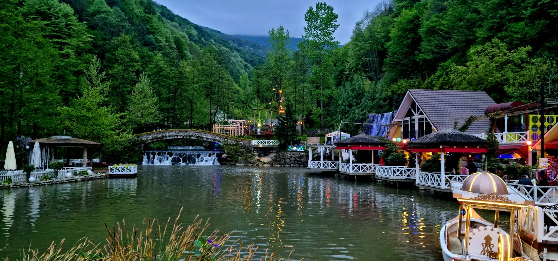
Discover historic bridges, mosques, museums, traditional towns, lakes, rivers, Black Sea beaches, waterfalls and wetlands throughout Sakarya Province.
View Sakarya GuideConnect Sakarya Bridge with more of the province's history, architecture and cultural landscapes.
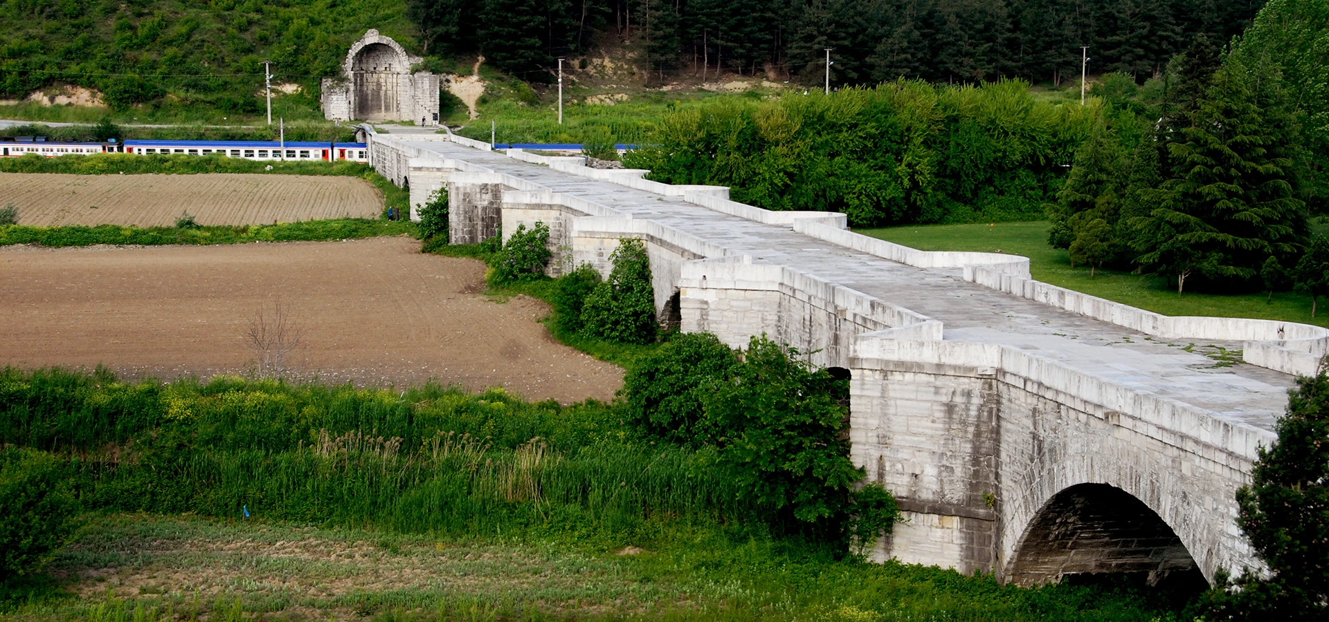
Travel from twentieth-century reinforced concrete to one of the great surviving bridge monuments of the early Byzantine world.
Explore Justinian Bridge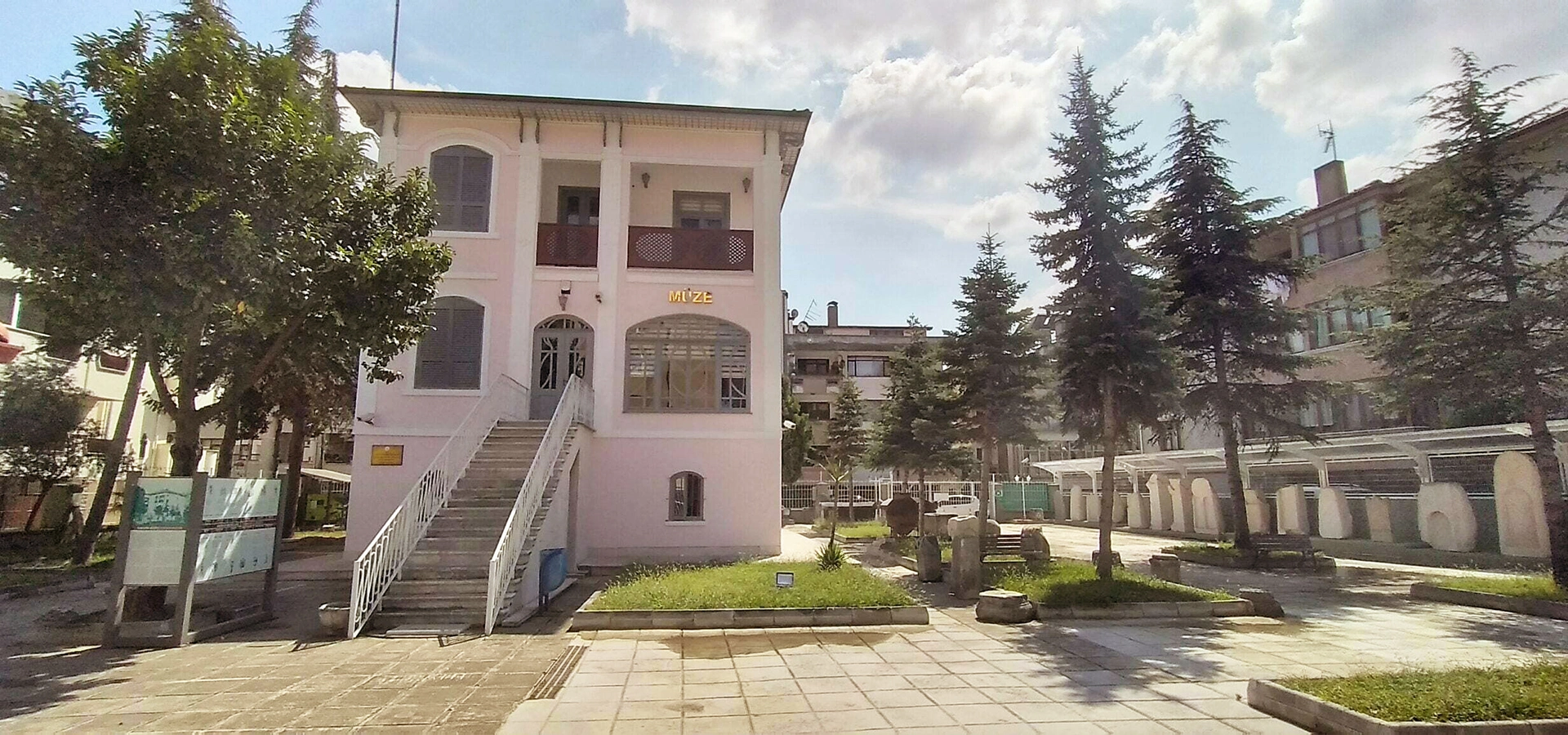
Continue into central Adapazarı to explore archaeological, Ottoman and Republican-period collections from across the province.
Explore Sakarya Museum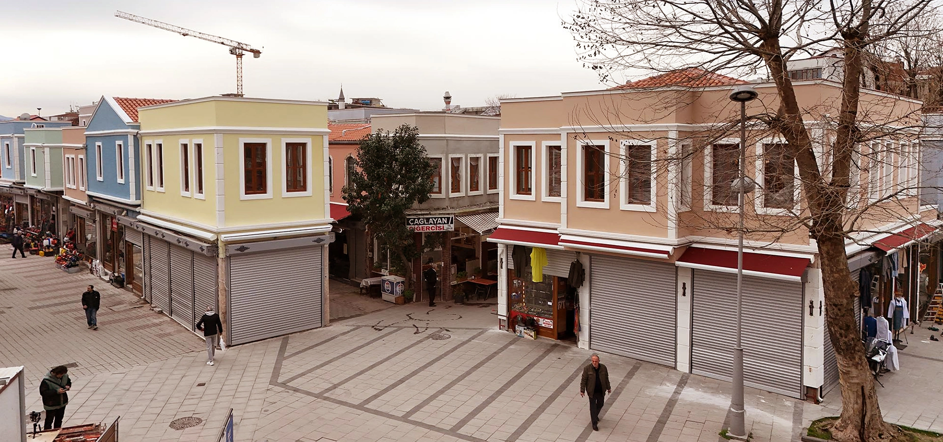
Finish your heritage route with traditional commercial streets, local shops and the atmosphere of old central Adapazarı.
Explore Historic Uzun Çarşı