Private Istranca Mountains Nature Experience
Ask us about a tailor-made day combining forest scenery, villages, nature walks and selected attractions across northern Kırklareli.
Request a Custom Tour





Across the northern landscapes of Kırklareli, a vast belt of wooded hills rises between the plains of Thrace, the Bulgarian border and the Black Sea. These are the Istranca Mountains, also widely known in Türkiye as the Yıldız Mountains and across the border as Strandzha.
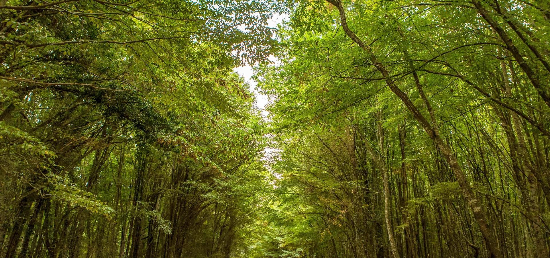
This is not a mountain range of bare alpine summits. The character of Istranca is defined instead by dense forest, deep valleys, streams, misty ridges, caves, wetlands and quiet rural roads. In places, the canopy seems almost continuous for kilometers.
The highest point is Mahya Dağı at 1,031 meters, the highest point in the European part of Türkiye. From these uplands, streams descend toward the Black Sea and help feed the remarkable wetland systems around İğneada Longoz Forests.
For travelers, the Istranca Mountains are best understood not as one single sightseeing stop, but as an entire nature region. A journey through them can include forest walks, scenic drives, cave exploration, birdwatching, traditional villages, the historic landscapes of Demirköy and the wild Black Sea coast.
Explore one of the most heavily forested landscapes in Turkish Thrace, dominated by broad-leaved woodland.
Discover the mountain region surrounding the 1,031-meter highest point of European Türkiye.
Visit Dupnisa Cave and travel through deeply cut valleys, streams and limestone landscapes.
Follow the forest eastward toward İğneada, Kıyıköy and some of Türkiye's most atmospheric Black Sea scenery.
Essential information for exploring the great forested mountain landscape of northern Kırklareli.
Northern and northeastern Kırklareli in Turkish Thrace, extending toward Bulgaria and the Black Sea.
Open on Google MapsMahya Dağı – 1,031 meters, the highest point in the European part of Türkiye.
Broad-leaved forests, wooded ridges, deep valleys, streams, caves, wetlands and rural settlements.
Istranca Dağları, Yıldız Dağları and, across the Bulgarian border, Strandzha or Strandja.
Nature walks, scenic drives, birdwatching, photography, caves, rural landscapes and slow travel.
One full day for a focused route; two or three days for a wider Istranca and Black Sea journey.
The Istranca Mountains form the great wooded upland separating the interior plains of Thrace from the Black Sea.
The Istranca Mountains stretch across southeastern Bulgaria and the European part of Türkiye. On the Turkish side they are generally called either Istranca Dağları or Yıldız Dağları.
In Kırklareli, the range runs broadly from northwest to southeast. Its northern side descends toward the Black Sea through a landscape broken by valleys and watercourses, while the southern side gradually lowers toward the Ergene Basin.
The mountains are moderate in height but exceptionally important in shaping the province. They influence rainfall, vegetation, river systems, wildlife and even the settlement pattern of northern Kırklareli.
Unlike dramatic high mountain chains elsewhere in Türkiye, Istranca often feels more like a vast rolling forest wilderness. The most memorable views are therefore not always from exposed summits, but from winding forest roads, valley openings, stream crossings and clearings where layers of wooded ridges disappear into the distance.
The highest point of the Istranca Mountains is Mahya Dağı, rising to approximately 1,031 meters between the Pınarhisar and Demirköy areas. It is also the highest point in the European part of Türkiye.
The surrounding uplands are heavily forested and form one of the most elevated parts of the Kırklareli landscape. The region is especially beautiful in mist, after rain and during the changing colors of autumn.
Travelers should understand, however, that Mahya is not a conventional tourist summit. The summit area contains a military radar installation, and access restrictions apply around the controlled zone. Visitors should never attempt to enter restricted roads or cross military warning signs.
Mahya Dağı is the highest point of the Istranca range and the highest point of European Türkiye.
The mountain is surrounded by dense woodland rather than the exposed rocky landscapes associated with higher alpine ranges.
Higher elevation and Black Sea influence can make the uplands noticeably cooler, wetter and mistier than the plains to the south.
The radar and military zone at the summit must be respected; do not treat the actual summit as an unrestricted hiking objective.
Many routes in the wider Mahya region use rural or forestry roads whose conditions and access status can change.
For walking in the area, confirm current access and choose legal routes away from military, border and forestry restrictions.
The defining feature of the Istranca Mountains is their forest. Rainfall from the Black Sea, cooler uplands and deeply cut valleys support extensive deciduous woodland across much of northern Kırklareli.
On wetter and higher slopes, oriental beech and hornbeam become especially important. Oak communities are widespread, while valleys and stream corridors support a richer mixture of trees adapted to moist conditions.
In places, visitors also encounter linden, ash, elm, alder, willow, maple and other species, creating a woodland structure that changes noticeably with altitude, slope and distance from the Black Sea.
The result is one of the most atmospheric forest landscapes in European Türkiye: bright green in spring, deep and shaded in summer, extraordinarily colorful in autumn and often stark, misty and dramatic in winter.
Beech becomes prominent in cooler and wetter parts of the mountains, particularly on northern-facing slopes.
Different oak communities form a major part of the Istranca woodland landscape.
Hornbeam is an important companion species in many moist broad-leaved forest areas.
Alder, willow, ash and other moisture-loving trees appear along valleys and watercourses.
In suitable humid forest habitats, dense rhododendron can contribute to the distinctly Black Sea character of the vegetation.
The forests offer completely different visual experiences in spring green, summer shade and autumn color.
The combination of continuous forest, valleys, streams, caves, wetlands and relatively low population density makes Istranca one of the most important wildlife landscapes in Turkish Thrace.
The region supports many forest mammals, reptiles, amphibians and a particularly rich bird community. Researchers have studied the mountains as an important habitat for both resident and migratory birds, especially around the Dereköy and northern Kırklareli forests.
The nearby cave systems also create specialized habitats. At Dupnisa Cave, for example, large bat colonies are one of the reasons seasonal access rules are necessary in part of the cave system.
Wildlife watching is best approached quietly and responsibly. Animals should never be fed, approached, chased or disturbed for photographs.
Dense woodland and varied elevation create excellent habitat for many resident and migratory bird species.
Caves in the Istranca landscape provide important underground shelter for multiple bat species.
The extensive forests provide habitat for larger mammals that require broad, relatively undisturbed landscapes.
Streams, ponds, wet forest floors and seasonal wetlands create valuable habitat for amphibians.
Old woodland, decaying timber, caves and wetlands support diverse insect and invertebrate communities.
Use binoculars and long lenses rather than moving close to nests, dens, caves or resting wildlife.
Water is one of the keys to understanding the Istranca landscape. The mountains are cut by numerous streams and valleys, especially on the slopes descending toward the Black Sea.
Rain falling over the forested uplands is collected by these watercourses and carried eastward. Around İğneada, several streams descend from the Yıldız Mountains toward the coast and help create the remarkable system of lagoons, wetlands and seasonally flooded forests protected within İğneada Longoz Forests National Park.
This relationship between mountain and coast makes Istranca much more than a forested ridge. Its waters connect upland woodland with caves, village valleys, lakes, floodplain forests, dunes and eventually the Black Sea.
Streams have cut the mountains into a complex landscape of wooded ridges and sheltered valleys.
Springs and small watercourses are common, but untreated natural water should never automatically be assumed safe to drink.
Many northern streams flow toward the coast, carrying water from the mountains into the İğneada wetland system.
Water levels and road conditions can change greatly after heavy rain, snowmelt or prolonged wet weather.
The mountain catchment is fundamental to the ecology of the longoz forests and coastal lakes.
Soap, food waste, chemicals and litter should never be introduced into streams, springs or wetland habitats.
One of the most remarkable landscapes connected with the Istranca Mountains lies at their eastern edge: İğneada Longoz Forests National Park.
Streams flowing from the Yıldız Mountains descend toward the Black Sea. Near the coast, sand barriers, lagoons and low-lying terrain create a complex hydrological system in which parts of the forest become seasonally flooded.
The national park protects approximately 3,155 hectares and includes lagoons, forest lakes, wetlands, dunes and floodplain woodland. It is one of the strongest reasons to combine an Istranca mountain journey with the Black Sea coast.
A seasonally flooded forest ecosystem shaped by water, low relief and the relationship between streams, lagoons and the sea.
The protected landscape includes lagoon and inland lakes such as Mert, Erikli, Saka, Deniz, Hamam and Pedina.
Coastal dunes form a highly sensitive ecosystem between the longoz forest and the Black Sea.
The meeting of forest, freshwater and coast creates particularly valuable habitat for birds.
The longoz changes dramatically with rainfall and seasonal flooding, so the same area can look very different through the year.
Follow all national-park rules, marked routes and current access instructions when visiting sensitive wetland areas.
Hidden within the forested landscape near Sarpdere Village, Dupnisa Cave is one of the most important natural attractions in Kırklareli.
The cave system extends for approximately 2,720 meters. Its chambers, underground river, pools, stalactites and stalagmites reveal an entirely different side of the Istranca landscape.
Dupnisa is also a major bat habitat. For conservation reasons, different sections have different access arrangements, and part of the wet cave is seasonally closed during the period when bats are especially concentrated there.
Read our complete visitor guide to Kırklareli's best-known cave system.
Water flows permanently through the lower cave, creating pools and an active underground environment.
Seasonal closure rules protect important bat colonies and should always be respected.
The journey to Dupnisa is part of the experience, passing through rural villages and dense Istranca woodland.
The Istranca Mountains offer wonderful conditions for walking, but travelers should not imagine a single, standardized national trail network. Routes may involve village roads, forest tracks, local paths and protected-area walking routes.
For casual visitors, the best experiences are usually short forest walks and clearly defined nature routes near established destinations such as Dupnisa, İğneada, Kastro and the villages around Demirköy.
Longer independent routes require much more preparation. Forest tracks can branch repeatedly, phone reception can be limited, and access may be affected by forestry operations, seasonal fire restrictions, border controls or military zones.
Ideal for most visitors and easiest to combine with caves, villages and scenic driving.
Use reliable route information, offline navigation, sufficient water and realistic timing.
After rain, woodland tracks can become muddy, slippery or difficult for ordinary vehicles.
Do not rely exclusively on mobile data; save maps and essential information before entering remote forest areas.
Never enter military, border, forestry or conservation areas marked as closed, even if an online trail appears to continue through them.
Forest darkness arrives quickly after sunset, especially in autumn and winter, so allow generous return time.
For many travelers, the easiest way to experience Istranca is by road. Routes between Kırklareli, Pınarhisar, Demirköy, Dupnisa, İğneada and Kıyıköy cross a changing landscape of forest, valleys, villages and Black Sea scenery.
The drive is especially beautiful in autumn, when broad-leaved woodland turns gold, copper and deep red. Spring offers fresh green foliage, while winter can bring fog, frost and occasional snow to the higher ground.
Main roads are generally straightforward, but small forest and village roads may be narrow, uneven or affected by weather. Do not leave public roads simply because a map shows a forestry track as a shortcut.
A classic introduction to the mountains, climbing from the interior toward the heart of the forest region.
Descend from the wooded uplands toward the longoz forests and Black Sea coast.
Travel through smaller villages and deep forest landscapes toward the cave near Sarpdere.
The southeastern edge of the Istranca landscape combines forest with dramatic Black Sea coastal scenery.
Some of the most photogenic views come from ordinary roads winding beneath a canopy of changing leaves.
Fog, animals, fallen branches, mud, ice and sharp bends can all occur in mountain forest conditions.
The Istranca experience is not only about wilderness. Scattered among the forests are villages whose history and daily life have long been shaped by woodland, livestock, agriculture, water, charcoal, timber and movement across the landscapes of Thrace.
Places such as Sarpdere, Dereköy, Yenice and other rural settlements give the region a very different character from the larger towns of southern Kırklareli.
Travel slowly and respectfully through these communities. Small local restaurants, village products and family businesses can become memorable parts of the journey, but visitors should remember that these are living settlements rather than open-air attractions.
Best known as the village associated with the approach to Dupnisa Cave.
A northern settlement close to the Bulgarian frontier and surrounded by rich Istranca forest habitat.
Located near some of the higher Istranca landscapes and routes approaching the Mahya region.
Simple local meals, dairy products, seasonal produce and regional dishes can be part of a slow-travel experience.
Allow extra driving time and expect agricultural vehicles, livestock and changing road surfaces.
Ask before photographing residents, homes, farms or private property.
At the heart of the eastern Istranca region lies Demirköy, a small district center surrounded by forests on the road toward İğneada.
Its name, meaning roughly "Iron Village," reflects the historic importance of metalworking in the area. The best-known monument is the Fatih Iron Foundry, an Ottoman industrial site associated with the production of iron in this heavily wooded region.
The relationship makes geographical sense: traditional iron production required access to ore, water and enormous quantities of fuel, all resources connected with the forested mountain environment.
Demirköy therefore provides an excellent cultural counterpoint to the natural landscape, showing that the Istranca forests have shaped human activity for centuries as well as wildlife and scenery.
Demirköy is one of the most useful bases for exploring the eastern Istranca Mountains.
An important Ottoman industrial heritage site revealing the historical use of the region's natural resources.
The road continues east from the mountain forests toward the longoz wetlands and Black Sea coast.
Rural roads from the wider Demirköy area lead toward Sarpdere and the Dupnisa cave system.
Take a relaxed forest walk and experience the sound, shade and changing light of the broad-leaved woodland.
Discover underground rivers, formations and one of the most important cave ecosystems in Kırklareli.
Visit in October or November for one of the most dramatic seasonal color displays in Turkish Thrace.
Bring binoculars and spend time quietly along woodland edges, streams and wetland transitions.
Combine mountain scenery with the historic industrial landscape of the Fatih Iron Foundry.
Follow mountain streams toward the longoz forests, lagoons, dunes and Black Sea.
Combine forested hills with a historic Black Sea town, cliffs, rivers and coastal scenery.
Discover where Istranca woodland reaches the Black Sea around Çamlıkoy and Kastro.
The Istranca Mountains are a large geographical region rather than a single gated attraction. There is therefore no single entrance ticket, opening time or visitor center covering the entire mountain range.
Individual destinations inside the region can have their own rules. Caves, national parks, recreation areas, protected forests and heritage sites may operate with specific opening hours, entrance fees, seasonal closures or access restrictions.
Travelers should also remember that parts of northern Kırklareli lie close to the Bulgarian border, while the Mahya summit contains a military radar zone. Respect all official signs, checkpoints, barriers and photography restrictions.
Istranca is a year-round landscape, but each season creates a completely different experience. For most travelers, spring and autumn offer the best combination of scenery and comfortable temperatures.
Fresh leaves, flowing streams, wildflowers and cool walking weather make spring one of the most beautiful seasons.
The forest offers shade, but humid conditions, insects and seasonal wildfire restrictions should be considered.
The broad-leaved forests turn yellow, copper, orange and red, making this the premier season for landscape photography.
Fog, rain, frost and snow can create dramatic scenery but may also make remote roads and walking routes difficult.
Streams rise and unpaved tracks can become muddy or damaged; allow more time and avoid unnecessary forest-road driving.
Soft light, mist and quieter roads make morning especially rewarding for forest photography and birdwatching.
Enough for a short scenic drive and a focused forest stop if you are already traveling through northern Kırklareli.
Ideal for combining scenic roads, a forest walk, a village stop and one major attraction such as Dupnisa Cave.
Combine the interior forests and Dupnisa with Demirköy, İğneada and the Black Sea coast.
Add Kıyıköy, Kastro, village landscapes and more relaxed nature walks without rushing.
A weekend is ideal for travelers coming from Istanbul who want forest, cave and coast rather than rapid sightseeing.
Photographers, birdwatchers and hikers can easily spend several days exploring different habitats and seasons.
Istranca rewards photographers who look for atmosphere rather than monumental landmarks. Fog between trees, wet roads, reflected leaves, streams, moss, village lanes and layered ridges often produce the strongest images.
Wide forest views and aerial-style compositions are especially dramatic during the autumn color season.
Low cloud and morning fog can turn ordinary forest roads into highly atmospheric scenes.
Use slower compositions around flowing water, moss-covered stones and shaded valleys.
Use long lenses and keep a respectful distance from birds and animals.
Old houses, gardens, farm roads and local architecture add a human dimension to the mountain story.
Never photograph military installations, checkpoints or locations where photography is prohibited.
Mobile reception can weaken in valleys and remote forest areas, so save your route before departure.
Bring sufficient drinking water rather than relying on springs or streams whose water quality you cannot verify.
Forest paths can be muddy, uneven and slippery even when the weather appears dry elsewhere.
The Black Sea influence means showers, mist and rapidly changing conditions are always possible.
When walking through vegetation, use appropriate clothing and check yourself carefully after returning.
Never light fires outside officially permitted areas and always follow seasonal forest-fire restrictions.
Forestry barriers, military signs and protected-area restrictions must be respected even when navigation apps suggest the route.
Distances are not enormous, but services become less frequent once you leave the main towns.
For longer independent walks, share your planned route and expected return time before entering remote areas.
Take all rubbish away and avoid damaging plants, fungi, streams, cave habitats or forest soil.
Because the Istranca Mountains cover a large area, the best route depends on which part of the region you want to explore. For most visitors, a private vehicle is the most practical option.
Central Kırklareli provides access toward the northern forests, while Pınarhisar and Demirköy are useful gateways for the higher eastern mountains, Dupnisa Cave and the road toward İğneada. Kıyıköy and Kastro provide access to the southeastern forest-and-coast landscapes.
Drive north or northeast toward the forested uplands, choosing your route according to Dupnisa, Demirköy or İğneada.
The Istranca region works well as a nature weekend, particularly when combined with Kıyıköy or İğneada.
Travel east through Kırklareli for a route that contrasts Ottoman city heritage with the forest landscapes of northern Thrace.
Continue north and east from historic Vize toward Kıyıköy, Kastro and the southern Istranca landscapes.
Buses and minibuses serve towns, but reaching remote forest stops efficiently is much more difficult without a vehicle.
A private vehicle makes it easier to combine forests, villages, caves, heritage sites and the Black Sea in one coherent route.
The greatest strength of Istranca is how easily forest, cave, coast and cultural heritage can be combined. Several of Kırklareli Province's most rewarding destinations lie within or directly beside the mountain landscape.
Explore Kırklareli's famous underground river cave hidden in the forests near Sarpdere.
Discover a historic Black Sea town surrounded by rivers, forested hills, cliffs and Byzantine heritage.
See one of the most dramatic places where the forests of Istranca descend directly toward the Black Sea.
Continue to the Black Sea coast near İğneada for historic maritime scenery at the northeastern edge of Kırklareli.
Combine nature with Roman, Byzantine and Ottoman heritage in one of Turkish Thrace's most historic towns.
Return to the provincial capital for museums, Ottoman architecture, archaeology and regional food.
The Istranca Mountains extend across southeastern Bulgaria and the European part of Türkiye. In Türkiye, a large and especially forested section lies across northern Kırklareli Province.
Yes. In Türkiye, the range is commonly called both Istranca Dağları and Yıldız Dağları. Across the Bulgarian side, the name Strandzha or Strandja is widely used.
The highest point is Mahya Dağı at approximately 1,031 meters. It is also the highest point in the European part of Türkiye.
The actual summit area contains a military radar installation and access restrictions apply. Do not cross military signs or barriers. For walking in the wider Mahya region, use legal routes and confirm current local access.
No single entrance fee covers the mountain range because it is a large geographical region. Individual caves, national parks, recreation areas or attractions may have their own fees and opening arrangements.
Spring and autumn are generally the most rewarding. Spring brings fresh green forest and flowing water, while autumn creates spectacular color across the broad-leaved woodland.
Yes, but routes vary from short nature walks to remote forest tracks. Longer walks require preparation, offline navigation and attention to current forestry, military, border and conservation restrictions.
Yes. Dupnisa Cave lies within the forested Istranca landscape near Sarpdere Village and is one of the region's most important natural attractions.
Yes. Streams descending from the Yıldız Mountains flow toward the Black Sea and help feed the wetland and lagoon systems around İğneada Longoz Forests National Park.
The forests include important communities of oak, oriental beech and hornbeam, with many additional species occurring in valleys, wetter slopes and streamside habitats.
Absolutely. Autumn is one of the finest times to visit because the deciduous forests develop rich yellow, orange, copper and red colors across the mountain valleys.
No. Camping and fire rules vary by protected area and season, and access can be restricted during periods of high wildfire risk. Use permitted areas and confirm current local regulations.
Coverage can be weak or disappear in remote valleys and densely forested areas. Download maps and important information before leaving the main towns.
Do not assume untreated spring or stream water is safe. Carry sufficient drinking water unless a source is specifically confirmed as potable.
Istranca is a genuine wildlife landscape. Serious encounters are uncommon for ordinary visitors, but travelers should keep distance from all wild animals, avoid feeding them and store food responsibly.
A full day works for one focused route. For Dupnisa, Demirköy, İğneada, Kıyıköy and relaxed forest experiences, two or three days is much better.
A car is highly recommended. Public transport can reach towns, but many of the most rewarding forest, cave and coastal locations are difficult to combine without private transport.
Yes, especially when choosing short forest walks, established attractions and scenic drives. Families should avoid remote unmarked routes and take extra care around water, caves and slippery forest terrain.
Excellent combinations include Dupnisa Cave, Kıyıköy, Kastro, İğneada Longoz Forests, Demirköy and central Kırklareli.
Yes. It is one of the best places in Turkish Thrace for travelers who enjoy forest landscapes, caves, wildlife, scenic roads, rural culture and the Black Sea.
The beauty of Istranca depends on the health of its forests, streams, wetlands and wildlife. Small decisions by visitors can make a real difference in a landscape that includes sensitive habitats and important protected areas.
Never light fires outside permitted areas, especially during dry summer and autumn conditions.
Do not leave food, plastic, cigarette ends, tissues or other waste anywhere in the forest.
Keep soaps, chemicals, waste and food scraps away from streams, springs, lakes and wetlands.
Do not bypass barriers or enter closed forestry roads, military areas, border zones or sensitive habitats.
Avoid collecting wild plants, flowers or fungi unless you clearly understand local regulations and ecological impact.
Never feed, chase, touch or deliberately approach wild animals for photographs.
Seasonal restrictions protect bats and other cave species; closed sections must remain undisturbed.
Use local restaurants, village businesses and regional products where appropriate while respecting private life and property.
Discover the forests, caves, villages and Black Sea landscapes of Kırklareli with a private route designed around your interests and travel pace.
Combine forest scenery with Dupnisa Cave, Demirköy, İğneada, Kıyıköy or other highlights of northern Kırklareli in a tailor-made private journey.
Ask us about a tailor-made day combining forest scenery, villages, nature walks and selected attractions across northern Kırklareli.
Request a Custom Tour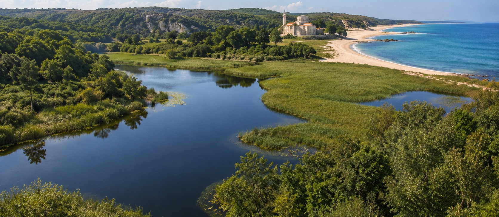
Discover more of Kırklareli, from prehistoric archaeology and Ottoman monuments to caves, forests, Black Sea towns and traditional food.
View Kırklareli GuideFollow the mountains from underground caves and deep forest to historic Black Sea towns and the coast of northern Thrace.
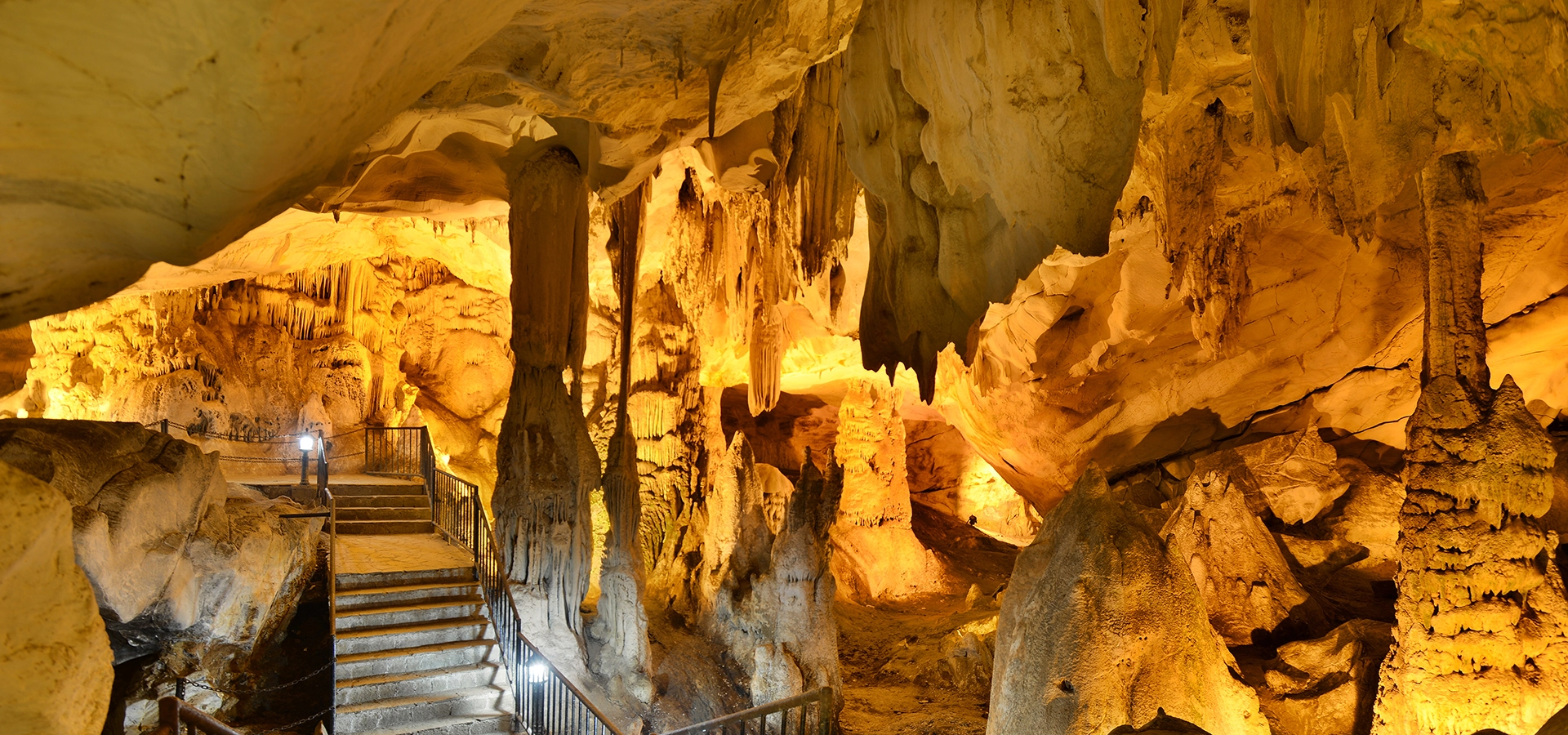
Enter the underground world of Istranca at Kırklareli's most famous cave system near Sarpdere.
Discover Dupnisa Cave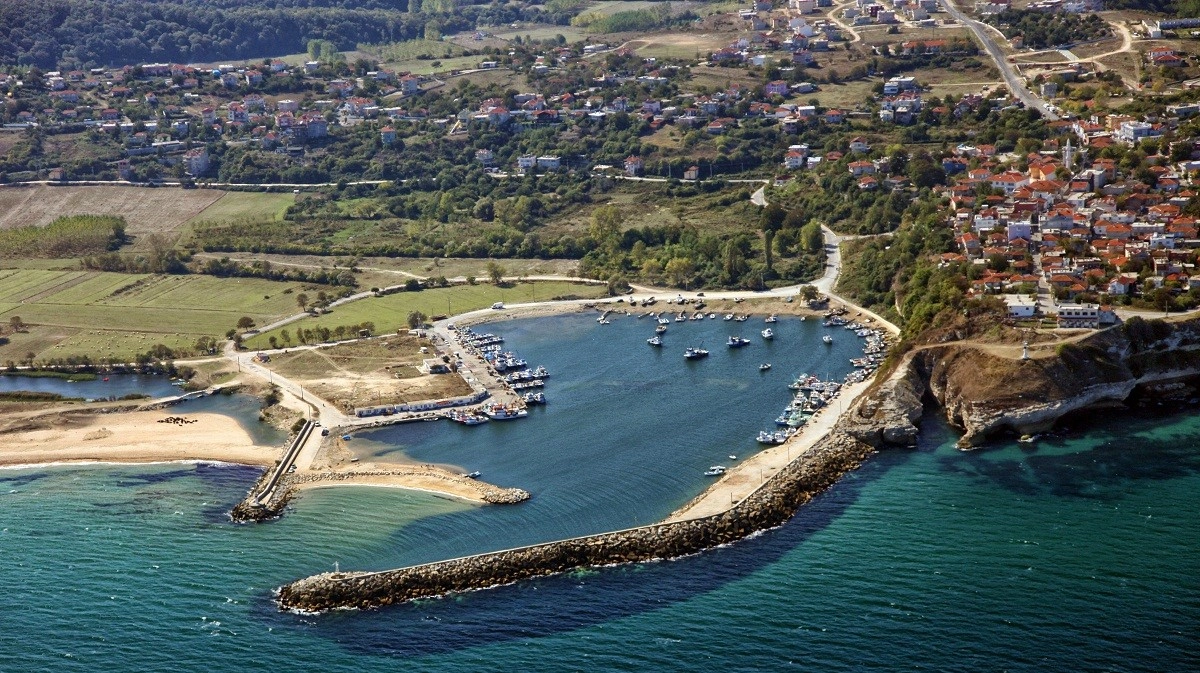
Discover a historic Black Sea town surrounded by forest, rivers, cliffs and ancient monuments.
Explore Kıyıköy
See where the forests of Istranca meet the Black Sea in one of Kırklareli's most dramatic coastal landscapes.
Explore Kastro