Sulu Cave
The lower and wetter part of Dupnisa contains the cave's continuously flowing underground river.
- Character: Cool and humid
- Main feature: Underground river
- Landscape: Pools, passages and active formations






Hidden beneath the dense forests of the Istranca Mountains in Kırklareli, Dupnisa Cave is one of the most impressive underground landscapes in northwestern Türkiye. Located near Sarpdere Village in the Demirköy district, the cave combines dramatic limestone formations, an underground river, subterranean pools and an extraordinarily important bat habitat.
Dupnisa is not simply one cavern. It is a large two-level cave system composed of three interconnected caves: Sulu Cave, Kuru Cave and Kız Cave. Official information from Kırklareli describes the system as approximately 2,720 metres long.
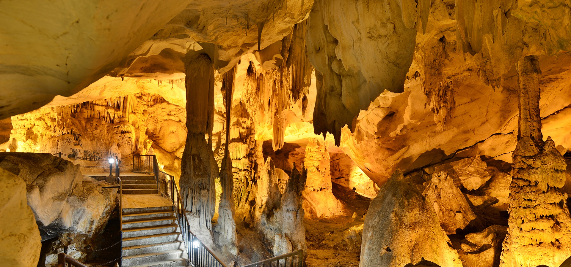
Visitors enter a world of enormous stalactites, stalagmites, columns, curtains and flowstone formations that have developed over millions of years. In the lower galleries, an underground river continues to flow through the mountain, while the upper chambers contain some of Dupnisa's richest formations.
But Dupnisa is equally important for what lives inside it. The cave is one of the region's major underground wildlife habitats and shelters tens of thousands of bats. For this reason, parts of the system are permanently or seasonally closed to visitors.
The officially recorded length of the interconnected Dupnisa cave system.
Sulu, Kuru and Kız caves form a remarkable two-level underground system.
Water flows continuously through the lower cave and forms subterranean pools.
The cave provides habitat for an exceptionally important community of bats.
Essential information for visiting one of the most extraordinary natural attractions in Kırklareli and Turkish Thrace.
Near Sarpdere Village, Demirköy District, Kırklareli Province.
Open Dupnisa Cave on Google MapsThree interconnected caves arranged on two principal underground levels.
Approximately 2,720 metres according to official Kırklareli tourism information.
A major bat habitat supporting tens of thousands of animals and numerous cave invertebrates.
Water slowly transformed ancient rock beneath the Istranca Mountains into the spectacular galleries seen today.
Dupnisa developed inside ancient marble formations of Jurassic age. Over immense periods of geological time, water entered fractures in the rock and gradually enlarged them through dissolution.
Streams and groundwater continued to carve passages through the mountain, eventually creating chambers, galleries, shafts and underground waterways. Official descriptions indicate that the cave system has continued its development for approximately four million years.
Mineral-rich water dripping from ceilings deposited calcium carbonate little by little. Over thousands of years these deposits created the extraordinary formations now visible throughout the cave: stalactites, stalagmites, columns, curtains, flowstones and rimstone pools.
The different elevations within the cave also created remarkably different environments. Some galleries became drier as underground water shifted downward, while the lowest passages remained active and continued carrying flowing water.
That contrast between dry fossil galleries above and an active underground river below is one of the defining characteristics of Dupnisa.
Dupnisa is scientifically described as a cave system rather than a single chamber because it consists of three interconnected caves with very different environments.
The lower and wetter part of Dupnisa contains the cave's continuously flowing underground river.
The upper dry cave contains some of Dupnisa's most spectacular stalactites, stalagmites and enormous columns.
Kız Cave is particularly important as a habitat for large colonies of bats and is protected from ordinary tourist access.
Kuru and Kız caves occupy the upper part of the system, while Sulu Cave lies approximately 50–60 metres below.
Water continues to move through Dupnisa today, demonstrating that parts of the cave remain hydrologically active.
Mineral deposits appear in shades ranging from pale white to red and brown.
Sulu Mağara — the “Water Cave” — forms the active lower level of the Dupnisa system. It lies approximately 50–60 metres below the upper caves and contains one of Dupnisa's most memorable features: a continuously flowing underground river.
The sound of moving water accompanies visitors through sections of the gallery. In places, the river forms pools among enormous rock walls and dripstone formations, creating a completely different atmosphere from the drier chambers above.
A permanent subterranean stream continues to shape the lower cave.
Water collects in natural basins, some of which reach considerable depth.
The lower cave generally remains around 10–12°C according to official descriptions.
Its active water system makes Sulu Cave noticeably more humid than the upper galleries.
After experiencing the cooler, wetter lower passages, the upper Kuru Cave — the “Dry Cave” reveals another side of Dupnisa.
Here the underground environment is noticeably warmer and drier. Over enormous periods of time, dripping mineral-rich water created some of the cave system's most impressive formations.
Mineral formations descend dramatically from the cave ceiling.
Deposits rising from the cave floor record countless generations of dripping water.
Where stalactites and stalagmites eventually meet, they form enormous natural pillars.
Thin sheets of calcite resemble folded curtains or flags hanging from the rock.
Different minerals create formations ranging from milky white to warm red and brown.
Official descriptions give average temperatures of approximately 17°C in the upper cave.
Dupnisa's visual appeal comes from the extraordinary variety of mineral formations accumulated throughout its galleries.
Every formation begins with water. As rainwater moves through soil and rock above the cave, it absorbs minerals before emerging as tiny droplets inside the underground chambers.
When those droplets release calcium carbonate, they leave microscopic deposits behind. Repeated thousands upon thousands of times, this process gradually builds the spectacular formations visible today.
Formations growing downward from the cave ceiling as mineral-rich water drips toward the floor.
Deposits growing upward where droplets repeatedly strike the cave floor.
Massive structures created when a stalactite and stalagmite eventually connect.
Flowing water can create thin folded formations resembling hanging fabric.
Sheets of mineral deposits cover walls and sloping surfaces like frozen waterfalls.
Natural mineral barriers can create small terraced basins within the cave.
Dupnisa is much more than a tourist attraction. It is one of the most important underground wildlife environments in the region.
Official Kırklareli tourism information records approximately 60,000 bats belonging to 11 species within the Dupnisa system, together with a remarkable diversity of cave invertebrates.
Caves provide bats with stable temperature, darkness and shelter. Large colonies can therefore use particular chambers for hibernation, breeding and resting. Even relatively small disturbances can have serious consequences when thousands of animals occupy the same underground habitat.
Dupnisa supports one of the region's most remarkable concentrations of cave-dwelling mammals.
Official provincial information records eleven bat species within the cave ecosystem.
Kız Cave is kept outside the normal tourist route because of its importance to bat colonies.
Parts of the system are closed during sensitive periods to reduce disturbance.
The subterranean habitat also supports a remarkable community of small cave-adapted organisms.
Never shine strong lights directly at bats, make unnecessary noise or attempt to approach them.
Although the complete Dupnisa system extends for kilometres, ordinary visitors explore only a specially prepared portion of the caves.
Official tourism information describes approximately 450 metres of developed visitor route, with walkways and lighting installed through sections of the Sulu and Kuru caves.
The public route uses constructed paths, platforms and stairs through the cave.
Lighting allows visitors to see the principal chambers and mineral formations.
The route changes elevation and includes a substantial number of steps.
Sections can remain damp and slippery because of dripping water and high humidity.
The transition between lower and upper caves can produce noticeable differences in temperature and airflow.
The developed route allows visitors to experience contrasting sections of the cave system rather than remaining in one chamber.
One of the most interesting aspects of visiting Dupnisa is the rapid change in underground climate.
Official descriptions indicate that the lower main cave is generally cooler at approximately 10–12°C and has high humidity, while the upper dry galleries average approximately 17°C.
The contrast between these environments creates noticeable air movement between different parts of the cave. Even during warm summer weather outside, entering the lower galleries can therefore feel surprisingly cool.
Generally around 10–12°C and comparatively humid.
Warmer and drier, averaging approximately 17°C.
A light jacket can be useful even when the weather outside is hot.
Shoes with reliable grip are recommended because cave surfaces may remain wet.
The journey to Dupnisa is part of the experience. The cave lies within one of the greenest landscapes in European Türkiye, surrounded by the dense forests and valleys of the Yıldız Mountains, better known as the Istranca or Strandzha Mountains.
This forested range stretches across the Türkiye–Bulgaria border region and receives strong climatic influence from the Black Sea. Oak, beech and other deciduous trees cover much of the landscape, while streams cut deeply into the hills.
The surroundings therefore make Dupnisa particularly rewarding for visitors who enjoy combining geology, forest landscapes, photography and quiet rural travel.
The road approaches Dupnisa through the extensive woodland of northern Kırklareli.
Water flowing through the Istranca landscape ultimately helps shape the caves and valleys.
The contrast between dark underground chambers and green forest makes Dupnisa especially rewarding for photographers.
The surrounding villages and forest roads reveal a very different side of Türkiye from the country's major tourist centres.
Dupnisa had long been known within Turkish cave literature before becoming an organized visitor attraction.
The cave was officially opened to tourism in 2003, making it the first major cave in Thrace to be developed specifically for tourism.
Walkways and lighting were installed through selected sections while large parts of the underground system were deliberately left outside the tourist route. This allows visitors to experience the cave without opening every chamber to human disturbance.
That balance remains particularly important because Dupnisa is simultaneously a geological monument, tourism destination and living wildlife habitat.
The underground temperature changes far less dramatically than the weather outside, but the experience of reaching Dupnisa varies considerably with the seasons.
The Istranca forests become intensely green and streams carry abundant water. Always verify which cave sections are open because seasonal wildlife restrictions may continue into May.
One of the easiest periods for combining Dupnisa with forest exploration. The cool interior also provides a dramatic contrast with warm weather outside.
Changing forest colours make the journey through the Istranca Mountains particularly beautiful for landscape photography.
Some cave sections are restricted for bat conservation and forest roads can be affected by wet or wintry weather. Check conditions before making a special journey.
Dupnisa Cave is located near Sarpdere Village in the Demirköy district of Kırklareli Province, deep within the forests of the Istranca Mountains.
Dupnisa does not require an entire day by itself, but the remote forest setting means it is worth allowing enough time to enjoy both the cave and its surroundings.
Allow approximately 45–60 minutes for a comfortable visit through the developed cave route.
Allow around 1.5–2 hours to explore the cave without rushing and spend time in the surrounding forest area.
Combine Dupnisa with Sarpdere, Demirköy and scenic stops through the Istranca Mountains.
Combine the cave with additional natural or cultural attractions across northern Kırklareli.
The lower cave can remain around 10–12°C even when summer temperatures outside are much warmer.
Dripping water can make walkways and steps wet or slippery.
Dupnisa is a multi-level cave and the visitor route includes changes in elevation.
Part of the cave closes during the bat protection period.
Stalactites and other mineral surfaces are extremely slow-growing and easily damaged.
Avoid loud noise, flash photography near wildlife and unnecessary disturbance.
Dupnisa lies deep within the Istranca countryside rather than beside a major highway.
Temporary closures can occur because of maintenance, weather or conservation requirements.
Dupnisa offers a completely different photographic experience from the landscapes above ground. Artificial illumination reveals details in the mineral formations while the surrounding darkness creates strong contrasts and an almost theatrical atmosphere.
Look upward for intricate formations silhouetted against illuminated cave ceilings.
Larger chambers contain dramatic natural pillars that communicate the enormous scale of the cave.
Reflections around pools and wet surfaces can create atmospheric compositions.
A wider lens is useful for showing the relationship between walkways and enormous underground chambers.
The transition between dense green forest and the dark cave entrance provides excellent visual contrast.
Keep your camera steady and follow any current restrictions regarding flash or tripods.
Dupnisa lies in the countryside southwest of Sarpdere Village, within the Demirköy district of northern Kırklareli. The remote setting is one of its attractions, but it also means that planning transportation is important.
The cave is approximately 60 km from Kırklareli city centre.
Dupnisa is approximately 26 km from the district centre.
The cave lies approximately 6 km beyond the village.
A private car or organized transfer is the most practical way to explore Dupnisa and the surrounding countryside.
Because the final section of the journey passes through forest and rural roads, driving times can be longer than the distance alone suggests. Allow extra time and avoid planning an overly tight schedule.
Dupnisa can be combined with forests, Ottoman industrial heritage, Black Sea landscapes and traditional settlements across northern Kırklareli.
Discover the province's archaeological sites, Ottoman monuments, forests, Black Sea settlements and distinctive local foods.
The small forest village closest to Dupnisa provides the final gateway into the cave landscape.
Explore the forested district centre surrounded by the Istranca Mountains and several of northern Kırklareli's most interesting attractions.
Discover the remains of an important Ottoman ironworking complex hidden within the forests near Demirköy.
Continue north toward the Black Sea and explore Türkiye's extraordinary flooded forests, wetlands, lakes and coastal dunes.
Experience one of European Türkiye's great forest landscapes, filled with streams, rural roads, wildlife habitats and secluded villages.
Explore a remarkable Byzantine rock-cut monastery carved into the hillside near the Black Sea settlement of Kıyıköy.
Combine underground landscapes at Dupnisa with beaches, forests, lagoons and dramatic Black Sea scenery around İğneada.
Dupnisa Cave is located near Sarpdere Village in Demirköy District, Kırklareli Province, within the forested Istranca Mountains of northwestern Türkiye.
Official Kırklareli tourism information gives the interconnected Dupnisa cave system a total length of approximately 2,720 metres.
Not exactly. Dupnisa is a two-level cave system consisting of Sulu Cave, Kuru Cave and Kız Cave.
Approximately 450 metres of the system has been developed for ordinary tourism, with walkways and lighting through sections of the Kuru and Sulu caves.
Sulu Cave is the lower and wetter part of Dupnisa. It contains a continuously flowing underground river and natural subterranean pools.
Kuru Cave forms part of the upper level and is warmer and drier than the lower cave. It contains particularly impressive stalactites, stalagmites and columns.
Kız Cave is an upper section of the system especially important for bat colonies. It is kept outside the ordinary tourist route for conservation.
Yes. Official provincial information records approximately 60,000 bats belonging to 11 species in the cave ecosystem.
Yes. Official tourism information states that the Sulu section is normally closed between 15 November and 15 May to reduce disturbance during an important period for the bats.
Not every section. Kuru Cave is described by the provincial tourism authority as being accessible throughout the year, while the Sulu section has seasonal restrictions and Kız Cave is protected from ordinary tourism. Temporary closures can also occur.
Yes. A continuously flowing underground river passes through the lower cave and creates natural pools that can reach considerable depth.
The cave developed within Jurassic-age marble, while the underground cave system itself has been forming and evolving for millions of years.
Visitors can see stalactites, stalagmites, columns, curtain-like deposits, flowstone and mineral pools in a wide range of colours.
Official descriptions give temperatures of approximately 10–12°C in the cooler, humid lower cave and around 17°C in the upper dry galleries.
Yes, particularly during summer. The lower cave can feel quite cold compared with warm outdoor temperatures.
Wear comfortable shoes with good grip. Cave walkways and stairs can become damp or slippery because of dripping water and humidity.
The public section has developed walkways, lighting and stairs, but visitors should be comfortable walking on damp surfaces and negotiating changes in elevation.
Dupnisa Cave was officially opened to tourism in 2003.
Official tourism information places Dupnisa approximately 60 km from Kırklareli city centre.
The cave is approximately 26 km from Demirköy.
Dupnisa Cave lies approximately 6 km from Sarpdere Village.
Around one hour is generally sufficient for the developed cave route. Allow longer if you want to enjoy the surrounding forest or combine Dupnisa with other attractions in the Istranca Mountains.
Late spring through autumn is particularly convenient for combining the cave with the surrounding forest landscape. Always check seasonal bat-protection restrictions before travelling.
Yes. Dupnisa is one of the most distinctive natural attractions in European Türkiye, combining spectacular mineral formations, an underground river, an important bat habitat and the forest scenery of the Istranca Mountains.
Nearby destinations include Demirköy, the historic Fatih Foundry, İğneada Longoz Forests, the Istranca Mountains, the Black Sea coast and Kıyıköy with its rock-cut Aya Nikola Monastery.
Cave environments are unusually fragile. Unlike an outdoor landscape, many underground formations grow extremely slowly, while cave-dwelling animals depend on stable darkness, temperature and humidity.
Even brief contact can leave oils and dirt on mineral surfaces that have taken thousands of years to develop.
Barriers protect sensitive geology as well as important bat habitats.
Avoid shouting or unnecessary noise, particularly in sections used by bats.
Do not approach, touch, feed or deliberately illuminate roosting animals.
Take all rubbish out of the cave and surrounding forest with you.
Access arrangements may change to protect visitors, wildlife and the cave itself.
Dupnisa can become part of a tailor-made private journey through the forests, villages, natural landscapes and cultural heritage of Kırklareli.
Travel through the Istranca Mountains and discover one of Thrace's most fascinating underground landscapes with a private itinerary adapted to your interests and schedule.
Ask us about a tailor-made journey combining Dupnisa Cave, the forests of the Istranca Mountains, Demirköy and other highlights of northern Kırklareli.
Request a Custom Tour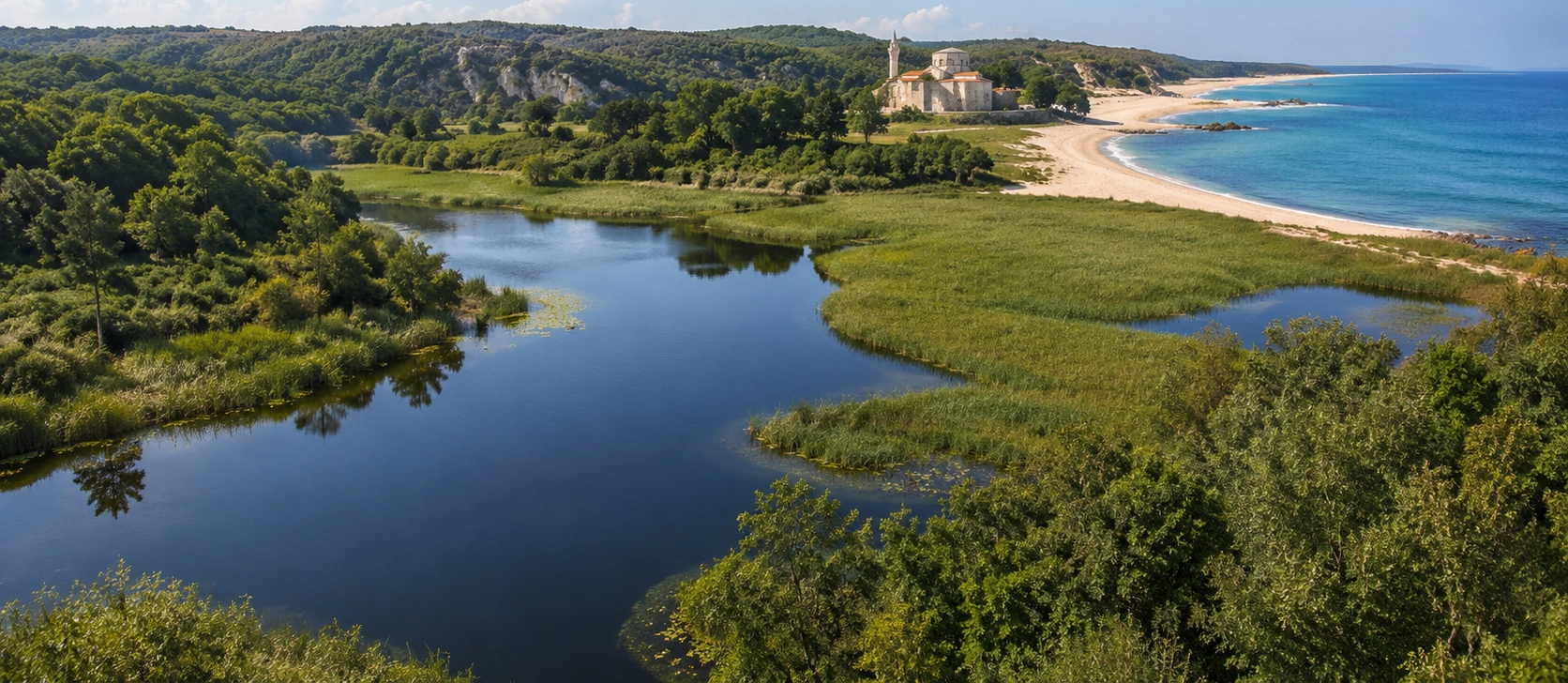
Continue planning your journey with our Kırklareli guide covering ancient sites, Ottoman monuments, caves, forests, Black Sea settlements and regional food.
View Kırklareli GuideNorthern Kırklareli is ideal for travelers looking for quiet landscapes, unusual natural environments and cultural heritage far beyond Türkiye's busiest tourist routes.
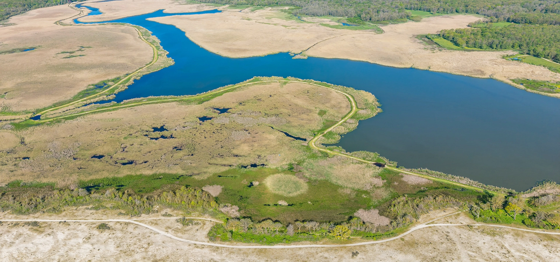
Combine the underground world of Dupnisa with the flooded forests, wetlands and Black Sea landscapes of İğneada.
Plan Your Nature Journey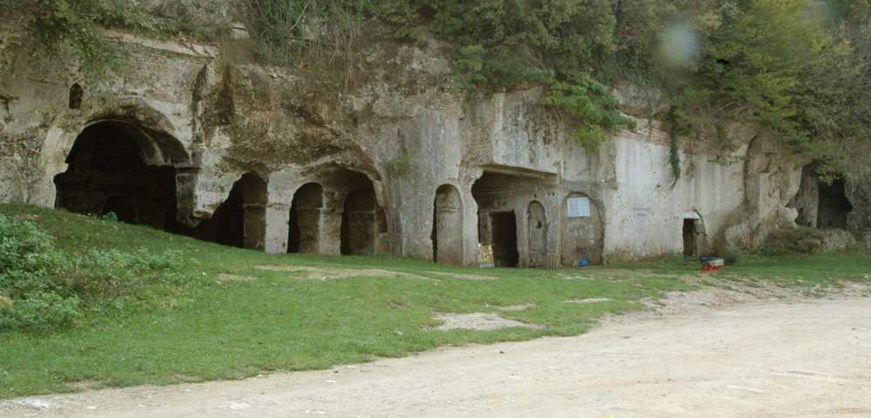
Pair the forests and caves of the Istranca Mountains with Kıyıköy's Black Sea scenery and extraordinary Byzantine rock-cut Aya Nikola Monastery.
Discover Kıyıköy