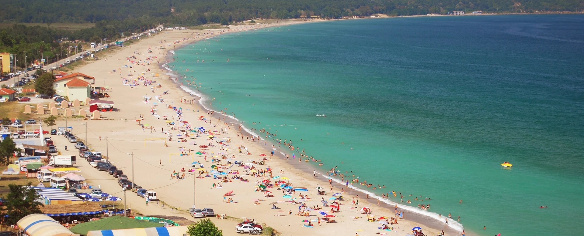
Private İğneada Nature Experience
Ask us about a tailor-made journey combining İğneada Longoz Forests, Mert Lake, forest walks, the Black Sea coast and Limanköy with private transportation.
Request a Custom Tour





On the remote Black Sea coast of Turkish Thrace, surrounded by forests, lagoons, wetlands and long sandy beaches, lies one of the most remarkable nature destinations in northwestern Türkiye: İğneada.
Administratively part of the Demirköy district of Kırklareli Province, İğneada sits close to the Bulgarian border where the forested Yıldız Mountains – Istranca Mountains descend toward the Black Sea.
The town itself is a peaceful seaside settlement, but the real treasure begins immediately beyond its streets: İğneada Longoz Forests National Park. Here, rivers flowing down from the mountains meet lagoons, wetlands and coastal dunes, creating extensive seasonally flooded forests known as longoz or floodplain forests.
Within this landscape are lagoons including Mert, Erikli, Deniz and Saka lakes, together with the forest lakes of Hamam and Pedina. Forests, reeds, freshwater, sand dunes and the Black Sea exist side by side within an exceptionally compact area.
İğneada is therefore much more than a summer beach destination. It is a place for nature walking, birdwatching, landscape photography, forest exploration and slow travel — and one of the finest places in Türkiye to experience the wild landscapes of Thrace.
Walk through rare floodplain forests where seasonal water transforms woodland into an extraordinary wetland ecosystem.
Discover Mert, Erikli, Deniz, Saka, Hamam and Pedina within the national park landscape.
Enjoy İğneada's broad sandy coastline where the forests of Thrace meet the Black Sea.
Experience forests, wetlands, coastal dunes, birds and small villages close to Türkiye's European frontier.
Essential information for exploring one of the most distinctive nature destinations in Turkish Thrace.
Demirköy district, Kırklareli Province, on Türkiye's Black Sea coast near the Bulgarian border.
Open on Google Mapsİğneada Longoz Forests, wetlands, lagoon lakes, Black Sea beaches and extensive natural landscapes.
İğneada Longoz Forests National Park covers approximately 3,155 hectares.
The longoz landscape was officially declared a national park in 2007.
Floodplain forests, lagoons, inland lakes, wetlands, coastal dunes, beaches and deciduous woodland.
Allow at least one full day; one or two nights are much better for experiencing the region properly.
İğneada stands in a landscape shaped by ancient Thrace, maritime routes, forests and the shifting frontier of southeastern Europe.
Long before İğneada became known as a seaside destination, the surrounding Black Sea coast formed part of the wider cultural landscape of ancient Thrace. Classical geographical sources describe Thynian groups inhabiting sections of this northern Thracian coastline.
The region's position was unusual. Behind the coast rose the heavily forested Yıldız – Istranca Mountains, while the Black Sea opened maritime routes toward the Bosphorus, western Black Sea settlements and the coast farther north.
For centuries, the area's dense forests strongly influenced local life. Timber, fishing, animal husbandry and small-scale agriculture helped sustain communities, while the difficult forest landscape kept the region comparatively isolated from major urban centers.
During the Ottoman period, the wider northern Thracian region became particularly important for its forests and natural resources. Nearby Demirköy developed around iron production, while coastal settlements remained connected with fishing and maritime activity.
Modern İğneada gradually developed as a small Black Sea settlement. Its beaches later attracted summer visitors, but recognition of the extraordinary ecological importance of the surrounding wetlands transformed İğneada into one of Türkiye's leading nature destinations.
In 2007, a large part of this landscape was protected as İğneada Longoz Forests National Park, helping conserve the floodplain forests, lagoons, wetlands, coastal dunes and biodiversity that make the area exceptional today.
İğneada feels very different from Türkiye's famous archaeological cities and Mediterranean resorts. Its appeal comes from the unusual concentration of forest, freshwater, wetlands and sea within the same landscape.
A morning can begin beside a lagoon surrounded by reeds, continue beneath oak and ash trees inside the longoz forest, and end watching the sun fall over a Black Sea beach.
The longoz is a seasonally flooded forest ecosystem created where water, flat terrain and woodland interact.
Few destinations combine dense deciduous woodland with lakes, wetlands, sand dunes and an open coastline so closely.
Lagoons, reed beds and forests create valuable habitats for resident and migratory birds.
Several national-park routes allow visitors to explore Mert, Erikli and Hamam lake landscapes on foot.
İğneada also offers an extensive sandy shoreline for travelers who want to combine nature exploration with the sea.
The region rewards travelers who stay overnight rather than trying to rush through the forests and lakes in only a few hours.
The landscape surrounding İğneada is protected within İğneada Longoz Forests National Park, one of Türkiye's most important examples of a large, well-preserved floodplain forest ecosystem.
The national park covers approximately 3,155 hectares and was declared in 2007. Its importance comes not from a single forest or lake, but from several interconnected ecosystems existing side by side.
Streams descending from the Yıldız Mountains approach the Black Sea, but coastal sand barriers can restrict their direct passage into the sea. Water therefore accumulates behind the dunes, feeding lagoons and wetlands.
During periods of high water, the surrounding low-lying forest floor can flood. Trees rise directly from the water, creating the remarkable landscape that visitors associate with the İğneada longoz.
The protected national park contains a remarkably varied landscape within a relatively compact area.
National-park protection brought several ecologically connected habitats under a broader conservation framework.
Seasonal flooding is a natural process essential to the longoz ecosystem rather than a problem to be eliminated.
Lagoons, inland lakes, marshes and reed beds create extensive freshwater habitat.
The sandy barrier between the lagoons and the Black Sea is among the most sensitive parts of the ecosystem.
Oak, ash, alder, beech and hornbeam are among the characteristic trees found across the wider landscape.
The Turkish word longoz is commonly used for a floodplain or seasonally flooded forest. Unlike an ordinary woodland, water is an essential part of the ecological cycle.
At İğneada, streams arrive from the forested mountains but encounter a nearly flat coastal landscape and sand dunes close to the sea. When water levels rise, the excess water spreads across the forest floor.
Trees adapted to wet conditions survive this seasonal flooding, while shallow pools, channels and marshes create habitats for fish, amphibians, insects, birds and mammals.
The result is one of İğneada's most memorable sights: tree trunks standing in still water beneath a dense green canopy.
The appearance of the forest changes dramatically according to rainfall, river flow and seasonal water levels.
The water is an ecological engine that supports the forest rather than simply covering it.
Small streams, flooded depressions and lake margins create constantly changing aquatic habitats.
The meeting of aquatic and woodland ecosystems allows many different species to live within a small geographic area.
Drainage, pollution, off-road driving and disturbance can damage the delicate hydrological system that keeps the longoz alive.
A trail visited in summer may look completely different after the wetter months when water levels are higher.
One of the most fascinating characteristics of İğneada is the concentration of lakes within and beside the forest. Official national-park information identifies six principal lakes.
Four — Erikli, Mert, Deniz and Saka — are lagoon lakes associated with the coastal zone. Two others — Hamam and Pedina — are inland forest lakes.
One of the most accessible and visually impressive lagoons, close to İğneada and surrounded by reeds and longoz vegetation.
A northern lagoon bordered by wetland vegetation and floodplain forest.
A coastal lagoon within the southern section of the protected national-park landscape.
An ecologically important lagoon associated with extensive wetlands and longoz forest farther south.
A peaceful forest lake reached through the interior woodland and one of the park's established walking areas.
A quieter inland forest lake forming part of the wider wetland network behind the Black Sea coast.
For many first-time visitors, Mert Lake provides the easiest introduction to the wetland landscapes of İğneada.
The lagoon lies close to the town and is bordered by reeds, wet woodland and the characteristic low-lying landscapes of the longoz. A bird-observation tower overlooks the area, making it an excellent first stop before exploring deeper into the national park.
Depending on the season and water levels, the lake can feel completely different — from a quiet reflective wetland in calm weather to a broad landscape of reeds, forest and shifting water.
The official national park maintains a viewing tower near Mert Lake for observing birds, wetlands and the surrounding landscape.
Reed beds, open water and forest margins provide classic İğneada photography compositions.
Mert Lake is associated with one of the national park's established nature-walking routes.
Its location makes Mert Lake particularly convenient for visitors with limited time in İğneada.
While the coastal lagoons are strongly influenced by the relationship between streams, dunes and the Black Sea, Hamam and Pedina are forest lakes located farther within the woodland landscape.
Hamam Lake is particularly rewarding for visitors seeking a quieter, more deeply forested atmosphere. The national park maintains a walking route and observation facilities around the lake area.
Pedina is more secluded and helps illustrate how varied the hydrological landscape of İğneada really is. The national park is not simply one flooded forest — it is a mosaic of forest, open water, marsh, streams and coastline.
An established national-park walking route provides an opportunity to explore the inland forest environment.
These lakes feel more enclosed and secluded than the coastal lagoons close to İğneada.
Quiet lake margins are excellent places to slow down, listen and observe the forest rather than simply passing through it.
Mud, standing water and changing forest-road conditions can affect access after periods of heavy rain.
Saka Lake lies within the southern section of the national park, where lagoon, reeds, dunes and floodplain forest form one of the wildest parts of the İğneada landscape.
This area was recognized for its conservation importance even before the creation of the national park. The surrounding wetlands are particularly valuable because they preserve the natural relationship between forest hydrology and the Black Sea coast.
Travelers should remember that ecologically sensitive areas are not outdoor amusement parks. Access may be controlled, routes can change according to conservation needs, and some sections are better appreciated from designated trails and observation points.
Although the longoz forests are İğneada's greatest natural attraction, the town is also one of Kırklareli's principal Black Sea seaside destinations.
The coast around İğneada includes a remarkably long sandy shoreline. Provincial tourism information describes the main beach as extending for approximately 10 kilometers, with broad sections of sand running along the Black Sea.
Summer visitors come for swimming and the beach, while outside the peak season the coast becomes quieter and especially attractive for walking and landscape photography.
The Black Sea must always be treated with respect. Waves, currents and weather conditions can change quickly, so swimmers should follow local warnings and avoid entering the water during unsafe conditions.
İğneada offers one of the broadest beach landscapes on the Kırklareli Black Sea coast.
The seaside becomes livelier in July and August when visitors arrive from Istanbul and towns throughout Thrace.
Spring and autumn transform the same beach into a peaceful landscape ideal for long coastal walks.
Always follow weather forecasts, warning flags and local safety instructions before swimming.
Around 4 kilometers from İğneada, the coastal settlement of Limanköy is home to one of the region's most distinctive historic landmarks: İğneada Koru Burnu Lighthouse.
Standing high above the Black Sea, the lighthouse was established during the Ottoman period in 1866 and was constructed by the French during the reign of Sultan Abdülmecid. For this reason, local people also know it as the French Lighthouse.
The cylindrical lighthouse tower rises beside its historic keeper's building, commanding a dramatic position above the sea. The Directorate General of Coastal Safety protects the lighthouse and associated building as cultural heritage.
The surrounding headland is especially atmospheric in changing Black Sea weather, when wind, waves and clouds create a completely different mood from the sheltered longoz forests only a few kilometers away.
The lighthouse dates to the Ottoman reign of Sultan Abdülmecid and was constructed with French involvement.
Its exposed position on Koru Burnu provides commanding views over the open sea.
The site preserves both the cylindrical light tower and its associated keeper's building.
Combine the lighthouse with the coastal atmosphere of this small settlement north of central İğneada.
The richness of İğneada comes from the close relationship between many different habitats. Within a short distance are flooded forest, ordinary deciduous woodland, lagoons, reed beds, freshwater marshes, coastal dunes and the Black Sea.
Each habitat supports different species, while the boundaries between them are particularly productive ecological zones.
The forests support mammals such as wild boar, roe deer, foxes and badgers, while the wetland environment provides habitat for amphibians, aquatic life and numerous bird species.
For most travelers, birdlife is the easiest wildlife to observe. Mert Lake and other wetland areas can be especially rewarding when visited quietly during the early morning.
Wetlands and forest margins provide feeding and resting habitat for both resident and migratory species.
Forest habitat across the Yıldız Mountains supports roe deer, although sightings require patience and luck.
Wild boar live throughout the forested region and should always be observed from a respectful distance.
Amphibians, fish and countless invertebrates depend on the lakes, marshes and seasonally flooded forest floor.
Ash, alder, oak, beech and hornbeam contribute to the area's rich deciduous woodland mosaic.
Specialized coastal vegetation grows within the sensitive sandy ecosystem between wetlands and the Black Sea.
İğneada is an excellent destination for travelers who enjoy birdwatching and quiet wildlife observation.
Open lake water, reed beds, wet woodland and surrounding forest create a wide range of habitats. The official national park maintains a bird-observation tower at Mert Lake, providing one of the easiest observation points for visitors.
Bird activity changes throughout the year, and migration periods can be especially interesting. Even visitors who are not dedicated birdwatchers should bring binoculars if possible.
Visit shortly after sunrise for quieter conditions and often greater wildlife activity.
The observation tower provides a wider view across the lagoon, reed beds and surrounding forest.
Many birds remain distant from trails, making binoculars far more useful than trying to approach wildlife.
Slow movement and low voices dramatically improve the chances of seeing and hearing wildlife.
İğneada is best experienced on foot. The national park identifies walking routes associated with Mert Lake, Erikli Lake and Hamam Lake.
These routes reveal very different sides of the ecosystem, from open lagoon views and reed beds to deeply shaded forest.
Trail conditions can change considerably according to rainfall and water levels. A path that is dry and easy during summer may become muddy or waterlogged during wetter months.
A convenient choice for combining lagoon scenery, birdwatching and the landscapes closest to İğneada.
Explore another part of the lagoon and longoz ecosystem north of the central town area.
Travel deeper into the interior forest for a quieter lake and woodland experience.
Good walking shoes are useful throughout the year, while waterproof footwear can be invaluable after rain.
Following designated paths protects fragile wetland vegetation and reduces disturbance to wildlife.
Do not assume that food, drinking water or other visitor facilities will be available along forest routes.
Make the national park the centerpiece of your visit rather than seeing İğneada only as a beach resort.
Enjoy lagoon views, the observation tower and one of the most accessible wetland environments.
Choose routes around Mert, Erikli or Hamam Lake depending on weather, time and current access conditions.
Bring binoculars and spend time quietly around lake margins and observation points.
In warmer months, combine the forest with İğneada's long sandy Black Sea coast.
Continue north to the historic lighthouse for a completely different coastal landscape.
Reflections, flooded trees, mist, reeds, beaches and dramatic Black Sea skies make İğneada exceptionally photogenic.
Travel inland through the Yıldız Mountains to discover the wider cultural landscape around İğneada.
The national park administration maintains a visitor and information center near the entrance to İğneada. It is a useful first stop for travelers planning to explore the longoz.
Because trail conditions, water levels and permitted access can change, current local information is particularly valuable in a wetland environment.
Ask about open walking routes, observation areas and any temporary restrictions before heading deep into the forest.
İğneada itself is a functioning seaside town with accommodation, restaurants, markets and basic visitor services. The national park surrounds the settlement and includes several separate access areas.
The official nature-tourism portal currently publishes daily visitor hours for the national park, but opening arrangements, access points and fees can change. Always check current information before making a special journey.
There is no single perfect season for İğneada. The best time depends on whether you are coming primarily for flooded forests, walking, wildlife or the Black Sea beach.
One of the most beautiful periods for fresh green forest, higher water levels, flowers and active birdlife.
The best period for combining national-park exploration with the Black Sea beach, although weekends can be much busier.
Excellent for forest photography, cooler walking temperatures and changing leaf colors across the Yıldız Mountains.
Quiet and atmospheric, but rain, mud, cold weather and changing trail conditions require more preparation.
The best time for calm wetland reflections, bird activity and peaceful forest photography.
For a quieter experience during the warmer months, visit outside summer weekends whenever possible.
Enough only for a brief look at Mert Lake, part of the longoz and the İğneada coastline.
A good minimum, allowing time for a lake, a forest walk, the town and the beach or Limanköy.
Much better for enjoying sunset on the coast and returning to the wetland early the following morning.
Ideal for exploring multiple lakes, longer walking routes, Limanköy and nearby Demirköy without rushing.
Add Dupnisa Cave, the Yıldız Mountains and other destinations across northern Kırklareli.
Combine İğneada with Demirköy, Dupnisa, Kıyıköy and other nature destinations in Turkish Thrace.
İğneada is one of the most rewarding landscape-photography destinations in Turkish Thrace. Its strongest photographs usually come not from a single monument, but from atmosphere, reflections and the relationship between water and forest.
Use reflections and vertical tree trunks to emphasize the unusual character of the longoz.
Photograph reeds, open water, birds and forest edges during the soft light of morning.
Overcast weather can be excellent beneath the canopy because it reduces harsh contrasts and emphasizes greens.
Changing leaves bring warmer tones to the woodland and create a completely different visual character.
Combine the historic lighthouse with dramatic clouds, sea and the exposed Black Sea headland.
Wide compositions reveal the meeting of sand, sea, wetlands and the forested horizon.
İğneada's food reflects its position between the Black Sea, Thracian countryside and forested interior.
Fresh fish is naturally prominent when locally available, while the wider Kırklareli region is known for dairy products, meat dishes and rural Balkan-influenced cooking.
Rather than looking only for elaborate tourist restaurants, consider small local establishments and seasonal dishes. Availability can change significantly between summer and the quieter winter months.
Ask which fish is genuinely fresh and in season rather than choosing only by a fixed menu.
Cheese, eggs, honey, preserves and village-style breakfast products suit İğneada's slow nature-travel atmosphere.
The wider region combines Turkish and Balkan culinary traditions developed across generations of migration and rural life.
Menus in smaller establishments may change according to locally available ingredients and season.
İğneada is much more rewarding when you have time to stop, walk and observe rather than simply driving between viewpoints.
It is one of the easiest places to understand the relationship between lagoon, reeds and longoz forest.
Water levels and rainfall can make forest routes muddy or temporarily unsuitable.
Walking shoes with good grip are much better than sandals when exploring forest and wetland routes.
Mosquitoes and other insects are a natural part of a healthy wetland ecosystem, especially in warmer months.
They dramatically improve the experience around lakes, reed beds and forest openings.
Facilities are limited once you leave İğneada and enter more remote sections of the national park.
Mobile reception can vary in forested and remote areas, so keep essential navigation available offline.
Never approach, feed or deliberately disturb wild animals for photographs.
Coastal dunes contain sensitive plants and should not be treated as areas for unrestricted vehicle access.
Black Sea swimming conditions can change quickly. Follow local warnings and never underestimate currents.
An overnight visit gives you the quietest hours of the day: sunset on the coast and early morning in the wetlands.
İğneada lies in the Demirköy district of Kırklareli Province on Türkiye's northwestern Black Sea coast.
The journey itself is part of the experience. Roads approach the coast through the forested landscape of the Yıldız – Istranca Mountains, a dramatic contrast with the open agricultural plains farther south in Thrace.
İğneada is approximately 25 km from Demirköy and is connected by road through the forested hills.
The provincial center is approximately 100 km away, making İğneada suitable for an overnight extension from Kırklareli.
İğneada is a popular road-trip destination from Istanbul, but travel time varies considerably according to starting district, route and traffic.
A private vehicle offers the greatest flexibility because the lakes, lighthouse, forest routes and nearby attractions are spread across the region.
Regional services may reach İğneada, but exploring remote national-park areas is considerably easier with private transportation.
Check weather and road conditions before travelling through the Yıldız Mountains during periods of heavy rain, frost or snow.
İğneada becomes even more rewarding when included in a wider journey through Demirköy and northern Turkish Thrace. Forests, caves, villages and historic landmarks are scattered throughout the surrounding Yıldız Mountains.
Explore İğneada's remarkable protected landscape of floodplain forest, lagoons, wetlands and coastal dunes in greater detail.
Visit the historic 1866 lighthouse overlooking the Black Sea only a few kilometers north of İğneada.
Discover the archaeological remains of an important Ottoman iron-production complex hidden within the forests of Demirköy.
Explore one of the most impressive cave systems in Turkish Thrace beneath the forests of the Yıldız Mountains.
Continue south along the Black Sea region to a historic coastal town surrounded by forests, rivers and cliffs.
Discover another beautiful meeting point of forest, river and Black Sea coastline farther south in Kırklareli Province.
Explore prehistoric archaeology, Ottoman monuments, local cuisine and the wider cultural heritage of the provincial capital.
Combine the nature of northern Kırklareli with Roman, Byzantine and Ottoman heritage in one of Thrace's most historic towns.
Begin while the wetlands are quiet. Visit the observation area and enjoy the softer morning light.
Follow one of the currently open national-park walking routes through the forest.
Return to town for a relaxed local lunch, ideally with seasonal regional dishes or fresh fish when available.
Explore a quieter inland forest environment and experience another side of the national park.
Drive north toward the historic lighthouse and enjoy panoramic views across the Black Sea.
Finish the day with a walk along the broad sandy coastline before dinner in town.
İğneada is a Black Sea town in the Demirköy district of Kırklareli Province in northwestern Türkiye, close to the Bulgarian border.
İğneada is best known for İğneada Longoz Forests National Park, its lagoon lakes, seasonally flooded forests, wetlands and long Black Sea beaches.
A longoz is a floodplain or seasonally flooded forest. Periods of high water naturally cover parts of the forest floor, creating an unusual ecosystem where woodland and wetland habitats overlap.
The protected area was officially declared İğneada Longoz Forests National Park in 2007.
The national park covers approximately 3,155 hectares.
Official national-park information identifies six principal lakes: Mert, Erikli, Deniz, Saka, Hamam and Pedina.
Mert Lake is a good introduction because it is close to İğneada and has an official bird-observation tower overlooking the wetland.
Yes. The national park identifies nature-walking routes around Mert Lake, Erikli Lake and Hamam Lake. Always check current conditions and closures before starting.
The amount of visible flooding changes naturally according to rainfall, stream flow and season. The landscape therefore varies substantially throughout the year.
Spring is particularly beautiful for green vegetation and higher water levels, while autumn is excellent for cooler walking weather and forest colors.
Yes. Summer allows travelers to combine the national park with İğneada's long sandy Black Sea beach, although weekends and holiday periods can be considerably busier.
İğneada is a popular Black Sea beach destination during summer. However, Black Sea waves and currents can become dangerous, so always follow local weather information and swimming warnings.
Yes. Lagoons, marshes, reed beds and forests create diverse bird habitat, and a dedicated observation tower is located at Mert Lake.
The historic İğneada Koru Burnu Lighthouse stands at Limanköy, approximately 4 km from central İğneada.
The lighthouse was established in 1866 during the reign of Sultan Abdülmecid and was constructed by the French, which explains its local nickname, the French Lighthouse.
İğneada is approximately 25 km from Demirköy.
İğneada is approximately 100 km from central Kırklareli.
A car is highly useful. The town is compact, but lakes, forest routes, Limanköy and other attractions are spread over a much wider area.
One full day is the minimum for a meaningful visit, but one or two nights provide a much more relaxed experience.
Yes. Dupnisa Cave and İğneada can form part of an excellent wider nature itinerary through the Yıldız Mountains, especially when travelling by private vehicle.
Absolutely. It is especially rewarding for travelers interested in nature, wetlands, forests, photography, birdwatching and quieter destinations away from Türkiye's main tourism routes.
İğneada's beauty depends upon a delicate relationship between water, forest, lakes, dunes and wildlife. Visitors can play an important role in protecting this landscape.
Leaving established routes can damage wetland vegetation and disturb wildlife habitats.
Vehicles can severely damage wet forest soils, dunes and sensitive plant communities.
Wild animals should remain wild and should never become dependent upon human food.
Carry everything out of the forest that you bring into it, including food packaging and cigarette waste.
Noise disturbs wildlife and removes the quiet natural experience other visitors have come to enjoy.
Dune vegetation helps stabilize the fragile barrier between the Black Sea and wetland ecosystems.
Temporary restrictions may exist for safety, flooding or conservation reasons and should never be ignored.
Do not collect plants, flowers, insects, animals or other natural material from protected areas.
Discover İğneada's longoz forests, Black Sea coast and the remarkable landscapes of northern Kırklareli with a private itinerary adapted to your interests.
Explore forests, lakes, wetlands and the Black Sea at a relaxed pace with private transportation and an itinerary designed around the season and your interests.
Ask us about a tailor-made journey combining İğneada Longoz Forests, Mert Lake, forest walks, the Black Sea coast and Limanköy with private transportation.
Request a Custom Tour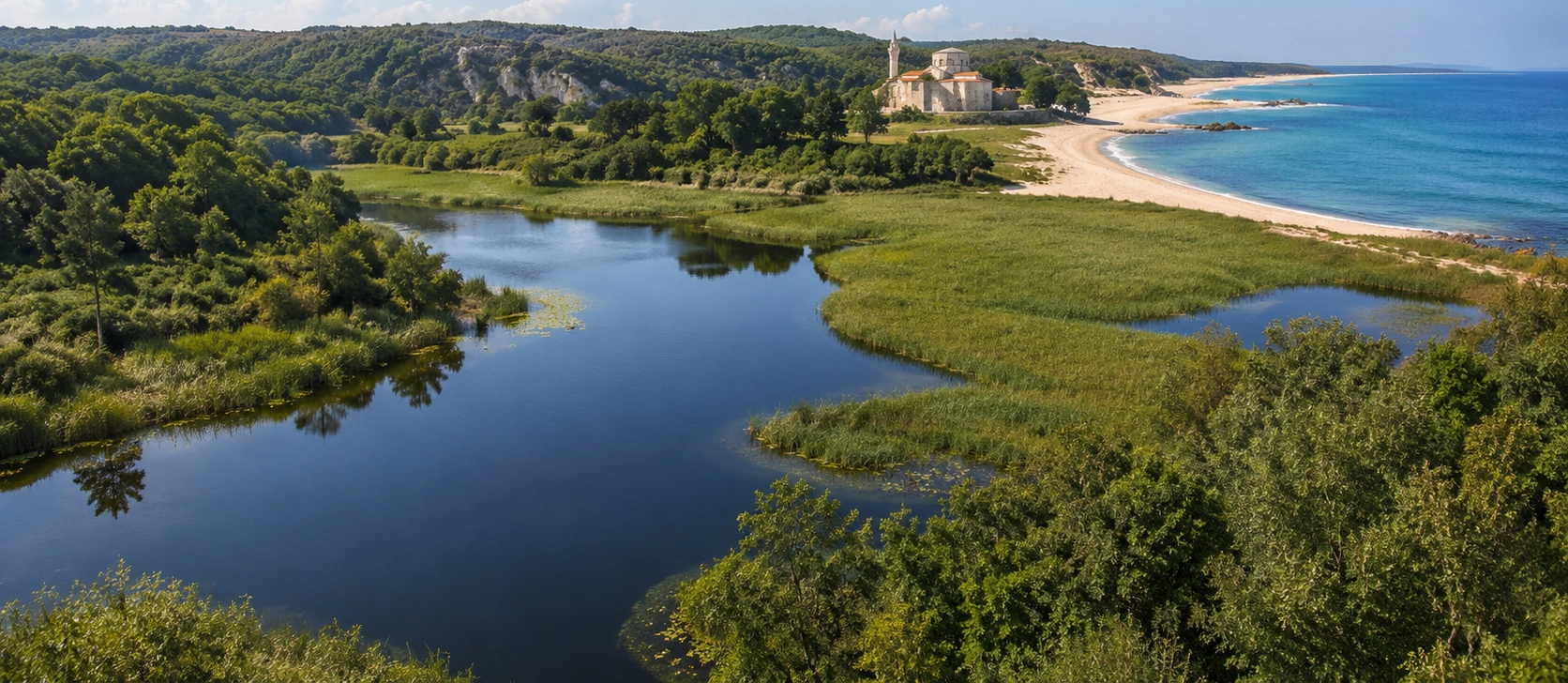
Discover more of Kırklareli, from prehistoric archaeological sites and Ottoman monuments to caves, forests, Black Sea villages and protected natural landscapes.
View Kırklareli GuideCombine the wetland forests and Black Sea landscapes of İğneada with caves, historic towns and protected nature areas elsewhere in Kırklareli Province.
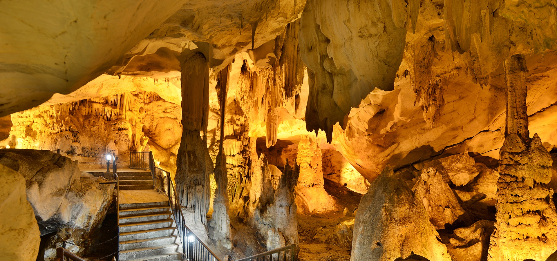
Travel beneath the Yıldız Mountains to discover one of the most spectacular cave systems in Turkish Thrace.
Discover Dupnisa Cave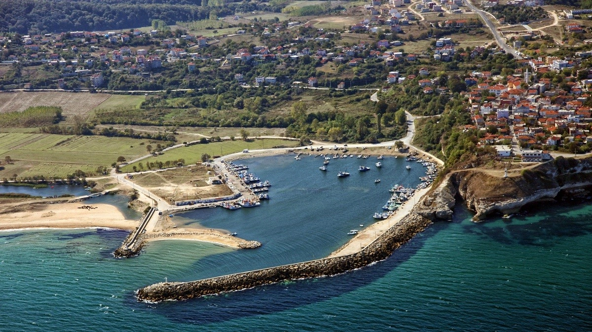
Explore a historic Black Sea town surrounded by forests, rivers, beaches and the rugged landscapes of eastern Kırklareli.
Discover Kıyıköy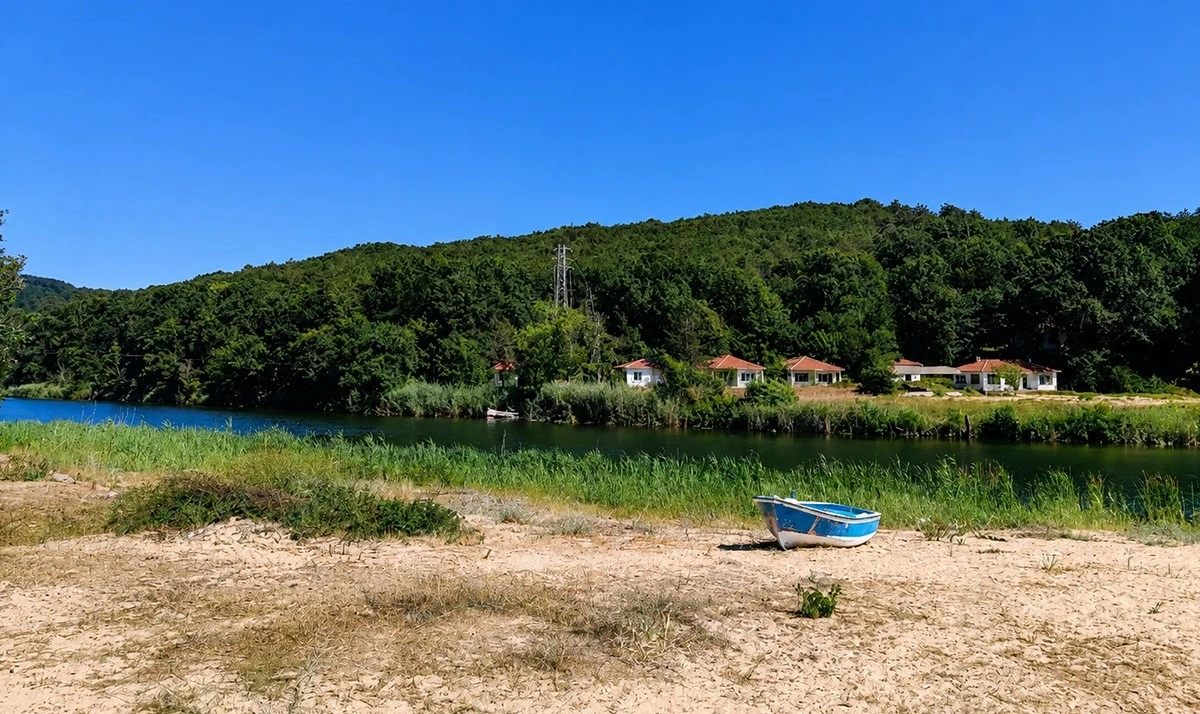
Continue along the Black Sea region to another beautiful landscape where forest, river and sandy coastline come together.
Explore Çamlıköy – Kastro