Hora Lighthouse
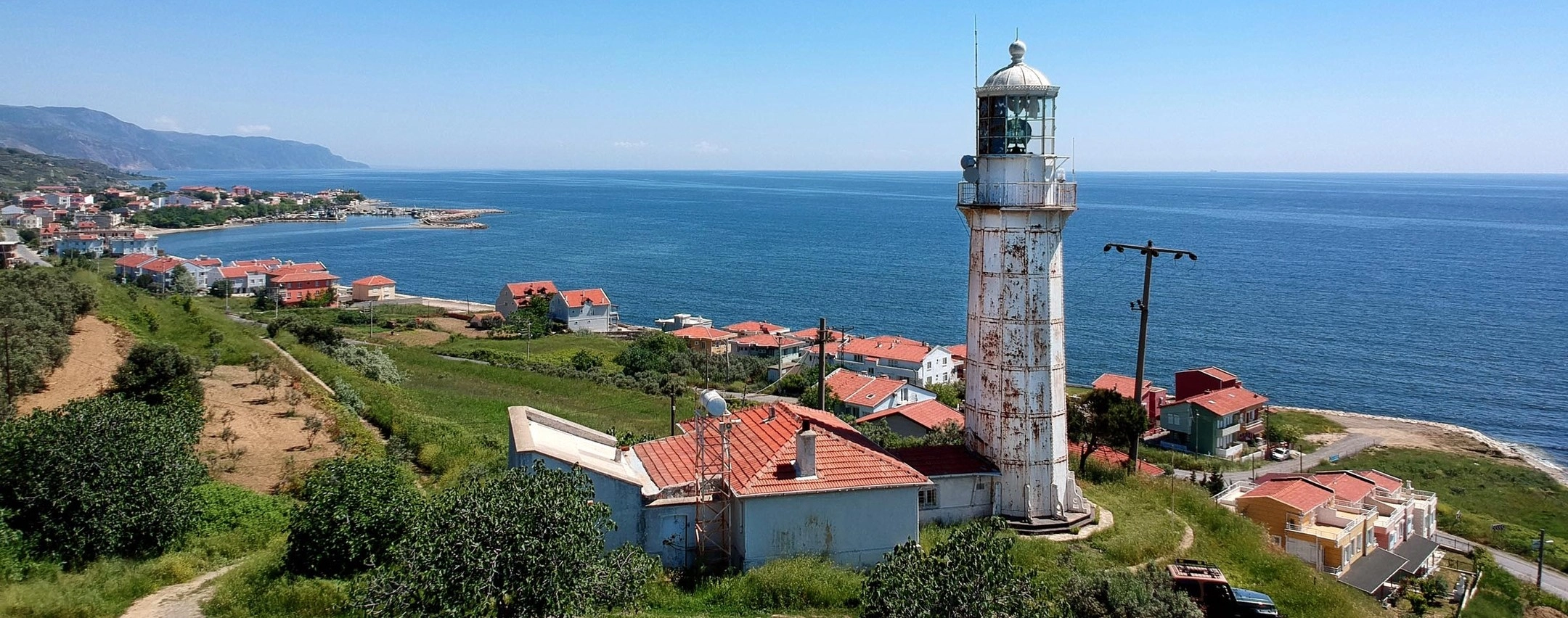
The 1861 iron lighthouse is Hoşköy's defining landmark and one of the most distinctive historic lighthouses on the Sea of Marmara.
- Date: 1861
- Height: Approximately 20 m
- Status: Active navigation aid






Set between the Sea of Marmara and the vineyard-covered foothills of the Ganos Mountains, Hoşköy is one of the most atmospheric settlements on the Şarköy coast. Historically known as Hora, the village combines fishing traditions, vineyards, olive groves and layers of maritime history.
Its unmistakable landmark is the Hora Lighthouse, also known as Hoşköy Lighthouse. Built in 1861 during the Ottoman period by French contractors using iron components brought from France, the lighthouse still stands above the coast as an active aid to navigation.
The lighthouse is more than a photogenic monument. Its location reflects Hoşköy's long relationship with the sea, while archaeological discoveries in the surrounding countryside reveal another story: this coast was once deeply connected with Byzantine wine production and maritime trade.
Today, a visit to Hoşköy can combine the lighthouse with the fishing harbour, village streets, local seafood, olive oil, vineyard landscapes and a scenic drive through Mürefte, Gaziköy and Uçmakdere.
A remarkable 20-metre iron lighthouse built in 1861 and still serving Marmara shipping.
Hoşköy's older name preserves a link with the multicultural history of this northern Marmara coast.
Grape growing and olive cultivation remain defining features of the surrounding countryside.
Hoşköy's active relationship with the sea continues through one of the area's important fishing harbours.
Essential information for visiting one of the most distinctive historic landmarks on the Şarköy coast.
Hoşköy, Şarköy District, Tekirdağ Province, on the northern coast of the Sea of Marmara.
Open Hora Lighthouse on Google Maps1861, during the Ottoman period, using iron components and materials brought from France.
Approximately 20 metres, with the light positioned around 50 metres above sea level.
Historic lighthouse, vineyards, olives, fishing, Marmara scenery and the old settlement of Hora.
Long before it became known for its lighthouse, the Hoşköy coast formed part of an important cultural and maritime landscape linking Thrace with the Marmara and Aegean worlds.
Hoşköy lies within a part of the northern Marmara coast that has been inhabited and cultivated for centuries. Its older name, Hora, survives most visibly today in the traditional name of its famous lighthouse.
During antiquity and the Byzantine period, the wider Hoşköy–Gaziköy coastline became closely associated with vine cultivation, wine production and maritime trade. Archaeological surveys have identified concentrations of Byzantine amphora production remains along the coast, demonstrating that locally produced goods were prepared for transport by sea.
The settlement remained part of the wider cultural world of Thrace through the Byzantine and Ottoman periods. Official regional tourism material notes that Hoşköy had a substantial Greek population during the Ottoman era, adding another layer to the village's architectural, agricultural and maritime heritage.
In 1861, the coastal landscape gained the monument that would become Hoşköy's best-known symbol: the Hora Lighthouse. Built as a route lighthouse for ships navigating the Sea of Marmara, it was constructed by French contractors using specially imported materials.
The population and social structure of the region changed dramatically during the upheavals of the early twentieth century, but agriculture and fishing remained central to local life. Vineyards, olive groves and the harbour still shape the character of Hoşköy today.
Rather than a single isolated historic monument, Hoşköy should therefore be understood as a complete cultural landscape — lighthouse, sea, vineyards, fishing harbour and traces of much older settlement all occupying the same narrow strip between mountain and coast.
Hoşköy is small enough to explore slowly, yet its landscape contains an unusual concentration of maritime, agricultural and archaeological stories.
The 1861 iron lighthouse is Hoşköy's defining landmark and one of the most distinctive historic lighthouses on the Sea of Marmara.
The settlement formerly known as Hora preserves the atmosphere of a small Marmara coastal town surrounded by vineyards and olive groves.
Vineyards extend across the hills around Hoşköy as part of the historic grape-growing landscape shared with Mürefte and Gaziköy.
Hoşköy remains closely tied to the Marmara through its harbour and fishing traditions, making fresh fish a natural part of the local experience.
The mild coastal microclimate supports olive cultivation alongside vineyards, giving Hoşköy a distinctly Mediterranean character within Thrace.
Archaeological investigations between Hoşköy and Gaziköy have identified evidence of Byzantine amphora workshops linked with regional wine production and maritime trade.
The foothills rising behind Hoşköy create a dramatic backdrop of forest, vineyards and elevated viewpoints above the Marmara Sea.
Hoşköy is one of the essential stops on the scenic route connecting Şarköy, Mürefte, Gaziköy and Uçmakdere beneath the Ganos Mountains.
Standing on elevated ground beside the Marmara Sea, the Hora Lighthouse is the landmark most closely associated with Hoşköy. It was built in 1861 as a route lighthouse for ships navigating the Sea of Marmara.
According to Türkiye's Directorate General of Coastal Safety, the lighthouse was constructed by French contractors during the Ottoman period. Its tower was assembled from original cast-iron panels and structural iron elements brought from France, and much of this historic fabric survives today.
The lighthouse remains part of the active maritime navigation system. Its continuing function gives the structure a special importance: visitors are not simply looking at an abandoned monument, but at a nineteenth-century lighthouse that still belongs to the working maritime landscape of the Marmara.
The engineering of the Hora Lighthouse is one of the main reasons it is so interesting. Rather than being a conventional masonry tower, the lighthouse was constructed using iron structural components brought from France.
The Directorate General of Coastal Safety describes the tower as a steel construction formed from original cast-iron panels and structural iron elements. This prefabricated approach reflects the growing international exchange of engineering technology during the nineteenth century.
Older regional descriptions also emphasize the use of mechanical connections in the structure, an important reminder that the tower was designed as a precisely assembled piece of maritime engineering rather than simply as a decorative coastal monument.
The tower is built from imported iron elements rather than conventional stone masonry.
Historic structural materials were specially brought from France for the lighthouse project.
The lighthouse has retained its maritime function rather than becoming only a museum object.
The elevated site allows the light to command a wide sector of the Sea of Marmara.
The technology inside the lighthouse has changed considerably since 1861. The coastal authority records that the original light source used a wicked kerosene lamp. Later systems used brighter mantle lamps powered by gas before electric lighting was introduced.
The lighthouse's optical system concentrates the light so that it can be detected far out at sea. Modern technical information gives the lighthouse a nominal visibility of approximately 19 nautical miles under suitable conditions.
Historic tourism information also records a mechanical clockwork or pendulum system that had to be wound periodically. This provides a fascinating glimpse into the era before modern automated lighthouse technology.
The lighthouse may be the reason many travelers first stop in Hoşköy, but the village itself deserves time. Hoşköy sits in a narrow coastal zone where the sea, harbour, vineyards and mountain foothills remain visually connected.
Official tourism information describes the settlement as historically known as Hora and notes its strong associations with grape growing, olive cultivation and fishing. These are not simply tourism themes — they remain part of the local landscape and economy.
The best way to experience Hoşköy is slowly. Walk near the harbour, look back toward the hills, notice the agricultural land immediately behind the settlement and allow time for the contrasts between working village life and the dramatic nineteenth-century lighthouse above the coast.
Explore the settlement on foot and look for details that reveal Hoşköy's long coastal history.
Fishing boats and the waterfront preserve Hoşköy's active relationship with the Marmara Sea.
Grapes, olives, olive oil and regional products reflect the surrounding agricultural landscape.
The Marmara is visible throughout much of the settlement and gives Hoşköy its distinctive atmosphere.
Hoşköy belongs to one of the most important vineyard landscapes in Turkish Thrace. The hills around Şarköy, Mürefte, Hoşköy and Gaziköy have supported grape cultivation for generations, while archaeological evidence shows that the relationship between this coast and wine is much older than the modern industry.
The combination of slopes, soils and maritime influence creates a distinctive agricultural environment. As you approach Hoşköy by road, vineyards often form part of the visual transition between the Marmara shoreline and the Ganos Mountains.
For visitors interested in regional gastronomy, the most rewarding approach is to experience the vineyards as part of a wider cultural route rather than as an isolated tasting stop — combining Hoşköy, Mürefte, local food, olive oil and the coastal landscape.
One of the most fascinating aspects of the Hoşköy coast lies beneath the modern vineyard landscape. Archaeological surveys have identified Byzantine-period amphora production areas between Hoşköy and Gaziköy.
Amphorae were the transport containers of the ancient and medieval Mediterranean world, used for moving commodities including wine by sea. Discovering production workshops close to the coast is therefore powerful evidence of an organized regional economy connected to maritime trade.
This archaeological background gives extra meaning to today's vineyards. The visible rows of vines around Hoşköy are part of a landscape where grapes, wine and sea transport have interacted over a very long period.
Archaeological research has documented Byzantine amphora-production evidence along the Hoşköy–Gaziköy coast.
The coastal position allowed agricultural products to enter wider networks across the Marmara and beyond.
Historic production helps explain why viticulture is so deeply rooted in the cultural identity of the region.
Most remains are part of a broader landscape rather than a conventional excavated visitor site.
Archaeological survey work has identified an ancient settlement area on the elevated ground associated with the Hoşköy lighthouse. Because this hill dominates the surrounding coast, it would have been a naturally strategic location for observing maritime movement.
Researchers have discussed the possibility that the site could be connected with Neon Teichos, an ancient settlement mentioned in classical sources. However, this identification remains a scholarly hypothesis rather than a securely proven conclusion.
For visitors, the important point is that the lighthouse occupies a location whose strategic value may predate the nineteenth-century monument by many centuries. The same commanding view that made the hill useful for modern navigation may also have attracted earlier settlement.
Hoşköy's relationship with the sea is not limited to the lighthouse. Fishing remains one of the settlement's defining traditions, and official regional tourism information highlights the importance of the local fishing harbour.
The harbour gives Hoşköy a very different character from a purely seasonal beach resort. Boats, nets, seafood and everyday maritime activity help preserve a working connection with the Marmara Sea.
For travelers, the harbour is also one of the best places to understand the rhythm of the village. Visit without rushing, particularly in the softer morning or late-afternoon light, when the combination of fishing boats, sea and hills is especially photogenic.
The harbour remains part of the working life of the settlement rather than only a visitor attraction.
Seafood is one of the natural culinary choices when eating along the Şarköy and Hoşköy coast.
Boats, reflections and changing Marmara light create strong photographic subjects.
The harbour offers a glimpse of everyday coastal life beyond the historic lighthouse.
Olive trees are another characteristic element of Hoşköy's countryside. The relatively mild conditions along the Şarköy coast allow olive cultivation to thrive beside vineyards, creating an agricultural landscape that feels unexpectedly Mediterranean for Thrace.
Local olive oil is an important regional product, and official provincial gastronomy information emphasizes the distinctive character of Şarköy olive oil. Travelers interested in food can therefore treat Hoşköy not only as a sightseeing stop but also as part of a broader agricultural journey.
Olive trees appear throughout suitable parts of the coastal hills around Hoşköy.
Olive oil is one of the characteristic products to look for while exploring the Şarköy district.
Olive oil, seafood and vineyard products naturally come together in the local culinary landscape.
Vines and olive trees explain much of Hoşköy's distinctive visual character.
A visit to Hoşköy can be much more varied than a quick stop at the lighthouse. The combination of sea, agricultural hills and the nearby Ganos Mountains supports several different outdoor experiences.
Explore the harbour and permitted public areas around the village at an easy pace.
Follow the roads linking Hoşköy with Mürefte, Gaziköy and the wider Şarköy vineyard countryside.
The Ganos foothills provide opportunities for nature walks and longer routes in the wider district.
Official tourism information lists paragliding among the outdoor activities associated with the Hoşköy area.
The lighthouse, harbour, vineyards and mountain backdrop provide excellent visual variety.
Combine your visit with fish, seafood, olive oil and other products of the Şarköy coast.
Green hills, comfortable temperatures and quieter roads make spring excellent for village and landscape exploration.
The coast is livelier, restaurants and seaside businesses are active, and Hoşköy fits naturally into a Marmara beach journey.
One of the most rewarding periods for vineyard scenery, harvest atmosphere and warm golden-hour photography.
Very quiet and atmospheric, although some tourism businesses may operate on reduced seasonal schedules.
Hoşköy is one of the most rewarding photography stops on the Şarköy coast because it offers very different subjects within a small area: nineteenth-century industrial architecture, fishing boats, open sea, vineyard rows, olive groves and mountain slopes.
Use the tower as a strong vertical subject against the open sky and Marmara horizon.
Fishing boats and reflections create a softer contrast with the industrial geometry of the lighthouse.
Rows of vines can create leading lines toward the coast or Ganos foothills.
Late-afternoon light can bring warmth to the iron tower, vineyards and coastal landscape.
Look for viewpoints where the Marmara, village and agricultural hills can be seen together.
Harbour equipment, doors, stonework and agricultural scenes can tell the quieter story of Hoşköy.
Hoşköy lies on the Marmara coast within Şarköy District. Official tourism information places the settlement approximately 20 kilometres from Şarköy town.
The most flexible way to visit is by private vehicle, especially if you want to continue along the scenic coastal road toward Gaziköy and Uçmakdere or stop at vineyards along the way.
The lighthouse is located near the Hoşköy approach, and official cultural information indicates that it can be approached on foot from the Hoşköy entrance area. Local road and access conditions may change, so follow current signs rather than relying exclusively on older directions.
Travelers who prefer a slower day can skip Uçmakdere and spend more time around Hoşköy, Mürefte and the vineyard countryside. The strength of this route lies in the combination of history, agriculture, food and coastal scenery rather than the number of stops completed.
The lighthouse is operational and interior access may be restricted. Plan your visit around exterior views and the surrounding landscape.
Hoşköy and Mürefte naturally belong to the same vineyard and coastal journey.
The village is more rewarding when you explore beyond the lighthouse and spend time beside the working waterfront.
The vineyards and Ganos foothills are as important to Hoşköy's character as the sea itself.
Do not assume wineries accept walk-in visitors. Contact individual producers in advance.
Vineyards, olive groves, houses and some land around the lighthouse may not be public access areas.
The coastal road becomes increasingly winding toward Gaziköy and Uçmakdere, so allow more time than the distance suggests.
Late-afternoon light is especially beautiful across the Marmara, vineyards and lighthouse landscape.
Hoşköy works best as part of a coastal journey through the Şarköy district, where historic settlements, vineyards and the Ganos Mountains are linked by a remarkably scenic road.
Explore the district centre, Marmara beaches, waterfront, vineyards, olive culture and regional food.
One of the historic centres of vineyard and wine culture on the Şarköy coast.
Continue east into the historic Ganos landscape, with Byzantine heritage and dramatic mountain scenery.
Discover a historic village beneath the Ganos Mountains known for traditional architecture, forests and paragliding.
Forested slopes and elevated viewpoints create some of the most dramatic scenery in Tekirdağ Province.
Explore the agricultural landscape that has made this coast one of Türkiye's most distinctive grape-growing regions.
Continue to the provincial capital for Ottoman monuments, museums, waterfront scenery and local cuisine.
Visit Tekirdağ's important sixteenth-century Ottoman mosque associated with Mimar Sinan.
Discover the story of the Hungarian prince and exile community that lived in Ottoman Tekirdağ.
Explore archaeological and cultural collections illuminating the long history of Thrace.
Hoşköy's food identity comes directly from its surroundings: the Marmara Sea, vineyards and olive groves. A meal here fits naturally into the same landscape you see from the road and harbour.
The fishing harbour makes fish and seafood natural choices while visiting Hoşköy.
Try olive oil produced in the mild microclimate of the wider Şarköy district.
Table olives are among the characteristic agricultural products of the coastal countryside.
Fresh grapes and other vineyard products reflect Hoşköy's deeply rooted viticultural tradition.
Try one of Tekirdağ Province's most famous regional specialties during your journey.
Discover the province's distinctive sweet made with fresh unsalted cheese, flour and sugar.
For adult visitors interested in local gastronomy, Hoşköy belongs to one of Thrace's most important vineyard areas.
Local markets and small producers offer different agricultural products depending on the season.
Hora Lighthouse is in Hoşköy, within Şarköy District of Tekirdağ Province, on the northern coast of the Sea of Marmara.
Yes. The historic Hora Lighthouse is also officially known as Hoşköy Lighthouse. Hora is the older name associated with the settlement.
The lighthouse was built in 1861 during the Ottoman period by French contractors using materials brought from France.
Official maritime and cultural sources state that it was constructed by French contractors during the Ottoman period.
The lighthouse tower is approximately 20 metres high. The light is positioned at an elevation of roughly 50 metres above sea level.
Yes. It remains an operational navigation lighthouse serving ships in the Sea of Marmara.
Do not assume that the tower interior is open to general visitors. Because the lighthouse is an active maritime facility, access can be restricted. Check current local arrangements and respect all signs and barriers.
Official technical information gives the lighthouse a nominal visibility of approximately 19 nautical miles under suitable conditions.
It combines nineteenth-century iron engineering with an active maritime role and has become one of the best-known historic landmarks on the Şarköy coast.
The settlement was historically known as Hora, a name that remains preserved in the traditional name Hora Lighthouse.
Hoşköy is known for the Hora Lighthouse, vineyards, grapes, olives, olive oil, fishing, its harbour and beautiful Marmara coastal scenery.
Yes. It is particularly rewarding for travelers interested in historic lighthouses, photography, vineyards, local food, maritime heritage and scenic coastal drives.
Official regional tourism information places Hoşköy approximately 20 kilometres from Şarköy town.
Yes. Hoşköy lies within the historic vineyard landscape extending through the Şarköy, Mürefte and Gaziköy area.
Yes. Fishing remains an important part of local life, and regional tourism information identifies Hoşköy as having one of the area's important fishing harbours.
Archaeological surveys between Hoşköy and Gaziköy have documented Byzantine amphora-production remains, providing evidence for regional wine production and maritime trade.
Archaeological evidence shows ancient settlement in the area. Researchers have suggested that the lighthouse hill might be connected with the ancient site of Neon Teichos, but this identification is not proven.
Spring and early autumn are excellent for scenery and road trips, while summer is livelier along the coast. Early autumn is especially attractive for vineyard atmosphere.
Allow at least one to two hours for the lighthouse surroundings, village and harbour. A half day is better if you want to include vineyards or Mürefte.
Yes. Hoşköy and Mürefte are close together and form one of the best combinations for experiencing the Şarköy vineyard coast.
Yes. A scenic road continues through the Ganos landscape toward Gaziköy and Uçmakdere. Allow extra time because the mountain-coast road is winding.
A private vehicle is the most convenient option, particularly if you want to explore vineyards, Mürefte, Gaziköy, Uçmakdere and other stops along the coast.
The Hora Lighthouse, fishing harbour, vineyards, olive groves, Marmara coastline and the Ganos foothills all provide excellent photographic subjects.
Fresh fish, seafood, olives, local olive oil and grape-based products are natural choices reflecting the surrounding coast and agricultural landscape.
Yes. Hoşköy can be included in a road trip from Istanbul through Tekirdağ and Şarköy, although staying overnight in the region makes the journey considerably more relaxed.
Hoşköy can be included in a private journey combining the Hora Lighthouse, vineyards, fishing villages, local food and the dramatic landscapes of the Ganos coast.
Tell us what interests you and we can design a private route focused on the lighthouse, vineyards, photography, village life, regional food, archaeology or the scenic Marmara coast.
Ask us about a tailor-made journey combining Hoşköy, the historic Hora Lighthouse, vineyard countryside, Mürefte and the scenic Marmara coast.
Request a Custom Tour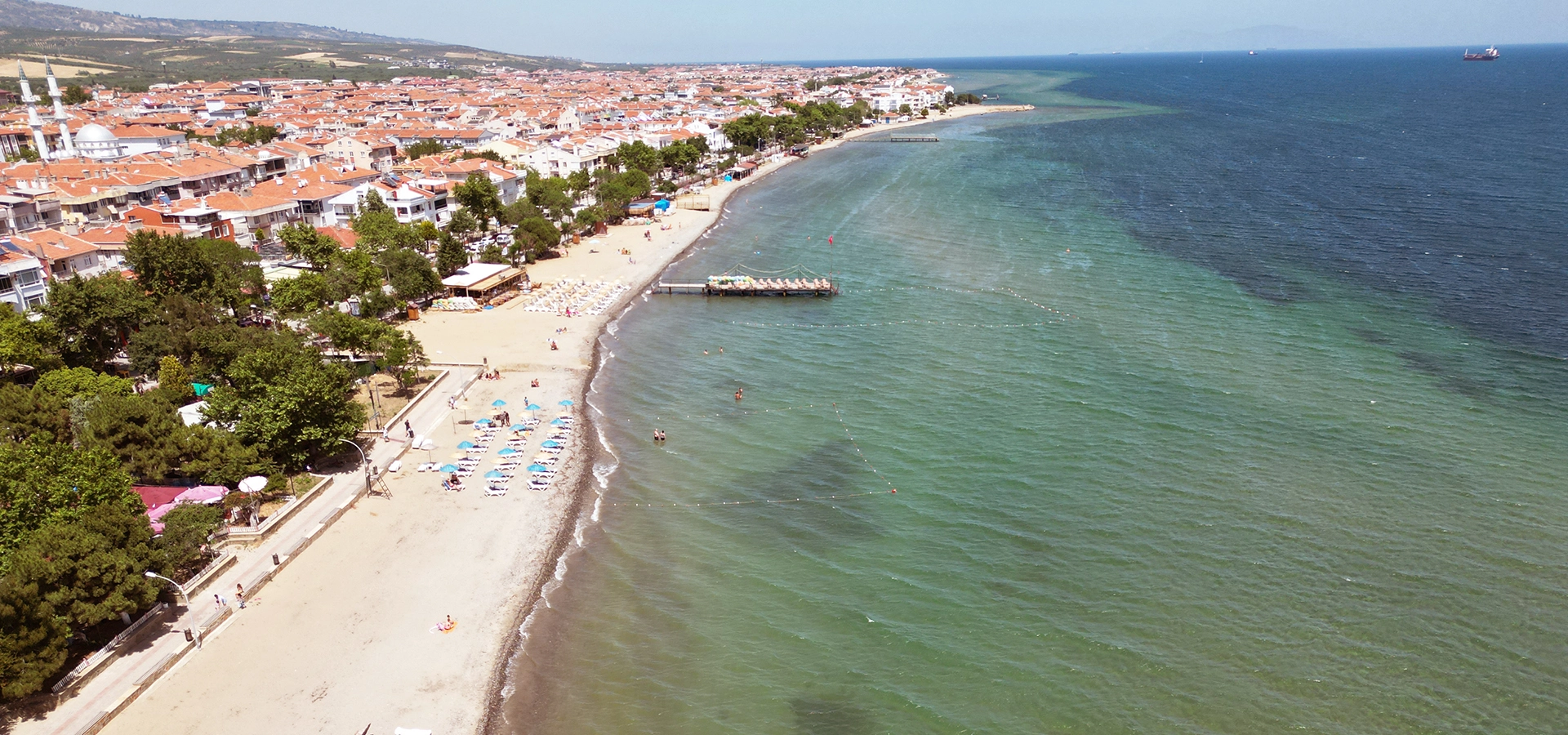
Continue planning your journey with our complete Şarköy guide covering vineyards, olive groves, beaches, Mürefte, Hoşköy, Gaziköy and Uçmakdere.
View Şarköy GuideHoşköy fits beautifully into a private route linking Istanbul with Tekirdağ, Şarköy, the Ganos Mountains, Gallipoli, Troy and the northern Aegean.
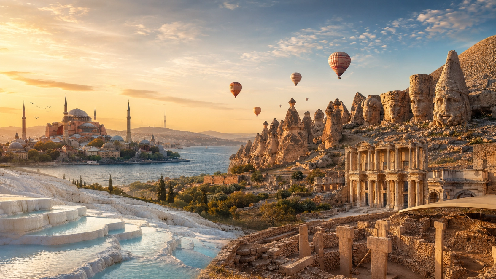
Explore Türkiye's historic landscapes through a longer journey combining archaeological sites, Ottoman cities, cultural regions and extraordinary heritage destinations.
View Tour
Create a private route linking Istanbul with Tekirdağ and Şarköy before continuing through Hoşköy, the Ganos Mountains, Gallipoli, Troy or the northern Aegean.
Plan Your Route