Saltanat Kapı
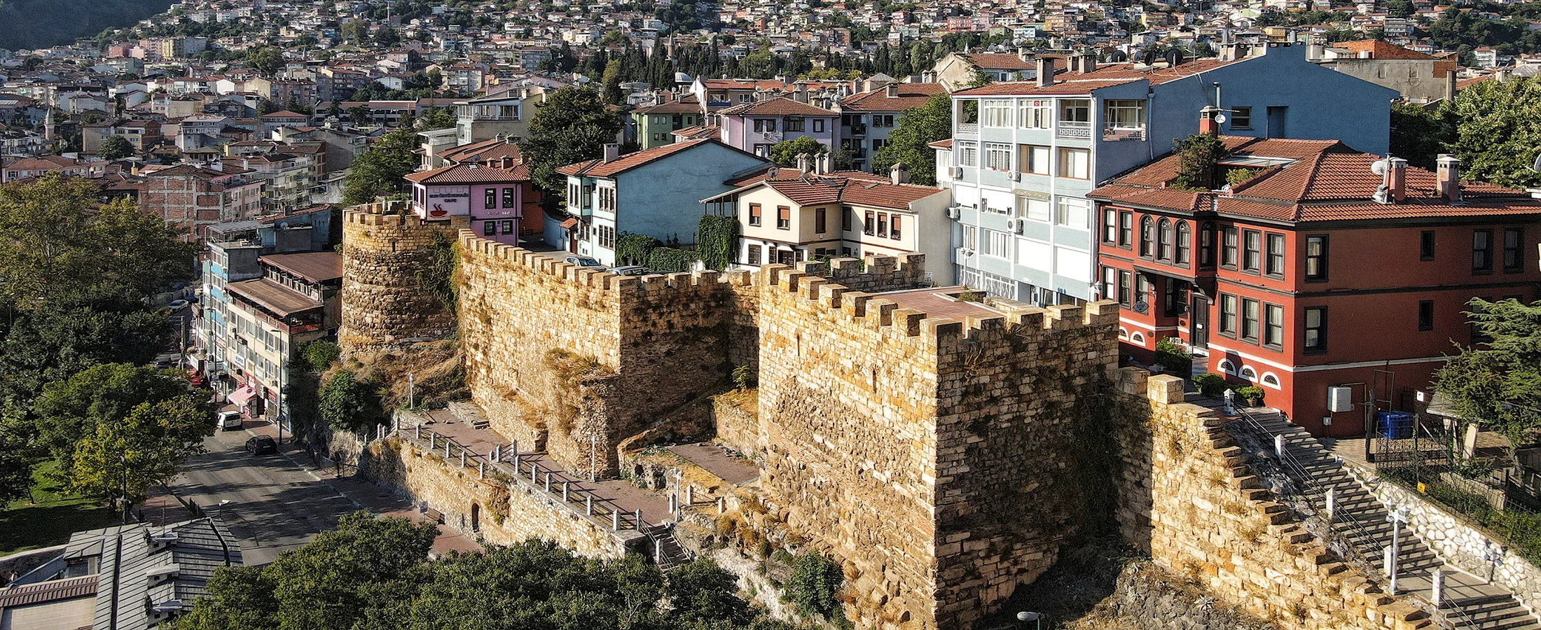
Enter Hisar through the reconstructed monumental eastern gateway that once controlled one of the principal approaches to the city.
- Also called: Hisar Kapısı
- Direction: Eastern approach
- Restoration: 21st century






Long before Bursa spread across the lower slopes of Uludağ, the city was concentrated on a naturally defended rocky hill now known as Hisar.
Surrounded by massive defensive walls, this elevated settlement formed the ancient and medieval core of Prusa, the city that would eventually become Bursa.
The origins of the fortifications are traditionally associated with the Bithynian Kingdom and the reign of Prusias I during the second century BC. Local historical tradition also connects the planning of the fortified city with Hannibal, the famous Carthaginian commander who spent part of his exile in Bithynia.
Whatever the precise details of the earliest construction, the walls clearly belong to a multi-layered defensive system repeatedly repaired and transformed over many centuries. Romans, Byzantines and Ottomans all reused, strengthened and altered the fortifications.
By the early fourteenth century, this walled hill was the Byzantine city of Prusa that Osman Gazi and later Orhan Gazi sought to capture. Following a prolonged Ottoman blockade, Bursa surrendered to Orhan Gazi in 1326.
The conquest transformed Hisar into one of the most important places in early Ottoman history. The former Byzantine administrative centre became the location of the Bey Sarayı, the residence of the early Ottoman rulers, while the area around today's Tophane became associated with the tombs of Osman Gazi and Orhan Gazi.
The Ottomans did not abandon the old fortress. Instead, they repaired and strengthened it while simultaneously creating a completely new urban model outside the walls. Mosques, markets, hans, hamams and imperial külliyes gradually expanded across the surrounding hills and valleys.
This transition from a compact Byzantine fortress city to an open Ottoman capital is one of the most fascinating stories visitors can still read in Bursa's urban landscape.
Substantial stretches of the walls survive today alongside reconstructed gates, historic streets, mosques, tombs, viewpoints and archaeological remains. The historic circuit is traditionally described as extending for approximately 3.38 kilometres and incorporating 14 bastions.
Six historic gateways are associated with the defensive system: Saltanat Kapı, Tahtakale Kapısı, Yer Kapı, Fetih Kapı, Zindan Kapı and Kaplıca Kapı.
Among them, Saltanat Kapı forms the monumental eastern entrance, Fetih Kapı recalls the Ottoman conquest, and the spectacular restored Zindan Kapı reveals underground prison spaces incorporated within the fortifications.
Today Hisar is not simply an archaeological site. It remains a living Bursa neighbourhood filled with historic houses, small mosques, traditional streets, gardens and viewpoints over the modern city.
This complete visitor guide explores Bursa Castle, Hisar, the ancient city walls, Bithynian Prusa, Roman and Byzantine fortifications, the Ottoman siege, the conquest of 1326, Saltanat Kapı, Tahtakale, Yer Kapı, Fetih Kapı, Zindan Kapı, Kaplıca Kapı, Bey Sarayı, Tophane, wall architecture, restoration, UNESCO heritage, walking routes, photography, visitor information and nearby attractions.
Explore the fortified hill where Bursa developed during the Bithynian, Roman and Byzantine periods.
Stand within the fortress whose capture transformed Bursa into the first great capital of the emerging Ottoman state.
Discover Saltanat, Tahtakale, Yer, Fetih, Zindan and Kaplıca gates around the old defensive circuit.
Trace substantial sections of the historic wall system reinforced by towers and natural cliffs.
Explore the political heart of early Ottoman Bursa and the area associated with its first rulers.
Combine ancient walls, Ottoman streets, viewpoints, gates, mosques and the tombs of Osman and Orhan Gazi.
Essential information for exploring the ancient fortified heart of Bursa.
Hisar and Tophane, immediately west of Bursa’s historic bazaar centre.
Open on Google MapsBithynian foundations traditionally associated with Prusias I in the second century BC.
Approximately 3.38 km, historically strengthened with numerous towers and bastions.
Saltanat, Tahtakale, Yer, Fetih, Zindan and Kaplıca gates.
More than two thousand years of urban history survive within and around Bursa’s ancient fortified hill.
The story of Bursa Castle begins long before the rise of the Ottoman Empire. The fortified settlement occupied a strategically powerful hill overlooking the plain north of Uludağ.
The ancient city became known as Prusa ad Olympum, distinguishing it as the Prusa situated below Mount Olympus, the mountain now called Uludağ.
Bursa's municipal heritage sources traditionally date the construction of the fortifications to the second century BC during the reign of Prusias I of Bithynia.
A long-standing historical tradition also associates the planning of Prusa with Hannibal, the celebrated Carthaginian general who took refuge in Bithynia after his conflict with Rome.
Because the walls were altered repeatedly during later centuries, however, visitors should understand Bursa Castle not as one perfectly preserved construction from a single period, but as a complex archaeological monument containing many historical phases.
Under Roman control, Prusa continued to develop as an important city of northwestern Anatolia. Existing fortifications were repaired, modified and incorporated into the changing urban landscape.
The defensive importance of the hill became even greater during the Byzantine period. Towers, strengthened gateways, reused ancient masonry and an internal citadel protected the administrative centre of the city.
By the beginning of the fourteenth century, Bursa was one of the most important Byzantine strongholds remaining in Bithynia.
Ottoman forces under Osman Gazi began applying sustained military and economic pressure to the city. Because the early Ottoman forces lacked the equipment required to storm such strong walls directly, the conquest developed largely through a prolonged blockade.
Fortifications established outside the city helped isolate Bursa from its surrounding countryside and communication routes. After Osman Gazi became seriously ill, his son Orhan Gazi continued the campaign.
On 6 April 1326, Bursa finally surrendered to Orhan Gazi.
The conquest represented an extraordinary turning point. The fortified Byzantine town became the political centre of the expanding Ottoman principality, and Bursa developed into the first great capital of the Ottoman state.
Initially, the Ottomans occupied and reused the fortified city. The Byzantine administrative residence in the inner citadel was transformed into the Bey Sarayı, while religious and political institutions were adapted for the new rulers.
Orhan Gazi also strengthened the defences, adding and repairing sections of the walls and towers.
The military value of the fortifications remained important during the turbulent early fifteenth century. Bursa suffered in the aftermath of the Battle of Ankara in 1402 and later regional conflicts.
During the reign of Çelebi Mehmed, major repair work was undertaken, traditionally associated with Hacı İvaz Paşa.
An inscription connected with Saltanat Kapı records repair work in 1418.
The importance of the fortress gradually changed as Ottoman Bursa expanded far beyond the old walls. Imperial külliyes, markets, hans, workshops and neighbourhoods spread across surrounding hills and valleys.
By the fifteenth century, Hisar had changed from being virtually the entire city into only one historic district within a much larger Ottoman capital.
The fortifications nevertheless survived, receiving repairs throughout the Ottoman period. They also suffered from earthquakes, changing roads, urban construction and the reuse of stone.
The devastating 1855 Bursa earthquake caused significant damage throughout the old city, including parts of the castle and several gateways.
During the twentieth century, portions of the walls disappeared behind later buildings or were damaged by modern development.
Large-scale conservation projects beginning in the early twenty-first century gradually exposed, restored and in some cases reconstructed important gates and wall sections.
Today, Bursa Castle once again forms one of the most understandable historical landscapes in the city, connecting the ancient settlement of Prusa directly with the story of the Ottoman conquest and the creation of Bursa as an imperial capital.
The fortress is best explored as an entire historic neighbourhood rather than as a single castle building.
Enter Hisar through the reconstructed monumental eastern gateway that once controlled one of the principal approaches to the city.
Examine masonry belonging to a fortification system repeatedly rebuilt by Bithynian, Roman, Byzantine and Ottoman builders.
Walk along the high northern edge of Hisar for panoramic views and some of the most important monuments of early Ottoman Bursa.
Visit the southern gate traditionally associated with the entry of Ottoman forces during the conquest of Bursa.
Explore one of the most dramatic restored sections of the fortress, complete with towers and historic underground prison spaces.
Discover the unusual defensive corridor and double-wall system in the vulnerable southern section of the fortress.
Walk through traditional lanes containing mosques, historic houses, gardens and traces of Bursa’s oldest urban neighbourhood.
Understand where the Byzantine administrative residence developed into the palace used by Bursa’s first Ottoman rulers.
Hisar is the Turkish word commonly used for a fortified place, citadel or castle district.
In Bursa, the name refers to the elevated historic neighbourhood occupying the area once enclosed by the ancient city walls.
Before Ottoman Bursa expanded across the surrounding landscape, Hisar was essentially the city itself.
The hill formed the principal settlement area of ancient Prusa and remained the urban centre for centuries.
Steep rocky slopes protected much of the hill while masonry walls strengthened the accessible approaches.
By the medieval period the city functioned as a strongly fortified Byzantine settlement.
After 1326 the same fortified space became the administrative centre of early Ottoman Bursa.
Hisar remains inhabited rather than surviving only as an archaeological park.
The elevated northern edge provides remarkable views over the commercial city and Bursa plain.
Understanding Hisar is therefore essential for understanding Bursa. The neighbourhood represents the point where ancient Prusa, Byzantine Bursa and Ottoman Bursa physically overlap.
The earliest monumental fortification of Bursa is traditionally associated with the Kingdom of Bithynia, which controlled much of northwestern Anatolia during the Hellenistic period.
Municipal heritage sources connect the foundation of the walled city with Prusias I and traditionally date the fortifications to approximately 185 BC.
The Bithynian ruler traditionally associated with the development of Prusa as a fortified city.
The ancient name distinguished the settlement as Prusa situated beneath Mount Olympus, today's Uludağ.
The rocky Hisar ridge provided natural protection while commanding views across the surrounding plain.
The wall system defined the boundaries of a compact city rather than simply protecting a separate military castle.
Archaeological evidence and reused masonry demonstrate that the fortifications developed through many phases, making it impossible to treat every surviving section as belonging to the original Bithynian construction.
One of the most fascinating traditions surrounding Bursa states that Hannibal Barca, the famous Carthaginian commander, was connected with the planning of the fortified city.
After Carthage's defeat by Rome, Hannibal spent part of his exile at the court of Prusias I of Bithynia.
Hannibal became one of antiquity’s most celebrated generals during the Second Punic War against Rome.
Late in his life he entered the service or protection of the Bithynian court.
Local historical sources traditionally associate him with the design or planning of Prusa’s fortified settlement.
The precise extent of Hannibal’s involvement cannot be demonstrated with the certainty possible for later historical periods.
For visitors, the most accurate approach is therefore to regard the Hannibal connection as an important historical tradition associated with the foundation of Prusa rather than as an unquestionable architectural fact.
Following the incorporation of Bithynia into the Roman world, Prusa continued to occupy the fortified Hisar hill.
Roman builders maintained and altered the defensive system while monumental structures, water infrastructure and other urban facilities developed within and around the city.
Existing fortifications were maintained and adapted as the city evolved under Roman rule.
Architectural blocks, inscriptions and other older stone elements were reused in later wall construction.
The medieval defensive system was repeatedly strengthened as military conditions changed.
A separately protected administrative and palace area occupied part of the northern fortress.
Churches and monasteries formed part of the religious landscape within Byzantine Prusa.
It was this fortified Byzantine city that confronted the prolonged Ottoman blockade.
For anyone interested in Byzantine Bursa, Hisar is particularly important because relatively few monumental Byzantine buildings remain intact elsewhere in the modern city. The walls preserve the physical outline of medieval Prusa even where individual structures within it have disappeared.
Bursa's strong walls made a rapid Ottoman assault extremely difficult.
Rather than relying entirely on direct attacks, the early Ottomans gradually isolated the city, reducing its ability to receive food, reinforcements and support from surrounding Byzantine territory.
The conquest was more than a military victory. By acquiring an established city with administrative buildings, commercial connections, religious institutions, craftsmen and sophisticated urban infrastructure, the Ottomans gained a foundation from which a much larger state could develop.
The walls of Hisar are therefore among the most important surviving physical witnesses to the transition from Byzantine Bithynia to Ottoman Bursa.
Bursa’s defensive system took advantage of the natural geography of Hisar.
Steep rocky slopes reduced the need for equally massive artificial defences along every section, while more vulnerable approaches required stronger walls, towers and multiple defensive lines.
The full defensive circuit is traditionally described as extending for approximately 3.38 kilometres.
Municipal heritage documentation identifies fourteen bastions associated with the historic wall system.
Rocky slopes formed part of the defensive strategy and made several sides of the fortress difficult to attack.
The more vulnerable southern approach received additional protection through parallel defensive walls.
Square, polygonal and rounded defensive elements reflect multiple construction and restoration phases.
Spolia from earlier ancient and Byzantine structures can be identified within portions of the masonry.
The walls are particularly interesting because they demonstrate how ancient fortifications were rarely static. Every generation repaired weak points, added towers, reused available materials and adapted the system to new military requirements.
Modern Bursa heritage documentation identifies six principal gates within the historic fortification system.
Older publications sometimes count them differently because certain entrances belonged to outer walls, inner walls or corridors rather than functioning in exactly the same way.
The monumental eastern gateway and ceremonial entrance into Hisar.
An entrance leading into the defensive corridor between the outer and inner walls.
The inner south-eastern gate known in Ottoman documents as Bâb-ı Zemin.
The southern gate traditionally associated with the Ottoman conquest and Pınarbaşı water system.
The western end of the double-wall sector, famous for its towers and underground prison chambers.
The western gate leading toward the historic thermal bath districts of Çekirge and Kükürtlü.
Saltanat Kapı is the most impressive and symbolically important entrance to Bursa Castle.
Opening toward the east, it connected the fortified city with major roads, markets and the commercial networks extending toward Anatolia.
Saltanat Kapı provided direct access into the fortified settlement from the east.
Governors, officials and important visitors historically used the entrance for formal arrivals and processions.
The gateway was also known simply as the Castle Gate or Fortress Gate.
Its proximity to Bursa’s mint led to another historic name associated with the gateway.
The road passing through the gate continued toward the ruler’s palace in the upper fortress.
An original inscription records restoration undertaken during the reign of Çelebi Mehmed.
The gateway visible today reflects major reconstruction and restoration work begun in 2005. It should therefore be appreciated both as the site of an ancient entrance and as a modern conservation project recovering the monumental form of Bursa’s principal fortress gate.
Tahtakale Kapısı occupied an unusual position between Saltanat Kapı and Yer Kapı.
Its name derives from an expression meaning roughly “beneath the castle”, which gradually developed into the familiar place name Tahtakale.
Passing through the gate did not immediately place a traveller inside the city.
The entrance led into a controlled corridor running between outer and inner fortifications.
Modern road construction caused the historic structure itself to disappear.
Excavations revealed foundations associated with the former gate.
The gateway was reconstructed in 2012 following archaeological and historical study.
Yer Kapı stands within the south-eastern part of the fortress.
Ottoman records call it Bâb-ı Zemin, meaning the Gate of the Ground.
Yer Kapı provided entrance from the protected corridor between the defensive walls into the city itself.
The adjoining fortifications formed part of the heavily defended southern sector.
Large stone blocks and reused architectural material reveal the complex history of the wall construction.
The gate suffered serious damage during Bursa’s catastrophic nineteenth-century earthquake.
Ottoman archival records indicate that a gatekeeper was employed here during the early nineteenth century.
The gateway was rebuilt as part of the modern restoration of Bursa’s fortifications.
Fetih Kapı is perhaps the most evocative gateway for understanding the events of 1326.
The southern entrance opens toward Pınarbaşı and is traditionally identified as the gate through which Ottoman forces entered the city following Bursa's surrender.
The name Fetih Kapı literally means the Conquest Gate and commemorates the Ottoman capture of Bursa.
The gate was also known by the name of the important spring immediately outside the walls.
Its association with Bursa’s water supply produced another historic name: Water Gate.
The gateway helped control and protect water entering the fortified city from Pınarbaşı.
A vaulted structure associated with the gate helped distribute water within the fortress.
The gate was reconstructed in 2008 as part of the wider Bursa walls conservation programme.
Combining Fetih Kapı with Pınarbaşı and Zindan Kapı is particularly useful for understanding the fortress's vulnerable southern side.
Zindan Kapı is one of the most dramatic places to experience Bursa’s fortifications from the inside.
Located at the western end of the fortified southern sector, the gate controlled a route passing beside the Cilimboz stream valley.
Ottoman historical documents refer to the gateway by a name connected with imprisonment.
Prison chambers beneath and around the fortifications gave the gate its modern name.
Archaeological and historical evidence represents Hellenistic, Byzantine and Ottoman phases.
Archival evidence indicates that the underground spaces continued to be used as a prison into the late nineteenth century.
Major conservation work recovered towers, corridors, wall sections and prison spaces.
The restored complex now functions as a cultural and museum space hosting exhibitions and events.
Unlike many sections of Bursa Castle that are best understood from outside, Zindan Kapı allows visitors to experience something of the interior world of the fortifications.
Kaplıca Kapı was the principal western entrance through Bursa's walls.
Its name reflects the route leading from Hisar toward Çekirge and Kükürtlü, districts famous for the thermal springs that have defined Bursa since antiquity.
The gateway formed the principal fortified connection toward the western side of Bursa.
Travellers passing through the gate could continue toward Bursa’s historic hot springs and baths.
The entrance used surrounding walls and an angled approach to increase protection.
Far less monumental fabric survives here than at restored Saltanat or Zindan gates.
One of the most interesting features of Bursa's fortifications is the double defensive wall used along part of the southern sector.
While natural rock formations made several sides of Hisar difficult to attack, the terrain toward Yer Kapı, Pınarbaşı and Zindan Kapı was comparatively vulnerable.
The first defensive line slowed attackers before they could reach the main inner fortifications.
A second fortified barrier provided another level of protection around the city itself.
The space between the two walls allowed movement to be restricted and monitored.
Towers strengthened the wall line and improved observation and flanking defence.
This gate demonstrates how visitors could first enter the wall corridor rather than proceeding directly into the city.
The southern wall route is particularly valuable for understanding the fortress as a complete defensive system.
Inside the main fortified settlement stood an even more strongly protected area traditionally known as the İç Kale, or Inner Castle.
During Byzantine rule, this zone contained the residence associated with the local governor or tekfur.
Following the conquest of Bursa, Orhan Gazi adapted and enlarged the existing palace complex, creating what became known as Bey Sarayı.
The Ottoman palace developed from the administrative residence already occupying the inner citadel.
The first Ottoman ruler of Bursa adapted and expanded the complex after the conquest.
The palace continued to function during the reign of Sultan Murad I Hüdavendigar.
Yıldırım Bayezid also used the palace during Bursa’s period as an active royal capital.
The palace zone was separately protected inside the already fortified city.
Only limited remains survive above ground, and the area is archaeologically sensitive.
The palace was damaged and plundered following the political upheavals associated with Timur and the Battle of Ankara in 1402. Its importance declined as Ottoman rulers increasingly used Edirne and later Istanbul.
Further damage, especially the 1855 earthquake, contributed to its eventual disappearance.
Although visitors should not expect to find an intact palace today, the Bey Sarayı area is historically crucial because some of the earliest decisions of the developing Ottoman state were made within this fortified hill.
The Ottoman conquest did not make Bursa's fortifications immediately obsolete.
Orhan Gazi repaired and strengthened the castle, and later rulers continued to maintain vulnerable sections.
The Ottomans reused a functioning fortified city rather than constructing their capital entirely from nothing.
Additional defensive work strengthened portions of the existing wall system.
Major repairs are associated with the reign of Çelebi Mehmed following early fifteenth-century conflict.
The Saltanat Kapı inscription records an important early Ottoman repair phase.
Older architectural blocks were incorporated into repairs, creating visible layers within the walls.
The fortress remained important even while the new Ottoman city developed rapidly outside it.
Careful examination of Bursa’s walls reveals blocks that were not originally produced specifically for the fortifications.
This reused material is known as spolia.
Large dressed stones from earlier structures were practical building materials for later repairs.
Pieces originally belonging to monumental buildings could be incorporated into defensive masonry.
Reused inscribed stones can preserve evidence of earlier historical periods even after their original buildings disappear.
Medieval builders regularly incorporated material from older Roman structures.
Early Ottoman restoration continued the pragmatic tradition of reusing available masonry.
Different stone types and construction techniques allow observant visitors to identify changing building phases.
For architecture enthusiasts, these irregularities are not flaws. They are among the most valuable features of the walls because they transform the masonry into a physical record of Bursa’s changing civilizations.
The area known today as Tophane occupies one of the most spectacular positions within historic Hisar.
The elevated terrace overlooks the lower city and Bursa plain, demonstrating immediately why this hill was chosen for a fortified settlement.
The founder of the Ottoman dynasty is commemorated at one of the most symbolic locations in Bursa.
The conqueror of Bursa and ruler responsible for making it an Ottoman capital lies nearby.
The six-storey landmark completed in 1905 dominates the modern park.
Views across Bursa reveal the relationship between Hisar and the city that later expanded below it.
Sections of fortification around Tophane preserve the historic boundary of the ancient city.
The palace and inner citadel occupied the broader fortified area around the northern summit.
For more detailed information about the tombs, clock tower and historic terrace, see our Tophane, Osman Gazi & Orhan Gazi Tombs Guide.
By the twentieth century, many sections of Bursa's fortifications were difficult to understand.
Modern buildings had grown directly against the walls, some gateways had disappeared and sections of historic masonry were concealed or damaged.
Large-scale conservation work beginning in the early 2000s gradually transformed the area.
Visitors should therefore distinguish carefully between original archaeological fabric, historically repaired masonry and modern reconstruction.
The value of Bursa Castle does not depend on every stone being untouched since antiquity. Its importance comes precisely from the way successive generations rebuilt the same defensive landscape.
The devastating earthquakes that struck Bursa in 1855 damaged monuments throughout the city.
The ancient fortress was not spared. Gateways, walls and buildings within Hisar suffered substantial damage.
Historical documentation records serious earthquake damage to this important southern gateway.
The already declining palace complex suffered further damage and eventually disappeared almost entirely.
Religious monuments within the neighbourhood also required rebuilding or extensive repair.
Unstable masonry and later urban development contributed to additional losses after the earthquake.
The modern appearance of Hisar is consequently the product not only of ancient and medieval construction, but also of nineteenth-century disaster and twenty-first-century conservation.
In 2014, “Bursa and Cumalıkızık: the Birth of the Ottoman Empire” was inscribed on the UNESCO World Heritage List.
UNESCO's interpretation of Bursa is especially important for understanding Hisar. The World Heritage story describes how a new Ottoman capital developed outward from an existing Byzantine fortress.
Hisar preserves the urban core that existed before the creation of the great Ottoman city outside the walls.
The area associated with the tombs of Osman and Orhan Gazi forms part of Bursa’s UNESCO heritage landscape.
Early Ottoman rulers deliberately created new social and religious centres outside the old fortified city.
Imperial complexes created new neighbourhood centres that expanded Bursa across the surrounding hills.
Markets and hans below Hisar became the economic heart of the growing Ottoman capital.
Bursa demonstrates the transition from a compact fortified medieval city to a distinctive Ottoman urban system.
The complete wall circuit is not presented as an independent UNESCO serial component, but Hisar is essential for understanding the World Heritage property's historical logic: the Ottoman capital was created by expanding far beyond the boundaries of the older Byzantine fortress.
Hisar preserves the location from which Bursa developed over more than two millennia.
The walls connect modern Bursa with the Hellenistic kingdom that shaped the earliest monumental city.
The fortress preserves part of the landscape of the important Roman city beneath Uludağ.
The walls are among the clearest surviving physical witnesses to medieval Prusa.
The fortress was the objective of one of the decisive early campaigns in Ottoman history.
Hisar became the administrative centre from which the new Ottoman capital developed.
The inner fortress contained one of the earliest palaces used by Ottoman rulers.
Bithynian, Roman, Byzantine and Ottoman construction traditions overlap within the same fortifications.
The surviving and reconstructed entrances help visitors understand the practical organization of a fortified city.
Hisar remains an inhabited neighbourhood rather than functioning only as an archaeological monument.
Modern Hisar offers an unusual experience because the ancient fortress has never become an isolated archaeological park.
Roads, homes, mosques, restaurants, gardens and everyday neighbourhood life continue within the historic walls.
Narrow lanes preserve a scale very different from Bursa’s modern boulevards below.
Timber-framed and Ottoman-style residential architecture survives throughout portions of the neighbourhood.
Small historic religious monuments document the Ottoman transformation of the fortified city.
Terraces along the northern edge reveal exceptional panoramas across central Bursa.
Several reconstructed gateways allow visitors to read the defensive plan far more easily than in the twentieth century.
Zindan Kapı has transformed part of the fortifications into an active museum and arts venue.
Bursa Castle is not operated as a single enclosed archaeological attraction.
There is no general entrance fee for walking through the historic neighbourhood.
Exterior wall sections and public streets around the fortifications can normally be viewed freely.
No conventional sightseeing ticket is required to walk through the public gateway.
These reconstructed public sections can generally be explored without an admission ticket.
The park and public viewpoints can normally be visited freely.
The municipal museum is currently listed by Bursa Metropolitan Municipality as free to visit.
Special exhibitions, events or future operational changes may have separate conditions, so visitors interested specifically in Zindan Kapı Museum should check current municipal information before travelling.
Because Hisar remains a functioning neighbourhood, there is no single opening and closing time for Bursa Castle as a whole.
If Zindan Kapı is an important part of your itinerary, confirm the current museum schedule before visiting, especially around public holidays or special cultural programmes.
Excellent for quiet streets, architectural photography and exploring gates before central Bursa becomes busy.
A good time for combining Hisar with Tophane and museums while most attractions are operating.
Ideal for a longer walls walk continuing through Pınarbaşı toward Zindan Kapı.
Warm evening light can be beautiful on the stone walls and panoramic terraces around Tophane.
Illuminated gates such as Saltanat Kapı become particularly atmospheric after sunset.
Mild temperatures make the hilly walking routes through Hisar considerably more comfortable.
Hisar lies immediately west of Bursa's main historic commercial centre, making it easy to combine with Ulu Camii, Koza Han and the covered bazaars.
Walk uphill west toward Saltanat Kapı or Tophane. The climb is relatively short but noticeably steep.
Continue west through central Bursa toward the slopes rising to Hisar and Tophane.
Central Bursa tram, bus and metro connections provide convenient access to the wider historic centre.
Ask for Tophane, Saltanat Kapı or Hisar. A taxi is useful for visitors wishing to avoid the steep climb.
Driving through the historic neighbourhood can be awkward because of narrow streets and limited parking.
A licensed guide can connect the walls directly with the conquest of Bursa and the creation of the Ottoman capital.
For most visitors, the best approach is to arrive near Tophane or Saltanat Kapı and explore the fortress on foot.
A wall-focused walk can be combined with the principal monuments of Hisar to create one of Bursa’s richest historical itineraries.
This route involves hills, slopes and changes in level, so comfortable footwear is strongly recommended.
Travellers interested in an even longer heritage walk can continue west toward Muradiye or return east toward Ulu Camii, Koza Han and Bursa’s historic bazaars.
There is no single castle building to enter. The streets, walls, gates and monuments together form the experience.
The monumental gate provides the clearest introduction to the transition from lower Bursa into the old fortress.
The panoramic terrace explains the strategic geography of Hisar better than almost anywhere else.
Changes in stone size, brickwork and reused blocks reveal different construction phases.
Yer Kapı, Fetih Kapı and Zindan Kapı reveal much more about the defensive system than Tophane alone.
The museum allows you to experience the fortifications internally rather than seeing only exterior walls.
Hisar contains steep streets, uneven paving and considerable changes in elevation.
A short Tophane visit takes around one hour, while a serious exploration of the walls can occupy several hours.
The northern terraces offer beautiful evening views while restored gates become atmospheric after illumination.
Walking from Hisar down to Ulu Camii and Koza Han demonstrates how Ottoman Bursa expanded beyond the fortress.
Hisar is a historic hill settlement, and accessibility varies considerably from one section to another.
Several approaches from central Bursa involve significant uphill walking.
Cobbles, uneven surfaces and older pavements may be difficult for wheelchairs or visitors using walking aids.
Road access can reduce the amount of climbing required to reach the principal panoramic terrace.
A complete gates walk includes slopes, stairs and sections that may not provide step-free alternatives.
The historic architecture and underground areas can create additional accessibility limitations.
Using a taxi or private vehicle to reach the upper Hisar area can make the visit considerably easier.
Visitors requiring guaranteed step-free routes should confirm current local conditions for individual monuments, particularly Zindan Kapı Museum.
Bursa Castle stands immediately beside some of the most important Ottoman monuments and commercial areas in the city.
Visit the tombs of Osman Gazi and Orhan Gazi together with Bursa’s famous Clock Tower and panoramic terrace.
Descend into Bursa’s historic commercial centre and discover the celebrated Ottoman silk market.
Explore the monumental twenty-domed Great Mosque constructed for Sultan Bayezid I.
Walk across Bursa’s remarkable fifteenth-century bazaar bridge above the Gökdere valley.
Discover the extraordinary architectural and tile decoration of Sultan Mehmed I’s imperial complex.
Continue west toward Çekirge and one of Bursa’s most unusual early Ottoman imperial foundations.
Explore the covered markets, hans and commercial streets that grew outside the Byzantine fortress.
Plan your entire stay covering Ottoman monuments, museums, thermal baths, Cumalıkızık, Uludağ and local cuisine.
Bursa Castle is the historic fortified city occupying the Hisar hill in central Bursa. The walls surrounded the ancient and Byzantine city of Prusa before becoming the administrative heart of early Ottoman Bursa after 1326.
The castle occupies the Hisar and Tophane area immediately west of Bursa’s historic commercial centre, Ulu Camii and Koza Han.
Essentially yes. Hisar is the historic neighbourhood occupying the old fortified city, while Bursa Castle usually refers more specifically to its walls, gates and defensive structures.
The fortifications have roots extending back more than two thousand years. Local heritage sources traditionally associate their major early development with Prusias I of Bithynia in the second century BC.
There was no single builder responsible for everything visible today. The earliest walls are associated with Bithynian Prusa, while Roman, Byzantine and Ottoman builders repeatedly repaired, expanded and altered them.
A long-standing Bursa tradition associates the famous Carthaginian general Hannibal with the planning of Prusa while he was in Bithynia. The precise extent of his involvement, however, cannot be established with certainty.
The city was known as Prusa and commonly as Prusa ad Olympum, referring to its position beneath Mount Olympus, today's Uludağ.
The fortress existed before direct Roman rule, but Roman builders repaired and adapted the walls during the centuries when Prusa formed part of the Roman world.
Yes. Before the Ottoman conquest, the fortified Hisar hill formed the principal Byzantine city of Prusa, and substantial elements of the medieval defensive system belong to Byzantine phases.
Bursa surrendered to Orhan Gazi on 6 April 1326 following a prolonged Ottoman blockade.
Osman Gazi began the campaign and blockade, but he became seriously ill before its conclusion. The city was ultimately taken by his son Orhan Gazi.
The Ottomans gained a major fortified urban centre with established commercial, administrative and craft traditions. Bursa subsequently became their first great capital and a foundation for further expansion.
Municipal heritage documentation describes the historic defensive circuit as approximately 3.38 kilometres in length. Not every section survives in the same condition today.
Modern municipal heritage documentation identifies 14 bastions within the historic wall system, although older historical descriptions sometimes give different numbers for different periods.
The modern heritage interpretation commonly identifies six: Saltanat, Tahtakale, Yer, Fetih, Zindan and Kaplıca.
Saltanat Kapı is the monumental eastern entrance to Hisar. It was one of the most important ceremonial and practical gateways into the fortified city.
Because it served as one of the principal entrances into the castle, it was historically known by several names including Hisar Kapısı and Kale Kapısı.
The location and historical gateway are genuine, but the monumental structure visible today reflects extensive modern reconstruction based on surviving evidence and historical research.
An original inscription associated with the gate records repairs undertaken in 1418 during the reign of Çelebi Mehmed.
Yer Kapı is an important gate in the south-eastern fortifications. Ottoman documents refer to it as Bâb-ı Zemin.
Tahtakale was an outer gateway that led travellers into a defended corridor between two wall lines rather than directly into the city.
Fetih Kapı is the southern Conquest Gate, traditionally associated with the Ottoman entry into Bursa in 1326.
The gate was closely connected with the important Pınarbaşı water source and infrastructure carrying and distributing water inside the fortress.
Zindan Kapı is a fortified gateway containing towers, wall passages and underground dungeon spaces. It has been restored and now functions as a museum and cultural venue.
Yes. Archival evidence indicates that the dungeon spaces beneath the gate and surrounding walls continued to be used as a prison until the late nineteenth century.
Kaplıca Kapı was the western gateway leading from the fortress toward the historic thermal districts of Çekirge and Kükürtlü.
The southern approach lacked some of the strong natural cliff protection found elsewhere, so additional walls, towers and defensive corridors strengthened this vulnerable sector.
Bursa Castle is not arranged as one continuous wall-top walkway. Visitors can explore public streets, gates, viewpoints and accessible restored areas, but many wall sections cannot be walked along their summit.
Bey Sarayı was the palace used by the early Ottoman rulers of Bursa. It developed from the administrative residence already occupying the Byzantine inner citadel.
The palace was associated especially with Orhan Gazi, Murad I and Bayezid I during Bursa’s period as an active Ottoman capital.
There is no surviving complete palace building to tour. The area is archaeologically important and only limited physical remains can be identified today.
Yes, but various gates, walls and monuments in Hisar suffered serious damage. Subsequent urban development caused further losses before modern conservation projects began.
No. They contain genuine ancient and medieval fabric, but also extensive historical repairs, Ottoman rebuilding and modern restoration or reconstruction.
Builders frequently reused masonry from older structures. These reused architectural elements, known as spolia, were practical building materials and can still reveal evidence of earlier periods.
The complete wall circuit is not a separate UNESCO serial component. However, Hisar and the Tophane area are fundamental to the story of “Bursa and Cumalıkızık: the Birth of the Ottoman Empire,” inscribed by UNESCO in 2014.
Hisar represents the older Byzantine fortified city from which the Ottomans expanded Bursa outward through new külliyes, commercial centres and neighbourhoods.
No general admission ticket is required for walking through Hisar, Tophane or the public exterior sections of the city walls.
Bursa Metropolitan Municipality currently lists Zindan Kapı among its free municipal museums. Conditions can change, so checking current information before visiting is recommended.
Current municipal information lists Zindan Kapı as open Tuesday through Sunday from approximately 09:30 to 17:30 and closed on Monday. Special events can occasionally affect these hours.
Allow approximately 1–2 hours for Saltanat Kapı, Tophane and the central Hisar streets. A serious exploration including the southern gates and Zindan Kapı can take 3–4 hours.
Some sections are moderately demanding because Hisar contains steep slopes, stairs, cobbled streets and significant changes in elevation.
For a first visit, Saltanat Kapı provides the most dramatic and historically meaningful entrance into Hisar.
The terraces around Tophane Park offer some of the best panoramic views over central Bursa and the surrounding plain.
Public streets and exterior gates can be particularly atmospheric after dark, especially around illuminated Saltanat Kapı and Tophane. Museums and individual monuments follow their own opening hours.
Yes. The walls, restored gates, historic streets and panoramic viewpoints make Hisar one of Bursa’s most rewarding photography areas.
Nearby highlights include Tophane, the tombs of Osman and Orhan Gazi, Ulu Camii, Koza Han, the historic bazaar, Muradiye and the traditional streets of central Bursa.
Yes. Walking downhill from Hisar toward Koza Han is one of the best ways to understand how Ottoman Bursa expanded beyond the older fortified city.
Yes. A longer historic-centre itinerary can continue east through Koza Han and the bazaar toward Irgandı Bridge and the Yeşil district.
Absolutely. For anyone interested in the origins of Bursa, Byzantine history, the Ottoman conquest or urban archaeology, Hisar is one of the most historically important areas in the entire city.
Hisar offers a remarkable variety of architectural, street and panoramic photography.
Photograph the monumental stone and brick gateway from the approach leading uphill toward Hisar.
Frame the historic street through the arch to create a powerful transition between modern Bursa and the fortified city.
Capture the lower city spreading across the plain beneath the ancient fortress.
Traditional houses, narrow roads, garden walls and historic mosques create atmospheric neighbourhood compositions.
The restored stone gateway is especially useful for architectural detail and fortification photography.
Combine the gate with Pınarbaşı and surrounding walls to illustrate the southern defensive landscape.
Towers, heavy masonry and enclosed passages create some of the most dramatic fortress photographs in Bursa.
Look closely for reused blocks, inscriptions and changes in masonry that reveal the walls’ multiple historical phases.
Late-afternoon sunlight can produce excellent warm views across the city and surrounding mountains.
Architectural lighting transforms the reconstructed gateway into one of Hisar’s strongest evening compositions.
For storytelling photography, try combining an ancient wall detail, a restored gate, a traditional Hisar street and the wide Tophane panorama. Together they explain far more about Bursa Castle than any single image.
Bursa Castle can be incorporated into private itineraries focusing on Ottoman origins, Byzantine Bursa, historic fortifications, UNESCO heritage, early Ottoman rulers and the development of the first Ottoman capital.
Flexible private routes with transportation and professionally licensed guiding.
Explore Saltanat Kapı, historic Hisar, Tophane, Osman and Orhan Gazi tombs, ancient city walls, Ulu Camii, Koza Han and Bursa’s historic bazaar with a private licensed guide.
Request This Tour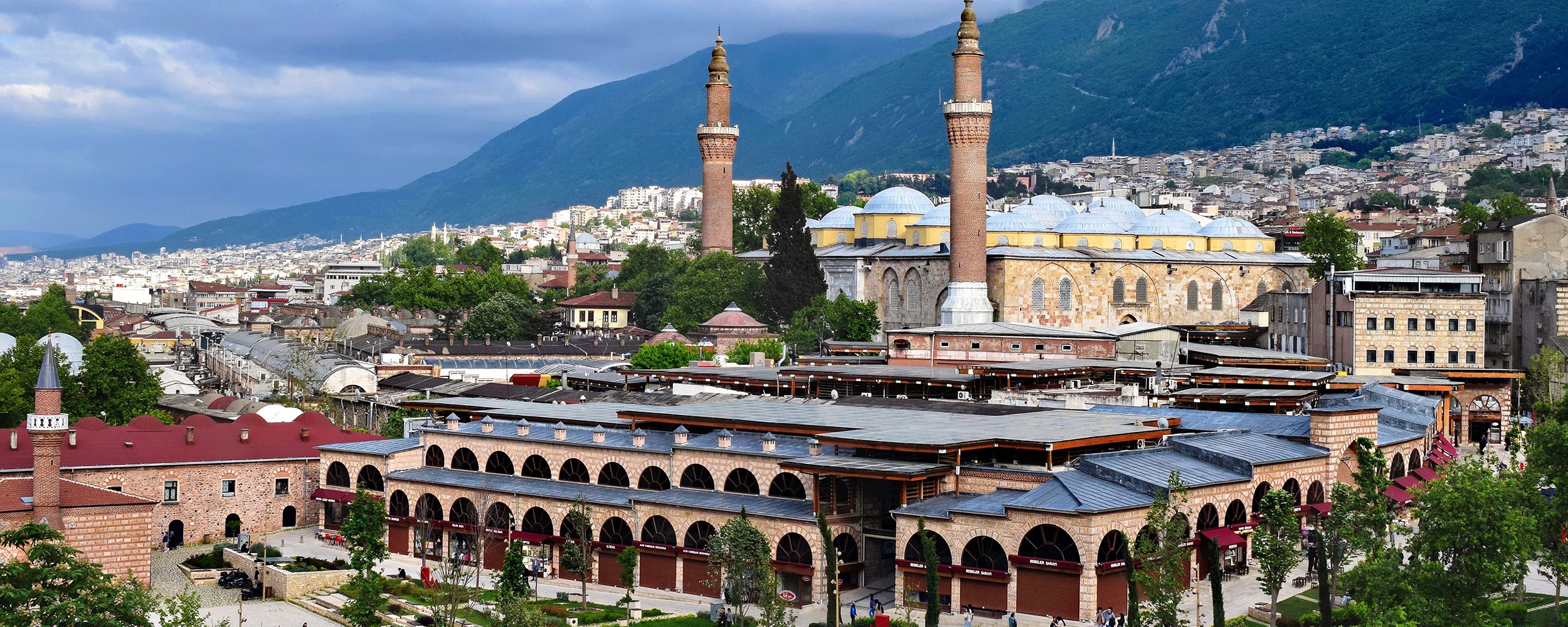
Follow Bursa’s transformation from Byzantine fortress to Ottoman capital, combining Hisar, imperial monuments, historic bazaars and the UNESCO village of Cumalıkızık.
Request This TourConnect Bursa’s ancient and Ottoman history with the great historical landscapes of Türkiye.
Travel through Istanbul, Bursa, Safranbolu, Hattusha, Cappadocia, Mount Nemrut, Şanlıurfa, Ephesus, Pamukkale, Pergamon, Troy and Gallipoli.
View Tour
Build a private journey through Bursa, Edirne and Istanbul, tracing the evolution of the Ottoman state through fortresses, palaces, imperial mosques, royal tombs and historic commercial centres.
Design Your Journey