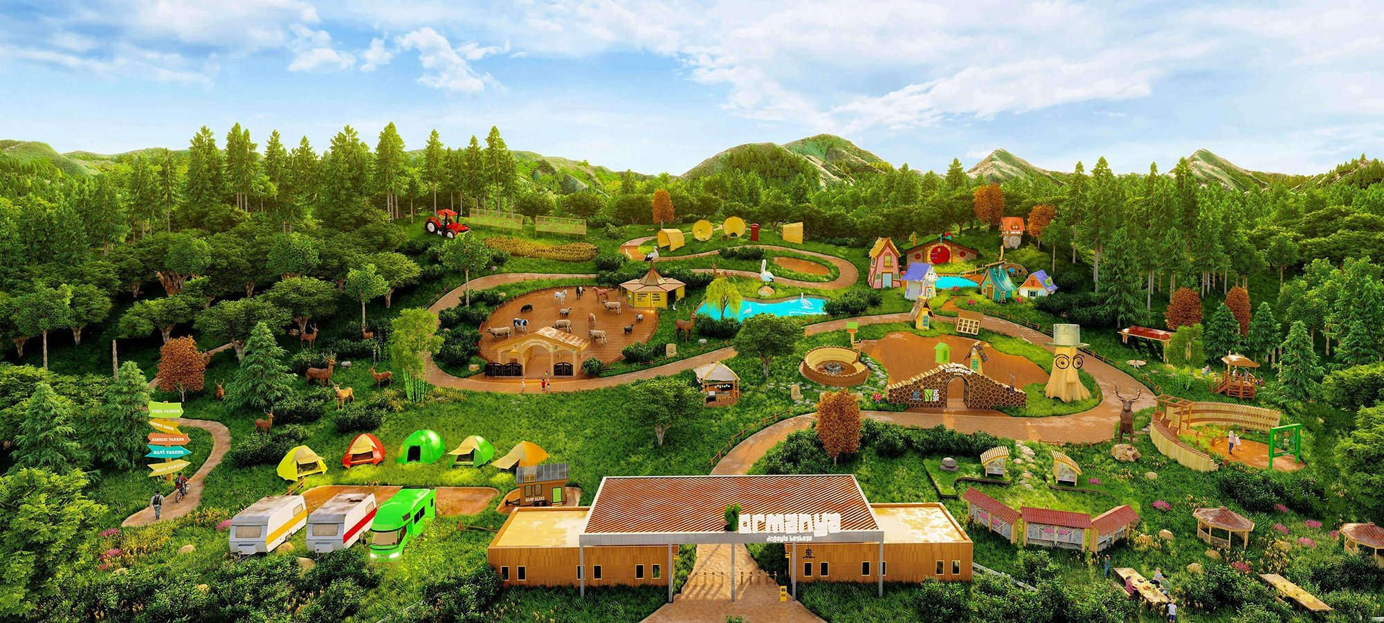
Ormanya Wildlife Park
Continue east toward Kartepe for one of Türkiye's largest nature recreation areas, with forest trails, wildlife zones, family activities and peaceful green landscapes.
Explore Ormanya





Only a short distance south of the industrial shores of the Gulf of İzmit, the scenery changes dramatically. Roads climb into forested hills, mountain streams cut through deep valleys and the blue-green surface of Yuvacık Dam appears between the slopes of the Samanlı Mountains.
Also known as Kirazdere Dam, Yuvacık is one of the most important pieces of water infrastructure in Kocaeli. It was constructed on the Kirazdere system and entered service in 1999, supplying drinking and utility water to a large part of the province. Its useful storage volume is approximately 51.1 million cubic metres, while the surrounding water basin covers about 258 km².
Yet Yuvacık is much more than an engineering project. The reservoir sits inside a richly wooded mountain landscape fed by streams descending from the highlands. Around it are traditional villages, viewpoints, trout restaurants, picnic areas and routes leading toward Aytepe, Beşkayalar Nature Park, Sıcakdere Canyon and Soğukdere Canyon.
For visitors, this combination is the real attraction: one moment you are looking across a major reservoir and its enormous dam body; the next you are following a forest road toward waterfalls, canyon paths and highland scenery.
The reservoir's useful storage volume makes Yuvacık one of the key water resources serving Kocaeli.
Forest-covered slopes, streams, valleys and changing seasonal colours create one of Başiskele's most impressive landscapes.
Camidüzü, Değirmendüzü, Sıcakdere and Soğukdere introduce very different levels of walking and canyon difficulty.
Yuvacık can be visited as a short scenic drive or expanded into a full day of hiking, village stops and mountain exploration.
Essential information about Kocaeli's best-known mountain reservoir and one of the principal gateways into the natural landscapes of Başiskele.
Yuvacık / Başiskele,
Kocaeli.
Drinking and utility water
for Kocaeli.
1999.
Approximately
51.1 million m³.
Approximately
258 km².
Reservoir views, forest roads,
trekking and canyon routes.
Yuvacık is important for two very different reasons: it is a strategic water reservoir for Kocaeli and one of the province's most popular gateways to the Samanlı Mountains.
The first story is about water security. Yuvacık stores mountain water that is treated and distributed through Kocaeli's drinking-water system. Its nearby treatment plant was designed for a maximum capacity of approximately 480,000 cubic metres per day.
The second story is about landscape. The reservoir flooded part of a mountain valley and created a long, branching body of water surrounded by steep green slopes. From high roads and viewpoints, the contrast between calm reservoir water and densely wooded mountains is spectacular.
The third story is about outdoor recreation. The wider Yuvacık area is connected with some of Kocaeli's classic walking routes. Easy forest walks, village roads, streams and picnic areas sit close to much harder canyon routes where water levels, slippery rocks and narrow passages require experience and careful planning.
Finally, Yuvacık demonstrates how close very different Kocaeli landscapes are to each other. Within a relatively short journey, travellers can move from the Gulf of İzmit and urban Başiskele into a setting of mountain villages, forest valleys, waterfalls and highland routes.
The reservoir is widely known locally and on travel maps as Yuvacık Barajı, after the nearby settlement of Yuvacık in Başiskele.
In engineering and historical sources it can also appear as Kirazdere Barajı, referring to the stream system on which the dam was constructed.
Both names describe the same major water project. For navigation, travellers will normally have the easiest experience searching for Yuvacık Barajı, Başiskele, Kocaeli.
The nearby Başiskele settlement that gives the reservoir its most familiar modern name.
The stream and valley system associated with the construction of the dam.
The Kocaeli district containing the reservoir and the principal visitor approaches.
The wider mountain system whose forests, streams and slopes shape the Yuvacık landscape.
Yuvacık lies south of the Gulf of İzmit, where the terrain rises rapidly from the coastal plain toward the Samanlı Mountains. This transition is one of the reasons the area feels surprisingly wild despite being close to a major urban and industrial region.
The dam collects water from a broad mountain catchment. Official Kocaeli sources describe a basin of approximately 258 km², extending through parts of Kocaeli and neighbouring mountain terrain.
The reservoir's long inlets follow the drowned shape of earlier valleys. When viewed from above, Yuvacık is not a simple round lake but a branching mountain reservoir that twists between ridges.
The surrounding slopes support broad areas of forest and humid vegetation. Streams descend through side valleys, and higher roads continue toward rural settlements and the walking country around Aytepe and Beşkayalar.
Rain and snowmelt from the Samanlı Mountains help feed the reservoir and its tributary streams.
The lake edge is frequently framed by forested hills rather than broad flat beaches.
Former valleys create narrow reservoir arms and changing views around almost every bend.
High approaches can open views back toward İzmit and the Gulf while the reservoir remains hidden inside the mountains.
Kocaeli's rapid urban and industrial growth created an urgent need for a large, dependable drinking-water system. Yuvacık was developed to collect the high-quality mountain water descending from the Samanlı range and deliver it toward the metropolitan distribution network.
Kocaeli's official encyclopaedia records the dam as being constructed between 1987 and 1999. The associated treatment system began operating in January 1999.
The project was built as a large rock-fill dam adapted to the geology of the valley. Its scale becomes especially impressive when seen from viewpoints where the dam body, spillway and reservoir can be understood as one engineering landscape.
The project also became part of Kocaeli's modern infrastructure history through its build-operate-transfer arrangements and later transfer into municipal control. Today the reservoir remains one of the central elements of the province's water-management system.
The principal construction period recorded in Kocaeli's official encyclopaedia.
The water-supply system entered operation and began serving Kocaeli.
The dam was designed as a major valley barrier suited to the mountain geology of the site.
Yuvacık belongs to the late twentieth-century transformation of Kocaeli's metropolitan water system.
The water stored in Yuvacık is not simply held behind the dam. It forms the first stage of a much larger system involving intake structures, transmission lines, treatment and distribution.
İSU describes Yuvacık's useful storage capacity as approximately 51.13 million cubic metres. Kocaeli Metropolitan Municipality gives an annual treated-water supply capacity of around 142 million cubic metres.
Water from the reservoir reaches the Yuvacık drinking-water treatment plant largely by gravity. The plant has a maximum design capacity of approximately 480,000 m³ per day and uses aeration, clarification, filtration and disinfection before treated water enters the municipal network.
Understanding this system changes the meaning of the landscape. The apparently quiet mountain lake is actually a working piece of infrastructure serving homes, businesses and industry across Kocaeli.
Approximate useful storage capacity reported by İSU.
Approximate treated-water supply capacity reported by Kocaeli Metropolitan Municipality.
Maximum design capacity of the associated drinking-water treatment plant.
Raw water can move from the reservoir toward the treatment plant using the elevation difference.
Yuvacık's beauty comes from contrast. The reservoir creates a broad horizontal surface inside a landscape otherwise dominated by steep slopes, narrow valleys and wooded ridges.
In spring, fresh foliage and high stream flow can make the entire basin intensely green. Summer brings long daylight and easier access to higher mountain routes. Autumn introduces yellow, copper and red tones into the forests. Winter can create mist, bare woodland and snow on the higher ground.
Water level also changes through the year. Because Yuvacık is a working reservoir, exposed shoreline can expand during dry periods and disappear again after strong seasonal inflow. Do not judge the value of the visit only by whether the water is at its highest level.
Lush vegetation, energetic streams and cool walking temperatures.
Long days and better conditions for highland roads, but canyon heat and weekend crowds can increase.
One of the most photogenic seasons as the Samanlı forests change colour.
Mist, snow on higher ground and a quieter atmosphere, with more demanding road and trail conditions.
Many of Yuvacık's finest views are not concentrated at a single formal observation deck. Instead, the experience unfolds gradually along the roads that climb above the reservoir and continue toward the mountain villages.
Look for safe roadside pull-offs and established viewing areas where the road widens. From higher ground, the reservoir's branching shape becomes clearer and the dam body can sometimes be understood in relation to the valley behind it.
Never stop on a blind bend or block local traffic simply for a photograph. Mountain roads can be narrow, and agricultural vehicles, residents and weekend visitors all use the same routes.
Elevated roads reveal the lake's winding arms and surrounding forested ridges.
Where safely visible, include both the engineering structure and the reservoir behind it.
The approach toward Aytepe introduces changing views of valleys, farms and wooded mountains.
Never park on narrow bends or obstruct access in search of the closest possible photo point.
Yuvacık is one of the classic hiking areas of Kocaeli. The Ministry of Culture and Tourism's visitor information identifies four traditional routes associated with the reservoir: Camidüzü, Değirmendüzü, Sıcakdere and Soğukdere.
These routes should not be treated as equivalent. Camidüzü is described as relatively easy, while the Sıcakdere and Soğukdere canyon routes are substantially more demanding and can involve water, slippery rock, difficult passages and rapidly changing conditions.
Trail conditions can change after storms, forestry work, landslides and seasonal flooding. For serious canyon hiking, use current local information rather than relying entirely on an old GPS track.
Approximately 9 km and traditionally described as one of the easier routes.
Approximately 8 km, traditionally finishing near a historic aqueduct.
Approximately 10 km and a difficult canyon route requiring much greater care.
Approximately 11 km and another demanding canyon route, traditionally recommended for summer conditions.
The Camidüzü route is traditionally described as approximately 9 kilometres long and one of the easier established walks in the Yuvacık area.
It is a better choice for visitors who want a real walk in the landscape without immediately committing to a technical canyon route. The route has historically included rest areas and simple exercise facilities.
Even an easy trail deserves preparation. Wear footwear suitable for uneven ground, carry water and check the weather before setting out.
A substantial walk, but easier in character than the major canyon routes.
Suitable for travellers who want to combine the reservoir with a moderate outdoor activity.
The route introduces the greener, quieter side of the Yuvacık basin beyond the main viewpoint roads.
Carry water, sun or rain protection and use proper walking shoes.
The traditional Değirmendüzü route is described as approximately 8 kilometres long. One of its most interesting features is its connection with a historic aqueduct near the Yuvacık area.
This makes the route particularly attractive for travellers who enjoy finding small pieces of cultural history inside natural landscapes. The aqueduct introduces an older chapter of water management beside the modern twentieth-century dam.
Conditions and route markings should be confirmed locally before walking. Do not assume that every historical trail description remains continuously signposted.
A classic Yuvacık walking distance that can fit into a half-day nature visit.
The route is traditionally associated with an old water structure near the reservoir landscape.
Compare older water engineering with the scale of the modern Yuvacık system.
Trail surfaces and markings can change, so use recent local guidance.
The Sıcakdere route is one of the adventurous walks associated with the Yuvacık region. Official tourism information describes it as approximately 10 kilometres long and significantly more difficult than Camidüzü.
The route traditionally begins around the Bahçecik side and continues through canyon terrain toward the Yuvacık area. Water levels and rock obstacles can make progress difficult.
This is not a route for visitors who simply arrive in ordinary shoes and decide to follow the stream. Group hiking is recommended, and current local conditions should be checked before entering the canyon.
The distance understates the challenge because much of the difficulty comes from canyon terrain.
Stream level, slippery surfaces and obstructed passages can change the character of the route.
Official visitor information recommends group walking for the difficult canyon route.
Avoid canyon hiking when heavy rain or sudden water-level changes are possible.
The Soğukdere route is another demanding canyon hike connected with the Yuvacık landscape. Traditional visitor information gives a length of approximately 11 kilometres.
The route is associated with Aytepe and follows canyon terrain toward the historic aqueduct area. Because the canyon involves water and difficult passages, older official guidance recommends it particularly for summer conditions.
Even in summer, rainfall upstream can change a canyon quickly. Only attempt the route with suitable footwear, navigation, group support and a clear understanding of current conditions.
A long and physically demanding canyon route.
The traditional route begins from the highland side around Aytepe.
Historically recommended for the warmer season because of water and canyon conditions.
Experience, preparation and companions are far more important here than simply following a map line.
Continue beyond the main reservoir landscape and the road climbs toward Aytepe, one of the best-known rural destinations associated with Yuvacık.
The journey is part of the experience. As elevation increases, reservoir views give way to deeper valleys, forest roads and the cooler atmosphere of the Samanlı highlands.
Aytepe is also an important starting point or reference point for walking routes toward canyon and nature-park landscapes. Local businesses and recreation areas make it a practical pause on a longer day.
Expect cooler air and more mountain character than at the Gulf shoreline.
The climb creates repeated opportunities to understand the scale of the Yuvacık basin.
Aytepe is associated with routes continuing toward canyon and forest areas.
The region is popular with Kocaeli residents seeking nature, food and outdoor recreation.
Beyond the reservoir, the mountain country opens toward Beşkayalar Nature Park, one of the most important trekking areas in the Başiskele region.
The landscape is shaped by the valleys of Sıcakdere and Soğukdere, with forest, canyon terrain, streams and routes continuing toward higher plateaus.
Beşkayalar is a much wilder environment than the roadside viewpoints around the dam. Anyone planning a serious trek should treat it as a mountain outing, not as an extension of a picnic stop.
A protected landscape associated with some of Başiskele's most impressive trekking terrain.
Sıcakdere and Soğukdere create deeply cut routes through the mountain landscape.
Routes can continue from stream valleys toward higher open areas and mountain settlements.
Use current trail information, weather forecasts and suitable equipment for longer walks.
The Yuvacık region has long been a weekend escape for Kocaeli. Roads leading toward the reservoir and higher villages include restaurants, breakfast places, trout facilities and recreation areas beside streams or forested slopes.
The most enjoyable approach is to treat food as part of the mountain journey rather than choosing a place solely because it is closest to the water. Higher valleys can offer a quieter atmosphere than the busiest reservoir viewpoints.
Public picnic conditions vary from place to place. Use only established areas where fires, barbecues or camping are permitted, and follow seasonal wildfire restrictions.
Yuvacık and the mountain road are popular for relaxed weekend breakfast stops.
Mountain streams supported trout facilities even before the reservoir became the area's dominant landmark.
Several local businesses use the cool valleys and flowing water as part of the dining atmosphere.
Never assume barbecues or open flames are allowed during dry weather or high wildfire risk.
Yuvacık is one of Kocaeli's best landscape-photography destinations because the scene changes with elevation, season, weather and reservoir level.
A wide lens is useful for capturing the reservoir between the mountain slopes. A longer focal length can isolate distant ridges, villages, the dam structure or layers of mist after rain.
Early morning often brings softer light and quieter roads. Late afternoon can create beautiful side-light on the ridges, although deep valleys may enter shadow earlier than expected.
Use a high viewpoint to reveal the branching water and surrounding slopes in one frame.
Mixed woodland creates excellent seasonal colour around the reservoir and mountain roads.
Clouds hanging in the Samanlı valleys can create dramatic atmospheric photographs.
Never stop on blind corners or enter restricted dam infrastructure for a photograph.
Yuvacık works well for families because the day does not need to revolve around a long hike. A scenic drive, safe viewpoint, short forest walk and meal in the countryside can already create a satisfying visit.
The reservoir also provides an easy way to explain where city water comes from. Children can see how mountain rainfall becomes stored water before treatment and distribution.
Canyon routes are a different matter. Sıcakdere and Soğukdere should not be treated as ordinary family strolls simply because they appear on tourism maps.
Families can enjoy the mountain landscape without committing to a difficult walk.
Use the reservoir to explain catchments, dams, treatment and drinking-water conservation.
Choose established easy paths and recreation areas rather than technical canyon terrain.
Supervise children carefully near steep roadsides, streams, reservoir banks and water structures.
Yuvacık is not a single museum or formal visitor centre. Accessibility therefore depends strongly on which part of the landscape you want to experience.
Many reservoir views can be enjoyed directly from a vehicle or after a very short walk from safe roadside areas. This makes the main scenic experience much more accessible than the canyon routes.
Forest paths, uneven picnic grounds and mountain trails may include mud, stones, steep gradients and unprotected natural surfaces. Visitors with limited mobility should plan around scenic driving and established facilities.
Much of the reservoir landscape can be appreciated without a long hike.
Natural viewpoints and picnic areas may not have uniformly paved surfaces.
Sıcakdere and Soğukdere involve terrain that is not suitable for visitors requiring step-free access.
Restaurant and recreation-area accessibility varies, so contact individual businesses when step-free access is essential.
Visitors should be very careful with assumptions about swimming, boating and water sports. Yuvacık is first and foremost a drinking-water reservoir protected by special basin regulations.
İSU's basin rules state that swimming, water sports and similar activities can only take place with the administration's permission. They are therefore not ordinary casual visitor activities.
The regulations also protect the critical operational zone around the water intake and spillway structures. Activities cannot take place within 300 metres of these installations.
Recreational angling may be possible under applicable rules, but fishing should only take place in permitted areas and in accordance with current regulations.
Swimming is subject to administrative permission because the reservoir supplies drinking water.
Kayaking, boating and similar activities are not automatically permitted tourist activities.
Keep away from intake and spillway structures and obey all security barriers.
Never leave waste, detergents, food remains or other pollutants near streams or the reservoir.
Breakfast and picnic traffic can increase significantly on pleasant Saturdays and Sundays.
The reservoir level changes; use established roads and viewpoints rather than walking onto unstable exposed banks.
Mountain temperatures can be noticeably cooler than the Gulf shoreline, especially in shade and after sunset.
Heavy rainfall can transform stream and canyon conditions even when the city weather looks harmless.
Mobile reception can weaken in deeper valleys; offline maps are useful for rural roads and trail approaches.
Narrow roads are shared with residents, agricultural vehicles and other visitors.
The reservoir is a protected water source, making responsible waste management especially important.
Dam infrastructure, intake facilities and operational zones are not sightseeing shortcuts.
Begin in the morning around Yuvacık and follow the road toward the reservoir. Stop only at safe, established viewpoints to appreciate the dam landscape and the wooded arms of the lake.
Continue gradually uphill toward the rural roads leading to Aytepe. A breakfast or early lunch stop works well before the busiest part of the day.
From Aytepe, choose the level of adventure that suits you. For a relaxed day, continue with short forest walks and viewpoints. Experienced hikers can plan a dedicated route toward the wider Beşkayalar landscape, but canyon routes should be treated as separate serious hikes.
On the return journey, descend toward Başiskele and finish near the Gulf shoreline. This creates a satisfying vertical journey from coast to reservoir, mountain villages and forest.
Yuvacık reservoir viewpoints – understand the scale of the lake and mountain catchment.
Scenic mountain road – pause safely for changing reservoir and valley views.
Aytepe – mountain atmosphere, local food and access toward outdoor routes.
Short forest walk or carefully planned Beşkayalar hiking route.
Return toward Başiskele and the Gulf for sunset or an evening meal.
Skip the highland drive and combine Yuvacık with central İzmit museums for a nature-and-culture day.
Enough for a quick scenic reservoir stop if you are passing through Başiskele.
Good for several viewpoints, a short walk and relaxed photography.
Add a countryside meal, mountain drive or easy walking route.
Best for Yuvacık, Aytepe, forest exploration and a carefully chosen nature route.
Reserve a separate full outing for Sıcakdere or Soğukdere with proper hiking preparation.
Stay in the Başiskele highlands and combine multiple walks without rushing.
Yuvacık Dam is not operated as a single ticketed tourist attraction. Visitors experience the landscape through public roads, viewpoints, villages, restaurants and permitted recreation areas around the wider basin.
There is therefore no universal opening hour or single entrance fee for “Yuvacık Dam.” Individual nature parks, private recreation facilities, restaurants, campsites or activity businesses can have their own hours and charges.
Operational dam structures and protected water facilities are different. Security barriers and restricted zones must be respected at all times.
Because the reservoir is a drinking-water source, environmental and water-use restrictions are stricter than they would be around an ordinary recreational lake.
Scenic reservoir, protected water basin and mountain recreation area.
No single admission ticket for the wider Yuvacık landscape.
No universal opening time for public scenic roads; individual facilities vary.
Operational and security-restricted areas are not open for casual sightseeing.
Spring and autumn are excellent for scenery; summer is popular for highland visits and selected canyon routes.
Morning for quieter roads and softer light; late afternoon for warm landscape photography.
Not an ordinary public activity; reservoir rules require administrative permission.
Excellent, but route difficulty ranges from easy walking to serious canyon terrain.
Yuvacık Dam lies in Başiskele district, south of İzmit and the eastern end of the Gulf of İzmit. The easiest way to explore the reservoir and continue toward the mountain villages is by car.
From central İzmit, travel toward Başiskele and follow signs for Yuvacık. Once you climb beyond the urban area, roads begin to divide toward the reservoir, local villages, recreation facilities and Aytepe.
From Istanbul, the motorway corridor reaches Kocaeli quickly outside peak traffic, but metropolitan congestion can greatly increase travel time. From the Ankara direction, approach İzmit and continue toward Başiskele.
Public transport can reach Yuvacık and parts of Başiskele, but the wider mountain landscape is dispersed. A private vehicle provides much more flexibility for viewpoints, rural restaurants and trailheads.
Travel south toward Başiskele and follow the local Yuvacık route into the hills.
Use the main motorway corridor toward Kocaeli, allowing extra time for city traffic.
The best option for combining viewpoints, Aytepe and rural trail approaches in one day.
Useful for reaching the broader Yuvacık area, but less convenient for dispersed mountain stops.
Expect narrower roads, sharp bends and changing weather as elevation increases.
Search for “Yuvacık Barajı, Başiskele, Kocaeli” rather than relying only on the district name.
Because Yuvacık is a broad landscape rather than a single attraction, there is no one central visitor car park for the entire reservoir. Parking conditions depend on the viewpoint, restaurant, picnic area or trailhead you choose.
Use designated parking at businesses and recreation areas whenever possible. On mountain roads, stop only where the road is clearly wide enough and visibility is good in both directions.
Never block gates, emergency access, village roads or dam service infrastructure.
The reservoir is explored from multiple roads and facilities rather than one entrance.
Restaurants and recreation areas often provide the safest stopping points.
Mountain-road visibility can be limited and local vehicles may approach quickly.
Do not obstruct private property, emergency routes or water-infrastructure entrances.
Yuvacık sits at the meeting point between Başiskele's mountain landscape and the urban heritage of İzmit. This makes it easy to build either a pure nature day or a mixed nature-and-culture itinerary.
Use our complete Kocaeli travel guide to continue across the province.
Continue uphill for mountain roads, local food and access toward forest and canyon routes.
One of Başiskele's strongest trekking landscapes, with deep valleys and mountain streams.
Combine nature with local history in the mountain villages associated with the Servetiye Front.
Return to sea level for a Gulf-side walk after a day in the mountains.
Continue into İzmit and discover one of Türkiye's most impressive industrial-heritage museums.
Explore ancient Nicomedia and the archaeological history of the Gulf region.
Add one of central İzmit's best-known late Ottoman landmarks.
Continue east toward Kartepe for another major Kocaeli nature destination with forests and wildlife areas.
Yuvacık Dam is in Başiskele district of Kocaeli, south of İzmit and the Gulf of İzmit in the foothills of the Samanlı Mountains.
Yes. Kirazdere Dam is an alternative name used for the same reservoir, while Yuvacık Barajı is the more familiar local and tourism name.
Kocaeli's official encyclopaedia records construction between 1987 and 1999. The associated water-supply system entered operation in 1999.
Its principal purpose is to store and supply drinking and utility water for Kocaeli, while also supporting flood and drought management.
İSU reports a useful storage capacity of approximately 51.13 million cubic metres.
Official Kocaeli information gives a basin area of approximately 258 km².
Yes, especially for travellers who enjoy reservoir panoramas, forest roads, photography, countryside meals and hiking. The most rewarding visit normally combines the lake views with the higher Başiskele mountain landscape.
There is no single general admission ticket for the wider reservoir landscape. Individual nature facilities, restaurants, campsites or activity areas may have their own charges.
Yuvacık is not a gated museum attraction, so there is no universal opening schedule for the public scenic roads. Individual facilities have their own hours, while operational dam zones can be restricted.
Do not treat Yuvacık as a normal swimming lake. İSU's drinking-water-basin rules state that swimming and similar activities require administrative permission.
Water sports and boating are regulated because Yuvacık is a protected drinking-water reservoir. Do not launch a craft unless the activity is explicitly authorized under current rules.
Recreational angling can be permitted under applicable rules and in designated conditions, but visitors should follow current fisheries and basin regulations and stay away from restricted infrastructure.
The four classic routes identified in official tourism information are Camidüzü, Değirmendüzü, Sıcakdere and Soğukdere.
It is traditionally described as approximately 9 km and one of the easier Yuvacık routes.
The traditional route is approximately 8 km and is associated with a historic aqueduct near the Yuvacık landscape.
Official visitor information describes it as approximately 10 km. It is a difficult canyon route where water and rock conditions can make progress challenging.
The traditional route is approximately 11 km and is another difficult canyon hike associated with Aytepe.
Not as casual walks. Canyon terrain, flowing water and slippery rocks can create serious difficulty. Check current conditions and use experienced group support.
Aytepe is a mountain settlement and recreation area above Yuvacık, popular for countryside visits and as a gateway toward forest and canyon routes.
It is a protected mountain landscape near Yuvacık known for forest, valleys, streams, canyon scenery and trekking routes.
Spring and autumn are excellent for scenery and comfortable walking. Summer is popular for highland recreation, while winter can be beautiful but brings colder and more difficult mountain conditions.
Yes. Autumn is one of the most photogenic periods because the forested slopes around the reservoir develop strong seasonal colour.
Yes, but higher roads can experience fog, ice or snow. Check local conditions before driving into the mountain villages.
Allow 1–2 hours for viewpoints and a short walk, a half day with a countryside meal, or a full day when continuing toward Aytepe and the mountain routes.
Yes. It is a practical nature escape from Istanbul by car, although weekend and metropolitan traffic can significantly affect journey time.
Yes for scenic driving, viewpoints, easy walks and countryside meals. Difficult canyon trails should be evaluated separately according to experience and conditions.
Yes. The wider Yuvacık and Aytepe area is known for countryside breakfast places, trout restaurants and streamside recreation businesses.
Camping is available at certain authorized businesses and recreation areas in the wider Başiskele highlands. Do not camp randomly inside protected water zones or forest areas where access or fire restrictions apply.
Landscape photography from public viewpoints is one of the pleasures of Yuvacık. Do not enter operational or security-restricted dam areas, and never stop unsafely on mountain roads.
For nature, continue to Aytepe and Beşkayalar. For a mixed day, descend to Başiskele coast or continue into İzmit for the SEKA Paper Museum, Kocaeli Archaeology Museum and İzmit Clock Tower.
Never throw waste, food, detergents or any contaminating material into streams or the reservoir.
Dam infrastructure, intake structures and security areas are not public recreation spaces.
Follow seasonal restrictions and never light an open fire in forest areas where it is prohibited.
Avoid damaging vegetation or creating unofficial shortcuts on steep slopes.
Leave picnic and viewpoint areas cleaner than you found them.
Do not block driveways, private land or agricultural access while parking or photographing.
Do not enter canyons during dangerous weather or without suitable preparation.
The mountain environment is shared by residents, wildlife and other visitors seeking quiet.
Yuvacık reveals Kocaeli's mountain side, while nearby İzmit, Kartepe and the wider province add forests, wildlife, archaeology, Ottoman landmarks and extraordinary industrial heritage.
Combine the reservoir landscape with some of the province's most interesting nature and cultural destinations.
Continue east toward Kartepe for one of Türkiye's largest nature recreation areas, with forest trails, wildlife zones, family activities and peaceful green landscapes.
Explore Ormanya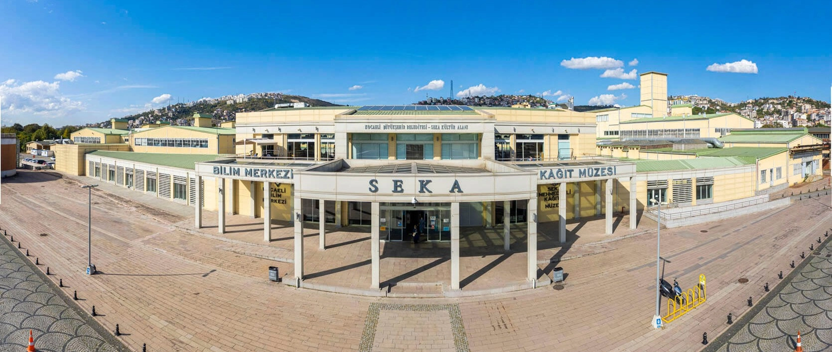
Descend from the mountains to İzmit and explore Türkiye's paper-industry history inside an extraordinary preserved factory complex.
Explore SEKA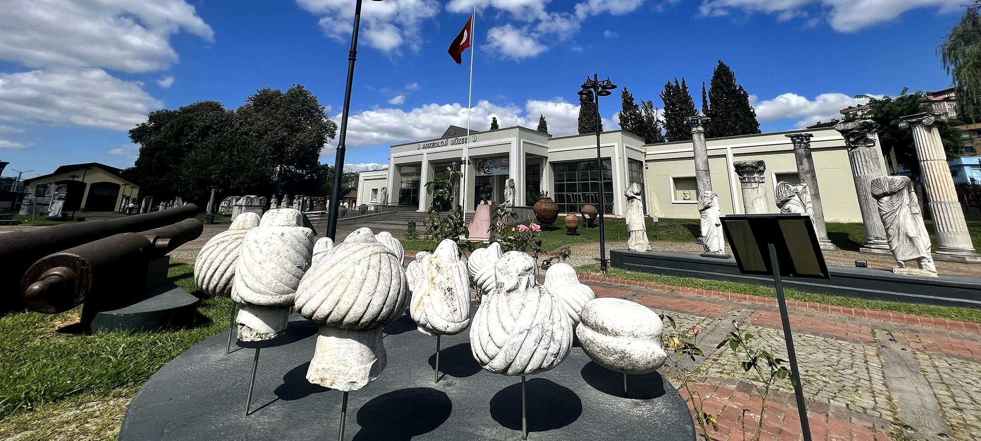
Move from modern water engineering to ancient Nicomedia through sculpture, inscriptions, coins and archaeological finds from the wider province.
Explore NicomediaContinue through İzmit or explore Kocaeli's forests, coastlines and hidden landscapes.
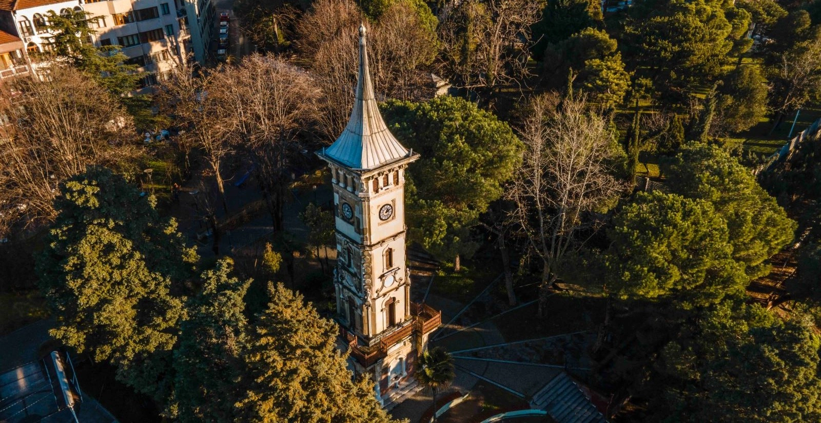
Return to central İzmit and discover one of Kocaeli's most recognizable late Ottoman landmarks with views toward the Gulf.
Explore the Clock Tower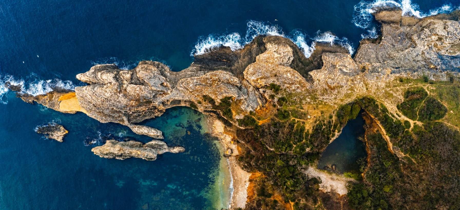
For a completely different Kocaeli landscape, travel north toward Kandıra for Black Sea cliffs, hidden coves and wild coastal scenery.
Explore Sardala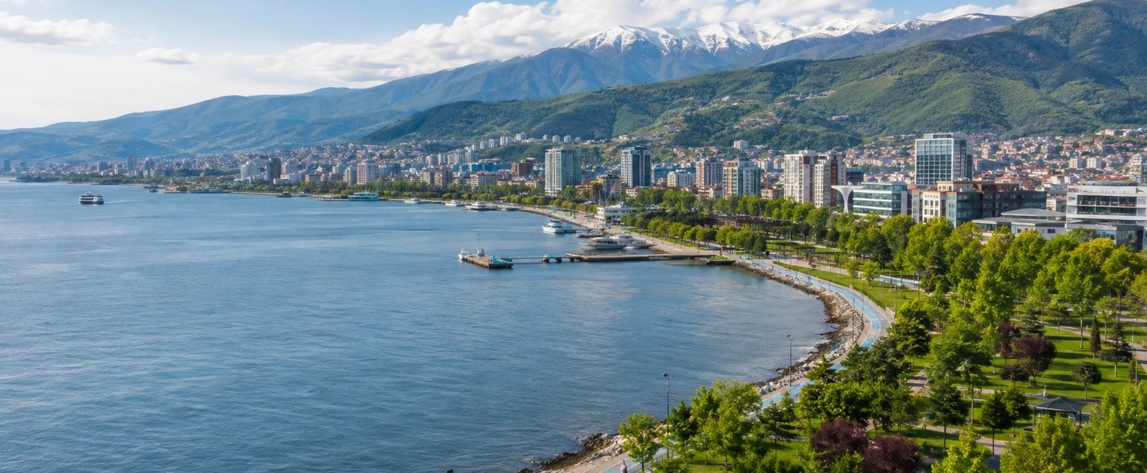
Discover Yuvacık, İzmit, Kartepe, Kandıra, Gebze, historic monuments, industrial heritage, nature and regional food.
Explore KocaeliWe can connect Istanbul, Kocaeli, Cappadocia and destinations throughout Türkiye in a private cultural and nature itinerary.
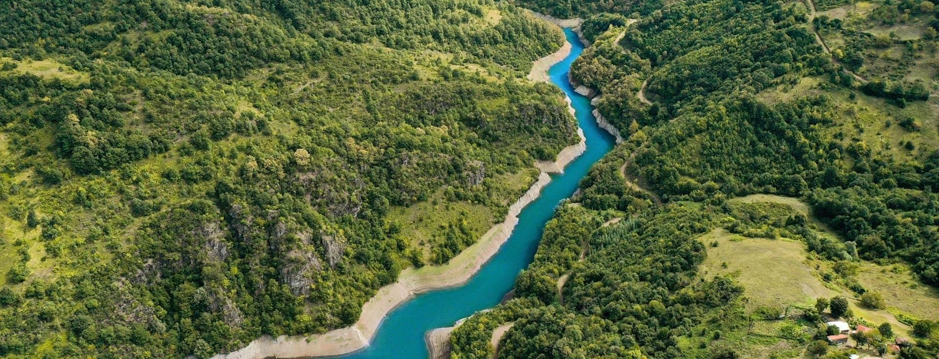
Build a private day around Yuvacık, Aytepe, mountain viewpoints, local food and the forested landscapes south of the Gulf of İzmit.
Plan Your Journey
Connect Yuvacık's mountain reservoir with the forests of Kartepe and Ormanya for a greener side of northwestern Türkiye.
Discover Natural Kocaeli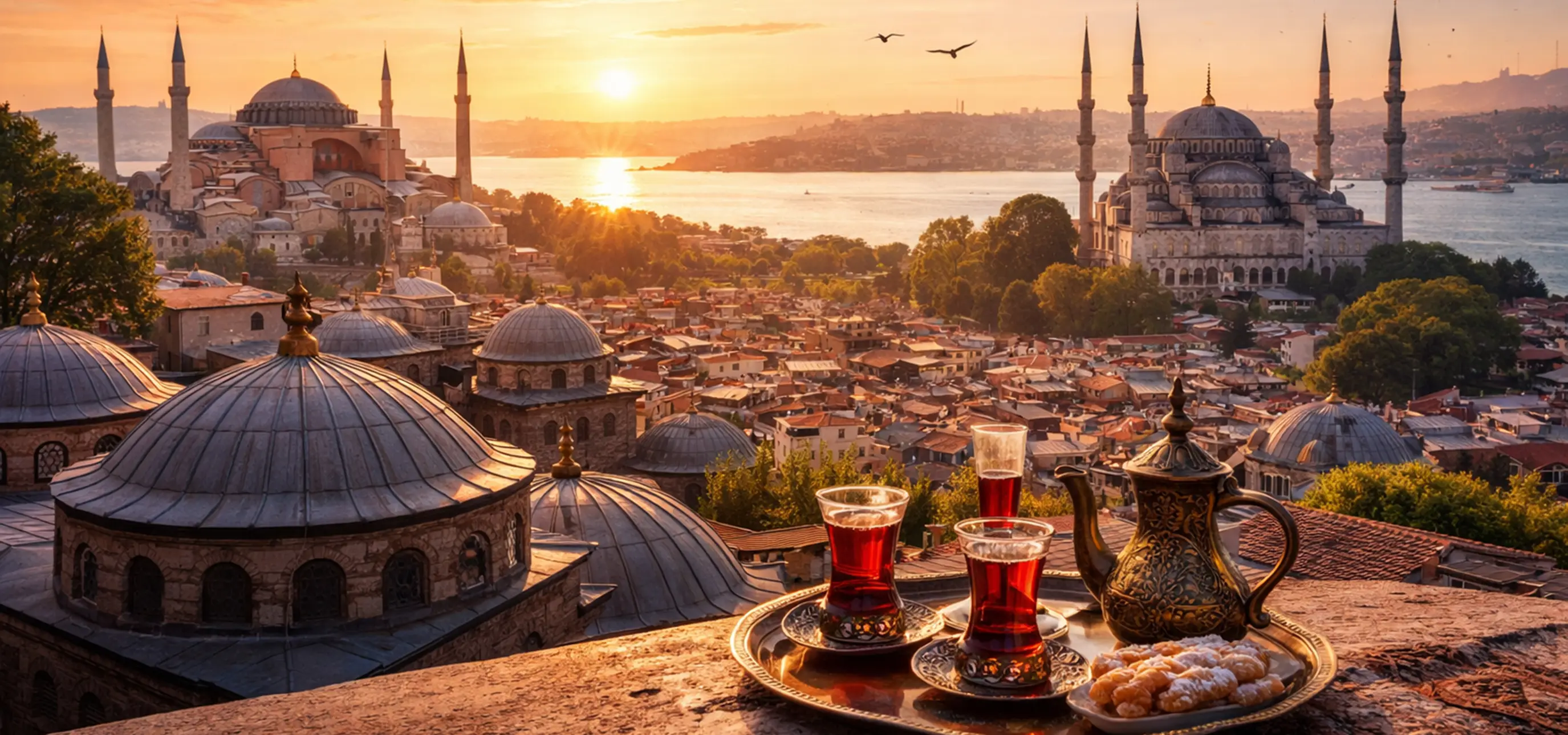
Continue throughout Türkiye with mountains, lakes, ancient cities, Ottoman heritage, historic towns, coasts and regional cuisine.
Explore Türkiye