Private Soma District Travel Guide Programme
Tell us your dates, group size and interests. We will check access and plan a sensible route.
Request Your Private Programme





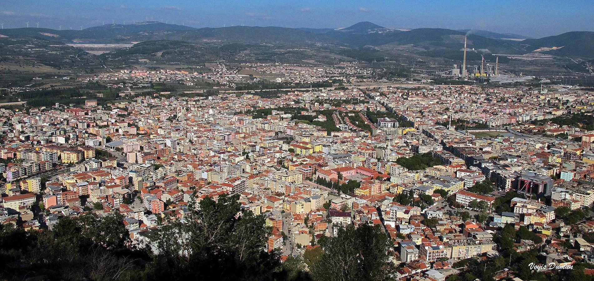
Soma is a district in northern Manisa, close to the border with Balıkesir and the historic Pergamon region. It is widely known for lignite mining and electricity production, yet its wider story includes agriculture, old settlements and the nearby village of Darkale.
A useful Soma itinerary is not a tour of active mines. Instead, it explores the town as a working community and connects it with protected architecture, local landscapes and regional history.
Darkale, a short journey from the centre, is the district’s most distinctive historic walking destination. The contrast between its old lanes and modern Soma helps visitors understand changing patterns of settlement.
Traditional houses and narrow lanes reveal a different side of Soma.
The district sits within a landscape historically linked to the Pergamon region.
Markets, neighbourhood streets and everyday food are a more grounded introduction than treating industrial facilities as tourist sites.
Mining and power production have shaped modern Soma.
Essential orientation for an informed visit.
Soma district, northern Manisa
District and heritage landscape
Ancient roots to modern industrial history
Manisa Province, western Türkiye
Allow half a day to a full day
Town and village sites have separate access rules
Soma broadens a Manisa journey beyond the familiar archaeological and Ottoman highlights to a district where industry, farming and heritage coexist.
It is also a practical base for understanding the conservation challenges of Darkale.
The Bakırçay basin has been connected with the worlds of Pergamon, Rome and Byzantium. Local official histories describe the historic Tarhala/Darkale area as an earlier centre of settlement.
Soma expanded in later Ottoman centuries and developed into a district centre. Its location between inland Manisa and the northern Aegean made it part of a wider network of roads and agriculture.
Lignite extraction and power generation became defining elements of the modern economy. This industrial history is inseparable from the community’s identity and should be approached with sensitivity to the lives of local workers.
The setting of Soma District Travel Guide is Soma district, northern Manisa. The relationship between the local terrain, historic movement and the surrounding settlements is important when planning a visit.
This district and heritage landscape is one element of a larger Manisa itinerary. Think about how its surroundings influenced the way people used the place, rather than separating it from the roads, communities and landscape around it.
Traditional houses and narrow lanes reveal a different side of Soma. Treat the village as a living conservation area, not an abandoned attraction.
The district sits within a landscape historically linked to the Pergamon region. Look at how valley routes connect inland and coastal settlements.
Markets, neighbourhood streets and everyday food are a more grounded introduction than treating industrial facilities as tourist sites.
Mining and power production have shaped modern Soma. Learn about this history through public information and community context rather than entering active industrial areas.
Manisa's story extends from the Gediz Plain and the slopes of Mount Spil to the Yunt Mountains and the northern districts. Soma District Travel Guide adds a particular perspective on this diversity, and its importance is clearer when the surrounding province is considered.
A thoughtful itinerary pairs sites by theme and geography rather than rushing between distant places. See the Manisa travel hub for a broader view of the province's archaeological, natural and Ottoman heritage.
Avoid romanticising mining or treating working industrial areas as open tourist attractions. Access is controlled and safety rules are essential.
Compare Darkale’s older urban form with Soma’s later growth; the relationship reveals changing livelihoods and transport routes.
Traditional houses and narrow lanes reveal a different side of Soma.
The district sits within a landscape historically linked to the Pergamon region.
Markets, neighbourhood streets and everyday food are a more grounded introduction than treating industrial facilities as tourist sites.
Mining and power production have shaped modern Soma.
Soma is a working district rather than a purpose-built tourist resort. Confirm local accommodation, transport and restaurant arrangements.
Do not enter mines, power stations or restricted industrial land. Cultural visits should remain on publicly accessible routes.
These resources provide historical background or current visitor information. Check directly before travelling, as conditions can change.
Spring and autumn are comfortable for village walking; summer can be hot and winter rain affects rural approaches.
For photographs of Soma District Travel Guide, start with a wide frame that includes the surroundings. Then choose details that reveal the character of the district and heritage landscape without obstructing other visitors.
Use only lawful viewpoints and respect people, religious activity, wildlife and protected surfaces. Ask permission for portraits, and do not move or touch historic material for a photograph.
Town-centre routes vary; Darkale’s historic lanes are steep. Plan a mixed itinerary with accessible town stops if needed.
The destination is associated with Soma district, northern Manisa. Confirm the actual public entrance or meeting point with an up-to-date map; a generic place pin may not mark the best approach.
For a multi-stop Manisa day, plan transport according to the actual distance between sites. Historic streets, rural roads and mountain access can require more time than a straight-line map suggests.
Stone lanes and traditional houses near Soma. Consider the travel time and access arrangements before combining the stops.
Melon country, historic mosques and Yortan archaeology. Consider the travel time and access arrangements before combining the stops.
An Aeolian city high in the Yunt Mountains. Consider the travel time and access arrangements before combining the stops.
Archaeology, art and life across Manisa. Consider the travel time and access arrangements before combining the stops.
Soma is a district in northern Manisa Province, near the Balıkesir border and the Bakırçay region.
It is widely known for lignite mining and electricity production, while the district also has agricultural and historic heritage.
Darkale’s historic village streets are a principal cultural highlight, along with the district’s wider landscape and town life.
Do not assume so. Active industrial sites are controlled workplaces and are not ordinary tourist attractions.
A half-day can cover a brief town visit and Darkale; a fuller day allows a more relaxed route.
Yes. The neighbouring districts make a logical northern Manisa route, with travel time planned in advance.
Follow official paths, barriers and directions; do not enter closed buildings or excavations.
Never touch carved surfaces, collect artefacts or climb fragile masonry.
Ask before photographing residents, worshippers or workers; keep private entrances clear.
Carry away rubbish and avoid disturbing wildlife, vegetation or historic material.
Ask Wow Cappadocia / Venere Travel to design a private, tailor-made route with a licensed guide and suitable vehicle, subject to confirmed access, with no compulsory shopping stops.
Combine heritage, village culture and landscapes at your own pace.
Tell us your dates, group size and interests. We will check access and plan a sensible route.
Request Your Private Programme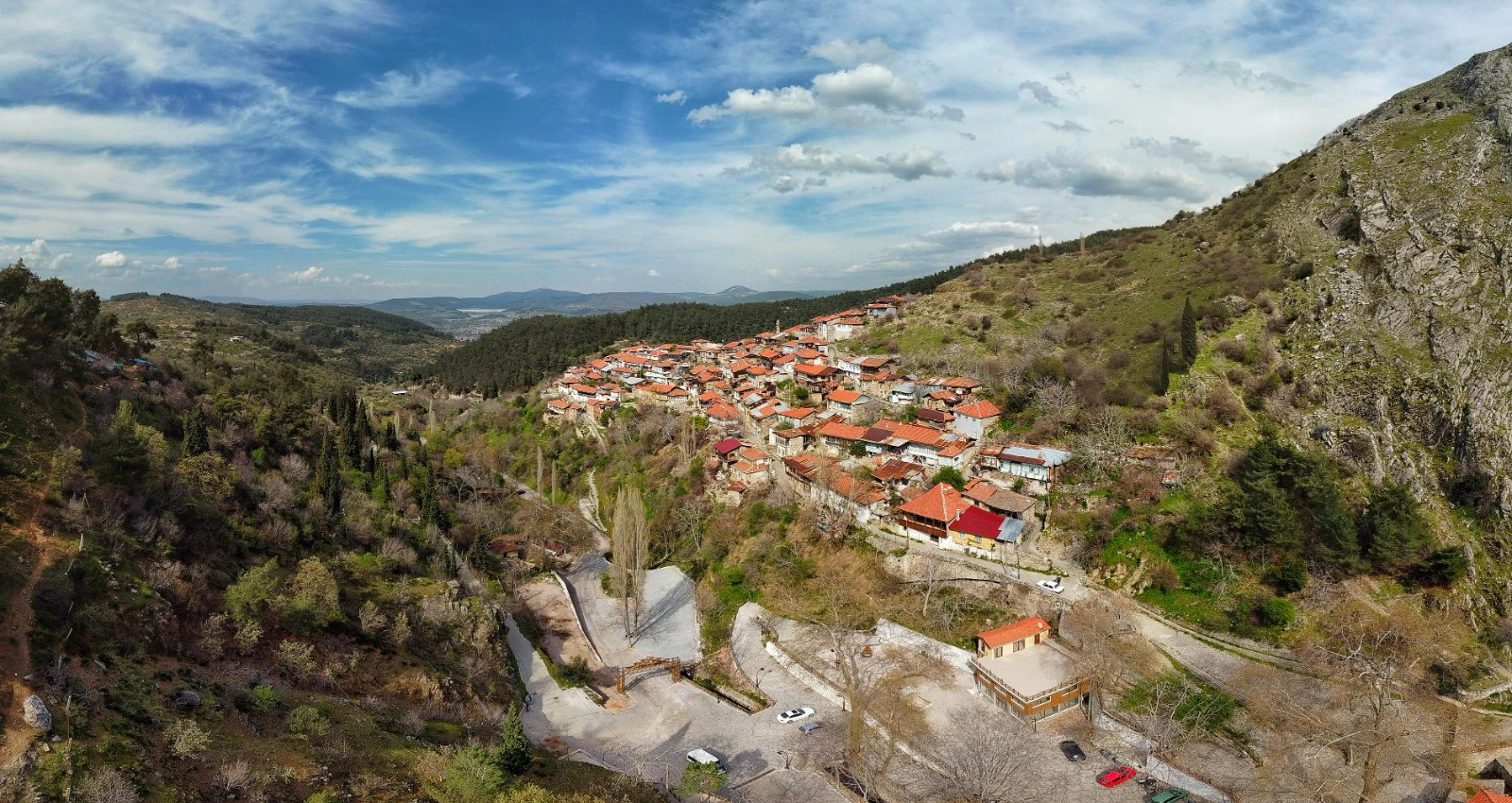
Stone lanes and traditional houses near Soma. Continue your journey with a related destination.
Read the Nearby Guide