
Private İnceğiz Canyon Viewpoint Excursion
Explore magnificent panoramic overlooks near Kale and enjoy a relaxed scenic day with private transportation.
Request a Custom Visit





İnceğiz Canyon (İnceğiz Kanyonu) lies near İnceğiz Mahallesi in the Kale district of Denizli Province, close to the wider meeting area of Denizli, Aydın and Muğla. Also called Arapapıştı Canyon in local tourism descriptions, the gorge combines dramatic rocky slopes, green-blue reservoir water and spectacular views from the hills above.
The canyon was sculpted over time by flowing water in the river system associated with Kemer Dam. The reservoir now shapes much of its familiar appearance. Around the slopes, pine, olive and fig trees add distinctive colours to the rocky scenery.
In seasons with sufficient water, boat excursions have taken visitors between the cliffs. This activity is not guaranteed year-round: falling reservoir levels forced an early end to the 2025 boat season, while July 2026 reports again warned of early suspension. The scenery and designated viewpoints can still be the main reason to visit, subject to local access.
Our detailed guide explains location, the Arapapıştı name, boat-tour seasonality, viewpoints, driving directions, roads and parking, visiting hours, tickets, scenery, geology, historical traces, photography, safety, nearby attractions and private-tour ideas. Check current conditions and operating arrangements before travelling.
A distinctive river-and-reservoir landscape framed by cliffs.
Admire dramatic bends and steep rocky canyon walls.
Boat services depend on water level and operator decisions.
Olive groves, pine-covered slopes and traces of old settlement.
Essential information for visiting the Kale side of İnceğiz / Arapapıştı Canyon.
İnceğiz Mahallesi, Kale district, Denizli, Türkiye.
Open on Google MapsA steep-sided gorge connected to the Kemer Dam reservoir.
Arapapıştı Canyon, a name used for this wider canyon landscape.
Seasonal and water-level dependent; never assume daily service.
Panoramic outlooks, emerald water and rugged rocky cliffs.
Official sources describe the canyon as roughly 45 km from the district centre.
Pine, olive and fig trees on the surrounding slopes.
Allow 45–90 minutes for a viewpoint stop, plus extra for any confirmed boat trip.
Few places in inland southwestern Türkiye combine green-blue water and high rock walls as dramatically as İnceğiz Canyon. From elevated viewpoints, the water appears to wind between steep outcrops and narrow inlets, creating a landscape that changes with sunlight and the level of the reservoir.
This is not simply a place to tick off another viewpoint. The countryside tells a story of water erosion, river valleys, the Kemer Dam and the relationship between local villages and the surrounding hills. Birdsong, pine-covered slopes and working olive and fig groves give it a distinct rural character.
For travellers who have already visited Pamukkale, the canyon offers a very different side of Denizli Province. A carefully planned visit can combine viewpoints, a local meal and optional additional stops without overloading the day.
Striking watercolour against pale and grey cliffs.
Impressive height and layered rock textures.
Wide compositions and dramatic bends in the gorge.
A rural landscape beyond busy city attractions.
Olives and figs are associated with İnceğiz.
Enjoy a land-based visit even if boats are not running.
İnceğiz Canyon is in İnceğiz Mahallesi of Kale district, Denizli Province. The Kale Municipality and the Denizli Provincial Directorate of Culture and Tourism both identify this as the local approach to the canyon.
The landscape is associated with the area between Denizli, Aydın and Muğla provinces. That geographic proximity explains why guides sometimes discuss İnceğiz and Arapapıştı together or use one name for the broader gorge-and-reservoir landscape.
The officially published distance is approximately 45 km from Kale district centre, not 45 km from Denizli city. For navigation, search for the specific İnceğiz Canyon viewpoint or the intended boat embarkation point; these are different destinations and may have different access roads.
Denizli.
Kale.
İnceğiz Mahallesi.
Approximately 45 km from Kale town, according to the municipality.
A canyon connected with the Kemer Dam water system.
Confirm whether you want a viewpoint or a boat departure point.
Visitors may see the names İnceğiz Kanyonu, Kale İnceğiz Kanyonu and Arapapıştı Kanyonu used for the scenic gorge in this region. Both Kale Municipality and the provincial tourism authority explicitly say that the canyon is locally known as Arapapıştı.
The name Arapapıştı is also widely associated with visitor routes and boat trips on the Aydın side of the Kemer Dam area. Therefore, two providers using the same canyon name may have completely different departure locations, road approaches or tour arrangements.
Before committing to a transfer, compare the actual meeting-point map pin and confirm whether the visit begins from Kale / İnceğiz in Denizli or from a separate boat base in Aydın Province. The name alone is not sufficient for planning.
The local Denizli name on Kale government and tourism pages.
A widely used alternative name for the regional canyon.
The Kale and İnceğiz viewpoint / tour area.
A separate approach to the same broader waterway region.
Use the full name, town and precise desired meeting point.
Share a screenshot or exact link from the operator before pickup.
Over a very long period, moving water and weathering shaped the valley that is now recognised as İnceğiz Canyon. Denizli’s official tourism description links its formation to the erosive action of rivers feeding the Kemer Dam system.
The narrow channel, steep slopes and exposed rocky faces show how valleys can become deeply incised as running water follows local terrain and weaknesses in the underlying rock. The landscape also continues to evolve through erosion, rockfalls and changes in vegetation.
The modern reservoir is important to understand: water impounded by Kemer Dam helps produce the present-day lake-like scenery. A dramatic green water level in one season does not mean the river will look identical later in the year.
Moving water helped shape the gorge.
Natural exposures created by prolonged valley development.
Kemer Dam influences modern water depth and appearance.
Temperature, rainfall and gravity reshape steep surfaces.
Reservoir levels reveal or submerge different rock sections.
Eroded cliffs and unstable edges call for caution.
The most famous photographs of İnceğiz show vivid turquoise or deep green water winding between the cliffs. The colour visitors perceive depends on sunlight, weather, suspended particles, viewing angle and the amount of water present.
Kemer Dam makes the area more than a simple free-flowing stream: reservoir management and agricultural irrigation can cause significant seasonal fluctuations. When levels drop, some boat navigation channels can become too shallow for scheduled service.
Local sources differ in the names used for watercourses in this system: the provincial tourism page mentions Aksu Çayı, while the national education visitor listing refers to Akçay. We describe the site as part of the Kemer Dam river-and-reservoir system rather than inventing a single uncontested label.
The perceived water colour varies naturally.
Water levels reflect seasonal inflows and management.
Can reduce depth available for boats.
A summer visit may look different from a spring photograph.
Check local conditions before setting out.
Do not enter exposed muddy banks when water retreats.
Boat excursions are one of the best-known activities associated with İnceğiz Canyon. Kale Municipality maintains a page for the service, and historical visitor information describes boat or canoe access along the canyon waterway.
When operating, the boat route can reveal rock faces, narrow passages and bays that are difficult or impossible to appreciate from land. Local reporting from February 2026 described municipal boats and indicated an approximate 2.5-hour excursion as a plan for that season, but this is not a guaranteed current trip duration.
Boat trips are not a permanent daily attraction. A vessel may be grounded because of low reservoir water, safety requirements, maintenance, weather or an operator’s seasonal schedule. Contact the Kale operator directly rather than arriving on the assumption that a boat will depart.
Kale Municipality has published a boat-tour service page.
The water level can shorten or interrupt the season.
Ask for the current trip length; older plans mentioned about 2.5 hours.
Obtain the exact pier pin for your date.
Ask about life jackets and boarding arrangements.
Verify operating day, time, price and vessel capacity.
Do not assume that a boat trip is operating in October 2026. In 2025, the Kale-side boat season ended early after falling water levels related to agricultural irrigation. July 2026 local reporting warned that tours could again finish within approximately 10–15 days because of declining reservoir levels.
Those reports do not constitute a live status feed and do not establish the exact date of every cancelled or reinstated sailing. They do, however, make a boat trip in late summer or autumn especially uncertain.
If a cruise is the main reason for your visit, telephone the municipal operator before paying for a long-distance transfer. If boats are suspended, arrange a land-based viewpoint visit instead if local access permits.
For many travellers, the highlight is the elevated view over the canyon’s twisting waterway. From safe, accessible viewing areas the landscape opens into a beautiful composition of steep rock, patches of green woodland and water reflecting the sky.
İnceğiz Seyir Tepesi is mentioned in regional reports as a popular panoramic viewpoint. Facilities, railing conditions and the last stretch of access should be checked before arrival; an impressive photograph from an exposed ledge does not mean the ledge is an official visitor platform.
Choose an established overlook where you can stand securely, keep clear of cliff edges and account for changing wind and ground conditions. Families with children and visitors with vertigo should be particularly cautious.
Look across the canyon bends and reservoir.
Can give soft illumination and lower haze.
Creates attractive contrasts along the rock faces.
Keep away from loose rock and exposed drops.
May vary with location and season.
Use only public and permitted viewing spaces.
The characteristic photograph of İnceğiz brings together a curving ribbon of turquoise water and the strong diagonals of the canyon walls. Wide-angle lenses work well at elevated viewpoints, while a longer focal length can isolate interesting rock formations and tree patterns.
Water reflections and vegetation change through the day. Rather than expecting identical colours to promotional photographs, compose around the conditions you actually find. Low reservoir levels may produce exposed banks or a narrower channel.
Drones may be subject to Turkish civil aviation rules and local airspace or site restrictions. Check all permissions before flying, and never stand near a precipice simply to capture a better angle.
Include a canyon bend and the surrounding slopes.
Pick out layers and textures in the rocky walls.
Expect different water colours as levels and light change.
Use only on stable, permitted ground.
Confirm aviation and local access requirements.
Do not approach unsupported cliff edges for a photograph.
The surrounding landscape is not only a geological attraction. Official educational material and Denizli’s provincial tourism authority note caves and traces of past habitation around İnceğiz, with educational material also mentioning ancient rock tombs.
It is tempting to assign a specific ancient civilisation to every opening in a cliff, but the available visitor sources do not establish dates, interpretations or public visitor routes for every feature. Archaeological claims should therefore be kept modest without site-specific excavation records.
Enjoy any remains visible from an authorised viewpoint or a permitted boat tour. Do not climb to rock-cut openings, enter unstable caves or disturb archaeological material. Protected heritage should be admired without removing fragments or marking the rock.
Older human activity is documented in tourism descriptions.
Some cavities may be visible in the canyon walls.
Referenced by the Ministry of Education visitor text.
Individual features should not be assigned unverified ages.
Treat cliff openings as off-limits unless authorised.
Never climb on or remove archaeological material.
The canyon’s vegetation helps create its famous colours. Both official and local sources describe pine, olive and fig trees on or near the surrounding slopes; shrubs and other Mediterranean plants add seasonal texture.
Birds may be seen flying along the cliffs or across the water, but the presence of a particular species should never be promised during a casual sightseeing visit. Keep distance from nesting areas, avoid loud music and do not feed wildlife.
The working agricultural landscape also deserves respect. Olives and figs are important regional products, but visitors should not pick fruit from private land without permission.
A green backdrop to the stone slopes.
Part of the local agricultural landscape.
Another product associated with İnceğiz.
Possible along quiet valley edges; sightings vary.
Keep to approved public roads and paths.
Take litter away and protect fragile habitats.
A visit can be as short as a focused viewpoint stop or as long as a half-day experience, depending on which activities actually operate. For a viewpoint and photographs, allow roughly 45–90 minutes on site as a practical planning estimate, not a fixed tour duration.
If a boat trip has been confirmed, reserve significantly more time for reaching the pier, ticketing, boarding, the cruise and returning to your vehicle. An approximate duration mentioned in an older news report is not a substitute for that day’s sailing details.
Allow generous driving time: the published 45 km from Kale town does not guarantee a fast journey on rural and winding roads. A relaxed programme is far more enjoyable than rushing between unrelated Denizli attractions.
There is no single verified entrance-gate schedule for every part of İnceğiz Canyon. A natural scenic landscape, a managed viewpoint, a private café area and a municipal boat departure may all follow different access rules.
The Ministry of National Education’s educational listing displays weekday hours but also contains an obvious Tuesday time typo; this appears to be directory metadata rather than a dependable live timetable for all outdoor sites. It should not be treated as proof that the entire canyon closes every weekend.
Before visiting, confirm the specific viewpoint’s access conditions and, separately, municipal boat schedules and any seasonal suspension. Mountain roads and facilities should not be assumed suitable for visiting after dark.
A photograph from a public overlook does not establish whether there is a ticket, parking payment, terrace charge or boat fare at your intended stopping point. Admission rules can differ between viewpoints and operated services.
Local media reported 2025 municipal boat-ticket figures and discussed intended 2026 pricing, but a current, operator-confirmed October 2026 tariff was not verifiable for this guide. Older newspaper prices should not be advertised as a guaranteed price today.
Ask the operator to confirm adult and child fares, payment methods, availability, pier location, cancellation or weather rules. When booking a private transfer, check whether boat tickets are included or separately payable.
The local access described by Kale Municipality is through İnceğiz Mahallesi in Kale district. The province tourism authority also places the canyon about 45 km from Kale town centre. Actual driving time varies widely with your starting point and precise destination.
Denizli Metropolitan Municipality announced that the approximately 12-km İnceğiz–Yenidere link road received a surface treatment in July 2025. This is useful background but it does not guarantee that the final approach to every viewpoint or pier is fully paved.
Use up-to-date road navigation and ask locally about the last kilometres, which may include steep bends or unsealed sections. If you are joining a boat cruise, navigate to its confirmed embarkation location, not simply to the centre of İnceğiz village.
Follow current navigation toward İnceğiz and your exact destination.
Allow a separate interdistrict journey before the rural approach.
Treat this as a substantial road excursion rather than a short detour.
Check for curves, gravel and weather-related changes.
The two need not share the same final road.
Useful when group comfort and flexible timing matter.
The countryside around İnceğiz includes uneven terrain and narrow stretches of rural road. A freshly improved connection route does not necessarily make all side roads suitable for a large coach, a low-clearance car or an accessible vehicle.
Check parking location, road surface, slope and any walking distance from the parking area to the viewpoint. A parked vehicle should never obstruct agricultural traffic or emergency access.
After heavy rain or in poor visibility, do not attempt unofficial dirt tracks just because a phone map suggests a shortcut. Ask municipal staff or local hosts for advice on the safest available public road.
A 12-km İnceğiz–Yenidere link was improved in 2025.
May differ in quality from the main access route.
Verify the correct legal area for your intended stop.
Check turning space and width before arrival.
Gravel and hillside surfaces may become slippery.
Avoid unfamiliar unlit approach roads where possible.
An outdoor canyon is not one uniformly accessible site. A viewpoint with a café or parking area may be easier to reach than an exposed rock overlook, while a pier may have steps, slopes or unstable boarding arrangements.
Continuous wheelchair-accessible access to all viewpoints and boats has not been independently confirmed. Ask for photographs or details of the actual path, entrance, toilets, gradient and any help available. General accessibility icons on directory listings should not be interpreted as a guarantee.
Travellers with reduced mobility can still consider a carefully selected scenic stop, provided the operator or driver has verified the route and any barriers in advance.
Confirm distance and surface condition.
Not established for every approach.
Request details on gangways, steps and stability.
Confirm rather than assume.
Match the vehicle to the guest’s needs.
Choose a verified accessible viewpoint before travelling.
Families can enjoy the shapes of the river valley, colours of the water and dramatic rock scenery. For children, the canyon can also introduce ideas such as river erosion, reservoirs and how communities use water.
However, elevated lookouts, loose gravel and steep drops demand constant supervision. Children should remain within arm’s reach at any exposed edge, and no one should climb over barriers or pose on precarious rocks.
If a boat excursion is confirmed, ask the operator in advance about child-sized life jackets, minimum ages, seating and boarding assistance. Never assume that a general passenger ticket includes suitable safety equipment for young children.
Keep children close near every drop.
Closed shoes with good grip are preferable.
Ask about child sizes before booking.
Carry hats, water and appropriate protection.
Choose a viewpoint stop for a simple family outing.
Stay within safe, authorised visitor spaces.
Despite its inviting colour, İnceğiz Canyon should not be assumed to be a designated swimming area. Cliff-sided reservoir waters can have unknown depth, submerged obstacles, changing levels and limited places to exit safely.
No general public swimming authorisation was verified for this guide. Do not jump from rocks, swim in boat channels or enter the water without express local authorisation and a properly managed activity.
A calm-looking surface is not enough to establish safe conditions. Enjoy the canyon from established viewpoints or through a properly operated boat trip when available.
The scenic reservoir is not automatically a swimming site.
Depth and underwater hazards may not be visible.
An emergency exit may be very difficult.
Stay clear of vessel movement areas.
Observe any prohibition or posted warnings.
Choose photography and authorised sightseeing.
İnceğiz is often described as appealing to nature lovers and walkers, but that does not prove that a continuous, signed hiking path follows the canyon rim. There is no verified official end-to-end rim trail detailed in the sources used for this page.
You may be able to enjoy short walks in suitable, publicly accessible areas around the viewpoint, depending on local conditions. Stick to existing marked paths and avoid steep, unprotected rock slabs.
For a longer nature outing, seek up-to-date local route guidance with distance, elevation and access status before leaving the visitor area. Never approach the canyon bottom through an unmarked gully.
Do not assume there is a protected continuous trail.
Possible where approved paths and conditions allow.
Closed, grip-soled walking shoes are advisable.
Keep a map and sufficient phone battery.
Rockfall and loose ground require caution.
Ask for current route advice before independent hiking.
Spring can bring greener hillsides and attractive water conditions, making it a popular candidate for a combined scenic-and-boat visit if the service is running. The landscape remains worth photographing in other seasons, but the waterline may change.
Summer offers bright skies and striking contrasts, yet reservoir drawdown for irrigation can limit boating well before the end of the warm season. Local reporting in both 2025 and 2026 illustrates the importance of checking this.
Autumn and winter can be appealing for quiet landscape photography, but daylight, wet roads, wind and boat availability must be assessed separately. For a relaxed visit, daylight hours and a secure viewpoint matter more than an exact month.
Often an attractive season for green landscapes.
Longer daylight but reservoir levels may begin changing.
Potential for suspended boats after irrigation drawdown.
Good for countryside atmosphere if access is open.
Check rain, roads, wind and daylight.
Verify the particular viewpoint and all optional services.
Facilities around İnceğiz may vary by access point. Visitor reviews describe a terrace or refreshments at some locations, but that should not be treated as a guarantee of staffed services on every day of the year.
Before driving out, confirm the availability of toilets, cafés, drinking water, parking, shade, card payment and any ticket office. A boat pier may have different services from a hilltop viewpoint.
Bring water and light snacks for the road, particularly with children. Leave no rubbish in the canyon or nearby olive groves, and respect any restrictions on food or drink within a managed visitor area.
Service availability should be checked locally.
Do not assume facilities at every viewpoint.
Use approved parking areas only.
Carry sun protection in warmer months.
Bring a backup payment option where practical.
Take rubbish away if bins are unavailable.
A steep canyon demands more care than an ordinary city attraction. Keep away from unstable edges, use railings where provided, avoid shortcuts and do not cross protective barriers. Rock surfaces can crumble unexpectedly.
The water itself can be hazardous because of depth, submerged obstacles and changing reservoir levels. Book only properly operated boat services, follow the crew’s instructions and wear a suitable life jacket when required.
Protect local habitats and cultural traces: keep noise down, remain on approved routes, do not disturb wildlife and never take rock or archaeological fragments. In an emergency in Türkiye, dial 112.
Never step beyond signs or barriers.
Loose terrain can shift underfoot.
Do not enter unverified swimming spots.
Use appropriate safety equipment and listen to the crew.
Leave caves and archaeological traces untouched.
112 throughout Türkiye.
The town of Kale makes a natural companion to İnceğiz Canyon. The district has a strong rural identity, with agricultural landscapes, regional dishes and viewpoints over the surrounding hills.
Kale pepper (Kale biberi) is a characteristic local food product mentioned by the Kale District Governorate. Stopping for regional cuisine can make the drive more satisfying, especially when the plan is mainly a land-based canyon visit.
The Denizli Provincial Tourism Directorate recommends a route combining a Tavas-area stop, Kale town centre and İnceğiz Canyon. Treat this as an example to customise around your starting point and the amount of time available.
A practical local meal and refreshment stop.
A distinctive regional pepper associated with the district.
Hillsides, fields and local villages.
Browse only if interested; no required shopping.
Additional scenic perspectives near the town.
An official suggestion pairing Kale and İnceğiz.
The best nearby additions depend on your exact approach and how much time you want to spend driving. Kale town and the Tavas area are more logical regional companions for many land-based canyon visits than attractions in northern Denizli.
The province’s official sightseeing routes specifically connect the canyon with Kale town centre and stops around Tavas. If you are staying in Pamukkale, it can be better to make İnceğiz the focus of a dedicated excursion rather than attempt every distant natural site in one day.
Other Denizli attractions—including Laodicea, Pamukkale, Kaklık Cave and Keloğlan Cave—are worthwhile in their own right but should not be mistaken for neighbouring stops along the same short route.
The most obvious cultural and food stop.
An optional heritage / countryside addition on a well-planned route.
A separate major archaeological and travertine visit.
Important Roman and early Christian heritage.
Decorative cave travertines in another part of Denizli.
A dramatic stalactite and stalagmite cave near Acıpayam.
İnceğiz Canyon is especially appealing for high viewpoints over water and steep cliffs. It differs from Pamukkale’s white mineral terraces, Keloğlan Cave’s underground formations and the wooded mountain landscapes around Honaz.
A traveller interested in boating should first establish whether a suitable İnceğiz cruise is operating. A traveller mainly interested in a striking viewpoint can plan a road-based visit without depending on the water-service schedule.
These places are spread across the province; do not select combinations from a simple list without checking road routes, opening hours and the energy of your group.
Because the canyon is some distance from larger tourism centres, it works best as a purposeful scenic excursion. These examples are flexible concepts, not fixed departures, route-time guarantees or assurances of boat availability.
For a morning or afternoon focused on photography, choose one confirmed viewpoint and allow plenty of time for the rural drive. For a full-day journey, include a local meal and an additional sensible stop in Kale or Tavas.
If a boat trip is confirmed, build the day around the operator’s departure time. If water levels force a cancellation, retain a satisfying viewpoint-and-Kale alternative rather than replacing it with a rushed cross-province drive.
Comfortable, closed shoes with good grip are among the most useful things to bring. Even near managed viewpoints, gravel and natural ground can be uneven. Choose clothing for the actual season, with sun protection during warm months and a wind layer when needed.
Bring water, a charged phone, offline navigation or a reliable map, and enough time to return safely in daylight. A camera with a wide-angle setting makes excellent use of the views.
For a boat tour, confirm whether a particular type of footwear, check-in document or personal flotation equipment is required. Keep valuables secured and never lean out from a boat or over a precipice to photograph the water.
Safer on loose and uneven paths.
Important for the rural road journey.
Hat and sunscreen when needed.
Navigation and contact with your driver / operator.
Useful on exposed lookouts.
Capture bends of the canyon from a safe vantage point.
Wow Cappadocia / Venere Travel can discuss a private İnceğiz Canyon excursion from an agreed pickup point, subject to transportation and licensed-guide availability and the suitability of current local access conditions.
We can tailor the day around landscape photography, a local food stop in Kale, regional heritage interests and a boat ride only when the municipality confirms a sailing. A private arrangement is especially helpful when road timing or a guest’s mobility needs deserve extra attention.
Each quotation will clearly identify the vehicle and driver, pickup and drop-off, licensed guiding if requested, any boat tickets, meals and entrance charges. Our private sightseeing programmes contain no compulsory shopping stops.
Comfortable transport matched to your group.
Hotel or another agreed location.
Can be requested subject to availability.
A satisfying trip even with no boats.
Only with directly confirmed operator service.
Transparent scope of transport, tickets and meals.
In İnceğiz Mahallesi, Kale district, Denizli Province, southwestern Türkiye.
İnceğiz Kanyonu. Kale İnceğiz Kanyonu is also used.
Kale Municipality and provincial tourism sources say the gorge is locally called Arapapıştı. The name can also refer to visitor approaches on the Aydın side; confirm your exact meeting point.
The local municipality reports approximately 45 km from the Kale district centre; final driving distance depends on which access point you choose.
It is a separate interdistrict excursion. Check current navigation from your hotel and your exact viewpoint or boat pier; do not confuse the 45-km Kale-town distance with the Denizli-city distance.
The appearance is influenced by light, water characteristics and viewing conditions, and can vary through the year.
The canyon is in the river-and-reservoir landscape connected to Kemer Dam; reservoir levels influence how the scenery looks and whether boats can operate.
Boat excursions have operated, but they are seasonal and water-level dependent. Confirm the current timetable with Kale Municipality.
A current operating schedule could not be verified. July 2026 news warned of early suspension due to falling reservoir water. Contact the operator before travelling.
Low reservoir levels, often connected with seasonal irrigation, can make boat navigation unsafe or impractical.
An early-2026 local news report described approximately 2.5 hours as a planned length; actual service duration must be reconfirmed.
The embarkation point depends on the operator and access side. Obtain a precise pier map pin from the provider.
No verified current official October 2026 tariff is stated here. Ask Kale Municipality directly.
Any charges depend on the particular access point, private terrace or managed facility. Confirm locally.
There is no single verified timetable covering every viewpoint and boat activity. Ask the appropriate operator for the date you plan to visit.
Do not infer canyon access from generic directory weekday hours. Confirm the particular viewpoint or boat service.
Yes, a land-based scenic viewpoint visit can be worthwhile, provided the chosen access point is open and safe.
İnceğiz Seyir Tepesi is mentioned in local reporting; check current access and stay behind any safety barriers.
Do not assume swimming is permitted or safe. Reservoir depth and conditions can be hazardous.
Use approved public routes only. An uninterrupted marked canyon-rim trail was not verified.
Full step-free access to viewpoints and boats has not been confirmed. Request specific route details in advance.
A carefully selected viewpoint may be enjoyable, but constant adult supervision is essential near cliffs. Ask about child life jackets for boats.
Spring can offer green landscapes; summer often offers bright views but potentially low reservoir water. Confirm current conditions for any season.
Comfortable clothing appropriate to the weather, closed grip-soled shoes and sun or wind protection as needed.
Official visitor descriptions mention pine, olive and fig trees.
Tourism and education sources mention caves, earlier settlement traces and rock tombs, but access and archaeological interpretation need site-specific confirmation.
It may be possible with substantial road travel, but Kale or Tavas often make more practical companions.
You can request a customised private trip. Availability, guiding, boat service and exact inclusions will be confirmed before booking.
Call 112 for emergencies.
This guide draws on the Kale Municipality, Denizli Provincial Directorate of Culture and Tourism, Ministry of National Education visitor listing and Denizli Metropolitan Municipality for core geography, activity descriptions and road information.
Where details are not operationally confirmed—such as today’s boat sailings, October 2026 ticket tariffs, viewpoint admission arrangements or exact final road conditions—we have not inserted invented prices or hours.
News reports from February and July 2026 provide context for boat plans and water-related interruption risk. Such reporting is not a substitute for the municipal operator’s up-to-date confirmation on your travel date.
Official locality, distance and alternative canyon name.
Municipal boat-service contact and reference page.
Official county placement, river setting and tree descriptions.
Natural features, heritage mentions and visitor guidance.
July 2025 information on the İnceğiz–Yenidere road.
Official recommended Kale and İnceğiz sightseeing combination.
Enjoy dramatic canyon views, local countryside and memorable natural attractions with a personalised itinerary. We offer private sightseeing concepts without compulsory shopping stops.
A day planned around scenery and your available time.
Explore magnificent panoramic overlooks near Kale and enjoy a relaxed scenic day with private transportation.
Request a Custom Visit
Discover the province’s varied geology, from deep canyon landscapes to richly decorated underground caves.
Customise Your Nature DayMore rewarding ways to discover Denizli Province.

Discover gleaming white terraces, thermal waters and one of Anatolia’s most remarkable ancient cities.
View Private Tour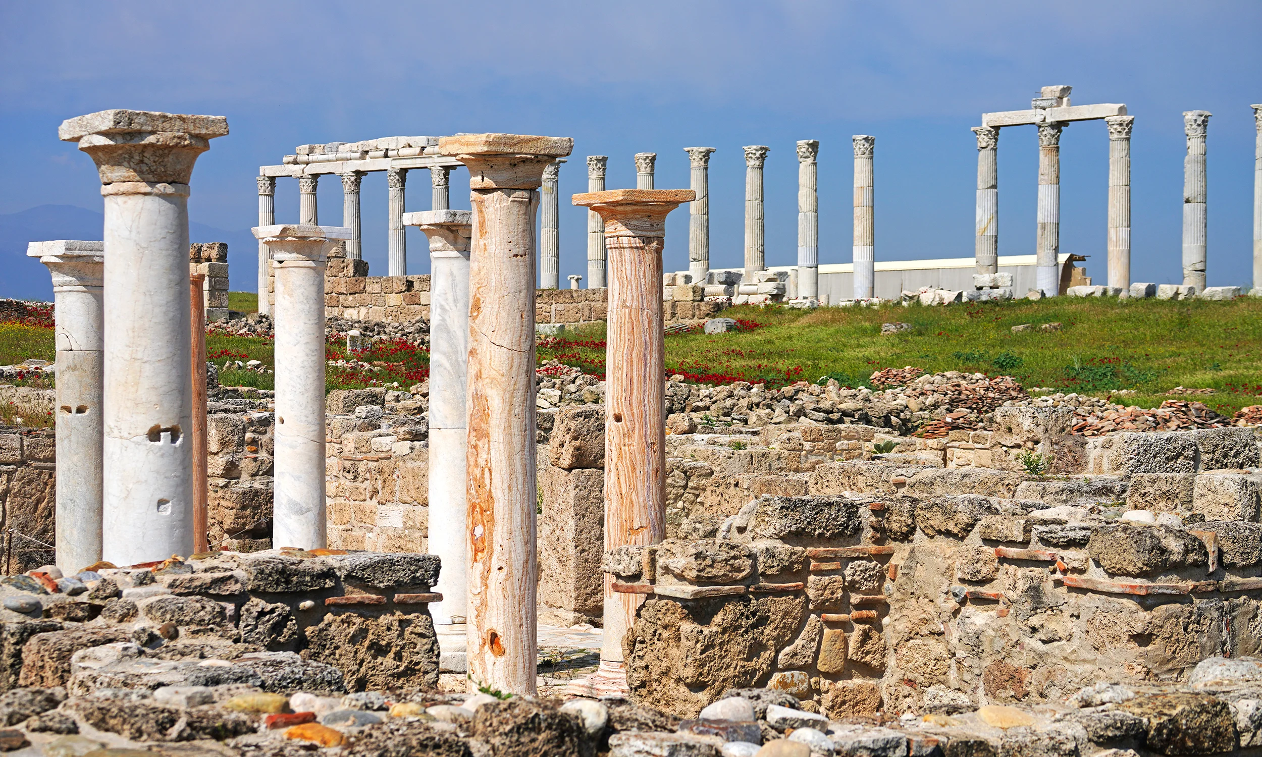
Walk monumental Roman streets and explore an ancient city with a major place in early Christian history.
Discover Laodicea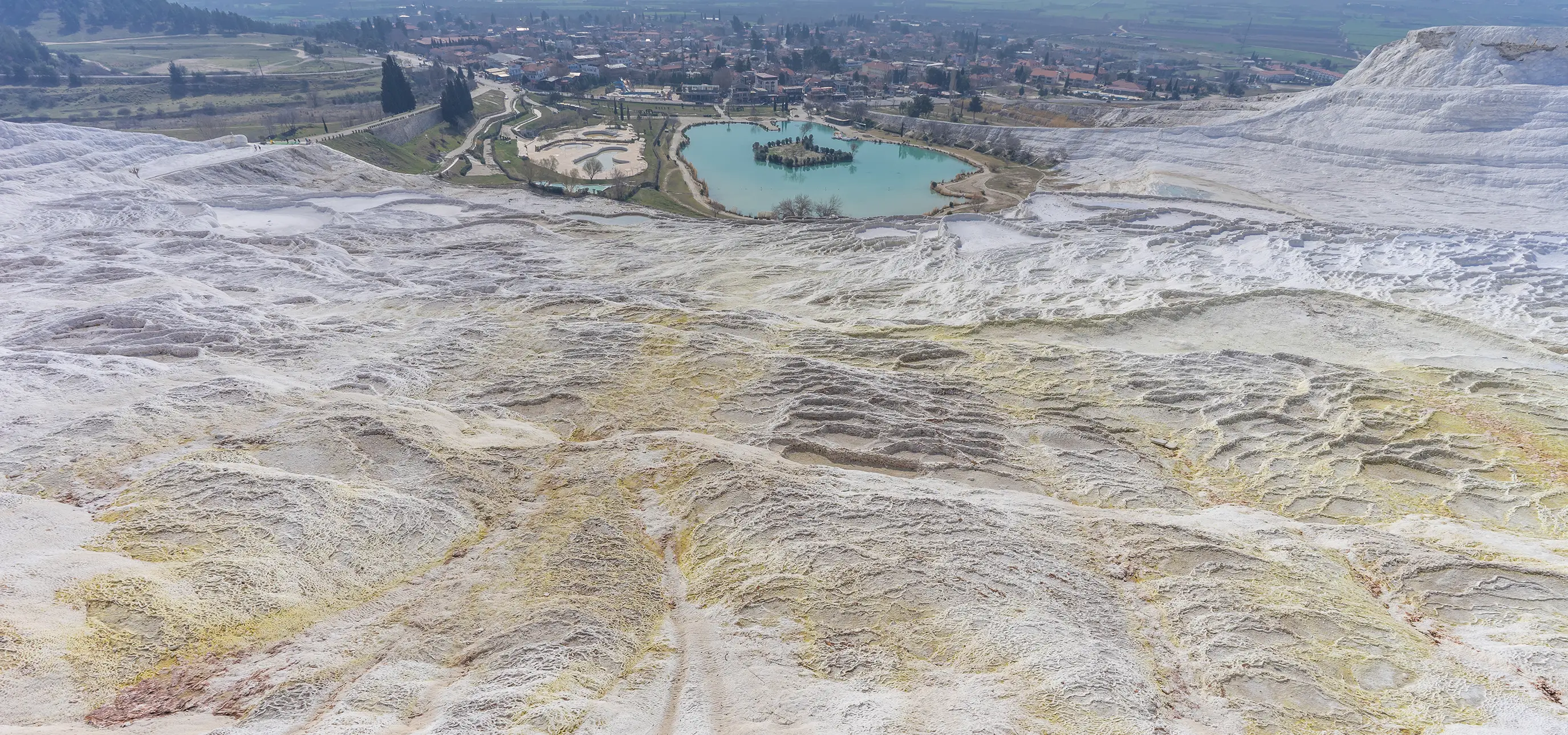
Combine distinctive scenery, archaeology and regional food with an itinerary designed around you.
Explore Regional Tours