Private Iasos Ancient City Programme
Share your dates and interests; we will check practical arrangements and create a route suited to your group.
Request Your Private Programme





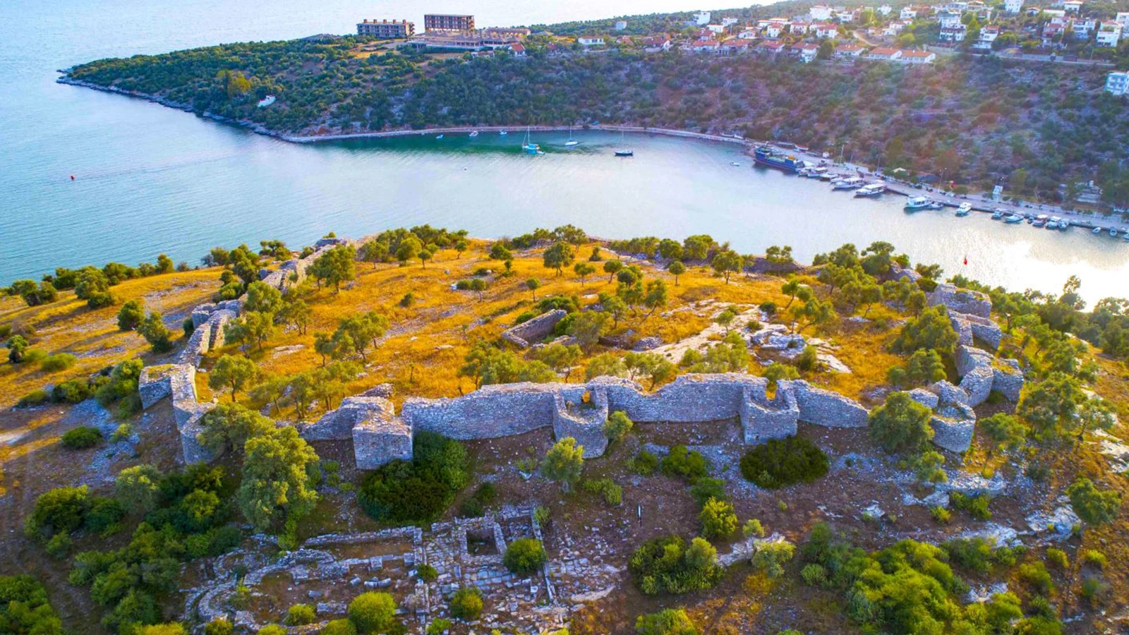
Iasos occupies a peninsula at modern Kıyıkışlacık, west of Milas. Its position beside a sheltered inlet made the sea essential to the city’s economy and identity.
The archaeological site includes a substantial agora, a bouleuterion or council house, and other remains from a long sequence of settlement. Nearby waterfront features help visitors imagine how the ancient harbour functioned.
Iasos is especially interesting because it joins a picturesque fishing-village setting with urban archaeology. It is not simply a scenic ruin: the remains record institutions, public gatherings and centuries of maritime exchange.
The civic centre provides a starting point for understanding public life in Iasos.
The council building preserves seating and architectural features associated with local government.
The sheltered inlet helps explain the city’s maritime role and settlement pattern.
The area associated with the so-called fish market and museum offers another perspective on Roman-period architecture.
An at-a-glance introduction to this part of Muğla’s heritage and travel landscape.
Kıyıkışlacık, Milas, Muğla, Türkiye
Open on Google MapsBronze Age origins; classical to Byzantine remains
Agora, council house and harbour landscape
Seafaring, fishing and ancient Carian urban life
Allow 1.5–2.5 hours
Ancient City
A meaningful visit begins with the people, landscape and ideas behind the site.
Iasos Ancient City brings together bronze age origins; classical to byzantine remains and agora, council house and harbour landscape. Its importance is easier to appreciate when the physical setting is considered alongside seafaring, fishing and ancient carian urban life.
Start by asking what made this particular location useful or meaningful to the people who shaped it. The answer may involve defence, ritual, trade, cultural expression or everyday work, depending on the period.
For a broader route, compare this place with the other destinations in our Muğla travel guide. The region’s coastal and inland sites are linked by centuries of movement, trade and cultural exchange.
Archaeological evidence at Iasos reaches back into the Bronze Age, with early finds dating to the third millennium BC and architectural remains from the second millennium BC.
The city developed through Greek, Carian, Hellenistic and Roman phases. Its civic buildings and inscriptions reflect the institutions of a Mediterranean polis.
Later Byzantine occupation and the changing coastal settlement preserved additional layers. The town’s relationship with fishing and the sea remained a persistent theme.
Bronze Age origins; classical to Byzantine remains
Seafaring, fishing and ancient Carian urban life
Agora, council house and harbour landscape
Different periods can overlap; interpret visible remains and later reuse with care.
Iasos is a good place to consider the economic side of ancient Caria. A harbour could connect agricultural hinterlands, craft production and coastal exchange.
Unlike a sanctuary such as Labraunda, Iasos was an inhabited port with a dense civic landscape; comparing them makes a Milas archaeology route more varied.
The location in Kıyıkışlacık, Milas is an essential part of the experience. Pay attention to the relationship between the built environment, approaches and wider landscape rather than viewing the principal landmark in isolation.
The civic centre provides a starting point for understanding public life in Iasos.
At Iasos Ancient City, agora should be considered within the larger setting rather than as a separate photo opportunity. Observe the scale, materials and placement; these clues often explain how the feature was used.
Which parts of agora are original, repaired or reconstructed? Interpretive panels may help distinguish them.
Consider how this element relates to bouleuterion elsewhere in the visit.
The council building preserves seating and architectural features associated with local government.
At Iasos Ancient City, bouleuterion should be considered within the larger setting rather than as a separate photo opportunity. Observe the scale, materials and placement; these clues often explain how the feature was used.
Which parts of bouleuterion are original, repaired or reconstructed? Interpretive panels may help distinguish them.
Consider how this element relates to harbour landscape elsewhere in the visit.
The sheltered inlet helps explain the city’s maritime role and settlement pattern.
At Iasos Ancient City, harbour landscape should be considered within the larger setting rather than as a separate photo opportunity. Observe the scale, materials and placement; these clues often explain how the feature was used.
Which parts of harbour landscape are original, repaired or reconstructed? Interpretive panels may help distinguish them.
Consider how this element relates to fish market monument elsewhere in the visit.
The area associated with the so-called fish market and museum offers another perspective on Roman-period architecture.
At Iasos Ancient City, fish market monument should be considered within the larger setting rather than as a separate photo opportunity. Observe the scale, materials and placement; these clues often explain how the feature was used.
Which parts of fish market monument are original, repaired or reconstructed? Interpretive panels may help distinguish them.
Consider how this element relates to agora elsewhere in the visit.
Iasos Ancient City belongs to a network of places connected by the geography of Kıyıkışlacık, Milas. Its story intersects with seafaring, fishing and ancient carian urban life, a useful starting point for understanding why this location matters beyond its own boundaries.
A day in this part of Muğla can contrast agora with harbour landscape, then continue toward another regional destination. That contrast helps visitors see different kinds of historical evidence rather than treating every monument as the same kind of attraction.
The best regional itineraries give each place enough time to reveal its own history. Nearby monuments may be related through geography or dynastic patronage, but their periods and purposes are not interchangeable.
To interpret Iasos Ancient City, begin with the surviving evidence: agora, council house and harbour landscape. Then ask which activities or beliefs the structures supported, and how much of the original setting is still visible.
Compare the evidence of bouleuterion with fish market monument. The two may reveal different aspects of the same place, or different phases of its history.
Where an archaeological identification is uncertain, avoid treating a proposed reconstruction as an established fact. Interpretation changes as research and conservation continue.
Start with the defining feature, then widen your view to the details that explain how the place functioned.
The civic centre provides a starting point for understanding public life in Iasos.
The council building preserves seating and architectural features associated with local government.
The sheltered inlet helps explain the city’s maritime role and settlement pattern.
The area associated with the so-called fish market and museum offers another perspective on Roman-period architecture.
Confirm which parts of the site and the nearby museum facilities are currently open. Archaeological paths and stones may be uneven or slippery.
The village and harbour are lived-in spaces. Respect local residents, working boats and protected archaeological boundaries.
Verify the current schedule directly before travel; seasonal hours and closures can change.
Confirm admission and accepted passes with the responsible operator.
Check toilets, drinking water, shade and any on-site services.
Allow 1.5–2.5 hours
The following sequence is an interpretive suggestion rather than a guarantee that every section is open.
Begin with agora and take time to orient yourself in the surrounding landscape.
Continue to bouleuterion, comparing it with harbour landscape.
Finish with fish market monument and consider a nearby stop if time and access permit.
Allow 1.5–2.5 hours
For outdoor ruins, spring and autumn generally offer more comfortable walking temperatures than the height of summer.
Summer afternoons can be hot in Muğla, while rain and wind can make outdoor stone surfaces slippery. Choose the time of day around comfort, visibility and the site’s confirmed opening schedule.
A shoulder-season itinerary often allows more relaxed travel between nearby sites. Check weather conditions and any seasonal transport arrangements before setting out.
Photograph architectural detail without crossing barriers, and use the surrounding landscape to give the subject scale.
A useful set of images includes an establishing view of Kıyıkışlacık, Milas, a closer study of agora, council house and harbour landscape, and a detail that illustrates the site’s material or craft tradition.
Do not touch objects, stand on archaeological walls or enter unsafe areas for a photograph. Respect the privacy of residents and other visitors.
Ask the responsible site or museum about the current accessible route before travelling with a wheelchair, stroller or limited mobility. Historic structures may contain steps, uneven paving or steep gradients.
Expect some uneven surfaces or thresholds; request details of the specific route.
Confirm the authorised parking and closest practical arrival point.
Ask about seating, toilets, shade and rest opportunities.
A shorter circuit or museum-focused stop may be more suitable for some visitors.
Iasos Ancient City is in the Kıyıkışlacık, Milas area of Muğla Province, southwestern Türkiye. Use the map as an orientation aid, but confirm the correct public entrance, parking and local access rules before departure.
Plan the journey around the official entrance and allow for local road conditions.
Agree on the exact drop-off and return arrangements in advance.
Combine nearby places selectively rather than assuming that every stop can be visited quickly.
Check road closures, restricted archaeological areas and seasonal transport changes.
Use the Muğla travel guide for a wider overview. These nearby ideas are not necessarily within walking distance and should be chosen according to travel time.
Consider this related stop as part of a carefully paced Milas itinerary; check access separately.
Consider this related stop as part of a carefully paced Milas itinerary; check access separately.
Consider this related stop as part of a carefully paced Milas itinerary; check access separately.
Consider this related stop as part of a carefully paced Milas itinerary; check access separately.
At Kıyıkışlacık, west of Milas in Muğla Province.
A council building used for civic meetings in an ancient Greek-style city.
Archaeological evidence reaches back to the Bronze Age.
Yes. Its ancient urban history is closely tied to a sheltered harbour.
As an initial planning estimate, allow 1.5–2.5 hours. Add time for transport, weather and any guided interpretation.
No. Schedules, fees, closures and available sections may change. Check the responsible authority or operator close to your visit.
Yes. A tailored route can combine this stop with nearby heritage and landscape sites, subject to confirmed access and travel times.
Respect barriers, conservation zones and the instructions of local staff.
Do not climb walls, remove fragments or touch fragile surfaces.
Avoid blocking paths or photographing people without permission.
Carry away rubbish and avoid disturbing vegetation or wildlife.
Ask Wow Cappadocia / Venere Travel to design a private, tailor-made regional itinerary with a licensed guide and comfortable vehicle, subject to confirmed site access, without compulsory shopping stops.
Choose archaeology, village culture, coastal landscapes and local food at a pace that suits you.
Share your dates and interests; we will check practical arrangements and create a route suited to your group.
Request Your Private Programme
Continue your Muğla journey with a related historical or coastal destination.
Read the Nearby Guide