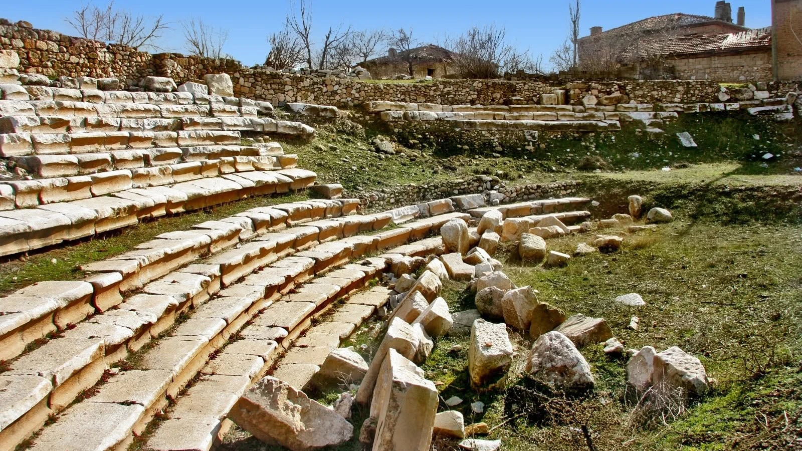
Herakleia Salbace Ancient City
Learn about a nearby Carian city, Roman physicians and the inscriptions of the Tavas region.
Explore This Guide →





Near Medet in the Tavas district of Denizli, the ancient city of Apollonia Salbace tells an unexpectedly long story. Official cultural authorities associate nearby Medet Höyüğü with Bronze Age occupation, describe the adoption of the city’s name in the Hellenistic period and identify the Roman era as its most flourishing phase.
The archaeological story is richer than the surviving architecture might suggest. Written records and remains point to a Temple of Apollo associated with Emperor Hadrian, a rocky necropolis south of the mound, and civic institutions known through Greek inscriptions and locally issued coins. A settlement now woven into everyday village life once participated in the political, economic and religious networks of inland Caria.
This practical guide separates documented evidence from attractive but unverified claims. It explains what visitors may realistically see, why navigation descriptions disagree, how to respect occupied village and archaeological land, and how Apollonia fits into a Tavas-area historical journey.
Settlement mound linked by official inventories with Bronze Age habitation.
Temple foundation remains and inscriptions assigned to Hadrian’s reign.
Ancient burial forms identified around the rocky ground south of the mound.
Material evidence for city identity, gods and Roman civic life.
Historical and practical essentials for the site at Medet, Tavas, Denizli.
Medet neighbourhood, Tavas, Denizli.
Commonly described as about 7 km from Tavas.
Official descriptions disagree on compass direction.
Caria, inland southwestern Anatolia.
Apollonia and Medet Höyüğü.
Bronze Age evidence in official inventory.
Associated with the Hellenistic period.
Roman imperial period.
Apollo temple, Hadrianic phase.
Rocky area south of the mound.
Greek-inscribed civic coins; Roman examples.
Hellenistic and Roman inscriptions.
Fertile Tavas Plain and a living village.
Private vehicle generally simplest.
No verified standard 2026 ticket schedule.
Unprepared, sometimes rocky or cultivated.
Apollonia Salbace is for travellers who appreciate archaeological landscapes and historical context as much as standing monuments. It does not present the rows of columns familiar from Aphrodisias or a large excavated theatre. Instead, the past survives in the shape of Medet Höyüğü, scattered stone, a rocky burial area and material reused or recorded within the village.
The most compelling historical threads are the Bronze Age origins indicated by mound finds, the temple of Apollo known from cultural descriptions, and the way civic inscriptions and bronze coins document a town that had its own public institutions and visual identity.
The site is especially rewarding as part of a specialist Tavas Plain heritage itinerary. If you prefer visitor centres, clear routes and extensive excavated architecture, a larger managed site may offer an easier first encounter with Roman Anatolia.
Archaeology enthusiasts
Bronze Age to Roman era
Mound, sanctuary and graves
Fragmentary and dispersed
Research-led, flexible
Verify locally
Apollonia Salbace lies at the modern Medet neighbourhood in Tavas district, Denizli Province, in the productive agricultural landscape of the Tavas Plain. The city and the nearby settlement mound are described in official records as lying within or close to the living settlement rather than inside a fully separate tourist park.
The Turkish page of the Denizli Provincial Directorate of Culture and Tourism places Medet about 7 km west of Tavas, but its English version says north. Other local heritage descriptions also vary. For practical navigation, use the unambiguous destination “Medet, Tavas, Denizli”, not a fixed compass bearing.
The site should not be confused with other ancient settlements also called Apollonia, including Apollonia ad Rhyndacum at Gölyazı or Apollonia sites in Pisidia and elsewhere. The distinctive qualifier Salbace / Salbake is important.
Denizli
Tavas
Medet
About 7 km in official summaries
Apollonia Salbace Medet
Not Apollonia ad Rhyndacum
The fertile Tavas Plain helped sustain a network of settlements in inland southwestern Anatolia. Apollonia’s position near productive fields created opportunities for farming, exchange and movement between neighbouring valleys.
Unlike a dramatic coastal harbour or a hilltop fortress, Apollonia was closely tied to an agricultural plain and the local routes crossing it. Official descriptions emphasise connections to the territories of Caria, Lycia and Phrygia, rather than a claim that each modern country road follows an excavated Roman pavement.
Today the same cultivated landscape can make archaeological features difficult to distinguish. Ancient remains may be buried, incorporated into later structures or surrounded by working farms. Land access should always be checked.
Tavas Plain
Agricultural land
Caria and neighbouring regions
Tabae and Sebastopolis
Village and farmland
Respect land boundaries
The name Apollonia refers to Apollo, the Greek god associated with prophecy, music, healing and other aspects of religious life. Many Greek-speaking communities were called Apollonia, so a second element helps identify which city a historical source means.
Salbace or Salbake distinguishes the city in ancient Caria. Classical geographical scholarship connects this epithet with Mount Salbakos to the south of the settlement. Greek and Latin spellings may differ in modern publications, while Turkish material often uses Apollonia Salbake.
Denizli’s official cultural inventory says the city acquired the name Apollonia during the Hellenistic period. This does not mean that human occupation first began at that time: evidence from Medet Höyüğü is much earlier.
Apollonia
Apollo
Salbace / Salbake
Mount Salbakos
Name established in this era
Always include Medet or Tavas
Official provincial descriptions place Apollonia along routes that connected Tabae and inland Caria toward the west, Sebastopolis and the southern districts toward Lycia, and the wider approaches to Phrygia in the east.
These links matter historically: roads carried traders, farmers, messengers, religious visitors and officials. A city situated among cultivated land and regional routes could play an important role without becoming one of the Mediterranean’s most famous monumental centres.
These descriptions are about regional geography. They do not guarantee a preserved cobbled Roman highway, clearly labelled city gates or walkable ancient road segments at Medet today.
Tabae / Caria
Sebastopolis direction
Tavas / Phrygian routes
Movement and exchange
Not verified for visitors
Regional network
The exact date of the city’s foundation remains unknown. Official descriptions of the Medet mound report evidence going back to the Bronze Age and portray the area as a long-lived settlement, but they do not provide a year-by-year excavation sequence for every occupation layer.
The Hellenistic period brought the city name known from later evidence and inscriptions illustrating civic affairs. Under Roman rule, Apollonia flourished, minted local bronze coins and had an Apollo sanctuary associated in official descriptions with the reign of Hadrian (117–138 CE).
Its later history is less visible in the public archaeological summaries. A historical Christian episcopal connection is documented in ecclesiastical tradition, but it would be inaccurate to turn that into a claim that a complete Byzantine cathedral can be visited at Medet.
Settlement evidence reported
City name and civic texts
Major period of activity
Apollo temple evidence
Less clearly exposed
Unknown
Medet Höyüğü is central to the earliest phase of Apollonia’s history. The official Turkish cultural account states that mound finds point back to the Bronze Age and suggest a long sequence of occupation.
A höyük is an archaeological settlement mound created as occupation layers accumulate over time. It is not automatically a burial tumulus, and its archaeological chronology can only be established securely through the recorded artefacts and stratigraphy.
The existence of Bronze Age material does not prove that the settlement was already called Apollonia, had a Greek temple or possessed later Roman civic institutions. These belong to subsequent chapters of the landscape’s history.
Medet Höyüğü
Bronze Age evidence
Settlement mound
Near or within Medet
Not established
Long-term occupation
During the Hellenistic era, communities of inland Caria participated in a Greek-speaking world of civic assemblies, regional rulers and shifting political alliances. The name Apollonia is associated with this period in the official Denizli inventory.
An exceptionally valuable piece of evidence is a Greek honorary decree catalogued as Apollonia Salbake 1 in the PHI Greek Inscriptions database. Its editorial dating is approximately 250–190 BCE, and the text preserves civic language concerning honours and service to the community.
Because the decree is fragmentary, the full biography of the person honoured is not recoverable from every surviving line. Nevertheless, it demonstrates that Apollonia’s civic history can be studied through texts, not just scattered stone remains.
Hellenistic
Greek honorary decree
Approx. 250–190 BCE
Council and people
PHI Apollonia Salbake 1
Names and offices require evidence
Official heritage sources identify the Roman era as Apollonia’s most prosperous period. Temple remains, inscriptions and a series of locally issued bronze coins collectively suggest sustained religious and civic activity.
Roman rule did not eliminate local Greek-speaking institutions. Cities in Asia Minor continued to honour benefactors, name magistrates and advertise distinctive local cults on their coinage. Apollonia’s surviving record fits that wider pattern.
It is possible to reconstruct aspects of the city’s public identity, but this should not be confused with a modern site where every named gymnasium, forum, theatre and bath has been excavated. The public visitor descriptions for Medet are much more limited.
Roman Imperial
Highlighted officially
Greek inscriptions
Bronze issues
Apollo temple
Not fully exposed
Bronze Age: finds at Medet Höyüğü indicate early settlement. Hellenistic age: the city’s name is established in heritage accounts and a fragmentary honorary decree is dated to roughly 250–190 BCE.
Early Roman empire: bronze civic coins document the city, its officials and its religious imagery. Hadrian’s reign (117–138 CE): official descriptions associate an Apollo temple with this period. Later 2nd century CE: coins dated 166–169 CE show local imagery and public titles.
Later antiquity and today: ecclesiastical history preserves Apollonia as an episcopal name, while the settlement landscape became part of the living community of Medet. The detailed dates of many surviving stone features remain uncertain.
Bronze Age
Approx. 250–190 BCE
1st century CE examples
Hadrianic attribution
166–169 CE examples
Medet village
The name Medet Höyüğü refers to the mound associated with the ancient settlement. In official writing, the mound and Apollonia Salbace are treated together because the later city occupied a landscape already used in much earlier periods.
Its principal importance is chronological: mound finds are cited as evidence that the area was settled from the Bronze Age. They do not establish a convenient visible walkway through every occupational phase or an excavated city model on-site.
Because the archaeological area adjoins a living neighbourhood, identify permitted vantage points before entering ground near the mound. Do not mistake garden walls, farm terraces or modern cuts for proven ancient fortifications.
Medet Höyüğü
Associated with Apollonia
Bronze Age
Limited
Modern village
Stay on permitted access
The most significant monument reported in the provincial culture inventory is the Temple of Apollo. The official Turkish and English descriptions both connect surviving foundations and inscriptions with the reign of Emperor Hadrian (117–138 CE).
This attribution is stronger than a modern guess based merely on the city name. Yet it should not be mistaken for a claim that a complete temple, with upright columns and intact roof, is still standing in Medet. Foundations, worked stone and inscriptions are the core evidence described.
If discussing the site in a tour, describe it as a sanctuary known from documentary and archaeological evidence. Specific architectural measurements, the complete floor plan and the precise location of all surviving fragments should be checked against authoritative site documentation.
Apollo
Hadrianic reign
Foundations and inscriptions
Not reported
Avoid presenting as fact
Understand the sanctuary context
A local account by the Tavas District Directorate of National Education states that the foundations of a village mosque were built over the foundations of the Apollo sanctuary. It also mentions cut-stone foundation remains on the southern side.
This offers a useful example of how later buildings may preserve, reuse or occupy sites associated with earlier architecture. But the relationship should be understood as a published local historical account; it is not permission to inspect a mosque’s private or active religious areas for ancient masonry.
If the building is in active use, behave as at any place of worship: obtain permission where required, dress and photograph respectfully, and do not disturb the fabric of the building or its surroundings.
Village mosque
Apollo temple foundations
Tavas education authority
Cut-stone foundation remains
Do not assume
Active worship and privacy
Apollo was a major divinity of the Greek world and commonly associated with music, prophecy, archery, healing and civic protection. In Apollonia Salbace, the city name, officially reported temple remains and religious designs on bronze coins all point to his public significance.
One catalogued early imperial coin from the city presents Apollo holding a raven and a branch. Another 2nd-century bronze coin shows a four-column temple enclosing Apollo, Artemis and Leto. These images are especially useful because they indicate how the community chose to present its cult to outsiders.
A coin image is an iconographic source, not a modern photograph of an intact building. Artistic conventions, idealisation and incomplete survival mean that a coin’s architectural design cannot by itself establish the present condition of the temple foundations.
Apollo
Artemis and Leto
Apollo with raven and branch
Four-column facade
Coin iconography
Not a measured site plan
The Tavas District Directorate of National Education describes the ancient cemetery on a rocky area south of the mound. A necropolis is a burial zone associated with a settlement, often positioned outside the more intensively occupied urban core.
The local description distinguishes three burial forms: tombs cut into rock in a chest-like form, burials constructed with fired bricks and jar burials. This is more informative than the general label “rock tombs,” because it suggests different funerary practices or periods.
No one should assume that all three forms can be reached, entered or easily identified today. Burial contexts may be disturbed, partly filled or on protected or private land; observation must not become excavation.
Rocky ground south of mound
Rock-cut chest-like graves
Fired-brick graves
Jar burials
Tavas education authority
Observe, never disturb
Rock-cut burial installations are among the more evocative reported features in the Medet landscape. They may appear as cavities, rectangular recesses or worked surfaces in naturally exposed rock.
The official local education summary specifically refers to chest-shaped graves cut directly into the bedrock. Such features offer clues about burial customs, but their age, ownership and relationships to other objects require individual archaeological study.
Do not enter openings, climb onto fragile edges or try to remove fill. Where photographic features have been interpreted online without published identification, this guide avoids assigning an unverified person, deity or date to each carving.
Living bedrock
Chest-like tombs
Necropolis area
Not generally identified
Take from safe ground
Keep away from cavities
The published local heritage account also mentions fired-brick tombs and jar burials in the necropolis. These categories describe techniques for enclosing the deceased, rather than naming a single monument that can be found with a navigation pin.
Jar burial, often called pithos burial in archaeological writing when large storage vessels are used, is documented at different places and times in Anatolia. Its occurrence at Medet should not be assigned an exact century without excavation evidence for each example.
Visitors should treat pottery fragments and broken bricks as potential archaeological material. Their exact position may matter to researchers; leave every piece in place, even when it appears loose.
Brick-built burial
Jar burial
Pithos
Require excavated context
Leave undisturbed
Funerary diversity
Photographic accounts of the Medet area show worked bedrock, cut recesses, rectangular hollows and carved surfaces. Some features may form part of burial installations, while others require caution before they can be identified as hydraulic, industrial or ritual structures.
Visual resemblance is not enough to turn every basin into a sacred pool or every circular motif into a precisely dated cult relief. Many stones are weathered, reused or detached from a secure archaeological context.
A careful visitor can enjoy these traces while asking the right questions: Where was the stone found? Has a qualified researcher identified its function? Is the feature still in its original position? The honest answers can be more engaging than an invented story.
Rock-cut features
Uncertain function
Archaeological context
Include surrounding landscape
Unverified sacred pools
Separate observation from theory
The strongest monument claims in the official provincial descriptions concern the temple foundation and inscriptions. A separate district education account mentions traces of aqueducts, fortifications and habitation, although those claims are not accompanied by a modern, publicly accessible plan of each monument.
It would be misleading to promise visitors a preserved theatre, an imposing amphitheatre, a restored agora or an excavated Roman bath as a normal Apollonia sightseeing route. Such structures are not described as reliably visitable in the sources used here.
Reused blocks in village settings can preserve ancient workmanship, but they may no longer be in their original architectural position. Always respect private houses, mosques, agricultural buildings and other modern uses of the site.
Apollo temple foundations
Waterworks and settlement
Not verified
Not verified
Context may be secondary
Identify buildings carefully
The Tavas district education authority’s historical summary mentions surviving traces of water channels or aqueducts associated with Apollonia. Given the importance of agriculture and settlement on the Tavas Plain, water infrastructure is a credible topic for the city’s history.
However, the brief published description does not identify a mapped, restored aqueduct route with modern entry points, lengths or safe access. A carved channel visible in rock should not automatically be classified as a Roman aqueduct without investigation.
For travel planning, consider waterworks part of the site’s historical research story rather than a guaranteed landmark on a walking circuit.
Ancient water management
Aqueduct / channels
Not established
Check before planning
Productive agricultural plain
No guaranteed aqueduct walk
Apollonia is recorded in collections of Greek inscriptions that preserve honours, dedications and funerary information. The PHI Greek Inscriptions project includes a series catalogued under Apollonia Salbake, with references to scholarly work by Jeanne and Louis Robert.
These texts help restore names of individuals and public institutions that may no longer be identifiable in the village’s scattered masonry. Honorific inscriptions reflect formal public recognition, while burial texts may regulate how family tombs were used.
A published findspot such as “Apollonia Salbake” or the area between nearby communities does not mean that an inscribed block remains where tourists can read it today. Never present an epigraphic database entry as an on-site display promise.
Greek
PHI Greek Inscriptions
Public honours
Funerary regulations
Not guaranteed
La Carie II
A fragmentary honorary decree catalogued as Apollonia Salbake 1 is dated in its scholarly record to approximately 250–190 BCE. The inscription describes honours voted through civic institutions and refers to a local man who had served the community.
The mention of the council (boule) and people (demos) is historically significant. It shows that political and civic life can be documented at Apollonia long before the famous 2nd-century imperial coin issues.
As with many ancient texts, portions are lost or reconstructed. The date is an editorial estimate, not an exact year written on the stone. Readers can consult the PHI published entry.
Apollonia Salbake 1
250–190 BCE
Honorary decree
Boule and demos
Fragmentary
PHI inscription entry
Another inscription catalogued in the Apollonia Salbake sequence concerns a sarcophagus acquired by Midas for himself and his family. The published text includes provisions and a penalty for unauthorised burial, illustrating the legal and social importance of funerary space.
Crucially, the record for Apollonia Salbake 18 describes its find location as between Uzunpınar and Tavas, not simply “the tomb visitors see beside the Medet mound.” That distinction prevents unrelated archaeological objects from being incorrectly joined together.
The full text is available in the PHI database. It makes an excellent example of how epigraphy reveals family relationships and social expectations, even when the original object is not on a marked visitor route.
Apollonia Salbake 18
Midas
Family burial rights
Between Uzunpınar and Tavas
Protection of tombs
Do not assign to a random grave
Honorary inscriptions refer to the council and people, while coin legends preserve the names and titles of local officials. Together, these pieces show Apollonia participating in the civic culture shared by many Greek-speaking cities of Roman Asia Minor.
For example, a coin type of the reign of Marcus Aurelius names the strategos Kallippos, a public office-holder. Earlier issues also identify magistrates, including Papias, son of Kallippos, in the reign of Trajan.
Coins and inscriptions illuminate offices and honours; they do not automatically locate a surviving council chamber or magistrate’s building. The most reliable approach is to distinguish documented institutions from visible archaeological buildings.
Boule
Demos
Strategos
Kallippos
Papias son of Kallippos
Not confirmed
Apollonia struck local bronze coins whose legends and designs can be studied in the Roman Provincial Coinage (RPC) catalogue. They are important primary sources because a city’s name appears beside figures chosen to communicate religion, political authority and civic identity.
The official local tourism page summarises local minting from the first century BCE into the first century CE. Specialist catalogues document clearly attributable Roman provincial issues from the early imperial period onward, and some older coin assignments have been revised. It is therefore safer to discuss securely catalogued coin types than to claim every early issue belongs to Apollonia.
Many surviving specimens are in museums or scholarly catalogues outside the village. Seeing a coin pictured online does not imply there is an on-site coin exhibition or souvenir shop.
Local bronze currency
Roman Provincial Coinage
Greek
Deities and civic offices
Early and later Roman Empire
Not guaranteed
A catalogued early imperial bronze type, listed as RPC I 2864, shows Apollo with a raven and a branch. The specimen is known from public academic collections, and catalogue discussions vary over the precise attribution of some imperial portraits between Augustus and Tiberius.
This iconography is especially fitting for a city named after Apollo. The design is valuable evidence for the deity’s role in the city’s presentation of itself, even if not every religious ritual is recoverable.
For careful further study, see the RPC I 2864 catalogue entry. Coins give real evidence, but their small images should not be treated as a direct depiction of a modern tourist site.
RPC I 2864
Apollo
Raven and branch
Early Roman Empire
City and magistrate
Civic religious imagery
A bronze issue catalogued under Marcus Aurelius and dated 166–169 CE places Hygieia and Asclepius together on the reverse, with the personification of the city on the obverse. The type is catalogued as RPC IV.2 849.
Hygieia represents health and well-being, while Asclepius is a healing deity often shown with a serpent-entwined staff. Their appearance is evidence of religious imagery, not proof that a specific excavated medical school, hospital or Asclepieion awaits visitors at Medet.
The distinction is useful when comparing Apollonia with nearby Herakleia Salbace, a site independently known for historical physicians. Shared healing symbolism must not lead to the merging of separate cities’ remains.
RPC IV.2 849
166–169 CE
Hygieia and Asclepius
Tyche
Not established
Herakleia Salbace
An unusual coin type in the RPC catalogue, IV.2 17525, is associated with Lucius Verus and dated within 166–169 CE. Its reverse shows a four-column temple facade with Apollo, Artemis and Leto standing within the architectural frame.
This is striking evidence for the Apolline triad in local visual culture. It is plausible to discuss connections with Apollonia’s sanctuary, while recognising that coins often depict religious buildings schematically.
The design does not provide a surveyed elevation of surviving ruins or prove that the actual monument had precisely the proportions shown by the engraver. See the RPC catalogue record.
IV.2 17525
Lucius Verus
166–169 CE
Four-column temple
Apollo, Artemis and Leto
Stylised coin scene
Popular summaries sometimes state that Apollonia minted coins as early as the first century BCE. More specialised numismatic work notes that certain pieces formerly assigned to Apollonia Salbace have been reclassified to Tripolis on the Maeander, a different city that also used the name Apollonia.
This is a good reason to avoid assigning every coin inscribed “Apollonia” to Medet. Secure identification may depend on the full legend, iconography, magistrate names, catalogue history and associated evidence.
The guide uses individual catalogued Roman imperial coin types to illustrate the city’s history while allowing that broader dates in older tourism texts and modern scholarship may not match exactly.
Several ancient Apollonias
Some coins reassigned
Tripolis on the Maeander
Full coin legends
Roman Provincial Coinage
Avoid false precision
Apollonia’s agricultural setting suggests that cultivation and rural exchange formed part of the economic background of the city. Regional routes connected surrounding settlements and made travel between the Tavas Plain and neighbouring districts possible.
Inscriptions and coins provide firmer evidence for civic honours, public office, the worship of Apollo and other divinities. Taken together, these sources reveal a community participating in the political and religious life of Hellenistic and Roman Caria.
It is tempting to add precise descriptions of Roman marketplaces, craft workshops or annual festivals, but those details require direct local evidence. A reconstruction should always be identified as an informed possibility, not an excavated fact.
Agricultural plain
Civic institutions
Apollo and other deities
Greek inscriptions
Coins and stone remains
Exact daily routines
Apollonia Salbace appears in Christian ecclesiastical reference traditions as an ancient episcopal see, later retained as a titular see in Catholic records. That indicates a later chapter in the city’s remembered institutional history.
However, the official visitor descriptions consulted here do not establish a clearly visitable, excavated cathedral or Byzantine church plan at Medet. The existence of a bishopric in historical records should not be stretched into a promise of a standing religious monument.
For the archaeological visitor, this distinction between textual history and surviving visible architecture is important at sites where much of the settlement lies beneath modern occupation.
Christian episcopal see
Titular see
Not established as visitable
Ecclesiastical records
Not verified
Avoid ungrounded claims
The archaeological area has not been presented as a fully exposed ancient urban centre. Parts of the settlement lie under or beside modern Medet, while agricultural land, later building activity and long-term weathering have changed the historic landscape.
Visible stone blocks may be secondary-use material, and the distinction between ancient walls and modern construction is not always clear without archaeological mapping. This is a normal problem in regions where historic settlement continued over the same ground.
The relative absence of large upright monuments does not mean the city was insignificant. Its temple, civic inscriptions and distinctive coins provide independent evidence of substantial activity.
Occupied settlement
Partly buried
Possible
Not exposed for visitors
Finds and texts
Fragmentary is not unimportant
Stay on public roads, clearly permitted paths and areas where local access is allowed. Do not walk onto crops, enter private yards, climb ancient walls, or treat a mosque or working farm as an unmanned archaeological exhibit.
Never remove pottery, coins, inscriptions or worked stone; never use digging tools or disturb any tomb. Archaeological finds are protected cultural heritage and their location is part of their scholarly value.
If a feature is fenced, covered, blocked or located on private land, remain outside. A licensed guide or advice from local heritage authorities can help you understand the site without endangering it.
Respect heritage
Observe privacy
Do not enter without permission
Do not access openings
Never remove
Ask local authorities
Expect a working neighbourhood and scattered archaeological remains, not a conventional ticketed outdoor museum with guaranteed signage and an established route between attractions.
Depending on lawful access and local conditions, you may be able to appreciate the mound landscape, masonry associated with the sanctuary, and rocky areas containing worked ancient surfaces or tombs. However, this guide cannot guarantee that every feature is presently visible, safe or legally accessible.
The most satisfying approach is to prepare with photographs and documented facts, identify an appropriate meeting point in Medet, and remain flexible if the archaeological ground is inaccessible. Travel plans should not depend on entry into a particular tomb or building.
Modern Medet and ruins
Mound and temple evidence
Access to be confirmed
Not guaranteed
Not established
Flexible specialist visit
No dependable standard 2026 entrance fee or visitor opening-hours schedule has been established from the official heritage descriptions consulted for this guide. It would be misleading to say the site is definitely free and open at all hours.
Access to parts of the archaeological landscape can be influenced by private land, religious buildings, conservation arrangements and local conditions. A destination listed in a culture portal is not automatically a managed archaeological park.
Before travelling specifically to Medet, check with the Denizli Provincial Directorate of Culture and Tourism or relevant museum/local administration. MuseumPass Türkiye acceptance is likewise not confirmed for this location.
Not verified
Not verified
Not confirmed
Not confirmed
Check locally
Verify before departure
The Türkiye Culture Portal describes reaching Medet from the Denizli–Muğla highway after passing the Tavas area and taking a local turn toward the settlement. Its general guidance mentions a road turn about 7 km beyond Tavas and a final approach of about 1 km to Medet.
Because official pages disagree about the site’s compass direction relative to Tavas, this page does not convert that narrative into exact turn-by-turn instructions. Enter Medet, Tavas, Denizli in current navigation and confirm where it is appropriate to park.
Once in Medet, a navigation pin for the neighbourhood should not be mistaken for permission to enter every nearby archaeological feature. Ask locally about access to the mound and burial landscape.
Tavas
Denizli–Muğla corridor
Medet neighbourhood
Check up-to-date route
Use lawful village spaces
Confirm permitted paths
Apollonia Salbace is a rural archaeological excursion in the Tavas district, not a central Denizli attraction. The regional road approach generally uses the Denizli–Tavas / Muğla corridor and then local roads to Medet.
Driving times vary with the departure point, road conditions and chosen meeting place. Without a verified end-to-end route to a lawful visitor entrance, we do not publish a false precise journey time.
If planning a history-focused outing, combine Medet only with other local stops whose access is independently confirmed. Allow room for changes because it may be difficult to recognise or reach ancient remains without local context.
Denizli
Tavas / Medet
Most practical in private car
Use current routing
Ancient Caria
Check each site separately
The Türkiye Culture Portal describes a minibus connection between Tavas and Medet. This establishes that public transport has been listed as a way to reach the neighbourhood, but it does not confirm the current timetable, number of departures or operating days in October 2026.
Travelling from Denizli may involve first reaching Tavas and then arranging the Medet connection. The final distance to any individual archaeological feature, and the safe access route, should be checked locally.
Anyone relying on buses or minibuses should confirm both the outward and return journey before setting out. A service to the settlement is not the same as a guided excursion through the archaeological remains.
Minibus listed officially
Not verified
Plan connection via Tavas
Separate question
Confirm in advance
Prearranged private vehicle
Guests staying at Pamukkale or Karahayıt can consider Medet as part of a wider history-themed visit to the Denizli hinterland. It is not a walkable extension of the travertine terraces, however, and requires travel toward Tavas.
For first-time visitors with limited time, the managed monuments at Hierapolis and Pamukkale generally provide a fuller, easier archaeological day. Apollonia suits those seeking more specialised material beyond the best-known attractions.
Avoid fitting the village between tightly timed monument visits before confirming the route, weather and access conditions. The value of a little-known site often depends on the flexibility to explore responsibly.
Pamukkale / Karahayıt
Specialist excursion
Hierapolis
Private archaeology day
Use live navigation
Confirm in advance
There is no verified continuous paved or step-free archaeological route linking all features at Medet in the official pages used for this guide. The mound, village and rocky necropolis are not necessarily one maintained circuit.
Ground conditions may include uneven stone, village lanes, exposed rock, field edges and changes in level. Actual walking distance depends on where you are permitted to enter and which features are accessible.
Use sturdy footwear and carry water. Travellers who need a wheelchair-accessible or low-effort visit should request a realistic access assessment rather than relying on descriptions of the wider settlement.
Uneven / rocky
Not verified
Not confirmed
Recommended
Access dependent
Do not climb tombs
Spring and autumn are often the most pleasant seasons for visiting exposed historical landscapes in inland Denizli. The Tavas Plain can feel hot during summer, while winter rain can make unpaved surfaces slippery.
The archaeological area is part of a functioning agricultural landscape. Seasonal crops, farm operations and temporary ground conditions may change where it is appropriate to walk or photograph.
Plan during daylight, carry enough water and check the weather. Do not expect a formal night-opening programme, floodlit ruins or guaranteed shaded rest areas.
Spring / autumn
Heat and sunlight
Mud and rain
Not guaranteed
Daylight
Water and sun protection
Try composing views that show worked bedrock, landscape and the modern village together. At Apollonia, the continuity of place can be as revealing as a close-up of a carved surface.
Avoid entering fields or enclosed religious spaces to find a more dramatic angle. Never reposition broken pottery or stone, and do not stand on burial cavities, fragile edges or ancient foundations for a photograph.
When publishing images, label them clearly as “Apollonia Salbace (Medet), Tavas, Denizli”. Several ancient cities shared the name Apollonia, and correctly captioned images help prevent a widespread source of mistaken attribution.
Rock and landscape
Modern Medet
Move stones
Photograph respectfully
Medet, Tavas, Denizli
Other Apollonias
History-loving families can find the story of the city’s name, Apollo’s temple and ancient burials engaging, particularly with a guide who can explain the archaeology without requiring entry into unsafe features.
But this is not a fully serviced visitor attraction with guaranteed toilets, shade, benches, smooth pathways or protective railings. The rocky burial zone and busy village environment require careful supervision of children.
For older visitors and travellers with limited mobility, plan a short, flexible stop based on conditions reported locally. If access proves difficult, nearby managed archaeological museums and larger sites may be more comfortable.
Supervise closely
Avoid cavities
Not verified
Not guaranteed
Assess case by case
Short specialist stop
Herakleia Salbace is another ancient Carian settlement associated with the wider Tavas landscape. Despite their similar geographic epithets, Apollonia and Herakleia were different communities with different historical records.
Apollonia is especially useful for discussing Medet Höyüğü, the Apollo sanctuary, tomb forms and civic coinage. Herakleia is independently connected with a tradition of physicians and medical history. Apollonia’s coins depicting Asclepius and Hygieia should not lead to mixing these two histories together.
The cities can complement each other on a specialist heritage itinerary, but the location, monument list and current accessibility of each stop should be confirmed individually.
Temple and mound
Physicians and Roman history
Inland Caria
Not same city
Specialist archaeology
Separate checks required
Sebastopolis near Kızılca, Tavas is linked to Apollonia in the ancient regional route descriptions. This historical connection should not be mistaken for proof of a preserved road that is now open to tourists.
The archaeological identities differ. Sebastopolis is described chiefly through its Höyük Tepesi, damaged stadium and Roman necropolis, whereas Apollonia is associated with Medet Höyüğü, Apollo’s temple and distinct burial traditions.
A thoughtful comparison reveals how different types of evidence illuminate neighbouring settlements. Both should be treated as fragmentary heritage landscapes, with access confirmed before making the journey.
Medet / Apollo sanctuary
Kızılca / stadium and tombs
Ancient routes
No
Specialist outing
Limited visitor infrastructure
The ancient city of Tabae features in the road geography of Apollonia, connecting communities of the Tavas region with the broader Carian interior. It is a valuable reference point for understanding how local cities related to one another.
Ancient regional history is not the same as a modern tourist circuit. The fact that a historic road once connected two settlements does not establish a signed route, a predictable driving time or access to specific monuments today.
If adding Tabae to an itinerary, first confirm its exact current visitor area and how much time its own monuments deserve. Archaeological sites should not be treated as interchangeable stops merely because they shared a region.
Tabae
Road network
Ancient Caria
Regional relations
Check separately
Allow site-specific time
Aphrodisias is famous for its impressive monumental architecture, ancient sculpture and extensive archaeological presentation. It offers a very different visit from the dispersed remains and inhabited setting of Medet.
Choose Aphrodisias for a substantial, managed day among highly visible Roman monuments. Choose Apollonia Salbace if your interest lies in lesser-known urban history, epigraphy, numismatics and the relationship between an archaeological mound and a modern village.
A full historical programme may include both, but Apollonia should remain an optional specialist addition unless its access has been independently arranged.
Monumental site
Fragmentary rural setting
Stronger at Aphrodisias
Both ancient Caria
Aphrodisias often easier
Medet may be rewarding
Begin in Tavas with orientation to the history of the plain and confirmation of current site access. Continue to Medet by an established road, and identify a safe lawful stopping point with local assistance.
In Medet, focus on the settlement mound and what is known of the Temple of Apollo. If access is permitted, view the rocky necropolis from an appropriate place without entering tombs or crossing enclosed land. Discuss the bronze coins and inscriptions that reconstruct the lost city.
Return to Tavas or continue only if another planned stop is accessible. This is an adaptable outline, not a guaranteed two-hour marked archaeological trail; actual time depends on travel and permissions.
Tavas
Medet
Mound and Apollo temple
Necropolis from permitted ground
Coins and inscriptions
Return by established route
A more ambitious heritage day could begin with Apollonia Salbace at Medet and continue toward Herakleia Salbace and Sebastopolis at Kızılca, provided each locality and archaeological viewing point is confirmed beforehand.
The sites make an interesting historical sequence: an Apollo sanctuary and prehistoric mound, the medical history and inscriptions of Herakleia, and the stadium and necropolis described for Sebastopolis.
This is not advertised as a standard operated circuit with guaranteed admissions. A private driver and knowledgeable guide can help evaluate road conditions and adjust the programme. Do not add exact stop durations until practical access is known.
Apollonia / Medet
Herakleia Salbace
Sebastopolis / Kızılca
Dedicated archaeology travellers
Custom route
Confirm all access first
The Tavas region sits within a wider landscape of ancient cities. Neighbouring subjects include Herakleia Salbace, Sebastopolis, and Tabae in the historic route network.
Farther-reaching archaeological itineraries can include Aphrodisias and Hierapolis at Pamukkale, which have much more extensive modern visitor facilities and outstanding surviving monuments.
Choose places based on the depth of your interests and the actual time you can give each one, rather than on map proximity alone. For rural sites, confirming access is as important as checking driving directions.
Tavas region
Herakleia Salbace
Sebastopolis
Tabae
Aphrodisias
Hierapolis / Pamukkale
Wow Cappadocia can help discuss a customised itinerary in the Denizli and Tavas region focused on inland Carian history, unusual archaeological landscapes and the sites that interest you most.
A private programme may include transport and a licensed professional guide, subject to availability, workable routes, local regulations and permission to access the relevant archaeological areas. We will not promise entrance to undocumented or restricted monuments.
For a broader holiday, this theme can be built into a tailored Türkiye journey with Aphrodisias, Hierapolis and other well-established ancient sites. Share your travel dates, starting point and historical priorities so the route can be assessed.
Private & tailor-made
History and archaeology
Licensed, subject to availability
Planned case by case
No restricted-entry guarantees
Contact Wow Cappadocia
Helpful answers on the city’s history, Medet Höyüğü, access, transport and what archaeology travellers should realistically expect.
At Medet in the Tavas district of Denizli Province, Türkiye, within the historic Tavas Plain.
Government heritage descriptions commonly give approximately 7 km, but disagree on the compass direction. Navigate to Medet, Tavas, Denizli.
They are closely related archaeological places: Medet Höyüğü is the mound associated with the ancient settlement area.
The exact foundation date is unknown. Heritage inventories cite settlement evidence going back to the Bronze Age.
The name refers to Apollo; Salbace or Salbake distinguishes the Carian city and is linked in scholarship with Mount Salbakos.
The site has earlier Bronze Age occupation, a Hellenistic civic name and inscriptions, and a particularly important Roman imperial phase.
Official descriptions identify temple foundations and inscriptions associated with Emperor Hadrian’s reign; an intact standing temple is not reported.
A Tavas local education authority account says the village mosque was built over the sanctuary foundations; access to an active religious building must be treated respectfully.
The local historical description places a rocky burial area south of the mound and records rock-cut, brick-built and jar burials.
Do not enter tomb openings or disturbed cavities. Conditions, legal restrictions and land ownership must be respected.
Yes. Scholarly catalogues preserve local bronze issues with Greek inscriptions and religious motifs from Roman imperial times.
Published examples include Apollo, Athena, Zeus, Asclepius, Hygieia, and a temple scene featuring Apollo, Artemis and Leto.
Some earlier coin attributions were revised, and the name Apollonia belonged to more than one city; specialist catalogues should be used for individual issues.
Yes. PHI Greek Inscriptions catalogues honorary, civic and funerary texts, including a Hellenistic decree dated approximately 250–190 BCE.
No fully exposed monumental visitor circuit is established in the consulted official information; much of the site is fragmentary and intertwined with Medet.
A verified standard entrance price has not been established from the current official public descriptions. Check before travelling.
A dependable published 2026 visitor schedule was not confirmed. Access to particular areas may be restricted.
Acceptance is not confirmed for this site; do not assume it works here.
The Türkiye Culture Portal lists a Tavas–Medet minibus service, but its present timetable should be checked locally.
A continuous step-free archaeological visitor route is not documented, and the ground may be rocky or uneven.
A careful supervised stop may be possible, but the site lacks confirmed family facilities and the rock-cut areas may be hazardous.
Apollonia Salbace is not independently inscribed as a UNESCO World Heritage property; Aphrodisias and Hierapolis–Pamukkale are separate UNESCO sites in the wider region.
No. Apollonia ad Rhyndacum at Gölyazı near Bursa is a different ancient city.
Possibly, on a specialist Tavas archaeology day, subject to separately confirmed site access and road arrangements.
We can discuss a tailor-made guided itinerary and transport subject to permissions, routing and guide availability.
The core site identification, Bronze Age mound, Hellenistic place-name, Hadrianic Apollo temple and Roman prosperity are described by the Denizli Provincial Directorate of Culture and Tourism. The specific three burial forms and the mosque/temple relationship come from the Tavas District Directorate of National Education. Ancient civic and religious details come from catalogued Greek inscriptions and Roman provincial coins.
Principal site references: Denizli Provincial Directorate (Turkish), Denizli Provincial Directorate (English), Türkiye Culture Portal and Tavas local history.
Research references: PHI Hellenistic civic decree, PHI funerary inscription, RPC early imperial Apollo coin, RPC Hygieia / Asclepius type, RPC temple and Apolline triad, and Encyclopedia of Ancient History: Apollonia Salbake.
Discover other historic sites in Denizli and build a thoughtful archaeological itinerary.
Explore connected settlements with very different stories and surviving monuments.
Learn about a nearby Carian city, Roman physicians and the inscriptions of the Tavas region.
Explore This Guide →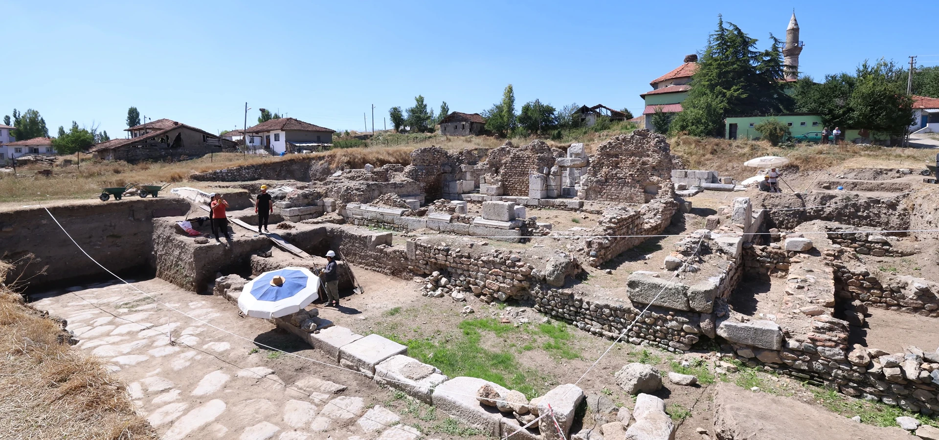
Discover the settlement near Kızılca, including an acropolis mound, stadium and necropolis.
Explore This Guide →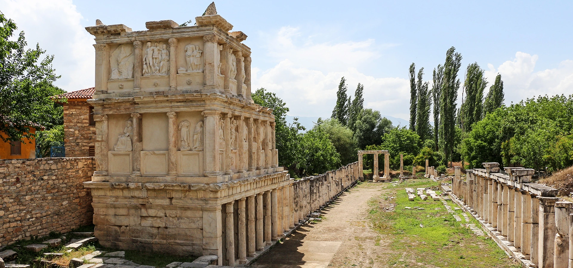
See spectacular monumental architecture and classical sculpture at a major Carian city.
Explore This Guide →
Explore UNESCO-listed travertines and the impressive ruins of Hierapolis.
Explore This Guide →Customise the journey with a professional guide and realistic site-access planning.
A tailored exploration of important Roman cities and their historical setting.
View Private Tour →
Discover iconic ruins and geological heritage with a flexible private programme.
View Private Tour →