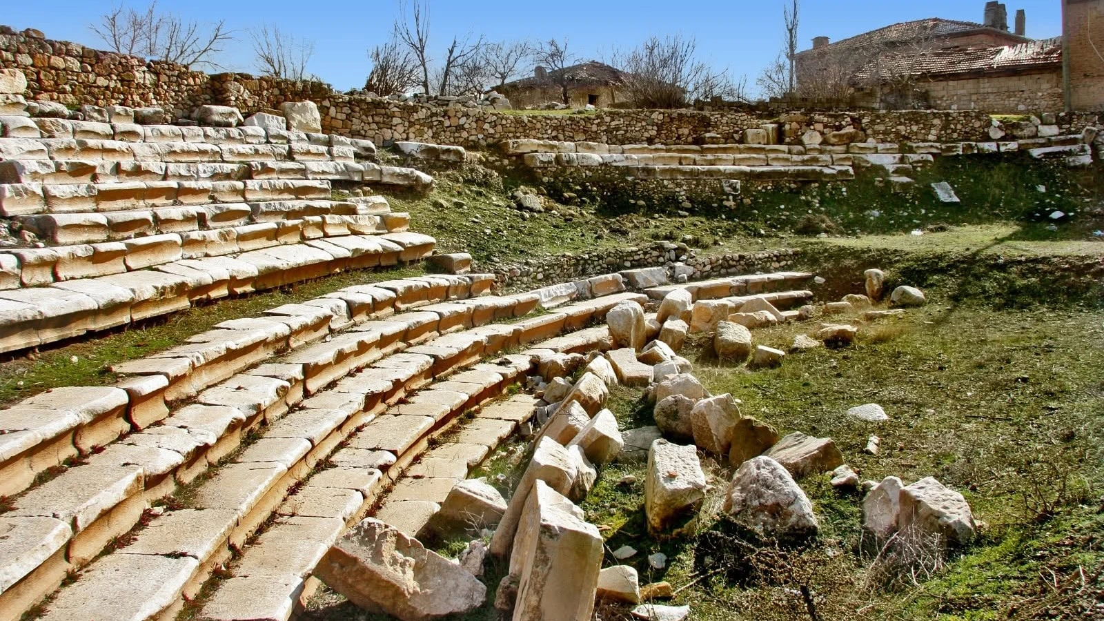
Herakleia Salbace Ancient City
Discover an ancient Carian city famous for its physicians and Roman inscriptions.
Explore This Guide →





Not far from Kızılca in Tavas, Denizli, the archaeological remains of Sebastopolis preserve a fragmentary but compelling chapter of Roman and Byzantine Anatolia. Beneath the agricultural landscape lie traces of a former town connected with other communities along the roads of the ancient Carian interior.
Its best-documented remains are Höyük Tepesi, identified as the city’s acropolis mound; a badly damaged stadium of approximately 60 × 150 metres; and an eastern necropolis with Roman-style sarcophagi. Written evidence, including a dated inscription honouring Emperor Trajan, adds depth to a place where relatively little urban architecture remains above ground.
This guide sets out what the evidence supports, what visitors should actually expect, how to approach Kızılca responsibly, and why this site must not be confused with Sebastopolis at Sulusaray in Tokat. Archaeological access, facilities and opening arrangements should be checked before travelling.
Acropolis mound and possible monumental foundations.
Heavily damaged athletic venue, still historically significant.
Sarcophagi and funerary traditions east of the city.
Written evidence for imperial-era public life.
Reliable essentials for the archaeological site near Kızılca, Tavas, Denizli.
Kızılca neighbourhood, Tavas, Denizli.
About 2 km east of Kızılca.
Inland southwestern Anatolia / Carian landscape.
Valley and agricultural countryside.
Höyük Tepesi settlement mound.
Published: approx. 150 m across, 7 m high.
Published: approx. 60 × 150 m, badly damaged.
East of city, about 1.5 km from acropolis.
Roman sarcophagi with garland decoration.
Trajan dedication dated 116/117 CE.
Visible Roman and Byzantine traces.
Exact date unknown.
Private vehicle usually simplest.
Current official fee not established.
Uneven; fields may be privately owned.
Not Sebastopolis in Tokat.
Sebastopolis is one of the quieter archaeological sites in the Tavas district of Denizli. Rather than restored colonnades, visitors encounter a landscape in which the visible traces of a Roman and Byzantine settlement survive among fields and later rural activity. Its value is the chance to understand how much ancient history still lies below the surface.
The site is especially notable for three features identified by the Denizli Provincial Directorate of Culture and Tourism: an acropolis mound called Höyük Tepesi, the damaged remains of a stadium, and an eastern necropolis with Roman sarcophagi. Inscriptions associated with Sebastopolis also reveal an ancient civic world that is harder to recognise from the surviving masonry alone.
Choose Sebastopolis if you are interested in local history, archaeology beyond the major tourism circuit and the relationship between the ancient Tavas Plain and its surrounding cities. Come with realistic expectations: this is not another Aphrodisias, and access to archaeological ground must be confirmed.
Curious archaeology travellers
Mound, stadium and necropolis
Rural valley near Kızılca
Quiet and research-led
Mostly fragmentary
Very limited formal interpretation
Sebastopolis is near Kızılca neighbourhood in Tavas district, Denizli Province, Türkiye. Official sources place the archaeological remains approximately 2 km east of Kızılca in a basin-like landscape between areas used by Kızılca and Aydoğdu.
The Denizli culture authority’s Turkish description places Kızılca about 19 km south of Tavas, whereas its English description says west. Because those official directions disagree, this guide uses the much clearer identification “Sebastopolis — Kızılca, Tavas, Denizli” and recommends checking up-to-date navigation rather than relying on a single compass direction.
Be aware that a much better-known ancient city also called Sebastopolis / Sebastapolis lies in Sulusaray, Tokat. That separate site has a different excavation history and different surviving buildings. Photographs and travel tips for Sulusaray should not be assumed to describe the Denizli ruins.
Denizli
Tavas
Kızılca
About 2 km east
Bowl-shaped rural valley
Sulusaray, Tokat
The ancient city occupies part of a valley landscape associated with the Tavas Plain. The combination of cultivable land and passages through the surrounding uplands helps explain why small and medium-sized cities developed in this part of inland southwestern Anatolia.
Provincial tourism accounts describe Sebastopolis as lying on a route connecting Herakleia, Apollonia and the Kibyra valley. The value of that statement is regional: it positions Sebastopolis within a network of settlements rather than depicting it as a remote, isolated ruin.
The present agricultural landscape also explains why the city is difficult to read on the ground. Boundaries between ancient building foundations and later field terraces are not always evident without a reliable archaeological plan.
Inland southwestern Anatolia
Kızılca
Tavas Plain
Herakleia–Apollonia–Kibyra
Fields and local settlement
Geography and context
The city’s name is conventionally written Sebastopolis, with Sebastapolis another spelling frequently used in Turkish heritage material. The Greek element sebastos conveys the sense of venerable or revered and was used as the Greek equivalent of the imperial title Augustus; polis means city.
The name therefore carries an imperial or honorific flavour, but the meaning of a name does not by itself establish the date when this particular town was founded or renamed. That requires independent inscriptional or archaeological evidence.
For online searches, always pair the city name with Kızılca, Tavas or Denizli. Search engines often return the extensively reported Sebastopolis at Sulusaray in Tokat instead.
Sebastopolis
Sebastapolis
Sebastos
Polis / city
Honorific or imperial language
Not a foundation date
There are two different Turkish archaeological places widely described as Sebastopolis. The site covered on this page is at Kızılca in Tavas, Denizli. A separate ancient city is located in Sulusaray, Tokat in north-central Anatolia.
The Tokat site is known from reports of excavated Roman baths and a Byzantine church. Those buildings must not be copied into an itinerary for Kızılca. The securely described surface remains at the Denizli site are instead Höyük Tepesi, the stadium and the eastern necropolis.
When searching for images, archaeological articles or social-media videos, look for the place names in the caption. A visually impressive photograph of masonry from Sulusaray may be completely unrelated to Sebastopolis near Tavas.
Kızılca, Denizli
Sulusaray, Tokat
Mound, stadium, necropolis
Different monuments and research
Include province
Verify every image location
The exact foundation date of Sebastopolis in Denizli is not established in the official heritage inventory. Its currently described visible remains belong principally to the Roman and Byzantine periods. That does not exclude earlier activity, but the public visitor information does not supply a securely dated earlier urban foundation.
Höyük Tepesi has been discussed as the acropolis or ancient urban core. Its mound-like form is interesting but is not, on its own, proof of any particular prehistoric occupation sequence at this city.
A careful interpretation distinguishes three questions: when people first lived in the valley, when a formal city emerged, and when the remains now visible were built. The answers may differ, and a single precise founding year would be misleading.
Exact date unknown
Roman
Byzantine
Not securely dated here
Official surface inventory
Avoid unsupported dates
Early history: the beginning of settlement is uncertain. Roman period: architectural fragments, stadium remains, funerary monuments and inscriptions document a functioning civic community. An inscription dated to 116/117 CE connects the city with the emperor Trajan and records local civic honours.
Byzantine period: official site descriptions identify Byzantine-period material among the surface remains. They do not, however, provide a complete published building-by-building sequence for visitors.
Modern period: cultivation, erosion, later settlement and burial beneath soil have transformed the site. Much of the ancient urban layout can no longer be followed as a continuous street plan above ground.
Undetermined
Roman civic life
Dated imperial inscription
Byzantine remains
Agriculture
Fragmentary landscape
Denizli’s official English-language site description places Sebastopolis on a route running through the territories of Herakleia, Apollonia and toward the Kibyra valley. This is a useful clue to the city’s place in regional movement and exchange.
Ancient routes linked communities for commerce, communications, religious journeys, agriculture and the exercise of government. A town did not need to be one of the largest cities of Caria to benefit from nearby passages and market connections.
Nevertheless, the existence of a regional corridor does not mean there is a fully exposed Roman paved road that tourists can walk across Sebastopolis today. Such a specific claim would require identified and mapped road remains.
Regional Carian communities
Herakleia Salbace
Apollonia Salbace
Kibyra valley
Movement and exchange
No claimed excavated highway
Sebastopolis is usually discussed within the wider archaeological geography of inland Caria, an ancient region covering much of southwestern Anatolia. Roman administrative relationships and local cultural identities changed over time, and modern provincial borders are not an accurate map of ancient territories.
Herakleia Salbace, Apollonia Salbace and Aphrodisias provide useful comparison points for the architectural, religious and inscriptional life of this landscape. Sebastopolis belongs to that larger historical discussion, though the remains visible at Kızılca are much less extensive.
Rather than attempting to assign every nearby valley to a single unchanging ancient district, visitors can learn more by comparing the ways neighbouring communities were connected through roads, land and shared civic customs.
Inland Caria
Denizli
Roman Asia Minor
Herakleia and Apollonia
Aphrodisias
Regional networks
One of the three principal features in the official inventory is Höyük Tepesi, the mound identified as the acropolis area of Sebastopolis. The Denizli cultural authority describes it as approximately 150 metres in diameter and 7 metres high. These are published descriptive figures, not survey measurements taken for this guide.
The mound is associated with traces of a monumental foundation and a surrounding wall. Its shape suggests a long history of occupation or accumulation, but the public descriptions do not establish a complete excavation sequence.
The word höyük means settlement mound in Turkish. It should not automatically be translated as proof that the place was a single elite burial tumulus. Here, the official interpretation connects the hill with the city’s elevated core.
Höyük Tepesi
Acropolis area
About 150 m
About 7 m
Foundations and wall remains
Not a proven single tomb
Heritage descriptions refer to foundation remains, carved architectural pieces and frieze fragments on or around Höyük Tepesi. These are the reasons authorities suggest that a temple may once have stood here. The identification should be presented as a possibility rather than a completely excavated and confirmed sanctuary.
For a visitor, architectural fragments can point to the scale and decoration of a former public building. They do not tell us the deity to whom the building was dedicated unless an associated inscription or other decisive context survives.
It is tempting to connect an ancient name containing sebastos with an imperial cult temple. Without specific site evidence, that would be speculation. The safest description is possible monumental or temple-related remains.
Höyük Tepesi
Foundations and friezes
Possible temple
Not confirmed
Not visible
Separate evidence from inference
The provincial culture inventory describes a stadium measuring approximately 60 × 150 metres. Agricultural activity and erosion have badly affected its original form. Today, only some steps and partial traces are described as remaining above ground.
The account states that the southern side was enclosed or built up while the northern side was open, and that the stadium floor has filled with eroded material. The terms reflect the published description of the damaged structure rather than a promise of a completely legible arena.
In the Roman world, public athletic facilities could form part of the social and festival life of a community. At Sebastopolis, it is reasonable to discuss that broader culture, but no visitor should expect grand continuous seating like that of Aphrodisias.
Stadium
About 60 × 150 m
Heavily damaged
A few steps
Cultivation and erosion
No intact grandstands
Because Sebastopolis has not been exposed as a major monumental visitor park, the stadium is better understood through surviving traces and the surrounding topography than by a complete architectural outline. Soil deposits obscure the lower parts of the structure.
An informed guide or reliable site plan can help explain the approximate dimensions and the relationship between the seating, floor and adjoining land. Visitors should not enter cultivated plots simply to gain a better camera angle.
Compare this stop with the stadium at Aphrodisias, where the large preserved form is much easier to recognise. At Sebastopolis, the educational reward is learning how archaeologists infer a building from incomplete evidence.
From permitted ground
Only partial remains reported
Partly filled by soil
Official inventory helpful
Aphrodisias Stadium
Do not climb unstable stone
The necropolis, or cemetery area, is described on the eastern side of Sebastopolis, approximately 1.5 km east of the acropolis mound. Official sources refer to sarcophagi and supporting platforms beside both sides of a route across the landscape.
Many tombs are partially buried, and some surviving sarcophagus lids are displaced. The visible material is generally described as Roman in character. This is evidence for funerary architecture, not proof that every grave can currently be reached or examined.
Necropoleis often lay outside the most densely occupied areas of ancient cities. Their location can help visitors understand the relationship between the city, the roads leading out of it and the rituals of remembrance practised by its inhabitants.
Necropolis / cemetery
About 1.5 km east
Sarcophagi
Tomb platforms or podia
Roman-style monuments
Verify land and route permissions
Some sarcophagi in the official description are decorated with garland motifs, a familiar design in Roman funerary art. Such carving might be especially interesting to travellers who have seen decorated sarcophagi at the larger museums and archaeological sites of western Anatolia.
Garlands can evoke festivity, commemoration, honour and the symbolic language of funerary art. The details of one particular monument—its owner, date or workshop—must be determined from individual documentation rather than inferred from a general style label.
Many of the Kızılca tombs are described as partly below the surface. Leave them undisturbed, avoid entering tomb chambers or loose cavities, and never attempt to turn or raise ancient lids.
Stone sarcophagi
Garlands
Roman
Often partly buried
Burial and memory
Move lids or objects
Funerary monuments help tell a different story from public buildings. While a stadium speaks of communal gatherings, a sarcophagus concerns personal identity, kinship and the desire for remembrance after death.
Sebastopolis has also left Greek funerary inscriptions known from the Kızılca area. The published epigraphic record includes texts concerning burial rights, families and penalties for unauthorised interment. These are important historical documents, even when they cannot be pointed out to tourists in their original findspots.
Inscriptions and tombs should be interpreted together only where the association is documented. It is not appropriate to assign a named inscription to an arbitrary stone coffin visible in a field.
Tombs and inscriptions
Family and status
Protection of burial spaces
Greek inscriptions
Requires documentation
Observe without disturbance
Official descriptions stress that substantial traces of ancient occupation exist even though little of the city’s original building fabric can be identified clearly at the surface. The main reasons include erosion, soil accumulation and long-term agricultural cultivation.
Fields occupy areas that once contained built structures. Ploughing has exposed occasional antiquities but has also contributed to damage and the dispersal of masonry. The surviving remains no longer join together into one coherent plan for a casual visitor.
This is a useful lesson in archaeological visibility: a poorly preserved surface does not mean the settlement was unimportant, and a modern field may contain protected heritage despite appearing ordinary.
Erosion and soil cover
Agricultural activity
Scattered fragments
Not exposed
May be private
Respect field boundaries
At Höyük Tepesi, local cultural authorities describe the remains of a monumental base or foundation, surrounding wall traces and scattered pieces of architectural decoration. Roman-character marble fragments are also mentioned in the official English account.
Such finds give clues to the material culture of the city, but individual pieces are difficult to interpret outside their original architectural context. A carved fragment can originate from a large structure that has disappeared or been reused over centuries.
Avoid identifying isolated pieces as a basilica, theatre, bathhouse or imperial palace without a supporting site plan or published study. The verified public inventory concentrates on the mound, stadium and necropolis.
Stone foundations
Frieze and marble fragments
Mound and surrounding site
Scattered
Limited
Use documentary evidence
Although relatively little architecture can be seen, Greek inscriptions associated with Sebastopolis at Kızılca provide more detailed information about the city’s social and civic institutions. Some of these inscriptions are recorded in the searchable PHI Greek Inscriptions database.
Inscriptions can preserve details absent from standing masonry: the names of local benefactors, honorific language, dedication formulas and aspects of burial regulation. They are not automatically on public display at the findspot where a nineteenth-century scholar recorded them.
The written record is particularly important when trying to understand how a city could have functioned beyond what is now an apparently quiet rural landscape.
Greek epigraphy
Kızılca
Civic honours and family life
PHI Greek Inscriptions
Not guaranteed
Details missing from ruins
An especially useful text is catalogued by the PHI Greek Inscriptions database as Sebastopolis 2. It is a marble dedication to Emperor Trajan and the people (demos) of Sebastopolis, dated to approximately 116/117 CE and recorded as found at Kızılca.
The inscription names Publius Statius Hermas and refers to civic honours and responsibilities. Such evidence moves Sebastopolis beyond a mere dot on the Roman map: it shows the community acknowledging the emperor and celebrating public benefaction.
For readers who want to explore the scholarly record, see the published inscription entry. Its surviving Greek text and catalogued interpretation are stronger evidence than unsourced claims about specific buildings visible today.
Sebastopolis 2
116/117 CE
Trajan
P. Statius Hermas
Marble inscription
Kızılca
The Trajan-era inscription associated with Sebastopolis includes references interpreted as a gymnasium, a four-column arrangement, the paving of an exedra and the erection of a statue of Nike (Victory). These details are valuable because they refer to public architecture and civic sponsorship.
Greek and Roman gymnasia were connected with education, athletic training and aspects of elite public life. A benefactor’s contribution to a building or monument could become the basis for formal civic recognition.
Crucial distinction: an inscription mentioning a gymnasium does not mean that visitors can currently walk around an excavated, identified gymnasium at Kızılca. The modern visible-site inventory does not list such an exposed monument.
Trajan-era inscription
Gymnasium
Exedra
Nike / Victory statue
Civic benefaction
Not confirmed
The published inscription’s references to public offices, honours and private contributions suggest a city whose wealthy residents could gain recognition by supporting communal works. This pattern is familiar from many Greek-speaking communities within the Roman Empire.
Public generosity might pay for decoration, paving, monuments or other amenities, while assemblies and local magistrates expressed approval through formal decrees. The details preserved at Sebastopolis are valuable precisely because its physical monuments are so fragmentary.
It would be misleading to claim that a particular administrative hall or civic square is standing today. The stronger conclusion is historical: the civic institutions of a Roman-era town are visible in its words, even when its buildings are not.
Roman Imperial
Greek
Public honours
Magistrates and benefaction
Inscriptions
Not verified
The Denizli heritage inventory identifies Byzantine-period traces among the visible archaeological remains. This tells us that the history of the place did not end with the high Roman Empire.
However, the material currently provided in official public descriptions does not identify a specific excavated Byzantine church, a bishop’s cathedral or a detailed sequence of dated Christian buildings at the Kızılca site. Those would require separate corroboration.
Because other places named Sebastopolis have well-publicised Byzantine architecture, keeping the provincial location attached to each claim is essential for an accurate page.
Byzantine
Surface traces
Not verified at Kızılca
More than one phase
Localised excavation data
Do not copy Tokat monuments
Modern Sebastopolis lies among privately worked farmland and nearby habitation. The official cultural inventory states that cultivation has damaged some traces of the stadium and that fragments of ancient buildings have appeared during ploughing.
Ancient stones in working fields create a genuine practical challenge for archaeological conservation. A visitor must distinguish between the desire to examine the past and the everyday rights of farmers using their land.
Stay on public roads and authorised paths. Do not cross planted areas, open gates, move stones or approach farm equipment for a photograph. A thoughtful visit respects both the heritage and the community living around it.
Agriculture
Disturbed masonry
May overlap ruins
Ask before entering land
Leave stones in place
Protect crops and livelihoods
Erosion is named repeatedly in the official site descriptions. Over long periods, soils move downslope and can both bury architectural remains and remove parts of buildings that once stood at the surface.
The stadium floor is particularly affected by accumulated deposits. Other buildings have left only intermittent traces, making it difficult to determine their original dimensions or layout from a casual walk.
For this reason, a visitor should not assume that any visible change in the landscape marks an ancient wall or ceremonial platform. Confirmed archaeological interpretation is more useful than guessing at the function of every rise and hollow.
Erosion and deposition
Stadium floor
Partly obscured
Irregular earth contours
Survey and stratigraphy
Avoid unsupported identifications
Sebastopolis is not a place to collect pottery, coins, stone fragments or broken sarcophagus pieces. Archaeological objects are protected cultural property, and their location and relationships are part of the historical evidence.
The Turkish conservation-board documentation also identifies registered archaeological protection at the Kızılca Sebastopolis area. This means that even apparently ordinary agricultural plots may contain regulated heritage.
Never dig, probe, use a metal detector without lawful authorisation, disturb burials or climb unstable masonry. If access is blocked, do not bypass a barrier. Visitors can contribute most by leaving the site exactly as they found it.
Protected archaeological area
Artefacts or loose fragments
Dig or disturb tombs
Pits and broken stone
Public/permitted ground
Preserve context
Expect an archaeological landscape rather than a conventional open-air museum. The official descriptions of Sebastopolis emphasise the difficulty of recognising a complete building plan at the surface.
Before departure, identify a realistic starting point in or near Kızılca and confirm which areas are safely accessible. A locally informed driver or licensed guide may be especially helpful if you want to understand the mound, stadium and eastern tomb area.
There may be limited signage, shade, toilets or other visitor infrastructure. This guide does not promise a visitor centre, ticket office or maintained loop walking trail.
Rural archaeological setting
Not guaranteed
Three documented features
Uneven, partly cultivated
Not confirmed
Confirm a local meeting point
No dependable current entrance price or standard visitor-opening hours for the Kızılca ruins have been verified from the official heritage material reviewed for this guide. That is different from saying that the protected site is open freely and without restriction at all times.
Where ancient remains overlap with farmland, archaeological registration or private plots, access may depend on land ownership and active preservation measures. Arrangements may change without a public-facing ticket timetable.
Before making a special journey, ask the Denizli Provincial Directorate of Culture and Tourism or relevant local authorities about access. Do not assume MuseumPass Türkiye applies unless an official visitor operation confirms it.
Not verified
Not verified
Acceptance not established
Not confirmed
Possible restrictions
Check local access first
The Türkiye Culture Portal gives the approach from Tavas along the Denizli–Muğla / Muğla-bound direction, followed by a southward turning toward Kızılca. It identifies Sebastopolis approximately 2 km east of Kızılca.
Official descriptions do not agree about whether Kızılca is south or west of Tavas, so a carefully selected navigation pin and updated road information are important. The archaeological features themselves can be spread across the countryside.
If visiting by private vehicle, agree on the meeting point and return plan before setting out. Avoid driving onto cultivated land even if a navigation application appears to show a shortcut.
Tavas
Muğla direction
Kızılca
About 2 km east of Kızılca
Verify correct site
Use established roads
From Denizli city, the practical regional approach is toward Tavas via the road system leading toward Muğla, and then toward Kızılca. Sebastopolis is not a walkable central Denizli attraction.
Driving time will depend on the starting address, road conditions and exactly which accessible archaeological feature is being visited. We recommend using current navigation rather than presenting an unsupported fixed journey time.
If the objective is a meaningful cultural excursion, it may be sensible to pair Sebastopolis with other Tavas-area heritage stops, but only after confirming that each destination is actually accessible.
Denizli city
Tavas
Kızılca
Private vehicle preferred
Use live routing
Tavas heritage
The official Türkiye Culture Portal states that minibuses have been available from Denizli bus station to Tavas and from Tavas to Kızılca. This is useful general guidance, but it does not verify a current 2026 timetable, route frequency or service on a specific day.
The ancient city lies beyond the centre of Kızılca, and transport from the village to a particular archaeological feature may require further arrangements. Roads, farmland and limited wayfinding make the last part of the journey less straightforward than reaching the village itself.
If travelling without a car, confirm both outbound and return services and ask locally whether a safe, authorised approach is possible. Do not rely on an unverified taxi rank or assume a minibus will stop directly beside the ruins.
Minibuses mentioned officially
Minibuses mentioned officially
Check locally
Extra planning needed
Confirm in advance
Not guaranteed
Travellers staying in Pamukkale or Karahayıt can consider Sebastopolis as part of a wider Denizli archaeology programme, but it involves a dedicated journey toward the Tavas district.
If you have only one day for classic sightseeing, the major monuments of Pamukkale and Hierapolis will usually offer a much more complete visitor experience. Sebastopolis is better suited to a return trip, an additional archaeology day or a specialist itinerary.
Avoid promising that an unexcavated site can be fitted between timed museum visits without allowing for navigation uncertainty, road access and variable visibility of the ruins.
Pamukkale / Karahayıt
Specialist excursion
Hierapolis
Usually most practical
Allow flexible time
Confirm separately
Sebastopolis is not described by the official authorities as a continuous paved attraction with handrails and a measured walking circuit. The various features are separated by rural terrain, and the necropolis is reported around 1.5 km east of Höyük Tepesi.
The actual route a visitor can legally and safely follow may be longer or shorter, depending on land boundaries, weather and road access. A published distance between ancient features should not be mistaken for a maintained walking trail.
Wear supportive shoes, carry water and check local access conditions. Visitors with reduced mobility should plan for the possibility that some monuments cannot be reached without crossing uneven ground.
Potentially rough
Not verified
About 1.5 km from mound
Not confirmed
Supportive walking shoes
Do not enter unstable tombs
Spring and autumn are often the most comfortable seasons for archaeology in Denizli’s inland countryside. Open fields may offer little shade, while summer heat can make even a short visit strenuous.
After heavy rain, earth tracks may be muddy and exposed stone slippery. Seasonal cultivation also affects where visitors may responsibly walk and what parts of the landscape are visible.
If photographic conditions matter, choose daylight with good visibility and plan around weather rather than expecting lighting, services or evening opening at a formal monument.
Spring and autumn
Consider midday heat
Check mud and weather
May be limited
Morning or later afternoon
Water and sun protection
The strongest photographs of Sebastopolis may combine ancient stones with the wider rural landscape. This is a place where context can tell more than a close-up of a single unlabelled block.
If photographing the necropolis, do not rearrange fragments or stand on tombs. Avoid entering crops, private gardens or enclosed plots for a better shot, and obtain consent before including residents or their homes prominently.
When publishing photographs, label the location as “Sebastopolis, Kızılca, Tavas, Denizli”. Such careful captions are especially important because photographs of the separate Tokat site are common online.
Stone and landscape
Carvings where accessible
Do not move artefacts
Permission required
Verify province
Kızılca, Tavas, Denizli
Visitors who enjoy learning outdoors may find the site interesting, particularly if a knowledgeable adult or guide can explain what the mound, stadium and sarcophagi reveal about the past.
However, this is not a museum park with guaranteed barrier-free surfaces, toilets, seating or shaded interpretation panels. Open tombs, loose stone and agricultural ground can be hazardous for children or anyone who needs stable pathways.
Families should keep children beside them, stay on permitted routes and consider a short, flexible visit rather than an ambitious trek between all remains. For easier and more extensive archaeology, a major managed site may be preferable.
Not guaranteed
Uneven
Open or unstable remains
Assess individually
Short guided stop
Managed major archaeological sites
Herakleia Salbace is another lesser-known ancient settlement within the Tavas district, but the two cities are not interchangeable. Herakleia is linked with a tradition of Roman medicine and physicians, while Sebastopolis is particularly represented in visitor inventories by its mound, stadium and necropolis.
Both are relatively fragmentary archaeological landscapes in active rural areas. Their distance on a regional map does not guarantee convenient access to individual remains or maintained visitor facilities.
A specialist trip can link the two cities as complementary chapters of ancient inland Caria, with exact stops confirmed locally and with no obligation to enter private or protected land.
Stadium and necropolis
Ancient physicians
Tavas
Limited visible fabric
Possible with planning
Two separate site locations
Apollonia Salbace lies in the area of Medet near Tavas, and the Denizli provincial inventory describes it as another important site within the same network of ancient settlements.
Official information about Apollonia mentions the foundations of a temple of Apollo and coinage associated with the city. Those details belong to Apollonia and must not be silently transferred to Sebastopolis.
For travellers interested in the ancient routes between Caria and neighbouring inland regions, the pairing offers a valuable comparison: one site with traces of a major religious building, the other with its acropolis mound, ruined stadium and funerary landscape.
Apollonia Salbace
Medet, Tavas
Ancient inland routes
Mound, stadium, tombs
Temple-related evidence
Verify each site independently
Aphrodisias has some of the region’s most impressive surviving Roman monuments and an outstanding sculpture museum. It is the stronger first choice for visitors who want an extensive, intelligible archaeological walk.
Sebastopolis tells a different story: the value of partly buried urban heritage, rural continuity, epigraphic research and a Roman burial landscape where original monumental forms are no longer fully visible.
If time is limited, prioritise the major managed monuments of Aphrodisias. Add Sebastopolis when you have a specific interest in the Tavas archaeology landscape and have verified current access.
Major excavated monuments
Fragmentary traces
First-time visitors
Specialist archaeology
Southwestern Anatolia
Only with sensible logistics
Articles about the Roman bath, Byzantine church and ongoing excavations at “Sebastopolis” often refer to the separate city at Sulusaray, Tokat. These features are documented in reporting by Ondokuz Mayıs University about that site.
The official Denizli inventory instead specifies the Höyük Tepesi acropolis area, damaged stadium and eastern necropolis. It would be inaccurate to advertise the better-known Tokat monuments on a Denizli sightseeing page.
Before booking a tour or saving an image, ask whether the location is Kızılca (Denizli) or Sulusaray (Tokat). This single check prevents a very common historical and travel-planning mistake.
Usually Tokat
Usually Tokat
Mound, stadium, necropolis
Kızılca
Sulusaray
Add province to name
A focused half-day programme can begin in Tavas or Kızılca, with an introduction to the ancient road network and the reasons Sebastopolis developed in this valley. Continue to whichever publicly accessible viewpoints of Höyük Tepesi can be reached safely.
Next, discuss the stadium and the way agriculture and erosion have altered its remains. If local conditions and land access permit, include the approach toward the eastern necropolis to learn about Roman sarcophagi and funerary customs.
The precise stop order depends on current access. The “half-day” label refers to a flexible excursion format, not a promise that all three archaeological features can be inspected up close.
Tavas / Kızılca
Ancient landscape
Höyük Tepesi
Stadium
Necropolis
Access first, timing second
For dedicated ancient-history travellers, a broader day can combine Sebastopolis with the Apollonia Salbace area at Medet and, if feasible, Herakleia Salbace at Vakıf. Each stop provides a different perspective on settlement and civic life in inland Caria.
At Sebastopolis, emphasise the mound, stadium and necropolis; at Apollonia, the broader history of the city and its religious monuments; at Herakleia, the evidence for physicians and Roman-period culture. Lunch can be planned in an appropriate town rather than expected at the ruin sites.
This is an itinerary concept, not a guaranteed operating tour. Access to the less-developed sites should be checked before an itinerary is confirmed, and the order may change depending on travel conditions.
Sebastopolis / Kızılca
Apollonia / Medet
Herakleia / Vakıf
Ancient Carian communities
Town stop
Verify every location
The southern Denizli region includes several significant ancient sites and landscapes. Tavas is the logical modern reference point for Sebastopolis, while Apollonia Salbace and Herakleia Salbace make suitable historical comparisons.
For major excavated architecture, Aphrodisias is an excellent larger companion destination. Farther into a separate excursion, Pamukkale and Hierapolis showcase a very different combination of archaeological monuments and geological scenery.
Rather than attempting to visit every city in one day, choose a programme that leaves time for interpretation, regional roads and any last-minute archaeological-access restrictions.
Tavas
Apollonia Salbace
Herakleia Salbace
Aphrodisias
Hierapolis
Quality over quantity
Wow Cappadocia can discuss a tailor-made cultural route through Tavas, Kızılca and the surrounding archaeological landscape, including a suitable private vehicle and a licensed professional guide where available.
We would check the feasibility of visiting Sebastopolis before confirming an itinerary and explain which features are securely documented and which may not be accessible on the day. Optional extensions could include Apollonia Salbace, Herakleia Salbace or Aphrodisias as routing allows.
Our programmes are built around cultural experiences and informed storytelling, with no compulsory shopping stops. Any quotation would clarify transport, guiding, timing and whether additional admission or local arrangements apply.
Private and flexible
Licensed guiding on request
Roman and Carian history
Denizli or agreed location
Confirm access and availability
No compulsory stops
Sebastopolis is approximately 2 km east of Kızılca neighbourhood in the Tavas district of Denizli Province, Türkiye.
Both spellings appear in published material. This page uses Sebastopolis and identifies the Denizli site by Kızılca and Tavas.
No. The Denizli site is at Kızılca near Tavas; the other Sebastopolis is at Sulusaray in Tokat Province.
Erosion, soil deposits and agricultural cultivation have obscured or damaged many ancient structures.
The precise foundation date is unknown. The official inventory describes surviving traces from the Roman and Byzantine periods.
The Greek word sebastos means revered or august, while polis means city. The name does not establish an exact founding date.
It is generally discussed in the regional geography of inland Caria and the neighbouring settlements of southwestern Anatolia.
The official Denizli inventory describes Höyük Tepesi, a badly damaged stadium and an eastern necropolis containing Roman sarcophagi.
It is a mound identified as the acropolis area, described as about 150 metres across and 7 metres high.
Foundation traces and decorative fragments suggest a possible temple or other monumental structure, but a securely identified complete temple is not exposed.
Yes. The identified stadium is approximately 60 by 150 metres, although only fragments and steps survive above ground.
No complete or intact stadium is described in official tourism material. It has suffered serious erosion and agricultural damage.
The necropolis is described to the east of the city, approximately 1.5 km from the acropolis mound.
The official inventory reports sarcophagi with Roman characteristics, including garland decorative motifs; some are partly buried.
A published Greek marble inscription from Kızılca honours Trajan and the people of Sebastopolis, dated 116/117 CE.
A Trajan-era inscription mentions gymnasium-related features, but that does not prove a visitor-accessible gymnasium building has been excavated.
Reports about an excavated Roman bath and Byzantine church at Sebastopolis generally describe the different site in Sulusaray, Tokat.
Do not enter tombs or disturbed cavities. Conditions, ownership and legal access must be checked locally.
Follow the route toward Kızılca and verify the ancient site about 2 km east of the neighbourhood; official descriptions vary about broader compass directions.
The Culture Portal mentions Denizli–Tavas and Tavas–Kızılca minibus links, but current schedules and last-mile transport need local confirmation.
A verified standard fee for the Kızılca ruins has not been established from the reviewed official sources.
A reliable universal opening schedule was not found. Confirm access before travelling and respect protected or private areas.
A continuous, step-free visitor route has not been verified. Terrain can be uneven and partly cultivated.
Plan a flexible, focused archaeological stop rather than a precise fixed circuit; more time may be needed to reach any permissible necropolis viewpoint.
A short, supervised visit may interest history-loving families, but there are no confirmed visitor amenities and uneven terrain can be hazardous.
This archaeological location is not listed as a UNESCO World Heritage property; Aphrodisias and Hierapolis–Pamukkale are distinct UNESCO sites in the wider region.
Possibly, as a specialist Tavas archaeology itinerary, provided driving routes and archaeological access are confirmed separately.
It is possible in a carefully timed road itinerary, but Aphrodisias deserves generous time and Sebastopolis access should be confirmed first.
A visitor centre, ticket kiosk, toilets and on-site dining have not been verified at the archaeological area; plan around nearby towns.
Wow Cappadocia can discuss a customised archaeological itinerary with transport and licensed guiding subject to availability, local access and routing.
This guide distinguishes verified historical descriptions from visitor assumptions. Its archaeological measurements and the three principal monuments come from the Denizli Provincial Directorate of Culture and Tourism. The Trajan-era civic evidence comes from the published PHI Greek Inscriptions catalogue. Online descriptions of a Roman bath and Byzantine church at “Sebastopolis” have been checked for provincial location and concern Tokat, not Kızılca.
For further information, see the official English provincial description, the official Turkish provincial description, the Türkiye Culture Portal visitor page, and the Sebastopolis 2 inscription.
Continue your exploration of the archaeological landscapes of Denizli and the Tavas region.
Follow the connections between rural Carian settlements and the great cities of the Roman period.
Discover an ancient Carian city famous for its physicians and Roman inscriptions.
Explore This Guide →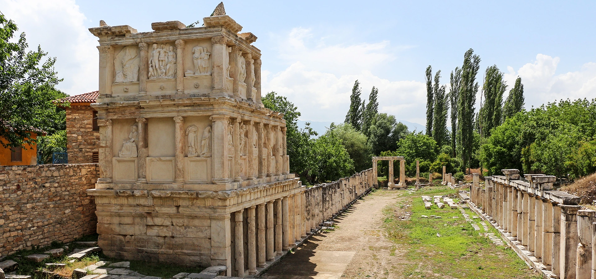
Explore one of the best-preserved and most fascinating archaeological cities in the region.
Explore This Guide →
Visit the extraordinary travertines and the monuments of ancient Hierapolis.
Explore This Guide →Personalised journeys with clear route planning and archaeological access checks.
Explore the outstanding cities of Roman Anatolia in a tailored itinerary.
View Private Tour →
Discover Denizli’s best-known UNESCO heritage landscape at your own pace.
View Private Tour →