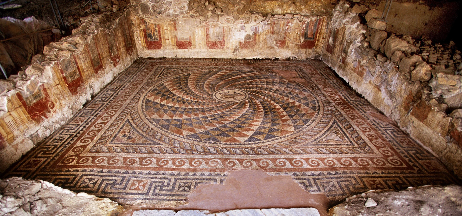
Antandros Ancient City
Explore the ancient settlement beside Altınoluk in greater depth, from its necropolis and Roman mosaics to the literary journey of Aeneas.
View Antandros Guide





Altınoluk is one of the most distinctive resort towns on the Edremit Gulf, squeezed between the northern Aegean and the steep southern slopes of Kazdağları – ancient Mount Ida. At first glance it looks like a classic summer settlement of beaches, apartments, cafés and a busy waterfront. Look a little deeper and the geography becomes far richer: forested mountain ravines descend almost to the sea, olive groves cover the lower slopes and one of the northern Aegean's most important archaeological sites lies only a few kilometres from the town centre.
The defining natural feature is Şahindere Canyon, a long mountain corridor cutting through the Kazdağı landscape behind Altınoluk. The canyon, forests and sea breezes are central to the town's reputation for fresh, moving air. Tourism literature has long promoted Altınoluk with dramatic claims about having one of the world's highest oxygen levels; the sensible way to understand that reputation is not as a scientific global ranking, but as a reflection of an unusually strong meeting point between sea air, forested slopes, cool streams and mountain ventilation.
Altınoluk also has historical depth that many beach resorts do not. Just east of town lies Antandros Ancient City, an archaeological settlement on the slopes of Mount Ida with a necropolis and a Roman residential complex famous for mosaics and wall paintings. Ancient literary tradition also connects Antandros with Aeneas, the Trojan hero whose legendary voyage from Anatolia toward Italy became central to Virgil's Aeneid.
For road-trippers, Altınoluk is particularly useful because it sits between two travel worlds. Drive east and you reach Güre, Akçay and Edremit; continue west and the coast leads toward Mıhlı, Küçükkuyu, Adatepe and Assos. Turn inland and the roads climb rapidly into olive country, village landscapes and the protected mountain environment of Kazdağları.
One of the Gulf's most important archaeological sites lies only a few kilometres from central Altınoluk, turning an ordinary beach stay into a journey through ancient Mount Ida.
The canyon behind town creates Altınoluk's dramatic mountain setting and is the natural feature most closely associated with the resort's clean-air reputation.
You can swim in the Aegean in the morning and be among forest streams, olive groves and mountain scenery soon afterwards.
Altınoluk is well placed for Mıhlı, Adatepe, Küçükkuyu, Assos, Tahtakuşlar and the wider Edremit Gulf.
Essential information for visiting one of the northern Aegean's best combinations of beach resort, archaeology and Mount Ida scenery.
Edremit district, Balıkesir Province, on the northern Aegean coast of Türkiye between the Edremit Gulf and the southern slopes of Kazdağları – Mount Ida.
Antandros Ancient City, Şahindere Canyon, beaches, Kazdağları scenery, olive groves and a lively summer waterfront.
A narrow coastal strip backed almost immediately by the forested and olive-covered foothills of Kazdağları.
Altınoluk is famous for the meeting of mountain air, sea breezes and the Şahindere corridor; dramatic online oxygen rankings should be treated as tourism claims rather than scientific league tables.
Mostly pebble, fine gravel and mixed shoreline, with clear water and long coastal stretches used for summer swimming.
Antandros lies only a few kilometres east of central Altınoluk and preserves important evidence from the ancient settlement, necropolis and Roman residential area.
Şahindere Canyon is one of the defining natural features of the Altınoluk side of Kazdağı National Park.
The wider Edremit Gulf is one of Türkiye's major olive and olive-oil landscapes, and groves climb the lower slopes behind town.
The municipal Altınoluk market is held on Saturdays; seasonal products, olives, cheeses, clothing and household goods are typical.
Balıkesir Koca Seyit Airport (EDO) near Edremit is the closest airport, normally around a 30–40 km road transfer depending on your exact accommodation.
May to October for the coast; April–June and September–October are particularly good for combining nature, archaeology and the sea.
Allow one full day for Altınoluk's essentials, or 2–4 nights if using it as a base for Kazdağları, Antandros, Mıhlı and the northern Aegean coast.
Altınoluk works especially well for travellers who want several different experiences without changing hotels every night. The beach and kordon provide the easy side of the trip, while Antandros, Şahindere, Mıhlı and the Kazdağları foothills add archaeology, nature and cultural depth.
The setting is the first reason to come. The mountains rise so close to the coast that Altınoluk never feels detached from its hinterland. Even from the waterfront, the dark forested mass of Kazdağları dominates the inland view. That relationship between mountain and sea shapes everything from local climate to food, water, olive cultivation and tourism.
The second reason is Antandros. Many Aegean holiday towns advertise nearby ruins, but here the ancient city is genuinely part of the local identity. Archaeology, the Mount Ida landscape and the literary story of Aeneas overlap in a way that gives Altınoluk a very different character from a resort based only on beach life.
Finally, Altınoluk sits at an excellent transition point on the northern Aegean road. It is close enough to the Edremit Gulf for easy access, yet already points west toward the landscapes of Küçükkuyu, Adatepe and Assos. That makes it particularly valuable on a slow coastal itinerary.
Altınoluk occupies the northern side of the Edremit Gulf, where the coastline runs beneath the southern slopes of Kazdağları. The modern town spreads along the main coastal road and waterfront while older settlement areas climb slightly inland into olive-covered foothills.
The geography changes quickly behind the beach. Streams and ravines descend from the mountain, olive groves occupy the lower elevations and forest becomes increasingly dominant as the slopes rise. This short distance between shoreline and mountain is one of Altınoluk's greatest strengths: the coast and hinterland remain visually and physically connected.
To the east, the coastline continues toward Güre, Akçay and Edremit. To the west, the road follows the base of the mountain toward Narlı, Mıhlı, Küçükkuyu and the Assos region. Inland routes climb toward viewpoints, traditional villages and national-park landscapes.
The broad northern Aegean gulf that links Altınoluk with Edremit, Akçay, Burhaniye and the olive-growing landscapes of western Balıkesir.
The mountain mass immediately behind the town provides forests, water, mythology, cooler air and some of the region's most important nature excursions.
A major canyon system descending toward Altınoluk and one of the natural features most closely associated with local airflow and mountain scenery.
The lower slopes between the sea and forest are filled with olive groves, linking the resort directly to Edremit's agricultural identity.
For decades, Altınoluk has been promoted as a place with exceptionally fresh air. Local and official tourism material often explains this through the combination of forested Kazdağları, the sea and Şahindere Canyon. The canyon is described as a natural ventilation corridor: cooler mountain air descends toward the coast while maritime air moves inland.
You will also see a much stronger claim repeated online — that Altınoluk has the “second-highest oxygen level in the world after the Alps.” This statement is part of the region's tourism identity, but it should not be presented as an established scientific world ranking. Atmospheric oxygen concentration is not normally used to rank holiday towns in that way, and the widely repeated percentages are not a meaningful basis for comparing destinations.
What is real and worth experiencing is the environment itself. Altınoluk lies beside large forested mountain areas, receives active coastal and canyon airflow, and often feels fresher than heavily built-up lowland resorts. The difference is especially noticeable when you move from the hot waterfront into shaded stream valleys or higher foothills.
Altınoluk is fundamentally a sea-and-town resort. Long stretches of the coast are used for swimming, and many accommodations sit within walking distance of the shoreline. The water is typically clear, particularly in calm conditions, while the mountain backdrop makes the setting more dramatic than the flat resort coast found in many other destinations.
The beach surface varies. Much of the Altınoluk coast is pebbly or mixed pebble-and-sand, and underwater entry can contain smooth stones. Travellers who strongly prefer powdery sand should inspect the exact beach section near their accommodation before booking. Sea shoes are useful for children and anyone with sensitive feet.
Altınoluk has also had several beaches represented in Türkiye's Blue Flag programme in recent seasons, including Antandros Halk Plajı and the Özdemir Sitesi Önü area. Because Blue Flag awards are seasonal and site-specific, always check the current year's official listing instead of assuming every stretch of coastline carries the same status.
A public-beach reference point on the Altınoluk coast, associated with the wider area around the ancient city and modern resort strip.
Convenient for swimmers who want cafés, shops, accommodation and the promenade within easy reach.
A pebbly public-beach section west of the busiest central zone and one of the local beaches with a long recent Blue Flag history.
The coast west of Altınoluk becomes more spread out, with additional beach sections, hotels and quieter stretches.
Often offers calmer conditions and clearer light, although the water can feel brisk before the day becomes hot.
A sensible addition because many entry points are pebbly or mixed rather than consistently sandy.
The kordon is where Altınoluk changes character after sunset. During the day, the waterfront is primarily about beach access and practical resort life. By late afternoon, cafés fill, families begin walking, fishing boats and small craft become part of the scene and the town's summer population moves toward the sea.
The harbour and central waterfront are useful orientation points for first-time visitors. Walk here on your first evening and you quickly understand where the busiest beach access, restaurants, cafés, small shops and seasonal excursion boats are concentrated.
Altınoluk is livelier than many mountain villages but less urban than a large city resort. The strongest experience is therefore not formal nightlife; it is the combination of sea breeze, evening walking, simple food and local summer life.
Late afternoon through blue hour, when temperatures soften and the mountain-and-sea contrast becomes most attractive.
Small boats, waterfront activity and sunset light make the harbour one of the most photogenic parts of central Altınoluk.
The central waterfront works well for easy evening walks, snacks and casual dining after a beach day.
Use the harbour in the foreground and the Kazdağları silhouette behind town for images that immediately identify the location.
Modern Altınoluk is dominated by the coastal resort strip, but the older settlement areas inland reveal a quieter side of the town. Streets climb away from the sea through neighbourhoods where older houses, garden walls, stone details and olive trees still preserve a sense of the pre-tourism landscape.
One of the best-known heritage buildings is Abdullah Efendi Konağı, a 19th-century mansion associated today with local cultural activity and the Antandros heritage community. It is valuable not because Altınoluk contains a huge preserved old town, but because it provides a physical reminder that the settlement has a much deeper social history than the apartment-lined coast suggests.
A short walk or drive through the older neighbourhood is especially worthwhile for travellers who enjoy architecture and local texture. Do not expect a perfectly restored museum district; the appeal comes from seeing layers of traditional settlement mixed with modern life.
A historic mansion linked with local cultural and Antandros heritage activity; access and events can vary, so check before planning a dedicated visit.
Short streets and hillside corners offer a calmer contrast with the busy summer waterfront.
The transition from town to olive landscape happens quickly and is part of Altınoluk's visual character.
Morning or late afternoon, when the slopes are cooler and the older streets are easier to photograph.
Only a few kilometres east of central Altınoluk, Antandros Ancient City occupies the southern slopes of Mount Ida above the Edremit Gulf. Its strategic position controlled movement along the coast between the Troad and the Gulf, while the mountain behind supplied timber and natural resources important in antiquity.
The site's history is complex. Ancient writers preserved different traditions about the communities associated with Antandros, while modern excavation has gradually built a more reliable archaeological chronology. Among the most important discoveries are the necropolis and a Roman residential complex with mosaics and wall paintings, evidence of a prosperous settlement rather than a minor roadside station.
Antandros also occupies a special place in literary tradition. In Virgil's Aeneid, Aeneas and the Trojan survivors build ships at Antandros before beginning the legendary voyage that eventually leads toward Italy. The story belongs to epic literature and mythology, but it has become an important cultural bridge between the archaeology of the site and the wider Mediterranean world.
If you are staying in Altınoluk, do not treat Antandros as an optional extra. It is the single place that most clearly explains why this section of coast matters historically.
Altınoluk's greatest natural advantage is direct access to Kazdağı National Park and the wider Mount Ida landscape. The protected mountain environment extends across the southern face of Kazdağı, and official descriptions place Şahindere Canyon among its major natural features.
The canyon is often described as roughly 27 kilometres long, although the routes accessible to ordinary visitors represent only a small part of that wider system. Deep sections can be rugged and should not be approached casually. Conditions change with weather, water, forest-fire risk and conservation management.
The safest way to think about Şahindere is as a range of experiences rather than one single trail. Some visitors only see the lower recreation areas and viewpoints. Others join guided excursions deeper into the mountain landscape. Serious canyoning or remote hiking requires appropriate local knowledge and equipment.
The signature natural feature above Altınoluk, combining steep ravine scenery, forest, water and views toward the Gulf.
A protected mountain environment of forests, streams, endemic species and mythological associations with ancient Mount Ida.
One of the broader nature areas associated with the Altınoluk side of Kazdağları and a useful option for travellers seeking a quieter forest excursion.
A traditional spring and recreation area west of central Altınoluk, shaded by mature trees and associated with the town's water supply.
Useful for deeper national-park access where route knowledge, permissions or seasonal restrictions matter.
High-risk summer conditions can lead to temporary forest restrictions. Verify access on the day rather than relying on old blogs.
West of Altınoluk, near the Balıkesir–Çanakkale provincial boundary, Mıhlı Çayı offers one of the easiest ways to exchange the hot coast for shade, running water and a greener landscape. The stream descends from the Mount Ida environment toward the Aegean and has long been used as a recreation stop.
Continuing inland from the coast leads toward the Başdeğirmen area, where an old stone bridge, mill landscape, pools and small cascades create a particularly photogenic setting. Local tourism sources connect the bridge with historic routes toward Troy, although precise dating and attribution are often simplified in popular descriptions.
Mıhlı is best visited as a relaxed nature stop rather than a checklist attraction. Wear shoes with grip, be cautious on wet rock and avoid entering fast or deep water after heavy rain.
Clear pools and shaded water create a dramatic contrast with the dry summer coast.
One of the area's most recognisable heritage features, set within the stream and mill landscape.
A useful destination for travellers interested in the relationship between water, old routes and rural infrastructure.
Morning or late afternoon in summer; spring offers stronger water flow but can also create more difficult conditions.
Behind Altınoluk's apartment streets, the landscape quickly returns to olive groves. This is not decorative planting; it is part of the agricultural system that has shaped the Edremit Gulf for generations. The trees occupy terraces and lower mountain slopes, linking coastal tourism with a much older rural economy.
For visitors, olive oil is therefore one of the most meaningful regional products to explore. Compare oils from reputable producers, ask about harvest timing and extraction, and taste them with simple food. Freshness, storage and production information matter more than elaborate souvenir packaging.
Autumn is especially interesting. The summer crowds thin, the weather becomes more comfortable for driving and walking, and the olive harvest gradually changes the rhythm of the countryside. Altınoluk becomes less of a beach resort and more of a base for understanding the working Edremit landscape.
Good producers are usually happy to explain flavour differences, harvest period and how the oil was extracted.
Recent harvest and proper storage are more useful quality indicators than vague claims such as “village style” or “natural.”
Vegetables cooked in olive oil are a central part of the Aegean table and give context to the product.
Seeing groves climb toward Kazdağları makes the connection between Altınoluk, agriculture and landscape immediately clear.
Altınoluk's food scene is at its best when you stay close to the ingredients of the Gulf. That means fish and seafood, olive-oil dishes, seasonal vegetables, local herbs, olives and cheeses. Summer waterfront restaurants offer the greatest choice, but small inland places can be equally rewarding when they cook with local produce rather than relying on generic resort menus.
For fish, ask what is genuinely fresh that day. Species and availability change with season, weather and fishing conditions. A simple meal of meze, salad, grilled fish and good olive oil suits Altınoluk better than chasing one supposedly compulsory dish.
For something sweet, höşmerim is one of Balıkesir's best-known desserts. Breakfasts commonly combine olives, white cheeses, tomatoes, pastries, preserves and tea — a good way to taste the region without turning the meal into a formal tasting session.
Choose according to season and daily catch; ask before ordering if freshness is your priority.
Cold vegetable dishes prepared with olive oil connect directly with the agricultural identity of the Edremit Gulf.
Taste it with bread, salads and vegetables, then buy from a reputable producer if you want to take some home.
Seasonal greens and herb-based dishes are especially worth looking for in spring and early summer.
A traditional Balıkesir dessert made with fresh cheese and semolina, widely associated with the province.
A simple evening stop on the kordon is part of the summer experience rather than just a snack.
Seasonal boat excursions operate along the Edremit Gulf during the warmer months. These trips generally focus on swimming, coastal views and time away from the busiest public beaches rather than formal historical sightseeing.
Routes, boat style, capacity and lunch arrangements can change every season. Confirm the current programme locally at the harbour or with your accommodation instead of planning around an old online timetable.
If you prefer a quieter day, ask about passenger numbers and music before booking. The experience varies considerably between family-oriented boats, larger entertainment trips and smaller private charters.
Edremit Municipality currently lists Altınoluk's weekly market on Saturday. The market is useful not only for shopping but also for seeing the resort function as a local neighbourhood rather than a purely seasonal holiday zone.
Expect a mixture of fruit, vegetables, olives, cheeses, household goods, clothing and seasonal produce. In summer the market can become crowded, so morning is usually the easiest time if you want to browse slowly.
For meaningful souvenirs, prioritise olive oil, table olives, local food products and small regional producers. As everywhere, check packaging, storage and product information before buying edible gifts for a long journey.
The essential nature excursion from Altınoluk and the landscape most closely associated with the town's mountain identity.
A shaded stream environment west of town with pools, cascades and old bridge-and-mill scenery.
A spring-fed recreation area near the Doyran road, traditionally valued for cold water and mature shade trees.
A quieter Kazdağı-side outing for travellers who want forest scenery away from the main resort strip.
The wider protected mountain landscape deserves a dedicated day if ecology, walking, waterfalls and mythology interest you.
A longer eastward mountain outing that can be combined with Güre, Tahtakuşlar or other Edremit Gulf stops.
The essential archaeological stop beside Altınoluk, with a necropolis, Roman residential remains and deep connections to Mount Ida.
A distinctive private collection introducing the traditions and material culture of Tahtacı Turkmen communities in the Kazdağları region.
A beautifully preserved stone village west of Altınoluk, ideal for combining architecture, cafés and the broader Mount Ida landscape.
A dramatic rocky viewpoint near Adatepe associated with the mythology of Mount Ida and panoramic views over the northern Aegean.
A coastal town just beyond the provincial border, useful for waterfront stops, olive culture and access to Adatepe and Assos.
A major ancient site and stone village farther west, best treated as a substantial half- or full-day excursion rather than a quick detour.
Altınoluk is a strong family base when the priority is easy beach access, casual food and short day trips. The central coastline offers the convenience of a resort, while Antandros and the mountain foothills give older children something different from repeated beach days.
The main beach consideration is the pebbly shoreline. Sea shoes can make entry much easier for children, and some families prefer managed beach sections where shade, changing facilities and showers are available.
Nature excursions require more judgment. Lower recreation areas can work well, but deep canyon routes, slippery stream sections and remote mountain tracks are not automatically family-friendly. Match the outing to the youngest traveller rather than choosing by photographs alone.
Altınoluk's best evening experience is the waterfront itself. After the heat fades, residents and visitors walk the kordon, restaurants fill, children stay out later and the harbour takes on a softer atmosphere beneath the dark silhouette of Kazdağları.
There are bars, cafés and seasonal entertainment, but the overall character is mixed and family-oriented rather than dominated by clubbing. Travellers who want quieter nights should avoid accommodation directly above the busiest waterfront streets in July and August.
For a calmer version of Altınoluk, visit in June or September. The evenings are still warm enough for long walks and outdoor meals, but the town usually feels less congested than in peak holiday season.
Do not point the camera only at the sea. The steep mountain backdrop is what makes Altınoluk visually different from many Aegean resorts.
Boats, piers and warm light across the Gulf create strong foregrounds in late afternoon.
Archaeological details and the hillside setting photograph better in softer morning or late-day light than at midday.
Include people or trail elements carefully to communicate the size of the canyon rather than producing only close-ups of rock.
For stream photography, slower shutter speeds can work beautifully where safe and permitted, but keep equipment away from slippery edges.
Harvest season adds workers, nets, baskets and richer cultural context to landscape photography.
Excellent for green slopes, streams and archaeology; swimming is secondary and some seasonal businesses may still be closed.
Mild, fresh and beautiful for walking, Antandros and mountain excursions; the sea can still feel cool.
One of the best all-round months for beaches, nature and sightseeing before the heaviest summer crowds.
Hot and lively, with long beach days and a busy waterfront; reserve accommodation early.
Peak holiday atmosphere, warm weather and major crowds, especially around weekends and national holidays.
Excellent for warm days, swimming, archaeology and easier driving; one of the strongest months overall.
Better for olive country, food, walking and cultural excursions than for guaranteed beach weather.
Quiet and local; useful for regional exploration, but many summer-focused businesses operate on reduced schedules.
Enough for the harbour, kordon, coffee and a quick look at the central beach if you are passing through.
Add Old Altınoluk or Antandros to the waterfront and still have time for a swim.
Combine Antandros, lunch, beach time, harbour and a late-afternoon drive toward Şahindere or the foothills.
Ideal for adding Mıhlı, Kazdağları, Tahtakuşlar, Adatepe, Küçükkuyu or Assos without rushing.
For a northern Aegean road trip, Altınoluk is especially useful as a base between the Edremit Gulf and the Troad. Staying several nights lets you alternate archaeology and mountain days with easy evenings by the sea.
Central Altınoluk is generally the easiest part of the destination for travellers with limited mobility. The waterfront contains long relatively level stretches, and many cafés, restaurants and shops are close to the main coastal area.
Beach access is more variable. Pebbles, steps, changing gradients and narrow access points can make some sections difficult for wheelchair users or anyone who needs stable footing. Managed public beaches may have better facilities, but conditions should be checked individually.
Old Altınoluk, Antandros and nature sites are less predictable. Hills, archaeological surfaces, rocks, wet stream edges and mountain paths may all create barriers. If accessibility is important, ask the specific site or operator about the exact route rather than relying on a general destination description.
Altınoluk lies directly on the coastal corridor linking Edremit with Küçükkuyu and Çanakkale. This makes it straightforward by road and especially convenient for travellers combining the Edremit Gulf with Assos, Troy or the wider Troad.
The nearest airport is near Edremit, normally around a 30–40 km road transfer depending on the exact hotel and route.
Altınoluk lies west of Edremit centre along the main Gulf road; driving time varies significantly with summer traffic.
Local buses, minibuses and road connections make movement along the Edremit Gulf relatively straightforward.
Altınoluk is a short eastbound coastal drive, making the two towns easy to combine.
Edremit Gulf settlements are served by regional and intercity coaches, with local onward connections to Altınoluk.
The best option if you plan to visit Şahindere, Mıhlı, Adatepe, Tahtakuşlar or several mountain villages.
Summer traffic can be slow along the coast, especially on Friday evenings, Sundays and holiday changeover days. Build extra time into airport transfers and long road journeys in July and August.
Best for travellers who want the kordon, restaurants and beach access within walking distance.
Lively and convenient, but summer evening noise and traffic can be higher.
Useful if mountain access and a slightly less central setting matter more than being beside the busiest waterfront.
A good choice for resort-style properties and travellers continuing west toward Mıhlı and Küçükkuyu.
Choose an inland guesthouse if cooler nights, views and quiet matter more than walking to the sea.
Alternative bases farther east if thermal hotels, a longer kordon or easier access to central Edremit are priorities.
There is no general entrance fee to walk Altınoluk's public waterfront or use ordinary public urban spaces. Beach businesses, sunbeds, umbrellas, managed facilities and private hotel sections may charge separately.
Antandros Ancient City and any associated visitor facilities can have changing opening arrangements because archaeological work continues. Check current access before building a tightly timed itinerary around the site.
Kazdağları and Şahindere access is even more dependent on current conditions. National-park management, fire risk, road condition and conservation rules can affect routes, guiding requirements and opening status.
If archaeology is less important, replace Antandros with Mıhlı Çayı. If nature is your priority, make Şahindere the main daytime excursion and keep the beach for late afternoon.
The essential archaeological site beside Altınoluk, with major finds and a powerful relationship with Mount Ida.
The defining natural feature behind the town and one of the most important landscapes on the western side of Kazdağı National Park.
A shaded stream, old bridge and mill landscape west of Altınoluk on the road toward Küçükkuyu.
A major protected mountain landscape of forests, streams, endemic nature, mythology and walking routes.
A culturally important collection focusing on Tahtacı Turkmen traditions connected with Kazdağları.
A historic stone village with strong architectural character and easy access to the Zeus Altar viewpoint.
A small coastal town west of Altınoluk and a practical gateway to Adatepe, olive-oil culture and Assos.
A larger resort farther east known for its kordon, famously cool coastal water and easy access to the central Edremit Gulf.
A neighbouring coastal settlement particularly associated with thermal water and the southern slopes of Kazdağları.
One of the northern Aegean's great archaeological and village destinations, reachable on a longer westbound excursion.
Many beach entries are pebbly or mixed, so sea shoes can make swimming much more comfortable.
Archaeological sites are easier to appreciate before the strongest summer heat.
Enjoy the fresh mountain-and-sea environment without repeating unsupported global rankings as scientific fact.
Forest-fire restrictions, park management and road conditions can change quickly in summer.
Morning is easier for produce shopping before heat and crowds build.
Choose according to the day's catch and season rather than relying only on printed menus.
Summer traffic and parking can be frustrating; explore the kordon on foot once you have found a space.
The town becomes far more rewarding when you add Antandros, Kazdağları and Mıhlı rather than spending every day on the same beach.
Seasonal departures and routes can change from year to year.
Look for harvest date, storage and production information rather than choosing by packaging alone.
Altınoluk is a coastal neighbourhood of Edremit in Balıkesir Province, on the northern Aegean coast beneath Kazdağları – ancient Mount Ida.
It is best known for beaches, clean coastal air, Şahindere Canyon, Antandros Ancient City, olive groves and its position between the Aegean Sea and Kazdağları.
That claim is widely repeated in tourism literature, but there is no widely accepted scientific global ranking of towns by oxygen percentage that establishes Altınoluk as number two. The meaningful fact is that the town sits beside extensive forest, the sea and the Şahindere airflow corridor.
Şahindere is a long canyon descending through the Kazdağı landscape above Altınoluk. It is one of the area's best-known nature features and is associated with forest scenery, spring water, viewpoints and guided outdoor excursions.
Access depends on the exact route, season and current national-park or fire restrictions. Some deeper mountain routes are better approached with an authorised local guide. Always check current access rules before setting out.
Yes. Swimming is one of the town's main summer attractions. Expect clear northern Aegean water and a shoreline that is often pebbly or mixed rather than uniformly sandy.
Some stretches contain finer material, but many central and nearby beaches are pebble or mixed sand-and-pebble. Sea shoes can be useful for sensitive feet.
Altınoluk has had Blue Flag-recognised public beaches in recent seasons, including Antandros Halk Plajı and Özdemir Sitesi Önü Plajı. Blue Flag awards are seasonal, so check the current year's official listing before travel.
Antandros is an important archaeological settlement on the southern slopes of Mount Ida, a few kilometres east of Altınoluk. Excavations have revealed a necropolis and a Roman residential complex with mosaics and wall paintings.
Ancient literary traditions push the city's story back toward the Bronze Age, while archaeological evidence reaches into the early first millennium BC and, according to the excavation project, includes indications extending earlier. The site's history should be understood as an evolving archaeological record rather than one simple founding date.
In Virgil's Aeneid, the Trojan hero Aeneas reaches the Mount Ida coast and builds ships at Antandros before beginning his Mediterranean journey. It is a literary and mythological tradition, not proof that every detail happened exactly as described.
Yes. The site lies only a short drive east of the town centre, making it one of the easiest cultural additions to an Altınoluk stay.
The older hillside settlement preserves a different atmosphere from the modern coastal strip, with traditional lanes, older houses and cultural landmarks connected with the town's pre-resort history.
Abdullah Efendi Konağı is a historic 19th-century mansion in Altınoluk associated today with local cultural and Antandros heritage activities. Access and event use can vary.
Yes. Mıhlı Çayı lies west of Altınoluk toward Küçükkuyu and is one of the best short nature excursions for stream scenery, old bridge remains, pools and shaded walking.
The bridge near Başdeğirmen is commonly described in local tourism sources as an old stone bridge associated with the historic route through the area. It is best appreciated as part of the broader mill-and-stream landscape rather than as a precisely dated monument unless current archaeological interpretation is available.
The town itself is on the coast, while protected Kazdağı landscapes rise immediately behind it. Parts of the wider Şahindere and mountain environment fall within the national-park landscape.
Yes, but route access varies. Fire restrictions, conservation rules and guide requirements can affect mountain entry, especially in summer. Check locally before planning a deep mountain hike.
Yes, particularly for families who want beach time, a walkable waterfront and easy day trips. The main considerations are pebbly beach entries, summer crowds and mountain routes that may not suit very young children.
The coastal promenade and central areas can be comfortable, but Old Altınoluk and nature sites may involve slopes, uneven paving or rocky terrain. Choose accommodation carefully if mobility is limited.
Focus on fish, seafood, meze, zeytinyağlı vegetable dishes, local olives, cheeses, herbs and Edremit Gulf olive oil. Höşmerim is a classic Balıkesir dessert to try during a wider regional trip.
Yes. The surrounding Edremit Gulf is one of Türkiye's major olive-growing zones. Look for harvest date, producer information, extraction method and proper storage rather than buying only by packaging.
Edremit Municipality currently lists the Altınoluk market on Saturdays. Market arrangements can change, so confirm locally if your itinerary depends on it.
Seasonal excursion boats operate along parts of the Gulf in summer. Routes and departure points can change, so confirm the current programme at the harbour or with a local operator.
Balıkesir Koca Seyit Airport (EDO) near Edremit is the closest airport.
Not for the central waterfront, but a car is extremely useful for Antandros, Şahindere approaches, Mıhlı, mountain villages, Tahtakuşlar and wider Kazdağları excursions.
Yes. Intercity buses and regional services connect the Edremit Gulf, and minibuses operate between the main coastal settlements. Frequencies can vary seasonally.
June and September are excellent all-round choices, combining warm coastal weather with easier sightseeing and fewer peak-season crowds than August.
Yes, especially for olive country, archaeology, photography and mountain scenery. Some beach businesses and seasonal boat services will be reduced outside the main summer period.
A day is enough for a first look, but 2–4 nights is much better if you want Antandros, Kazdağları and Mıhlı as well as the coast.
Top choices include Antandros, Şahindere Canyon, Mıhlı Çayı, Adatepe, Zeus Altar, Tahtakuşlar, Güre, Akçay and Kazdağı National Park.
Yes. Altınoluk is well positioned for a northbound road trip toward Küçükkuyu and Assos, although Assos deserves enough time to enjoy the ancient city and village rather than treating it as a quick photo stop.
Yes, but it is a longer excursion south along the Gulf. Ayvalık and Cunda are better treated as a full-day trip if you want historic streets, food and waterfront time.
Altınoluk sits closer to the western Kazdağı foothills, Şahindere Canyon and Antandros, giving it a stronger archaeology-and-mountain identity. Akçay is more strongly associated with its long kordon, cold freshwater influence and central Edremit Gulf resort atmosphere.
It can be very busy in July and August, especially on weekends and public holidays. June, September and weekday stays are easier if you prefer a calmer atmosphere.
Walk the waterfront, spend time around the harbour, explore the older hillside character, visit Antandros, and reserve at least half a day for the mountain-and-canyon landscape behind the town.
Use Altınoluk as the meeting point between the Edremit Gulf, Kazdağları and the ancient landscapes leading toward the Troad.
Continue into Mount Ida, explore Antandros in greater depth, discover Tahtacı Turkmen heritage or follow the Gulf east toward Akçay.
Explore the ancient settlement beside Altınoluk in greater depth, from its necropolis and Roman mosaics to the literary journey of Aeneas.
View Antandros Guide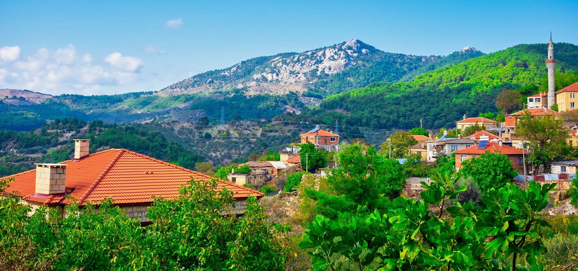
Go beyond the resort into the forested mountain that shapes Altınoluk's water, climate, mythology and natural landscape.
View Kazdağı Guide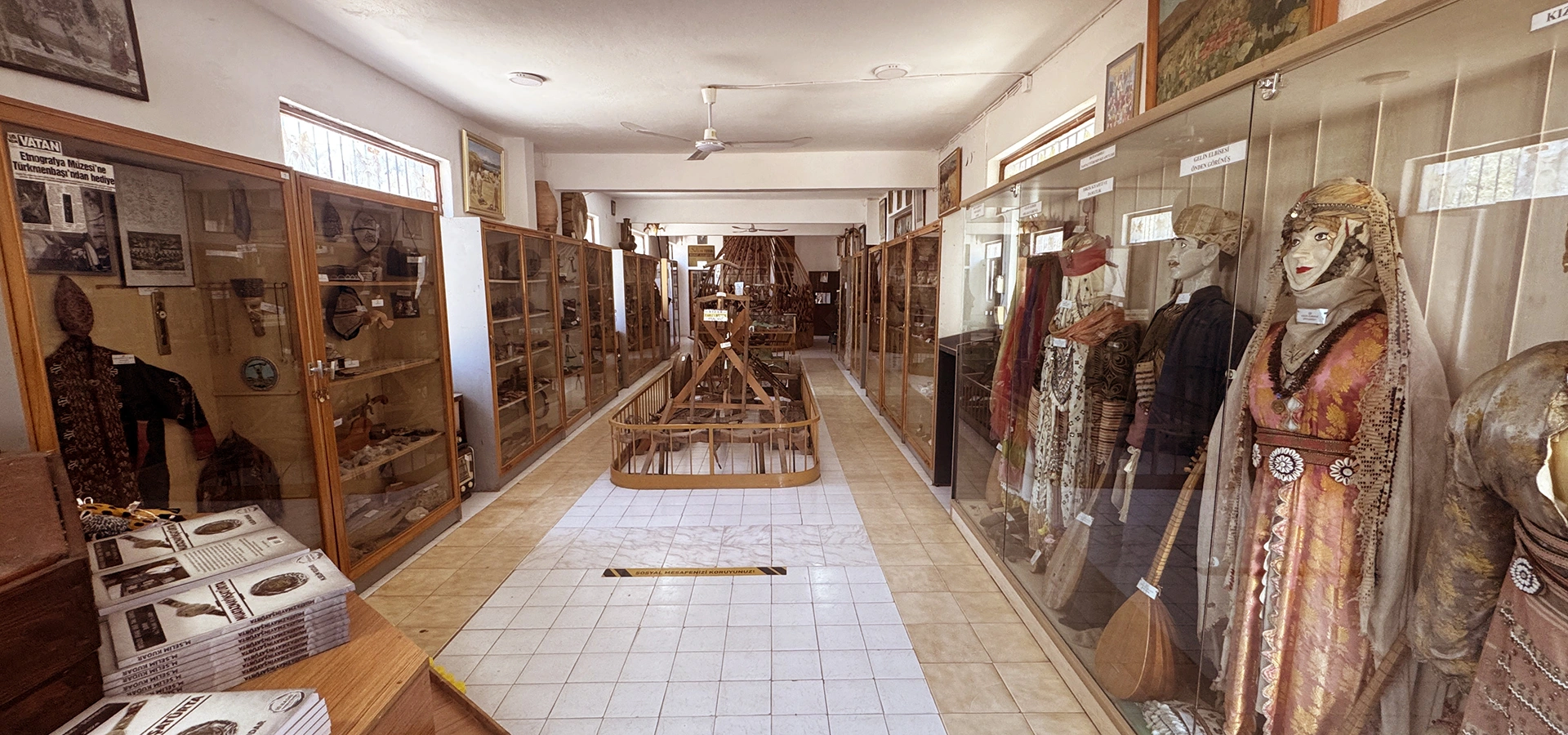
Discover Tahtacı Turkmen traditions and the cultural identity of communities connected with the Kazdağları landscape.
View Tahtakuşlar Guide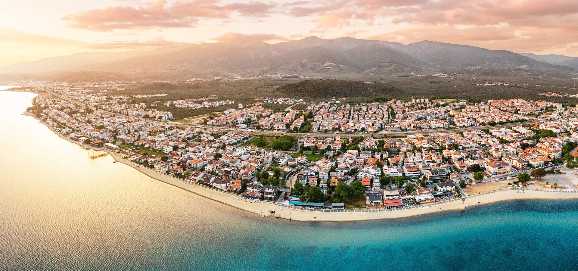
Continue east along the Gulf for cool coastal water, a lively kordon and another easy base for Kazdağları and Edremit's olive country.
View Akçay Guide