Private Sofular Highland Experience
Ask us about a tailor-made route combining Sofular Plateau, other Bozüyük highlands and selected historical places in the district.
Request a Custom Tour





Sofular Plateau, known in Turkish as Sofular Yaylası, is a spacious mountain plateau in the Bozüyük district of Bilecik Province. Located approximately 25 km from Bozüyük district centre, it is one of the area’s important destinations for highland tourism, camping and nature-based recreation.
The plateau is surrounded by pine and fir forests and contains approximately 104 hectares of open highland land. The landscape alternates between broad grassy clearings, forest edges and rural mountain roads, giving Sofular a quiet, spacious character well suited to walking, photography and relaxed outdoor visits.
Official sources differ slightly on the plateau’s exact elevation. The Bilecik Governor’s Office gives an average elevation of about 1,445 metres, while the Ministry of Culture and Tourism’s Culture Portal and the provincial tourism directorate describe it at around 1,600 metres. Whichever figure is used, Sofular is unmistakably a cool highland environment where weather can differ significantly from lower Bozüyük.
Sofular is also linked with the local “Osmanlı’nın Kışlaktan Yaylaya Göç” highland festival tradition. The first event was organized by Bozüyük Municipality on 14 July 2012, connecting the plateau with the historical memory of seasonal movement from winter quarters to summer pasture.
For travelers exploring the wider province, Sofular fits naturally into a route through Bilecik’s forests, plateaus and historical landscapes. It can also be combined with Çiçekli Plateau, Kömürsu Plateau and the forest attractions around Erikli.
Approximately 25 km from Bozüyük district centre.
Official sources describe around 104 hectares of open plateau land.
Forest scenery is one of Sofular Plateau’s defining natural features.
The plateau became associated with a local migration-themed highland festival.
Essential information for planning a nature visit in the Bozüyük highlands.
Bozüyük district, Bilecik Province, Türkiye.
Open on Google MapsApproximately 25 km from Bozüyük district centre.
Official sources give approximately 1,445–1,600 metres.
Surrounded principally by pine and fir woodland.
Approximately 104 hectares of open plateau land.
Highland scenery, camping, outdoor recreation and seasonal gatherings.
Walking, photography, camping and quiet time in nature.
Cooler mountain weather and fast-changing conditions are possible.
Approx. 39.846542, 29.773403.
Connected by mountain roads toward Kömürsu and other Bozüyük plateaus.
Sofular combines broad open meadow, cool mountain air, pine-and-fir forest and an enduring local highland tradition.
The first thing that makes Sofular distinctive is its scale. Official sources describe approximately 104 hectares of open land, giving the plateau a wide, spacious feeling rather than the impression of a single viewpoint or picnic clearing.
The second defining feature is the pine-and-fir forest landscape. The open plateau is framed by wooded slopes and mountain forest, creating a strong contrast between grassy clearings and darker tree cover. This transition is one of the most attractive aspects of the area for walking and photography.
Sofular is also important in the local tradition of yayla tourism. High plateaus have long provided cooler summer conditions and open grazing country in western Anatolia, while today they also attract campers, nature lovers, photographers and visitors looking for quieter rural landscapes.
The plateau additionally gained a cultural identity through the “Osmanlı’nın Kışlaktan Yaylaya Göç” festival, first organized by Bozüyük Municipality in July 2012. The event refers to the historical rhythm of moving between winter quarters and summer highlands.
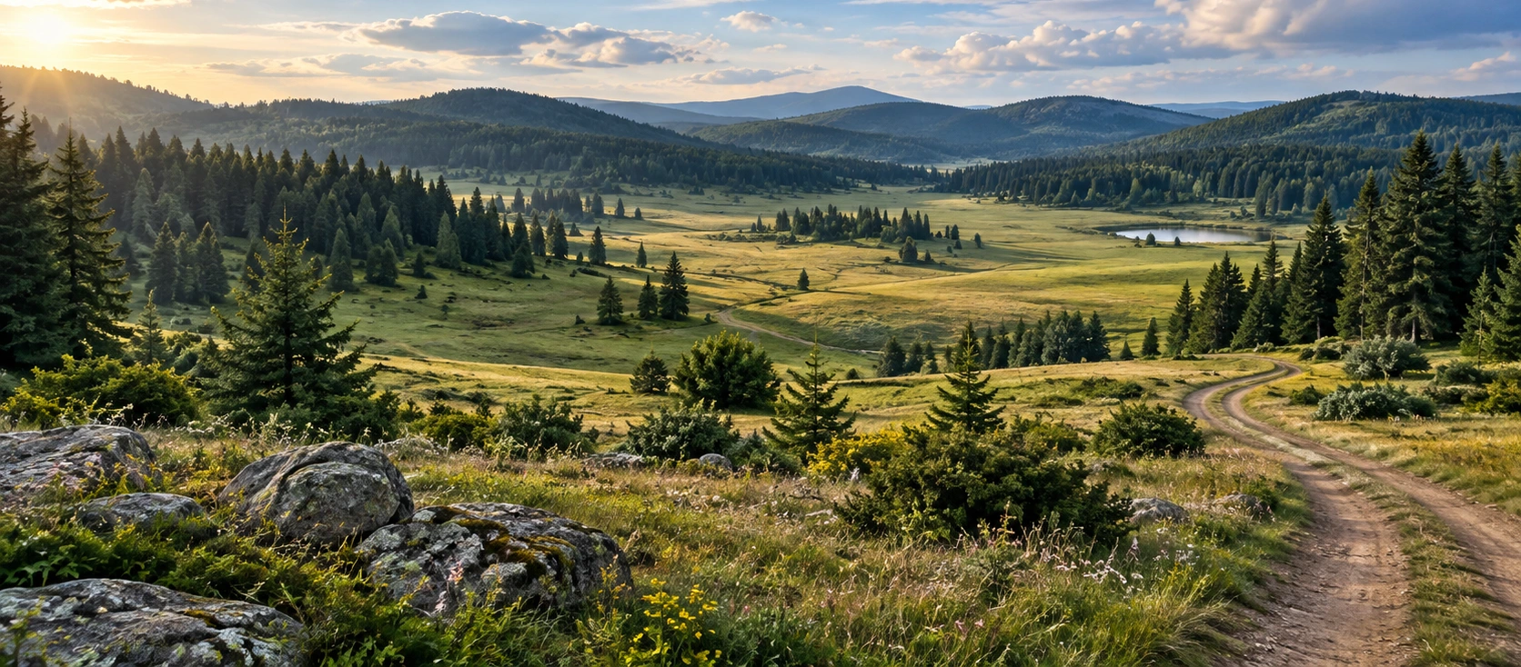
Sofular Plateau is a large upland clearing surrounded by mountain forest. The broad grassy ground gives the plateau an open horizon, while pine and fir trees form a natural frame around much of the landscape.
Because the plateau lies well above the lower valleys and settlements, its atmosphere can feel noticeably cooler and more exposed. Cloud, fog, wind and sudden showers can change the appearance of the landscape quickly, even when the weather in Bozüyük seems settled.
The open area is crossed by rural and forest roads, some of which continue deeper into the Bozüyük highlands. These roads are part of the visual character of Sofular and are useful for scenic exploration, but their condition can vary after rain, snow or forestry activity.
The plateau also forms part of a wider mountain landscape extending toward Kömürsu Plateau and the upper Bozüyük highlands. Travelers who continue beyond Sofular should treat the route as rural mountain driving rather than an ordinary urban road journey.
Official tourism descriptions consistently identify pine and fir trees as the dominant visual elements around Sofular Plateau. The forest surrounds broad open clearings, creating a classic western Anatolian highland landscape.
Scientific fieldwork carried out in the wider Sofular area has also described mixed fir and black-pine habitat. This supports the picture of Sofular as an ecologically varied transition zone between open meadow and mountain forest.
The open plateau itself changes strongly with season. Spring and early summer bring fresh grass and new growth, while the drier part of summer can produce a more golden appearance. Autumn shifts attention toward forest tones, mist and cooler mountain light.
Visitors should avoid damaging young trees, collecting plants or driving across soft meadow ground. The plateau’s appeal depends on preserving the natural contrast between open highland and forest.
Pine woodland is one of the plateau’s defining landscape features.
Fir forest adds a cooler mountain character to the highland surroundings.
Broad grassland gives Sofular its spacious, panoramic quality.
The meeting of meadow and woodland creates varied scenery and habitat.
Sofular is not only a scenic highland but also a functioning mountain ecosystem. Forest, meadow and rocky ground provide habitat for birds, small mammals, insects and reptiles typical of the region.
A scientific study published from field records in western and northeastern Anatolia documented Baran’s adder in the Sofular Plateau area in 2015, within mixed fir and black-pine habitat. The record is useful evidence of the ecological value of the plateau and a reminder that visitors are entering a natural environment rather than a landscaped park.
Wild animals should be observed from a respectful distance. Do not attempt to handle snakes or other wildlife, and supervise children and pets carefully when walking through long grass, forest edges or rocky ground.
Sofular Plateau is associated with a local event known as “Osmanlı’nın Kışlaktan Yaylaya Göç”, which can be translated approximately as “Ottoman Migration from Winter Quarters to the Highland.”
According to the Bilecik Governor’s Office, the first festival was organized by Bozüyük Municipality on 14 July 2012. The theme reflects the traditional seasonal movement from lower winter settlements toward cooler highland pasture in the warmer months.
The festival gave Sofular a cultural role in addition to its natural attraction, linking modern recreation with the historical idea of seasonal mobility and life on the yayla.
Event dates, programs and whether the festival is being organized in a particular year can change. Travelers visiting specifically for an event should check current announcements from Bozüyük Municipality or local authorities before making plans.
The Ministry of Culture and Tourism’s Culture Portal specifically lists Sofular Yaylası as a camping area, making camping one of the clearest visitor activities associated with the plateau.
Its broad open land and surrounding forest create an attractive setting for tents and nature-based stays. However, visitors should not assume that a natural camping area has the same services as a commercial campground. Electricity, toilets, showers, waste collection or staffed reception should not be taken for granted.
Mountain nights can be much colder than daytime temperatures suggest. A warm sleeping system, rain protection, sufficient drinking water and food are important even during the warmer months.
Fire regulations are especially important in a forested landscape. Never assume that open fires are permitted, and always follow current forestry restrictions and local instructions.
Carry enough food, drinking water and basic camping equipment.
Highland temperatures can fall quickly after sunset.
Check current forest-fire rules before using any stove or flame.
Take all rubbish away and leave the meadow cleaner than you found it.
A first visit to Sofular can be enjoyed with a simple walk across the open plateau and along the forest edge. The broad meadow allows visitors to appreciate the scale of the landscape without needing a formal attraction-by-attraction itinerary.
Longer exploration becomes more demanding because the surrounding highlands include unpaved roads, forest tracks, uneven ground and changing slopes. After heavy rain or snow, soft surfaces and mud can make walking and driving more difficult.
Anyone planning a longer hike should download offline maps, carry sufficient water and allow extra time for route finding. Do not assume that all forest tracks are waymarked hiking trails.
Because mountain mobile coverage can be inconsistent, it is sensible to tell someone your intended route and expected return time before continuing far from the main plateau.
Explore the broad meadow and nearby forest edge.
Use offline navigation and prepare for unmarked rural tracks.
Choose shoes with good grip for grass, mud and forest ground.
Carry an extra layer even during a warm day in Bozüyük.
Sofular is particularly rewarding for landscape and outdoor photography. Its strongest compositions come from the contrast between the open grassland, forested slopes and wide highland sky.
Morning conditions can produce soft light and occasional mist, while late afternoon can bring stronger shadows across the meadow and more definition to the surrounding tree-covered ridges.
Rural roads can also work well as leading lines in photographs, drawing the eye through the open plateau toward the darker forest. Campers, walkers or grazing animals may add scale when photographed respectfully and without intrusion.
Seasonal changes are significant. Spring greenery, dry-summer grass, autumn forest tones and winter snow can make the same viewpoint look entirely different.
Soft light and possible mist suit wide landscape photographs.
Low-angle light can reveal meadow contours and forest texture.
Use winding rural tracks as natural leading lines.
Return in different seasons for completely different highland moods.
For most visitors, the most practical period is late spring through early autumn, when the highland is generally easier to reach and outdoor walking is more comfortable.
Late spring brings fresh vegetation and cool air, although rain, soft ground and lingering cold are still possible at this elevation.
Summer is usually the easiest season for first-time visitors. The plateau offers a cooler alternative to lower elevations and is well suited to picnics, camping, walking and photography.
Early autumn can be quieter and more atmospheric, with cooler nights and changing forest tones. Daylight becomes shorter, so longer walks should be planned conservatively.
Winter gives Sofular a completely different character. Snow and ice can transform both the scenery and the practical difficulty of access. Check local road and weather conditions before attempting a winter visit.
Sofular Plateau lies in the Bozüyük district of Bilecik Province, approximately 25 km from Bozüyük district centre.
The Bilecik Governor’s official visitor page gives the coordinates as approximately 39°50'47.55"N, 29°46'24.25"E, equivalent to about 39.846542, 29.773403. Saving these coordinates can help when navigating rural mountain roads.
Official sources agree that Sofular is a significant highland tourism area, although they differ on elevation. The Governor’s Office gives about 1,445 metres, while Ministry tourism sources give approximately 1,600 metres.
Sofular is a natural plateau rather than a museum-style attraction. Published visitor sources do not provide formal daily opening hours. Practical access can still be affected by snow, mud, forestry work, road maintenance or temporary restrictions.
Bring drinking water, food, sun protection and an extra warm layer. For emergency assistance in Türkiye, call 112.
Sofular is a peaceful highland landscape, but visitors should still prepare for changing weather, uneven terrain, forest roads and distance from services.
Fog, wind, rain and sudden temperature changes are possible.
Rural sections can be affected by mud, snow or forestry activity.
Grass, stones and forest ground can become slippery when wet.
Do not depend on seasonal vendors or untreated natural water.
Highland temperatures can fall quickly after sunset.
Download maps before continuing onto more remote mountain roads.
Do not approach or handle snakes or other wild animals.
Call 112 for emergency assistance in Türkiye.
Sofular is a natural highland landscape rather than a fully developed visitor attraction. Accessibility depends on road condition, where a vehicle can safely stop and which part of the plateau you want to explore.
Visitors who remain close to their vehicle can still enjoy broad views, but the ground may include grass, stones, mud, ruts and uneven slopes.
Wheelchair users and travelers with limited mobility should not assume that there are paved, step-free walking routes or accessible toilets. If specific facilities are essential, confirm current conditions locally before making the journey.
Sofular Plateau is approximately 25 km from Bozüyük district centre. The journey continues into rural highland terrain, so travel time depends on road and weather conditions rather than distance alone.
The Bilecik Governor’s Office describes an approach from the area of Atatürk Mansion / Atatürk Köşkü. From the earth road in front of the pavilion, routes continue west toward Sofular and then toward Kömürsu. The shorter branch reaches the broad Sofular meadows after approximately 5 km.
For navigation, use “Sofular Yaylası, Bozüyük, Bilecik” or the official coordinates 39.846542, 29.773403. Saving the coordinates offline is advisable before entering areas where mobile coverage may weaken.
Road surfaces can change after heavy rain and especially during winter. Check the latest local situation before continuing into the upper highlands in poor weather.
Approximately 25 km from the district centre.
The Governor’s Office describes a westward route from the pavilion area.
The shorter route from the junction reaches Sofular after about 5 km.
Use the plateau name or coordinates 39.846542, 29.773403.
Expect slower travel if rural road surfaces become soft or muddy.
Snow and ice can significantly alter access conditions.
For a simple scenic visit, 45–90 minutes is enough to appreciate the open meadow, take photographs and make a short walk near your vehicle.
A 2–3 hour visit gives more time to explore the forest edge, enjoy a picnic and photograph different parts of the plateau without rushing.
A half day works well if you want a longer walk or plan to combine Sofular with another nearby highland stop.
A full day can suit campers, prepared walkers and photographers exploring the wider Bozüyük highlands, but longer outings require more attention to weather, water, daylight, navigation and road conditions.
Scenery, photographs and a short meadow walk.
Forest-edge exploration, a picnic and slower photography.
Combine Sofular with nearby highland scenery or a longer walk.
Best for prepared hikers, campers and landscape photographers.
Begin by stopping in a safe area where your vehicle does not block forestry or rural traffic. Take a few minutes to look across the open highland before starting your walk.
Walk first through the open meadow, where the scale of Sofular is easiest to appreciate. Stay on durable ground and avoid driving or walking repeatedly over soft vegetation.
Continue toward the forest edge for a closer look at the pine-and-fir landscape. The transition between open grassland and wooded slopes is one of Sofular’s most distinctive visual features.
If conditions are good, continue your day toward another Bozüyük highland or return via the Erikli area. Do not extend the journey deep into remote forest roads without reliable navigation, sufficient fuel and enough daylight.
A visit to Sofular can be combined with other natural and historical stops around Bozüyük, creating a day that mixes highland scenery, forest nature and local history.
Continue deeper into the Bozüyük highlands toward another major plateau known for forest and mountain scenery.
Discover Bozüyük’s highest plateau, known for wildflowers, thyme-scented meadows and wide mountain views.
Explore a forest recreation area with walking opportunities, highland scenery and a viewing terrace.
Visit the historic pavilion in Erikli forest and connect the plateau route with Bozüyük’s modern history.
Continue into the strategic landscape associated with the Battles of İnönü.
Discover more nature parks, Ottoman heritage, museums and countryside across the province.
Sofular is part of a wider highland system rather than an isolated scenic clearing. Official local information describes roads continuing from Sofular toward Kömürsu Plateau, placing it within a natural chain of mountain landscapes west of Bozüyük.
This connection makes the area appealing for travelers who enjoy scenic drives, walking, camping and cycling. The landscape changes gradually between broad meadow, forest road and higher mountain terrain.
The farther you travel from the main approach, the more important fuel, navigation, daylight, road surface and mobile coverage become. Do not assume that every forest road shown on a map is suitable for an ordinary passenger car.
Carry every piece of rubbish back with you, including tissues and food packaging.
Do not drive across soft grassland simply to reach a picnic or photo spot.
Do not cut branches, damage saplings or disturb planted forest areas.
Never light a fire when restrictions apply or outside permitted areas.
Protect the quiet atmosphere for wildlife, campers and other visitors.
Observe animals from a distance and never attempt to handle them.
Keep forestry and rural access routes clear when parking.
Leave plants, stones and natural material where you find them.
It is in the Bozüyük district of Bilecik Province in northwestern Türkiye.
Its Turkish name is Sofular Yaylası.
Official sources place it approximately 25 km from Bozüyük district centre.
Official sources differ. The Bilecik Governor’s Office gives an average elevation of around 1,445 metres, while Ministry of Culture and Tourism sources give approximately 1,600 metres.
Official tourism sources describe approximately 104 hectares of open plateau land.
It is known for pine-and-fir forests, open highland meadow, camping, nature tourism and seasonal outdoor recreation.
The Bilecik Governor’s Office gives approximately 39°50'47.55"N, 29°46'24.25"E, or about 39.846542, 29.773403.
Yes, the plateau is reached by rural road from the Bozüyük highlands. Road condition can change with rain, snow and forestry activity, so check locally in poor weather.
Not necessarily in dry, good conditions, but a more capable vehicle may be preferable after heavy rain or during snow season. Always judge the current road rather than relying only on map distance.
Yes. The Ministry of Culture and Tourism’s Culture Portal specifically lists camping as an activity at Sofular Plateau. Visitors should still check current local rules and fire restrictions.
Do not assume commercial-campground facilities are available. Plan the visit as a natural highland stay and bring essential supplies.
The official tourism sources used for this guide do not publish a standard visitor entrance fee for the natural plateau. Check current local information if access arrangements change.
Official sources do not publish museum-style opening hours. Practical access can nevertheless be limited by weather, road conditions or temporary forestry restrictions.
Yes. Short meadow and forest-edge walks are straightforward in good conditions, while longer routes require navigation and suitable footwear.
Yes. The strongest subjects are open meadow, pine-and-fir forest, rural mountain roads, mist and broad highland skies.
For most visitors, late spring through early autumn offers the easiest conditions. Winter can be beautiful but access is more demanding.
The plateau is associated with the “Osmanlı’nın Kışlaktan Yaylaya Göç” festival tradition, first organized by Bozüyük Municipality on 14 July 2012. Check current official announcements for present-day dates.
Yes. Sofular is a natural mountain habitat. A scientific field record documented Baran’s adder in the area in 2015, so visitors should observe wildlife from a distance and avoid handling animals.
It can be an enjoyable family nature stop when children are supervised around uneven ground, rural roads, forest edges, campfires and wildlife.
Formal step-free infrastructure should not be assumed. Natural meadow and forest terrain can be grassy, muddy, stony or uneven.
Search for “Sofular Yaylası, Bozüyük, Bilecik” or use coordinates 39.846542, 29.773403.
Consider combining Sofular with Kömürsu Plateau, Çiçekli Plateau, Erikli Nature Park, Atatürk Mansion and Metristepe Victory Monument.
It is especially appealing to travelers who enjoy quiet mountain scenery, forest landscapes, camping, photography and less-developed nature destinations.
Combine Sofular Plateau with other highland landscapes and selected historical sites around Bozüyük through a private itinerary designed around your interests and pace.
Enjoy a tailor-made day combining forested highland scenery, peaceful open landscapes and selected heritage stops around Bozüyük.
Ask us about a tailor-made route combining Sofular Plateau, other Bozüyük highlands and selected historical places in the district.
Request a Custom Tour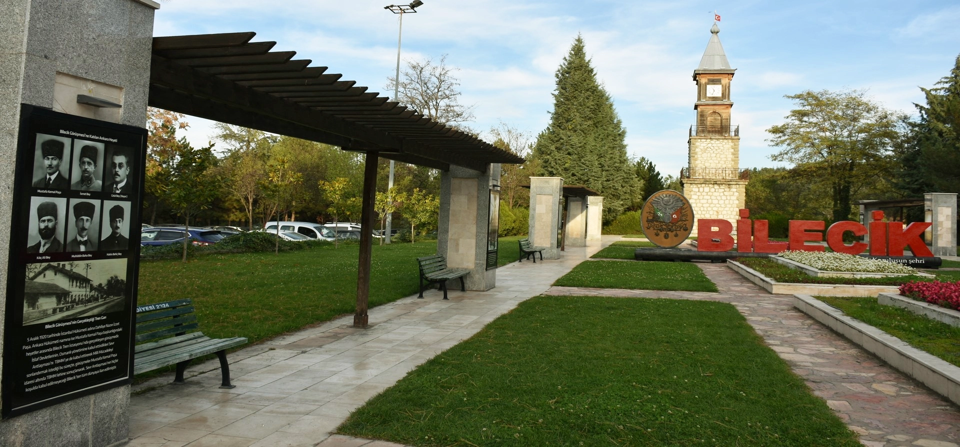
Discover Ottoman foundation history, forest landscapes, plateaus, nature parks and historic towns throughout Bilecik Province.
View Bilecik GuidePair Sofular’s open highland scenery with nearby plateaus, forest landscapes and the historical sites of Bozüyük.
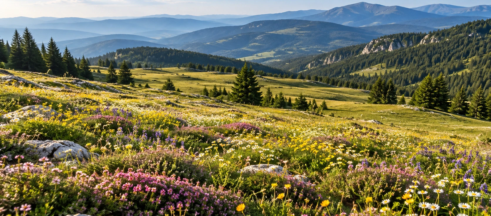
Continue into Bozüyük’s highest highland landscape, known for wildflowers, thyme-scented meadow and broad mountain views.
Explore Çiçekli Plateau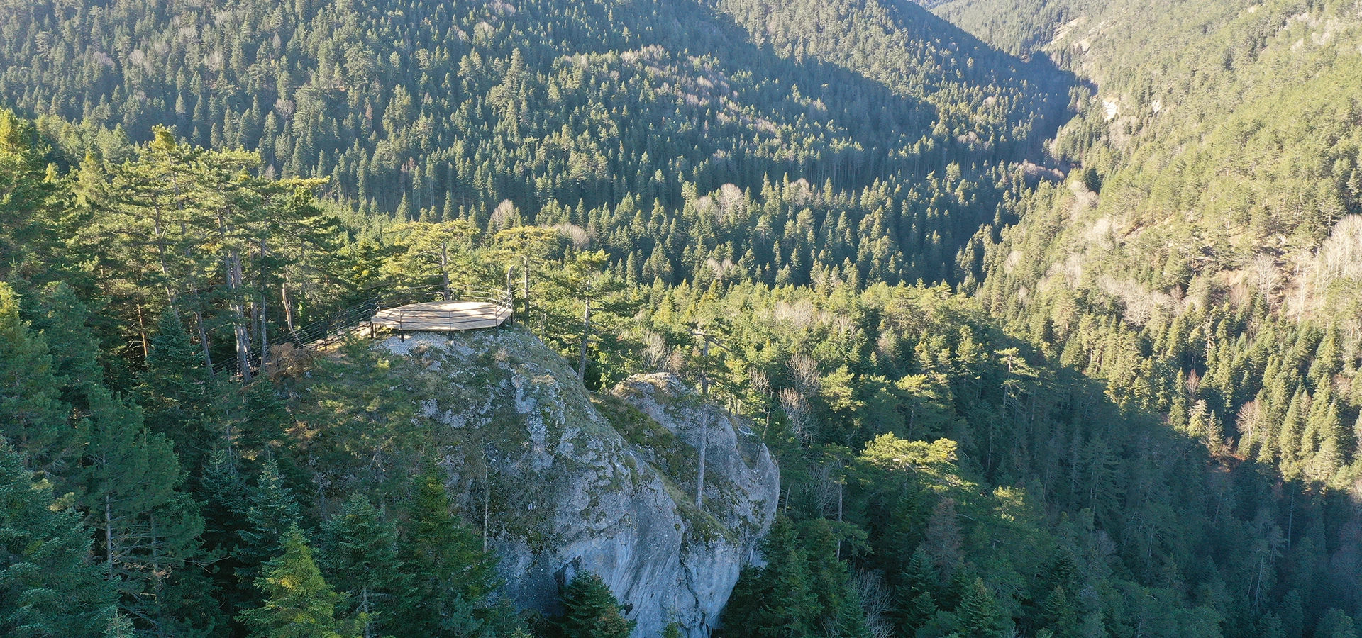
Explore forest scenery, walking areas, a viewing terrace and the historic Atatürk Pavilion near Bozüyük.
Explore Erikli Nature Park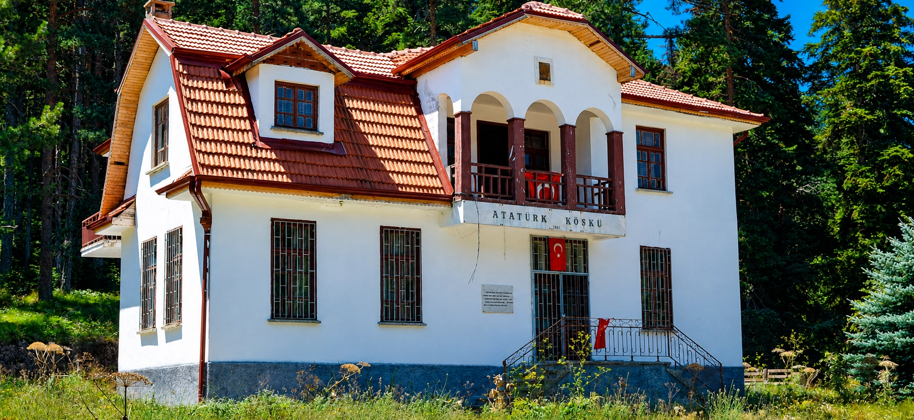
Discover the historic pavilion in Erikli forest and its place in Bilecik’s modern historical landscape.
Explore Atatürk Mansion