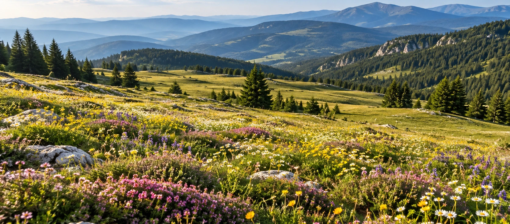
Private Çiçekli Highland Experience
Ask us about a tailor-made route combining Çiçekli Plateau, other Bozüyük highlands and selected historical places in the district.
Request a Custom Tour





Çiçekli Plateau, known locally as Çiçekli Yayla, is a highland landscape in the Bozüyük district of Bilecik Province. Reaching an elevation of approximately 1,906 metres, it is identified by official local sources as the highest plateau in Bozüyük.
The plateau lies in the Üç Tepeler area, near Camili Yayla village, and is known for green meadows, colorful seasonal flowers, clear mountain water, forest scenery and the fragrance of wild thyme. Its high elevation gives Çiçekli a cooler and more open character than the lower countryside around Bozüyük.
One of the plateau’s most frequently mentioned natural features is a locally named endemic plant called “Çimtien” in official tourism and local-government sources. Because those sources do not provide a scientific botanical name, visitors should treat “Çimtien” as the recorded local name rather than assume a Latin species identification.
Çiçekli is not a formal urban park with a dense concentration of visitor facilities. Its appeal is the highland itself: open grassland, forest margins, mountain air, seasonal flowers and a sense of remoteness. It is therefore best suited to travelers who enjoy nature photography, walking, scenic drives and quiet outdoor landscapes.
For travelers exploring the wider province, Çiçekli fits naturally into a route through Bilecik’s forests, plateaus and historical landscapes, and can be combined with other nature and heritage stops around Bozüyük.
Official sources identify Çiçekli as Bozüyük’s highest plateau.
The plateau lies in the highland area known as Üç Tepeler.
Seasonal flowers and green meadows are central to Çiçekli’s landscape.
Official sources record a locally named endemic plant associated with the plateau.
Essential information for planning a highland nature visit in Bozüyük.
Üç Tepeler area, near Camili Yayla village, Bozüyük, Bilecik.
Open on Google MapsApproximately 1,906 metres above sea level.
Officially described as the highest plateau in Bozüyük district.
Approximately 32 km from Bozüyük district centre.
Wildflowers, green meadows, forest scenery, clean air and clear mountain water.
Official sources mention a locally named endemic plant called “Çimtien”.
Open highland meadow bordered by mountain forest and rolling upland terrain.
Walking, photography, scenic driving and quiet nature time.
Official tourism information recommends access by private vehicle.
High elevation means cooler temperatures and potentially rapid weather changes.
Çiçekli combines high elevation, open meadow scenery, forest edges, wildflowers and a distinctive local botanical identity.
The defining feature of Çiçekli is its 1,906-metre elevation. This places the plateau well above Bozüyük’s lower settlements and gives it the cool, exposed character of a genuine highland landscape. The air can feel noticeably fresher, nights can be much cooler than the district centre, and the seasonal rhythm is strongly shaped by altitude.
The second reason Çiçekli stands out is its flower-rich meadow environment. Official descriptions repeatedly emphasize green grass, colorful flowers, clear water and the scent of thyme. The name “Çiçekli,” meaning roughly “flowered” or “full of flowers,” suits the plateau especially well during the growing season.
A third point of interest is the plant referred to as “Çimtien” in official local sources. It is presented as an endemic plant associated with the plateau. Because the available official visitor sources do not provide a scientific species name, this guide deliberately avoids assigning one.
Finally, Çiçekli forms part of a wider chain of Bozüyük and Domaniç highlands. The road network around Kömürsu and the upper plateaus creates opportunities for scenic drives and longer outdoor itineraries, while still requiring careful route planning because the landscape becomes increasingly remote.
Çiçekli Plateau is best understood as a high-elevation meadow landscape rather than a single viewpoint or built attraction. Broad grassy areas spread between forested slopes and upland ridges, creating an open visual character that differs from the denser woodland found at lower elevations.
At around 1,906 metres, the plateau sits in a climatic zone where spring arrives later and the warm season is shorter. Snow, rain, wind and fog can all shape the appearance of the landscape, while summer brings the greenest meadows and the strongest display of flowers.
The combination of open grassland and forest edge is especially attractive for photography. A wide-angle view can capture the scale of the plateau, while closer compositions reveal wildflowers, thyme, grasses and the changing textures of the upland vegetation.
The landscape is also connected to the wider mountain country extending toward Kömürsu, Karagöl and the Domaniç highlands. Visitors who continue beyond the main plateau should carry navigation tools and avoid assuming that every unpaved road is suitable in all weather conditions.
The plateau’s vegetation is one of its most celebrated features. Official tourism descriptions highlight green grass, colorful flowers, forest vegetation and wild thyme, with the scent of thyme often mentioned as part of the Çiçekli experience.
The exact flower display changes with season, rainfall and temperature. Late spring and early summer generally offer the best opportunity to see fresh grass and a wider variety of flowering plants, although timing can vary from year to year at this elevation.
Forest vegetation around the open meadow creates a transition between grassland and woodland habitats. This edge effect adds visual variety and helps explain why a short walk can move quickly from open sunlight into shaded forest surroundings.
Visitors should avoid picking flowers or digging up plants. High-elevation vegetation can have a short growing season, and even apparently common meadow plants may be important to the local ecosystem.
Colorful seasonal flowers are one of the plateau’s defining visual features.
Official descriptions repeatedly mention the thyme fragrance across the highland landscape.
Open green meadow creates the broad, spacious character of Çiçekli.
Woodland around the meadow provides shade, contrast and ecological diversity.
Official tourism and local-government sources for Çiçekli Plateau repeatedly mention an endemic plant called “Çimtien”. The plant is presented as one of the plateau’s distinctive natural features and is closely associated with descriptions of its flower-rich meadow environment.
However, the visitor information currently available from those official sources does not provide a scientific Latin name or detailed botanical classification. For that reason, it is better to retain the local name exactly as recorded rather than identify it with another species without specialist botanical evidence.
For travelers, the important point is that Çiçekli is recognized locally for botanical distinctiveness. Visitors should photograph plants in place and avoid collecting specimens unless participating in properly authorized scientific work.
Clear water is another feature repeatedly emphasized in official descriptions of Çiçekli. The wider Bozüyük highlands contain springs and wet areas that help support meadow vegetation through the warmer months.
Visitors should nevertheless avoid assuming that every natural water source is safe to drink untreated. Even water that looks exceptionally clean can contain microorganisms or contamination that cannot be seen.
Carry sufficient drinking water for your visit, particularly if you plan to walk beyond the immediate roadside or spend several hours in the highlands. This is especially important because there is no guarantee of staffed food-and-drink service at the plateau.
A visit to Çiçekli can be as simple as a short walk through the meadow and along the forest edge. The open landscape makes it easy to slow down, photograph flowers and enjoy wide highland views without needing a formal monument-style itinerary.
Longer walking becomes more demanding because the surrounding highlands include unpaved roads, uneven ground, slopes, wet meadow sections and forest tracks. Conditions can change after rain or snow, and route markings should not be assumed.
The plateau’s connection with nearby highland areas makes it appealing to hikers and cyclists who want a more ambitious route. Anyone continuing far from the main approach road should use offline maps or GPS and carry enough food, water and clothing for changing weather.
Because mobile coverage can be inconsistent in mountain terrain, it is sensible to tell someone your planned route and expected return time before beginning a longer walk.
Walk through the meadow and explore the forest edge close to your vehicle.
Use navigation tools and prepare for unmarked tracks and changing surfaces.
Choose walking shoes with grip rather than smooth city footwear.
Download route information before entering more remote parts of the highlands.
Çiçekli’s open scenery naturally attracts visitors who want to spend several hours outdoors. A simple picnic can work well if you bring everything you need and remove all rubbish when you leave.
The official visitor sources used for this guide do not describe Çiçekli as a staffed campground with guaranteed services. If you intend to stay overnight, confirm current local rules, land-use restrictions and fire regulations before setting up a tent.
At nearly 1,900 metres, nighttime temperatures can drop sharply even after a warm afternoon. Campers should prepare for wind, dew, rain and sudden cold rather than relying on daytime conditions.
Open fires should never be assumed to be permitted. Forest-fire restrictions can change seasonally, and visitors should follow all current official rules and local instructions.
Carry food, drinking water and basic essentials rather than expecting shops on the plateau.
High elevation can produce surprisingly low temperatures after sunset.
Check current restrictions before using any stove or flame.
Pack out all rubbish and never leave food waste in the meadow or forest.
Çiçekli is especially suitable for landscape and nature photography because it offers a combination of open meadow, wildflowers, forest boundaries, mountain weather and distant ridges.
Morning light can create soft detail across the grass and flowers, while late-afternoon light can add stronger contrast to the shape of the surrounding slopes. Mist and low cloud can also transform the plateau into a much more atmospheric landscape.
For close-up photographs, focus on flowers, grasses and natural textures without trampling vegetation. For wider compositions, include the forest edge or a winding highland road to give a sense of scale.
Seasonal variation is significant. A photograph taken in flower season can look completely different from the same viewpoint under autumn cloud, winter snow or early-spring thaw.
Look for colorful foregrounds against the darker forest edge.
Soft light and possible mist can create gentle, layered scenes.
Low sunlight can reveal the shape of ridges and meadow contours.
Fast-changing mountain weather can produce dramatic atmospheric photographs.
Snow can be beautiful but access conditions may become substantially more difficult.
Photograph flowers where they grow instead of picking or rearranging them.
For most visitors, the most practical period is late spring through early autumn, when road conditions are generally easier and the plateau is most likely to show its green meadow character.
Late spring can bring fresh growth and the beginning of flower season, but wet ground, cool weather and lingering snow are still possible at this elevation.
Summer is often the easiest season for a first visit. The plateau can provide a welcome escape from heat at lower elevations, although wind and rapid temperature changes remain possible.
Early autumn offers crisp air and quieter conditions, while the color palette begins to shift away from peak summer greens. Night temperatures can fall rapidly.
Winter turns Çiçekli into a much more demanding mountain environment. Snow, ice, fog and road conditions should be checked carefully before travel, and ordinary passenger cars may not always be appropriate depending on conditions.
Çiçekli Plateau lies in the Bozüyük district of Bilecik Province, in the Üç Tepeler highlands near Camili Yayla village. Bozüyük Municipality’s current strategic planning material places it approximately 32 km from Bozüyük district centre.
The Bilecik Governor’s official visitor page gives the plateau coordinates as approximately 39°51'13"N, 29°43'10"E. These coordinates are useful when navigation apps return several similarly named rural locations.
Unlike a formal museum or developed nature park, Çiçekli does not have published museum-style opening hours in the official visitor sources used for this guide. Access can nevertheless be limited in practice by snow, mud, road maintenance, forestry activity or temporary restrictions.
Bring drinking water, food, sun protection and an extra warm layer. For emergency assistance in Türkiye, call 112.
Çiçekli is a peaceful landscape, but its altitude and remoteness mean that visitors should prepare more carefully than they would for a city park. Weather, road condition and distance from services are the most important practical considerations.
Fog, wind, rain and rapid temperature changes are possible at high elevation.
Unpaved or rural sections may be affected by rain, mud, snow or maintenance.
Wet grass, loose ground and forest tracks can become slippery.
Do not rely on natural water sources or seasonal visitor services.
Temperatures can fall quickly even in the warmer months.
Download maps before leaving areas with reliable mobile coverage.
Never assume open fires are permitted in or near forest areas.
Call 112 for emergency assistance in Türkiye.
Çiçekli is a natural highland landscape rather than a fully developed visitor attraction. Accessibility therefore depends heavily on road condition, parking position and the exact area you wish to explore.
Visitors who remain close to a vehicle may still be able to enjoy the broad scenery, but meadow surfaces, forest edges and unpaved tracks can include uneven ground, grass, mud, stones and slopes.
Wheelchair users and travelers with limited mobility should not assume there are paved, step-free paths or accessible toilets. If these facilities are essential, confirm current local conditions before making the journey.
Official tourism information places Çiçekli Plateau near Camili Yayla village in the Bozüyük district and recommends travel by private vehicle. The plateau lies in the Üç Tepeler area at approximately 1,906 metres.
Bozüyük Municipality describes the plateau as roughly 32 km from Bozüyük district centre. Driving time should not be estimated from distance alone because the final part of the route passes through rural highland terrain.
For navigation, use the name “Çiçekli Yayla, Bozüyük, Bilecik” or the official coordinates 39.853611, 29.719444. Saving the coordinates offline before departure can be useful if mobile data becomes unreliable.
Road conditions can change after rain and especially during the snow season. If traveling outside summer, check the latest local conditions before continuing into the upper highlands.
Approximately 32 km according to Bozüyük Municipality planning material.
Private vehicle is the access method given by the official tourism portal.
Use “Çiçekli Yayla, Bozüyük, Bilecik” or the official coordinates.
Expect rural and highland road conditions rather than urban streets.
Mud and soft road surfaces can make the approach slower.
Snow and ice can substantially change access conditions.
For a simple scenic visit, 45–90 minutes is enough to enjoy the meadow, take photographs and make a short walk near the main access area.
A half day is better if you want to explore more slowly, follow nearby tracks, photograph flowers or combine Çiçekli with another plateau in the Bozüyük highlands.
A full day can work well for experienced walkers or photographers who are deliberately exploring the wider highland landscape. Longer outings require more careful planning for weather, water, navigation and road conditions.
Scenery, wildflowers and a short meadow walk.
Slower photography and exploration of the surrounding highland.
Combine Çiçekli with nearby plateau scenery and a longer walk.
Best for prepared hikers, cyclists or landscape photographers.
Begin by stopping at a safe point where your vehicle does not block the highland road. Take a few minutes to look across the landscape before setting out on foot.
Walk first through the open meadow, where the scale of the plateau and its seasonal flower display are easiest to appreciate. Avoid trampling dense flower patches simply to reach a photograph.
Continue toward the forest edge for a different perspective on the highland environment. The contrast between open grassland and darker woodland is one of the plateau’s most attractive visual features.
If weather and road conditions are good, continue your day with another highland stop before returning toward Bozüyük. Do not extend the route deep into remote forest roads without navigation, sufficient fuel and suitable preparation.
A trip to Çiçekli can be combined with other landscapes and historical stops around Bozüyük, creating a day that mixes mountain scenery, forest nature and local history.
Another important Bozüyük highland, known for forest vegetation, meadow scenery and mountain springs.
A nearby highland area that can be considered as part of a longer plateau route when road conditions are suitable.
Explore a developed highland forest with a viewing terrace, walking areas and the historic Atatürk Pavilion.
Add modern historical context with the pavilion located in the forest at Erikli.
Continue into Bozüyük’s twentieth-century history at the landscape associated with the Battles of İnönü.
Discover more nature parks, Ottoman heritage, museums and countryside across the province.
Çiçekli is not an isolated pocket of upland terrain. Official local information places it within a wider highland landscape connected with Kömürsu Plateau and routes continuing toward the Domaniç highlands.
This connection is one reason the area is attractive to drivers, hikers and cyclists who want to experience more than a single viewpoint. The scenery changes gradually between open meadow, forest road and higher mountain country.
The wider route should be approached with more preparation than a short stop at Çiçekli itself. Fuel, daylight, navigation, mobile coverage and road surface all become more important as you continue away from the main district roads.
Leave flowering plants in place so the meadow can continue its natural cycle.
Carry all rubbish back with you, including food packaging and tissues.
Do not drive vehicles across soft grassland or sensitive flower-rich areas.
Never light a fire during restrictions or outside clearly permitted areas.
The quiet highland atmosphere is part of the value of the place.
Give grazing animals space and never block pastoral or forestry roads.
Do not wash dishes, vehicles or equipment directly in natural water sources.
Leave plants, stones and natural material where you find them.
It is in the Bozüyük district of Bilecik Province, in the Üç Tepeler area near Camili Yayla village.
Its Turkish name is Çiçekli Yayla or Çiçekli Yaylası.
Official sources give an elevation of approximately 1,906 metres.
Yes. Official Bilecik and Bozüyük sources describe it as Bozüyük district’s highest plateau.
Bozüyük Municipality places it approximately 32 km from the district centre.
The Bilecik Governor’s official page gives approximately 39°51'13"N, 29°43'10"E.
It is known for high-elevation meadow scenery, colorful flowers, clear water, forest vegetation, wild thyme and the locally named endemic “Çimtien” plant.
Official local sources describe “Çimtien” as an endemic plant associated with Çiçekli Plateau. They do not provide a scientific Latin name, so this guide does not assign one.
Late spring and early summer are generally the most promising periods, although flowering time changes with snowmelt, rainfall and temperature each year.
Yes. The official tourism portal lists private vehicle as the practical way to reach the area.
Not necessarily in dry, good conditions, but rural road surfaces can change. After rain or during snow season, a higher-clearance or more capable vehicle may be preferable. Check locally before travel.
The official visitor sources used for this guide do not publish museum-style opening hours. Practical access can still be affected by weather, roads or temporary restrictions.
The official tourism pages used for this guide do not publish a standard visitor entrance fee for the plateau. Check locally if any access or service arrangements change.
Formal visitor facilities should not be assumed. Bring what you need and plan the trip as a remote nature visit.
Yes. Short meadow walks are easy to combine with a visit, while longer highland routes require navigation, suitable footwear and weather awareness.
Do not assume that an informal-looking meadow is automatically an authorized campsite. Confirm current local land-use, fire and overnight rules before pitching a tent.
A simple low-impact picnic is possible in suitable areas, but bring your own supplies and remove every piece of waste when you leave.
Do not assume untreated natural water is safe simply because it looks clear. Bringing your own drinking water is the safest option.
Yes. Its strongest subjects are wildflowers, open grassland, forest edges, mountain weather and broad highland views.
It can be a good family nature stop if children are supervised closely around roads, uneven ground, forest edges and any livestock.
Formal step-free infrastructure should not be assumed. Natural meadow and forest terrain can be rough, grassy, muddy or sloping.
Search for “Çiçekli Yayla, Bozüyük, Bilecik” or use coordinates 39.853611, 29.719444.
Consider combining the plateau with Kömürsu, the wider Bozüyük highlands, Erikli Nature Park, Atatürk Mansion and Metristepe Victory Monument.
It is especially rewarding for travelers who enjoy quiet mountain landscapes, wildflowers, photography, scenic drives and less-developed nature destinations.
Combine Çiçekli Plateau with other highland landscapes and selected historical sites around Bozüyük through a private itinerary designed around your interests and pace.
Enjoy a tailor-made day combining highland scenery, wildflower landscapes and selected heritage stops around Bozüyük.
Ask us about a tailor-made route combining Çiçekli Plateau, other Bozüyük highlands and selected historical places in the district.
Request a Custom Tour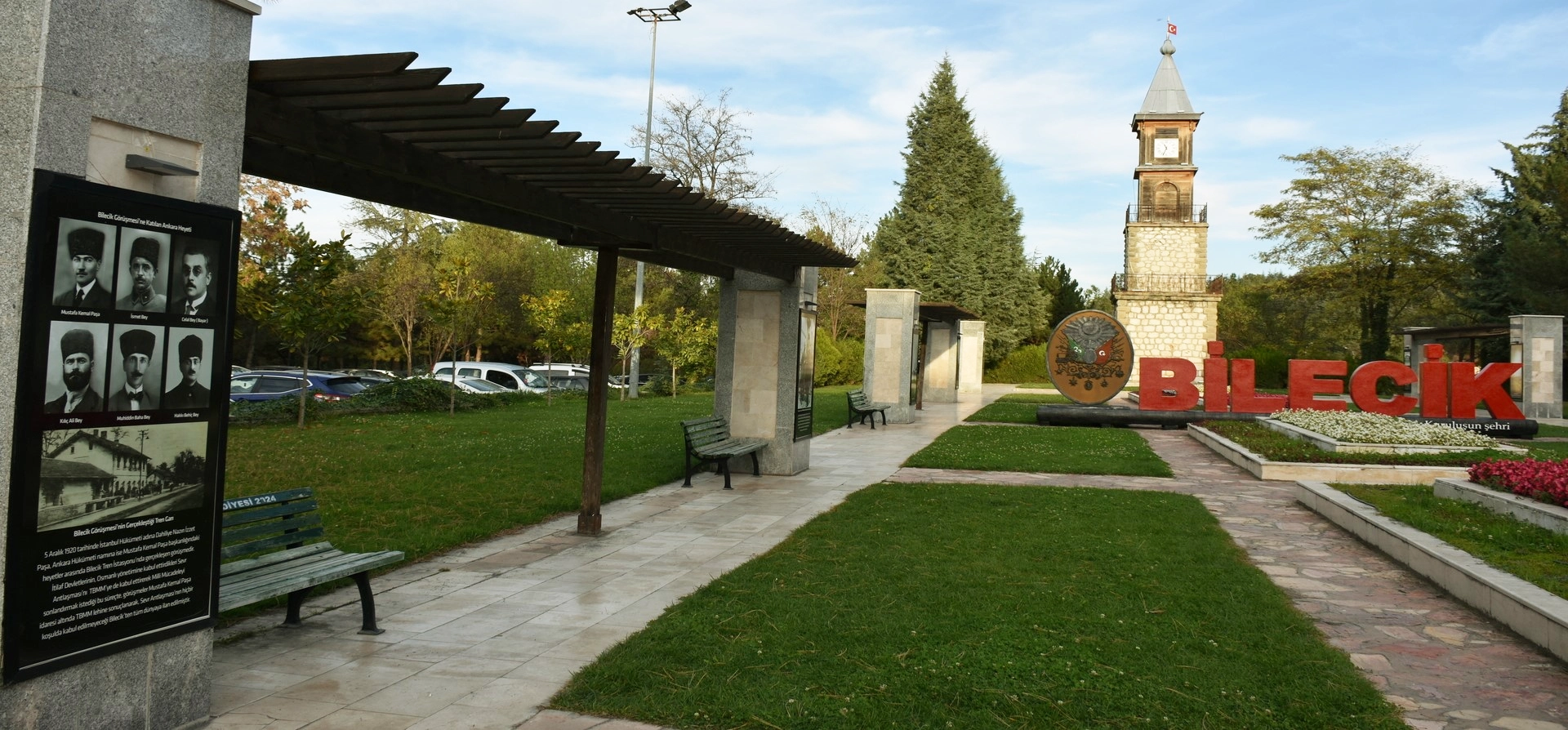
Discover Ottoman foundation history, forest landscapes, plateaus, nature parks and historic towns throughout Bilecik Province.
View Bilecik GuidePair Çiçekli’s highland meadows with forest scenery and the historical landscapes of the surrounding district.
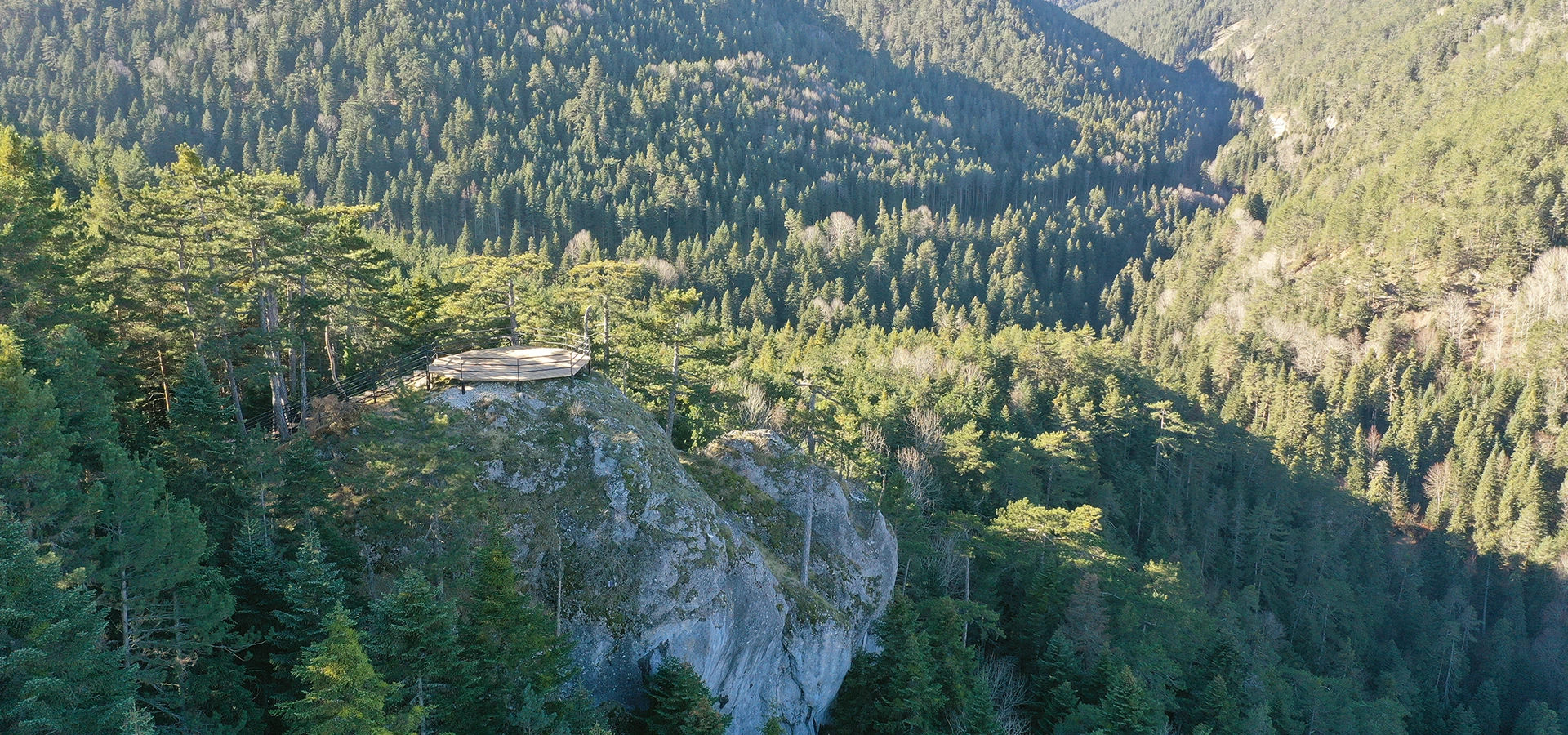
Explore highland forest, a viewing terrace, walking areas and a historic Atatürk Pavilion near Bozüyük.
Explore Erikli Nature Park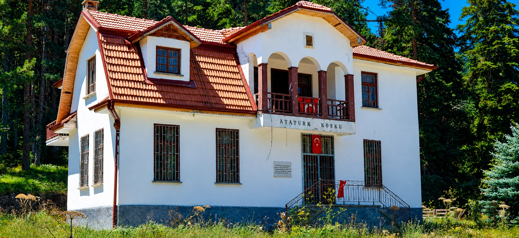
Discover the historic pavilion hidden in Erikli’s forest and its place in Bilecik’s modern historical landscape.
Explore Atatürk Mansion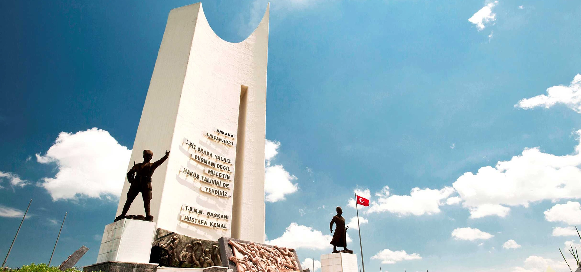
Continue through Bozüyük’s modern history at the strategic landscape associated with the Battles of İnönü.
Explore Metristepe