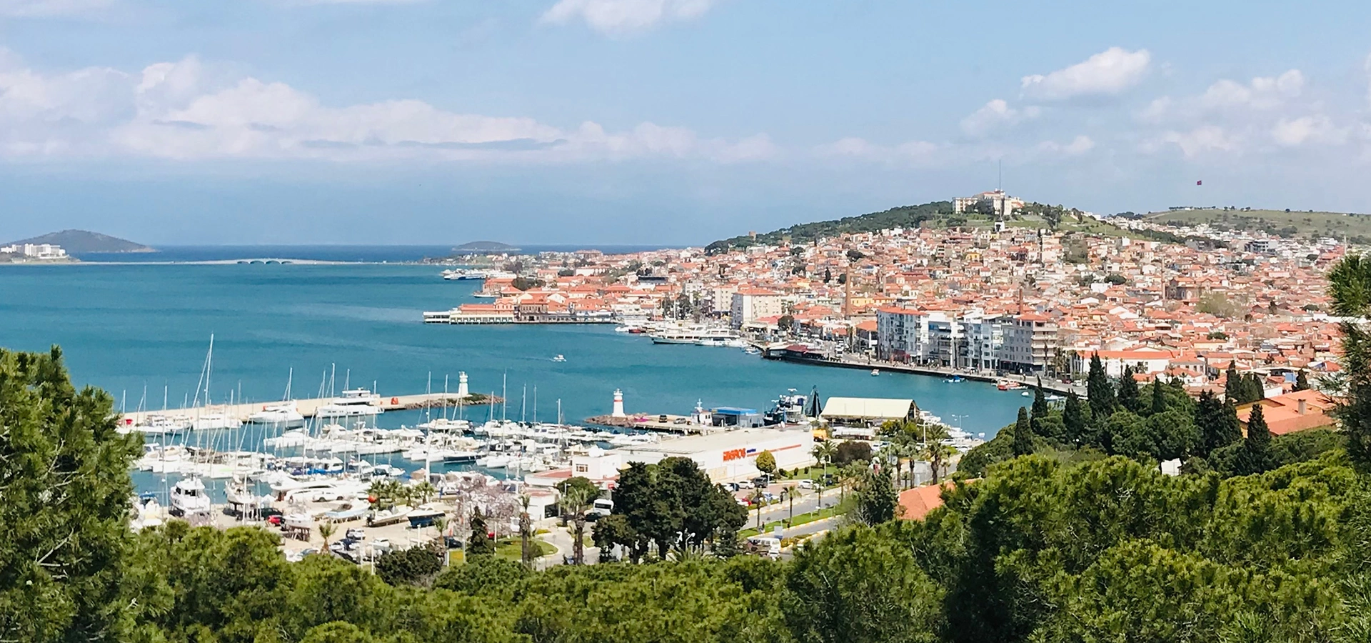
Ayvalık
Explore one of the northern Aegean's richest historic towns through stone architecture, former churches, olive-oil heritage and island scenery.
View Ayvalık Guide





Ören, on the coast of Burhaniye in Balıkesir Province, is one of the most unusual seaside settlements on the northern Aegean. At first glance it looks like a green, low-rise holiday district with a broad sandy beach, shaded walking areas and quiet residential streets. Beneath that modern landscape, however, lie the remains of Adramytteion, one of the important ancient cities of the Edremit Gulf.
This overlap between resort life and archaeology is what makes Ören special. The ancient city is not contained inside a fenced archaeological park outside town. Its remains survive beneath and between the modern neighbourhood, while excavated areas, architectural fragments and the submerged ancient harbour reveal pieces of a much larger settlement whose history reaches back thousands of years.
Ören's modern identity is also worth understanding. The resort was deliberately planned in the late 1950s as a seaside settlement, and much of its low-rise, garden-oriented character has survived because large areas are protected as archaeological and natural conservation zones. Registered mature palamut oaks – valonia oaks, pines, lawns and broad public spaces give the neighbourhood a greener atmosphere than many intensely developed Aegean resorts.
Then there is the beach. Ören's municipal public beach is known for fine sand, a broad shoreline and Blue Flag recognition. Add Burhaniye's geographically registered olive oil, the nearby marina and fish restaurants of İskele, day trips toward Ayvalık and Mount Ida, and Ören becomes far more than a place for a quick swim.
Modern Ören occupies the site of Adramytteion, where archaeological work has revealed layers from prehistoric periods through Greek, Roman and Byzantine times.
The principal public beach is approximately 1.5 km long, broad and sandy, with Blue Flag certification in the 2026 season.
Mature registered valonia oaks, pines, gardens and conservation rules help preserve the low-rise identity for which Ören is known.
Few northern Aegean bases combine a serious archaeological story, easy swimming and a protected regional olive-oil culture so naturally.
Essential information for visiting Ören's beach, archaeological landscape and green residential quarter on the Edremit Gulf.
Burhaniye district, Balıkesir Province, on the southern side of the Edremit Gulf in northwestern Türkiye.
Ören stands over Adramytteion, an ancient coastal city whose archaeological sequence reaches back roughly six millennia.
The municipal description gives approximately 1.5 km of fine sandy beach with an average width of about 75 metres.
Ören Mahallesi Halk Plajı is listed in the official Blue Flag programme for the 2026 season.
Ören is known for registered mature palamut meşesi – valonia oaks, pines, lawns and protected natural character.
Submerged remains of Adramytteion's harbour survive directly off the coast and have been systematically documented by researchers.
Acts 27:2 refers to a ship from Adramyttium used during Paul's voyage toward Rome; the text does not say Paul visited the city itself.
Burhaniye Zeytinyağı is a registered geographical-origin olive oil produced from the regional Ayvalık olive variety.
Burhaniye Municipality currently lists the Ören neighbourhood market on Thursdays.
Balıkesir Koca Seyit Airport (EDO) is approximately 11 km from Ören Beach according to municipal visitor information.
The beach is roughly 5 km from central Burhaniye, with frequent local transport during the main season.
Allow one full day for beach and archaeology, or 2–4 nights for a slower Edremit Gulf stay with nearby excursions.
Ören is ideal for travellers who want a real northern Aegean beach holiday without giving up history, local food and cultural depth. Its strongest attractions are not separated into different districts; the beach, protected trees, ancient city and modern resort occupy the same compact landscape.
The first reason to visit is the remarkable relationship between modern Ören and ancient Adramytteion. Archaeological remains appear in permanent excavation areas, architectural fragments are displayed in the neighbourhood, and the ancient harbour survives under the sea immediately offshore. You are not simply travelling from a resort to a ruin; you are walking through a living settlement built over a much older one.
The second reason is the beach. Ören's main public beach is unusually generous in scale for the region, with fine sand and enough width to give the seafront an open feeling even in a developed summer resort. Blue Flag status and organised municipal facilities make it especially practical for families and travellers who prefer a straightforward public-beach experience.
The third reason is atmosphere. Ören's protected trees, gardens and low-rise streets create a calmer visual character than many coastal towns where large apartment blocks dominate the shore. Add the olive landscape of Burhaniye, easy access to İskele and the marina, and day-trip possibilities toward Ayvalık and Kazdağları, and the destination works equally well for history-focused travellers and relaxed summer visitors.
Ören lies on the southern side of the Edremit Gulf, west of Burhaniye town centre and opposite the broad mountain landscapes that frame the Gulf. The ancient city developed on a coastal rise surrounded by alluvial land, with access to maritime routes through its harbour.
This position helps explain both ancient Adramytteion and modern Ören. In antiquity, the coast connected the city with maritime trade and the ports of western Anatolia. Today the same geography supports beach tourism, sailing, fishing and quick road connections toward Edremit, Gömeç and Ayvalık.
The wider district sits between the Aegean and the Madra Mountain landscape. Olive groves dominate much of the countryside, while the northern horizon across the Gulf is shaped by Kazdağları – ancient Mount Ida. Ören therefore belongs to both a coastal and agricultural landscape rather than functioning as an isolated resort strip.
The large northern Aegean gulf linking Burhaniye with Edremit, Gömeç, Ayvalık and the coastal landscapes beneath Mount Ida.
The mountain mass south and southeast of Burhaniye, helping define the district's rural landscape, water systems and olive-growing geography.
Flat alluvial land surrounds Ören and helps explain the broad beach, agricultural hinterland and easy cycling terrain around the resort.
Adramytteion's harbour connected the city with the Aegean and made the coastline central to its economic and political importance.
Adramytteion is the archaeological heart of Ören. Modern research describes a settlement sequence extending back approximately 6,000 years, with evidence from prehistoric periods through the Bronze and Iron Ages, the Lydian and Classical worlds, Roman rule, Late Antiquity and the Byzantine period.
The important point for visitors is that Adramytteion does not survive as one monumental excavation field. Much of the ancient city remains beneath modern Ören, protected by archaeological-site regulations. Permanent excavation areas expose selected parts of the settlement, while many additional discoveries have come from controlled archaeological sondages carried out at different points across the neighbourhood.
Research has identified streets, houses, commercial spaces, churches, burials, water systems and a Roman bath complex with a mosaic courtyard. The harbour has also survived offshore. Together these finds reveal a city that changed repeatedly over many centuries rather than a single-period settlement frozen in time.
Visitors sometimes arrive expecting a single ticket gate and a long monumental route. Ören is different. Archaeological remains are distributed through the neighbourhood in separate excavation and display areas, and their visibility can change depending on conservation work and active research.
Permanent research areas have included Byzantine storage and residential remains, church and burial zones, and the Roman bath. Around Ören Square, an open-air display contains columns, capitals, inscriptions and architectural fragments from Roman and Byzantine periods.
This scattered presentation rewards travellers who enjoy archaeology with context. Walk slowly, read any current interpretation panels and remember that the unexcavated archaeology beneath surrounding streets is often as significant as the exposed stone in front of you.
One of the most important excavated components, with evidence including a mosaic courtyard and associated Roman-period architecture.
Excavations have documented early medieval Christian architecture, burials and associated settlement activity.
Architectural pieces in Ören include columns, capitals and inscribed material that help make the ancient city visible above ground.
Research across modern plots has revealed deeper occupation layers and helped map the scale and chronology of the buried city.
One of Ören's most remarkable archaeological features is largely underwater. The remains of Adramytteion's ancient harbour extend from the modern shoreline into the Aegean and have been documented through detailed archaeological survey.
Researchers have recorded more than a thousand stone blocks associated with the harbour system, including hundreds still lying in their original positions. The documented breakwater extends outward from the coast and then curves northward, preserving the basic logic of the ancient maritime structure.
Under normal sea conditions much of this evidence is submerged or difficult to recognise from shore. Occasionally exceptionally low water levels make portions more visible, but visitors should not walk over, move or disturb archaeological material. The harbour is most meaningful when understood as part of a functioning ancient city whose economy depended heavily on the sea.
Adramyttium appears in the New Testament in the account of Paul's voyage toward Rome. Acts 27:2 describes Paul and his companions boarding a ship associated with Adramyttium that was sailing toward ports along the coast of the Roman province of Asia.
The detail is important because it reflects Adramytteion's place inside the maritime network of the eastern Mediterranean. Ships connected with the city were part of coastal traffic moving between ports of Asia Minor and the wider Roman world.
A careful historical reading is essential: Acts does not state that Paul visited Adramyttium itself on this journey. The reference is to the origin or home port of the vessel. For travellers interested in early Christianity, the value of Ören is therefore maritime and contextual rather than a claim that Paul personally walked through the city.
Modern Ören was created as a planned seaside settlement in the 1950s. A general resort plan was prepared in 1957–1958 by architect-planners Abdullah Ardalı and Nihat Güner as part of an effort to develop a tourism and summer-residence district.
The choice of location eventually created a complicated conservation problem because the modern settlement was built over ancient Adramytteion. Protection decisions introduced from the 1970s onward and strengthened in later decades placed significant parts of Ören within archaeological and natural conservation zones.
The unexpected result is that Ören today preserves two forms of heritage at once: the ancient city underground and a relatively low-rise mid-20th-century garden-resort landscape above it. This is why the neighbourhood's identity is not simply beach plus archaeology. The modern settlement itself has become part of the cultural story.
Ören's modern streets and summer-house character emerged from deliberate tourism planning in the late 1950s.
Large areas are protected because substantial remains of Adramytteion survive beneath the modern neighbourhood.
Registered mature trees and the neighbourhood's green character are also part of the protected landscape.
Garden houses, shaded streets and limited building intensity distinguish Ören from more heavily urbanised coastal resorts.
One of the first things many visitors notice in Ören is the shade. Mature palamut meşesi – valonia oak trees, pines and landscaped public spaces soften the resort and create a striking transition between residential streets and the beach.
Official tourism information notes that Ören's old palamut oaks were individually registered and protected by conservation authorities. Their survival is a major reason the neighbourhood still deserves the long-used description “Green Ören.”
For travellers this matters practically as well as visually. Shaded walking areas make summer evenings more pleasant, while lawns and tree-lined public spaces create alternatives to spending the entire day under a beach umbrella. Respect barriers around protected trees and avoid damaging roots or trunks when parking or picnicking.
Ören Beach is the modern resort's main attraction and one of the best-known beaches in the Burhaniye district. Municipal visitor information describes the beach as approximately 1.5 kilometres long, averaging around 75 metres wide, and consisting of fine sand.
The large width changes the experience significantly. Even when summer facilities occupy parts of the shoreline, the beach still feels more open than narrow strips squeezed between a road and the sea. Municipal sections include showers, toilets and changing facilities, while the Blue Flag zone provides lifeguard and first-aid services during the certified season.
The official Blue Flag programme lists Balıkesir Büyükşehir Belediyesi Ören Mahallesi Halk Plajı for the 2026 season. Certification applies to a defined beach area and is renewed seasonally, so future travellers should always verify the current listing rather than relying on an old sign or travel article.
The main municipal beach is officially described as fine sand, one of Ören's strongest advantages for classic beach holidays.
Approximately 1.5 km long and broad enough to create a spacious resort-beach atmosphere.
Officially listed for the 2026 season; always re-check annual certification for future trips.
Municipal beach sections provide practical facilities such as showers, toilets and changing cabins.
Ören works especially well for travellers who want an uncomplicated beach day. The sandy shore allows easy movement between sunbathing, swimming, cafés and shaded public areas, while the neighbourhood behind the beach remains close enough for meals and short breaks.
Summer afternoons on the Edremit Gulf can become breezier, so many swimmers prefer the calmer feel of the morning. Families may also find early hours more comfortable before the beach reaches its busiest point.
As anywhere on the Aegean, conditions vary by day. Follow lifeguard flags, avoid swimming around archaeological remains or boat traffic, and do not assume that a calm morning guarantees the same water conditions later in the afternoon.
Ören's seafront is calmer than the dense promenades of some larger resorts. The broad beach is backed by green areas, residential streets, accommodation, cafés and public spaces rather than a continuous wall of high-rise development.
Evenings are especially pleasant because the focus shifts from swimming to walking and sitting outdoors. Families gather in green areas, cafés become busier and the archaeological character of Ören is easier to notice once the heat of the day fades.
For a more marina-oriented evening, continue to Burhaniye İskele. Its fishing harbour, marina, restaurants and coastal activity provide a different atmosphere from Ören while remaining close enough for an easy dinner excursion.
Around Ören Square, archaeological material from Adramytteion has been gathered into an open-air display area. Roman and Byzantine columns, capitals and architectural fragments allow visitors to see material from the ancient city without entering an enclosed museum.
One of the most interesting pieces is an inscribed honorific monument connected with civic life and Roman merchants. Even if you cannot read the ancient inscription, the display gives a useful sense of how much architectural material has been recovered from the wider settlement.
Treat the area as an introduction rather than a complete museum. Its real value is that it encourages you to recognise Ören itself as the archaeological site and to connect the objects with nearby excavation zones and the ancient harbour.
Central Burhaniye lies only a short drive inland from Ören and is useful for markets, everyday shopping, local restaurants and understanding the district beyond its summer coastline. The contrast with Ören is worthwhile: the centre feels like a working Aegean town rather than a purpose-built resort.
If your visit includes a Monday, Burhaniye Municipality currently lists the central market on that day. Local produce, olives, cheese, vegetables and household goods make the market particularly interesting for travellers renting an apartment or planning a picnic.
The town centre also provides practical services including banks, pharmacies, supermarkets and transport connections. For a longer stay, combining the calm of Ören with the daily rhythm of Burhaniye gives a much fuller picture of the area.
Burhaniye's İskele district offers a more harbour-focused coastal experience than Ören. The marina sits on the Gulf and supports visiting yachts with berthing and service facilities, while nearby restaurants and cafés make the waterfront an easy evening destination.
The prevailing warm-season winds of the Gulf have also made the area attractive for sailing. Even if you are not arriving by boat, the marina is worth seeing for the contrast between yacht activity, local fishing and the open northern Aegean horizon.
For dinner, İskele is one of the natural places to look for fish and seafood. Ask what is fresh that day rather than ordering only from a fixed list; the quality of a simple grilled fish meal depends heavily on season and catch.
Burhaniye is one of Türkiye's important olive-growing districts, and olive oil is not simply a souvenir here. Burhaniye Zeytinyağı has registered geographical-origin protection and is produced from the regional Ayvalık olive variety within a defined area around Burhaniye and Gömeç.
The connection between olive cultivation and the district is ancient. Archaeological evidence from the Adramytteion area contributes to a much longer history of olive-related activity, while modern groves continue to dominate the landscape outside the built-up coast.
If you want to buy oil, look beyond packaging. Ask about harvest date, extraction method, storage and producer origin. A good tasting with bread, tomato or simple vegetables reveals much more than choosing a bottle only because the label looks attractive.
Burhaniye Zeytinyağı has registered origin protection in Türkiye, tying the product to a defined local production area.
The oil is associated with the regional Ayvalık – Edremit Yağlık – olive variety.
Choose reputable local producers and ask for harvest, pressing and storage information before buying larger quantities.
Autumn and early winter give the district a more agricultural atmosphere, with fresh-season oil becoming a central local product.
Burhaniye Municipality currently lists the Ören neighbourhood market on Thursdays. For travellers, it is a useful break from the beach and a chance to buy the same everyday products used by local residents.
Expect seasonal fruit and vegetables, olives, cheese, pantry goods, clothing and household items. Summer produce can be especially good for apartment stays or a simple beach picnic.
Go earlier in the day for easier movement and fresher produce. Market arrangements can change, particularly outside the main season, so confirm locally if the market is an important part of your itinerary.
The best meals around Ören reflect the meeting point of sea and olive country. Look for fish, seafood, zeytinyağlı vegetable dishes, seasonal Aegean herbs, olives, local cheese, salads and Burhaniye olive oil.
At fish restaurants around the wider Burhaniye coast, ask what is fresh and in season. Simple grilling, lemon, herbs and olive oil often suit the local ingredients better than elaborate preparation.
Breakfast is another good regional experience: olives, white cheese, tomatoes, peppers, eggs, preserves, bread and strong tea. For dessert, höşmerim remains one of Balıkesir's classic local sweets.
The district's signature product and the foundation of many vegetable dishes, salads and meze.
Best chosen according to the day's availability, especially around İskele and the marina.
Seasonal greens appear in salads, warm dishes and meze, particularly in spring.
Simple local breakfast ingredients that make an excellent market purchase for self-catering travellers.
A Balıkesir dessert traditionally associated with fresh cheese and semolina.
Combine a late swim with an evening meal in Ören or continue to İskele for a harbour atmosphere.
A quieter stretch of Burhaniye's coastline with summer beaches and a more dispersed holiday-home atmosphere.
Rural roads, olive groves and inland villages reveal the agricultural landscape behind Burhaniye's coast.
Drive north across the Gulf region for forests, springs, waterfalls and the mountain landscape of ancient Mount Ida.
Popular spring-and-waterfall recreation areas near Edremit, best checked for seasonal access conditions.
A dramatic sunset viewpoint near Ayvalık overlooking islands and the northern Aegean.
A long beach zone south of Ayvalık that works well when you want a different swimming day from Ören.
Begin in Ören itself with excavation zones, the ancient harbour and the open-air archaeological display.
Historic streets, former churches, stone houses, olive-oil heritage and one of the northern Aegean's strongest urban identities.
A rewarding extension of an Ayvalık day for stone architecture, waterfront dining and cultural heritage.
A major archaeological site beneath Mount Ida, ideal for travellers comparing the ancient cities of the Edremit Gulf.
A thermal-and-cultural base beneath Kazdağları, with museums, spring-water recreation areas and Mount Ida traditions.
An ethnography gallery that introduces the material culture and traditions of Tahtacı Turkmen communities.
Yes. Ören's strongest family advantages are its sandy beach, broad shoreline, public facilities, green areas and compact scale. You can move between swimming, shade, cafés and accommodation without turning every activity into a car journey.
The archaeological dimension also gives families an easy way to add education without committing to a long, exhausting ancient-city visit. A short walk around the display areas and excavation zones can be enough to introduce children to the idea that an entire older city lies beneath the modern neighbourhood.
In peak summer, use the beach earlier in the morning or later in the afternoon and reserve the hottest period for lunch, rest or shaded green areas. Always follow lifeguard instructions and supervise children closely at the water.
Ören can be a comfortable choice for travellers who prefer short distances, level coastal walking and a slower daily rhythm. The main neighbourhood is relatively flat, and the beach, green areas, cafés and archaeological points can be combined without long mountain walks.
Accessibility still varies. Sand itself is difficult for some mobility needs, while individual archaeological areas may contain uneven ground. The official Blue Flag listing should be checked for current accessibility facilities rather than assuming the entire beach is step-free.
For a relaxed stay, choose accommodation close to the section of beach or promenade you expect to use most. This reduces reliance on summer driving and makes evening walks considerably easier.
Ören's mature oaks and pines give beach photographs a distinctive green foreground rarely found in heavily built resorts.
Look for compositions where excavation areas, garden houses and everyday street life show the unusual overlap of Adramytteion and modern Ören.
Early hours give cleaner sand, softer contrast and fewer people along the wide shoreline.
When ancient harbour blocks are visible beneath clear water, photograph from safe public areas without entering protected remains.
The wide beach and low-rise skyline work well just after sunset when the remaining light softens the entire Gulf.
Autumn trips into the Burhaniye countryside offer groves, nets, crates and agricultural scenes beyond the summer-resort image.
Excellent for archaeology, cycling, green landscapes and quiet walks; swimming depends on weather and personal preference.
One of the best all-round months for beach time, outdoor dining and day trips before the heaviest summer crowds.
Hot and lively, with full summer services and busy beaches. Plan archaeology and inland excursions earlier in the day.
Peak holiday atmosphere with warm-season events, busy evenings and strong demand for accommodation.
Excellent for combining swimming with archaeology and road trips after the main school-holiday rush begins to ease.
Best for olive-country atmosphere, food, photography and quieter exploration; beach services become more limited.
Very quiet and local. Good for archaeology and regional food on clear days, but many seasonal businesses reduce hours.
Burhaniye hosts cultural events in summer; check the current municipal calendar because dates and programmes change annually.
Enough for a short beach walk, the open-air archaeological display and a quick look at the resort's green character.
Combine archaeology with a swim and lunch, or visit the beach late in the day after exploring Burhaniye.
Ideal for Adramytteion, Ören Beach, shaded walks, local food and an evening trip to İskele.
A strong base for Burhaniye, Ayvalık, Cunda, Kazdağları and Antandros while keeping a relaxed beach rhythm.
Ören is especially effective on a northern Aegean road trip because it gives you a place to slow down between major sightseeing days. Spend one day locally, then use additional days for Ayvalık or the Edremit side of Mount Ida.
Ören's coastal neighbourhood is generally flatter than many Aegean destinations built on steep hills. This makes public streets, green areas and waterfront walks comparatively straightforward for travellers who prefer level terrain.
The beach itself is naturally sandy, which can be difficult for wheelchairs and some walking aids. Current Blue Flag information should be checked for the exact facilities available at the certified beach section, including ramps or assisted sea access.
Archaeological areas are more variable. Excavation edges, gravel, uneven surfaces and protective barriers may limit close access. Visitors with mobility needs should focus on publicly accessible display areas and ask locally about the current condition of individual excavation zones.
Ören is easy to reach by road from the main Edremit Gulf corridor. It lies only a few kilometres from central Burhaniye and is connected with the wider coastal route toward Edremit, Gömeç and Ayvalık.
Balıkesir Koca Seyit Airport is the nearest airport; municipal information places Ören Beach approximately 11 km away.
The beach is roughly 5 km from the town centre, making taxi, minibus and short private-transfer journeys straightforward.
Long-distance buses serve Burhaniye, with local transport or taxi connections continuing to Ören.
Drive north through Gömeç toward Burhaniye; Ören works well as a beach-and-archaeology stop on a wider Ayvalık trip.
Follow the main Gulf road toward Burhaniye, then turn toward the coast for Ören.
Useful for regional excursions, but not essential for a beach-focused stay if your accommodation is centrally located in Ören.
In July and August, allow extra time for parking and short coastal drives. Distances are modest, but peak-season traffic can make simple journeys slower than expected.
Best for walking to the beach, archaeological areas, green public spaces and cafés without using a car constantly.
Ideal when swimming is the main priority and you want the shortest possible walk to the sand.
Quieter accommodation slightly back from the beach can offer more shade and a stronger sense of Ören's low-rise residential character.
A good alternative for travellers who prefer marina scenery, harbour restaurants and a more nautical evening atmosphere.
Useful for year-round services, markets and local-town life, with Ören only a short drive away.
A quieter coastal alternative for travellers prioritising a more dispersed holiday-home and beach environment.
There is no general entrance fee for Ören itself, its public streets, green spaces or ordinary public access to the beach. Optional sunbed services, private beach operations and individual facilities may charge separately.
The archaeological situation is different from a conventional ticketed ancient city. Excavation zones and display areas may have different access conditions depending on active research, conservation and local management. Do not cross barriers or enter a closed trench simply because no ticket booth is visible.
The Blue Flag season is limited to specific dates each year, and lifeguard or service availability outside that period should not be assumed. Always check current local information if a particular facility is essential to your visit.
If archaeology is your main priority, shorten the beach time and continue north to Antandros Ancient City. If you are travelling with children, keep the archaeology walk short and protect the middle of the day for lunch, shade and swimming.
The ancient city beneath Ören, with excavation areas, architectural fragments and a documented submerged harbour.
A broad fine-sand public beach with official Blue Flag recognition and organised seasonal facilities.
The district's harbour and marina area, useful for waterfront restaurants and evening atmosphere.
A working town with markets, local services and a less seasonal atmosphere than the coast.
One of the northern Aegean's great historic towns, known for stone architecture, former churches and olive-oil culture.
Historic streets, waterfront restaurants and island atmosphere connected easily with an Ayvalık day.
A famous panoramic viewpoint near Ayvalık, especially popular around sunset.
A long sandy beach south of Ayvalık and a useful comparison with Ören's calmer resort identity.
A thermal resort beneath Mount Ida with spa hotels, museums, Pınarbaşı and Tahtakuşlar nearby.
A major archaeological site below Kazdağları, ideal for a second ancient-city day after Adramytteion.
Adramytteion survives beneath the neighbourhood, so understand Ören as a distributed archaeological landscape.
Morning temperatures are better for walking excavation zones and reading interpretation panels.
Choose the officially certified section when seasonal lifeguard and organised beach services matter to you.
The old oaks are part of Ören's heritage; avoid damaging trunks and root zones or parking carelessly around them.
Low water can make ancient blocks easier to see, but visibility does not make archaeological material free to touch or move.
Use the Ören market for seasonal produce, olives, cheese and practical supplies.
Look for Burhaniye origin, harvest information and reputable producers rather than buying only by bottle design.
The combination of beach, lawns and mature trees becomes particularly pleasant once the summer heat drops.
Short distances around Burhaniye can take longer in July and August, especially near beach access roads.
Ören works best as a relaxed base between heavier sightseeing days elsewhere on the northern Aegean.
Ören is a coastal neighbourhood of Burhaniye in Balıkesir Province, on the southern side of the Edremit Gulf in northwestern Türkiye.
Ören is known for Adramytteion Ancient City, its wide sandy beach, Blue Flag status, protected old oaks and green low-rise resort character.
Adramytteion was an important ancient coastal settlement whose remains survive beneath modern Ören. Archaeological evidence spans roughly six millennia.
Not in the same way. Adramytteion is distributed beneath and around modern Ören rather than presented as one enormous fenced archaeological park.
You can see selected excavation areas, architectural fragments, an open-air display and the coastal zone associated with the ancient harbour.
Current archaeological research describes occupation in the Ören area extending back approximately 6,000 years, with many cultural phases represented.
Yes, but its history is much longer than the Roman period. The city had earlier phases and later continued through Late Antiquity and Byzantine times.
Yes. Archaeological research has identified a Roman bath complex, including a mosaic courtyard and associated architecture.
Remains of Adramytteion's harbour survive underwater immediately off the Ören coast. Much of the structure is normally submerged.
No. If stones become visible during unusually low water, treat them as protected archaeological material and observe without climbing, moving or disturbing them.
Yes. Acts 27:2 refers to a ship from Adramyttium used during Paul's voyage toward Rome.
Acts 27:2 does not say that Paul visited the city. It says he boarded a ship associated with Adramyttium, so the connection should be understood carefully.
Yes. Burhaniye Municipality describes the principal Ören public beach as consisting entirely of fine sand.
Municipal visitor information gives a length of approximately 1.5 kilometres and an average width of about 75 metres.
Yes. Ören Mahallesi Halk Plajı is listed in the official Blue Flag programme for the 2026 season. Certification should be rechecked for future years.
Municipal information lists showers, toilets and changing cabins along the public beach, with lifeguard and first-aid services in the Blue Flag area during the operating season.
The neighbourhood contains mature registered valonia oaks, pines, gardens and public green areas, while conservation rules have limited intensive redevelopment in important zones.
Ören is particularly associated with old palamut meşesi – valonia oak trees that have been individually registered and protected.
The planned seaside settlement took shape in the late 1950s, with a general resort plan prepared in 1957–1958.
Burhaniye Municipality currently lists the Ören neighbourhood market on Thursdays.
Look for fish, seafood, olive-oil vegetable dishes, Aegean herbs, olives, cheese, salads and Burhaniye olive oil. Höşmerim is a classic Balıkesir dessert.
Yes. Burhaniye Zeytinyağı has registered geographical-origin protection and is one of the district's most important local products.
Ören has dining options, while Burhaniye İskele and the marina are particularly natural choices for a harbour-side fish dinner.
Yes. Its sandy beach, broad shoreline, public facilities, green spaces and relatively flat terrain make it one of Burhaniye's easier family bases.
Generally yes. The main neighbourhood is comparatively flat, although sand and archaeological surfaces can still create accessibility challenges.
Balıkesir Koca Seyit Airport (EDO) is the nearest airport, approximately 11 km from Ören Beach according to municipal information.
Ören Beach is roughly 5 km from central Burhaniye, depending on your exact starting point.
Yes. Local public transport connects central Burhaniye and Ören, while taxis are practical for short distances.
Not for a beach-focused stay. A car becomes much more useful if you want to visit Ayvalık, Kazdağları, Antandros or rural Burhaniye.
June and September are particularly good for combining beach time with archaeology and regional sightseeing. July and August are busier.
Yes, especially for archaeology, walking, photography and olive-country trips. Expect much quieter streets and reduced seasonal beach services.
One full day is enough for a first visit, while 2–4 nights is better if you want to use Ören as a base for the wider northern Aegean.
Yes. Ayvalık is an easy southbound excursion and adds historic streets, island scenery and a much larger urban heritage experience.
Yes. Combine Cunda Island with Ayvalık for a full-day excursion from Ören.
Yes. Drive north toward Edremit and Güre for Kazdağı National Park, museums, springs and mountain landscapes.
Yes. Antandros Ancient City is an excellent companion site if you want to compare the archaeology of two major Edremit Gulf settlements.
Ören is quieter, greener and more beach-oriented, with the buried city of Adramytteion as its defining historical layer. Ayvalık offers a much larger historic urban centre and island culture.
Ören is defined by Adramytteion, a wide sandy beach and protected green resort planning, while Güre is more strongly associated with thermal springs and immediate Mount Ida access.
Do not miss Adramytteion's visible archaeological areas, Ören Beach, the protected old oaks and an evening walk through the green resort landscape. If you have time, add dinner at Burhaniye İskele.
Use Ören as a relaxed beach-and-archaeology base, then follow the Gulf toward historic towns, Mount Ida landscapes and other major ancient sites.
Continue to Ayvalık and Cunda, head north to Mount Ida or compare Adramytteion with Antandros.
Explore one of the northern Aegean's richest historic towns through stone architecture, former churches, olive-oil heritage and island scenery.
View Ayvalık Guide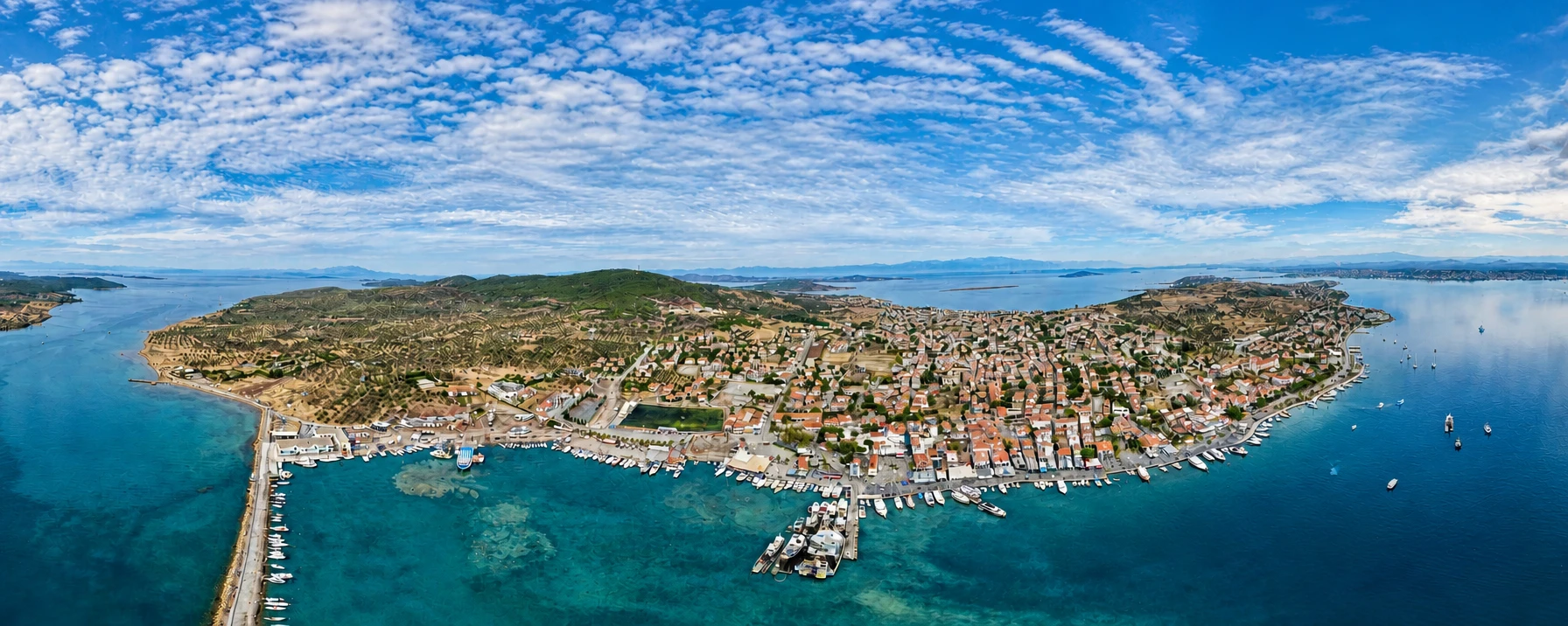
Continue through Ayvalık to Cunda for historic stone streets, church heritage, waterfront restaurants and island atmosphere.
View Cunda Guide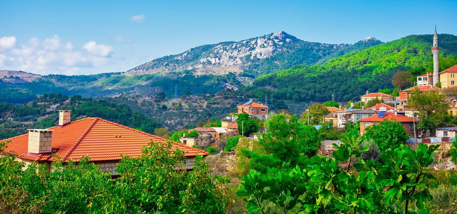
Cross to the northern side of the Gulf for forests, springs, mythology, mountain villages and one of northwestern Türkiye's great natural landscapes.
View Kazdağı Guide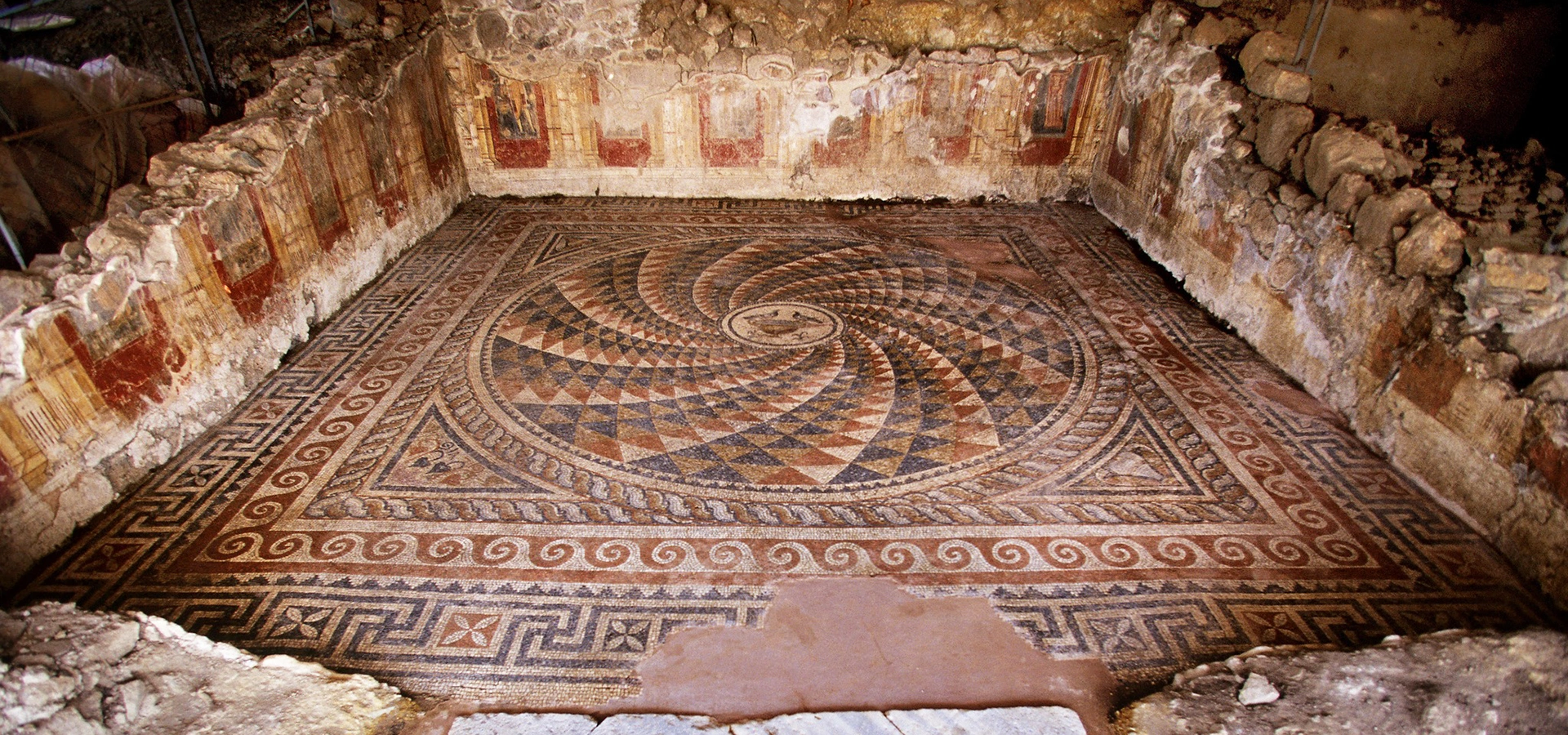
Compare Adramytteion with another major Edremit Gulf city, known for its necropolis, Roman residential remains and Mount Ida connections.
View Antandros Guide