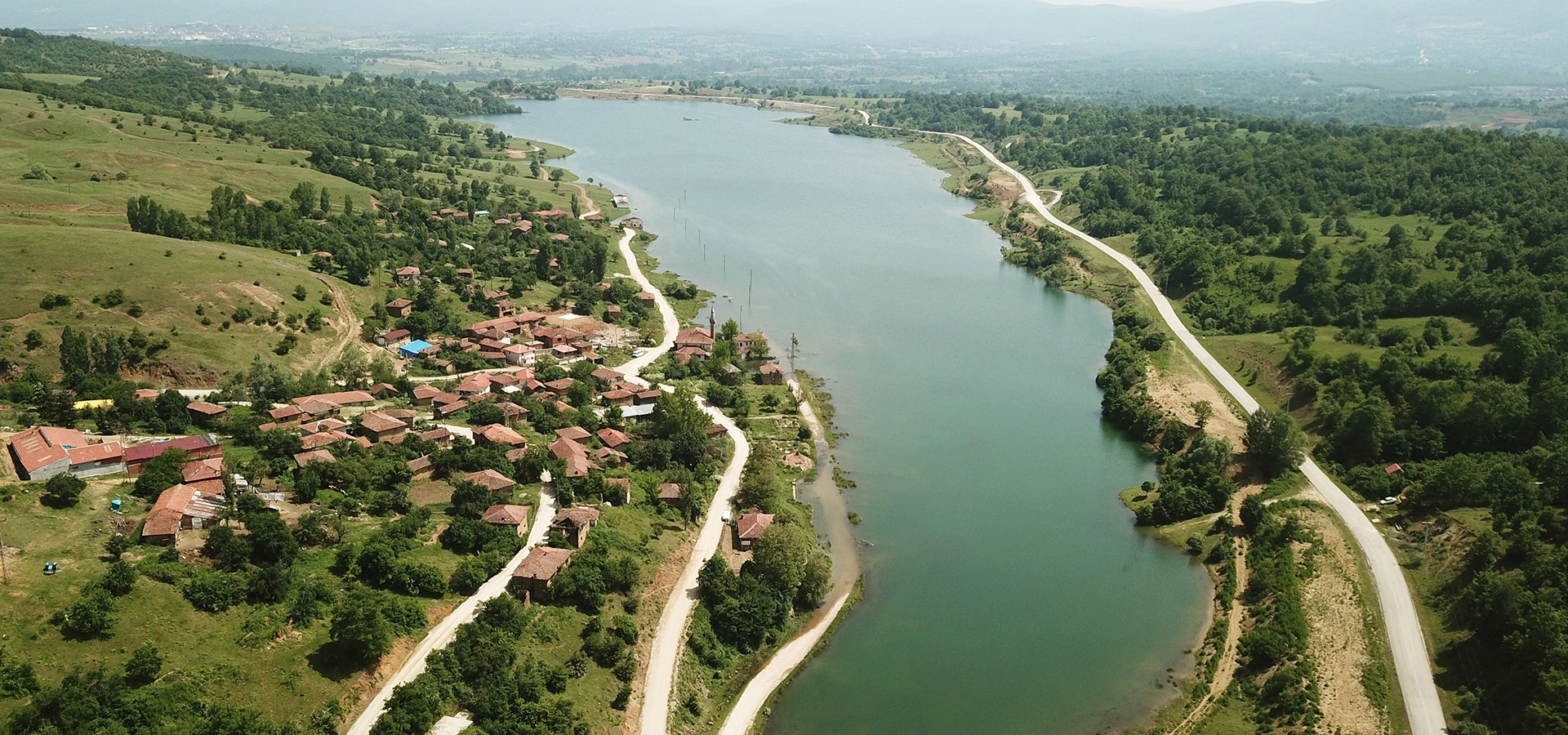
Private Günyurdu Nature Experience
Ask us about a tailor-made route combining Günyurdu Pond, the old-village landscape, Pazaryeri’s countryside and selected nature and cultural places in the district.
Request a Custom Tour





Günyurdu Pond, also known as Günyurdu Baraj Göleti or Günyurdu (Bakraz) Barajı, is a reservoir in the Pazaryeri district of Bilecik Province. Built on the Bakraş Stream primarily for agricultural irrigation, the dam was constructed between 1993 and 2001.
Today, the reservoir combines an important working-water function with one of Pazaryeri’s most unusual rural landscapes. Its calm water, open shoreline, surrounding countryside and views toward the former settlement make it a rewarding stop for photography, walking, picnics, camping and recreational fishing.
What makes Günyurdu especially distinctive is the story of old Günyurdu village. Part of the former settlement was left beneath the reservoir waters after the dam was created, giving the area a striking sense of memory and change. Depending on water level and viewpoint, the landscape can reveal unusual traces and perspectives connected with the old village.
The reservoir also attracts birdlife. Official local tourism information specifically mentions angut birds — ruddy shelducks — sometimes seen with their young, making the pond particularly interesting for patient nature photographers.
Günyurdu is easy to combine with other rural attractions around Pazaryeri. It fits naturally into a route including Bozcaarmut Pond, Küçükelmalı, Büyükelmalı, Kınık Waterfall and other countryside destinations across Bilecik Province.
Official local sources give the reservoir an elevation of approximately 835 metres.
The Günyurdu Dam was constructed during this period for irrigation.
The reservoir covers approximately 0.43 km² at normal water level.
Part of the former Günyurdu settlement lies beneath the reservoir waters.
Essential information for planning a visit to this unusual reservoir landscape near Pazaryeri.
Günyurdu, Pazaryeri district, Bilecik Province.
Open on Google MapsApproximately 6.9 km by the official described route.
Approximately 835 metres above sea level.
Approximately 0.43 km² at normal water level.
Built between 1993 and 2001 on the Bakraş Stream.
Agricultural irrigation for approximately 805 hectares.
Ruddy shelducks, known locally as angut, are specifically noted in official sources.
Fishing, photography, walking, camping and countryside recreation.
Part of the former village was submerged after the reservoir was created.
Approx. 40.036069, 29.842797.
A working irrigation reservoir, a nature-recreation area and the landscape of a partially submerged village come together at Günyurdu.
Günyurdu is more than a scenic pond. Its strongest character comes from the combination of engineering, agriculture, landscape and local memory. The reservoir exists because of a dam constructed to support irrigation, yet over time the water and surrounding countryside have also become a place for outdoor recreation.
The most unusual element is the former Günyurdu village landscape. Part of the old settlement remained within the area affected by the reservoir, creating a visual reminder of how major water projects can reshape rural geography.
The site also has ecological interest. Open water provides habitat and resting space for birds, while official local descriptions particularly highlight angut birds with their young. For visitors willing to remain quiet and observe carefully, the reservoir can therefore be rewarding beyond its scenic views.
Finally, Günyurdu belongs to a broader network of ponds, forests and villages around Pazaryeri. The concentration of nearby natural attractions makes the district especially suitable for slow countryside itineraries rather than a single isolated stop.
The reservoir was formed by Günyurdu Dam on the Bakraş Stream. Official provincial sources state that construction took place between 1993 and 2001, with irrigation as the primary purpose.
The dam is described as a rock-fill structure. Its body volume is approximately 546,000 cubic metres, and its height from the stream bed is approximately 46 metres.
At normal water level, the reservoir has a volume of approximately 7.40 hm³ and a surface area of around 0.43 km². The project provides irrigation service to roughly 805 hectares of agricultural land.
These figures help explain why Günyurdu should be understood as both a visitor destination and an active piece of regional water infrastructure. Visitors should therefore respect any operational, restricted or signed areas around the dam.
Rock-fill dam.
Approximately 46 metres from the stream bed.
Approximately 7.40 hm³ at normal water level.
Approximately 805 hectares of agricultural land.
One of the most memorable aspects of Günyurdu Pond is its connection with the former Günyurdu village. Official local descriptions explain that part of the village was left beneath the reservoir waters, creating dramatic and unusual photographic scenes.
The old village area is reached by continuing around the reservoir. Official directions place it approximately 3.5 km beyond the main reservoir approach when following the road around the water.
The appearance of submerged or former-settlement features can vary with water level, season and viewpoint. For that reason, visitors should not expect the landscape to look exactly the same throughout the year.
The area should be approached respectfully. This is not simply a picturesque ruin setting: it is connected with a real community landscape transformed by the creation of the reservoir.
At approximately 835 metres above sea level, Günyurdu lies within the rolling rural landscape of Pazaryeri. Its visual character differs from the heavily forest-enclosed setting of Bozcaarmut Pond.
Here, the broad water surface, agricultural surroundings, low hills and traces of the former settlement combine to create a more open landscape. The result is especially attractive when changing light moves across the reservoir.
The shoreline can appear very different depending on seasonal water levels. Exposed banks, receding water, green spring growth or dry late-summer tones can all alter the visual character of the same viewpoint.
Weather also matters. Bright days produce clear blue water and broad sky reflections, while cloud, fog and subdued light can emphasize the quieter and more haunting character of the old-village landscape.
Official local tourism sources specifically mention angut birds, known in English as ruddy shelducks, as one of the characteristic wildlife sights at Günyurdu. Visitors may occasionally see adults moving across the water with their young.
Reservoirs can also support a wider range of waterbirds, insects, amphibians and aquatic life, although wildlife sightings are never guaranteed. Quiet observation is usually more rewarding than walking quickly along the shore.
Early morning is often a good time for birdwatching because visitor activity and wind may be lower. A pair of binoculars or a telephoto lens allows visitors to observe birds without approaching nesting or resting areas.
Never feed waterbirds, disturb young birds, approach nests or release fishing line and hooks into wildlife habitat.
Ruddy shelducks are specifically mentioned in official descriptions of the pond.
Quiet conditions can improve the chances of observing bird activity.
Use binoculars or a long lens rather than approaching birds closely.
Do not leave fishing line, food waste or plastic near the shoreline.
The Ministry of Culture and Tourism’s Culture Portal identifies recreational rod fishing as one of the reasons Günyurdu has become a popular countryside recreation area. Local tourism information also lists fishing among the reservoir’s outdoor activities.
Fishing in Türkiye’s inland waters is regulated. Species rules, closed seasons, minimum sizes, daily catch limits and other restrictions can change. Always check the current recreational inland-fishing regulations before fishing.
Do not assume that old blog posts or previous local practice reflect current regulations. Temporary restrictions, water-management conditions or conservation measures can take priority.
Anglers should remove all line, hooks, packaging and bait waste. Lost monofilament and hooks are especially dangerous to birds using the reservoir.
Fishing seasons and legal limits can change.
Avoid steep, unstable or muddy shoreline sections.
Never leave line or hooks where waterbirds can become entangled.
Remove all food, bait and equipment packaging when you leave.
Pazaryeri tourism information lists Günyurdu among destinations associated with recreation, camping, fishing and trekking. The reservoir’s open scenery makes it attractive for visitors who want to spend several quiet hours outdoors.
Travelers should still approach the site as a rural reservoir rather than a guaranteed full-service commercial campground. Facilities, water points, toilets, waste collection and maintained picnic furniture can vary.
Bring sufficient drinking water, food, sun protection, warm layers and everything needed to remove waste afterward. At 835 metres, evenings can become noticeably cooler than daytime conditions.
During dry periods, forest and countryside fire restrictions are extremely important. Never assume that a barbecue or open flame is permitted. Follow all current local, forestry and provincial rules.
Do not rely on shops or staffed services immediately beside the water.
Seasonal restrictions may prohibit barbecues and open flames.
Wind, rain and evening temperature changes can affect comfort quickly.
Take bottles, food packaging and all other rubbish with you.
Walking is one of the best ways to understand the scale and character of Günyurdu. Even a short stroll can reveal changing views across the water, birdlife, farmland and the old-village landscape.
The route toward the former village continues around the reservoir, but visitors should not assume that every shoreline section is a formal, engineered walking trail. Ground conditions may include soil, gravel, mud, grass, stones and uneven slopes.
After rain, snow or prolonged wet weather, some sections can become slippery or difficult. Strong footwear is preferable to smooth-soled city shoes.
If continuing farther into rural roads, save offline navigation and be aware of agricultural, reservoir-management and local vehicle traffic.
Enjoy changing viewpoints along accessible reservoir-side areas.
The former settlement lies farther around the reservoir.
Choose shoes suitable for gravel, mud and uneven rural ground.
Save the reservoir coordinates before leaving Pazaryeri.
Günyurdu offers a very different photographic experience from a conventional park or lake. Its strongest subjects include reservoir reflections, open countryside, waterbirds and the partially submerged old-village landscape.
Official local tourism descriptions specifically point to the dramatic imagery created by the village area affected by the reservoir. Changing water levels can make the same location look very different from one visit to another.
For wildlife photography, watch quietly for angut birds and their young. A telephoto lens is preferable to approaching birds, particularly during breeding periods.
Morning and late-afternoon light can add depth to the low hills and shoreline. Cloudy or misty weather may be especially effective if you want to emphasize the reservoir’s more atmospheric, reflective character.
Use distant and safe viewpoints to photograph the altered settlement landscape.
A long lens is useful for photographing ruddy shelducks without disturbing them.
Calm water can mirror the sky and surrounding slopes.
Changing reservoir levels can reveal very different shoreline compositions.
Günyurdu can be visited in several seasons, but the experience changes with weather, vegetation, bird activity and reservoir water level.
Spring brings green countryside, cool temperatures and active birdlife. Rain can make unpaved ground soft or muddy, so waterproof footwear may be useful.
Summer is generally easier for long outdoor visits, picnics and walking. Shade can be limited in some open areas, so sun protection and drinking water are important.
Autumn brings softer light and changing countryside colours. Lower-angle sunlight can be particularly effective for reservoir photography.
Winter can create atmospheric scenery, but frost, snow, cold wind and muddy roads may complicate access. Check conditions before traveling.
Günyurdu Pond lies in the Pazaryeri district of Bilecik Province and is reached from the district centre by following the road toward the Günyurdu and Büyükelmalı direction.
Official local directions state that the road reaches the relevant junction after approximately 4.2 km. From there, continue north for another 2.7 km to reach the reservoir.
The pond lies at approximately 835 metres elevation. Official coordinates are 40°02'09.85"N, 29°50'34.07"E, equivalent to approximately 40.036069, 29.842797.
Günyurdu is an outdoor reservoir landscape rather than a museum-style visitor attraction. Do not expect fixed ticket counters, guaranteed staffed services or standardized visitor facilities.
Bring drinking water, appropriate footwear, sun protection and a warm layer. For emergency assistance in Türkiye, call 112.
Günyurdu is a peaceful countryside destination, but it remains an active reservoir environment. Changing water levels, steep or muddy banks, operational infrastructure and variable weather require sensible precautions.
Water-edge ground may be soft, steep, muddy or unstable.
Keep young visitors close beside the reservoir and rural roads.
Do not enter unstable remains, exposed foundations or restricted dam infrastructure.
Rain, fog, frost and wind can change conditions quickly.
Gravel, mud and sloping ground require footwear with good grip.
Follow current local restrictions during dry periods.
Treat the reservoir as unsupervised water unless authorities explicitly designate otherwise.
Call 112 for emergency assistance in Türkiye.
Günyurdu should be approached as a rural outdoor destination rather than a fully accessible urban park. The experience available to each visitor depends on road, parking and shoreline conditions.
Some reservoir views may be possible from relatively close to a vehicle, but areas around the water can include gravel, grass, mud, slopes, loose soil and uneven surfaces.
Wheelchair users and travelers with limited mobility should not assume that continuous paved, step-free routes or accessible toilets are available around the reservoir.
If particular accessibility facilities are essential, confirm the latest local conditions before traveling.
From Pazaryeri district centre, follow the road in the direction of the Günyurdu and Büyükelmalı area. Official directions state that after approximately 4.2 km, the road separates toward Günyurdu and Büyükelmalı.
At the junction, continue north. After approximately 2.7 km, you reach Günyurdu Baraj Göleti.
Visitors who continue around the reservoir for roughly 3.5 km can reach the area associated with old Günyurdu village. Drive cautiously, as conditions on local and reservoir-side roads may vary.
For navigation, search for “Günyurdu Baraj Göleti, Pazaryeri, Bilecik” or save the coordinates 40.036069, 29.842797.
Leave Pazaryeri toward the Günyurdu and Büyükelmalı direction.
Reach the relevant junction after approximately 4.2 km.
Continue north for approximately 2.7 km to the reservoir.
Continue around the reservoir approximately 3.5 km farther.
Use 40.036069, 29.842797 as a coordinate backup.
Check locally for snow, frost, mud and slippery road conditions.
For a simple sightseeing stop, 45–60 minutes allows time to enjoy the reservoir, take photographs and make a short walk.
A more relaxed 1.5–2 hour visit gives you time to explore several viewpoints, watch for birds and spend longer beside the water.
A half day works well if you want to continue toward the old-village area, photograph changing shoreline perspectives or spend time fishing.
A full day can combine Günyurdu with other Pazaryeri nature destinations such as Bozcaarmut Pond, Küçükelmalı, Büyükelmalı or Kınık Waterfall.
Main reservoir views and a short photography stop.
Walking, birdwatching and several shoreline viewpoints.
Add the old-village area or spend more time fishing and photographing.
Combine several Pazaryeri ponds and countryside attractions.
Begin at one of the safe, open reservoir viewpoints and take time to understand the scale of the water and surrounding countryside. The broad surface and rural setting are very different from Pazaryeri’s more enclosed forest ponds.
Continue with a short walk along safe ground, watching for angut birds and other waterbirds. Keep your distance from wildlife and avoid approaching nesting areas.
If road and weather conditions are suitable, continue around the reservoir toward the old Günyurdu village landscape. The changing relationship between water and former settlement is the most distinctive part of the visit.
Finish with a picnic or quiet photography stop, then continue toward another nearby Pazaryeri attraction if daylight allows.
Günyurdu works especially well as part of a Pazaryeri ponds and countryside route, combining reservoirs, forests, villages and waterfalls within a relatively compact district.
Discover one of Pazaryeri’s most beautiful forest reservoirs, known for pine-framed water, reflections and peaceful scenery.
Visit another quiet reservoir near Büyükelmalı Village, surrounded by pine and oak woodland.
Continue toward another well-known Pazaryeri waterside recreation landscape surrounded by greenery.
Explore a contrasting landscape of forest, rock and flowing water in the Pazaryeri countryside.
Visit one of Bilecik Province’s best-known waterside recreation areas near the provincial centre.
Discover Ottoman heritage, museums, forests, waterfalls, ponds and historic towns across the province.
Pazaryeri contains an unusually rich concentration of ponds, reservoirs, forests and rural recreation areas. Günyurdu is one of the district’s larger and most historically distinctive water landscapes.
Nearby destinations include Büyükelmalı, Küçükelmalı, Bozcaarmut and Esere, each with a different combination of water, forest, farmland and countryside atmosphere.
This makes it possible to design a day around several short nature stops without spending most of the itinerary driving between distant parts of the province.
Road quality, facilities and seasonal conditions can differ significantly between destinations, so a flexible plan is better than assuming identical visitor infrastructure at every pond.
Carry away bottles, food packaging, tissues and all other rubbish.
Do not throw food, chemicals, cigarette ends or waste into the reservoir.
Observe angut birds and other wildlife from a distance.
Follow current regulations and remove all hooks and fishing line.
Do not damage, climb on or remove material from any exposed historical remains.
Never use flames when local or seasonal restrictions prohibit them.
Do not block rural roads, agricultural access or reservoir infrastructure.
Quiet behavior improves both the visitor experience and wildlife protection.
It is in the Pazaryeri district of Bilecik Province, northwestern Türkiye.
It is commonly called Günyurdu Göleti, Günyurdu Baraj Göleti or Günyurdu (Bakraz) Barajı.
It was built primarily for agricultural irrigation. Official provincial information states that it serves approximately 805 hectares.
Construction took place between 1993 and 2001.
The dam was built on the Bakraş Stream.
Official local sources give an elevation of approximately 835 metres above sea level.
At normal water level, official sources give a reservoir area of approximately 0.43 km².
Its normal-water-level volume is approximately 7.40 hm³.
The official coordinates are approximately 40°02'09.85"N, 29°50'34.07"E, or 40.036069, 29.842797.
The official described route is approximately 4.2 km to the junction and another 2.7 km to the reservoir, or roughly 6.9 km in total.
Official local sources state that part of the former village was left beneath the reservoir waters after the dam was created.
Official directions state that after reaching the reservoir, continuing around it for approximately 3.5 km leads to the old-village area.
Official local tourism information specifically mentions angut birds — ruddy shelducks, sometimes seen with their young. Other waterbirds may also occur.
Yes, recreational rod fishing is specifically associated with the reservoir. Always follow current inland-water fishing regulations, closed seasons and catch limits.
The reservoir is promoted as a countryside recreation and picnic destination. Bring your own supplies and follow all current fire and waste regulations.
Local tourism information lists camping among the activities associated with Günyurdu. Visitors should still check current local restrictions and not assume commercial-campground facilities are available.
Yes. Local tourism information lists trekking among the area’s activities, although reservoir-side ground can be uneven, muddy or unpaved.
Yes. The combination of open water, birdlife, changing reservoir levels and the former-village landscape makes Günyurdu particularly distinctive for photography.
Visitors should not assume that the reservoir is a designated or supervised swimming area. Treat the water as an active reservoir and follow any local restrictions or warning signs.
The official visitor sources used for this guide present Günyurdu as an outdoor reservoir and recreation area, not as a museum-style attraction with standard published opening hours. Local arrangements can change.
Facility availability can change. Visitors should not depend on toilets, shops or potable water without current local confirmation and should bring sufficient drinking water.
It can be an enjoyable family nature stop, but children must be closely supervised near water, steep banks, roads and reservoir infrastructure.
Formal continuous step-free infrastructure should not be assumed. Some views may be possible from near a vehicle, but natural ground around the reservoir can be uneven.
Search for “Günyurdu Baraj Göleti, Pazaryeri, Bilecik” or use 40.036069, 29.842797.
Consider combining Günyurdu with Bozcaarmut Pond, Büyükelmalı Pond, Küçükelmalı, Kınık Waterfall and other Pazaryeri countryside attractions.
It is especially interesting for travelers who enjoy quiet reservoir scenery, birdlife, photography, rural landscapes and places with a strong local story.
Combine Günyurdu Pond with rural landscapes, traditional villages and selected historical attractions around Bilecik through a private itinerary designed around your interests and pace.
Enjoy a tailor-made day combining reservoir scenery, the old-village landscape, Pazaryeri countryside and selected nearby nature stops.
Ask us about a tailor-made route combining Günyurdu Pond, the old-village landscape, Pazaryeri’s countryside and selected nature and cultural places in the district.
Request a Custom Tour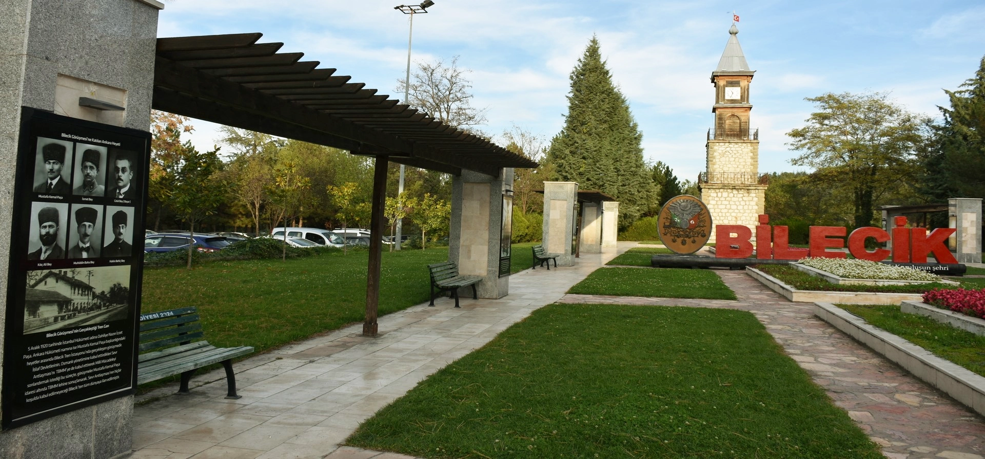
Discover Ottoman foundation history, forest landscapes, ponds, waterfalls, villages and historic towns throughout Bilecik Province.
View Bilecik GuidePair Günyurdu’s reservoir scenery and unusual village story with nearby forest landscapes, ponds and waterfalls.
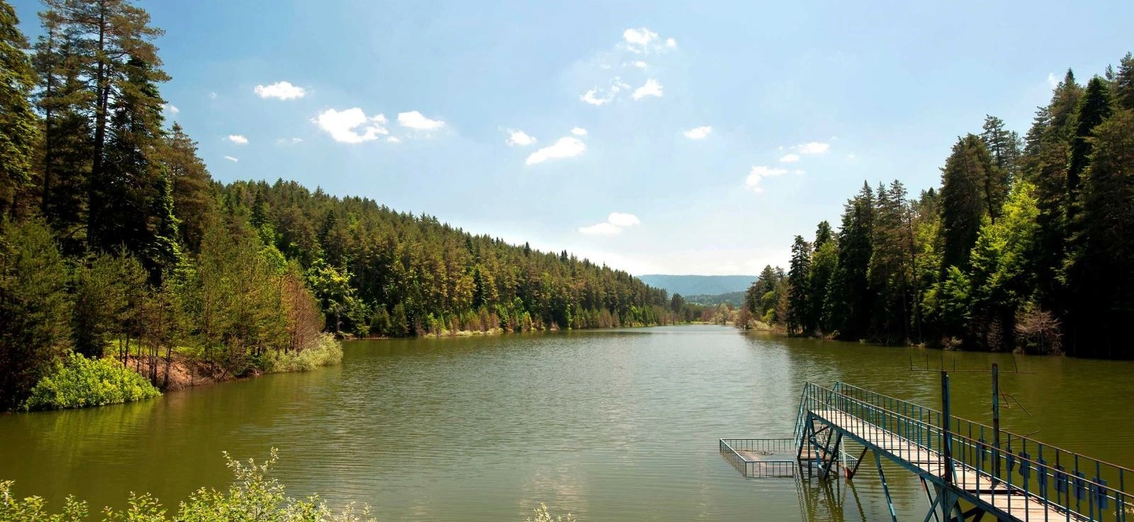
Discover pine-framed water, forest reflections and one of Pazaryeri’s most peaceful nature landscapes.
Explore Bozcaarmut Pond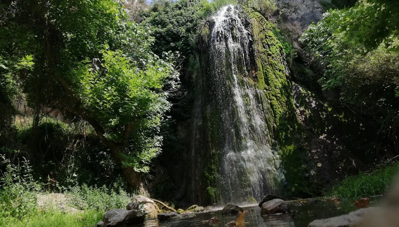
Continue through Pazaryeri’s countryside to explore forest scenery, rock formations and flowing water around Kınık.
Explore Kınık Waterfall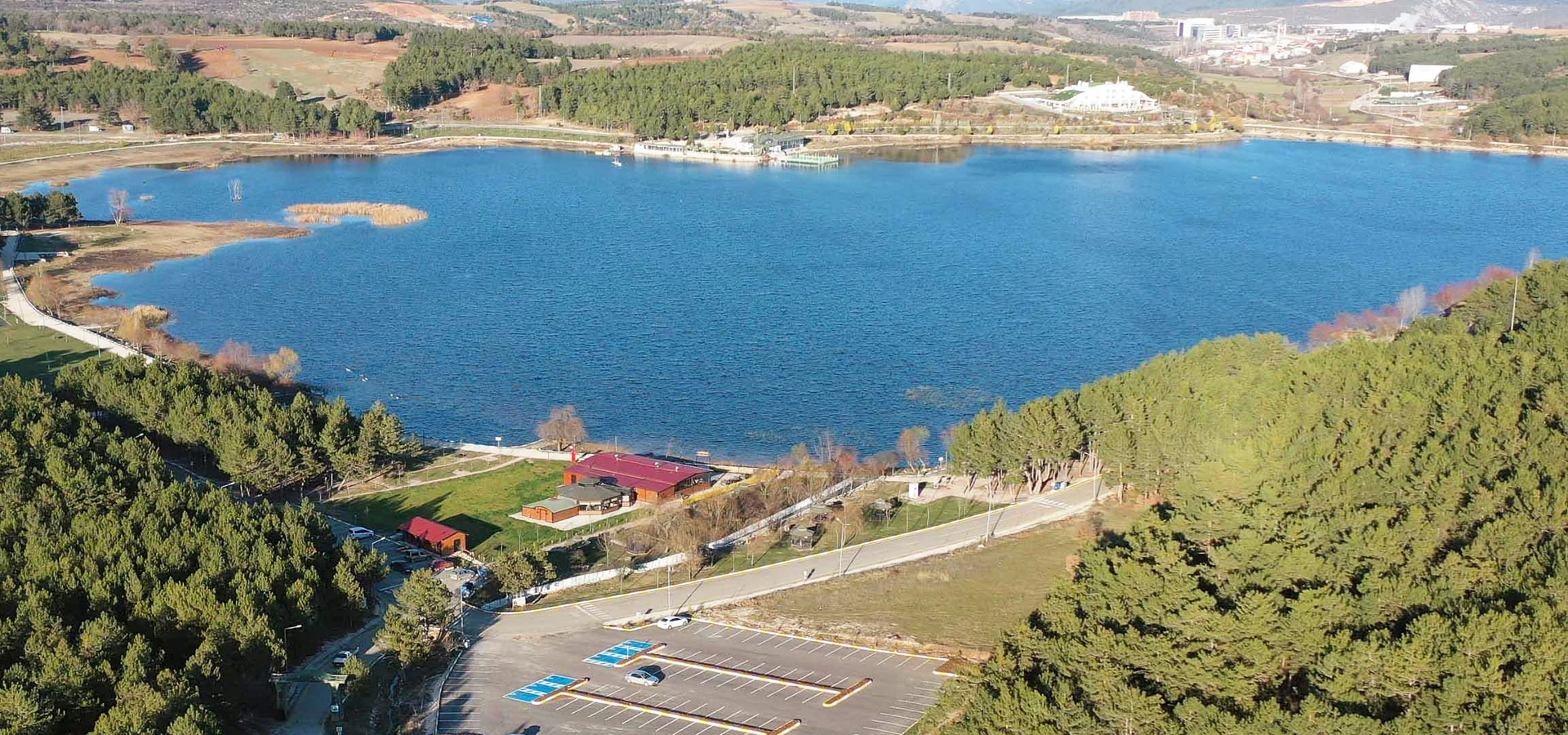
Discover another popular Bilecik waterside landscape with recreation areas and peaceful views close to the provincial centre.
Explore Pelitözü Pond