Private Bozcaarmut Nature Experience
Ask us about a tailor-made route combining Bozcaarmut Pond, Pazaryeri’s forest scenery and selected nature and cultural places in the district.
Request a Custom Tour





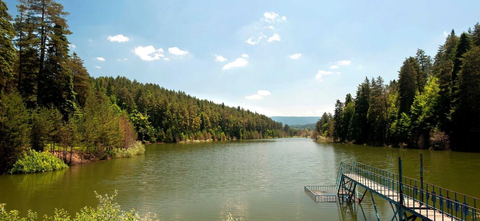
Bozcaarmut Pond, known in Turkish as Bozcaarmut Göleti or Bozcaarmut Baraj Göleti, is a peaceful reservoir near Bozcaarmut Village in the Pazaryeri district of Bilecik Province. Surrounded by forest and lying at approximately 1,090 metres above sea level, the pond has become one of the district’s best-known destinations for quiet nature visits, photography, walking, picnics and recreational fishing.
The attraction of Bozcaarmut comes from its simplicity. Still water lies between wooded slopes, while pine trees descend toward the shoreline and create striking reflections when the surface is calm. The absence of a heavily developed tourism atmosphere gives the area a peaceful, rural character.
The Ministry of Culture and Tourism highlights the pond’s unspoiled natural setting, surrounding pine trees, fresh air, silence and suitability for rod fishing. The wider forest landscape also changes dramatically through the seasons, particularly during autumn when deciduous trees introduce yellow, orange and copper tones among the darker evergreens.
Bozcaarmut Pond is relatively easy to include in a Pazaryeri nature itinerary. From Pazaryeri, travelers continue approximately 5.5 km to Bozcaarmut Village, then follow the road for another 2.9 km to the reservoir. The final approach passes through attractive countryside and forest scenery.
For travelers exploring the wider province, Bozcaarmut fits naturally into a route through Bilecik’s forests, ponds, villages and nature attractions. It can also be paired with Küçükelmalı Nature Park, Kınık and other rural landscapes around Pazaryeri.
Official sources give the pond an elevation of approximately 1,090 metres.
The reservoir lies approximately 2.9 km beyond Bozcaarmut Village.
Wooded shores and forest reflections define the scenery.
Popular for quiet outdoor visits, photography, walking and fishing.
Essential information for planning a visit to this forest reservoir near Pazaryeri.
Bozcaarmut Village, Pazaryeri district, Bilecik Province.
Open on Google MapsApproximately 8.4 km via Bozcaarmut Village.
Approximately 1,090 metres above sea level.
A reservoir surrounded by forest and pine-dominated scenery.
Official tourism information identifies the pond as suitable for rod fishing.
Walking, photography, picnics, fishing and quiet nature visits.
Forest reflections and autumn colours are among the strongest subjects.
Highland weather can be cooler and more changeable than lower areas.
Approx. 39.962022, 29.788183.
Nature tourism and countryside recreation.
Still water, forested slopes, quiet surroundings and changing seasonal colours create one of Bilecik’s most photogenic rural landscapes.
The strongest feature of Bozcaarmut Pond is the relationship between water and forest. The reservoir occupies a sheltered landscape where trees approach the shoreline, allowing the surrounding woodland to dominate almost every view.
When wind conditions are calm, the water can reflect the forest and sky with remarkable clarity. This gives Bozcaarmut a very different character from open, exposed reservoirs surrounded by farmland or urban development.
Its second attraction is quietness. Official tourism descriptions repeatedly emphasize the fresh air, silence and natural beauty of the area. For visitors accustomed to crowded attractions, this peaceful atmosphere is a major part of the experience.
Bozcaarmut is also valuable as part of the wider Pazaryeri nature-tourism landscape. Nearby forests, villages, ponds and recreation areas allow travelers to combine several different outdoor environments in a single day.
Bozcaarmut Pond occupies a forested highland environment at approximately 1,090 metres. The reservoir is enclosed by wooded slopes, creating a sheltered feeling and limiting long-distance horizons.
Instead of dramatic mountain summits, the visual appeal comes from layers of water, shoreline vegetation and forest. The shape of the reservoir creates changing perspectives as visitors move along accessible sections of the shore.
Pine trees are among the defining features mentioned by official tourism sources, although the surrounding Pazaryeri forests also contain deciduous species that become especially visible in autumn.
Weather plays a major role in the appearance of the pond. A bright summer day can produce strong green-and-blue reflections, while overcast autumn mornings can create darker water, misty forest tones and a much more atmospheric landscape.
The forest surrounding Bozcaarmut is one of the main reasons the reservoir feels so secluded. Official tourism information particularly emphasizes the pine trees surrounding the water.
The wider Pazaryeri forest landscape contains both evergreen and deciduous trees. Regional autumn reporting has documented species including pine, beech, oak, maple, willow and poplar around the forests associated with Bozcaarmut and nearby Küçükelmalı.
This mixture creates strong seasonal variation. Evergreen trees maintain dark green structure throughout the year, while deciduous woodland introduces bright spring growth and dramatic autumn colour.
Visitors should avoid breaking branches, collecting plants or driving onto sensitive forest-floor vegetation. The natural appearance of the shoreline is one of the pond’s greatest assets.
Evergreen forest creates much of the pond’s characteristic scenery.
Beech, oak, maple, willow and poplar contribute seasonal variety.
Yellow, orange and copper tones contrast beautifully with dark evergreen forest.
Plants around the water soften the transition between reservoir and forest.
A reservoir surrounded by woodland creates habitat for birds, insects, amphibians, small mammals and aquatic life. Visitors who spend time quietly near the water may notice more wildlife than those making only a short roadside stop.
Bird activity can be particularly noticeable around water, forest margins and quieter shoreline areas. Early morning is generally the best period for observing birds before visitor activity increases.
As with any natural forest destination, wildlife should be watched rather than approached. Do not feed wild animals, disturb nests or attempt to handle snakes, amphibians or other species encountered on trails.
The Ministry of Culture and Tourism’s Culture Portal specifically describes Bozcaarmut Pond as suitable for rod fishing, making fishing one of the best-established recreational activities associated with the reservoir.
Fishing in inland waters in Türkiye is regulated. Closed seasons, species rules, minimum sizes, daily limits and other restrictions can change, so visitors should check the current recreational inland-fishing regulations before casting a line.
Do not rely on information from old travel blogs when determining whether fishing is currently permitted. Local restrictions and seasonal conservation measures take priority.
Anglers should also remove fishing line, hooks, bait containers and all other waste. Discarded fishing equipment can be especially dangerous to birds and other wildlife.
Fishing seasons and species restrictions can change.
Observe legal size and catch limits.
Never leave line, hooks or bait packaging behind.
Avoid unstable, steep or slippery shoreline sections.
Bozcaarmut is widely visited as a nature-recreation and picnic destination, and its quiet forest setting also attracts visitors interested in simple outdoor stays.
However, travelers should treat the area as a natural rural destination rather than a full-service commercial campground. The availability and condition of toilets, water points, picnic furniture or other facilities can vary by season and maintenance.
Anyone planning to spend several hours or camp in the area should arrive with sufficient drinking water, food, warm clothing, rain protection and everything needed to remove waste afterward.
Forest-fire restrictions are extremely important during dry periods. Never assume that a barbecue or open flame is permitted simply because other visitors have used one previously. Current forestry and local authority rules should always be followed.
Do not depend on shops or staffed visitor services beside the reservoir.
At 1,090 metres, evenings can be much cooler than daytime conditions suggest.
Seasonal forest-fire restrictions can prohibit flames and barbecues.
Take all rubbish away, including food waste and disposable barbecue material.
Walking is one of the simplest ways to enjoy Bozcaarmut. Even a short stroll allows visitors to experience different angles across the water, forest reflections and quieter sections away from parked vehicles.
The terrain should not be confused with a fully engineered promenade. Natural ground can include soil, leaves, roots, stones, mud and uneven slopes, especially close to the water and along forest tracks.
After rain or snow, some areas may become slippery. Good walking shoes are preferable to smooth-soled urban footwear.
Visitors planning to continue farther into surrounding woodland should use reliable navigation and avoid assuming that every forestry road is a marked recreational trail.
Explore accessible shoreline viewpoints and nearby forest scenery.
Longer exploration may follow rural or forestry roads rather than formal trails.
Choose shoes with grip for leaves, mud and uneven ground.
Save offline maps before entering more remote wooded areas.
Bozcaarmut is particularly attractive for landscape, forest and seasonal photography. The water creates a natural foreground, while surrounding trees form layers of texture and colour behind it.
On calm mornings, forest reflections can become one of the strongest compositions. A light breeze can change the surface within minutes, so photographers interested in mirror-like water should arrive early.
Autumn brings a different visual character. Yellow and orange foliage mixed with evergreen pine creates strong colour contrast, especially when reflected across darker water.
Fog, cloud and low light should not necessarily be considered poor conditions. At Bozcaarmut, mist and subdued weather can make the landscape more atmospheric than bright midday sunshine.
Often best for calm water, soft light and reflections.
Forest colour produces some of the pond’s most distinctive scenery.
Soft light reduces harsh contrast across water and woodland.
Use trees and sky reflected in the reservoir to create layered compositions.
Bozcaarmut can be visited in different seasons, but conditions and scenery change considerably because of its 1,090-metre elevation and forest setting.
Spring brings fresh vegetation, cool air and renewed forest colour. Rain can make unpaved ground soft or muddy, so waterproof footwear can be useful.
Summer is generally the easiest season for picnics, walking and long outdoor visits. Forest shade can make the area more comfortable than exposed open landscapes.
Autumn is particularly rewarding for photographers. Deciduous trees around the Pazaryeri forests turn yellow, gold and orange while evergreen trees retain darker tones.
Winter can create beautiful forest and reservoir scenery, but snow, frost and ice make road, walking and shoreline conditions more demanding.
Bozcaarmut Pond lies near Bozcaarmut Village in Pazaryeri district and is approximately 8.4 km by the official described route from Pazaryeri.
Official sources give the reservoir an elevation of approximately 1,090 metres and coordinates of 39°57'43.28"N, 29°47'17.46"E, equivalent to approximately 39.962022, 29.788183.
The pond is a natural outdoor attraction rather than a museum-style visitor site. Do not expect fixed museum opening hours, ticket counters or guaranteed staffed services.
Access conditions can still change because of weather, forestry work, maintenance, fire restrictions or other local measures.
Bring drinking water, suitable footwear, sun protection and a warm layer. For emergency assistance in Türkiye, call 112.
Bozcaarmut is a peaceful destination, but visitors should remember that they are entering a natural reservoir and forest environment. Shoreline slopes, changing water levels, wet ground and seasonal weather require sensible precautions.
Water-edge ground may be steep, muddy or slippery.
Young visitors should remain closely supervised near the reservoir.
Rain, fog, frost and temperature changes can alter conditions quickly.
Forest paths and shoreline ground can become slippery when wet.
Do not rely entirely on seasonal or outdoor water points.
Follow all current forestry restrictions during dry periods.
Do not enter operational or restricted reservoir infrastructure.
Call 112 for emergency assistance in Türkiye.
Bozcaarmut should be approached as a rural natural area rather than a fully accessible urban park. The experience available to each visitor depends on road, parking and ground conditions.
Some views may be enjoyed relatively close to a vehicle, but shoreline and forest terrain can include slopes, loose soil, leaves, grass, mud, stones and uneven surfaces.
Wheelchair users and travelers with limited mobility should not assume that continuous paved, step-free routes or accessible toilets will be available around the reservoir.
Visitors for whom specific facilities are essential should confirm the latest local conditions before traveling.
The official route begins from Pazaryeri district centre. Travel in the direction of Kınık and Küçükelmalı. After approximately 5.5 km, you reach Bozcaarmut Village.
Continue through the village and follow the road for another 2.9 km to reach Bozcaarmut Pond. The approach passes into attractive forest scenery, making the drive part of the overall experience.
For navigation, use “Bozcaarmut Göleti, Pazaryeri, Bilecik” or save the official coordinates: 39.962022, 29.788183.
Road conditions can change after heavy rain, snow, frost or forestry work. Drivers visiting outside the warmer months should allow additional time and assess conditions locally.
Leave Pazaryeri toward Kınık and Küçükelmalı.
Reach Bozcaarmut Village after approximately 5.5 km.
Continue approximately 2.9 km from the village to the pond.
Use coordinates 39.962022, 29.788183 as a backup.
The final journey passes through attractive wooded countryside.
Check for snow, frost and slippery road conditions before traveling.
For a simple sightseeing visit, 45–60 minutes allows enough time to enjoy the main scenery, take photographs and make a short walk.
A more relaxed 1.5–2 hour visit gives you time to explore different shoreline viewpoints, walk through nearby forest scenery and enjoy a picnic.
A half day works particularly well for photographers, anglers or visitors who simply want to spend a quiet period outdoors.
A full day can include Bozcaarmut together with other Pazaryeri attractions such as Küçükelmalı Nature Park or Kınık Waterfall.
Main views, photographs and a short walk.
Slower exploration and a relaxed picnic.
Ideal for photography, fishing or extended time in nature.
Combine the pond with other Pazaryeri nature attractions.
Begin with a slow approach through Bozcaarmut Village and the surrounding forest. The transition from rural settlement to wooded reservoir landscape is part of the character of the trip.
After parking safely, walk to an open viewpoint and spend a few minutes taking in the forest-lined water and reflections. Avoid blocking rural roads or access routes.
Continue with a short walk along safe, accessible ground near the reservoir. The scenery changes as the shoreline curves and different groups of trees come into view.
If you have brought food, choose an appropriate established recreation area for a quiet picnic. Keep all rubbish with you until it can be disposed of properly.
After Bozcaarmut, continue toward another Pazaryeri attraction if daylight and conditions allow. Küçükelmalı Nature Park is a natural companion destination, while Kınık adds a different rural landscape to the day.
Bozcaarmut works especially well as part of a Pazaryeri countryside and nature route, combining reservoirs, forest recreation areas, villages and waterfalls.
Explore a protected forest-and-wetland landscape with walking roads, viewing areas and developed recreation facilities near Küçükelmalı Village.
Continue through Pazaryeri’s countryside to discover another natural landscape of forest, rock and flowing water.
Discover a pine-forested highland near Bozcaarmut that is traditionally used for camping and recreation.
Explore another Pazaryeri reservoir set within the district’s rural and forest landscape.
Visit another of Bilecik Province’s best-known waterside recreation areas near the provincial centre.
Discover Ottoman heritage, museums, forests, waterfalls, ponds and countryside across the province.
Bozcaarmut Pond is not an isolated natural attraction. The wider Pazaryeri district contains forest landscapes, reservoirs, highlands, villages and recreation areas that together create one of Bilecik Province’s strongest areas for outdoor tourism.
The provincial tourism directorate includes Bozcaarmut and Küçükelmalı ponds within its youth-tourism resources, while nearby Kamçı Plateau is highlighted for its pine forests, camping and recreation.
This concentration of natural sites makes it possible to create a full-day route without spending most of the day on long-distance transfers.
Travelers should nevertheless remember that several destinations remain rural. Conditions, facilities and access standards can differ significantly from one place to another.
Carry away food packaging, bottles, tissues and all other rubbish.
Do not throw food, chemicals, cigarette ends or waste into the reservoir.
Never use flames when seasonal forestry restrictions prohibit them.
Do not cut branches or damage young trees for campfires or shelters.
The quiet atmosphere is part of what makes Bozcaarmut special.
Observe animals without feeding, chasing or handling them.
Follow current regulations and remove all hooks and fishing line.
Do not block rural, forestry or emergency access routes.
It is near Bozcaarmut Village in the Pazaryeri district of Bilecik Province, northwestern Türkiye.
It is called Bozcaarmut Göleti or Bozcaarmut Baraj Göleti.
The official route is approximately 5.5 km from Pazaryeri to Bozcaarmut Village and another 2.9 km from the village to the pond, or roughly 8.4 km in total.
Official sources give an elevation of approximately 1,090 metres above sea level.
The official coordinates are approximately 39°57'43.28"N, 29°47'17.46"E, or 39.962022, 29.788183.
It is known for pine-framed water, forest reflections, fresh air, quiet surroundings, photography and recreational fishing.
Yes. Official local sources provide a road route through Bozcaarmut Village. Road conditions can still change with weather and seasonal maintenance.
A 4x4 is not normally presented as a requirement for the standard approach, but drivers should always judge current road, snow and mud conditions before continuing.
The Ministry of Culture and Tourism describes the pond as suitable for rod fishing. Visitors must still follow current inland-water fishing seasons, species rules and catch limits.
The reservoir is commonly used for nature recreation and picnics. Bring your own supplies and follow all current fire and waste regulations.
Nature travelers do use the area for outdoor stays, but it should not be assumed to operate like a commercial campground. Check current local rules and arrive self-sufficient.
Facilities reported around natural recreation areas can change in availability and condition. Visitors should not depend on them without current local confirmation and should carry sufficient drinking water.
The official visitor sources used for this guide do not publish a standard admission fee for simply visiting Bozcaarmut Pond. Local arrangements can change.
The pond is a natural outdoor destination rather than a museum attraction, and official tourism pages do not publish standard museum-style opening hours.
Visitors should not assume that the reservoir is a designated or supervised swimming area. Water depth, shoreline conditions and reservoir operations can create risks.
Yes. The area is attractive for short nature walks, although ground conditions can include mud, roots, slopes and uneven forest terrain.
Yes. Forest reflections, calm water, seasonal foliage and misty conditions make it one of Pazaryeri’s most photogenic natural landscapes.
Early morning can offer calm water and reflections, while autumn is especially attractive for changing forest colours.
Late spring through autumn generally provides the easiest conditions. Autumn is particularly beautiful, while winter visits require more attention to snow and ice.
It can be an enjoyable family nature destination, but children must be closely supervised near water, steep banks, forest roads and uneven terrain.
Formal continuous step-free infrastructure should not be assumed. Some views may be accessible from near a vehicle, but natural shoreline terrain can be uneven.
Search for “Bozcaarmut Göleti, Pazaryeri, Bilecik” or use coordinates 39.962022, 29.788183.
Consider combining Bozcaarmut with Küçükelmalı Nature Park, Kınık Waterfall, Kamçı Plateau and other countryside attractions around Pazaryeri.
It is particularly appealing for travelers who enjoy quiet forest scenery, reflections, photography, fishing and less-developed nature destinations.
Combine Bozcaarmut Pond with forest landscapes, traditional villages and selected historical attractions around Bilecik through a private itinerary designed around your interests and pace.
Enjoy a tailor-made day combining peaceful reservoir scenery, forest landscapes and selected countryside stops around Pazaryeri.
Ask us about a tailor-made route combining Bozcaarmut Pond, Pazaryeri’s forest scenery and selected nature and cultural places in the district.
Request a Custom Tour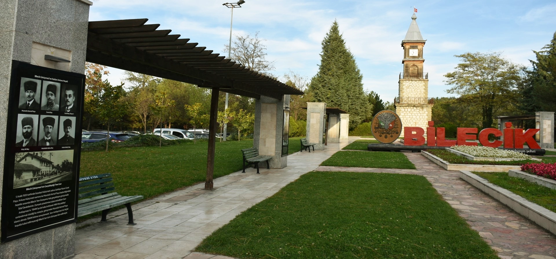
Discover Ottoman foundation history, forest landscapes, ponds, waterfalls, villages and historic towns throughout Bilecik Province.
View Bilecik GuidePair Bozcaarmut’s peaceful reservoir scenery with nearby forest landscapes, waterfalls and other natural attractions.
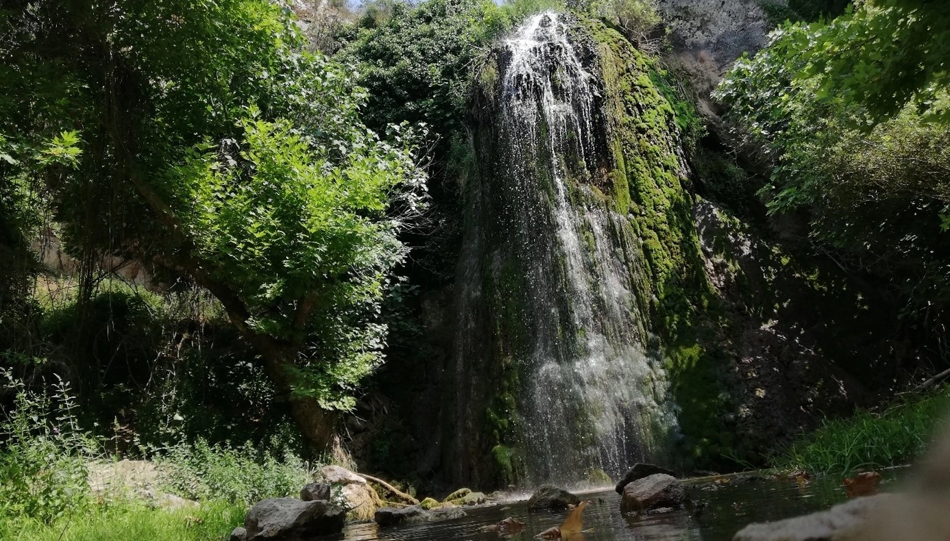
Continue through Pazaryeri’s rural landscape to explore forest scenery, rock formations and flowing water around Kınık.
Explore Kınık Waterfall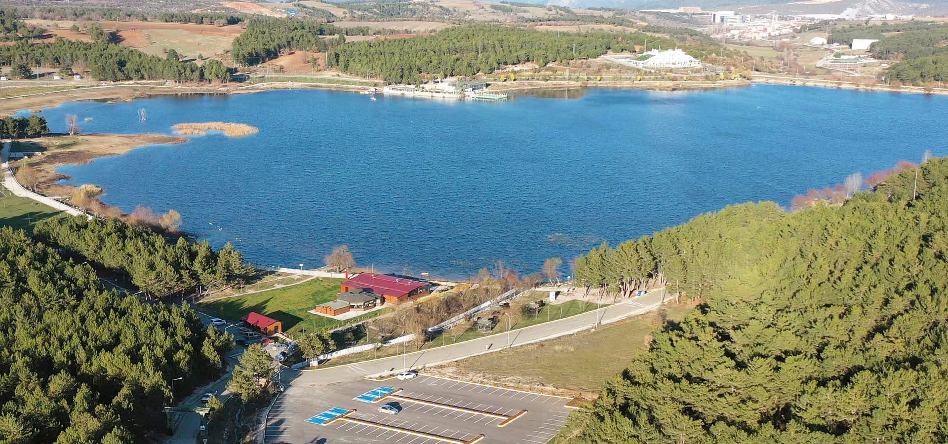
Discover another popular Bilecik waterside landscape with recreation areas and peaceful views close to the provincial centre.
Explore Pelitözü Pond
Continue exploring Ottoman heritage, museums, historic towns, forests and countryside across Bilecik Province.
Explore Bilecik