Forests, Vineyards and Marmara Sea Views

Ganos Mountains – Complete Nature & Travel Guide

Discover one of the most dramatic landscapes in Turkish Thrace,
where forested mountains rise directly above the Sea of Marmara.

Discover the Ganos Mountains

Discover the Ganos Mountains of Tekirdağ

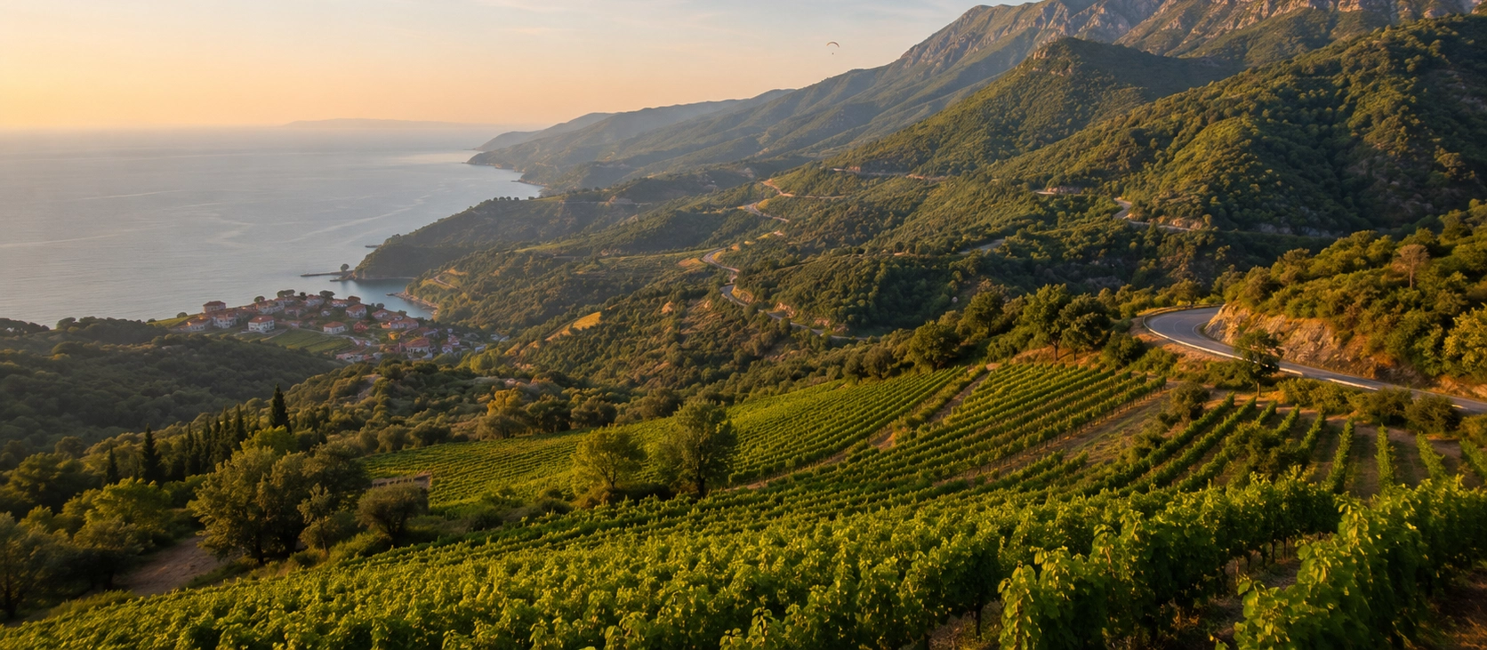
Rising sharply above the Sea of Marmara in western Tekirdağ, the Ganos Mountains — also known as the Işıklar Mountains — form one of the most impressive natural landscapes in Turkish Thrace.

The mountain system reaches approximately 945 meters at its highest point. What makes Ganos especially striking is not extreme altitude, but the way its forested slopes climb almost directly from the coast, creating panoramic viewpoints over villages, vineyards, beaches and the open Marmara.

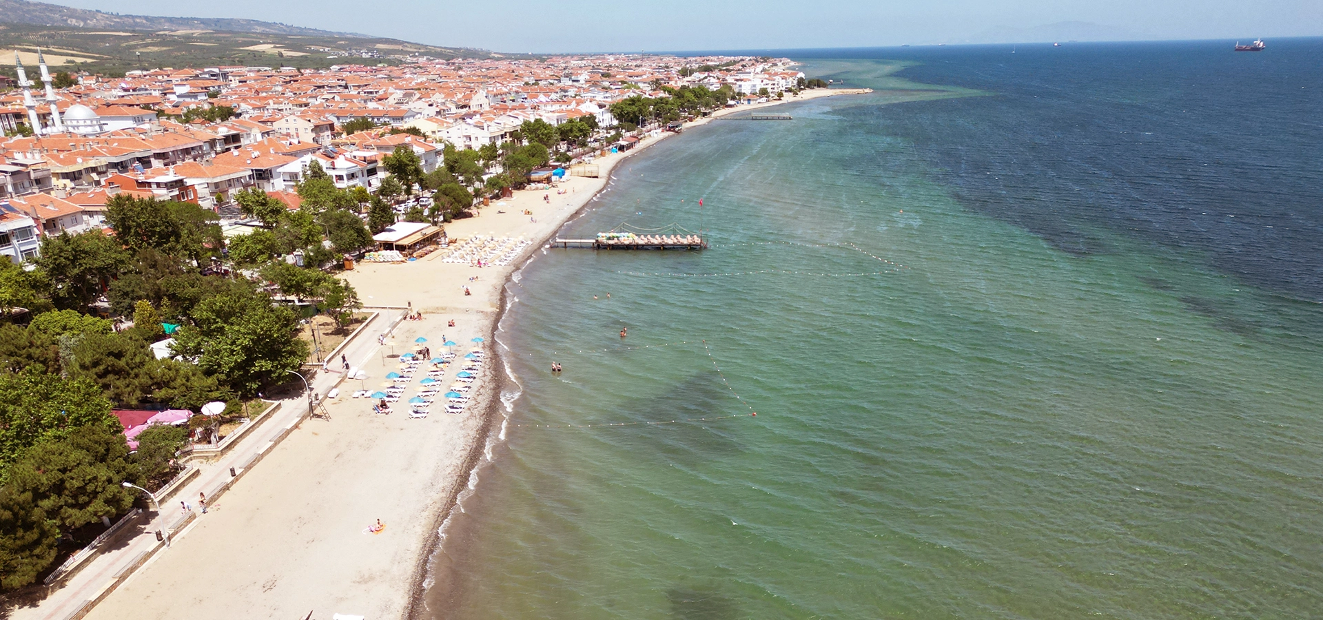
The region is ideal for travelers who enjoy hiking, scenic driving, photography, village life, paragliding, vineyards, forests and quiet coastal landscapes. Uçmakdere is the best-known gateway, while Şarköy, Mürefte, Hoşköy and Gaziköy reveal different sides of the mountain-and-sea environment.

Ganos is also a cultural landscape. In antiquity and the Byzantine period, the mountain carried religious importance and was associated with settlements, sacred sites and monastic communities. Today, nature, agriculture and centuries of human history remain closely intertwined.

Mountain & Sea

Experience steep green slopes rising directly above the blue waters of the Sea of Marmara.

Hiking & Nature

Explore forest tracks, village paths and elevated routes through one of Tekirdağ's most scenic outdoor areas.

Uçmakdere

Visit the historic village best known for traditional houses, trekking routes and spectacular paragliding scenery.

Vineyards & Villages

Travel through a cultural landscape shaped by vineyards, olive groves, rural settlements and the Marmara coast.


Know Before You Visit

Ganos Mountains – Quick Facts

Essential information for planning a journey into the mountain landscape behind the Şarköy and Tekirdağ coast.

📍

Location

The Ganos Mountains rise along the northern shore of the Sea of Marmara in Tekirdağ Province, especially around Şarköy and the western coast.

Open Ganos Mountains on Google Maps
⛰️

Highest Point

The mountain system reaches approximately 945 meters, making it the highest mountainous area in Tekirdağ Province.

🥾

Best Known For

Hiking, panoramic viewpoints, forests, paragliding, vineyards, village routes and spectacular Marmara Sea scenery.

🚗

Ideal Route

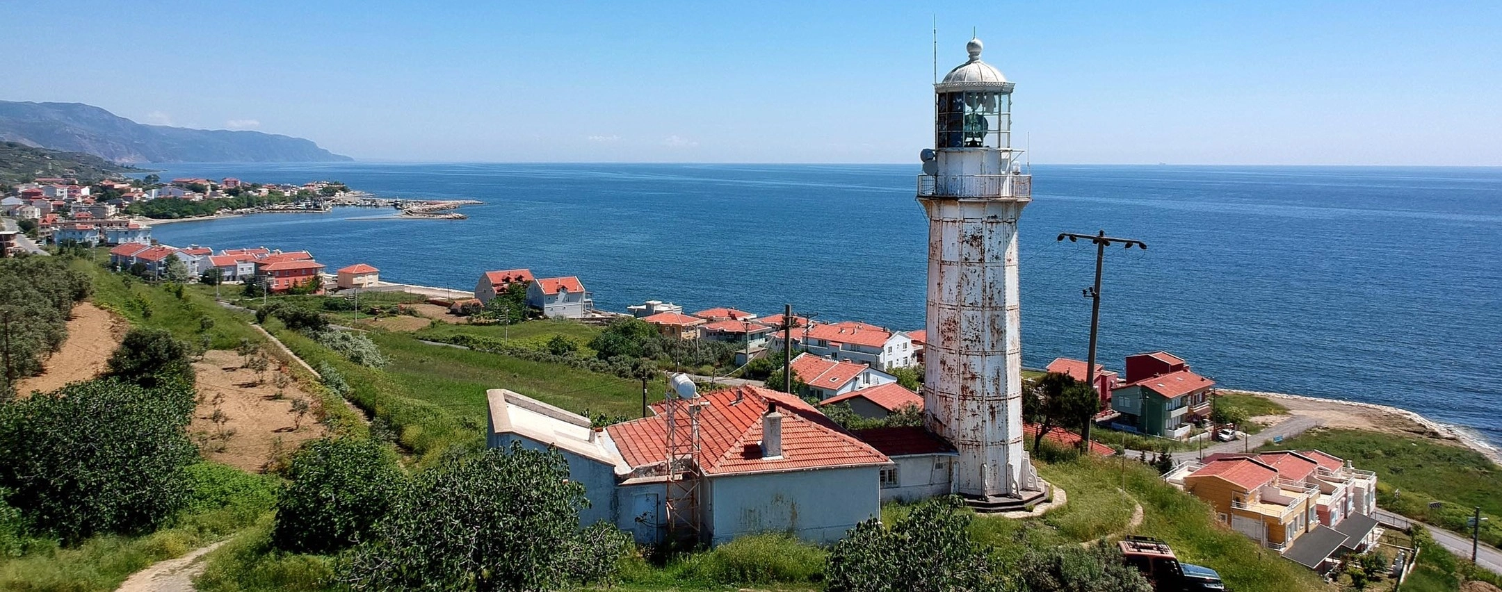
Combine the mountains with Uçmakdere, Şarköy, Mürefte, Hoşköy, Hora Lighthouse and scenic coastal roads.


A Mountain Shaped by Nature and History

The Story of the Ganos Mountains

The Ganos landscape has influenced settlement, agriculture, religion and travel along the northern Marmara coast for centuries.

The Ganos Mountains form the highest part of the mountain chain extending across southern Tekirdağ. Also called Işıklar Dağı, the massif rises close to the Sea of Marmara and creates a dramatic natural barrier between the coast and the inland plains of Thrace.

Its position has always mattered. The steep slopes protected small valleys and villages while also shaping local agriculture. On the warmer southern and coastal side, vineyards, olives and Mediterranean-type vegetation thrive; higher and more sheltered areas support denser forest.

The mountain also has a deep cultural past. Ancient and Byzantine sources connect the Ganos area with a sacred mountain tradition, and archaeological research has identified fortified and sacred sites in the higher country.

During the Byzantine period, Ganos became associated with Christian monastic life. Monks and religious communities sought remote mountain environments, while nearby coastal settlements remained connected with maritime trade across the Marmara.

Today, the Ganos Mountains are best experienced not as a single attraction but as an entire landscape: forest roads, small villages, vineyards, high viewpoints, hiking routes and coastal settlements all belong to the same journey.

Forests, Trails, Villages and Sea Views

What Makes the Ganos Mountains Special?

Few places in Thrace combine mountain scenery and the Sea of Marmara as dramatically as Ganos.

Panoramic Marmara Views

The rapid rise from sea level creates elevated viewpoints where the coastline, islands, villages and open water spread out below.

  • Highlight: Mountain-and-sea panoramas
  • Best Light: Morning and late afternoon
  • Ideal For: Landscape photography

Uçmakdere

One of the most famous villages in the Ganos region, Uçmakdere sits in a green valley surrounded by slopes, vineyards and traditional rural scenery.

  • Known For: Nature and village atmosphere
  • Activities: Hiking and paragliding
  • Setting: Ganos valley

Ganos Forests

Higher elevations support rich woodland, creating a cooler and greener environment than the cultivated coastal slopes below.

  • Experience: Forest roads and trails
  • Best Seasons: Spring and autumn
  • Atmosphere: Quiet and rural

Paragliding

The slopes above Uçmakdere are among Tekirdağ's best-known paragliding areas, offering extraordinary views over the Marmara coast.

  • Main Area: Nişantepe
  • View: Marmara Sea and Ganos forests
  • Experience: Tandem flights available locally

Vineyard Slopes

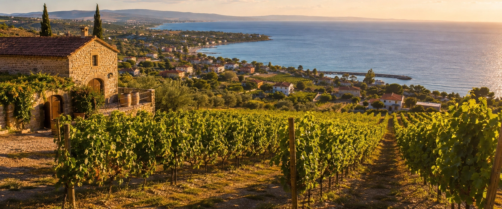
Vineyards cover parts of the lower mountain landscape, especially toward Şarköy, Mürefte, Hoşköy and the coastal villages.

  • Tradition: Viticulture
  • Season: Late spring to autumn
  • Highlight: Harvest landscapes

Scenic Roads

Winding roads cross ridges, valleys and coastal slopes, making the Ganos region one of the most rewarding road-trip areas in Tekirdağ.

  • Travel Style: Car or private vehicle
  • Terrain: Curving mountain roads
  • Best For: Flexible day trips

Historic Sacred Landscape

Archaeological and historical evidence shows that the high Ganos landscape held religious and strategic significance from antiquity into the Byzantine era.

  • Ancient Character: Sacred mountain
  • Byzantine Heritage: Monastic tradition
  • Archaeology: Fortified and sacred sites

Coastal Villages

Small settlements around Ganos preserve a strong sense of place shaped by vineyards, olives, fishing, old roads and the surrounding mountains.

  • Nearby: Uçmakdere and Gaziköy
  • Coast: Şarköy–Mürefte–Hoşköy
  • Ideal For: Slow travel

The Landscape of the Ganos Mountains

The defining feature of Ganos is the contrast between elevation and sea. The mountain rises rapidly from the Marmara shoreline, creating steep slopes, narrow valleys, ridges and viewpoints that feel far more dramatic than its moderate altitude might suggest.

The range extends roughly northeast to southwest through southern Tekirdağ. Its highest elevations approach 945 meters, and the abrupt relief creates very different environments over short distances.

On the sea-facing side, the climate is softened by the Marmara. Lower elevations can support vineyards, olive groves, scrub vegetation and agricultural land, while higher areas become increasingly wooded.

This transition is one of the pleasures of exploring Ganos by road or on foot. In a single day, travelers can move from a coastal village to vineyard slopes, enter dense woodland, reach a high viewpoint and return to the sea.

Region Southern Tekirdağ / Turkish Thrace
Also Known As Işıklar Mountains / Işıklar Dağı
Highest Elevation Approximately 945 m
Defining Feature Forested mountains rising directly above the Sea of Marmara
Best Experience Scenic driving, hiking, villages and elevated sea views

Forests and Vegetation of Ganos

One of the most interesting natural features of the Ganos Mountains is the way vegetation changes with altitude, slope direction and distance from the sea.

The warmer coastal slopes support Mediterranean-influenced vegetation together with agricultural landscapes of grapes and olives. As elevation increases, conditions become cooler and wetter, allowing woodland to become denser.

This variety gives Ganos a different appearance in every season. Spring brings fresh greens and flowering vegetation, summer emphasizes the contrast between dry lower slopes and shaded forests, and autumn transforms the woodland into warmer colors.

Lower Slopes

Expect cultivated land, vineyards, olive groves and scrub adapted to the warmer coastal environment.

Higher Slopes

Woodland becomes denser as elevation increases and conditions become cooler and more humid.

Spring

Fresh foliage and mild weather make spring especially attractive for walking and countryside photography.

Autumn

Changing forest colors add another layer to the already dramatic contrast between mountains and sea.

Uçmakdere Village

For many visitors, Uçmakdere is the most memorable introduction to the Ganos Mountains. The village lies in a narrow green valley where old houses, orchards, vineyards and forested slopes create an intimate rural setting.

Uçmakdere is especially popular with travelers from Istanbul and Tekirdağ who come for walking, photography, nature trips, village breakfasts and paragliding.

The road between the village, the mountain slopes and the Marmara coast is part of the experience. At several points, the landscape opens dramatically toward the sea, while the interior of the valley feels secluded and peaceful.

Village Walk

Explore the quiet streets and observe the traditional rural character of a settlement surrounded by Ganos scenery.

Nature

Use Uçmakdere as a starting point for walks through valleys, forest tracks and routes toward the coast.

Local Food

Village-style breakfasts and regional products are popular additions to a day in the area.

Sea Views

Continue from the village toward the coast for some of the most impressive panoramas in Tekirdağ.

Paragliding in the Ganos Mountains

The slopes near Uçmakdere are one of the best-known paragliding locations in the Marmara region. A major take-off area is Nişantepe, at roughly 625 meters above sea level.

From the air, the landscape is extraordinary: green Ganos forests lie below while the Sea of Marmara fills the horizon. Depending on visibility, the panorama can extend along the coast toward Şarköy, Hoşköy, Kumbağ and beyond.

Visitors without flying experience can look for tandem paragliding with qualified local operators. Conditions are always weather-dependent, and flights may be delayed or cancelled when wind or visibility is unsuitable.

Main Area Nişantepe / Uçmakdere
Take-Off Elevation Approximately 625 m
Main View Ganos forests and the Sea of Marmara
For Beginners Tandem flights may be available with professional operators
Important All flights depend on current wind and weather conditions

Safety note: Paragliding is an adventure activity. Use an established operator, follow instructor guidance and never assume that a flight will operate simply because the weather appears clear at sea level.

Hiking and Trekking in Ganos

The Ganos Mountains contain numerous routes used by hikers, outdoor groups and local nature enthusiasts. Trails may follow forest roads, ridges, old village paths and steep descents toward the Marmara coast.

One of the great attractions is constant visual variety. A route can begin among trees, cross open high ground, reveal a wide sea panorama and descend through vineyard or village scenery.

However, Ganos is not a single managed national-park trail network with uniform signs and facilities. Route conditions can vary, and some tracks cross forestry land, agricultural areas or remote terrain.

Short Walks

Choose village surroundings and accessible forest tracks when you want scenery without committing to a long mountain route.

Longer Treks

Experienced walkers can explore ridge and descent routes linking the high country with Uçmakdere and the coast.

Navigation

Carry an offline map or GPS track for longer hikes and do not rely on mobile coverage throughout the mountains.

Water

Bring enough drinking water, especially during warm weather when exposed sections can become hot and dry.


Hiking advice: For unfamiliar or long routes, consider walking with a local guide or organized hiking group. Trail conditions, forestry access and road surfaces can change.

Vineyards, Olives and the Ganos Slopes

Ganos is not only a wilderness destination. Its lower slopes form one of the most distinctive agricultural landscapes on the northern Marmara coast.

The wider Şarköy–Mürefte–Hoşköy region has a long association with viticulture. Vineyard rows spread across hillsides where sea influence, slope and local soils help create favorable growing conditions.

Olive cultivation is another important element, especially in the milder coastal zone. Together, vines and olives give the southern slopes of Ganos a landscape that can feel unexpectedly Mediterranean.

Ganos as a Historic Sacred Mountain

The cultural importance of Ganos reaches far beyond modern tourism. In antiquity, the mountain was associated with the idea of a sacred mountain, and archaeological surveys have identified sacred and fortified locations in commanding positions.

The high landscape later became important in the Byzantine Christian world. Remote mountains offered the seclusion sought by monks and ascetics, and historical research records a notable monastic presence on Ganos during the medieval period.

This does not mean visitors will encounter a preserved monastic complex comparable with Mount Athos. Many remains are fragmentary, remote or archaeological rather than developed visitor attractions.

The most meaningful way to understand this history is therefore as part of the wider landscape: isolated ridges, commanding peaks, forested slopes and coastal settlements help explain why the mountain acquired spiritual significance.

Archaeological respect: Some historic remains in the Ganos highlands are protected archaeological areas rather than formal tourist sites. Do not remove objects, disturb masonry or enter restricted zones.

Gaziköy and the Historic Ganos Coast

Gaziköy, on the Marmara side of the mountains, is closely connected with the historic name Ganos. The settlement and surrounding landscape preserve layers of ancient, Byzantine, agricultural and maritime history.

The approach to Gaziköy is especially memorable for its combination of steep slopes, sea views, vineyards and rugged coastal terrain.

For travelers following the entire Ganos coast, Gaziköy works best as part of a slow road journey rather than as a checklist attraction. Stop for the landscape, observe the changing geography and continue toward nearby villages and viewpoints.

Ganos Mountains Visitor Information

Location Southern Tekirdağ Province, Turkish Thrace
Also Known As Işıklar Mountains / Işıklar Dağı
Highest Point Approximately 945 m
Best Known For Hiking, forests, Marmara views, paragliding, vineyards and villages
Main Gateway Uçmakdere
Suggested Visit Full day; longer if combining several coastal towns and vineyard stops
Best Travel Style Car, private vehicle or organized outdoor excursion
Best Seasons Spring and autumn for nature; summer for coast and longer daylight

Road conditions: Mountain and village roads can be narrow, steep or winding. Allow extra travel time and check local conditions during poor weather.

Best Time to Visit the Ganos Mountains

Spring

Fresh vegetation, mild temperatures and clear countryside make spring excellent for hiking and scenic drives.

Summer

Combine mountain viewpoints with beaches and coastal villages, but plan strenuous walks for cooler hours.

Autumn

Forest color, vineyard harvest atmosphere and softer temperatures make autumn one of the most rewarding seasons.

Winter

The mountains are quiet and atmospheric, but rain, wind, mud and occasional winter conditions can affect outdoor plans.

Photography in the Ganos Mountains

Ganos offers some of the strongest landscape photography opportunities in Tekirdağ. The most characteristic compositions combine forested ridges, vineyard slopes, winding roads, villages and the Sea of Marmara.

High Viewpoints

Use elevated road stops and ridgelines to show the dramatic drop from the mountains toward the sea.

Uçmakdere Valley

Traditional village roofs surrounded by steep green slopes create atmospheric rural compositions.

Paragliders

Colorful canopies against the Marmara provide a strong sense of scale when flying conditions are suitable.

Vineyard Patterns

Rows of vines create geometric foregrounds with the Ganos ridges or sea in the distance.

Forest Roads

Curving roads disappearing into woodland can produce excellent travel and adventure images.

Golden Hour

Late-afternoon light softens the coastline and adds depth to the mountain ridges and agricultural slopes.


Photography etiquette: Use safe pull-off areas when stopping on mountain roads, respect private vineyards and never block traffic for photographs.

How to Get to the Ganos Mountains

The Ganos region lies southwest of Tekirdağ city and along the road network leading toward Şarköy and the western Marmara coast.

For most visitors, a car or private vehicle is the easiest option. Public transportation may reach larger settlements, but many viewpoints, hiking starting points and rural roads are difficult to explore efficiently without independent transport.

Travelers from Istanbul usually approach through Tekirdağ and then continue toward the mountain and coastal routes. Uçmakdere is one of the most popular first destinations, while travelers heading farther west can continue toward Şarköy, Mürefte and Hoşköy.

Province Tekirdağ
Main Gateways Tekirdağ, Uçmakdere and Şarköy
Best Transport Car or private vehicle
Road Style Scenic, winding mountain and coastal roads
Continue Toward Şarköy, Mürefte, Hoşköy and Hora Lighthouse

Full-Day Ganos Mountains & Uçmakdere Itinerary

Morning Leave Tekirdağ and drive toward the Ganos foothills and Uçmakdere
Late Morning Explore Uçmakdere village and enjoy a short walk through the valley
Midday Continue toward an elevated viewpoint or paragliding area, depending on road and weather conditions
Lunch Enjoy a village breakfast-style meal, local dishes or seafood depending on your route
Afternoon Drive through forest and mountain scenery toward the Şarköy side of Ganos
Late Afternoon Stop among vineyard landscapes or continue toward Mürefte and Hoşköy
Sunset Choose a safe coastal or elevated viewpoint for late-afternoon Marmara scenery

This route combines nature, mountain roads, village culture, vineyards and the Sea of Marmara, giving first-time visitors an excellent introduction to the wider Ganos region.

Ganos Mountains Visitor Tips

Travel by Car

A private vehicle gives you the flexibility to stop at viewpoints, villages, trailheads and vineyard landscapes.

Start Early

An early departure gives you time to combine the mountains with Uçmakdere and several coastal stops without rushing.

Check the Weather

Wind, rain and low cloud can change conditions quickly at higher elevations and may affect hiking or paragliding.

Wear Proper Shoes

Even short nature walks can include loose ground, mud, stones or steep sections.

Carry Water

Do not assume that drinking water or shops will be available on remote mountain routes.

Download Offline Maps

Mobile coverage can be less reliable in valleys and remote sections of the mountain.

Respect Private Land

Vineyards, olive groves and some rural tracks cross working agricultural landscapes.

Allow for Winding Roads

Distances may look short on a map but mountain roads can take longer than expected.

Avoid Forest Fire Risk

During hot and dry periods, follow all forestry restrictions and never light fires outside officially permitted areas.

Stay for the Coast

The strongest Ganos experience combines the mountains with the nearby Marmara shoreline rather than visiting only the high country.

Places to Visit Near the Ganos Mountains

The Ganos Mountains sit at the heart of one of Tekirdağ's most rewarding scenic corridors, with coastal towns, villages, vineyards and historic landmarks all within the same wider region.

What to Eat Around the Ganos Mountains

The food culture around Ganos reflects the meeting of mountain villages, vineyards, olive-growing country and the Sea of Marmara.

Village Breakfast

Uçmakdere and nearby rural stops are popular for breakfasts featuring cheese, olives, eggs, preserves and seasonal produce.

Local Seafood

Fish and seafood are natural choices when your route continues toward Şarköy, Mürefte or other Marmara settlements.

Olives & Olive Oil

The milder coastal slopes support an important olive-growing tradition throughout the Şarköy region.

Grape Products

Vineyard culture produces wine as well as seasonal grapes, grape juice, molasses and other local products.

Tekirdağ Meatballs

Try the province's most famous savory specialty before or after your mountain journey.

Tekirdağ Cheese Halva

Finish with a distinctive regional dessert traditionally prepared with fresh unsalted cheese.

Frequently Asked Questions About the Ganos Mountains

Where are the Ganos Mountains?

The Ganos Mountains are in southern Tekirdağ Province in Turkish Thrace, rising along the northern side of the Sea of Marmara.

Are the Ganos Mountains also called the Işıklar Mountains?

Yes. Ganos Dağı is also widely known as Işıklar Dağı, and both names are used for the mountain landscape in southern Tekirdağ.

How high are the Ganos Mountains?

The highest part of the mountain system reaches approximately 945 meters above sea level.

Why do the Ganos Mountains look so dramatic?

The mountains rise very quickly from the Sea of Marmara, creating a strong contrast between the coast and high forested ridges.

What are the Ganos Mountains famous for?

They are known for forests, hiking, paragliding, panoramic Marmara views, vineyards, traditional villages and scenic roads.

Is Uçmakdere in the Ganos Mountains?

Yes. Uçmakdere lies among the Ganos slopes and is one of the best-known gateways for nature trips in the region.

Can you hike in the Ganos Mountains?

Yes. There are numerous walking and trekking routes, but conditions and signage vary, so longer routes require careful navigation and preparation.

Is Ganos suitable for beginner hikers?

Short village and forest walks can suit beginners, while longer ridge or descent routes may require more experience, fitness and route-finding skills.

Can you go paragliding in Ganos?

Yes. The Uçmakdere area is one of Tekirdağ's best-known paragliding destinations, with Nişantepe serving as a major take-off location.

How high is the Nişantepe paragliding area?

The principal Nişantepe take-off area is approximately 625 meters above sea level.

Do you need experience for paragliding in Uçmakdere?

Visitors without experience may be able to book tandem flights with professional local operators, subject to weather and wind conditions.

Are there vineyards in the Ganos Mountains?

Yes. Vineyards are a defining feature of the lower slopes and coastal landscape, especially around Şarköy, Mürefte and Hoşköy.

Were the Ganos Mountains important in Byzantine history?

Yes. Historical research connects Ganos with Byzantine monastic life, while archaeological evidence also shows earlier sacred and fortified activity in the mountain landscape.

Is Ganos a national park?

No. Visitors should not expect a single national-park entrance, visitor center or uniformly marked trail system across the entire mountain range.

What is the best time to visit the Ganos Mountains?

Spring and autumn are especially good for hiking and scenery. Summer is ideal for combining mountain trips with the coast, while winter can be wetter and more changeable.

Can I visit Ganos on a day trip from Istanbul?

Yes. A day trip is possible by road, especially for Uçmakdere and nearby viewpoints, although an early departure is recommended.

Do I need a car to explore Ganos?

A car or private vehicle is strongly recommended if you want to reach multiple villages, viewpoints and mountain roads efficiently.

Can I combine Ganos with Şarköy?

Yes. Şarköy is an excellent extension of a Ganos trip and adds beaches, vineyards, olives and coastal restaurants.

Can I combine Ganos with Mürefte and Hoşköy?

Yes. Continuing through Mürefte and Hoşköy creates a rewarding full-day or overnight route combining mountains, vineyards, wine heritage and the Marmara coast.

Is the Ganos region good for photography?

Yes. The combination of forested ridges, sea views, vineyard patterns, villages, winding roads and paragliders makes it one of Tekirdağ's strongest landscape-photography areas.

Are the mountain roads difficult?

Some roads are narrow, steep and winding. Drive carefully, allow extra time and check local conditions during bad weather.

Can you camp in the Ganos Mountains?

Camping is practiced in parts of the wider region, but access rules and fire restrictions can change. Use legal, permitted areas and follow current forestry regulations.

Ganos Mountains & Marmara Coast Experiences

The Ganos Mountains can be included in a private journey through western Tekirdağ combining nature, villages, vineyards, local food and the Sea of Marmara.

Private Ganos Mountains & Uçmakdere Experience

Explore the mountain landscape at your own pace with a flexible private route tailored to nature, photography, villages and scenic viewpoints.

Continue Along the Ganos Coast

Extend your route west through Mürefte and Hoşköy for vineyard heritage, coastal villages and Hora Lighthouse.