Private Divlit Volcanic Park Experience
Share your dates, group size and interests. We will propose a sensible route and confirm access before booking.
Request Your Private Programme





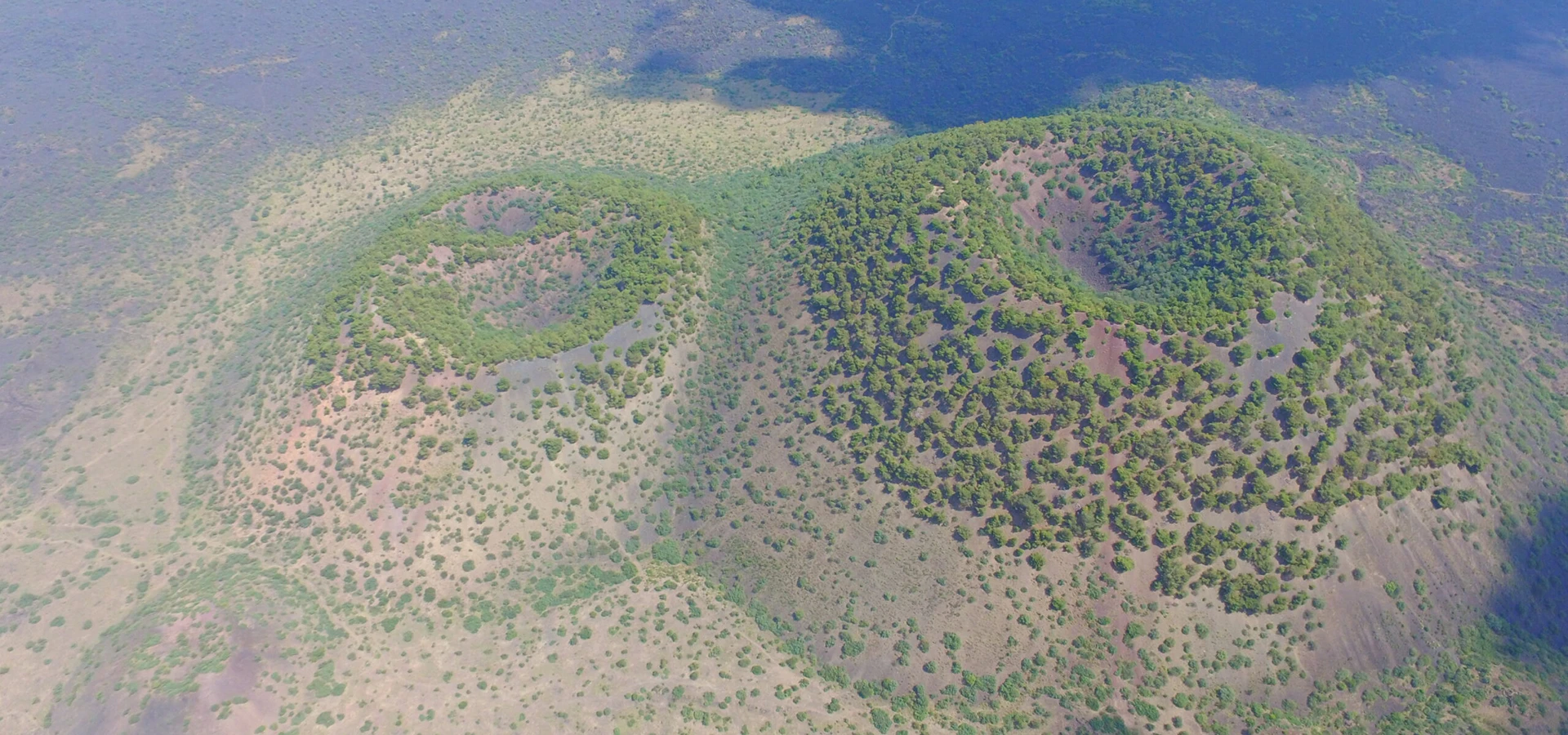
Divlit is one of the clearest places to experience why the Kula region became known as the 'burned land'. A dark cinder cone rises above rough lava surfaces that look surprisingly fresh compared with the surrounding cultivated countryside.
The park sits within Kula–Salihli UNESCO Global Geopark. Its geology is dramatic, but the most valuable experience is learning to distinguish the cone, erupted fragments and lava that flowed away from the vent.
Designated walking infrastructure has been described by the Kula district authorities. Visitors should check present access and stay on maintained routes rather than attempting to cross loose volcanic ground.
A steep cone made from scoria—vesicular fragments of volcanic material. Its loose slopes are easily damaged and unsafe to climb off-route.
Solidified flows show rough textures, cracks and hummocks formed as molten rock cooled and moved.
The wider park includes additional vents and lava-related structures that illustrate the complexity of an eruption field.
Local authorities describe a walking route with visitor infrastructure. Check its current condition rather than relying on historic distances or facilities.
Useful orientation before planning a visit.
Northeast of Kula town, Manisa
Volcanic geosite within UNESCO Global Geopark
Young Quaternary volcanism
Black scoria cone and rough basalt lava
1–2 hours for an authorized short trail
Confirm current entry and route conditions before travel
Divlit makes volcanic processes easy to visualize: a vent, a cone and a surrounding lava field are visible together.
It is especially effective when contrasted with older basalt columns and the erosion-shaped fairy chimneys elsewhere in the geopark.
Kula volcanism occurred in several phases. Divlit represents a comparatively young phase of eruption that left scoria cones and lava flows.
The cone is built largely of dark, porous volcanic fragments thrown from eruptive vents. Lava spread across lower ground before cooling into irregular, often sharp surfaces.
The volcanic landforms belong to a wider tectonic setting associated with the Gediz Graben. They are geological monuments, not evidence of a currently erupting volcano.
Dark lava absorbs heat and can make summer visits tiring. Loose scoria and sharp rock edges are hazards.
Sparse vegetation on some lava surfaces is part of the landscape’s ecological character; do not drive or walk off-route.
A steep cone made from scoria—vesicular fragments of volcanic material. Its loose slopes are easily damaged and unsafe to climb off-route.
Look at this feature in relation to the broader setting rather than as an isolated photo opportunity.
Solidified flows show rough textures, cracks and hummocks formed as molten rock cooled and moved.
Small construction or geological details can tell a different story from the broad panorama.
The wider park includes additional vents and lava-related structures that illustrate the complexity of an eruption field.
What is visible today may reflect more than one historical period or natural process.
Local authorities describe a walking route with visitor infrastructure. Check its current condition rather than relying on historic distances or facilities.
Interpret this feature alongside the other highlights, while respecting current access limits.
Manisa brings together Lydian history, the Seven Churches of Revelation, Ottoman architecture, craft villages and volcanic geology. Divlit Volcanic Park offers a particular window into that varied region.
For a coherent itinerary, choose neighbouring sites by theme and geography rather than trying to cover the whole province in a single day.
Look for differences between scoria fragments around the cone and more coherent basalt in the lava flows.
The site illustrates eruption and cooling, whereas Kula fairy chimneys mainly illustrate later erosion of layered sediments.
A steep cone made from scoria—vesicular fragments of volcanic material. Its loose slopes are easily damaged and unsafe to climb off-route.
Solidified flows show rough textures, cracks and hummocks formed as molten rock cooled and moved.
The wider park includes additional vents and lava-related structures that illustrate the complexity of an eruption field.
Local authorities describe a walking route with visitor infrastructure. Check its current condition rather than relying on historic distances or facilities.
Use sturdy closed footwear, sun protection and sufficient water. Do not attempt shortcuts over jagged lava or loose cone slopes.
Check whether the designated trail, visitor centre and any cycle routes are open before departure.
Begin with an orientation to the geopark’s volcanic phases, then follow the designated Divlit path to suitable viewpoints.
Add historic Kula or a basalt-column site afterward rather than trying to cross the entire lava field.
Spring and autumn are best for walking comfort. Summer midday heat is intensified by exposed dark rock; wet weather can reduce traction.
A wide view of the cone against its lava apron communicates the eruptive landscape. Stay on marked paths for all close-ups.
Lava terrain is uneven and can be difficult for wheelchairs or anyone with balance limitations. Ask about safe roadside or short-path viewpoints.
Divlit Volcanic Park lies northeast of Kula town. Use current geopark guidance for the visitor approach rather than navigating directly across open lava.
Explore Kula–Salihli UNESCO Global Geopark as a complementary stop. Check travel time and access before combining sites.
Explore Kula Basalt Columns as a complementary stop. Check travel time and access before combining sites.
Explore Historic Kula Houses as a complementary stop. Check travel time and access before combining sites.
It is a volcanic geosite near Kula featuring a cinder cone and associated lava flows within Kula–Salihli UNESCO Global Geopark.
No eruption is occurring; the site preserves evidence of comparatively young geological volcanism.
Much of the landscape is basaltic lava and porous volcanic scoria formed during eruptions.
Use only designated, safe paths; rough lava and loose cone material make off-route walking hazardous.
One to two hours is a practical estimate for a short authorized geotrail and viewpoints.
Historic Kula, the basalt columns and other selected geopark geosites make good thematic combinations.
Respect signs, barriers and any directions from site staff.
Do not collect scoria or basalt, carve rock, climb unstable slopes or drive vehicles onto the protected volcanic surface.
Keep entrances clear and ask before photographing residents or worshippers.
Carry away rubbish and avoid disturbing vegetation, rocks or historic material.
Wow Cappadocia / Venere Travel can plan a private, tailor-made route with a licensed guide and suitable vehicle, subject to confirmed access and without compulsory shopping stops.
Combine archaeology, living culture and natural landscapes at your preferred pace.
Share your dates, group size and interests. We will propose a sensible route and confirm access before booking.
Request Your Private Programme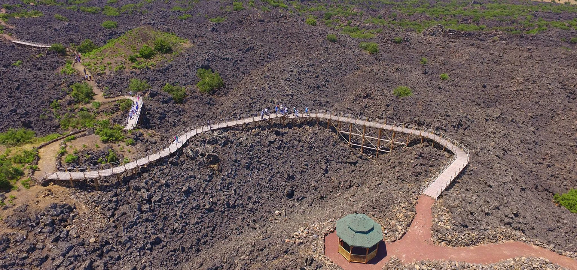
Discover a related destination and plan a route with realistic travel times.
Read the Nearby Guide