Private Çobankale & Altınova Heritage Experience
Ask us about a tailor-made excursion combining Çobankale, medieval history, historic Hersek, Hersek Lagoon and selected cultural places across Yalova Province.
Request a Custom Tour





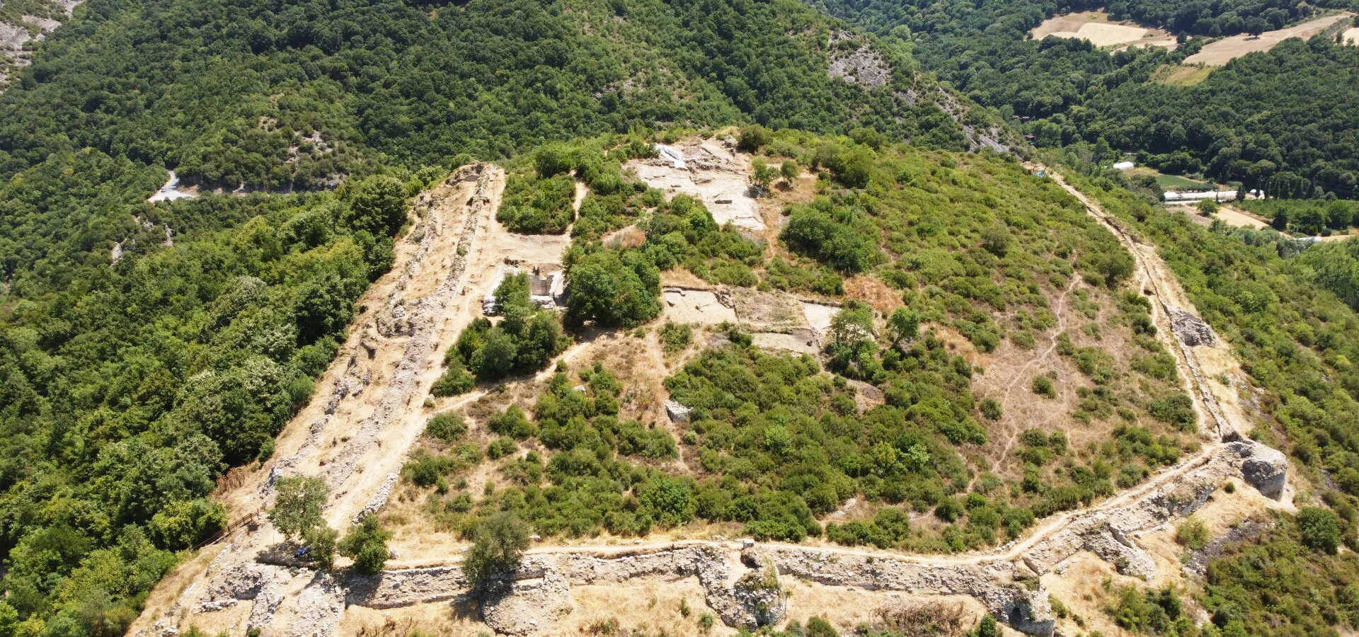
Çobankale is one of the most important archaeological and historical sites in Altınova district of Yalova Province. The ruined fortress rises above the Yalakdere Valley, on a natural height overlooking a route that once connected the Marmara coast with İznik and the interior of Anatolia.
Its importance comes from geography. For centuries, armies, merchants, messengers and travellers moving between Constantinople, Nicomedia, Nicaea and western Anatolia used corridors associated with this part of the southern Marmara region. A fortified position above the valley could therefore observe, control and defend movement through the landscape.
Archaeological research at Çobankale began in 2017. Excavations have revealed sections of the fortification system, a large cistern, architectural remains, ceramics, metal objects, burials and other evidence that is helping researchers reconstruct the medieval history of Yalova.
The castle is especially associated with the turbulent centuries between the Byzantine, Seljuk, Crusader and early Ottoman periods. It is also discussed in connection with the regional events surrounding the Battle of Bapheus in 1302, a major early victory of Osman’s forces against a Byzantine army.
Systematic archaeological excavation at Çobankale began in 2017.
The interior of the fortress extends across more than 20 decares, with a wider archaeological zone around it.
Excavation teams have reported archaeological material spanning approximately the 9th to 14th centuries.
The wider Altınova–Yalakdere region is closely associated with the Battle of Bapheus and early Ottoman expansion.
Essential information for understanding one of Yalova’s most important medieval archaeological sites.
Karadere area, Altınova district, Yalova Province.
Search on Google MapsMedieval fortress and protected archaeological site overlooking the Yalakdere Valley.
A naturally commanding hill above the old route linking the Marmara coast with İznik and inland Anatolia.
Systematic archaeological work has been underway since 2017.
Ceramics, metal objects, arrowheads, architectural remains, burials and other medieval material.
A large water cistern of roughly 150 square metres was uncovered during excavation work.
A control and defence point used across several medieval political periods.
The castle belongs to the landscape associated with the Battle of Bapheus and early Ottoman expansion.
An archaeological landscape rather than a fully restored castle attraction.
Medieval history, archaeology, landscape photography and travellers exploring lesser-known Yalova.
The castle mattered because it watched a road that connected coast, valley and inland Anatolia.
Çobankale occupies a position that makes immediate strategic sense. The fortress stands above the Yalakdere Valley, a natural corridor running south from the Altınova and Hersek area toward the interior.
In the medieval period, this wider route formed part of the communication network between Constantinople and Nicaea and onward toward western and central Anatolia. Control of the valley therefore meant control over movement, supply, military passage and communication.
This geographical role helps explain why Çobankale remained relevant through changing political periods. The region witnessed Byzantine, Seljuk, Crusader and Ottoman activity, and the fortifications preserve evidence of repeated occupation, repair and adaptation.
For historians and archaeologists, the site is especially valuable because Yalova has historically received far less archaeological investigation than neighbouring centres such as İznik and Kocaeli. The Çobankale excavations are therefore filling an important gap in the medieval archaeology of the southern Marmara region.
Çobankale is located in Altınova district of Yalova Province, in the Karadere area above the Yalakdere Valley. Official local descriptions place it several kilometres south of Altınova and a short distance south of the Soğuksu–Ayazma area.
The castle occupies a naturally elevated position where the valley narrows. From a military perspective, this allowed the fortress to watch movement between the Marmara coastline and the routes leading south toward İznik.
The landscape is quite different from Yalova’s better-known coastal and thermal attractions. Çobankale belongs to an inland environment of wooded hills, valley slopes and rural roads, making the journey part of the experience.
Because the exact approach to an active archaeological area can change, visitors should use current navigation, follow local signs and respect any access restrictions connected with excavation or conservation work.
The key to understanding Çobankale is not simply its walls, but the road beneath them.
For much of antiquity and the medieval period, the southern side of the Gulf of İzmit formed part of the overland and maritime network connecting Constantinople, Nicomedia and Nicaea. The Hersek–Yalakdere corridor offered a route from the Marmara shore toward the interior.
A castle positioned above this valley could act as a watchpoint, defensive stronghold and controlled passage. Travellers approaching from the coast could be observed before they moved deeper into the valley, while forces coming from inland Anatolia could be detected before reaching the Marmara shoreline.
The strategic value of this geography did not belong to a single empire. It remained important as political control shifted, which is one reason Çobankale contains evidence from more than one medieval phase.
The precise first construction date of Çobankale remains a subject of historical and archaeological study. Older scholarship and local official summaries commonly connect the main medieval fortress with the 11th century Byzantine period.
One influential interpretation, citing medieval castle studies, has suggested a construction date around 1087 during the reign of Byzantine Emperor Alexios I Komnenos.
Archaeological excavation, however, has produced material spanning a broader chronological range. The excavation team has reported finds from approximately the 9th through 14th centuries, showing that the hill and its fortifications belong to a much longer sequence of occupation and reuse than a single construction event.
For this reason, it is better to understand Çobankale as a multi-period medieval fortress whose walls, towers and internal spaces changed over time.
Çobankale is often discussed in modern scholarship in connection with a fortress named Xerigordos in accounts of the opening phase of the First Crusade.
The identification is important because medieval narratives describe fighting over a fortified position in this wider region during 1096, when forces associated with the People’s Crusade moved into territory contested between Byzantines and Seljuks.
Modern archaeological publications concerning Çobankale use Xerigordos as a key term, reflecting the continuing scholarly connection between the excavated fortress and the site described in medieval sources.
Nevertheless, historical place-name identification can be complex. Topography, written sources, archaeological chronology and route reconstruction all have to be considered together. For visitors, the most useful approach is to understand Çobankale as a fortress that belongs to the same highly contested frontier landscape described in the sources of the late 11th century.
The late 11th century transformed northwestern Anatolia. After the Seljuk advance across Anatolia, the region around Nicaea became a frontier contested between the Byzantine Empire and Turkish powers.
When the First Crusade movement began in 1096, armed groups arrived in the Byzantine world before the main princely armies. Campaigning around Nicaea and the Gulf of İzmit brought renewed attention to strategic fortresses controlling roads and valleys.
Çobankale’s position above the route from the Marmara coast toward İznik made it exactly the type of stronghold that could become important during such campaigns. Local historical accounts connect the castle with clashes between Crusader forces and the Seljuks of Kılıç Arslan I.
Archaeology is especially valuable here because written medieval narratives were not designed as modern maps. The excavated fortifications, weapon finds and occupation layers provide material evidence that can be compared with the political and military events described in texts.
Excavation reports and official summaries indicate that Çobankale was used during the Seljuk period. This makes the site particularly important for understanding how Turkish power extended into northwestern Anatolia after the 11th century.
Researchers have described the fortress, during part of its history, as one of the westernmost Seljuk-held strongholds and a strategic position unusually close to Constantinople.
Archaeological work has produced ceramics, small finds and other material associated with medieval occupation. These finds help move the discussion beyond written chronicles and toward the daily life of people who actually occupied the fortress.
At a frontier castle, soldiers and residents needed water, food storage, weapons, cooking vessels, shelter and communication with surrounding settlements. The cistern, defences and portable finds discovered at Çobankale together begin to reveal how such a community functioned.
Çobankale is also closely linked with the historical geography of the Battle of Bapheus, fought on 27 July 1302 between forces led by Osman and a Byzantine army.
The exact reconstruction of medieval battlefields depends on careful reading of sources and landscape, but the wider Altınova–Hersek–Yalakdere region plays a central role in modern historical discussions of Bapheus.
The battle is significant because it demonstrated that Osman’s forces had become a major military power in northwestern Anatolia. Historian Halil İnalcık gave particular emphasis to Bapheus when discussing the emergence of the Ottoman polity, arguing that the victory marked an important turning point in its development.
Çobankale should therefore be understood not simply as a castle where a single battle happened, but as part of the strategic landscape through which early Ottoman expansion developed. Its commanding position above the valley helps visitors understand why this district mattered militarily.
Systematic excavation at Çobankale began in 2017 with work involving museum authorities, specialists from Mimar Sinan Fine Arts University and support from Altınova Municipality.
The first seasons included vegetation clearance, documentation and investigation of the surviving fortifications. Researchers recorded substantial sections of the walls and towers and identified areas affected by earlier illicit digging.
Later work expanded into the interior of the castle, where archaeologists investigated the cistern, fortification lines, a chapel area and occupation deposits. Geophysical work was also used to help identify subsurface remains.
By 2021, Çobankale had been included among archaeological projects working on a 12-month excavation basis, allowing research, conservation, documentation and study of finds to continue beyond a short summer campaign.
The work is important not only for Çobankale itself. Researchers have repeatedly emphasized that the excavation provides rare stratified archaeological evidence for medieval Yalova, a region where comparatively little systematic excavation had previously taken place.
One of the most important architectural discoveries at Çobankale is a large cistern inside the fortified area.
Excavation reports describe the structure as covering approximately 150 square metres. For a hilltop fortress, such a water-storage system was essential. A garrison could not depend entirely on daily access to springs or streams outside the walls, especially during conflict.
Rainwater and other collected water could be stored for drinking, cooking, cleaning and emergency use. The presence of a substantial cistern therefore shows that Çobankale was designed for sustained occupation, not simply as a temporary lookout.
Archaeologists also recovered numerous ceramic fragments from excavation contexts around the site. Together, architecture and pottery help reconstruct both the military and domestic sides of life inside the fortress.
The surviving castle is defined by a stone fortification circuit adapted to the shape of the hill. Excavation and clearance have revealed towers, wall lines and defensive features that were previously hidden beneath dense vegetation.
Local stone forms the principal building material, with brick fragments and courses appearing in some sections. Differences in masonry and mortar suggest that parts of the fortress were repaired, altered or rebuilt during different phases of use.
The northern side has been particularly important in recent excavation campaigns. Research has exposed elements of a double defensive line and helped clarify the plan of the fortifications.
The southern and western areas have also preserved substantial defensive remains. Visitors should remember that archaeological walls can be fragile: loose masonry, uneven ground and active conservation areas are part of the site.
Stone fortifications follow the natural contours of the hill.
Projecting towers strengthened vulnerable points and improved observation along the valley.
Changes in masonry suggest repair and rebuilding over a long medieval occupation.
Steep slopes and the commanding hilltop position worked together with the built fortifications.
Excavation has produced a wide range of medieval archaeological material. Ceramics are among the most common finds, providing evidence for chronology, food preparation, storage and everyday activity.
Metal finds are also important. Research published in 2026 examined the medieval arrowheads recovered during the Çobankale excavations using both archaeological classification and archaeometallurgical analysis.
The arrowheads include different body and cross-section forms, offering evidence for medieval offensive and defensive technology. Scientific analysis can reveal not only shape, but also metal composition, manufacturing processes and traces of use.
Excavation teams have additionally reported small personal objects, architectural remains and human burials. Such material adds a human dimension to a site that might otherwise be understood only through battles and walls.
Pottery helps date occupation phases and reconstruct daily life inside the fortress.
Medieval iron arrowheads provide direct evidence for military technology at the site.
Portable objects provide clues about the people who lived and worked within the castle.
Human remains and associated objects contribute to the archaeological history of occupation.
Çobankale is a place where topography is part of the archaeology. The fortress makes much more sense when viewed together with the valley, hills and routes around it.
The Yalakdere corridor runs between the Marmara coast and the inland landscapes toward İznik. The castle’s elevated position allowed observation in multiple directions, while the surrounding slopes created natural defensive advantages.
Today, the area is greener and quieter than the military frontier described in medieval sources. Forested slopes, rural settlements and winding roads can make the site feel remote despite its proximity to the highly developed Marmara Region.
Take time to look beyond the masonry. The relationship between castle, valley and road is one of the most important things to understand at Çobankale.
Çobankale should not be imagined as a fully restored fortress with polished visitor paths, interior exhibitions and permanent tourist services. It is first and foremost an archaeological site.
That means the experience is about reading wall foundations, towers, excavated spaces, the cistern and the surrounding landscape. For travellers who enjoy archaeology, this can be more rewarding than visiting a heavily reconstructed monument.
At the same time, conditions may include uneven surfaces, vegetation, exposed stone and temporarily restricted excavation zones. Access arrangements can change as archaeological work continues.
Before making a special journey, check current local information about public access, road conditions and any excavation-season restrictions. Never enter fenced or closed areas.
Çobankale is well suited to archaeological and landscape photography. The strongest images often combine the surviving masonry with the valley that explains the fortress’s strategic purpose.
Look for wall textures, tower outlines, excavated stonework, vegetation growing around the ruins and wider views down the Yalakdere corridor.
Morning and late afternoon can provide softer side light that reveals the relief of rough stone, mortar and uneven medieval masonry. Overcast conditions can also be excellent for photographing archaeological details without harsh shadows.
Do not climb unstable walls or cross excavation boundaries for a better photograph. If archaeological work is taking place, follow the instructions of site staff.
Use side light to emphasize the texture and construction of the walls.
Wide compositions help explain why the castle was built on this particular hill.
Photograph excavated features only from permitted visitor areas.
Spring greenery, autumn tones and winter atmosphere can transform the character of the ruins.
For most visitors, spring and autumn are the most comfortable seasons for exploring the inland hills of Altınova. Temperatures are generally milder and the surrounding landscape can be particularly attractive.
Spring brings fresh vegetation and long enough daylight for combining Çobankale with Hersek and other Yalova attractions. Rain can, however, make unpaved or uneven surfaces muddy.
Summer offers dry weather and long days, but exposed archaeological areas can feel hot around midday. Carry water, sun protection and suitable footwear.
Autumn is excellent for softer light, cooler walking conditions and changing colours on the surrounding slopes.
Winter can create a dramatic atmosphere, but rain, mud and slippery stone may make access more difficult. Always prioritize safe conditions over reaching a particular viewpoint.
If access conditions allow, morning is usually an excellent time to explore an archaeological site like Çobankale. The air is cooler, the light is softer and stone details are easier to photograph.
Late afternoon can also be beautiful, especially when low sunlight reaches the walls and wooded slopes.
Avoid leaving an unfamiliar archaeological landscape too close to darkness. Uneven ground, loose stone and rural access roads are easier to manage in full daylight.
Çobankale is a medieval hilltop archaeological site, so visitors should expect uneven natural terrain rather than the smooth surfaces found at a museum or landscaped monument.
Exposed stone, slopes, temporary excavation trenches, mud and vegetation can affect movement around the site. The condition of approach roads and paths may also change with weather or ongoing works.
Visitors with limited mobility should confirm current access conditions before travelling. If full site access is difficult, the wider Altınova area offers more accessible heritage and nature alternatives, including Hersek Lagoon’s modern visitor facilities.
For children interested in castles and archaeology, Çobankale can be a memorable way to explain how historians learn from walls, pottery, weapons and landscapes.
Instead of expecting a reconstructed castle, encourage younger visitors to look for clues: Why is the fortress on a hill? Where would water have been stored? How could defenders watch the road? Why do different wall sections look different?
Children should remain closely supervised. Archaeological sites can contain uneven drops, loose stones, excavated areas and fragile remains. Climbing on masonry should be avoided.
If public access is available, allow roughly 45–60 minutes for a focused look at the visible fortifications and the strategic setting.
Around 1.5–2 hours is more suitable for travellers who want to study the ruins slowly, take photographs and think about the relationship between the castle and the valley.
A half-day works well when Çobankale is combined with nearby Altınova heritage, while a full-day Yalova route can add Hersek Lagoon, Yürüyen Köşk or other attractions farther west.
A focused introduction to the visible ruins and strategic landscape.
A slower archaeological visit with photography and time to study the valley.
Combine Çobankale with historic Hersek and the Altınova area.
Add Hersek Lagoon and more places across Yalova Province.
Choose shoes with grip for uneven stone, soil and potentially muddy ground.
Carry drinking water, especially in warm weather.
A hat and sunscreen are useful during exposed summer visits.
Conditions can change quickly in the wooded inland hills.
Wide and normal focal lengths work well for both architecture and valley views.
Save the route in advance in case mobile coverage becomes inconsistent on rural roads.
Archaeological sites preserve information that cannot be replaced once damaged. A responsible visit helps protect Çobankale for future research and future travellers.
Historic masonry may be unstable and can be damaged by repeated climbing.
Pottery, metal fragments and stones are archaeological evidence and must remain in context.
Do not cross barriers, ropes or closed zones even when no archaeologists are visible.
Avoid unstable slopes, deep trenches and loose masonry.
Carry all waste away from the archaeological and natural landscape.
Unauthorized excavation destroys archaeological context and is illegal.
Follow instructions from excavation, museum or conservation personnel.
Even an ordinary-looking ceramic fragment can be scientifically important.
Çobankale lies inland from Altınova in eastern Yalova Province. The site is reached through the rural road network leading toward the Karadere and Yalakdere Valley area.
From central Yalova, travel east toward Altınova and then continue inland using current navigation for Çobankale. From Kocaeli or Istanbul, Altınova is readily approached through the eastern Marmara road network.
A private car, taxi or arranged transfer is usually the most practical option, particularly if you want to combine the castle with Hersek Lagoon or other Yalova attractions.
Do not rely only on old written directions. Archaeological access, local road conditions and the most appropriate final approach can change. Check navigation and local information shortly before travelling.
Travel east to Altınova, then continue inland toward the Karadere–Yalakdere area.
The fortress is only several kilometres inland, but the final approach uses rural roads.
Approach Altınova from the east and continue south using current navigation.
Search for Çobankale or Çoban Kale, Altınova, Yalova and confirm the final route locally.
Begin with Çobankale while the day is cool. Study the walls, cistern and valley views, keeping the old coast-to-İznik route in mind as you explore.
Continue north toward the Hersek area, where Ottoman monuments and the historic peninsula reveal another period of Altınova’s past.
Then visit Hersek Lagoon Bird Sanctuary. The contrast is remarkable: within the same district, you can move from a medieval military landscape to one of Yalova’s most important wetlands.
If time allows, continue west toward central Yalova for Yürüyen Köşk or extend the day into the forested thermal district.
Çobankale fits especially well into a route combining medieval history, Ottoman heritage, wetlands and Yalova’s Marmara landscapes.
Discover flamingos, migratory waterbirds and one of Yalova’s most important protected wetlands.
Explore the peninsula’s Ottoman heritage and archaeological landscape on the Marmara coast.
Visit one of Altınova’s principal surviving Ottoman monuments in the Hersek area.
Continue to Yalova’s famous Atatürk mansion beside the Sea of Marmara.
Combine archaeology with the historic thermal waters and forest landscape of Termal.
Add a forest waterfall to a longer Yalova nature and heritage itinerary.
Discover more castles, wetlands, forests, waterfalls, beaches, thermal springs and cultural attractions.
Çobankale is in Altınova district of Yalova Province, in the Karadere area above the Yalakdere Valley.
Official and archaeological descriptions place the castle roughly 4–5 km south of Altınova, although distances vary depending on the reference point and road used.
It is a medieval fortress and archaeological site that controlled an important valley route between the Marmara coast and the interior toward İznik.
The exact first construction date remains under study. The main fortress is generally associated with the Byzantine medieval period, and one influential interpretation places a major construction phase around 1087.
The excavation team has reported archaeological material spanning approximately the 9th to 14th centuries.
Systematic archaeological excavation began in 2017.
The project has involved museum authorities, Mimar Sinan Fine Arts University specialists and local institutional support, with Doç. Dr. Selçuk Seçkin closely associated with the excavation and research program.
Finds include fortification walls, a large cistern, ceramics, metal objects, medieval arrowheads, small finds, burials and other architectural remains.
Excavation reports describe an interior area of more than 20 decares, with a wider archaeological zone of roughly 30 decares.
Yes. Archaeologists uncovered a substantial water cistern covering approximately 150 square metres.
The fortress is strongly associated with Byzantine medieval occupation, but archaeological and historical evidence also records Seljuk and later activity.
Yes. Excavation and historical research indicate Seljuk occupation and use during the medieval period.
Yes. The fortress is discussed in connection with the First Crusade era and fighting in the Nicaea frontier region.
Çobankale is widely discussed in modern archaeological scholarship in connection with Xerigordos, but historical place-name identification should be presented carefully because scholarly interpretation remains important.
The castle belongs to the strategic Altınova–Yalakdere landscape associated with the 1302 Battle of Bapheus and the early expansion of Osman’s forces.
It is safer to understand Çobankale as part of the wider military geography of the campaign rather than assume that the entire battle took place within the fortress itself.
The 1302 Byzantine–Ottoman battle was a major early victory for Osman’s forces and is frequently treated as a turning point in the emergence of Ottoman power in northwestern Anatolia.
Çobankale is an archaeological site with ongoing research and conservation history. Public access conditions may change, so check current local information before making a special journey.
No. Visitors should expect excavated ruins and archaeological remains, not a completely reconstructed medieval fortress.
The site includes uneven hilltop archaeological terrain. Visitors with mobility requirements should confirm current access conditions in advance.
Wear sturdy walking shoes and clothing suitable for a rural archaeological landscape.
Allow approximately 1–2 hours for a relaxed archaeological visit if access is available.
Yes. The combination of medieval masonry, wooded slopes and valley views makes it particularly rewarding for historical and landscape photography.
No. Never remove pottery, metal, stone or any other object from an archaeological site. Even small fragments can be important scientific evidence.
No. Historic masonry may be fragile or unstable, and climbing can damage the monument and create a serious safety risk.
Nearby highlights include Hersek Lagoon, historic Hersek, Hersekzade Ahmed Pasha Mosque and additional attractions across Yalova Province.
For travellers interested in medieval history, archaeology, Byzantine–Seljuk frontiers and early Ottoman history, Çobankale is one of the most significant historical landscapes in Yalova.
Combine Çobankale with historic Hersek, Hersek Lagoon, Altınova and selected cultural and natural attractions through a private itinerary designed around your interests and pace.
Discover the medieval fortress, the Yalakdere Valley, historic Hersek and selected heritage sites across eastern Yalova.
Ask us about a tailor-made excursion combining Çobankale, medieval history, historic Hersek, Hersek Lagoon and selected cultural places across Yalova Province.
Request a Custom Tour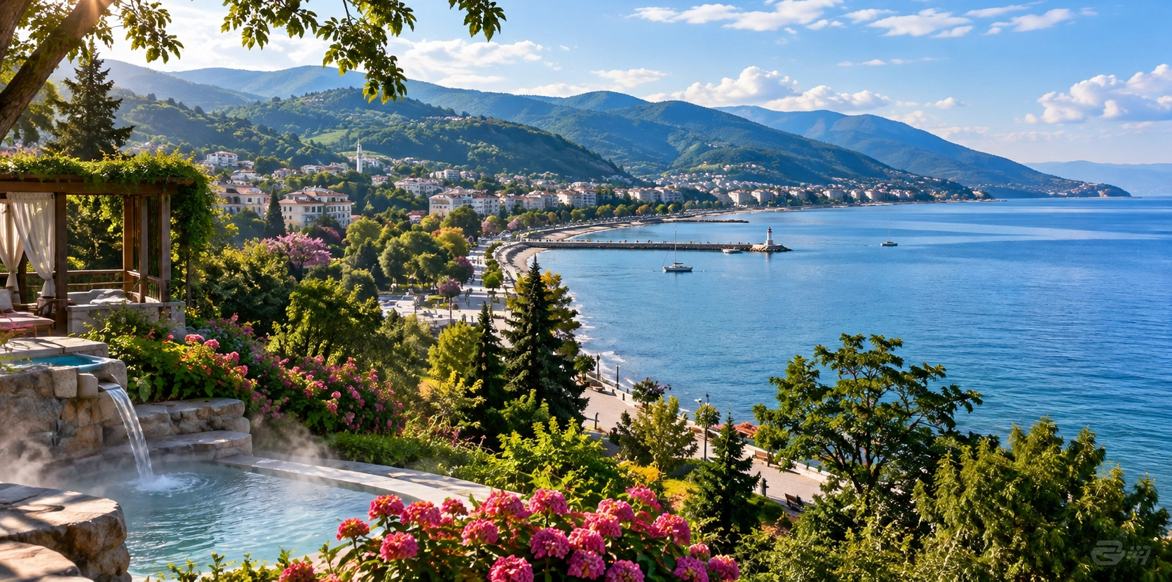
Discover castles, wetlands, forests, waterfalls, hot springs, historic mansions, coastal towns and cultural attractions throughout Yalova Province.
View Yalova GuidePair Çobankale with places that reveal Yalova’s wetlands, Atatürk heritage, thermal history and forest landscapes.
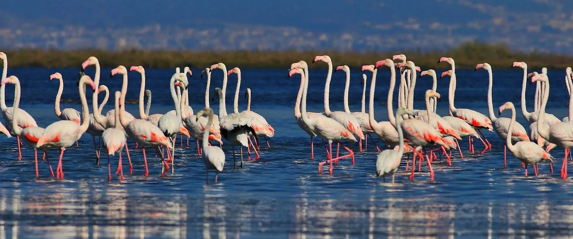
Move from medieval fortifications to one of Yalova’s richest wetlands, known for flamingos, migratory birds and accessible observation facilities.
Explore Hersek Lagoon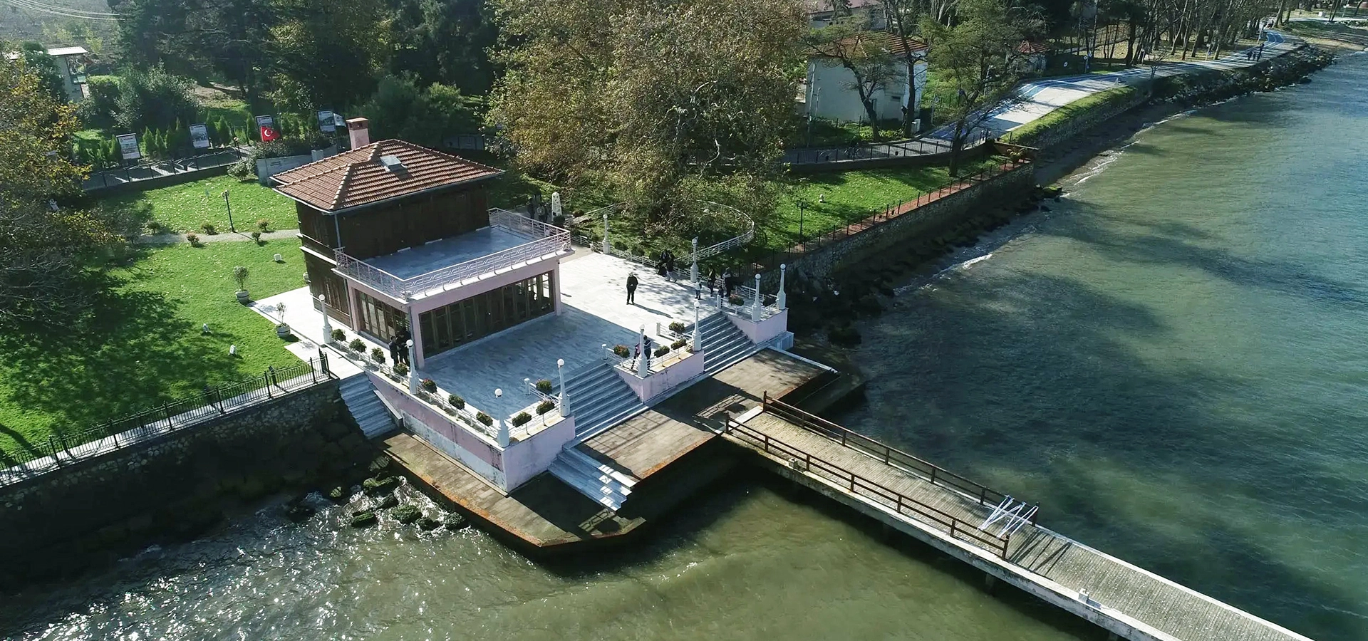
Discover the famous waterfront mansion associated with Mustafa Kemal Atatürk and one of Yalova’s best-known environmental stories.
Explore Yürüyen Köşk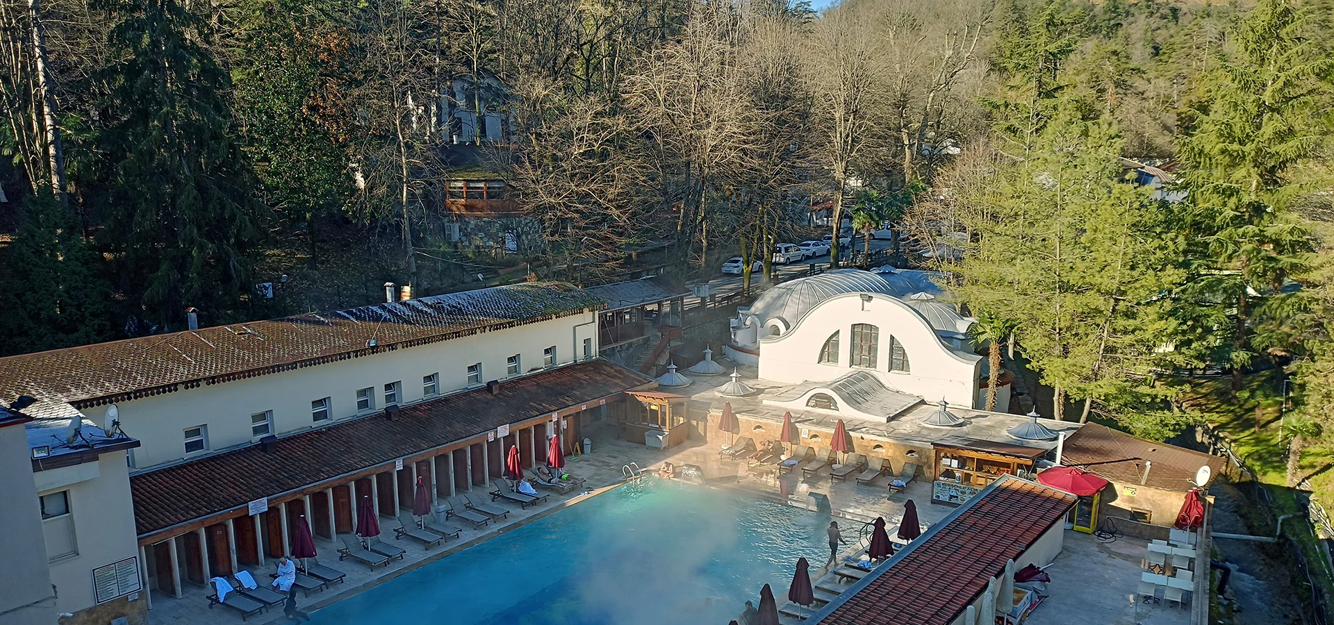
Continue from Altınova’s medieval landscape to the historic thermal baths, forested gardens and mineral-water heritage of Termal.
Explore Yalova Termal