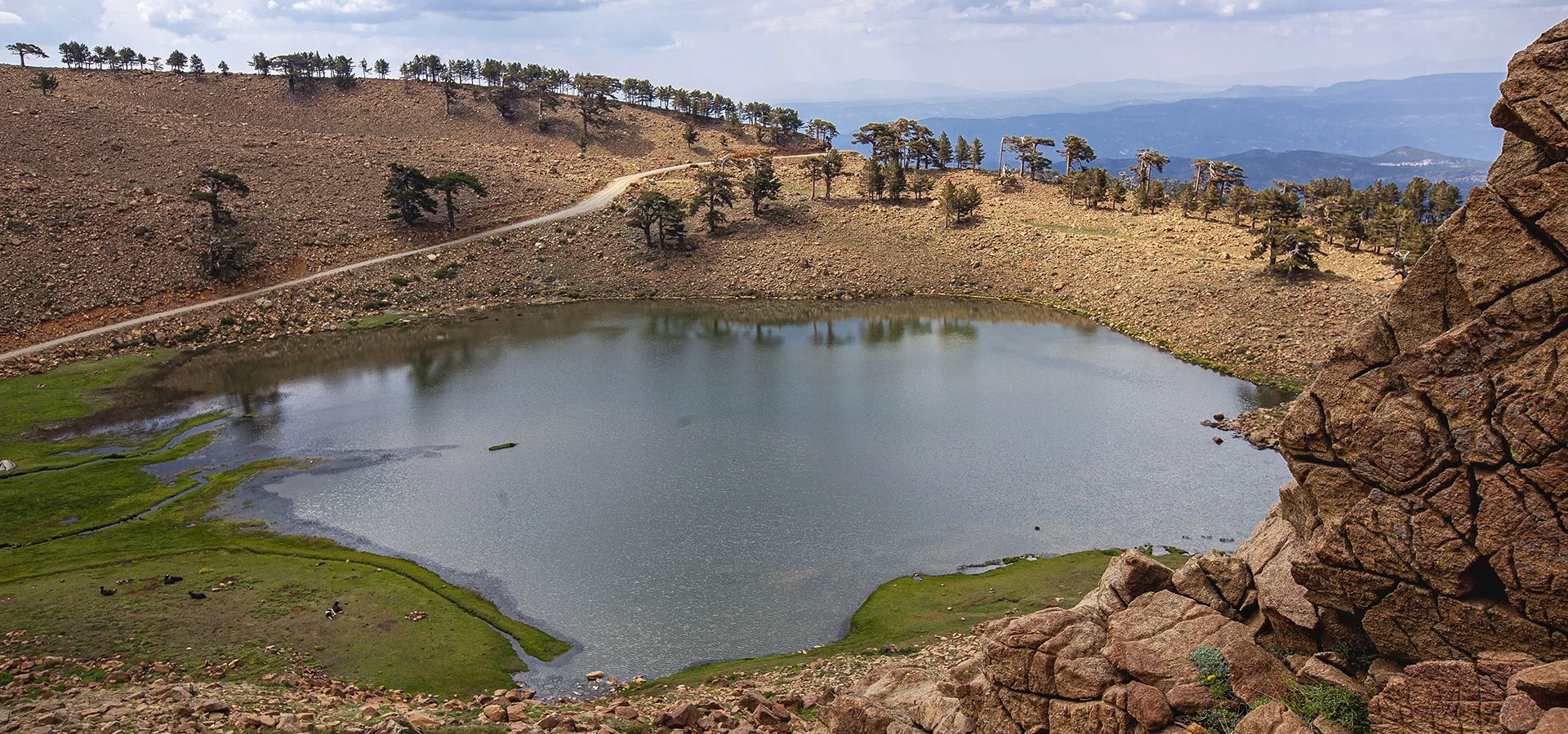
Sandıras Mountain
Explore the broader mountain massif, ancient forests and remarkable geological landscapes.
Explore This Guide →





Southwest of Denizli, Beyağaç opens onto a landscape of pine-clad mountains, farm valleys and traditional Yörük–Türkmen culture. Above the town, Kartal Lake (Kartal Gölü) lies in a glacially shaped basin on the Sandıras–Çiçekbaba massif, near ancient black pine forests whose monumental trees have made the area nationally significant.
Beyond the famous lake, explore the highland atmosphere of Topuklu Yaylası, the forest setting of Eşenler Pond, the seasonal waters of Karagöl and the cultural story of Eren Günü. Beyağaç is not a museum town with a compact pedestrian circuit: different valleys and elevations call for thoughtful route planning.
Essential access warning: The official Nature Conservation and National Parks (DKMP) listing says entry to Kartal Gölü Nature Conservation Area without permission is prohibited. Before arranging a lake, old-growth forest or Çiçekbaba visit, contact the responsible Muğla DKMP office for current authorization requirements and permitted activities.
Kartal Gölü, a protected high-altitude landscape.
Remarkably old black pines on Çiçekbaba’s slopes.
Topuklu Yaylası and its cool mountain air.
Eren Günü and regional Yörük–Türkmen traditions.
A quick guide to locations, elevations, heritage and the access rules that matter most.
Denizli, southwestern Türkiye
Southwest of Denizli city
Approximately 94 km to town
Approximately 650 m
Eskere Plain and Sandıras mountains
Ancient Anatolian black pine forests
Kartal Gölü
About 1,903 m in official visitor listings
23 December 1994
1,343 hectares
Prior authorization required
Çiçekbaba / Sandıras
Topuklu Yaylası
Approximately 1,700 m
Eşenler Pond
Karagöl
Eren Günü
1990; operating from 1991
Farming, livestock and forestry
Highland skywatching events
Verify forest-road conditions
Usually late spring to early autumn
Beyağaç appeals to travellers who prefer an authentic working district and memorable scenery over heavily developed attractions. Below the mountain crests lie the cultivated Eskere Plain, rural settlements and forested roads; high above them are lake basins, summer pastures and stands of ancient Anatolian black pine. The elevation changes are part of what makes the district special.
The standout landscape is Kartal Gölü, but Beyağaç should not be reduced to that single photograph. Topuklu Yaylası offers a more conventional highland outing, Eşenler Pond is much closer to town, and Karagöl is known for its seasonal water. The region also has compelling cultural depth through Yörük–Türkmen traditions and the annual Eren Günü observance.
The most successful visit begins with the right distinction: a recreational highland area and a legally protected nature conservation area are not interchangeable. Ask about access before planning any activity within the Kartal Lake reserve.
Mountain scenery, ecology and cultural travel
Kartal Gölü and old-growth pines
Topuklu Yaylası, subject to facilities
Legal access and mountain-road conditions
Beyağaç is a district in the south of Denizli Province, neighbouring Kale, Tavas, Acıpayam and Çameli and lying near the provincial boundary with Muğla. The Denizli Provincial Directorate of Culture and Tourism puts the district centre about 94 kilometres from Denizli city.
The district centre stands on the Eskere Plain at around 650 metres elevation. The surrounding mountains rise much higher: Topuklu Yaylası is around 1,700 metres, while Kartal Lake is commonly described at roughly 1,903 metres. Travelling a relatively short map distance can therefore mean a substantial change in elevation and weather.
Although Kartal Lake is closely associated with Beyağaç tourism, the national conservation database administratively lists the reserve under Muğla / Köyceğiz, at the border area accessible from Denizli. This explains why the appropriate conservation authority for permissions is the Muğla DKMP office.
About 94 km
Eskere
About 650 m
Kartal reserve: Muğla DKMP jurisdiction
Beyağaç lies in a fertile part of inland southwestern Anatolia, where farming, herding and access to the surrounding forest shaped settlement long before the modern administrative district existed. The local history published by the provincial tourism authority recounts an Ottoman-era connection to Mihrişah Sultan and charitable endowment traditions, but readers should distinguish these local historical accounts from independently dated archaeological evidence.
The names Sazak, Sarıyer and Eskere appear in the story of how settlements in the area developed. The tourism directorate explains that Sarıyer and Eskere eventually joined under the name Beyağaç. This is a useful reminder that the district is a modern administrative unit formed from older communities.
Beyağaç was organised as a municipality on 6 June 1972. It became a district by a law dated 20 May 1990, and began operating separately from Kale on 5 August 1991. Today the local economy still reflects agriculture, animal husbandry and forest-related work.
Sazak, Sarıyer and Eskere
6 June 1972
20 May 1990
5 August 1991
The name Beyağaç identifies today’s district and town; Eskere survives in local geographical and forestry terminology, including the Eskere Plain and Eskere Forest Management. Sandıras or Sandras refers to the mountain massif, while Çiçekbaba names an important summit and a focal point of local stories.
These names appear together in travel articles, which can make it seem as though they describe one place. In reality a lake, a protected forest, a meadow and the district centre occupy different parts of a large upland landscape. Historic spellings and interpretations of the mountain names vary; this guide does not claim a definitive linguistic origin that the official sources do not establish.
The distinction is especially useful when navigating: entering “Beyağaç” in a map application takes you to town, not automatically to the correct authorized approach for Kartal Lake, Topuklu or an individual forest route.
The district and its centre
Older settlement and local forest designation
Mountain massif
Summit and cultural landscape
Kartal Gölü (Eagle Lake) lies high on the Sandıras–Çiçekbaba slopes, amid rock, alpine vegetation and ancient pines. Official Denizli visitor descriptions put it at approximately 1,903 metres above sea level. The small lake and the older trees form a striking combination, particularly in the open light of the summer uplands.
The lake is significant not only for its beauty. Government tourism sources describe a glacially shaped valley and moraine-dammed lake in this landscape. That means the water and the surrounding slopes tell a geological story about former ice, erosion and sediment movement.
Kartal Lake is part of a Nature Conservation Area (Tabiatı Koruma Alanı), not simply a lakeside public park. Do not rely on old articles describing free picnic or camping access. Consult the current rules, authorizations and route conditions before setting off.
Kartal Gölü
1,903 m
Glacial landforms and moraine
Permission requirements apply
The Directorate of Nature Conservation and National Parks (DKMP) lists Kartal Gölü Nature Conservation Area as declared on 23 December 1994, with an official area of 1,343 hectares. The national database places it under Muğla’s administration, while many tourism guides approach it from Beyağaç in Denizli.
The current DKMP listing uses an unambiguous warning: entry without permission is prohibited. It does not establish an unrestricted tourist schedule, ordinary admission-ticket system, automatic camping entitlement or general authorization for drones, collecting plants, fires or off-trail hiking.
For a planned visit, contact Muğla Nature Conservation and National Parks Directorate, listed by DKMP at +90 252 223 03 09, and ask what authorization is required for your specific date and purpose. Check the current access route, whether a guide or written approval is necessary, and any restrictions linked to fire risk or wildlife protection.
A separate forest or highland venue outside the legally protected reserve may have different rules. Never interpret a general festival announcement or an old camping photograph as blanket permission to enter the conservation area.
Nature Conservation Area
23 December 1994
1,343 hectares
Muğla DKMP: +90 252 223 03 09
The official Culture and Tourism description identifies a glacial valley extending northeastward from around Ulugöl Tepe, a Sandıras mountain summit listed at about 2,261 metres. The account describes a valley roughly 1.5 kilometres long, with distinctive evidence of glacial erosion and deposition.
Glaciers can carve bowl-shaped hollows and steep-sided valleys, while the unsorted material they leave behind forms moraines. Kartal Lake is interpreted in national tourism material as a lake held by a moraine barrier. That explanation is different from calling it a volcanic crater lake, a description sometimes seen in local visitor copy.
The terrain has real educational value for geology enthusiasts. Yet research significance does not make high-elevation slopes automatically accessible: use authorized, established routes, and avoid unstable scree, sensitive vegetation or unapproved collecting.
Glacially shaped mountain valley
About 1.5 km
Moraine-dammed in national tourism description
Conserve landforms and vegetation
The ancient black pines (Anadolu karaçamı) near Kartal Lake are among the district’s greatest natural treasures. These mountain trees withstand cold, wind and difficult growing conditions. Government tourism sources describe unusually old specimens, with many of the trees assessed in the centuries-old range and some individual examples reported at more than a millennium.
The ages found in publications differ according to which trees were measured and when the survey was conducted. It is more accurate to describe this as an exceptionally old black pine ecosystem than to claim every large tree is 1,300 years old. Tree age requires scientific methods; trunk size alone is not proof.
Ancient bark, exposed roots and weathered branches are vulnerable. Do not carve names, climb or lean equipment on the trees, collect wood or cones, or walk across regeneration areas. Their value is ecological and scientific, not merely photographic.
Anatolian black pine
Old-growth forest ecology
Vary by measured specimen and source
Never damage trees or forest soil
The Kartal Lake landscape includes a transition from black pine forest to open alpine vegetation. Official descriptions mention herbaceous meadow plants, flowers and other species thriving under relatively severe mountain conditions. This diversity is a principal reason for protected-area designation.
Beyağaç’s broader valleys also support forest birds, insects and wildlife adapted to woodland and open slopes. Wildlife encounters cannot be guaranteed, and sensitive breeding habitats should never be approached for a photograph. Use binoculars instead of leaving a designated route.
Choose low-impact observation: stay in approved visitor spaces, carry litter out, avoid loud music, keep pets only where rules allow and do not pick flowers. If you encounter livestock and shepherd dogs outside the reserve, give animals room and follow local guidance.
Black pine stands and alpine meadow
Observation rather than collection
Keep distance; no guaranteed sightings
Leave no trace
Çiçekbaba is part of the Sandıras mountain landscape and also a place rich in local belief and oral tradition. The Denizli tourism directorate records multiple stories about the name, linking it with a revered elder, flowers and spiritual associations. These are living narratives, not one fully proven historical biography.
From a natural-history perspective, the slopes are especially notable for old pine stands, changing vegetation with height and traces of glacial processes. From a cultural perspective, the mountain is connected with the Eren Günü gathering and the remembrance of Eren Dede.
Because some areas are protected and high-altitude, reaching a named summit should never be treated as a casual self-guided stroll. Check land-management rules, route permission, weather, visibility and physical demands independently.
Sandıras / Sandras
Eren Dede and Çiçekbaba traditions
Pines, alpine habitats and glacial terrain
Protected access and mountain readiness
Eren Günü is one of Beyağaç’s best-known cultural traditions. The Denizli cultural authorities describe a long-standing annual gathering linked to the Çiçekbaba–Kartal Lake mountain area and the Yörük–Türkmen heritage of southwestern Anatolia. Local accounts speak of a history extending over several centuries.
The tradition has involved families and groups coming together in the highlands, visiting the place associated with Eren Dede, offering prayers and sharing communal time. Certain ritual practices are matters of local belief and vary with participation; they should be approached respectfully rather than staged for tourists.
An official culture document states that a proposal was made in 2013 to consider this tradition for UNESCO intangible-heritage recognition. A proposal must not be misrepresented as confirmed UNESCO inscription. The date and public programme can change, and festival access does not automatically replace reserve permits.
Eren Günü
Yörük–Türkmen highland traditions
Çiçekbaba / Eren Dede
Proposal reported; no inscription claimed
Beyağaç’s event calendar includes more than its traditional highland gathering. In 2026, local reporting announced a Tarhana and Culture Festival for 26–29 August, starting with an Eren Günü programme and followed by activities in the district. That was a specific past-year programme, not a guaranteed annual set of dates.
The region also hosts traditional wrestling and other cultural or sporting events. The Turkish Traditional Wrestling Federation’s 2026 calendar listed a Beyağaç municipal oil-wrestling event on 4 October 2026. Festival dates, venues and visitor restrictions need fresh confirmation for any future trip.
An event is a good way to experience community life, but crowded programmes are different from quiet mountain travel. Plan parking and accommodation early when relevant, respect participants and residents, and never assume special-use rules apply outside the announced event arrangements.
26–29 August 2026
4 October 2026
Check next year’s official programme
Attend as a respectful guest
Topuklu Yaylası is a highland recreation landscape south of Beyağaç, around 1,700 metres above sea level and approximately 20 kilometres from town in the provincial tourism listing. Large trees, mountain air and forest scenery make it an attractive contrast to the warmer cultivated plain.
Government tourism material describes a picnic and camping environment with water and various visitor facilities, including buildings for food service and recreation. Those descriptions are older and should not be taken as proof that every shower, restaurant, lodging unit or activity remains open on the day of your visit.
Topuklu is a useful alternative for travellers primarily seeking a forest-and-meadow break rather than navigating the stricter permission regime of Kartal Lake’s nature conservation area. Still, verify current management, camping rules, fire restrictions and access before departure.
1,700 m
About 20 km in tourism descriptions
Scenery and authorized highland recreation
Current facilities and camping permission
With its elevated position and distance from the biggest urban centres, Topuklu Yaylası has become associated with skywatching and astronomy gatherings. In August 2026, local reporting described a week-long public sky-observation programme organised with municipal participation.
The appeal of the highland night sky is easy to understand: clear horizons and relatively limited nearby artificial light can make stargazing rewarding. However, cloud, moonlight, seasonal haze and the lighting of an event itself all affect what you can actually see.
Bring warm clothing even after a hot day in town, use a dim red light when appropriate, and stay on lawful accessible areas. Do not drive or camp on unauthorized forest tracks after dark; check event dates or arrange a permitted observation location before travelling.
Topuklu Yaylası
August 2026 skywatching programme
Warm layers and a safe light
Verify opening and permission
Eşenler Göleti, also written Eşen Göleti, lies in the Eşenler area east of town. The Denizli provincial tourism guide puts it approximately 8 kilometres from Beyağaç, surrounded by pine woodland. It is a more manageable first look at the district’s outdoor landscapes than a trip into the far higher protected mountains.
The district governorate describes the pond’s setting as an established forest recreation area. Older official information refers to angling and a sizable water surface but also says the area has no visitor facility; do not count on staffed services, rentals, toilets or food service without checking.
Fishing and camping rules can change, especially around managed reservoirs and forests. Follow current permits and fire regulations. Swimming or motorized water sports should never be assumed to be authorised simply because there is open water.
Approximately 8 km
Pine forest and pond
Do not assume facilities
Check current fishing and recreation rules
Karagöl is described in official Denizli tourism material as lying in the uplands between Çiçekbaba and Armıtçık, approximately 16 kilometres from Beyağaç and about 1,334 metres above sea level. It should not be confused with Kartal Lake.
The local description emphasises a shallow, seasonal body of water influenced by spring flow and rainfall. It reports that the water may disappear in summer and return in autumn. A traveller expecting a full lake in every month could therefore be disappointed; water levels cannot be guaranteed.
The scenery is attractive for those interested in ecological change and old pines, but the approach and exact site-management rules need verification. Do not assume that every road on a satellite map is public or suitable for a normal passenger car.
1,334 m
About 16 km in older tourism information
Seasonal water
Water and access vary by season
Official district-tourism information names more remote natural features such as Boyalıdere, Gökçay and Doğançay. These valley environments combine mountain water, trees, rocky sections and habitats that are less developed for conventional tourism.
The names are interesting for researchers and experienced nature travellers, but a place’s appearance in a tourism inventory is not evidence of a maintained public trail, safe vehicle access or permission to enter. In particular, the local description of Doğançay suggests a wild valley rather than an established sightseeing path.
Treat these as special-interest places requiring up-to-date local information, not guaranteed stops on a half-day itinerary. Ask relevant land and forest authorities about route conditions, protected designations, seasonal stream levels and any need for a knowledgeable local guide.
Boyalıdere, Gökçay and Doğançay
Research-led nature exploration
Not confirmed as public visitor trails
Do not improvise remote approaches
The provincial tourism directorate identifies Beyağaç as an important Yörük–Türkmen cultural landscape in a geographical transition zone. Seasonal herding traditions, foodways, family stories and community celebrations all contribute to this identity.
The mountains should not be pictured as an untouched medieval world. Beyağaç’s communities are contemporary and varied, and people participate in inherited practices in different ways. A careful visitor will listen rather than assume every household follows the same customs.
Eren Günü is one window into the tradition, but so are local conversations, farming routines and the relationship between pastures and settlements. Always ask permission before photographing residents, livestock, homes or devotional activities.
Yörük and Türkmen traditions
Eren Günü
Farming, pasture and family heritage
Ask and listen
Beyağaç’s district centre is surrounded by an agricultural landscape. Government accounts mention the cultivation of crops such as wheat, barley, maize, beans and vegetables, together with animal husbandry and beekeeping. Crop mixes and production levels fluctuate with seasons and market conditions.
The mountains add an important forestry dimension to the district’s economy and history. The Eskere forestry name appears repeatedly in local administration; timber, woodwork and the management of forest resources form part of the area’s story.
Visitors should respect cultivated fields, irrigation channels and private tracks. Buying locally made food can support the district, but it is important not to advertise an agricultural product as officially certified or geographically protected without independent evidence.
Eskere Plain
Farming and livestock
Forestry and woodwork
Private farmland and working roads
Beyağaç is well suited to discovering simple inland Denizli cooking: soups, local breads, seasonal vegetables, yoghurt-based foods, grilled dishes and home-style meals, depending on the kitchen and market. Restaurants are not necessarily organised around tourist set menus, so availability matters more than a long list of promised dishes.
Tarhana has particular cultural prominence. The town hosted a Tarhana and Culture Festival in 2026, reflecting the local significance of this traditional fermented soup base. Regional versions and household recipes vary; a festival’s name does not prove the existence of a formally protected Beyağaç-only recipe.
For a relaxed day, consider lunch in town and carry water and snacks to highland stops. Do not assume that cafés will be operating at Topuklu on your date or that food is available near Kartal Lake’s protected area.
Everyday inland Denizli dishes
Tarhana
Town centre, depending on opening
Carry your own drinking water
The best-known compositions are Kartal Lake with the old black pines, dramatic high-elevation slopes and the changing colours of the glacial basin. Yet these should be photographed only with lawful access and without damage to sensitive vegetation or the old trees.
Topuklu Yaylası offers forest paths, mountain light and open highland scenery, subject to present visitor rules. Eşenler Pond may suit reflective waterside compositions, while the cultivated Eskere Plain offers a different visual language of fields, roads and rural settlement.
If you plan a drone flight, commercial photo shoot or organised group photography, obtain any relevant aviation, land-management and protected-area permissions in advance. Do not treat social-media drone images as proof of authorization.
Ancient pines and Kartal Lake
Topuklu
Eşenler Pond
Permissions before drones or reserve entry
The provincial tourism authority places Beyağaç about 94 kilometres from Denizli. A published driving approach follows the Denizli–Muğla road toward Kale, then takes the Beyağaç road from the Kale area. Actual distance and time depend on the starting location and route conditions.
Older tourism material mentions minibus services from Denizli or Kale to Beyağaç, but does not establish current timetables or onward transport to the mountain sites. Check locally before relying on a public connection, particularly if you intend to return the same day.
For dispersed natural destinations, a private car or prearranged driver is generally easier. But a paved approach to Beyağaç town is not the same as an authorized or passable route to Kartal Lake. Check both the legal permission and the current condition of higher forest roads.
Via Kale from Denizli–Muğla road
Approx. 94 km to town
Confirm current minibus timetable
Separate road and permission checks
Build the itinerary around geography. Eşenler Pond is commonly listed around 8 km from town, Karagöl around 16 km, Topuklu around 20 km, and the black-pine forest around 27 km in an older local description. These figures are indicative; actual driving distance and conditions may differ substantially.
For Kartal Lake, government sources give different distances depending on the access route or measurement method: one culture-portal description mentions about 18 km from Beyağaç, while an English ministry page refers to a 40 km forest road. Never use the shorter figure as a guaranteed driving mileage.
Forest roads may be unpaved, steep, exposed or seasonally closed. Do not use an unfamiliar remote road without checking with local road or forestry authorities. Ask your driver about vehicle suitability, return arrangements and daylight.
Eşenler Pond in local tourism descriptions
Different route lengths reported
Confirm road surface and suitability
Return route, fuel and daylight
Late spring through early autumn is often the most straightforward period for highland outings, but snow, storms and road closures can persist well beyond winter at the highest elevations. Conditions around the town at 650 metres can be very different from those at a 1,700–1,900 metre mountain site.
Summer often offers the clearest chance of comfortable time in the highlands, while bringing stronger sun and possible forest-fire controls. Autumn can be beautiful for photography, but mountain weather changes fast and daylight grows shorter. Winter requires caution: do not assume that forest roads or recreational facilities remain open.
Kara göl’s seasonal water level and the date of Eren Günü add another dimension. The best month depends on whether your priority is a cultural gathering, forest recreation, lake photography or observing a particular ecological season. Check current access regardless of the date.
Green landscapes; possible snow higher up
Popular for highlands; fire restrictions possible
Cooler, shorter days; changing lake levels
High-elevation routes may be inaccessible
Beyağaç’s scenery invites walking, but it is important not to invent a marked hiking network where one has not been established. Some paths are forestry routes, agricultural tracks or routes within legally sensitive nature areas rather than signposted public trails.
For a modest outdoor outing, focus on currently open recreation areas and ask managers about the approved paths. More demanding routes should be planned with current local information, offline navigation, suitable gear, daylight and the ability to turn around.
Highland weather can deteriorate quickly. Take layers, adequate water, sun protection and footwear with good grip. Stay clear of unstable slopes; avoid lone off-trail hikes and never enter a protected area without the relevant permit.
Use confirmed legal trails
Storms, cold and changing visibility
Layers, water and navigation
A marked map line means open access
Camping in a permitted recreation area and camping inside a Nature Conservation Area are not the same thing. Older sources describe picnic and tent facilities at Topuklu Yaylası and recreation around Eşenler Pond. Ask the current operator or forest authority which activities and locations are allowed now.
For Kartal Lake, the DKMP listing expressly prohibits entry without permission. Do not interpret blogs portraying tents near the lake as proof that camping is routinely authorized. Verify the reserve’s exact rules, restrictions and any permit process before placing it on your itinerary.
Wildfire prevention is especially important in pine country. Fires, barbecues, overnight stays, vehicle access and drone use may be banned or restricted at short notice. Pack out waste and do not disturb grazing areas, forest wildlife or water sources.
Topuklu, with current confirmation
Eşenler Pond, rules to check
Reserve permission required
No fires unless expressly allowed
Beyağaç can be a lovely regional stop for families who like fresh air and outdoor learning. A short visit to the town and Eşenler Pond, or a carefully planned trip to Topuklu, may be a better match for young children than a high-elevation reserve visit.
On any mountain outing, account for cooler temperatures, longer drives, limited toilets, weak mobile coverage in places and possible motion sickness on winding roads. Carry warm clothing, water and snacks, and keep children away from lake edges and steep slopes.
For a family interested in old forests and glacial scenery, treat Kartal Lake as a permission-led special outing, not an obligatory part of the day. A pleasant experience comes from matching each stop to the group’s ability and the current rules.
Town and Eşenler Pond
Topuklu, if open and suitable
Layers, water and sun protection
Unpermitted reserve access and risky edges
The district centre and the high mountain landscapes offer very different conditions. Do not assume that Kartal Lake, old-growth forest trails or unpaved approaches are wheelchair accessible simply because they appear on a sightseeing map.
Topuklu Yaylası has been described as having visitor facilities, but the current operating status and accessible routes are not guaranteed by older publications. Ask about parking distance, surface gradients, step-free access, toilets and any mobility assistance before travel.
For travellers who need minimal walking, a scenic drive through legal public roads with an accessible meal stop in town may be more realistic. Share specific mobility requirements with a driver or tour organiser early.
Check venue-by-venue accessibility
Confirm paths and toilets directly
Do not assume step-free access
Agree on a site-specific route
For a comfortable half-day from the Beyağaç area, consider the district centre and Eşenler Pond. Begin with a look at the valley setting and local shops, take a simple meal or café break if available, then drive to the pond if current access and weather allow.
This plan offers a taste of the district without making complicated assumptions about high-elevation forest roads or protected-area access. It suits travellers making a short stop on a wider Denizli–Kale regional route.
A half-day is not an appropriate default for a rushed Kartal Lake excursion. A nature-reserve visit needs a separate decision based on permission, road distance, conditions and available daylight.
Beyağaç town
Eşenler Pond, if accessible
Car or prearranged local driver
A relaxed local outing
For a nature-focused full day, begin with the town and its Eskere Plain context, then travel to Topuklu Yaylası if the area is open and facilities or trails suit your group. Enjoy the woodland setting without overloading the schedule, then return for a local meal.
If your interests are more cultural, include conversations about Yörük–Türkmen traditions or plan around a confirmed community event. Festivals involve their own crowd and access arrangements, so they need a separate transport plan.
If you specifically want Kartal Lake and the ancient pines, design a different, permission-led full day. First obtain the required confirmation from DKMP; only then establish a legal route, vehicle, weather contingency and realistic return time. Never advertise both routes as interchangeable.
Town + Topuklu
Documented local event
Authorized Kartal Lake outing
Weather, access and road conditions
Day one could focus on Beyağaç town, its rural landscape, Eşenler Pond and possibly Karagöl if reliable local access information is available. The aim is to understand the district’s plain and middle elevations, not to tick off every mapped feature.
Day two can be a highland outing at Topuklu Yaylası, provided access and facilities are confirmed. Travellers who have obtained the necessary reserve permissions might instead choose a dedicated Kartal Lake / ancient-pine visit. Build in a weather alternative, especially outside peak summer.
Accommodation choice matters: do not assume that a historic description of Topuklu’s overnight facilities confirms present-day bookability. Check the availability of licensed accommodation in town or the wider region before booking travel.
Town + nearby landscapes
Topuklu or separately permitted reserve
Verify current operation
One major mountain focus per day
Kale is a practical neighbouring area on the drive from Denizli, while Tavas offers a wider look at inland villages, craftsmanship and heritage. The Sandıras Mountain guide helps place Beyağaç’s glacial landscapes and black pines in their broader geographical setting.
Acıpayam is another district with a very different visitor offer: Keloğlan Cave, Yazır Mosque and traditional shoemaking around Yeşilyuva. Pamukkale and Hierapolis represent Denizli’s best-known archaeological and travertine landscape, best given a separate substantial visit if time allows.
Distances between mountain valleys can be deceptive. Pair places for geography and interests, not just because they appear close on a provincial map. Reserve time for mountain roads and confirm the specific accessibility of each stop.
Kale and Tavas
Sandıras Mountain
Acıpayam
Pamukkale and Hierapolis
Wow Cappadocia can discuss tailor-made travel across Denizli and southwestern Türkiye, with a Beyağaç itinerary adapted to nature, landscapes, culture or photography. This is a destination guide, not a promise of an established daily departure or automatic access to protected places.
Let us know your travel date, guest numbers, accommodation or pickup point, walking ability and priorities. A family might enjoy Eşenler Pond or a confirmed Topuklu visit; a specialist group may be interested in the ecology and geology of the Sandıras landscape.
Any proposed Kartal Lake / Çiçekbaba reserve experience is conditional on the responsible authority’s permission and permitted activities, along with guide, vehicle, road and weather suitability. For enquiries, visit our contact page.
Private and tailor-made enquiries
Ecology, local culture and photography
Permits, conditions and availability
Tell us the date and starting point
Practical answers on Kartal Lake, nature-reserve permissions, Topuklu Yaylası, Eren Günü and mountain travel.
Beyağaç is in southern Denizli Province in southwestern Türkiye, near Kale and the Muğla provincial border.
The Denizli provincial tourism directorate gives approximately 94 km to the district centre. Distances to mountain attractions are different.
It is particularly associated with Kartal Lake, ancient black pine forests, Topuklu Yaylası and the Eren Günü tradition.
Yes for travellers interested in highland scenery, ecological history, quiet rural landscapes and regional cultural traditions, with careful planning.
Kartal Gölü is in the Sandıras–Çiçekbaba mountain landscape near Beyağaç; the protected area is administered through Muğla DKMP.
No. The official DKMP listing explicitly says unauthorized entry is prohibited. Contact the responsible Muğla DKMP office first.
DKMP lists Muğla Nature Conservation and National Parks Directorate, telephone +90 252 223 03 09. Confirm the current procedure directly.
Its formal DKMP designation is Nature Conservation Area (Tabiatı Koruma Alanı), a category with its own restrictions.
The national DKMP database lists the designation date as 23 December 1994.
Official Denizli visitor descriptions commonly list the lake at about 1,903 metres above sea level.
National tourism descriptions emphasize glacial processes and a moraine-dammed lake; older local accounts sometimes use the word crater. The glacial explanation is more specific.
Many trees are centuries old, with some individually measured examples reported as more than a thousand years old. Ages vary by tree and source.
Do not assume camping is allowed. Because the lake is in a Nature Conservation Area, ask DKMP whether entry and overnight stays are permitted for your particular purpose.
Different official guides give different figures, including an 18 km location description and a longer forest-road route. Check the actual lawful route with local authorities.
It is a highland landscape south of town at roughly 1,700 metres, known for trees, cool air and recreation; verify current operation and access.
Older tourism material mentions tent camping, but present-day rules, capacity, restrictions and facilities must be confirmed with the current management.
The highland has hosted astronomy and sky-observation events, including one reported in August 2026. Plan permitted access and check the weather.
Eşenler Göleti is a pine-fringed pond about 8 km from the centre, described in official local tourism listings as a forest recreation setting.
Yes. Karagöl is a separate seasonal mountain waterbody described at about 1,334 metres and around 16 km from Beyağaç.
Not necessarily. The Denizli provincial tourism description says its water can disappear in summer and return with the autumn season.
It is a long-standing Yörük–Türkmen-associated cultural and devotional gathering linked to the Çiçekbaba mountain landscape.
An official cultural document describes a 2013 proposal for consideration; that should not be confused with confirmed inscription.
The 2026 programme was announced for 26–29 August. Future-year dates must be checked when the organisers publish them.
Look for everyday local and inland Denizli dishes. Tarhana has a particularly visible place in the district’s festival culture.
Late spring through early autumn often works best for highland plans, although road conditions and site-specific permission remain essential.
Yes, with appropriate routes such as the town or approved recreation spaces. High-elevation, isolated and protected terrain needs special care.
Do not assume so. Forest-road conditions and access restrictions need direct verification; a map pin does not establish safe access.
It can be included in a wider Denizli itinerary, but a worthwhile mountain outing requires enough time and careful route planning.
You can request a tailor-made itinerary. Any reserve visit or special activity remains subject to permits, safe access and operational availability.
Discover mountains, heritage towns and remarkable landscapes across southwestern Türkiye.
Balance natural scenery, rural traditions and the wider region’s rich heritage.
Explore the broader mountain massif, ancient forests and remarkable geological landscapes.
Explore This Guide →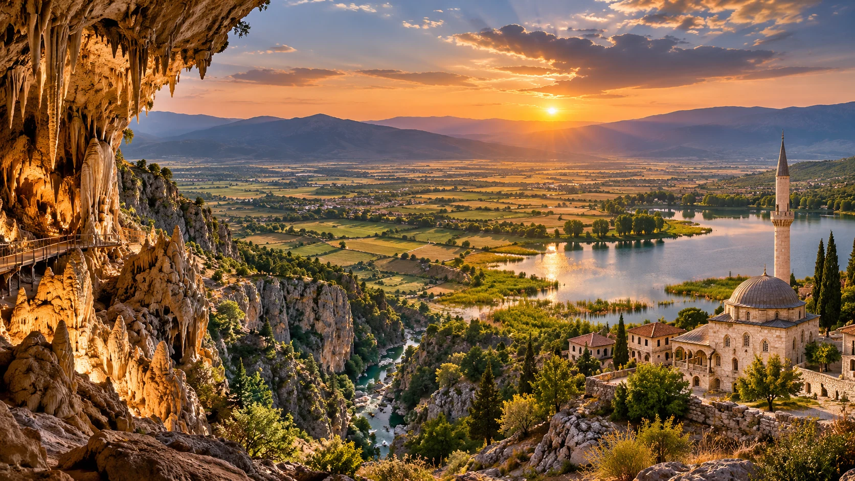
Continue to caves, Ottoman painted architecture and the region’s living craft traditions.
Explore This Guide →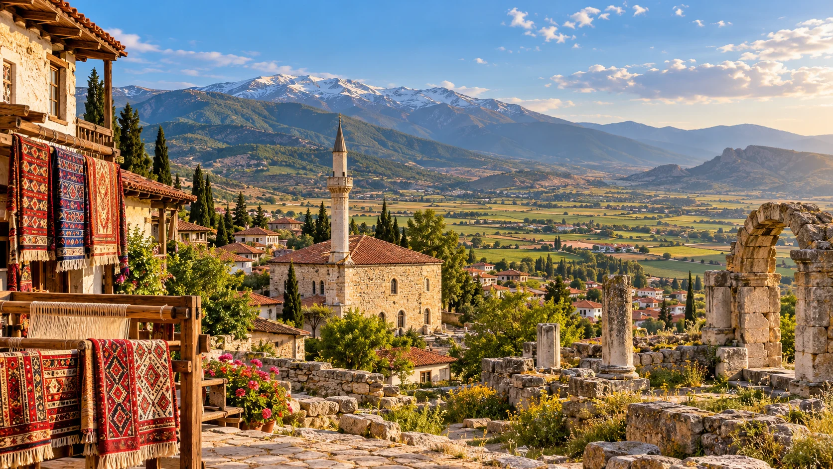
Discover neighbouring inland Denizli villages, food and traditional heritage.
Explore This Guide →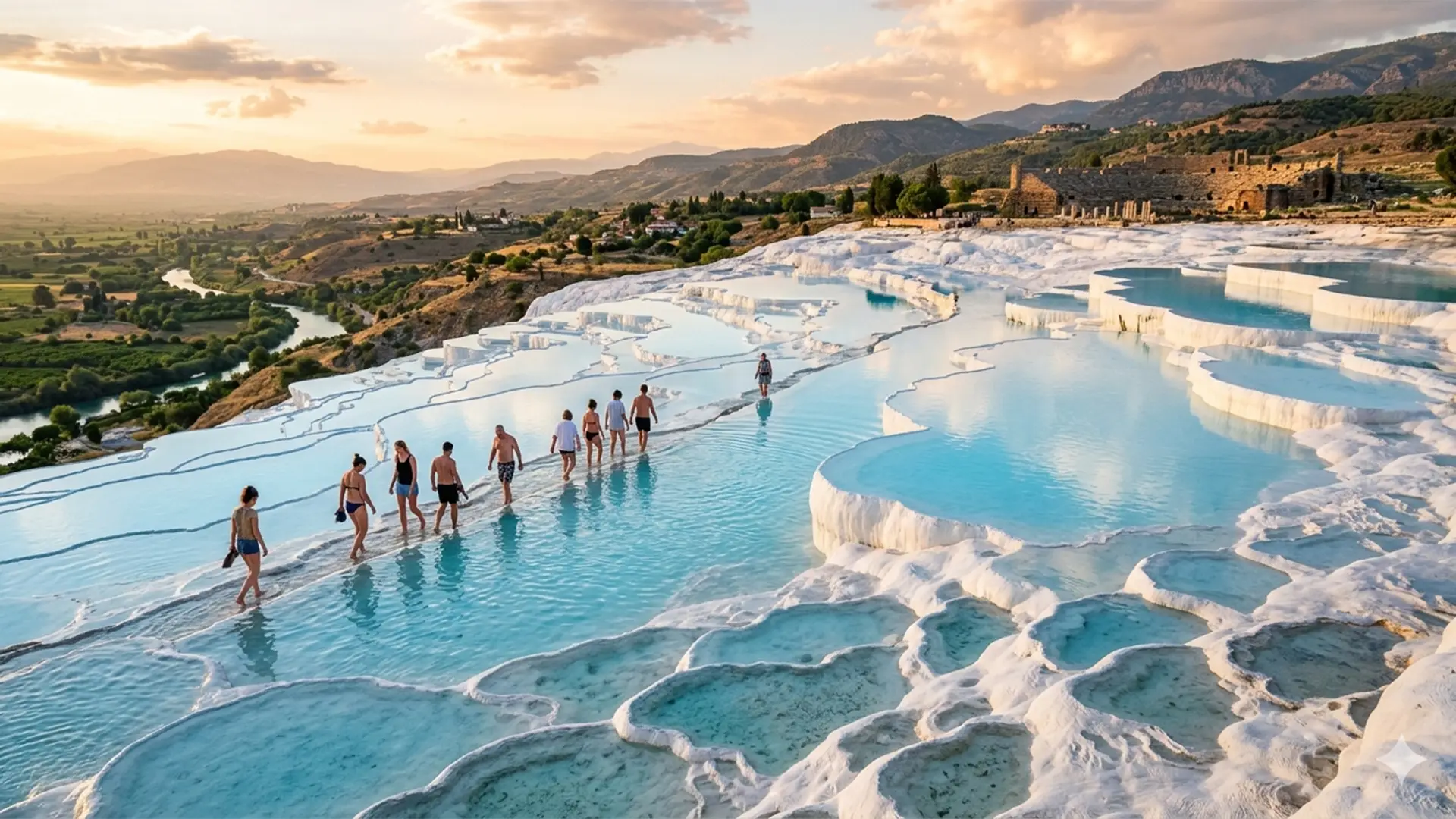
Contrast highland Beyağaç with Denizli’s renowned travertine terraces and classical city.
Explore This Guide →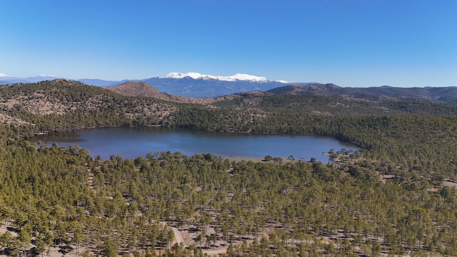
Enquire about a carefully planned route with confirmed site access and local arrangements.
Send an Enquiry →