Private Yenipazar Nature Experience
Ask us about a tailor-made route combining Kayaboğazı Canyon, Yenipazar countryside, Su Uçtu Waterfall and selected natural or historical places across Bilecik.
Request a Custom Tour





Kayaboğazı Canyon, or Kayaboğazı Kanyonu, is a canyon name associated with the rugged countryside of Yenipazar district in Bilecik Province. Provincial tourism material places the Kayaboğazı canyon route between Karahasanlar in Yenipazar and Harmanköy in İnhisar.
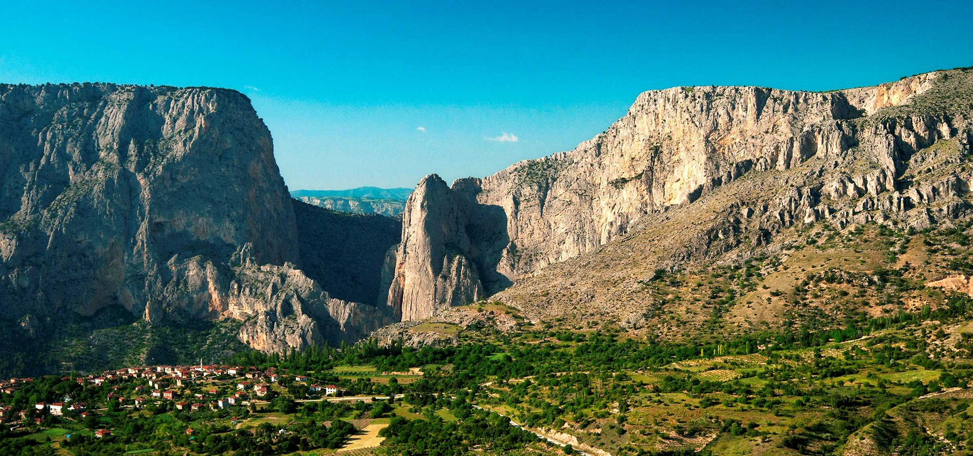
The area is characterized by high limestone walls, narrow valley scenery, flowing water, cave openings and sparsely developed rural terrain. A speleological field report describing Kayaboğazı records a much broader canyon environment of roughly 10 kilometres, while Bilecik tourism material identifies a 3.1-kilometre canyon trekking route between Karahasanlar and Harmanköy.
The canyon is particularly interesting because of its karst landscape. Bilecik planning documents list Kayaboğazı Canyon Caves among the province’s recorded cave sites, with a documented cave length of approximately 36.5 metres.
There is an important naming point for travelers. Official and regional sources also use the name Harmankaya Canyon for the protected canyon corridor between Karahasanlar and Harmanköy. For practical trip planning, it is therefore wise to search both Kayaboğazı Kanyonu and Harmankaya Kanyonu when checking current access, maps and local directions.
For visitors exploring the province, Kayaboğazı fits naturally into a wider route through Bilecik’s canyons, waterfalls, forests and rural landscapes. Nearby nature destinations include Su Uçtu Waterfall and the wider Yenipazar–İnhisar canyon country.
The provincial tourism walking route associated with Kayaboğazı runs between Karahasanlar and Harmanköy.
A cave-research field report describes the broader Kayaboğazı canyon system as approximately ten kilometres long.
Regional planning records list Kayaboğazı Canyon Caves with a documented length of about 36.5 metres.
Steep carbonate rock walls and karst features define the canyon landscape.
Essential information for understanding and planning a visit to this rugged canyon landscape in the Yenipazar–İnhisar area.
Yenipazar–İnhisar area of Bilecik Province, associated with the Karahasanlar–Harmanköy corridor.
Search on Google MapsBilecik tourism material lists a 3,100-metre canyon walking route between Karahasanlar and Harmanköy.
A speleological field report describes the wider Kayaboğazı canyon environment as approximately 10 km long.
Limestone walls, karst forms and cave development are central to the canyon’s character.
Kayaboğazı Canyon Caves are listed in regional planning documents at approximately 36.5 m in length.
Rocky slopes, scrub, trees, rural fields, watercourses and steep canyon walls.
Landscape photography, geology, quiet nature excursions and experienced hiking.
Expect natural, uneven and potentially steep ground rather than a fully developed visitor attraction.
Kayaboğazı and Harmankaya are both used in sources for the Karahasanlar–Harmanköy canyon corridor.
A dramatic rural canyon landscape where scenery and geology are the main attractions.
The appeal of Kayaboğazı lies in the meeting of limestone cliffs, cave formations, flowing water and quiet countryside.
The strongest visual feature of Kayaboğazı is its steep limestone topography. The canyon landscape rises abruptly above the valley floor, creating a dramatic transition from cultivated countryside to exposed rock.
Its geological character also explains the presence of caves. Limestone can dissolve gradually along fractures and bedding planes, producing karst features, cavities and cave passages that add another layer of interest to the canyon.
Kayaboğazı is also valuable because it remains comparatively rural. Visitors encounter a landscape shaped by rock, water, vegetation and village life rather than dense tourism infrastructure.
The canyon name appears in both tourism and cave-research records, making it an interesting example of how local geographical names can overlap with later protected-area and route names used in official tourism promotion.
Bilecik Provincial Directorate of Culture and Tourism materials describe a canyon route between Karahasanlar in Yenipazar and Harmanköy in İnhisar and identify it with the name Kayaboğazı.
Other official sources describe the protected canyon in the same Karahasanlar–Harmanköy corridor as Harmankaya Canyon. This means visitors may encounter both names when researching the area.
Historical cave-research material also uses the name Kayaboğazı Canyon for a wider canyon system in the Yenipazar area and describes it as lying on a local stream within limestone terrain.
For modern trip planning, do not rely on a single search term. Use both Kayaboğazı Kanyonu Bilecik and Harmankaya Kanyonu Bilecik, then confirm the exact starting point with current local mapping or tourism authorities.
Kayaboğazı’s most distinctive physical feature is the presence of large limestone rock masses. A cave-research account describes the stream entering the canyon near a major limestone wall and records the canyon as a significant karst landscape.
Limestone is especially important because it is vulnerable to slow chemical dissolution by water. Over long periods, this process can enlarge cracks, create underground voids and contribute to caves, cavities, ledges and irregular rock forms.
The canyon walls reveal the relationship between surface erosion and underground karst development. Water cuts through the valley while fractures in the rock can guide cave formation inside the cliffs.
This combination makes Kayaboğazı interesting not only as a scenic destination but also as a small-scale geotourism landscape for visitors interested in how rock, water and time shape northwestern Anatolia.
Large carbonate rock faces dominate the canyon scenery.
Water can dissolve limestone along fractures and gradually create cavities and caves.
The canyon illustrates the close relationship between flowing water and erosion.
The area rewards visitors who look beyond scenery and pay attention to geological structure.
One of the most interesting details in regional planning records is the listing of Kayaboğazı Canyon Caves among Bilecik Province’s documented cave sites.
The Bilecik spatial strategy plan, drawing on the province’s nature-tourism master planning, lists the Kayaboğazı Canyon Caves in Yenipazar with a recorded length of approximately 36.5 metres.
Speleological field notes also describe multiple cave mouths in the canyon walls. Some openings were reached only by steep natural approaches and rope techniques during research activity.
These records should not be interpreted as an invitation for casual cave entry. A cave that is suitable for trained researchers is not automatically safe for unprepared visitors.
Regional planning records list Kayaboğazı Canyon Caves at approximately 36.5 metres.
Field researchers documented several cave mouths in the canyon walls.
Some cave approaches described by researchers involved steep terrain and rope work.
Unmanaged caves can contain fall hazards, loose rock, darkness and difficult exits.
Kayaboğazı is visually defined by the contrast between pale rock faces and the greener valley below. The cliff walls rise sharply from a landscape of shrubs, trees, fields and scattered rural settlement.
Depending on the viewpoint, visitors may see the canyon as a broad geological gateway or as a narrower corridor shaped by the local watercourse. The strongest compositions often combine rock, vegetation and winding rural roads.
The natural appearance changes significantly through the year. Fresh spring growth softens the rock, summer creates stronger colour contrast, and autumn brings warmer vegetation tones.
Because the terrain is rural and not uniformly developed, the landscape should be experienced with patience. Some of the most rewarding views may come from safe roadside or village-side viewpoints rather than from attempting a difficult canyon descent.
Bilecik tourism material lists a 3,100-metre canyon route between Karahasanlar and Harmanköy associated with Kayaboğazı. This gives the area a clear connection with hiking and nature tourism.
However, visitors should not assume that the entire route is a simple recreational footpath. The wider Karahasanlar–Harmanköy canyon landscape includes steep rock, water, loose surfaces and sections that can require much greater experience.
For a casual visit, the safest approach is to enjoy accessible viewpoints and established rural tracks rather than committing to a full canyon crossing without current route information.
Use proper walking shoes, carry water, and turn back whenever the terrain becomes exposed, slippery or difficult to interpret. Never assume that a visible track continues safely.
A 3.1 km Karahasanlar–Harmanköy canyon route appears in provincial tourism material.
Expect stone, earth, vegetation and uneven surfaces rather than continuous paving.
Use current mapping and local advice because old route descriptions may not reflect present conditions.
Do not continue into terrain that requires climbing, rope work or water crossings without proper experience.
Kayaboğazı is especially rewarding for landscape and geological photography. The scale of the limestone walls can be emphasized by including roads, fields, trees or buildings in the frame.
Wide-angle compositions work well from open viewpoints, while longer focal lengths can isolate cave openings, eroded rock textures and layered cliff faces.
Morning and late-afternoon light can add depth to the canyon walls. Cloudy conditions can also be useful because softer light preserves detail in both pale limestone and darker vegetation.
Never climb exposed rock or approach unstable cave openings merely for a photograph. Use stable viewpoints and respect private agricultural land around the canyon.
Show the full relationship between canyon walls and the rural valley floor.
Include roads, trees or buildings to communicate the size of the cliffs.
Look for fractures, cavities, vegetation pockets and weathered limestone textures.
Do not approach exposed edges or unstable slopes for a better angle.
The best time to experience Kayaboğazı depends on weather, ground conditions, vegetation and water level. For most casual visitors, dry and stable conditions are more important than choosing a specific month.
Spring brings green vegetation and potentially stronger water flow, but rain can make soil and rock slippery.
Summer usually provides easier road and walking conditions, although exposed areas can become hot. Carry more drinking water than you expect to need.
Autumn is often excellent for photography because softer light and changing vegetation add colour to the limestone scenery.
Winter can make rural access, shaded rock and steep tracks significantly more hazardous because of rain, frost, snow or ice.
Kayaboğazı should be treated as a rural canyon landscape rather than a conventional staffed attraction. Do not assume the presence of a ticket office, café, toilets, marked parking bays or permanent personnel at every approach.
The most useful geographical reference is the Yenipazar–İnhisar corridor around Karahasanlar and Harmanköy. Because naming differs between sources, searching both Kayaboğazı and Harmankaya is recommended.
Before leaving a populated area, save offline maps and make sure your phone is charged. Mobile coverage can be inconsistent in steep rural terrain.
Bring drinking water, sturdy footwear, sun protection, a light layer and a basic first-aid kit. For emergency assistance in Türkiye, call 112.
Kayaboğazı is a natural canyon environment. Potential hazards include steep slopes, loose stone, wet rock, hidden drops, cave openings and difficult route finding.
Use walking or hiking footwear with dependable grip.
Stay well back from cliff tops, unstable ledges and loose slopes.
Cave exploration requires lights, helmets, route knowledge and appropriate experience.
Rain can rapidly change footing and water conditions in canyon terrain.
For longer or remote routes, travel with companions and tell someone your plan.
Do not rely on finding safe drinking water in the canyon.
Do not cross gates, fields or agricultural property without permission.
Call 112 for emergency assistance in Türkiye.
Kayaboğazı has significant accessibility limitations because the attraction is a natural canyon landscape rather than a fully engineered visitor site.
Do not assume continuous paved paths, ramps, handrails, accessible toilets or wheelchair-friendly viewing platforms. Roadside viewpoints may be easier to reach than canyon-floor routes.
Visitors with limited mobility, balance concerns or difficulty on uneven ground should prioritize safe panoramic viewpoints and avoid steep or unmarked tracks.
If step-free access is essential, verify current conditions locally before traveling because approach roads and viewpoints can change over time.
The most consistent location information places the Kayaboğazı canyon route in the Yenipazar–İnhisar area of Bilecik, between Karahasanlar and Harmanköy.
From Yenipazar, use Karahasanlar as a primary reference point. Regional sources describing the nearby protected canyon corridor place its northern approach in the Karahasanlar area.
Because current digital maps may favour the name Harmankaya Canyon, search both names before departure and compare the route with the villages shown on the map.
Do not follow an unverified pin deep into rural terrain after dark. Arrive with daylight, ask locally when necessary and avoid narrow roads during severe weather.
Travel to Yenipazar district in Bilecik Province.
Use Karahasanlar as the main reference for the Yenipazar side of the canyon corridor.
Cross-check Kayaboğazı and Harmankaya names on current maps.
Confirm the safest current viewpoint or walking access before leaving established roads.
Harmanköy in İnhisar provides the principal geographical reference for the opposite side.
Plan rural driving and walking so you can return before dark.
A simple scenic visit can be planned around 1–2 hours if you are mainly interested in views, photographs and a short walk on safe ground.
A half day is more comfortable if you want to explore rural roads, visit several viewpoints and combine the canyon with nearby villages.
A full day allows time to combine Kayaboğazı with other nature destinations around Yenipazar, including Su Uçtu Waterfall.
A full technical canyon crossing is a completely different activity and should not be estimated like ordinary sightseeing. Route difficulty, water and technical requirements must be evaluated independently.
Panoramic views, photography and a short safe nature stop.
Several viewpoints, rural driving and time around the canyon approaches.
Combine Kayaboğazı with waterfalls and other Yenipazar landscapes.
Plan separately with experienced leaders and current local conditions.
Begin in Yenipazar and continue toward the Karahasanlar side of the canyon landscape. The road gradually leaves the district centre and enters a quieter rural environment.
Before leaving the main village roads, check your saved map and compare the Kayaboğazı and Harmankaya names. Choose a safe viewpoint rather than following every unpaved track.
Spend time taking in the limestone walls, cave openings and rural valley scenery. Use a telephoto lens or binoculars to study rock details without approaching exposed slopes.
If you want to walk, stay on a clear and manageable route. Turn back before the terrain becomes steep, technical or difficult to follow.
Return to Yenipazar with sufficient daylight. If conditions and timing are good, extend the day to Su Uçtu Waterfall for a contrasting highland-waterfall landscape.
Kayaboğazı works best as part of a Yenipazar–İnhisar nature route, combining canyons, waterfalls, rural villages and Sakarya-basin landscapes.
Visit Yenipazar’s approximately thirty-metre highland waterfall near Yukarıçaylı village.
Explore the protected canyon landscape associated with the same Karahasanlar–Harmanköy corridor; check current route conditions before technical access.
Use this rural Yenipazar village as a key geographic reference for the canyon area.
Explore the İnhisar side of the canyon country and its steep valley landscape.
Continue across the province for Ottoman heritage, waterfalls, forests, ponds, traditional villages and historic towns.
Compare Kayaboğazı’s limestone canyon scenery with another peaceful natural landscape in Bilecik Province.
Yenipazar and İnhisar form one of Bilecik’s most interesting areas for canyons, steep valleys, caves, waterfalls and rural nature tourism. The terrain drops toward the Sakarya basin through deeply incised valleys.
Kayaboğazı belongs to this broader geological setting. The combination of carbonate rock, water erosion and steep relief has produced a landscape very different from the gentler agricultural areas found elsewhere in the province.
The nearby Harmankaya Canyon Nature Park is the best-known protected canyon in this corridor and has become the principal modern reference for canyon tourism between Karahasanlar and Harmanköy.
Kayaboğazı remains useful as a historic and local geographical name, particularly because it also appears in cave-research and provincial tourism records.
Carry out every bottle, wrapper, tissue and item you bring with you.
Do not damage rock, write on walls, remove formations or disturb wildlife.
Avoid creating new shortcuts on erosion-prone slopes.
Do not cut branches, pick plants unnecessarily or damage scrub around the cliffs.
Preserve the quiet character of the canyon and nearby villages.
Do not light fires or barbecues unless clearly permitted under current local rules.
Park responsibly and never block homes, farm roads, forestry access or emergency routes.
Leave geological features in place for future visitors and scientific value.
It is associated with the Yenipazar–İnhisar area of Bilecik Province, particularly the canyon corridor between Karahasanlar and Harmanköy.
It is called Kayaboğazı Kanyonu.
The available sources use both names for the Karahasanlar–Harmanköy canyon corridor, while cave-research records also preserve the Kayaboğazı name. For navigation, search both names and verify the current access point locally.
Different sources describe different scales. Provincial tourism material lists a 3.1 km canyon route, while a speleological field report describes the broader Kayaboğazı canyon as approximately 10 km.
Yes. Regional planning documents list Kayaboğazı Canyon Caves in Yenipazar with a documented length of approximately 36.5 metres.
Do not assume cave entry is suitable for casual visitors. Research accounts describe steep access and rope use at some openings, so unprepared entry should be avoided.
Yes for experienced nature walkers, but route conditions vary. Casual visitors should remain on clear, manageable tracks and avoid technical canyon terrain.
Only the safer roadside or village-side viewpoints may be suitable. Children should remain under close adult supervision around steep slopes, cave openings and uneven ground.
Do not assume wheelchair access. The area is a rugged rural landscape with uneven natural surfaces and limited visitor infrastructure.
The sources used for this guide do not identify a dedicated Kayaboğazı ticket office. Because the area overlaps with the modern Harmankaya canyon corridor, check current local arrangements before visiting.
Kayaboğazı is primarily a natural landscape rather than a conventional indoor attraction. Plan a daylight visit and verify any protected-area access restrictions that may apply.
Do not assume full visitor facilities are available at the canyon. Carry water and basic supplies from Yenipazar or another populated centre.
Yes. The combination of limestone cliffs, cave openings, rural roads and vegetation makes it one of Yenipazar’s most distinctive geological landscapes.
Spring through autumn can all be rewarding, but dry and stable weather is more important than a specific month for casual sightseeing.
Try “Kayaboğazı Kanyonu Bilecik” and “Harmankaya Kanyonu Bilecik”, then compare the result with Karahasanlar and Harmanköy.
The name Kayaboğazı also appears in other parts of Türkiye, including the Araç district of Kastamonu. This guide refers specifically to Bilecik Province.
Good combinations include Su Uçtu Waterfall, Yenipazar countryside, Harmankaya Canyon and the rural landscapes around İnhisar.
It is especially rewarding for travelers who enjoy geology, canyon scenery, photography, caves and less-developed rural destinations.
Combine Kayaboğazı Canyon with Su Uçtu Waterfall, Yenipazar countryside and selected historical attractions around Bilecik through a private itinerary designed around your interests and pace.
Enjoy a tailor-made day combining Kayaboğazı’s dramatic limestone scenery, Yenipazar countryside and selected nature and heritage stops across Bilecik Province.
Ask us about a tailor-made route combining Kayaboğazı Canyon, Yenipazar countryside, Su Uçtu Waterfall and selected natural or historical places across Bilecik.
Request a Custom Tour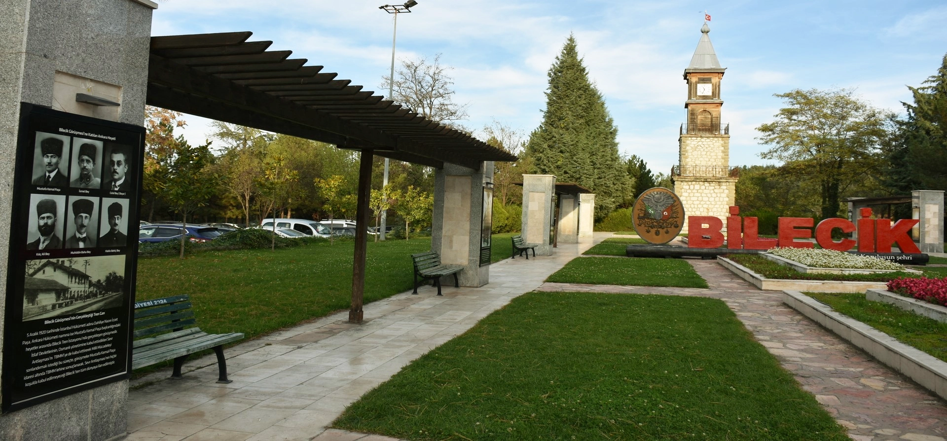
Discover Ottoman foundation history, canyons, waterfalls, forests, ponds, villages and historic towns throughout Bilecik Province.
View Bilecik GuidePair Kayaboğazı’s limestone cliffs with other dramatic natural landscapes across Bilecik Province.
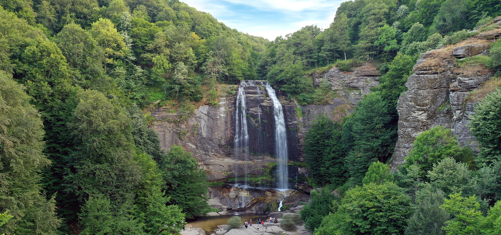
Discover Yenipazar’s approximately thirty-metre highland cascade, surrounded by rock, forest and quiet countryside.
Explore Su Uçtu Waterfall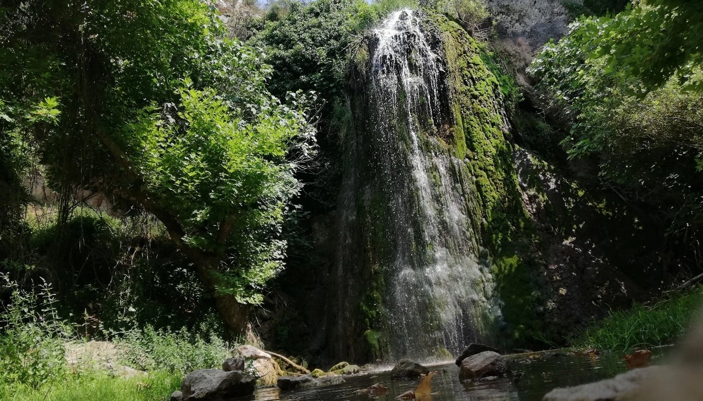
Explore another Bilecik nature destination surrounded by vegetation, rock formations and peaceful countryside.
Explore Kınık Waterfall
Continue exploring Ottoman heritage, museums, historic towns, forests, waterfalls and countryside across Bilecik Province.
Explore Bilecik