Private Daskyleion & Lake Manyas Experience
Ask us about a tailor-made day combining Daskyleion Ancient City, Bandırma Museum and Lake Manyas Bird Paradise with private transport and flexible timing.
Request a Custom Tour





On a low archaeological mound known as Hisartepe, close to Ergili village and the southern shore of Lake Manyas, Daskyleion preserves one of north-western Anatolia's most unusual ancient stories. This was not simply another Greek or Roman city. For roughly two centuries under the Achaemenid Empire, Daskyleion served as the administrative centre of the Persian satrapy usually known to Greek writers as Hellespontine Phrygia.
The site matters because its archaeology records cultural contact in unusually direct form. Phrygian and Lydian fortifications, a Lydian-period kitchen, Persian-period administrative architecture, seals and clay bullae, Anatolian-Persian funerary art, Greek pottery, local inscriptions and later Hellenistic and medieval remains all occupy the same landscape. Daskyleion was a place where Anatolian, Persian and Greek traditions interacted rather than existing in isolation.
Among the most important discoveries are the seal impressions and bullae connected with the satrapal administration. Marks left by papyrus and cords on the backs of some sealings indicate that they once secured documents, providing rare archaeological evidence for an official archive. These small objects helped confirm the identification of Hisartepe as ancient Daskyleion and remain central to the study of Achaemenid government in western Anatolia.
The surrounding landscape is equally important. Ancient authors describe the residence of the satrap Pharnabazus together with villages, abundant supplies and hunting grounds or paradeisoi. The modern setting beside Lake Manyas — today famous for its wetlands and birdlife — helps visitors understand why this fertile, well-watered territory could support an elite administrative estate.
Daskyleion governed a strategically important Achaemenid territory around the Propontis, Hellespont and north-western Anatolia.
Hundreds of complete and fragmentary bullae preserve impressions from seals associated with administration, correspondence and elite identity.
Fortifications, domestic architecture and the remarkable Lydian kitchen reveal the city before Persian rule.
Recent work continues to expose the monumental Lydian fortification and detailed evidence for food, architecture and everyday life.
Essential information for understanding one of the most important Achaemenid administrative centres excavated in western Anatolia.
Hisartepe near Ergili, Bandırma district, Balıkesir Province, beside Lake Manyas in north-western Türkiye.
A low mound in a fertile lake-and-wetland environment close to modern Lake Manyas / ancient Daskylitis Lake.
A major Achaemenid satrapal centre governing Hellespontine Phrygia and strategically important lands near the Propontis and Hellespont.
Pharnabazus, one of the best-documented Persian satraps in Classical Greek historical sources.
Hundreds of complete and fragmentary clay bullae, many preserving seal impressions and traces of papyrus or cords.
Important Phrygian and Lydian walls demonstrate major pre-Persian occupation and defensive investment.
Excavated kitchen layers include hearths, seeds, fish remains and animal bones preserved through destructive fire episodes.
Ancient literary sources associate the satrapal estate with hunting grounds and landscaped elite territory.
Important finds from Daskyleion are displayed in Bandırma Museum.
Allow around 1.5–2.5 hours for the site, or a full day with Bandırma Museum and Lake Manyas Bird Paradise.
Daskyleion is one of the best places in Türkiye to explore the meeting point between Achaemenid Persia, western Anatolia and the Greek world.
The first reason to visit is its Achaemenid history. Daskyleion was not a peripheral village loosely influenced by Persia; it was a major seat of provincial power. Satraps based here controlled territory of direct strategic importance to the Hellespont, Propontis and the routes connecting Anatolia with the northern Aegean.
The second reason is the administrative archive. Clay bullae preserve seal impressions, and some retain the physical traces of documents that they once closed. These objects provide a remarkably intimate view of bureaucracy: orders, correspondence and packages once moved through this centre under the authority of Persian officials.
The third reason is the pre-Persian city. Phrygian and Lydian fortifications, domestic architecture and food remains show that Hisartepe already had a complex history before Cyrus the Great brought Lydia and much of western Anatolia into the Achaemenid Empire.
Finally, Daskyleion is still evolving. Excavations in 2024–2025 expanded the monumental Lydian fortification and continued micro-scale research in the Lydian kitchen. It is a site where new fieldwork still changes the story from season to season.
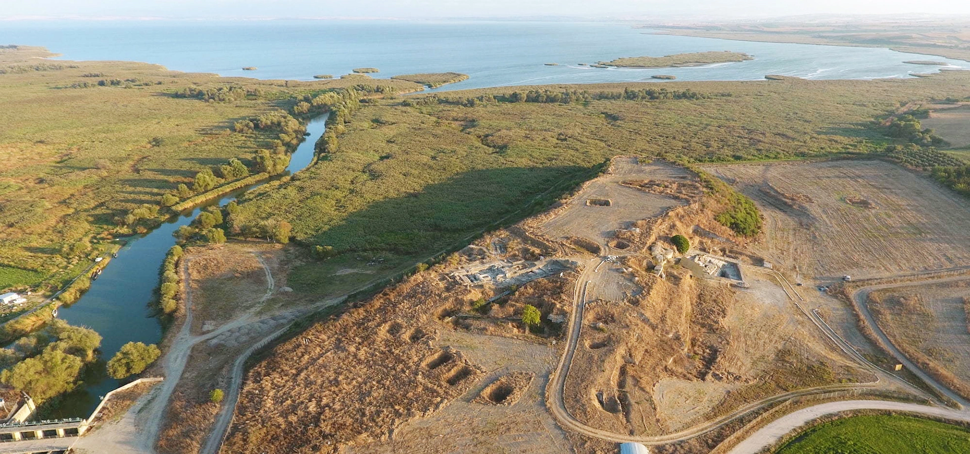
Daskyleion lies at Hisartepe near Ergili in the Bandırma district of Balıkesir Province. Official tourism information places the site roughly 30 km south of Bandırma and around 2 km east of Ergili, close to Lake Manyas and the internationally important wetland landscape associated with Kuş Cenneti.
The archaeological settlement occupies a relatively modest mound rather than a dramatic mountain acropolis. That low position is deceptive: the surrounding plain provided agricultural potential, water, routes toward the Propontis and access to a wider region that Persian administrators needed to supervise.
Ancient writers knew the nearby water body as Daskylitis Lake or by related names. Modern Lake Manyas has changed naturally over time, so the ancient shoreline should not be imagined as identical to today's. Even so, the lake environment remains central to understanding the site's economy and elite landscape.
Daskyleion stood within a region that connected the Hellespont, the Propontis and north-western Anatolia. Control here mattered because armies, tribute, messages and commercial traffic moved between the Aegean-facing world and the interior of the Persian Empire.
The site also commanded a rich local environment. The Lake Manyas basin supplied water, agricultural land, grazing and wetland resources. Xenophon's description of Pharnabazus's territory emphasises villages, supplies and hunting grounds, suggesting a landscape organised to sustain both administration and elite residence.
Achaemenid imperial power did not depend only on fortified capitals. It also depended on estates, roads, local communities, military strongpoints and controlled resources. Daskyleion's position allowed the satrap to draw on all of these while remaining close to the maritime frontier with the Greek world.
For modern visitors, this is why the view outward matters almost as much as the excavated walls. Daskyleion makes the most sense when read as the centre of a managed regional landscape, not simply as a mound containing ancient architecture.
The earliest history of Daskyleion is still being refined. Older official summaries note surface material that may point to activity before the Iron Age, while the best-defined excavated sequence highlights Phrygian and Lydian occupation during the early first millennium BCE. The settlement was therefore already important before Persian rule.
Ancient tradition connected the name Daskyleion with Daskylos, a figure associated with the Lydian royal house. The historical details belong partly to later literary tradition, but the archaeological evidence clearly demonstrates strong Lydian presence. Monumental walls and a substantial kitchen complex provide some of the most vivid evidence for this phase.
After Cyrus the Great defeated the Lydian king Croesus in the mid-6th century BCE, western Anatolia was incorporated into the Achaemenid Empire. Daskyleion became the centre of a satrapy that Greek sources call Hellespontine Phrygia. Herodotus and later authors record Persian governors based here, while Xenophon provides memorable descriptions of the estate of Pharnabazus.
The city remained important through the conflicts between Persia, Athens and Sparta in the 5th and early 4th centuries BCE. Its governors were deeply involved in diplomacy, naval warfare and the management of Greek cities around the Hellespont and Propontis.
Persian rule ended after Alexander the Great's campaign in 334 BCE transformed the political order of north-western Anatolia. Daskyleion continued into the Hellenistic period, and archaeology also records later phases including medieval occupation, though the Persian satrapal era remains the site's defining historical chapter.
Ancient and later traditions connect Daskyleion with a Lydian figure named Daskylos. In the traditional story, dynastic conflict at Sardis brought members of the Lydian royal house into this region, and the settlement eventually took a name meaning approximately the place or settlement of Daskylos.
The story is useful but should not be treated as a literal foundation record. Archaeology demonstrates that Hisartepe had settlement and fortification phases independent of the later royal narrative. The city therefore cannot be reduced to one named founder.
What is secure is the importance of Lydian culture in the 7th and 6th centuries BCE. The monumental wall discovered in recent excavations, the kitchen layers and other architectural evidence show that Daskyleion was already a substantial centre before the arrival of Persian administration.
Daskyleion's greatest historical significance comes from its role as an Achaemenid satrapal centre. The satrap was a provincial governor responsible for taxation, security, diplomacy and royal interests across a large territory. Greek writers knew the province by names such as Hellespontine Phrygia, while Persian imperial terminology organised the region within a broader system of peoples and lands.
The satrapy could include territories extending toward the southern Troad, Mysia, Bithynia and the shores around the Hellespont and Propontis, although exact boundaries changed over time. This placed Daskyleion at the centre of one of the empire's most politically sensitive western zones.
Governors based here had to negotiate with Greek poleis, collect revenue, maintain forces, secure routes and respond to wars that repeatedly crossed the Aegean-Anatolian frontier. Daskyleion was therefore both an administrative residence and an active political headquarters.
Its archaeology is especially valuable because relatively few provincial Persian capitals can be studied in such detail. Even where the actual satrapal palace survives only fragmentarily, seals, architecture, funerary monuments and imported or hybrid material culture reveal the presence of imperial authority.
The best-known ruler associated with Daskyleion is Pharnabazus, active during the late 5th and early 4th centuries BCE. Greek sources place him at the centre of diplomacy and warfare involving Persia, Athens and Sparta, making him one of the most visible Persian officials in Classical Greek historiography.
Xenophon describes a landscape around Daskyleion that included a palace, large villages, abundant supplies and hunting grounds. Some were enclosed parks, part of the Persian elite tradition known through the Greek word paradeisos, from which the later word “paradise” ultimately developed.
These descriptions are significant because they expand our image of an ancient capital beyond walls and buildings. The satrapal centre included agricultural production, dependent settlements, elite leisure landscapes and transport routes — an entire political economy surrounding the residence.
The modern wetland plain does not preserve the ancient estate in a simple visible form, but the scale and fertility of the landscape make the literary description easier to imagine.
One of Daskyleion's most important discoveries is the group of clay bullae uncovered during the early excavations. Approximately three hundred complete and fragmentary examples have been reported from the archive context, many carrying impressions made by seals.
The documents themselves — likely including papyrus — have not survived in the damp soil and destructive history of the site. Yet marks on the backs of some bullae preserve traces of papyrus surfaces and cords, demonstrating that the clay pieces had once closed documents or packages.
The imagery on the sealings is extraordinarily important. Persian-style, Greek-style and other motifs reveal the cosmopolitan nature of the administrative environment. Officials and individuals working through Daskyleion participated in a visual world that crossed political and cultural boundaries.
These bullae also played a decisive role in identifying Hisartepe as ancient Daskyleion. They transformed a topographic hypothesis into a much stronger archaeological case by connecting the mound directly with Persian administrative activity.
A small piece of clay pressed over a cord, document or closure and stamped with a seal.
A seal impression could identify an official, office or authorised sender while showing that a document had not been opened.
Papyrus and cord traces on the reverse of some examples point to a lost documentary archive.
Different artistic traditions represented in the glyptic material reflect the multicultural world of the satrapy.
The seals and seal impressions from Daskyleion are among the site's most informative objects. They include forms and imagery connected with Achaemenid, Babylonian, Anatolian and Greek artistic traditions, showing how provincial administration operated in a culturally mixed environment.
Seals were practical tools, but they were also statements of identity. A hunting scene, heroic figure, animal combat or divine symbol could communicate rank, cultural affiliation and political values in a space only a few centimetres wide.
Daskyleion is equally important for Anatolian-Persian funerary art. Stelae associated with elite tomb landscapes around the satrapal territory blend local stone-working and burial practice with motifs linked to Persian courtly culture.
Many of these objects are best appreciated in Bandırma Museum, where the archaeological material can be studied more closely than at the open-air mound.
Daskyleion stood at a cultural crossroads, and its inscriptions reflect that complexity. Phrygian writing appears in the region, while Aramaic — widely used in Achaemenid administration — is represented by important funerary evidence connected with the wider Daskyleion landscape.
Greek was also essential in a province that interacted constantly with Greek-speaking coastal cities. The combination of languages should not be understood as separate ethnic communities living without contact; rather, Daskyleion was part of a political environment in which people moved between administrative, military, economic and religious traditions.
The famous gaming board inscription mentioning Bagabazos is a striking example of this mixed world: the personal name is Persian, while the inscription is written with the Phrygian alphabet. Such finds capture cultural interaction at the level of ordinary objects rather than only royal monuments.
Religion at Persian-period Daskyleion was probably as culturally complex as its administration. Archaeological and textual studies discuss Iranian religious practices, sacred fire, local Anatolian traditions and Greek influences within the satrapal environment.
It is tempting to label every Persian religious feature “Zoroastrian,” but specialists continue to debate how closely Achaemenid royal and provincial religion should be identified with later, more clearly documented Zoroastrian institutions. Daskyleion is therefore best presented as evidence for Iranian religious traditions in a multicultural western province.
The official Culture Portal also notes a Persian-period three-roomed structure interpreted as having administrative and religious functions. Its meaning should be discussed within the wider archaeological context rather than identified too confidently with one specific cult.
This caution is part of what makes Daskyleion intellectually rewarding: it allows visitors to see how archaeology separates what is physically documented from broader historical interpretation.
Daskyleion preserves major fortification phases associated with both Phrygian and Lydian occupation. These walls demonstrate that the settlement had strategic and political importance before it became a Persian provincial centre.
Recent excavation has transformed understanding of the Lydian defence system. Work in 2024 identified a monumental wall east of the previously known Phrygian fortification, while the 2025 campaign extended the known line to approximately 157 metres of potential length, with around 72 metres exposed by that season.
The wall is built from andesite and limestone blocks and is dated by the excavation team to the 7th century BCE. In the best-preserved areas it survives to considerable height, and parts may have served both as defensive construction and as retaining architecture supporting the mound.
As excavation continues, this fortification may become one of the most visually impressive elements for future visitors. For now, access and visibility can change according to conservation work.
One of the most remarkable excavation areas is the so-called Lydian kitchen, interpreted by the excavation team as part of a larger palace-related complex. Rather than being famous for monumental decoration, the area is valuable because it preserves everyday evidence of food preparation and repeated destruction.
Excavators identified a major fire layer from the late 7th century BCE. The kitchen was rebuilt, only to be destroyed again by fire around the middle of the 6th century BCE. A later Persian-period building — often called the three-roomed structure — was then constructed above these earlier layers.
Research proceeds at an unusually fine scale. Soil is processed through flotation to recover tiny seeds, fish remains and micro-faunal material. Finds reported from the kitchen include cereal and pulse remains, fish bones, rodents, cat remains and butchered animal bones, allowing archaeologists to reconstruct food habits in extraordinary detail.
In 2025, the team reported two additional hearths. These discoveries show why Daskyleion should not be understood only through kings and satraps: kitchens can preserve a more direct record of daily labour, ingredients, diet and household organisation.
Official archaeological summaries identify an Achaemenid-period road or processional route together with a substantial three-roomed structure interpreted as having administrative and possibly religious significance.
These remains are important because they move the visitor beyond the idea of Daskyleion as merely a governor's residence. Provincial power needed spaces for controlled movement, reception, ritual, storage and administration, all organised within the satrapal complex.
The building also overlies earlier Lydian remains, including the kitchen sequence. This superposition makes Daskyleion especially instructive: instead of presenting one frozen historical moment, the mound reveals how a centre of Lydian power was physically reworked under Persian administration.
Because interpretation is still evolving, architectural labels should be understood as working archaeological descriptions rather than final reconstructions of every room's function.
The political landscape of Daskyleion extended beyond the mound. Around the wider territory, tumuli and funerary monuments preserve evidence for elites who participated in the mixed Anatolian-Persian culture of the Achaemenid period.
Research on stelae and ceremonial areas suggests that decorated monuments could stand near the skirts of tumuli, creating formal spaces for commemoration. Their imagery combines local practices with Persian courtly themes, hunting, banqueting and symbols of status.
The Koru Tumulus is among the important burial contexts studied by the Daskyleion project. Such monuments remind us that provincial governance was supported by networks of local and imperial elites whose identities were expressed through burial as well as administration.
Many tumulus areas are research landscapes rather than conventional visitor attractions. Do not enter agricultural land, climb burial mounds or approach protected monuments without clear legal access.
In 334 BCE, Alexander the Great crossed into Asia and defeated Persian forces at the Battle of the Granicus. The victory dismantled Achaemenid control across this part of north-western Anatolia and brought the satrapy of Hellespontine Phrygia into the Macedonian political system.
Daskyleion did not disappear immediately. Archaeology records Hellenistic occupation, and the strategic value of the region continued even as administrative structures changed.
What did change was the role that had made Daskyleion famous for two centuries. It was no longer the western residence of Persian satraps governing a frontier province of the Achaemenid Empire.
For visitors following Alexander's route, Daskyleion provides an excellent counterpart to the Granicus landscape: one site explains the battle's political target, while the other represents the military event that ended Persian rule in the region.
The modern identification of Daskyleion developed in the early 1950s. Kurt Bittel recognised the importance of Hisartepe in 1952, combining ancient geographical information with the archaeological landscape around Ergili and Lake Manyas.
Ekrem Akurgal began excavation in 1954 and continued until 1959. These early campaigns uncovered the famous bullae that strongly confirmed the site's identification and demonstrated the importance of Persian administrative activity.
After a long interval, systematic work restarted in 1988 under Prof. Dr. Tomris Bakır and continued through 2008. The excavations greatly expanded knowledge of the Achaemenid satrapal centre, its architecture, funerary landscape and Anatolian-Persian art.
In 2009 Prof. Dr. Kaan İren assumed leadership of the excavation. Current work continues with archaeological excavation, conservation, archaeobotany, zooarchaeology, paleogeography and other specialist studies that reconstruct both the city and its environment.
The most visible recent development is the continuing excavation of the Lydian fortification. By the 2025 season, the team reported that the line could extend to approximately 157 metres and that a substantial section had already been exposed, together with work around a major tower.
The second major research focus is the Lydian kitchen. Two additional hearths were reported in 2025, while flotation and micro-excavation continue to recover seeds, fish remains and small animal bones that would once have been discarded during ordinary excavation.
These discoveries represent two very different scales of archaeology. One is monumental — walls several metres high that define the settlement physically. The other is microscopic — burnt seeds and food debris that reveal what people actually ate.
Together they demonstrate why Daskyleion remains a living research site. Its future importance will come not only from exposing more architecture, but from integrating environmental, biological and material evidence into a more complete history of the settlement.
Daskyleion should not be approached with the visual expectations of Ephesus, Aphrodisias or Perge. The site is a stratified mound where walls, foundations, fortifications and excavation areas reveal successive periods rather than one monumental cityscape.
The most meaningful remains are often low architectural lines. Without context, a wall may look modest; with the history in mind, it becomes part of a Phrygian defence, a Lydian palace complex or the infrastructure of a Persian satrapal capital.
Recent exposure of the large Lydian wall is increasing the visual impact of the site. Nevertheless, many of Daskyleion's greatest discoveries — bullae, seals, pottery, stelae and small finds — are protected in museum collections rather than left outdoors.
The best way to visit is therefore to combine Daskyleion with Bandırma Museum. The mound gives you geography and architecture; the museum gives you the objects that explain the people and administration behind them.
The most important museum for Daskyleion is Bandırma Museum. It was established specifically to display material from Daskyleion, Kyzikos and archaeological sites in the surrounding region.
Its collections include Anatolian-Persian funerary stelae, Phrygian-inscribed monuments, Persian-influenced ceramics and other finds that give Daskyleion much of its historical depth. Objects in cases can often communicate cultural interaction more clearly than foundations on the mound.
A Daskyleion visit without the museum is therefore incomplete for serious archaeology travellers. If time allows, plan the site and museum on the same day.
Museum displays can rotate, and conservation requirements may keep individual objects off display. Verify current opening arrangements if a specific artefact is central to your visit.
Green landscapes, cool temperatures and excellent conditions for combining archaeology with birdwatching around Lake Manyas.
Warm, long days and a strong balance between archaeological comfort and wetland scenery before peak summer heat.
Hot and exposed on the mound. Visit early, then continue to Bandırma, Erdek or Kapıdağ later in the day.
Excellent for archaeology with softer light, cooler weather and rewarding conditions in the wider Manyas landscape.
Quiet and atmospheric, but rain and mud can make an active excavation mound less comfortable.
Possible for dedicated visitors, though wet weather, wind and seasonal site conditions can affect access.
For most travellers, April–June and September–October offer the most comfortable balance. If Lake Manyas Bird Paradise is equally important, plan around current birdwatching and reserve conditions rather than archaeology alone.
In warm months, begin in the morning. Hisartepe is relatively open, and early light makes wall lines and changes in ground level easier to read while keeping temperatures comfortable.
Morning also works well if you plan to continue to Lake Manyas Bird Paradise, where wildlife activity and visitor arrangements can depend on season and local conditions.
Late afternoon can provide attractive light across the plain, but Daskyleion is an active archaeological area rather than a conventional sunset viewpoint. Do not rely on unrestricted late access.
A practical sequence is Daskyleion in the morning, Bandırma Museum around midday or early afternoon, then the lake, Bandırma waterfront or Erdek depending on your route.
Daskyleion is listed by the Ministry of Culture and Tourism as an archaeological site / ören yeri, but the current official pages checked for this guide do not provide a dedicated, up-to-date public timetable or ticket tariff for Daskyleion itself.
Because fieldwork, conservation and local management can affect access, travellers should verify current visiting conditions before departure, especially if travelling a long distance specifically for the site.
The safest practical contacts are the relevant Balıkesir cultural authorities or Bandırma Museum, which is closely connected with the Daskyleion collections and regional archaeology.
Daskyleion lies roughly 30 km south of the city. A private car or taxi is the simplest option for combining the site with the museum.
The archaeological mound is about 2 km east of the village according to official tourism information.
The two attractions are close enough to form one archaeology-and-nature day, though use current road navigation rather than assuming a direct walking route.
Drive through the Bandırma area toward Manyas. Daskyleion works well with Kyzikos and Kapıdağ on a two-day South Marmara itinerary.
Approach north toward the Bandırma–Manyas region. A car gives the greatest flexibility for rural archaeological stops.
Regional transport serves settlements in the Bandırma–Manyas corridor, but the final archaeological access is far easier with a car, taxi or private transfer.
The most practical base, with the archaeological museum, transport connections, restaurants and easy road access to Daskyleion.
A good seaside option if you want to combine Daskyleion with Kyzikos, Kapıdağ and a relaxed Marmara coast evening.
Convenient for travellers whose main priority is the lake basin and bird paradise, though accommodation choice is more limited.
Useful for a wider inland route and travellers interested in combining archaeology with the district's thermal tradition.
A larger city base for travellers linking Daskyleion with other archaeological and cultural destinations across the province.
Ideal for a slower coast-and-nature itinerary after visiting Daskyleion and Kyzikos.
Enough for a focused look at the accessible excavation sectors and the main historical interpretation.
Recommended for archaeology lovers who want time to understand the Phrygian, Lydian and Persian sequence.
Combine Daskyleion with Bandırma Museum, where the seals, stelae and other finds add essential context.
Add Lake Manyas Bird Paradise for one of the strongest archaeology-and-nature combinations in the South Marmara region.
Use the second day for Kyzikos, Erdek and the Kapıdağ Peninsula.
Build a larger route through Bandırma, Manyas, Kyzikos, Kapıdağ, Gönen and other Balıkesir heritage sites.
Exact access within the mound can change with excavation and conservation. Treat this as a historical sequence rather than a guaranteed physical circuit.
Explore Daskyleion slowly, concentrating on the Lydian wall, satrapal administration, archive story and kitchen sequence.
Visit Bandırma Museum and continue to Lake Manyas Bird Paradise for a combined archaeology-and-landscape day.
Visit Kyzikos Ancient City near Erdek to compare Daskyleion's Persian provincial world with a major Greek and Roman urban centre.
Continue around the Kapıdağ Peninsula for coastal scenery, villages and a relaxed South Marmara finish.
Use angled light to show the scale, masonry courses and relationship between the monumental wall and the mound.
Photograph different wall phases together where allowed to show how Phrygian, Lydian and Persian layers overlap.
Wide frames help explain why the fertile Manyas basin mattered to the satrapal estate.
Thresholds, hearths, stone joints and soil changes can tell more of the story than a distant panorama.
Check current museum photography rules before photographing seals, stelae or display cases.
Never enter trenches, move finds or cross barriers for a better angle. Drone use may require permission.
Daskyleion can be fascinating for children who enjoy stories about Persian kings, secret seals, ancient letters, hunting parks and archaeological discoveries. The bullae story is especially effective: the original papyrus disappeared, but the clay closure survived.
Younger visitors may find the mound less immediately spectacular than a city with theatres and columns. A short explanation before arrival — “we are visiting the headquarters of a Persian governor” — makes the archaeology much easier to understand.
Accessibility is more difficult to generalise. Daskyleion is an active excavation mound with uneven ground, exposed soil and changing work areas. Travellers with limited mobility should confirm current conditions before making the site the main purpose of a journey.
In summer, heat and shade are practical concerns. Bring water, sun protection and closed footwear, and keep the archaeological visit shorter if travelling with young children.
Active trenches can contain unstable edges and archaeological contexts that are still being recorded.
A plain-looking sherd can be chronologically important and loses much of its scientific value when moved.
They may protect newly exposed walls, fragile deposits or areas under conservation.
Ancient masonry and newly excavated sections can be damaged by repeated pressure.
If combining Daskyleion with Lake Manyas, follow reserve rules and avoid disturbing birds or nesting areas.
Protected archaeological sites and sensitive wetland zones may require separate permissions.
Bandırma Museum is essential for connecting the site with the artefacts recovered from excavation.
A knowledgeable guide can transform low wall lines into a coherent history of Phrygian, Lydian and Persian rule.
Knowing what a satrap was immediately makes the site more meaningful.
The bullae, stelae and ceramics are essential to understanding why the mound is historically important.
Expect soil, stones and uneven excavation surfaces rather than paved visitor streets.
The mound can be exposed and hot from late spring through early autumn.
Current excavation and conservation work can alter which parts of the site are open.
Helpful on rural roads between Ergili, Daskyleion and Lake Manyas.
Do not look only for Persian remains; the Phrygian and Lydian phases explain the city that Persia inherited.
The Daskyleion–Lake Manyas combination is one of the most distinctive day trips in Balıkesir Province.
The natural companion to Daskyleion, preserving the wetland environment that still defines the wider landscape.
The essential museum for Daskyleion's Anatolian-Persian stelae, pottery and archaeological finds.
A practical transport base with a Marmara waterfront, restaurants and the main archaeological museum for the district.
A major ancient city near Erdek, famous for its Greek and Roman history and an excellent contrast with Daskyleion.
Mountain, forest, villages and Marmara Sea scenery for travellers who want nature after a dense archaeological day.
A relaxed seaside base close to Kyzikos and the gateway to Kapıdağ.
A useful inland extension known for thermal traditions and access to the wider Balıkesir countryside.
A good regional base if Daskyleion forms part of a larger archaeological route through the province.
Combine archaeology with one of Türkiye's best-known wetland ecosystems and bird habitats.
Explore an important ancient city, then finish with the Marmara waterfront and seaside atmosphere.
A nature-focused day of forest roads, villages and coastal viewpoints.
An easy cultural day that pairs Daskyleion artefacts with a relaxed city visit.
Travel inland for thermal culture and a different side of Balıkesir Province.
Continue south toward museums, local cuisine and other archaeological landscapes if you are travelling by car.
The archaeological site itself is rural, so plan meals in Bandırma, Manyas or along your wider route. Balıkesir cuisine is particularly strong in dairy products, meat dishes and traditional sweets, while Bandırma adds the advantage of Marmara seafood.
Balıkesir's signature cheese-based dessert, made from fresh unsalted cheese, semolina and sugar.
A slow-cooked wheat-and-meat dish traditionally associated with communal meals and celebrations.
A festive stuffed lamb or kid preparation filled with seasoned rice, pine nuts and currants.
Look for regional cheeses, yoghurt, butter and kaymak from a province famous for livestock and dairy production.
Bandırma restaurants often provide a good opportunity for seasonal fish and simple coastal meze.
A rich local sweet worth trying if you continue toward central Balıkesir or find it in a regional pastry shop.
It is at Hisartepe near Ergili in Bandırma district, Balıkesir Province, close to Lake Manyas.
Official tourism information places it roughly 30 km south of Bandırma.
It was a major Achaemenid Persian satrapal centre and preserves exceptional evidence for administration, seals and cultural interaction.
It was the name commonly used by Greek writers for the Persian-controlled province centred on Daskyleion in north-western Anatolia.
A powerful Persian satrap associated with Daskyleion during the late 5th and early 4th centuries BCE.
Ancient sources describe elite hunting grounds or parks associated with the satrapal estate. The exact ancient layout is not preserved as a modern visitor garden.
They are clay sealings once used to secure documents or closures, many carrying impressions from official or personal seals.
Traces on the backs of some bullae indicate contact with papyrus and cords, although the original documents themselves did not survive.
It was a Persian administrative centre, but the population and material culture were multicultural and included strong Anatolian and Greek elements.
Yes. Phrygian and Lydian fortifications and architecture demonstrate substantial pre-Persian occupation.
An excavated food-preparation area associated by the excavation team with a larger Lydian palace complex.
Hearths, seeds, fish remains and animal bones have been recovered, together with evidence for repeated fire destruction.
Excavations have been exposing a monumental 7th-century BCE Lydian fortification built from andesite and limestone.
By the 2025 season, the excavation team reported a potential length of around 157 metres, with part of the wall still under excavation.
Scholars discuss Iranian religious practices and fire-related traditions at Daskyleion, but identifying Achaemenid provincial religion simply as later-style Zoroastrianism remains debated.
Evidence from the wider site and territory includes Phrygian, Aramaic and Greek, reflecting a multicultural administrative world.
Major phases were led by Ekrem Akurgal, Tomris Bakır and Kaan İren, after Kurt Bittel's identification work in 1952.
Yes. Daskyleion remains an active archaeological research project.
Expect exposed walls, fortification lines, foundations and excavation sectors rather than a complete standing city.
Bandırma Museum displays important material from the site, including Anatolian-Persian funerary art and other finds.
A dedicated current official timetable was not available in the sources checked for this guide. Verify access locally before a special trip.
Allow around 1.5–2.5 hours for a thoughtful archaeological visit, longer if guided.
Yes, especially older children interested in Persian history, seals and archaeology, though the mound has uneven ground.
Do not assume full accessibility. The active excavation mound can be uneven, so confirm current conditions before travelling.
The strongest combinations are Bandırma Museum, Lake Manyas Bird Paradise, Kyzikos Ancient City, Erdek and the Kapıdağ Peninsula.
Try höşmerim, keşkek, Balıkesir dairy products, sura and seasonal seafood in Bandırma.
A private route can combine Daskyleion with Bandırma Museum, Lake Manyas Bird Paradise, Kyzikos and the Kapıdağ Peninsula while allowing enough time to understand the archaeology rather than rushing between stops.
Tell us whether your priority is Achaemenid Persia, Phrygian and Lydian archaeology, birdwatching, photography or a broader South Marmara journey, and we can shape the route around your available time.
Ask us about a tailor-made day combining Daskyleion Ancient City, Bandırma Museum and Lake Manyas Bird Paradise with private transport and flexible timing.
Request a Custom Tour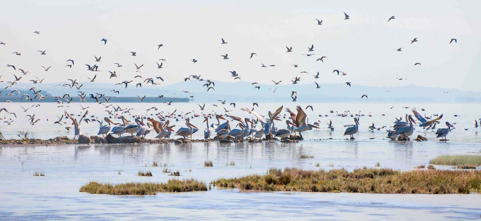
Continue into the wetland landscape beside Daskyleion and discover why the Manyas basin remains one of the region's most distinctive natural environments.
View Lake Manyas Guide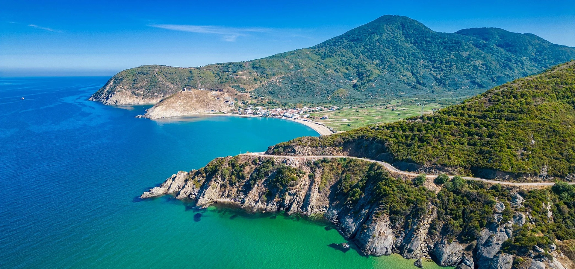
Extend your South Marmara route to Kyzikos, Erdek and the Kapıdağ Peninsula for a strong second day of archaeology, coastline and landscape.
View Kyzikos & Kapıdağ Guide