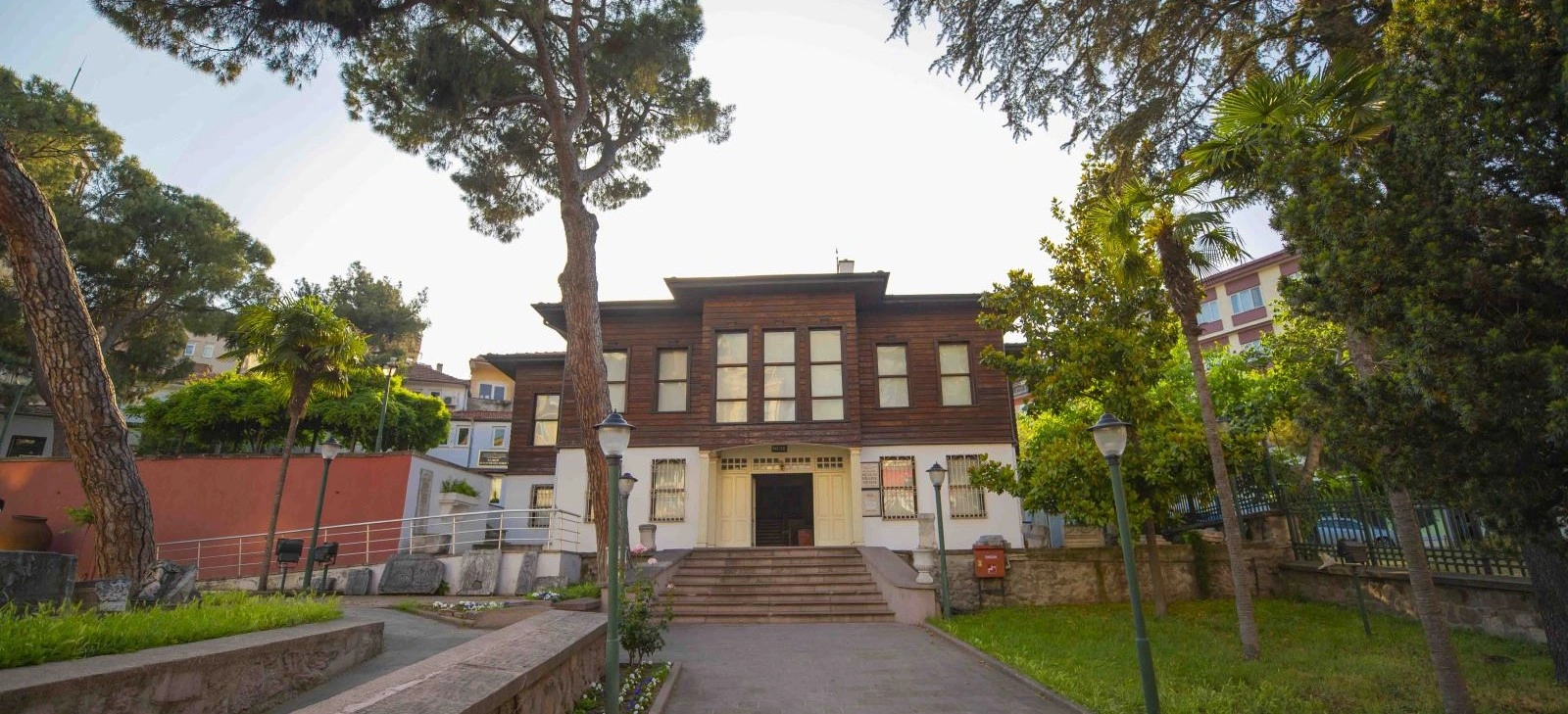
Kuva-yi Milliye Museum, Balıkesir
Continue next door into the story of Balıkesir's National Forces movement, local congresses, archaeology and ethnography.
View Museum Guide





In the historic centre of Balıkesir, rising beside the streets that lead toward the Kuva-yi Milliye Museum and the old commercial core, the Balıkesir Clock Tower is one of the city's most recognisable landmarks. Local people have long known it simply as Koca Saat — “the Great Clock.”
The tower seen today dates from 1901, but its story begins earlier. An original clock tower was commissioned in the early 19th century by Giritli Mehmet Paşa and is traditionally described as having been inspired by Istanbul's Galata Tower. That first structure was cylindrical. After a major earthquake in the late 1890s destroyed it, the clock tower was rebuilt in the square, cut-stone form that now defines Balıkesir's skyline.
The present monument is a very different architectural statement from the lost first tower. Its pale stone shaft rises in a narrowing square prism, with clock faces oriented toward the city, an open upper pavilion, a domed cap and a large bell. The design reflects the late Ottoman culture of civic clock towers — public monuments that made standardised time visible and audible in growing provincial centres.
Yet the Clock Tower is more than a device for telling time. It survived the transformation of its surroundings, the disappearance of the historic Hamidiye Garden, changes in municipal buildings and streets, the republican period and the expansion of modern Balıkesir. It therefore functions as a rare visual bridge between the Ottoman city and today's provincial capital.
For travellers, this is not a monument that demands several hours on its own. Its value comes from context. Combine it with the Kuva-yi Milliye Museum, Zağnos Paşa Mosque, old streets and central Balıkesir landmarks, and the tower becomes one of the best starting points for understanding the city's urban history.
The present tower was built after the earlier cylindrical structure was destroyed by the great late-19th-century Balıkesir earthquake.
Known affectionately by generations of Balıkesir residents as the “Great Clock,” the tower remains one of the city's strongest visual symbols.
Clocks on the upper faces made time visible from multiple directions, while the bell historically carried the sound of time across the centre.
The Clock Tower is especially rewarding when paired with the nearby Kuva-yi Milliye Museum and Zağnos Paşa Mosque.
Essential information for visiting one of central Balıkesir's best-known historic landmarks.
Dumlupınar area, Karesi, Balıkesir, in the historic city centre near the Kuva-yi Milliye Museum.
Koca Saat — the name commonly associated with the tower in Balıkesir's local urban memory.
Official tourism sources date the first clock tower to 1829, commissioned by Giritli Mehmet Paşa.
1901, rebuilt after the earlier tower was destroyed by the major earthquake of the late 1890s.
About 21 metres to the upper pavilion according to modern architectural research.
Predominantly light-coloured cut stone, with decorative relief details and a square-prismatic form.
One clock face on each principal side allows the time to be read from multiple directions around the city centre.
A large bell crowns the clock system beneath the upper roof structure and historically announced the time audibly.
As part of a walking route through historic central Balıkesir, rather than as a stand-alone excursion.
10–20 minutes for the exterior; 1.5–3 hours when combined with nearby historic sites.
Morning for cleaner street scenes; late afternoon and evening for warmer stone colour and illuminated views.
Ottoman urban history, architecture, city photography, local heritage and short cultural walks in Balıkesir.
The Clock Tower is worth visiting because it compresses nearly two centuries of Balıkesir's urban history, earthquake memory, Ottoman modernisation and civic identity into a single landmark in the middle of the old city.
The first reason is architectural. The tower is an excellent example of the way Ottoman provincial centres adopted public clock towers as highly visible symbols of organised civic time. The clock could be seen from surrounding streets, while the bell made time audible beyond the immediate square.
The second reason is the story of destruction and rebuilding. Balıkesir's late-19th-century earthquake damaged or destroyed major buildings across the city. The Clock Tower was among them. Rebuilding it in 1901 was not merely a practical decision; it restored a recognisable urban marker after a disaster that had physically altered the city.
The third reason is location. The tower sits within walking distance of several places that explain Balıkesir's transition from Ottoman provincial town to a city strongly associated with the Kuva-yi Milliye / National Forces movement. This allows visitors to move from late Ottoman architecture directly into the city's early republican and National Struggle story.
Finally, the Clock Tower offers something increasingly rare in fast-growing cities: continuity. Roads, parks and buildings around it have changed, but the tower remains a fixed reference point in historic photographs, local memory and the everyday geography of central Balıkesir.
Balıkesir Clock Tower stands in the Dumlupınar area of Karesi district, within the central historic fabric of Balıkesir city. The Ministry of Culture and Tourism identifies it specifically as being close to the Kuva-yi Milliye Museum, making the two monuments a natural pair for visitors exploring the centre on foot.
This is not an isolated monument in a large archaeological park. The tower is woven directly into active city streets. Shops, municipal life, traffic, older buildings and newer construction all sit close to it. That urban setting is part of the experience: Koca Saat was designed to belong to the city rather than stand apart from it.
Because the centre is compact, visitors can continue from the tower toward Zağnos Paşa Mosque, the Kuva-yi Milliye Museum and other old-city streets without needing a separate vehicle between each stop.
In everyday local memory, the Clock Tower is widely known as Koca Saat. The phrase can be translated simply as “the Great Clock” or “the Big Clock,” but its significance is more cultural than literal. For generations, the tower was not merely a building containing a clock — it was the public clock of the city centre.
Before wristwatches, mobile phones and digital displays made time constantly available, a civic tower provided a shared reference. People could see the clock from different directions and hear the bell signal the hour. The monument therefore became part of daily routines, meeting points and collective memory.
Academic literature also discusses the rebuilt tower in relation to Hadika-i Hamidiye / Hamidiye Garden, the landscaped public garden historically arranged beside it during the reign of Sultan Abdülhamid II. Although that historic garden has not survived in its original form, it helps explain why the tower once belonged to a broader civic landscape rather than standing as an isolated object.
Travellers researching the Clock Tower will quickly notice that published dates are not completely consistent. The Republic of Türkiye Ministry of Culture and Tourism uses 1829 for the first tower. Some local and academic publications instead give 1827 or 1828, often in connection with the inscription and the conversion of Ottoman / Hijri dates.
A similar difference appears in descriptions of the earthquake. The official Culture Portal states that the original tower collapsed in 1897, while educational and academic sources frequently associate the destruction with the major 1898 Balıkesir earthquake.
For visitors, the secure chronology is more important than forcing a false precision: an early-19th-century cylindrical tower commissioned by Giritli Mehmet Paşa was destroyed in the great earthquake of the late 1890s, and the present square tower was completed in 1901.
The story begins in the first half of the 19th century, when Giritli Mehmet Paşa commissioned a clock tower in Balıkesir. Official tourism sources date the building to 1829. Later descriptions state that the tower was cylindrical and was conceived in relation to Istanbul's Galata Tower, although the exact degree of architectural similarity should be treated as a historical tradition rather than a claim that the structures were identical.
The original tower became a prominent marker in the centre of the Ottoman town, but Balıkesir lies in an earthquake-prone region. A destructive earthquake in the late 1890s brought down the tower and damaged other major buildings in the city.
In 1901, under Ömer Ali Bey, the tower was rebuilt in the form visible today. Instead of recreating a cylindrical silhouette, the new monument was constructed as a square-prismatic cut-stone tower. Four clock faces, decorative stonework, an upper pavilion and a large bell transformed it into a distinctly late Ottoman civic monument.
The tower continued to function through the final Ottoman years and the republican period. Published sources record later repairs and conservation work, including interventions to the inscription and building fabric. Modern restoration has focused on keeping the historic structure and clock mechanism functioning while preserving its role in the cityscape.
What makes this history especially meaningful is continuity of purpose. Unlike many monuments that lost their original function, Balıkesir's clock tower has remained associated with public timekeeping for more than a century in its present form.
The late-19th-century earthquake that destroyed Balıkesir's earlier clock tower is essential to understanding the monument. The disaster did not simply damage a decorative landmark; it interrupted one of the city's major visual and functional reference points.
Balıkesir's historic centre also lost or suffered damage to other important structures during the same earthquake era. This helps explain why several central monuments were rebuilt or substantially repaired around the turn of the 20th century.
The new 1901 tower therefore belongs to a wider story of urban recovery. Its square form, cut-stone construction and renewed clock system represented both continuity and change: the city regained its clock tower, but not in exactly the same architectural form as before.
For heritage travellers, this is an important reminder that “historic” does not always mean untouched. Balıkesir Clock Tower is valuable precisely because it records reconstruction after disaster and the choices a city made about which symbols were important enough to rebuild.
The present Clock Tower is built as a tall square prism that narrows subtly as it rises. Architectural research gives its height as approximately 20.99 metres to the upper pavilion. The walls are faced with carefully worked light-coloured stone, creating a strong contrast with the darker traditional buildings that historically surrounded it.
Horizontal mouldings divide the tower visually into stages. Narrow openings bring light into the internal stair and shaft, while decorative details soften the otherwise vertical mass. Small projecting balcony elements and the clock stage create additional shadow and depth on the façades.
Near the top, four clock faces allow the time to be read from different directions. Above them, an open pavilion carried on timber elements gives the monument a lighter appearance before the roofline. The upper structure is capped by a domed form, with the bell integrated into the clock tower's audible timekeeping system.
The 1901 rebuild abandoned the cylindrical form traditionally associated with the first tower.
Pale dressed stone gives the monument its clean vertical character and distinguishes it within the surrounding streetscape.
The clocks face outward in multiple directions, reinforcing the tower's public civic function.
The open upper level introduces timber, arches, balconies and a lighter architectural rhythm near the summit.
The crowning roof and bell form the distinctive silhouette visible above the surrounding city fabric.
Its narrow, rising proportions were designed to be seen from surrounding streets rather than appreciated only at close range.
The Clock Tower is especially interesting because it is not simply an empty architectural shell. The upper levels contain the mechanical system that drives the clock and connects it with the bell above.
News documentation from Balıkesir has recorded the mechanism being manually maintained and wound on a regular basis. This continued hands-on care is one of the reasons the monument feels more alive than many historic towers whose original machinery has disappeared or become purely decorative.
Academic descriptions note that the bell marks the passing of time through different strikes at the hour and half-hour. The exact operating pattern can depend on maintenance and current settings, but the key point is that the tower historically provided both a visual clock and an audible civic signal.
The internal stair and mechanical levels are functional heritage spaces rather than a conventional observation attraction. Visitors should therefore not assume that the inside of the tower is open for public climbing. Plan your visit around the exterior unless an official local announcement specifically confirms interior access.
Historical and official sources repeatedly state that the original 19th-century Balıkesir tower was built in a cylindrical form associated with or inspired by Istanbul's Galata Tower. This tradition is important, but it should not be misunderstood when looking at the monument today.
The tower now standing in Balıkesir was rebuilt in 1901 after the earthquake and has a clearly square plan. It does not visually resemble the massive circular medieval body of the Galata Tower in the way a casual visitor might expect from reading a short description online.
The Galata comparison therefore belongs primarily to the lost first phase of Balıkesir's clock tower history. The current monument should be appreciated on its own terms as a late Ottoman provincial civic tower shaped by the rebuilding programme that followed the earthquake.
One of the most interesting parts of Balıkesir Clock Tower's story is not the tower itself, but the landscape that once surrounded it. Research into historic photographs and Ottoman-era documents associates the monument with Hadika-i Hamidiye, or Hamidiye Garden, a landscaped public space developed in the area around the tower and municipal buildings.
The garden belonged to the late Ottoman transformation of the city centre, when promenades, public greenery, fountains and civic monuments increasingly shaped urban life. The Clock Tower therefore stood within a designed setting intended for visibility, public use and representation.
That historic composition has changed substantially. Modern streets, buildings and urban infrastructure now define the area, so visitors should not expect to find the original Hamidiye Garden intact. However, knowing that it existed helps explain why period photographs show the tower as part of a larger ceremonial and civic landscape.
This is also why the tower matters to researchers studying urban memory. It survives even though much of its original setting does not, making it a fixed point through which changing versions of Balıkesir can be compared.
A monument that contains mechanical parts, timber elements, stone masonry and exposed architectural details requires continuous care. Published accounts document several phases of repair and restoration during the 20th and 21st centuries.
Research records work to the inscription and building fabric during earlier restorations, while more recent conservation projects have addressed elements such as interior plaster, timber stairs, exterior joints, stone cleaning and damaged architectural details. Archival photographs and historic documentation have also been used to guide conservation decisions.
The most important principle is that the tower remains legible as a historic structure rather than being redesigned as a new monument. Conservation therefore has to balance stone repair, safety, the mechanical clock system and the architectural silhouette that Balıkesir residents recognise.
Visitors can support this heritage simply by treating the base, railings and surrounding historic fabric with care and avoiding attempts to access restricted internal areas.
The Clock Tower is easiest to visit as part of a walk through central Karesi. Because it stands within the urban fabric rather than inside a ticketed archaeological complex, you can appreciate the exterior whenever the surrounding streets are accessible.
There is no need to allocate a long independent visit. Allow enough time to walk around the base, look at the different façades, identify the four clock faces and step back along nearby streets for a better view of the upper pavilion and dome.
The tower's interior should be treated as a restricted functional heritage space unless the municipality or another responsible authority announces public access. Historic reports describing maintenance staff climbing the tower do not mean it operates as a regular observation deck.
Best for quieter streets, cleaner architectural photographs and easier observation of the lower façades.
Good if you plan to continue directly into museums and other central attractions during normal daytime opening hours.
Warm light can bring out the texture of the pale cut stone and create stronger shadows around mouldings and balconies.
Artificial lighting gives the tower a more dramatic urban presence, especially when the clock faces are illuminated.
Comfortable temperatures make a longer historic-centre walking route more enjoyable than in the hottest summer hours.
The tower remains easy to see year-round, but rain, cold and shorter daylight can affect a wider walking itinerary.
The main photographic challenge is perspective. Because the Clock Tower rises from a dense central neighbourhood, photographing it from too close can exaggerate vertical distortion and crop the upper dome.
Use surrounding street lines to create enough distance for the entire tower rather than shooting only upward from the base.
Do not remove all urban context. Shops, neighbouring façades and pedestrians show how the monument functions inside modern Balıkesir.
A moderate telephoto view is useful for the clock faces, stone surrounds, pavilion arches and roof details.
Blue-hour photography can balance illuminated stone and clock faces with remaining colour in the sky.
Frame the tower together with older Balıkesir buildings to emphasise the historical streetscape rather than producing only a monument portrait.
The area remains an active city centre. Avoid blocking entrances, pavements or traffic while setting up photographs.
Because the tower is visible from street level, most visitors can experience its main architectural features without entering the monument. This makes it more accessible than historic towers whose value depends on climbing stairs.
However, the surrounding old-city streets are not a purpose-built visitor platform. Pavement width, gradients, kerbs, traffic and parked vehicles can vary. Travellers using wheelchairs or walking aids may find it easier to approach from the broadest nearby streets and choose viewpoints that do not require negotiating narrow edges around the tower.
The interior contains steep functional access and should not be considered an accessible visitor route. For most travellers, the meaningful experience is the exterior architecture and historic setting.
Immediately relevant to the Clock Tower area and essential for understanding Balıkesir's role in the National Struggle and the development of the Kuva-yi Milliye movement.
One of Balıkesir's major Ottoman religious monuments, originally founded in the 15th century and rebuilt after earthquake damage.
Part of the historic religious ensemble around the mosque and an important continuation of the city's Ottoman story.
Walking between the Clock Tower and mosque reveals the living city centre rather than presenting heritage as isolated monuments.
Modern squares, local restaurants, shops and public buildings allow visitors to combine historical sightseeing with everyday city life.
Use the city as a gateway to wider regional journeys toward Manyas, Ayvalık, Mount Ida, the Kapıdağ Peninsula and the Marmara islands.
Exact walking times depend on your route and museum opening arrangements, but the centre is compact enough that the Clock Tower works naturally as the opening landmark rather than a separate transport stop.
Enough only for a quick photograph if you are passing through the city centre.
Ideal for walking around the exterior, viewing the clock faces and noticing architectural details.
Allows the Clock Tower plus a relaxed walk through the immediately surrounding historic streets.
The strongest option if you combine the tower with the Kuva-yi Milliye Museum and Zağnos Paşa Mosque.
Useful for travellers who want lunch, central Balıkesir culture and additional neighbourhood exploration.
Only necessary if Balıkesir city itself is your main destination rather than a brief stop on a wider regional route.
The tower makes far more sense when connected with the surrounding historic centre than when visited alone by car.
Plan around exterior viewing unless an official source specifically confirms public access to the tower interior.
The nearby Kuva-yi Milliye Museum has its own operating schedule, which is more important for timing your route than the exterior tower.
Historic-centre pavements, kerbs and slopes are easier when you are prepared for urban walking rather than only museum interiors.
If you are staying centrally, a second look in evening illumination gives a very different impression from the daytime tower.
Most of the monument's distinctive features — clocks, balconies, pavilion and dome — sit well above street-level distractions.
The tower, museum and Zağnos Paşa complex represent different chapters of Balıkesir history and work best as one narrative.
This is a functioning city centre, not a pedestrian-only archaeological zone. Take care when stepping back for photographs.
It is in the historic centre of Karesi district, Balıkesir, in the Dumlupınar area near the Kuva-yi Milliye Museum.
The official Culture Portal dates the first tower to 1829. The present tower was built in 1901 after the earlier structure was destroyed by earthquake.
Different local and academic publications give 1827, 1828 or 1829 for the first tower. The discrepancy is connected with historical records and date interpretation; 1829 is the date used by the Ministry of Culture and Tourism's visitor information.
Yes. The original tower was destroyed in the major late-19th-century Balıkesir earthquake. Sources differ between 1897 and 1898 for the exact year.
It was commissioned by Giritli Mehmet Paşa, an Ottoman provincial administrator.
The rebuilding is associated with Ömer Ali Bey, who oversaw the construction of the present square tower after the earthquake.
Koca Saat means roughly “Great Clock” or “Big Clock.” The name reflects the tower's long role as Balıkesir's dominant public timekeeping landmark.
The first, lost cylindrical tower is traditionally described as having been inspired by Galata Tower. The present 1901 monument is square and should not be expected to look like today's Galata Tower.
Modern architectural research gives a height of approximately 20.99 metres to the upper pavilion.
Four, positioned so the time can be read from different directions around the city centre.
Yes. A large bell forms part of the upper timekeeping system and historically announced hours audibly across the centre.
Published reports document the mechanism being manually maintained and wound, preserving the tower's functional identity rather than leaving it as a purely decorative façade.
Do not assume regular visitor access. The interior is a narrow functional heritage space used for maintenance, and the tower is best planned as an exterior monument unless official current information states otherwise.
The tower is primarily appreciated from the surrounding public streets. There is no normal exterior admission process, but any special interior access would depend on current local authority arrangements.
About 10–20 minutes for the Clock Tower itself, or 2–3 hours when combined with nearby historic Balıkesir attractions.
The Kuva-yi Milliye Museum is the most natural companion because it is very close and explains a central chapter of Balıkesir's modern history.
Yes. The mosque is another major monument in the historic centre and fits naturally into the same walking route.
It was a historic landscaped public garden associated with the Clock Tower area during the late Ottoman period. The original garden arrangement has not survived intact.
Yes. It is especially effective in early morning, late afternoon and evening illumination, though the tight urban setting makes perspective important.
Yes if you are exploring central Balıkesir. It is a short stop, but one of the city's clearest symbols and an excellent gateway into its late Ottoman and early modern urban history.
Use the Clock Tower as the starting point for a deeper route through Balıkesir's Ottoman monuments, National Struggle history and wider cultural landscapes.
Continue with the museum, mosque and complete city guide, or ask us to shape a private route through the wider Balıkesir region.
Continue next door into the story of Balıkesir's National Forces movement, local congresses, archaeology and ethnography.
View Museum Guide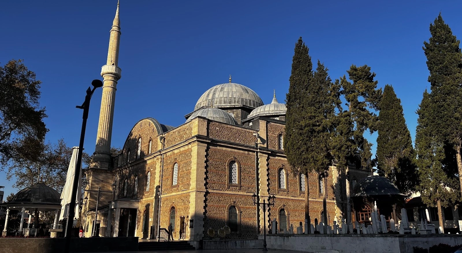
Explore one of the city's major Ottoman monuments and the historic complex associated with Zağnos Mehmet Paşa.
View Zağnos Paşa Mosque Guide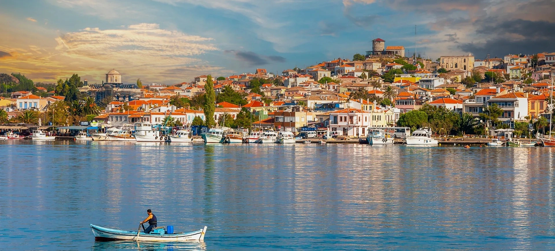
Plan a wider journey through Balıkesir city and province, from cultural landmarks to Mount Ida, Ayvalık, Manyas and the Marmara coast.
View Balıkesir Guide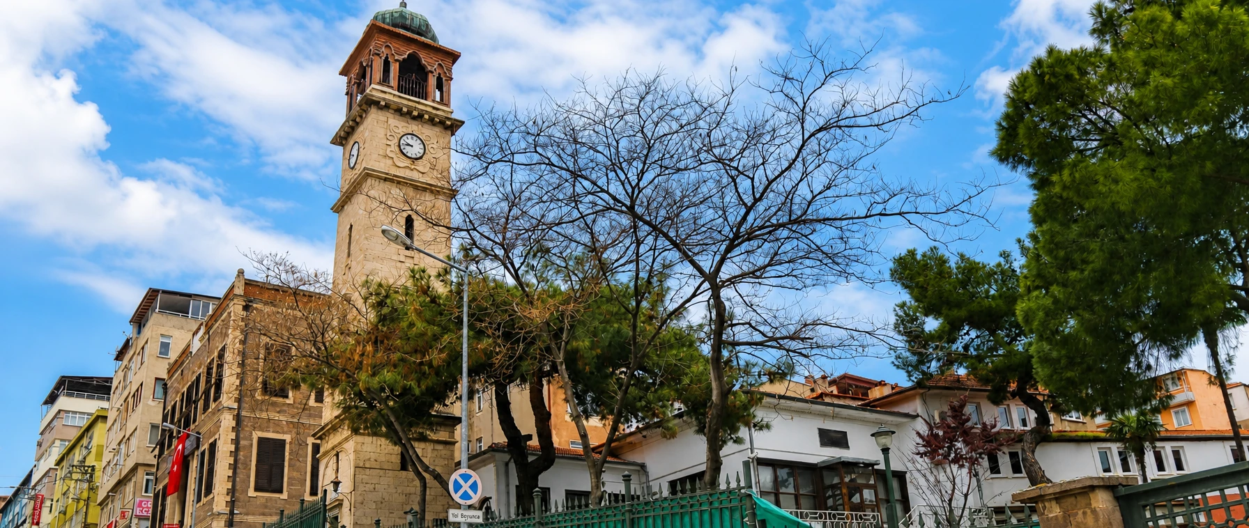
Ask us about a tailor-made route combining Balıkesir city, archaeological sites, Ottoman heritage, the Marmara coast or North Aegean landscapes.
Request a Custom Tour