Private Ottoman Road & Bridge Route
Ask us to design a private journey through Babaeski, Lüleburgaz and Edirne, focused on stone bridges, imperial roads, architecture and local history.
Request a Custom Tour





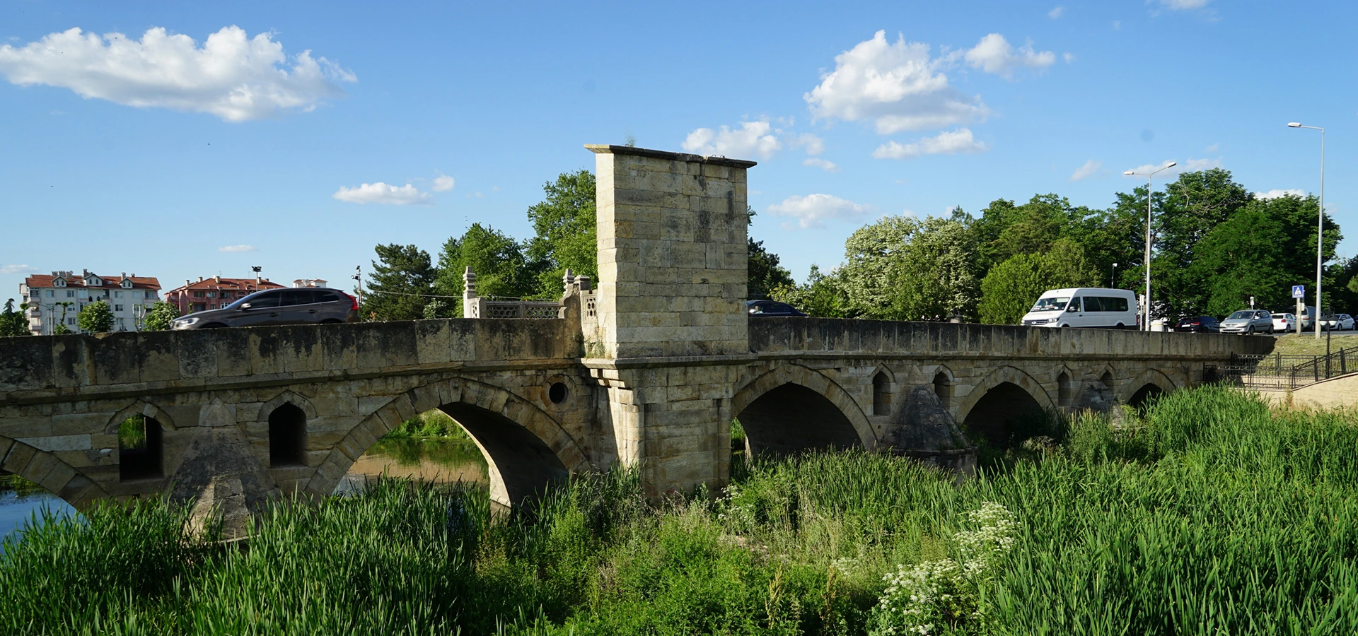
At the eastern side of Babaeski, a long stone bridge crosses Babaeski Stream, also known locally as Şeytan Dere. Its six visible pointed arches, carefully cut masonry and distinctive inscription pavilion preserve the character of the great Ottoman road that once linked Istanbul with Edirne and the Balkans.
The bridge was completed in 1043 AH (1633–34), during the reign of Sultan Murad IV. It carried merchants, messengers, pilgrims, officials and armies along one of the empire's most important land routes.
The identity of its patron is not completely certain. Evliya Çelebi attributed the bridge to Çoban Veli Kasım Ağa, but modern scholarship treats that story cautiously. The monument is also sometimes called Mimar Sinan Bridge, although Sinan died in 1588—decades before the date recorded by the bridge's inscription.
Look beyond the arches and you will find sophisticated flood-control features: pointed cutwaters on the upstream side, rounded buttresses downstream and small relief openings that allow high water to pass with less pressure on the masonry.
Together with nearby Cedid Ali Pasha Mosque, the bridge makes Babaeski a rewarding stop on an Ottoman heritage journey through Turkish Thrace.
The marble inscription dates the bridge to the reign of Sultan Murad IV.
Pointed stone arches carry the historic roadway across Babaeski Stream.
The crossing served the caravan and military route from Istanbul into Rumelia.
An open-air monument that still forms part of Babaeski's townscape.
Essential details for understanding one of Kırklareli Province's finest Ottoman stone bridges.
Eastern Babaeski, across Babaeski Stream near the Lüleburgaz approach to town.
Open on Google Maps1043 AH, corresponding to 1633–34, during the reign of Sultan Murad IV.
An Ottoman masonry bridge with six visible pointed arches and flood-relief openings.
Approximately 72 metres long and 5.85 metres wide.
A crossing on the caravan and campaign road from Istanbul toward Edirne and Rumelia.
An outdoor public monument with no standard sightseeing ticket or formal entrance gate.
The bridge is both an elegant work of Ottoman engineering and a physical reminder of Babaeski's strategic place on the road into Europe.
Babaeski Bridge belongs to a network of bridges, caravanserais, mosques, bathhouses and market towns that supported travel between the Ottoman capital and Rumelia. Before modern highways and railways, reliable crossings such as this one kept trade, government communication and military movement functioning through every season.
Its architecture responds directly to the landscape. Six pointed arches span the stream, while cutwaters, downstream buttresses and small openings between the main arches reduce the force of floodwater. The result is practical engineering shaped with the proportions and stone craftsmanship of an important public monument.
The bridge also preserves rare ceremonial details. At its centre, a projecting inscription pavilion displays a five-couplet marble text, and a platform on the opposite side has traditionally been interpreted as a small namazgâh, or open-air prayer place.
For visitors, the bridge gives historical context to the grander religious foundations of Babaeski and Lüleburgaz. It shows that Ottoman architecture along this corridor was designed not only to impress, but also to solve the everyday challenges of distance, water and movement.
Its survival within the modern town makes it one of the clearest remaining markers of the old Istanbul–Edirne road in Turkish Thrace.
The bridge's marble inscription provides the most secure part of its history: it dates construction to 1043 AH (1633–34) and places the work in the reign of Sultan Murad IV. The text refers to the sultan and his campaign, probably the Polish campaign of 1633, but it does not clearly identify the individual who financed the bridge.
The 17th-century traveller Evliya Çelebi wrote that the monument was the charitable work of Çoban Veli Kasım Ağa. According to his colourful account, Kasım Ağa had once tended sheep in the area, rose within the Ottoman establishment and later fulfilled a vow by building the bridge.
This story remains part of the bridge's historical tradition, yet scholars distinguish it from proven fact. The identity of the patron is still uncertain, and the claim that the work was connected with the court architect Kasım Ağa does not rest on firm evidence.
The name Mimar Sinan Bridge also appears locally and online, but it should not be treated as an attribution. Mimar Sinan died in 1588, around forty-five years before the bridge's inscribed date.
The inscription places construction in 1633–34, in Sultan Murad IV's reign.
The person who commissioned or financed the bridge is not definitively known.
The traveller credited the charitable foundation to Çoban Veli Kasım Ağa.
The bridge was built decades after Mimar Sinan's death, despite a popular modern nickname.
Babaeski developed beside the principal overland corridor connecting Istanbul with Edirne and the Ottoman territories beyond. Travellers moving west encountered river crossings, seasonal mud, flooding and long distances between secure stopping places. Durable stone infrastructure turned that difficult journey into a dependable route.
The bridge was used by caravans carrying goods, imperial couriers carrying orders, officials travelling between administrative centres and armies moving toward campaigns in Europe. Its position therefore joined local town life to the much larger political and commercial geography of the empire.
Nearby monuments completed that system. Mosques provided places of worship, bathhouses served residents and travellers, markets supported exchange, and charitable foundations helped maintain public services over generations.
Pack animals and carts carried food, textiles, tools and other goods along the east–west road.
The route connected the imperial capital with Ottoman territories and campaign roads in the Balkans.
Reliable bridges supported couriers, officials and the circulation of state orders.
Traffic encouraged markets, services and charitable institutions to grow around strategic stopping points.
Babaeski Bridge is a masonry structure faced with regularly dressed stone. It measures approximately 72 metres long and 5.85 metres wide, dimensions suited to the traffic of the historic route while preserving a narrow, human scale today.
Six pointed arches are presently visible. Evliya Çelebi described seven openings, and architectural scholarship suggests that a seventh may have become buried as the stream bank and surrounding ground changed. The widest visible opening spans about 7.30 metres.
Between the arches, triangular cutwaters face upstream and rounded buttresses face downstream. Smaller relief openings beside these projections give floodwater additional paths through the bridge, helping reduce pressure on the main structure when the stream rises.
Stone parapets line the roadway. Near the centre, projecting platforms interrupt the long profile: one supports the inscription pavilion and the other forms a balcony-like space traditionally described as a namazgâh. These details turn a work of infrastructure into a civic and ceremonial landmark.
The surviving openings create the bridge's characteristic rhythm across the stream.
Carefully shaped blocks give the elevations strength, clarity and visual unity.
Pointed upstream projections divide the current before it reaches the bridge piers.
Small passages between the main arches help release water during periods of high flow.
A central stone projection frames the marble construction inscription.
The opposite projection is traditionally interpreted as a place for prayer or rest.
Walk slowly across the bridge, then view it from both sides of the stream if conditions and public access allow. Its engineering is easiest to understand when the arches, piers and flood-control details can be seen together.
Follow the sequence of six visible arches and notice how their rhythm changes with the stream banks.
Look above the smaller water passages that reduce the solid mass between the principal spans.
The pointed projections split the current and protect the piers from direct impact.
Rounded forms on the opposite side reinforce the bridge while producing a softer silhouette.
The marble panel is framed by carved rosettes and tulip motifs and records the construction date.
Decorative posts around the central projections add an architectural accent to the roadway.
The narrow deck helps visitors imagine the scale of pre-modern carts, caravans and mounted travellers.
Step back to appreciate the gentle rise of the roadway and the long horizontal line of the parapets.
Seasonal water, reeds and vegetation show why flood management was central to the design.
The town-side approach connects the bridge visually with the historic monuments nearby.
At the centre of the bridge, a five-couplet Ottoman Turkish inscription is set into a marble panel beneath a pointed arch. Rosettes and tulip reliefs decorate its sides, combining historical information with carefully composed stone ornament.
The inscription supplies the date 1043 AH and praises Sultan Murad IV. One line indicates that a servant of the sultan laid the bridge upon the road, suggesting that the actual founder was someone in imperial service rather than the ruler personally.
Evliya Çelebi identified that servant as Çoban Veli Kasım Ağa and preserved a memorable foundation legend. The tale gives the monument a human story of hardship, advancement, imprisonment, gratitude and charitable giving, even though the attribution cannot be independently confirmed.
The best interpretation is therefore to separate evidence from tradition: the date and reign are securely recorded in stone, while the identity and biography of the patron remain an open historical question.
The inscribed Hijri date corresponds to 1633–34 in the Gregorian calendar.
The poetic text occupies a white marble panel in the central pavilion.
Carved floral motifs enrich the inscription without overwhelming its calligraphy.
The monument combines firm epigraphic evidence with Evliya Çelebi's later narrative.
The bridge is an outdoor monument on the eastern side of Babaeski and can be included easily in a short town walk or driving stop. There is no enclosed archaeological site, ticket office or formal museum route.
Conditions around the stream, traffic arrangements and access to the banks may change. Stay on safe public surfaces, watch for vehicles and do not climb onto parapets, cutwaters or masonry beside the water.
The monument can be seen throughout the year, but dry weather and soft side-light make walking and photography more comfortable. Early morning and late afternoon usually reveal the texture of the stone more clearly than bright midday sun.
Quieter local streets and softer light suit a relaxed first stop in Babaeski.
Low-angle light can emphasize the arches, parapets and central pavilion.
Mild temperatures and fresh vegetation make the stream setting especially attractive.
Comfortable weather is ideal for combining Babaeski with Lüleburgaz and Edirne.
Avoid slippery banks and keep a generous distance from fast or rising water.
Watch for wet, icy or muddy surfaces and allow extra care near the approaches.
The bridge is easy to see on a short stop, but a little extra time lets you study both elevations and the inscription pavilion.
Enough for a quick walk across the bridge and a view from one approach.
Best for most visitors, with time to see the arches, inscription and flood-control features.
Useful for photographers and travellers studying Ottoman bridge engineering in detail.
Combine the bridge with Cedid Ali Pasha Mosque, Fatih Mosque, the historic bathhouse and the town centre.
The best photographs explain the bridge as a whole: arches, water, road and central pavilion together. Choose legal public viewpoints and keep yourself, other visitors and local traffic safe.
A viewpoint parallel to the stream can capture several arches and the full rise of the roadway.
Use the parapets as leading lines toward the inscription pavilion at the centre.
Photograph the marble panel and carved motifs without touching or leaning equipment against the stone.
Side light reveals the contrast between pointed upstream forms and rounded downstream buttresses.
Calm water may reflect the arches, but never step into the stream or onto unstable banks.
Do not fly without confirming current aviation rules, local restrictions and heritage-site permissions.
The bridge stands near the eastern approach to Babaeski, where the old Istanbul–Edirne route crosses Babaeski Stream. It is straightforward to combine with the town centre and nearby Cedid Ali Pasha Mosque.
The bridge is close to the central historic area and can be reached by a short walk or local drive.
The two monuments stand very close together and form a natural paired visit.
Babaeski lies roughly 35 kilometres south of Kırklareli city by road.
Travel west along the D100 corridor; Babaeski is approximately 25 kilometres away.
Drive east toward Babaeski for approximately 55 kilometres, depending on the route chosen.
Babaeski is around 150 kilometres from central Istanbul; allow additional time for urban traffic.
Babaeski's location between Lüleburgaz, Kırklareli and Edirne makes the bridge an excellent anchor for a wider heritage route.
See Babaeski's monumental 16th-century mosque, designed by the Ottoman master architect Mimar Sinan.
Visit an earlier Ottoman mosque whose inscription records construction under Mehmed the Conqueror in 1467.
Discover the hamam associated with the Semiz Ali Pasha foundation, also known locally as Fatih Hamamı.
Continue to Lüleburgaz for Mimar Sinan's great 16th-century foundation on the same historic route.
Explore Selimiye Mosque, Ottoman bazaars, palace remains and historic bridges in the former imperial capital.
Plan a wider journey through museums, archaeological sites, Ottoman monuments, forests and the Black Sea coast.
Compare Babaeski Bridge with a dramatic 16th-century crossing associated with Sokollu Mehmed Pasha and Mimar Sinan.
See an important early Republican industrial and social landscape near Babaeski.
It crosses Babaeski Stream on the eastern side of Babaeski in Kırklareli Province, near the road toward Lüleburgaz.
Its inscription dates it to 1043 AH, corresponding to 1633–34, during the reign of Sultan Murad IV.
The patron is not known with certainty. Evliya Çelebi credited Çoban Veli Kasım Ağa, but modern scholarship regards the attribution as a historical tradition rather than proven fact.
No secure evidence supports that claim. The bridge was completed in 1633–34, around forty-five years after Mimar Sinan died, although it is sometimes called Mimar Sinan Bridge locally.
Yes. The alternative name refers to Sultan Murad IV, whose reign is celebrated in the construction inscription.
The bridge is approximately 72 metres long and 5.85 metres wide. Its widest visible arch has a span of about 7.30 metres.
Six pointed arches are visible today. Evliya Çelebi mentioned seven, and scholars have suggested that another opening may have become buried.
It crosses Babaeski Stream, also known locally as Şeytan Dere, a tributary within the Ergene river system.
They act as flood-relief passages, allowing additional water through and reducing pressure on the bridge during high flow.
The five-couplet Ottoman inscription praises Sultan Murad IV, refers to his campaign and provides the date 1043 AH. It does not clearly name the bridge's patron.
It is traditionally interpreted as a small namazgâh, an open-air place for prayer, although it also functions visually as a balcony-like projection from the roadway.
No standard sightseeing admission is charged because the bridge is an outdoor public monument rather than a ticketed museum.
It is normally visible as an open-air landmark, but road, conservation or safety restrictions can change local access without notice.
Allow about 20–30 minutes for the roadway, inscription, arches and safe views from beside the stream.
Yes, from safe and legal public viewpoints. Do not block traffic, climb on the stonework or enter the stream channel.
The route is relatively short, but historic surfaces, narrow edges, slopes and nearby traffic may create difficulties. Check current conditions locally and visit with assistance if needed.
Nearby highlights include Cedid Ali Pasha Mosque, Fatih Mosque, the historic bathhouse and the central streets of the town.
Yes—especially for travellers interested in Ottoman roads, stone bridges and the history of Turkish Thrace. Its close proximity to Cedid Ali Pasha Mosque makes it an easy and rewarding stop.
Stay off parapets, inscription structures, cutwaters and other historic masonry.
Remain alert, keep the route clear and never stand in the roadway for photographs.
Do not touch, trace, wet, rub or lean equipment against the carved marble panel.
Avoid the channel and unstable banks, especially during or after heavy rain.
Spend time in local cafés and shops and combine the bridge with the town's other monuments.
Take litter away and do not carve, paint or attach anything to the historic stonework.
Follow the historic road between Istanbul and Edirne through stone bridges, Mimar Sinan's charitable complexes and the towns that supported travel across Ottoman Thrace.
Combine Babaeski Bridge and Cedid Ali Pasha Mosque with the Sokollu Mehmed Pasha complex in Lüleburgaz and the imperial monuments of Edirne on a tailor-made private route.
Ask us to design a private journey through Babaeski, Lüleburgaz and Edirne, focused on stone bridges, imperial roads, architecture and local history.
Request a Custom Tour
Continue to the former Ottoman capital for Selimiye Mosque, historic bazaars, bridges, palaces and centuries of frontier heritage.
View Edirne GuideDiscover more Ottoman architecture, archaeological sites, historic towns and natural landscapes across the province.
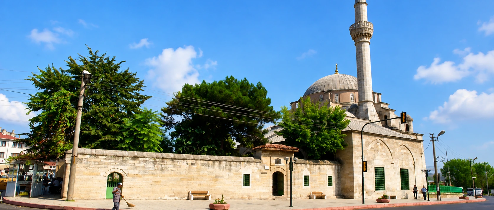
Explore Babaeski's great 16th-century mosque, a major provincial work by the Ottoman master architect Mimar Sinan.
Discover the Mosque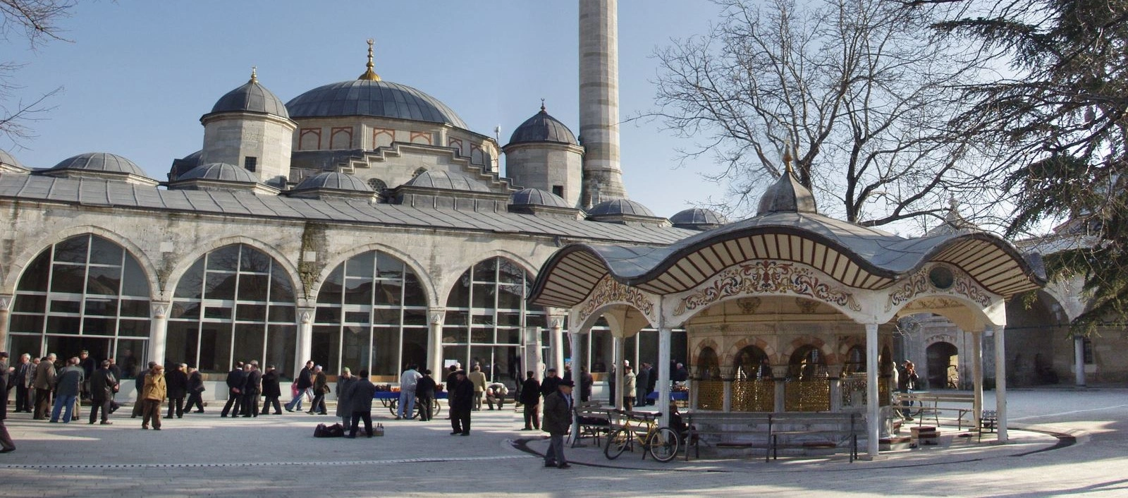
Continue to Lüleburgaz for Mimar Sinan's 16th-century foundation, created for worship, education, commerce and travellers.
Discover the Complex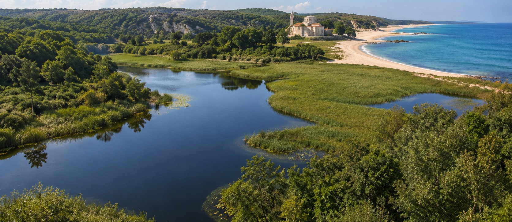
Plan a wider journey through prehistoric settlements, Ottoman monuments, museums, forests, caves and the Black Sea coast.
View Kırklareli Guide