Private Adramytteion & Edremit Gulf Experience
Ask us about a tailor-made day combining Adramytteion, Burhaniye Museum and the Edremit Gulf with private transport, flexible timing and an archaeology-focused route.
Request a Custom Tour





On the northern Aegean coast of Türkiye, beneath the tree-lined seaside neighbourhood of Ören in Burhaniye, lies one of western Anatolia's most unusual archaeological landscapes. Adramytteion was a harbour city of ancient Mysia whose history stretches from prehistoric settlement through the Lydian, Classical, Hellenistic, Roman and Byzantine periods. Unlike a deserted ruin field, much of the ancient city survives beneath a living modern community.
That makes Adramytteion a very different archaeological experience from Ephesus, Pergamon or nearby Antandros. Visitors encounter excavated sectors, architectural fragments, churches, Roman and Byzantine buildings and the shoreline remains of an ancient harbour while moving through a contemporary seaside district. The relationship between archaeology and modern life is part of the site's identity.
The city was important because of its position on the Gulf of Adramyttium — today's Edremit Gulf. Ancient writers mention Adramytteion repeatedly, Xerxes passed the city during his march toward Greece in 480 BCE, exiles from Delos settled here during the Peloponnesian War, and under Rome the city became the centre of a judicial district in the Province of Asia. The New Testament adds a famous maritime connection: in Acts 27, Paul begins his voyage toward Rome aboard a ship described as being from Adramyttium.
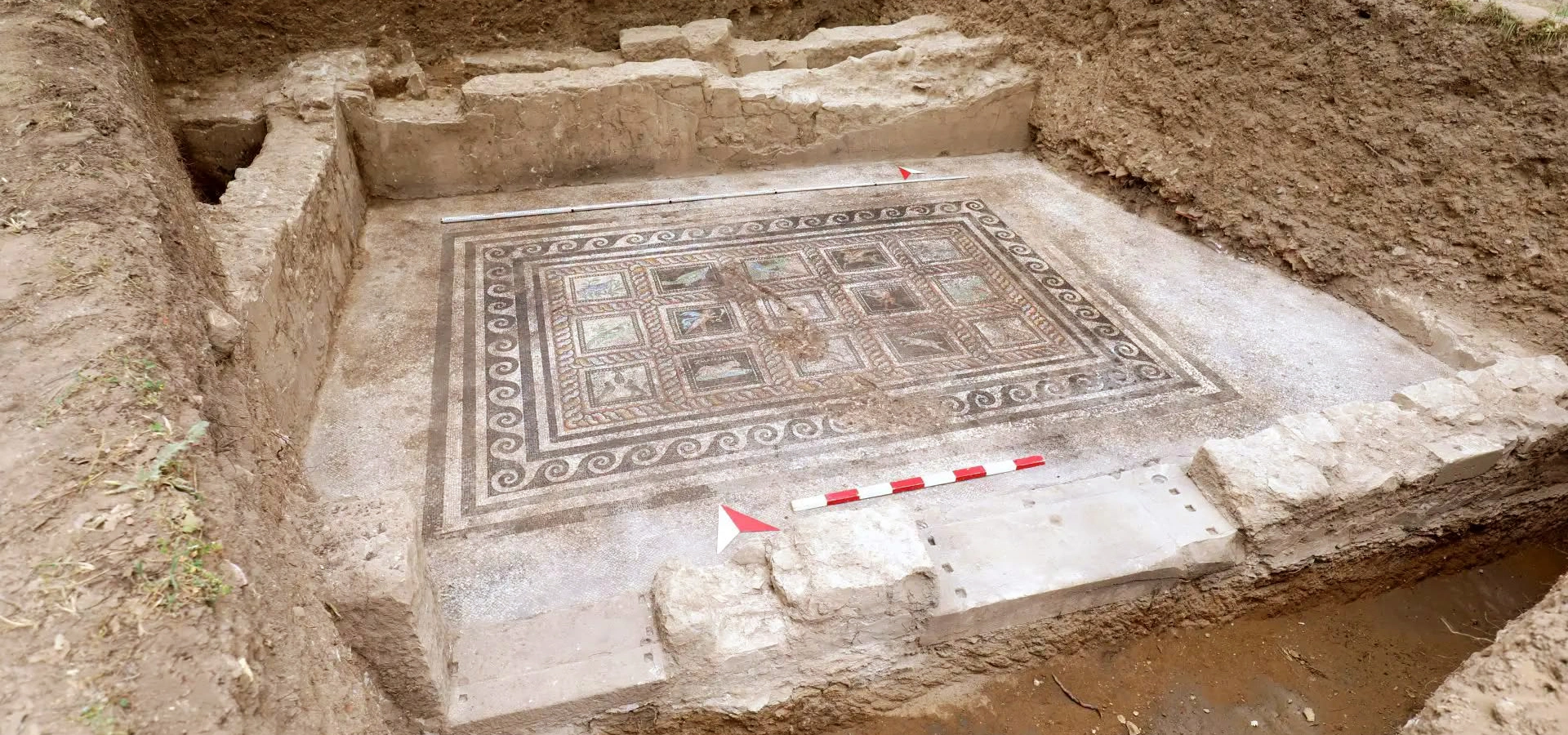
Adramytteion is also changing quickly through archaeology. Excavations begun in their present long-term form in 2012 have revealed a Roman bath with mosaics and hypocaust heating, Byzantine houses and commercial spaces, churches and burials, while recent work has exposed an impressive Roman residential complex organised around an atrium. In 2026, richly preserved mosaic floors with birds, fish, a winged horse and other figures brought renewed attention to the site.
Adramytteion gave its name to the Edremit Gulf and preserves important remains of one of its ancient harbour structures.
Excavations have revealed a Roman bath, hypocaust heating and a recently uncovered atrium-centred residence with mosaic floors.
Acts 27 records Paul boarding a ship from Adramyttium, reflecting the city's place within Roman Mediterranean coastal shipping.
Much of ancient Adramytteion remains beneath modern Ören, making preservation, excavation and everyday urban life inseparable.
Essential information for understanding the harbour city hidden beneath Ören on the Edremit Gulf.
Ören neighbourhood, roughly 3–4 km west of Burhaniye town centre in Balıkesir Province, north-western Türkiye.
A coastal city in the Mysian cultural sphere at the meeting zone of Mysia, Aeolis and the Troad, facing the Edremit Gulf.
Archaeological work traces occupation at Ören back to the Chalcolithic period, giving the settlement a history of about 6,000 years.
Ancient sources associate Adramytteion with two harbours; one substantial harbour structure survives offshore at Ören.
Under Roman rule, Adramyttium served as the centre of a conventus iuridicus, a regional judicial district of the Province of Asia.
Acts 27:2 describes Paul embarking from Caesarea on a ship of Adramyttium bound for ports along the coast of Asia Minor.
Adramytteion struck its own coinage from the Classical and Hellenistic periods onward; a winged horse became one of its memorable civic images.
A 2nd–3rd-century CE bath complex preserves mosaic flooring, drainage and an underground hypocaust heating system.
Recent excavation revealed an atrium-centred Roman residence with mosaic reception rooms, water systems and richly figured panels.
Allow around 1.5–2.5 hours in Ören, or a full day with Burhaniye Museum, the coast and nearby archaeological sites.
Adramytteion is one of the most rewarding places on the northern Aegean coast for travellers who enjoy archaeology that is still being actively discovered.
The first reason to visit is the ancient harbour. Adramytteion was fundamentally a maritime city, and the gulf itself carried the city's name in antiquity. Part of the harbour survives in shallow water off Ören and can become especially visible when sea level and wind conditions expose more of the masonry.
The second reason is the exceptional contrast between Roman urban sophistication and Byzantine continuity. A bath with mosaics and hypocaust heating, water channels, houses, workshops, pithos storage installations, churches and graves show how the same urban landscape was rebuilt and reused for centuries.
The third reason is the site's connection with written history. Herodotus places Adramytteion on Xerxes' route in 480 BCE, Thucydides records the settlement of displaced Delians here, Strabo calls it a notable city, Roman evidence identifies it as a judicial centre, and Acts of the Apostles preserves the memory of an Adramyttian ship participating in long-distance coastal trade.
Finally, Adramytteion is unusually dynamic in 2026. The newly exposed Roman residence and its mosaic programme add an important new chapter to the site. This is not archaeology whose interpretation was finished a century ago; each campaign can significantly change what visitors and scholars know about the city.
Adramytteion lies beneath and around the modern Ören neighbourhood of Burhaniye in Balıkesir Province. The ancient settlement occupies a series of low ridges and slopes immediately beside the northern Aegean, approximately 3.5 km west of the present Burhaniye town centre.
Official cultural information also identifies the broader archaeological area with the Karataş locality and Ören Tepe. Rather than one fenced ruin field, archaeological remains are distributed through multiple excavation zones, public spaces and coastal areas within the protected settlement.
The site is framed by two major mountain systems: Mount Ida / Kaz Dağı rises to the north, while the Madra Mountains dominate the southern side of the gulf. This enclosed geography made the Edremit basin a distinctive ecological and cultural zone linking the Troad, Mysia, Aeolis and the island of Lesbos.
Modern Ören should not be imagined as a perfect copy of the ancient coastline. Research by the Adramytteion project shows that sediments carried by the Havran Çayı and Karıncadere — ancient Eunos and Ollios — gradually changed the coastal plain around the city.
Palaeogeographical work indicates that the Ören elevation functioned for a substantial part of antiquity as a peninsula joined to the mainland on the east. This helps explain why Adramytteion developed as a harbour centre even though its modern shoreline may appear relatively open and shallow.
The surrounding gulf connected the city westward toward Lesbos and the Aegean, north toward the Troad and Hellespont, south toward Aeolis and Pergamon, and inland through the fertile plains below Mount Ida and the Madra range. Maritime and terrestrial routes converged here.
For visitors, understanding this changing coastline is essential. Some archaeological features now lie beneath streets, gardens or shallow water not because the city moved, but because the landscape itself evolved around it.
Archaeology has pushed the history of settlement at Ören far earlier than the written city. Excavation and test trenches have identified cultural layers reaching back to the Chalcolithic period, followed by Bronze and Iron Age occupation. The later urban centre therefore developed on a location that had already attracted communities for millennia.
Ancient and Late Antique traditions connect the city's name with a Lydian prince called Adramys, usually described as a son of Alyattes and brother of Croesus. The story should be treated as foundation tradition rather than literal archaeological proof, but Lydian influence in this part of western Anatolia is historically plausible and strongly embedded in later memory.
By the 5th century BCE, Adramytteion was firmly within the written historical record. Herodotus says the army of Xerxes passed the city in 480 BCE. During the Peloponnesian War, displaced inhabitants of Delos were settled at Adramytteion in 422 BCE, and Thucydides later records the killing of prominent Delians by the Persian official Arsaces.
The city prospered further through the Hellenistic and Pergamene periods and became an important coastal centre under Rome. It struck coinage, participated in Aegean trade and served as the seat of a Roman conventus iuridicus. Its Roman urban landscape included substantial houses, public bathing facilities and sophisticated water infrastructure.
Christian Adramytteion remained active through Late Antiquity and the Byzantine era. Churches, burials, workshops, houses, storage buildings and later fortifications testify to repeated rebuilding. The city suffered severe disruption around the end of the 11th century, was restored in the early 12th century and continued through the complicated Byzantine-Latin political landscape before being abandoned during the first half of the 14th century.
Later ancient traditions connect the name Adramytteion with Adramys, a Lydian prince associated with the royal family of Alyattes and Croesus. Strabo records that the city was said to have been founded by Lydians, and a gate was remembered as the “Lydian Gate.”
The foundation story is valuable because it preserves how ancient writers understood the city's identity, but it does not mean that occupation began with one royal founder. Modern archaeology demonstrates that people had lived on the Ören elevation for thousands of years before the Classical city took shape.
A careful interpretation therefore separates the origin of the urban name from the much earlier history of the settlement. Adramys may belong to the city's political memory, while the physical site has roots reaching far deeper into prehistory.
Adramytteion appears in some of the central narratives of 5th-century BCE history. Herodotus describes the Persian king Xerxes crossing the plain of Thebe and passing Adramytteion and Antandros during his march toward the Hellespont in 480 BCE.
Several decades later, the city became entangled in the Peloponnesian War. In 422 BCE the Athenians expelled the inhabitants of Delos as part of a religious purification, and Thucydides records that the satrap Pharnaces provided Adramytteion as a place of settlement for them.
Their refuge ended tragically. Thucydides later recounts that the Persian official Arsaces, associated with Tissaphernes, lured leading Delians from the city under false pretences and had them killed. The episode shows how Adramytteion stood within a contested political landscape shaped by Athenian, Spartan, Persian and local interests.
These texts should not be read as a complete civic history, but they demonstrate that Adramytteion was already sufficiently important to function as a recognised urban centre within the regional power struggles of the Classical Aegean.
Following Alexander the Great's conquest of western Anatolia, Adramytteion entered the changing political geography of the Hellenistic world. Its harbour position gave it continuing value as kingdoms competed for the coast and the routes connecting Pergamon, the Troad and the Aegean islands.
The city's importance increased within the wider orbit of the Attalid kingdom of Pergamon. Numismatic evidence demonstrates active civic identity, and Adramytteion produced coinage that circulated within the economic systems of north-western Asia Minor.
One of the best-known civic images is the winged horse, which appears on Classical or Hellenistic coinage associated with the city and was strikingly echoed many centuries later in the mosaic decoration of the Roman residence excavated in 2026.
Archaeological work in multi-phase areas has also identified Hellenistic foundations beneath later Roman and Byzantine structures, demonstrating that subsequent builders repeatedly reused the same urban zones.
Under Roman rule, Adramyttium became one of the important administrative cities of the Province of Asia. Ancient geographical and legal evidence identifies it as the centre of a conventus iuridicus — a judicial district where the Roman governor or his representatives could hear cases and conduct official business for surrounding communities.
This role helps explain why Adramytteion should be imagined as much more than a small harbour. Courts, officials, merchants, local elites, shipping and regional visitors all converged on the city. Its coinage continued under the Empire, preserving the names of civic magistrates and images of deities such as Athena, Zeus, Dionysus and Demeter.
Strabo calls both Assos and Adramyttium notable cities. He also preserves a darker episode from the Mithridatic Wars, when members of Adramyttium's civic council were killed by Diodorus in support of Mithridates. The city later produced the celebrated orator Xenocles, who defended the Province of Asia before the Roman Senate.
Archaeology increasingly supports this picture of prosperity. The bath, large residences, mosaic floors, drainage systems, water pipes and monumental architectural fragments all point to a substantial Roman urban environment hidden beneath Ören.
The harbour is one of the most important physical survivals from Adramytteion. Ancient sources indicate that the city possessed two harbours, while the surviving breakwater at Ören preserves the clearest archaeological trace of this maritime infrastructure.
Detailed study by the excavation project has identified several construction lines and techniques within the harbour remains. The best-preserved main body uses carefully cut stone, box-wall construction and dovetail clamps. Architectural comparisons and the broader Roman building programme at Adramytteion suggest that the principal surviving monumental phase may belong to the late 1st or early 2nd century CE, while earlier harbour phases must have existed for a city whose maritime history reaches much further back.
This distinction matters because popular reports sometimes describe the visible harbour simply as “2,500 years old.” The deeper history of maritime use can indeed extend back toward the Classical period, but the harbour should be understood as a multi-phase structure rather than one building event confidently dated to a single century.
The remains lie in shallow water and can become unusually clear when seasonal wind and sea-level conditions expose more of the masonry. Do not climb, move stones or treat the ancient breakwater as an ordinary swimming platform; it is protected archaeological fabric.
Adramyttium appears indirectly in one of the New Testament's most detailed travel narratives. In Acts 27:2, Paul and his companions leave Caesarea aboard a ship described as being from Adramyttium and intending to sail to ports along the coast of Asia.
The passage is important for Adramytteion because it confirms the city's participation in the ordinary commercial shipping networks of the Roman eastern Mediterranean. Smaller coastal vessels commonly moved cargo and passengers between a sequence of ports rather than sailing directly across the open sea to one final destination.
It is important not to overstate the connection. Acts does not say that Paul visited Adramyttium on this voyage; it says that the vessel itself was Adramyttian. The significance is maritime and economic: a ship identified with this northern Aegean port was operating far to the south at Caesarea and along the coast of Asia Minor.
For travellers interested in early Christianity, this small detail creates a useful bridge between the excavated harbour of Adramytteion and the practical world of Roman-era sea travel described in the New Testament.
One of the clearest Roman buildings excavated at Adramytteion is the bath complex generally known as E Structure. The excavation team dates the principal Roman phase to the 2nd–3rd centuries CE.
A carefully made black-and-white mosaic floor, geometric and vegetal motifs, substantial drainage channels and underfloor pipework demonstrate the quality of the building. Excavation later exposed the hypocaust — the system of raised floors and heated air channels used to warm Roman bathing rooms.
The bath is especially valuable because it was not simply abandoned after Rome. Byzantine builders reused and altered the structure, closing some passages and reorganising spaces. A lead seal connected with the 11th-century Constantinopolitan archbishop John Xiphilinos was recovered in the later levels, illustrating how long the area remained active.
For visitors, the bath turns an abstract idea of Roman urbanism into something tangible: water entered, drained, circulated and was heated through an engineered system beneath decorated floors only a short distance from the harbour.
The most important recent discovery at Adramytteion is a substantial atrium-centred Roman residential complex. Academic publication in 2026 describes a residence organised around a central atrium, with mosaic-paved reception rooms, service areas and water-related installations forming a coherent domestic plan.
The building did not remain unchanged. Stratigraphy indicates at least two major phases, with the central space altered after a destruction event. Pipes, channels, drains and floor treatments reveal careful management of water, while an adjacent multi-phase complex preserves development from Hellenistic foundations through Roman alterations to later storage and workshop use.
Fieldwork publicised in August 2026 revealed especially rich decoration. Three large halls were identified around the central area, with mosaics and painted wall surfaces. The northern hall contains a series of figural panels including birds, a fish and a winged horse — a motif with a particularly striking connection to Adramytteion's earlier civic coinage.
The discovery is still under study, so details of chronology, room function and mosaic iconography may be refined in future publications. That uncertainty is part of the excitement: Adramytteion's Roman residential archaeology is being reconstructed almost in real time.
The residence is organised around a central court or atrium that structured circulation between major rooms.
Decorated rooms demonstrate elite domestic display rather than purely utilitarian occupation.
Pipes, drains, channels and floor treatments show that water management was integral to the design.
A winged horse in the mosaic programme echoes a civic image known from Adramytteion's ancient coinage.
Adramytteion's coinage is one of the strongest sources for the city's civic identity because monumental architecture survives only in fragments. The city struck its own coins from the Classical and Hellenistic periods and continued issuing local bronze coinage under the Roman Empire.
A winged horse became an especially memorable emblem in the earlier series. Other issues feature Athena, Zeus, Dionysus, Demeter, Homonoia and civic magistrates, providing evidence for religion, administration and local self-representation.
Roman Provincial Coinage records Adramyteum within the Province of Asia and specifically within the Conventus of Adramyteum, confirming the city's judicial importance as well as its minting activity.
The reappearance of a winged horse in the mosaic programme of the newly excavated Roman residence is therefore especially intriguing. It suggests that a civic image established centuries earlier may still have carried meaning in Roman-period Adramytteion.
Christian occupation at Adramytteion is represented by several church phases, burials and associated structures concentrated particularly in the excavation area known as C Region.
Excavation has identified an earlier church or funerary chapel whose use belongs broadly to the Early or Middle Byzantine period, together with a later church reconstructed in the changing urban conditions of the 11th–12th centuries. The site also preserves numerous graves, creating one of the richest windows into the Christian community of medieval Adramytteion.
The excavation project has suggested that the concentration of religious architecture on one of the city's most commanding elevations may relate to an episcopal centre. This remains an archaeological interpretation rather than a simple one-building identification, but it fits the known ecclesiastical importance of the city in the Byzantine period.
Mosaic floors, tombs, architectural phases and later repairs reveal a Christian landscape repeatedly adapted rather than a single church standing unchanged for centuries.
Adramytteion's Byzantine archaeology is unusually important because many excavation areas preserve ordinary urban life rather than only churches or fortifications. Houses, storage rooms, commercial spaces, workshops and streets have been documented beneath modern Ören.
Large pithoi — storage jars set into or beside floors — show how foodstuffs and other commodities were kept. Reused Roman architectural blocks appear in later walls, illustrating how Byzantine builders treated the earlier city as both inherited landscape and convenient building resource.
The multiple building phases demonstrate resilience. Rooms changed function, passages were blocked, floors were raised and older monuments were absorbed into new plans. Urban continuity at Adramytteion was therefore not a matter of preserving Roman architecture intact, but of constant practical adaptation.
This is one of the reasons the site can feel archaeologically complex. A single trench may contain Hellenistic foundations, Roman construction, Byzantine repair and medieval storage, all occupying the same few metres of ground.
The visible fortification remains documented by the excavation project belong primarily to the Byzantine period. By the Middle Ages the defended city had contracted compared with the larger Roman urban area.
Historical sources describe a devastating attack associated with Çaka Bey around 1090, after which the population was dispersed. Adramytteion was then restored and repopulated around 1109 under Eumathios Philokales, an official serving Emperor Alexios I Komnenos. Rebuilding likely included renewed fortification of the reduced city.
The 13th century brought further political change. Byzantine and Latin forces fought the Battle of Adramyttium in 1205; the city subsequently remained within the shifting political landscape created by the Fourth Crusade and the Empire of Nicaea. By 1224 it had returned to Nicaean control.
Commercial arrangements of the later 13th century also brought Genoese interests into the region. Archaeological evidence suggests continued activity before a long decline, with the settlement finally abandoned during the first half of the 14th century.
Modern long-term excavation at Adramytteion began in its current form in 2012 under the scientific direction of Dr. Hüseyin Murat Özgen, with work conducted under the authority of the Ministry of Culture and Tourism and the relevant museum administration.
The project faces an unusual challenge: most of the ancient city is not an empty field but lies beneath the protected modern neighbourhood of Ören. Archaeologists therefore combine permanent excavation areas with targeted test trenches, rescue investigations, architectural documentation and regional survey.
Dozens of test trenches across Ören — some extending several metres below present ground level — have revealed a deep sequence from prehistoric settlement to Byzantine occupation. Regional surveys begun in 2015 have also documented the broader territory of Adramytteion across Burhaniye, Gömeç and Ayvalık, including prehistoric settlements, rural sites, quarries and defensive networks.
Conservation is treated as part of the archaeology rather than an afterthought. The long-term vision includes archaeological parks, in-situ presentation, public interpretation and a planning model intended to protect both the ancient city and the low-rise green character of modern Ören.
Adramytteion does not look like a single monumental ruin surrounded by a ticket wall. The ancient city is distributed beneath and between the streets, gardens, parks and coastline of modern Ören.
Visitors may encounter fenced excavation areas, displayed columns and architectural fragments, church remains, Roman structures and the shoreline harbour rather than one continuous circuit. Some of the most important remains lie below modern ground level and are visible only where archaeological work has opened windows into the city.
This makes interpretation especially important. A modest trench beside a road may preserve several centuries of architecture, while a quiet section of beach may lie beside the harbour that connected Adramytteion with the wider Mediterranean.
The site is therefore best approached as urban archaeology. Walk slowly through Ören, read the interpretation panels where available and think of the modern settlement as the uppermost layer in a much longer history.
The most useful local collection is the Burhaniye Kuva-yı Milliye Culture Museum in Burhaniye town centre. Although the museum also tells the modern history of the district, its ground-floor archaeology section includes material from Adramytteion and neighbouring ancient sites.
The archaeological displays include examples of ceramics, coins, glass vessels and other small finds that help turn the exposed architecture at Ören into a more complete picture of everyday life. The museum is particularly useful because many of Adramytteion's scientifically important objects cannot remain outdoors at the excavation areas.
Ören itself also preserves an open-air display of architectural pieces, including Roman and Byzantine columns, capitals and inscribed blocks. These pieces make the modern public space part of the archaeological experience.
Museum schedules and displays can change, so verify current opening arrangements if the museum is an essential part of your day.
Mild weather, green landscapes and quiet streets make this one of the best periods for archaeological walking.
Warm but generally comfortable, with long daylight and an excellent balance between archaeology and the coast.
Ören becomes a lively seaside destination. Visit excavation areas early, then use the afternoon for the beach or shaded town walks.
Excellent light, warm sea temperatures and fewer crowds make early autumn especially attractive.
Quiet and atmospheric, but rain can affect exposed excavation areas and coastal walking.
Winter visits are possible, and seasonal sea retreat can sometimes reveal more harbour masonry, but wind and rain are more likely.
For most archaeology-focused visitors, April–June and September–October offer the best overall conditions. Summer is ideal if Adramytteion forms part of a wider Edremit Gulf holiday rather than a dedicated archaeological journey.
In warm weather, begin in the morning. The excavation areas are easier to understand before the strongest heat, and lower-angle light makes walls, mosaics and changes in ground level easier to photograph.
Late afternoon is ideal for the shoreline and harbour. The western light across the Edremit Gulf creates a strong sense of Adramytteion's maritime setting, especially when the sea is calm and shallow masonry can be seen beneath the water.
Because the archaeological zones are distributed through a living neighbourhood, there is no need to force the entire visit into one rigid circuit. A comfortable plan is archaeology in the morning, lunch in Burhaniye or Ören, then a museum or coastal walk later in the day.
Adramytteion is officially recognised as an archaeological site, but it is not organised like a single gated monumental city. Different excavation areas and public displays sit within modern Ören, while some active research sectors may be closed for conservation or fieldwork.
The official public sources checked for this guide do not provide one reliable, current ticket tariff and timetable covering every Adramytteion sector. For a special-purpose visit, particularly if you want to see a specific excavation area, verify current conditions with local cultural authorities or the Adramytteion research project.
Do not enter active trenches, cross barriers or assume that a visible excavation sector is open simply because it lies beside a public street or park.
Ören lies only a few kilometres west of the town centre. Taxi, local transport, bicycle or private car all work well.
Follow the coastal road south toward Burhaniye and Ören. The drive is straightforward and works well with a Kaz Dağı itinerary.
Travel south through the Edremit area toward Burhaniye. Adramytteion is an easy half-day historical extension from the resort coast.
Drive north toward Gömeç and Burhaniye. The route makes an excellent archaeology-and-coast day with Ayvalık.
Follow the gulf south from Altınoluk through the Edremit area. The two sites form one of the strongest ancient-history pairings around the gulf.
Burhaniye and Ören are connected by local transport. Once in Ören, several archaeological points can be explored on foot.
The most atmospheric option if you want to stay directly above and beside the archaeological city and enjoy the beach.
Practical for restaurants, transport, the local museum and quick access to Ören.
A larger transport hub for travellers combining Adramytteion with Kaz Dağı, Antandros and the northern gulf.
A lively seaside base north of Burhaniye with easy road access to archaeological and mountain destinations.
Ideal for travellers who want historic architecture, islands and restaurants together with day trips north to Adramytteion.
Best for combining Adramytteion with Antandros Ancient City and the southern slopes of Mount Ida.
Enough for a quick walk through the main public archaeological areas and the harbour edge in Ören.
Recommended for visitors who want time to understand the Roman, Byzantine and maritime layers without rushing.
Add Burhaniye Kuva-yı Milliye Culture Museum and a relaxed walk along the Ören coast.
Combine Adramytteion with Burhaniye, local olive-oil culture, the museum and a nearby beach or rural stop.
Add Antandros, Kaz Dağı or Ayvalık for a wider Edremit Gulf cultural route.
Build a complete northern Aegean itinerary linking Adramytteion, Antandros, Assos, Pergamon, Ayvalık and Mount Ida.
Exact access within excavation sectors changes with conservation and active fieldwork. Treat this as a historical sequence, not a guaranteed route through every trench.
Explore Adramytteion slowly, focusing on the harbour, Roman bath, residential archaeology and Byzantine churches.
Visit Burhaniye Museum, enjoy local food and spend late afternoon on the Ören coast.
Travel north to Antandros Ancient City for its Roman villa, mosaics, wall paintings and necropolis.
Continue into Mount Ida / Kaz Dağı for scenery, villages and the mythic landscape above the gulf.
Use calm water and low-angle light to reveal submerged masonry and the relationship between the breakwater and coastline.
Frame Roman and Byzantine walls together where possible to show how different periods occupy the same urban space.
If an excavated mosaic is open to view, photograph from permitted paths only and avoid leaning over barriers.
Include modern trees, low-rise houses and archaeological areas to capture what makes Adramytteion different from a deserted ruin.
Columns, capitals and inscriptions in the open-air display work especially well in soft morning or evening light.
Protected archaeological areas and populated coastal zones may require permissions. Do not fly without checking current rules.
Adramytteion works well for families because the visit can be divided into short sections rather than one long archaeological circuit. Children may especially enjoy the stories of Roman baths, underground heating, mosaic animals, ancient ships and the submerged harbour.
The modern neighbourhood provides cafés, shade and seaside space close to the archaeological areas, making the site easier to combine with a relaxed family day than many isolated ruins.
Accessibility varies. Public streets and parts of the Ören waterfront are relatively easy to navigate, but excavation trenches can involve uneven ground, steps, temporary walkways or areas closed to the public. Travellers with limited mobility should focus on the publicly accessible displays and verify access to specific sectors in advance.
In summer, plan archaeology early and use shaded areas or the coast later in the day. Closed shoes remain useful even though much of the wider visit takes place inside a modern resort neighbourhood.
Excavation barriers protect fragile contexts and visitors. Never enter an active archaeological area without permission.
Even a plain fragment can be archaeologically important when it remains in its original context.
Do not move submerged blocks, climb masonry or treat ancient structures as recreational platforms.
Much of the ancient city lies beneath a living neighbourhood. Avoid entering private gardens or photographing homes intrusively.
Freshly excavated mosaics, plaster and walls can be especially vulnerable to weather and physical contact.
Archaeological protection, residential privacy and coastal aviation rules can all apply.
Burhaniye's archaeology displays help connect small finds and civic history with the excavated city.
The unusual coexistence of Ören and Adramytteion is itself part of the cultural heritage worth preserving.
Knowing that Adramytteion was a maritime city makes the entire geography of Ören easier to understand.
Most of the ancient city remains underground. The visible trenches are windows into a much larger settlement.
New discoveries and conservation work can change what is visible from season to season.
Coins, ceramics and glass provide the human-scale detail that excavated walls alone cannot show.
You will move between streets, park areas, coastline and uneven archaeological surfaces.
Ören has services nearby, but archaeological exploration under the summer sun can still be tiring.
The biblical connection is to an Adramyttian ship, not a recorded visit by Paul to the city itself.
The two sites together create an excellent picture of Roman life and ancient settlement around the Edremit Gulf.
The district centre provides the local archaeology museum, traditional food, markets and the cultural context for Ören.
A major archaeological site near Altınoluk with a Roman villa, mosaics, wall paintings and an extensive necropolis.
The mountain landscape north of the gulf combines mythology, forest, waterfalls, villages and exceptional biodiversity.
Historic streets, Greek-Ottoman architecture, islands and celebrated food make Ayvalık one of the best cultural extensions south of Burhaniye.
A picturesque island district connected to Ayvalık, known for stone houses, churches, seafood and sunset views.
The regional centre is useful for transport and for routes toward Kaz Dağı, Akçay, Güre and Altınoluk.
A quieter coastal district between Burhaniye and Ayvalık with olive landscapes and access to the southern gulf.
One of western Anatolia's great ancient cities and an excellent next stop for travellers following the Hellenistic and Roman history of the region.
Compare two major ancient settlements of the Edremit Gulf, then finish beside the sea.
Trade the coast for mountain roads, forests, waterfalls and villages in one of western Türkiye's most famous landscapes.
Spend the day among historic streets, island scenery, seafood and olive-oil culture.
Explore the Acropolis, Asklepion and the monumental legacy of the Attalid kingdom and Roman Asia.
Continue north along the Aegean for the Temple of Athena, ancient harbour and dramatic views toward Lesbos.
Combine villages, olive-oil producers and local cuisine for a slower cultural day between the mountains and sea.
The Edremit Gulf is one of Türkiye's great olive and olive-oil landscapes, so food around Adramytteion naturally combines North Aegean flavours with the broader cuisine of Balıkesir. Ören and Burhaniye offer many easy lunch options after an archaeological visit.
Try local extra-virgin olive oil with bread, salads, vegetables or simple meze to taste the agricultural identity of the region.
Seasonal vegetables, beans, stuffed leaves and wild greens prepared with olive oil are classic North Aegean choices.
Look for radika, şevketi bostan and other seasonal greens served as salads or cooked dishes.
The coastal setting makes grilled seasonal fish, calamari and simple meze a natural choice in Ören or nearby towns.
Balıkesir's best-known dessert, made with fresh unsalted cheese, semolina and sugar.
Regional cheeses, yoghurt, butter and kaymak reflect the province's strong livestock and dairy traditions.
It lies beneath and around Ören neighbourhood in Burhaniye, Balıkesir Province, on the Edremit Gulf.
Ören is roughly 3–4 km west of Burhaniye town centre.
It was a major ancient harbour city, Roman judicial centre and long-lived settlement preserving layers from prehistory through the Byzantine period.
No. The ancient city is at modern Ören near Burhaniye, although its name survives in the wider Edremit place-name and gulf.
Archaeological work at Ören identifies settlement back to the Chalcolithic period, giving the site a sequence of around 6,000 years.
Ancient tradition links the city's name with the Lydian prince Adramys, but archaeology shows settlement existed long before any single historical foundation.
Lydian tradition and influence are important, but the city's long history includes Anatolian, Greek, Hellenistic, Roman and Byzantine phases.
Yes. Herodotus places the Persian army passing Adramytteion and Antandros during the 480 BCE invasion route toward the Hellespont.
After Athens expelled the inhabitants of Delos in 422 BCE, the satrap Pharnaces provided Adramytteion as a place for them to settle.
Yes. It served as a conventus iuridicus, a regional judicial centre within the Roman Province of Asia.
Acts 27:2 says Paul boarded a ship of Adramyttium at Caesarea during his journey toward Rome.
Acts does not say that Paul visited the city on that voyage. The text identifies the ship as Adramyttian, so the connection is primarily maritime.
Yes. Harbour masonry survives in shallow water off Ören, although visibility varies with sea conditions.
The harbour has multiple phases. Project research dates the main preserved monumental phase broadly to the late 1st–early 2nd century CE while recognising earlier maritime use.
Mosaic floors, drainage systems, channels and a hypocaust underground heating system were identified.
A major Roman residential complex with a central atrium, mosaic reception rooms, wall decoration and sophisticated water infrastructure was brought into much clearer view.
They include figural and geometric panels with birds, fish and a winged horse that recalls imagery from Adramytteion's earlier civic coinage.
Yes. The city issued coinage in the Classical and Hellenistic periods and continued local issues under Roman rule.
Yes. Excavations have identified multiple church phases, associated burials and evidence for an important medieval Christian community.
Historical sources associate a major destruction with Çaka Bey; the city was later restored and repopulated in the early 12th century.
The archaeological project places the final abandonment broadly in the first half of the 14th century.
Yes. Adramytteion remains an active archaeological research and conservation project.
Expect distributed excavation areas, Roman and Byzantine walls, churches, architectural fragments, open-air displays and the harbour rather than one complete monumental city.
The archaeology section of Burhaniye Kuva-yı Milliye Culture Museum contains material from Adramytteion and neighbouring sites.
Access differs between public areas and active excavation sectors. A single current site-wide timetable was not located in the official sources checked, so verify locally.
Allow around 1.5–2.5 hours for a thoughtful visit, or a half day with the Burhaniye museum.
Yes, especially if you use stories about ancient ships, Roman heating, mosaic animals and the harbour to make the archaeology accessible.
Parts of modern Ören are accessible, but excavation sectors vary and can include uneven ground or steps. Check current access for specific areas.
Antandros, Mount Ida / Kaz Dağı, Ayvalık, Cunda and Pergamon are among the strongest nearby extensions.
Try local olive oil, Aegean herbs, seafood and Balıkesir specialities such as höşmerim.
A private route can combine Adramytteion with Antandros, Mount Ida, Ayvalık, Cunda or Pergamon while allowing enough time to understand the archaeological layers rather than rushing between sites.
Tell us whether your priority is ancient history, Roman mosaics, early Christianity, biblical travel, photography, olive-oil culture or a broader northern Aegean journey, and we can shape the route around your available time.
Ask us about a tailor-made day combining Adramytteion, Burhaniye Museum and the Edremit Gulf with private transport, flexible timing and an archaeology-focused route.
Request a Custom Tour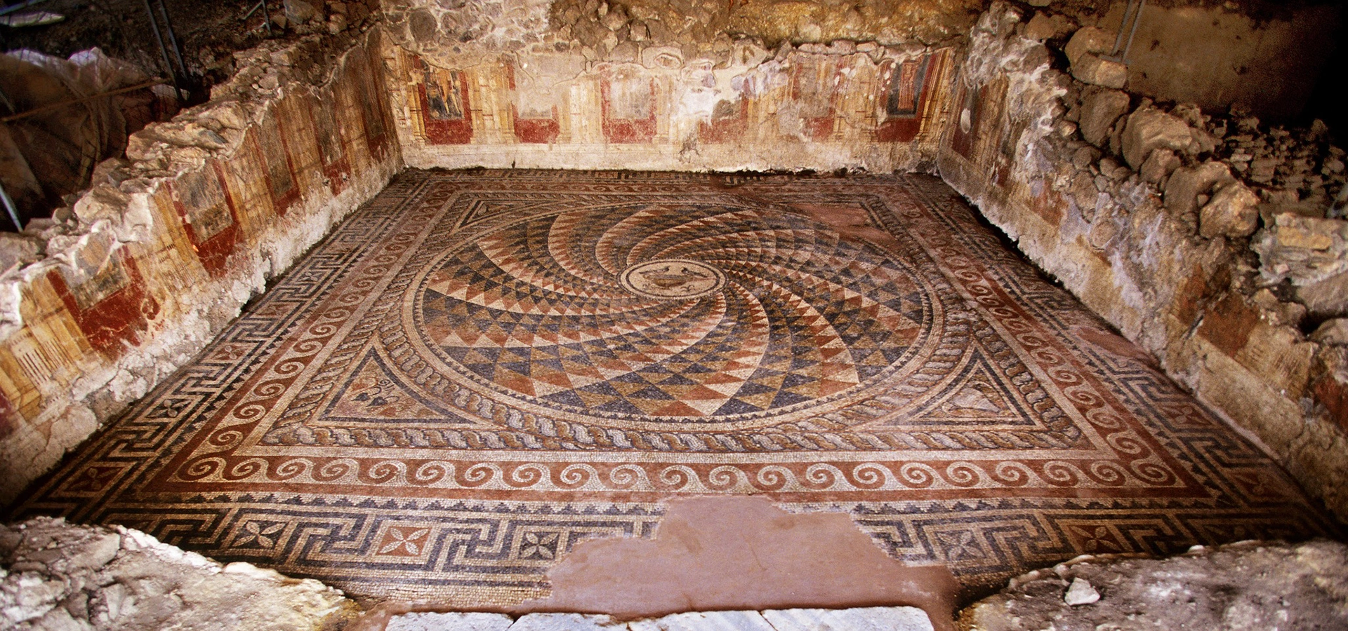
Continue around the Edremit Gulf to Antandros for its Roman villa, mosaics, wall paintings, necropolis and connections with the mythic landscape of Mount Ida.
View Antandros Guide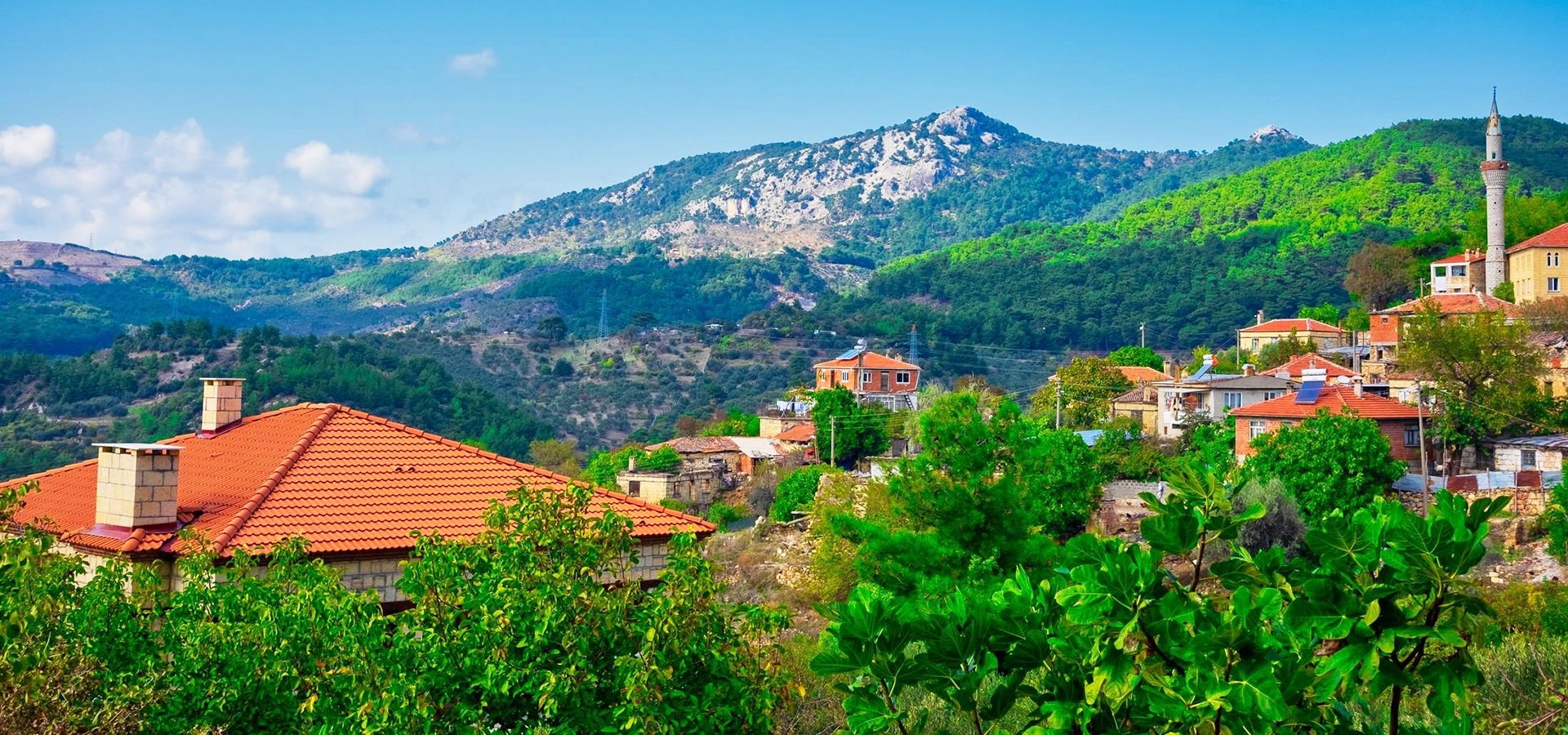
Combine coastal archaeology with the mountain landscape that shaped the mythology, climate and settlement history of the entire Edremit Gulf.
View Mount Ida Guide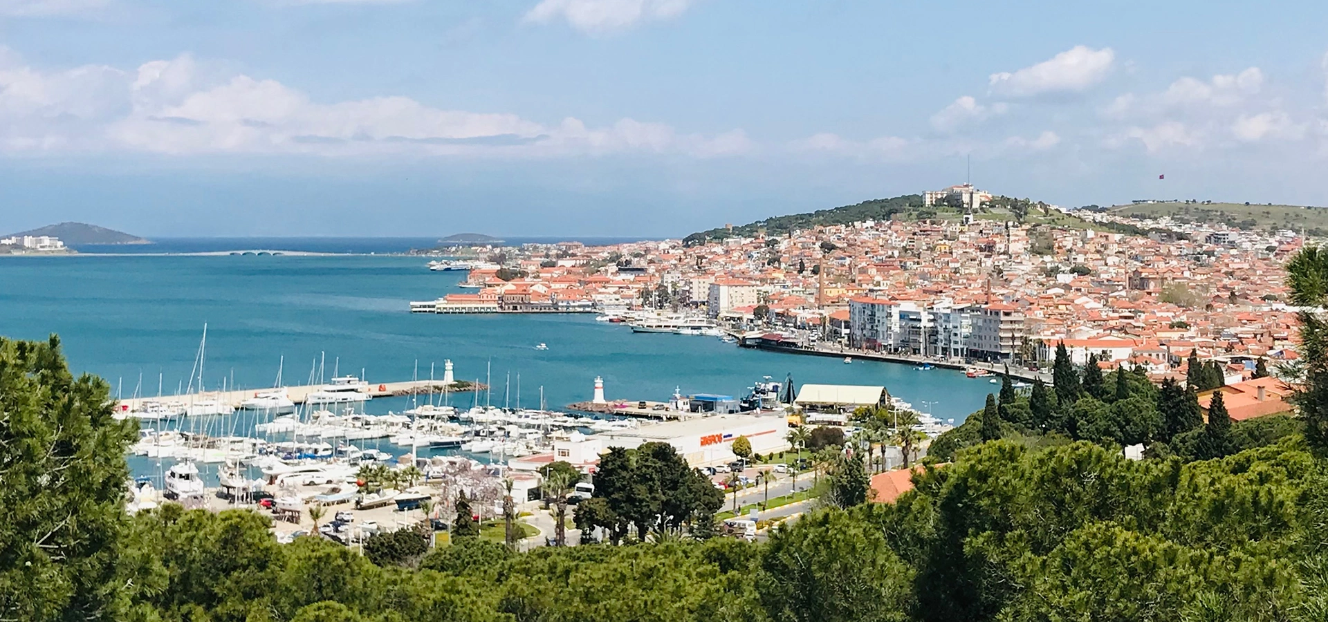
Extend south through Gömeç to Ayvalık and Cunda for historic architecture, islands, olive-oil culture and one of the northern Aegean's finest coastal landscapes.
View Ayvalık Guide