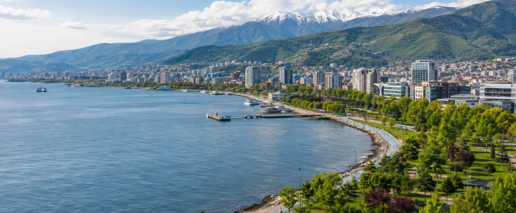
Kocaeli Travel Guide
Continue beyond Pembe Kayalar to discover Kefken, Kerpe, Cebeci, nature parks, İzmit and the landscapes of the wider province.
Explore Kocaeli





Pembe Kayalar, meaning Pink Rocks, is one of the most distinctive natural and historical landmarks on the Kandıra coast of Kocaeli. Located near Kefken on Türkiye's western Black Sea shoreline, the site combines pink, reddish, cream and gray rock layers with wave-cut platforms, cliffs and traces of an ancient stone quarry.
At first glance, Pembe Kayalar looks like a dramatic geological formation. Look more carefully, however, and the human story becomes just as interesting. The rock was quarried here from antiquity onward, and official cultural sources record that stone extracted from the Kefken area continued to be cut during the Ottoman period and transported by sea toward Istanbul.
The most remarkable surviving details are not monumental ruins but the landscape itself: rectangular quarry cuts, channels, worked rock faces and blocks still visible beside the Black Sea. These traces make Pembe Kayalar one of those rare places where a natural attraction is also an archaeological landscape.
Official heritage records also note prehistoric finds in the wider area and identify parts of the coast around Pembe Kayalar toward Cebeci as protected archaeological and natural site territory. Today the rocks are especially popular for photography, coastal walks, fishing atmosphere and sunset views.
See the layered pink, red, cream and gray coastal rocks that give the site its name.
Look for rectangular cuts and extraction traces left by centuries of stone working.
Learn how Kefken stone was carried by sea and used in major buildings in Istanbul.
Combine geology and history with open-water views, photography and golden-hour light.
Essential information for visiting Kefken's famous Pink Rocks on the Kandıra coast.
Kefken, Kandıra District, Kocaeli Province, Türkiye.
Open on Google MapsPink-toned coastal rocks, cliffs, quarry marks, sea views and photography.
Stone quarry used from antiquity and again extensively during the Ottoman period.
Part of a wider protected archaeological and natural coastal landscape.
Allow around 1–2 hours; longer for photography or a wider Kefken coastal route.
The quarry-cut surfaces and the changing rock colors in late-afternoon light.
Few places on the Kandıra coast combine geology, quarry archaeology and Ottoman architectural history so clearly in one landscape.
The first attraction is visual. Pembe Kayalar is formed from rock layers displaying pink, reddish, cream, beige and pale-gray tones. The colors become especially noticeable where sunlight, wet surfaces and erosion reveal different parts of the stone.
The second is geological. The Kefken coast has been shaped continuously by Black Sea waves, weathering and chemical erosion. Over time these processes have produced cliffs, wave-cut notches, hollows, honeycomb-like weathering and broad rocky platforms.
The third is historical. Pembe Kayalar was not merely admired: it was worked as a quarry. Stone was extracted here from antiquity, and quarrying continued during the Ottoman period. The coast still preserves physical traces of blocks being cut and removed.
Finally, Pembe Kayalar belongs to a wider Kandıra travel landscape. Visitors following our guide to places to visit in Kocaeli can combine the site with Kefken, Cebeci, Kerpe, Miço Bay and other Black Sea stops.
The Pink Rocks are part of a geologically varied section of the Kefken coastline. Studies summarized in the Kocaeli Encyclopedia describe rock units in the area that include limestone-rich layers together with volcanic formations. This complex composition helps create the varied colors and textures visible along the shore.
Pembe Kayalar is not uniformly bright pink. Depending on the exact surface, visitors can see muted rose, red, cream, beige, gray and darker weathered bands. The name comes from the characteristic pinkish tones that stand out against the blue-green Black Sea.
Waves continually attack the exposed headland. Mechanical erosion, salt, water movement and chemical weathering have created cavities, grooves, softened edges and undercut cliff sections. Some surfaces show small honeycomb-like hollows, while others form broad natural platforms close to sea level.
The rocks are known for warm pink and reddish surfaces mixed with cream, beige and gray layers.
Black Sea erosion has shaped parts of the coast into low cliffs and undercut faces.
Broad natural shelves extend toward the water and create Pembe Kayalar's distinctive shoreline.
Small cavities and honeycomb-like forms can be seen where the stone has weathered unevenly.
The rock colors look different in strong midday sun, wet weather and warm evening light.
The coast is still changing under the action of waves, wind, salt and weather.
Official cultural records state that Pembe Kayalar was used as a stone quarry from antiquity. The wider Kefken area has also produced prehistoric finds, showing that human activity on this coastline extends much farther back than its modern tourism identity.
The quarry is best understood as an archaeological landscape rather than a conventional ruin. There are no standing temples or reconstructed buildings here. Instead, the evidence survives in the rock itself: cut faces, straight channels, rectangular recesses and worked blocks that contrast with naturally eroded surfaces.
These traces help explain why the shoreline has such an unusual stepped appearance in places. Some shapes were created by waves; others were created by people extracting usable stone. Learning to distinguish the two is one of the most interesting parts of a careful visit.
Straight-edged recesses show where rectangular blocks were removed from the living rock.
Grooves and channels preserve evidence of traditional stone-cutting techniques.
Some rectangular blocks remain around the quarry landscape close to the sea.
The site is documented as a quarry from antiquity rather than only from Ottoman times.
Official heritage records note prehistoric material in the wider Pembe Kayalar area.
The archaeology is embedded in the coast itself, without a museum-style entrance or reconstruction.
Official tourism and heritage sources traditionally describe the Kefken stone as being relatively soft while saturated with water and becoming harder after it is cut, removed and exposed. This working quality made the material useful for producing regular architectural blocks.
For quarry workers, the advantage was practical: a stone that could be cut and shaped comparatively easily near the shore could then be transported as prepared blocks for use in construction. The sea beside the quarry provided an obvious transport route toward Istanbul and other Black Sea or Bosphorus destinations.
Today visitors can still see the geometric results of that process. Rectangular extraction scars make it clear that the coast was once a working industrial landscape as well as a natural one.
Quarrying at Pembe Kayalar continued into the Ottoman period. Workers cut the stone into regular blocks and used the nearby Black Sea as the first stage of a maritime transport network toward Istanbul.
Official cultural sources identify stone from the Kefken quarry with major Ottoman building projects, including Rumeli Hisarı and the Sultan Ahmed Mosque, better known internationally as the Blue Mosque. The Kocaeli Encyclopedia also notes that the quarry continued supplying stone into the nineteenth century.
This connection gives Pembe Kayalar an importance far beyond its small coastal setting. A visitor standing among the quarry scars is looking at part of the material supply landscape that supported the monumental architecture of the Ottoman capital.
Stone was cut into regular forms suitable for architectural construction.
Prepared blocks could be moved from the Black Sea coast toward Istanbul by boat.
Kefken stone is associated in local historical sources with the building of the great Bosphorus fortress.
Official cultural sources also identify Kefken stone among materials used for the Blue Mosque.
The quarry remained significant for centuries rather than serving only one building campaign.
Pembe Kayalar preserves the memory of quarry labor, transport and construction as well as natural beauty.
The easiest way to understand Pembe Kayalar is to slow down and look for shapes that nature rarely makes with such regularity. Straight edges, long grooves and rectangular voids often mark places where quarry workers prepared or removed blocks.
Long cut lines may show where quarry workers separated a block from surrounding rock.
Sharp-edged recesses reveal places from which stone was extracted.
Successive quarrying created terrace-like areas that can resemble artificial platforms.
Worked surfaces can preserve marks different from naturally weathered rock.
Rounded hollows tend to reflect erosion, while geometric cuts usually point to quarry activity.
Many quarry traces lie immediately beside the water, emphasizing the connection with maritime transport.
Pembe Kayalar is more than a scenic viewpoint. Official heritage inventories place the rocks and sections of the coastline toward Cebeci within protected archaeological and natural site areas. The protected landscape includes locations where prehistoric finds and quarry traces have been recorded.
That status matters because the value of the site depends on preserving both the visible rock formations and the archaeological information contained within them. Uncontrolled building, filling, stone removal and physical damage can permanently alter a coastline that took thousands of years to form and centuries of human activity to shape.
Visitors can help simply by treating Pembe Kayalar as heritage rather than as an empty picnic ground. Stay on durable surfaces, take waste away, avoid damaging rock faces and leave any unusual object exactly where it is found.
The site is a low, exposed rocky headland rather than a conventional sandy beach. Broad stone platforms descend toward the water, while higher sections form layered faces and short cliffs. Quarry scars give parts of the coast a surprisingly geometric appearance.
In calm conditions, shallow water between the rocks can reflect the pink and orange tones beautifully. When the Black Sea is rough, the same landscape feels completely different: waves strike the platforms, spray reaches farther inland and the edges become much more dangerous.
The site faces the Black Sea and offers wide, unobstructed sea views.
Large flat rock surfaces make the quarry landscape easy to recognize from above.
Higher outcrops show bands of different colors and textures.
Small water-filled depressions may appear among the rocks after waves and spray.
Human-cut lines create sharp shapes within an otherwise naturally eroded coast.
The atmosphere can shift rapidly from calm reflections to powerful wave action.
Photography is one of the main reasons people visit Pembe Kayalar. The combination of warm-colored rock, dark blue water, straight quarry cuts and irregular natural erosion creates strong compositions at almost any scale.
Wide views work well when the sea is calm, while close details reveal the site more clearly than a simple panorama. Photograph the contrast between cut and uncut rock, the layered colors, small pools, weathered cavities and the sharp lines where blocks were once removed.
Low evening light strengthens the pink and reddish tones and emphasizes surface texture.
Wet rock can appear darker and more saturated, but surfaces may also become dangerously slippery.
Use the quarry platforms as foreground with the open Black Sea behind them.
Rectangular cuts, channels and weathering patterns tell the historical story better than distant views alone.
Calm pockets of water can mirror the cliffs and create symmetrical compositions.
A carefully positioned person can show the size of quarry faces without approaching unsafe edges.
Late afternoon is one of the most atmospheric times to see Pembe Kayalar. As the light becomes warmer, the differences between rose, orange, cream and gray surfaces become easier to notice, while the Black Sea takes on deeper blue and silver tones.
Arrive well before the sun reaches the horizon. The site has uneven natural surfaces, quarry cuts and unprotected edges, so exploring for the first time in fading light is not a good idea. Use the daylight to understand the terrain and choose a safe place before sunset.
Pembe Kayalar should be approached primarily as a geological and historical sightseeing area, not as a conventional swimming beach. The coast is rocky, water depth changes suddenly around ledges and submerged rock is difficult to judge from above.
The Black Sea can also change quickly. Even when the water appears calm, waves and currents can make exposed rock platforms hazardous. For ordinary swimming, nearby designated beaches around Kefken and Cebeci are generally a better choice when they are officially open and supervised.
Pembe Kayalar is a rocky heritage landscape rather than a standard public beach.
Water depth and submerged rock cannot be judged reliably from the edge.
A larger wave can reach platforms that appeared dry only moments earlier.
Algae, spray and smooth stone can make surfaces extremely slippery.
For swimming, choose nearby supervised beaches and follow their warning flags.
The combination of quarry cuts, uneven rock and open edges requires direct supervision.
Walk slowly through the accessible rock platforms and identify old extraction marks.
Compare the pink, reddish, cream and gray layers and the different forms of erosion.
Capture wide sea views, quarry geometry, layered cliffs and close-up textures.
Visit in the late afternoon for warmer colors and a quieter coastal atmosphere.
Suitable sections of the Kandıra coast are used by local anglers; give them space and stay clear of lines.
Continue to the harbor, waterfront and beaches of nearby Kefken.
Add a broad sandy Black Sea beach only a short drive farther along the coast.
Combine Pembe Kayalar with Kerpe and other natural stops for a full coastal day.
Green surroundings, mild temperatures and fewer visitors make spring excellent for walking and photography.
Long days and generally warmer weather make it easy to combine the rocks with nearby beaches.
The Kandıra coast is busiest; arrive early or visit later in the day to avoid peak congestion.
Warm light, softer crowds and a lingering summer atmosphere make September especially pleasant.
Clouds, stronger seas and quieter roads can create dramatic photography conditions.
The site remains visually powerful, but wind, rain and rough seas require much greater caution.
Children can find Pembe Kayalar fascinating because the quarry cuts, colors and sea pools make the coast feel like an outdoor geology lesson. However, the area has uneven surfaces, open edges and wave-exposed rock, so it requires much closer supervision than a promenade or ordinary beach.
Keep younger children physically close around edges and drops.
Avoid algae-covered or wave-washed rock where footing is uncertain.
The open platforms can look flatter and safer than they really are.
Show older children the rectangular cuts and ask them to spot human-made shapes.
Shade is limited on the open rocks, especially during summer.
Move to a designated sandy beach if the family wants a proper swimming stop.
Pembe Kayalar is a natural and archaeological coastal site rather than a fully engineered attraction. Access can therefore be difficult for visitors with limited mobility, especially once the route leaves the approach area and reaches the irregular rock platforms.
Natural surfaces, quarry steps and cracks make continuous level access difficult.
Many viewpoints do not have conventional guardrails.
Full exploration of the quarry platforms is generally not suitable for standard wheelchair access.
Strollers are impractical on rough rock and may become a safety problem near edges.
Visitors who cannot cross the rocks can still appreciate parts of the landscape from the approach area.
Local paths and parking arrangements can change, so verify specific mobility needs before traveling.
Closed shoes or sturdy trainers are safer than smooth sandals on rock.
Hot weekends can bring heavy traffic to Kefken and Cebeci.
Facilities immediately beside the rocks may be limited compared with Kefken center.
There is little shade on the open coastal platforms.
Salt spray and unexpected waves can damage phones and cameras.
Do not approach exposed platforms when waves are breaking over them.
Take all litter, bottles and food packaging away with you.
Late afternoon is particularly good for photographs, but leave enough daylight for the return walk.
Begin at Pembe Kayalar while the light is good and the rock surfaces are easy to read. Walk only where footing is secure and spend time identifying the difference between natural erosion and geometric quarry cuts.
Continue to Kefken, approximately 3 km away. Walk around the harbor and waterfront, have lunch and enjoy the fishing-town atmosphere.
If you are visiting in warm weather, use an officially designated beach around Kefken or continue toward Cebeci for a longer sandy shoreline.
If you have a full day and your route continues west, add Kerpe and its sheltered bay and layered coastal rocks. This creates one of the most varied sea-and-nature days in northern Kocaeli.
Enough for a quick viewpoint stop and a few photographs if conditions are good.
Comfortable for the main rock formations and visible quarry marks.
Best for a first visit with geology, history and photography at an unhurried pace.
Combine Pembe Kayalar with Kefken harbor, lunch and a nearby beach.
Add Cebeci, Kerpe or other Kandıra coastal destinations.
Allow extra time before sunset so you can explore and return safely in daylight.
Pembe Kayalar is an open coastal heritage landscape rather than a conventional museum complex. There is no reconstructed archaeological park to follow in a fixed sequence, and visitors should expect natural terrain rather than formal exhibition infrastructure.
Access, parking and nearby seasonal facilities can change. If a particular service is essential, check current Kandıra or Kocaeli local information before traveling, especially during peak summer weekends.
Pembe Kayalar lies near Kefken in Kandıra District, approximately 3 km from Kefken center and around 20 km from Kandıra. The site is reached from the road corridor connecting Kandıra with Kefken and the Cebeci coast.
A private vehicle is the easiest option, especially when combining several Kandıra coastal stops.
Follow the road toward Kefken, then continue according to local signs for Pembe Kayalar and Cebeci.
Pembe Kayalar is only about 3 km away and can be added easily before or after the harbor.
Travel north through Kandıra toward the Black Sea coast; allow extra time on summer weekends.
A road day trip is possible, but peak traffic can make the journey much longer than normal.
Reach Kandıra and Kefken using current regional services, then confirm the latest local connection or taxi options for the final section.
Parking conditions around Pembe Kayalar can vary with season, weather and visitor numbers. The coast becomes much busier on hot summer weekends and public holidays, when Kefken and Cebeci receive large numbers of day visitors.
Morning gives you the best chance of easier parking and quieter rock platforms.
Never block narrow access roads, private entrances or emergency routes.
Some approach areas may feel more natural than a paved urban car park.
Do not drive onto fragile coastal rock or vegetation simply to shorten the walk.
Photography visitors may create a second busy period late in the day.
Parking a little farther away can be easier than repeatedly circling the closest approach.
Pembe Kayalar sits within one of the best coastal discovery areas in Kocaeli. Use our complete Kocaeli travel guide to connect geological sites, beaches, fishing settlements and forest-backed coves.
The nearest coastal settlement, with a harbor, beaches, fish restaurants and a lively summer atmosphere.
A long sandy Black Sea beach farther east, popular for swimming, camping and summer holidays.
An offshore island with ancient and Byzantine remains; landing and boat access can vary with conditions.
A sheltered bay west of Kefken with a sandy beach, ancient Kalpe harbor history and dramatic rock formations.
A forest-backed cove between Kerpe and Kefken, known for unusual coastal formations and a natural stone pool.
A broad sandy shore between Kerpe and Kefken, especially popular during the summer season.
A quieter fishing and beach settlement with rugged coastal scenery farther west.
The inland district center, useful for local food, supplies and connections before continuing to the coast.
Pembe Kayalar are near Kefken in Kandıra District of Kocaeli Province on Türkiye's Black Sea coast.
The Turkish name means “Pink Rocks,” referring to the characteristic pink and reddish tones visible in parts of the coastal stone.
They are famous for unusual coastal geology, pink-toned rock layers, ancient quarry traces, Ottoman stone-working history and Black Sea photography.
Yes, although the color is not uniform. Surfaces can range through pink, reddish, cream, beige, pale gray and darker weathered tones.
Light angle, wetness, weather and the specific mineral composition of each exposed layer can change how strongly the pink and red tones appear.
Yes, but the modern appearance is also partly cultural. Natural erosion shaped the coast, while centuries of quarrying created many geometric cuts and stepped surfaces.
Yes. Official cultural records state that the area was used as a stone quarry from antiquity.
Official heritage inventories note prehistoric finds in the wider Pembe Kayalar area.
Look for rectangular extraction scars, straight channels, cut faces, stepped platforms and worked blocks close to the sea.
Yes. Quarrying continued during Ottoman times, and prepared stone blocks were transported from the Kefken coast by sea.
Official cultural and local historical sources associate Kefken quarry stone with major Ottoman construction in Istanbul.
Yes. Official cultural sources identify stone from the Kefken quarry among materials used for the Sultan Ahmed Mosque, commonly known as the Blue Mosque.
Local historical sources record Kefken quarry stone in connection with the construction of Rumeli Hisarı on the Bosphorus.
Official sources traditionally describe the stone as comparatively soft while saturated with water and harder after extraction, making it suitable for cutting into regular building blocks.
Yes. Official heritage inventories place the site and sections of the nearby coast within protected archaeological and natural heritage areas.
Yes, especially for visitors interested in geology, archaeology, photography, coastal landscapes and unusual links between nature and architecture.
Around one to two hours is comfortable for the main quarry landscape and photography. Allow longer if you want to wait for golden-hour light.
It is an open coastal site rather than a conventional museum. Parking or privately operated services nearby may have separate charges, so check current local arrangements.
The site is rocky and exposed, so it is better treated as a sightseeing area. For normal swimming, choose a nearby designated beach and follow current safety warnings.
No. Water depth, submerged ledges, waves and currents are difficult to judge from above, so cliff or rock jumping is unsafe.
Children can enjoy the geology, but the area requires close supervision because of uneven rock, quarry cuts and unprotected sea edges.
Shoes with good grip are strongly recommended. Smooth sandals are a poor choice on wet, algae-covered or uneven rock.
Morning is quieter, while late afternoon is especially attractive for photography because warm light emphasizes the rock colors.
Yes. The open Black Sea horizon and warm light on the quarry faces make late afternoon and sunset especially photogenic.
Spring and September are excellent for comfortable sightseeing. July and August are the busiest months on the Kandıra coast.
The site is approximately 3 km from Kefken center.
Pembe Kayalar are approximately 20 km from Kandıra town.
Yes. They are very close, so the rocks, Kefken harbor and nearby beaches fit naturally into the same half-day or full-day plan.
Yes. Cebeci lies farther along the same coastal area and adds a long sandy beach to the quarry and geology experience.
Yes. Kerpe adds a sheltered bay, ancient harbor history and a completely different style of coastal rock scenery.
Facilities immediately beside the rocks can be limited. Kefken is the better place for restaurants, markets and other services.
Yes, where access is safe. Photograph them without climbing unstable edges, moving stones or damaging the rock.
Yes. Spring and autumn are excellent for photography, while winter can be dramatic, although wind, rain and rough seas demand much greater caution.
Take bottles, food packaging and cigarette waste away from the rocks.
Scratching names or symbols destroys both geological surfaces and historic quarry evidence.
Leave blocks, fragments and unusual objects exactly where you find them.
Do not dig, pry, chip or disturb old quarry cuts and worked surfaces.
Stay back from wave-washed edges during rough conditions.
Dry coastal vegetation and summer wind can spread fire quickly.
Keep access roads clear and do not drive over sensitive natural ground.
Allow other visitors to experience the open Black Sea landscape without unnecessary amplified sound.
Combine the Pink Rocks' geological and quarry heritage with fishing towns, beaches, forest-backed coves and the wider landscapes of northern Kocaeli.
Turn a short geological stop into a complete Kandıra coast journey with Kefken, Cebeci, Kerpe and the Black Sea shoreline.
Continue beyond Pembe Kayalar to discover Kefken, Kerpe, Cebeci, nature parks, İzmit and the landscapes of the wider province.
Explore Kocaeli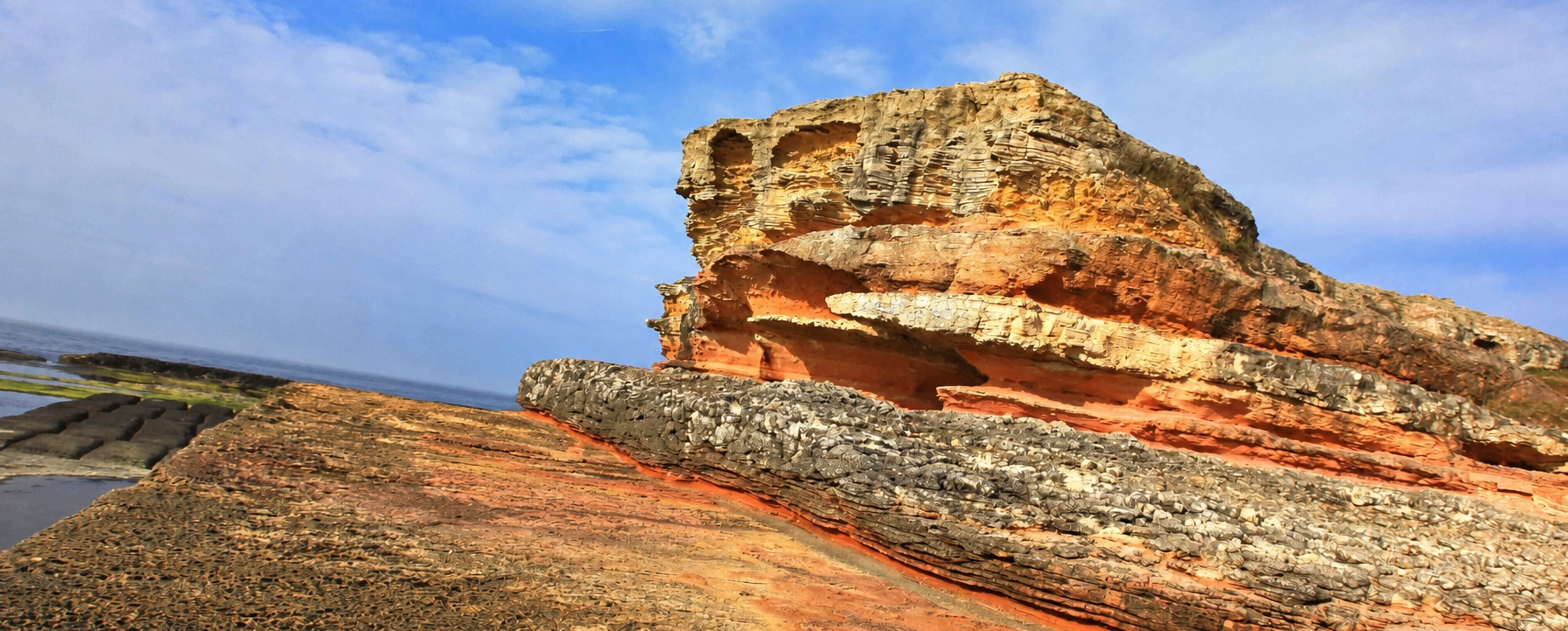
Ask us about including Pembe Kayalar, Kefken, Kerpe, Cebeci and other Kocaeli highlights inside a privately designed Turkey journey.
Request a Custom RouteWe can combine Kocaeli's Black Sea coast with Istanbul, Cappadocia and destinations throughout Türkiye.
Build a private coastal day around Pembe Kayalar, Kefken, Cebeci, Kerpe and the quieter landscapes of Kandıra.
Plan Your Journey
Discover the Gulf of İzmit, Kandıra coast, Kartepe, historic sites, nature attractions and regional food traditions.
Explore Kocaeli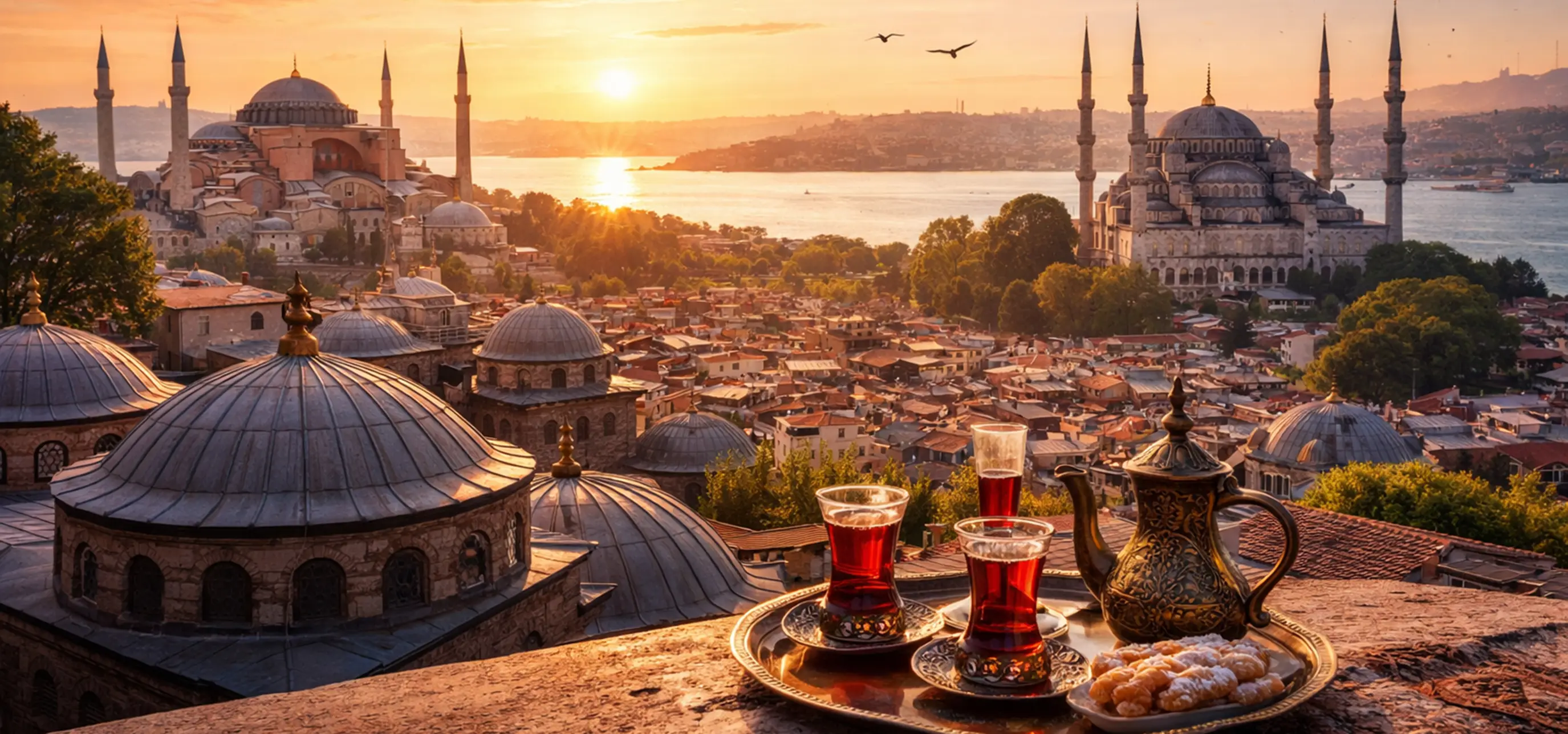
Continue throughout Türkiye with archaeological sites, historic cities, coastal landscapes, food traditions and cultural heritage.
Explore Türkiye