Private Gökçeler Canyon and İncirliin Cave Programme
Tell us your dates, group size and interests. We will check access and plan a sensible route.
Request Your Private Programme





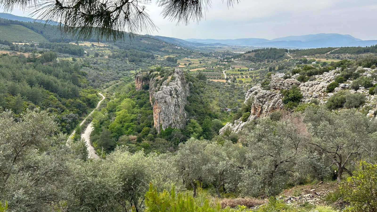
Gökçeler Canyon, also called Uyku Vadisi in local travel material, is a green inland landscape southwest of Milas. Its stream corridor, old trees and rocky slopes offer a very different experience from the coastal resort towns.
İncirliin Cave lies on the northern side of Manastır Mountain overlooking the canyon. The provincial culture directorate describes a cave about 345 metres long, of which a shorter section was developed for tourism.
The canyon and cave should not be treated as a single unrestricted hiking circuit. Cave entry, path conditions, water levels and conservation arrangements require separate checks before travel.
A key part of the visit: Look for changes in the cave walls and dripstone forms where entry is authorized.
A key part of the visit: The watercourse gives the canyon its green character.
A key part of the visit: The remains of old milling activity link the canyon to the working countryside, not only to recreation.
A key part of the visit: Olive, walnut, fig, plane and Mediterranean scrub are described in local environmental accounts.
Essential orientation for an informed visit.
Gökçeler, Milas
Canyon and show-cave environment
Natural karst landscape with archaeological traces
Milas countryside
Several hours; longer for permitted walks
Confirm current opening and permitted routes before travelling
Gökçeler Canyon and İncirliin Cave deserves attention because it makes a particular chapter of Milas countryside tangible. Its canyon and show-cave environment cannot be separated from the routes, communities and environment around it.
The most revealing features are i̇ncirliin cave formations and historic mill landscape. Together they connect the physical setting with the wider historical and cultural narrative, helping visitors understand more than a single famous viewpoint.
For a useful visit, begin with the location and its wider context, then look carefully at the surviving evidence. The strongest interpretation distinguishes what can be seen today from traditions or reconstructions that cannot be independently verified.
The canyon follows the course of Değirmen Deresi, also called Hamzabey Çayı. Local accounts preserve the memory of numerous flour mills along the stream, with some surviving remains.
The provincial directorate notes archaeological traces in the canyon and identifies several caves in the surrounding slopes. İncirliin and Çatal are among the better-known examples, but scientific study and tourism access are not the same thing.
Karst processes slowly shaped the underground chambers and formations. The cave’s geological story is best appreciated by observing the rock rather than touching formations that took immense periods to develop.
The location around Gökçeler, Milas shapes the experience of Gökçeler Canyon and İncirliin Cave. Pay attention to mixed woodland and maquis as a way to understand the surroundings, rather than separating the attraction from its environment.
The broader Milas countryside landscape provides clues to access, settlement and the ways people used the area. Consider the relationship between slopes, water, roads and the surrounding communities rather than viewing any one structure or feature in isolation.
Changing weather, vegetation and modern development can affect what is visible. Where a site has archaeological or environmental protections, use authorised viewpoints and avoid disturbing the surroundings.
Look for changes in the cave walls and dripstone forms where entry is authorized. Lighting and safe routes may be limited to a designated section.
The detail called i̇ncirliin cave formations is a useful starting point for interpreting Gökçeler Canyon and İncirliin Cave. Consider how it relates to değirmen deresi stream and what can actually be inferred from the evidence, rather than treating a picturesque view as a complete explanation.
For i̇ncirliin cave formations, observe details from a respectful distance and check current conditions. The feature may be fragile, privately used or seasonally inaccessible, and photographs do not establish a right of entry.
The watercourse gives the canyon its green character. Flow and safe crossings vary by season and recent rainfall.
The detail called değirmen deresi stream is a useful starting point for interpreting Gökçeler Canyon and İncirliin Cave. Consider how it relates to historic mill landscape and what can actually be inferred from the evidence, rather than treating a picturesque view as a complete explanation.
For değirmen deresi stream, observe details from a respectful distance and check current conditions. The feature may be fragile, privately used or seasonally inaccessible, and photographs do not establish a right of entry.
The remains of old milling activity link the canyon to the working countryside, not only to recreation.
The detail called historic mill landscape is a useful starting point for interpreting Gökçeler Canyon and İncirliin Cave. Consider how it relates to mixed woodland and maquis and what can actually be inferred from the evidence, rather than treating a picturesque view as a complete explanation.
For historic mill landscape, observe details from a respectful distance and check current conditions. The feature may be fragile, privately used or seasonally inaccessible, and photographs do not establish a right of entry.
Olive, walnut, fig, plane and Mediterranean scrub are described in local environmental accounts. Stay on established tracks to limit disturbance.
The detail called mixed woodland and maquis is a useful starting point for interpreting Gökçeler Canyon and İncirliin Cave. Consider how it relates to i̇ncirliin cave formations and what can actually be inferred from the evidence, rather than treating a picturesque view as a complete explanation.
For mixed woodland and maquis, observe details from a respectful distance and check current conditions. The feature may be fragile, privately used or seasonally inaccessible, and photographs do not establish a right of entry.
The story of Gökçeler Canyon and İncirliin Cave intersects with the cultural geography of Milas countryside. Its characteristic features, especially değirmen deresi stream, help explain how this part of the province developed and how people adapted to its conditions.
Muğla contains a dense mixture of Carian cities, Byzantine heritage, Ottoman townscapes and working villages. Gökçeler Canyon and İncirliin Cave adds its own perspective to this regional history and makes a worthwhile contrast with more familiar beach destinations.
A good itinerary connects nearby sites by geography and theme rather than simply combining the maximum number of stops. Time spent understanding one place is often more rewarding than collecting several rushed photographs.
Interpretation is strongest when observation is tied to evidence. At Gökçeler Canyon and İncirliin Cave, compare i̇ncirliin cave formations with historic mill landscape, noting both the differences and any practical relationship between them.
Start with the most clearly identifiable feature, i̇ncirliin cave formations, and ask how it relates to değirmen deresi stream. A good guide can explain the limits of what survives as well as the historical context.
Use inscriptions, official interpretation boards and museum collections where available. Be cautious with confident claims about unlabelled stones, uncertain dates or legendary founders; not every appealing story is an archaeological fact.
On site, give this feature time and context: Look for changes in the cave walls and dripstone forms where entry is authorized. Lighting and safe routes may be limited to a designated section. Where it is not open or visible, ask for an authorised alternative viewpoint.
On site, give this feature time and context: The watercourse gives the canyon its green character. Flow and safe crossings vary by season and recent rainfall. Where it is not open or visible, ask for an authorised alternative viewpoint.
On site, give this feature time and context: The remains of old milling activity link the canyon to the working countryside, not only to recreation. Where it is not open or visible, ask for an authorised alternative viewpoint.
On site, give this feature time and context: Olive, walnut, fig, plane and Mediterranean scrub are described in local environmental accounts. Stay on established tracks to limit disturbance. Where it is not open or visible, ask for an authorised alternative viewpoint.
Visitor arrangements may change because of weather conditions, conservation work, or local restrictions. Check the latest access information before departure, particularly if Gökçeler Canyon and İncirliin Cave are the main purpose of your trip.
Wear sturdy, non-slip footwear and carry drinking water, sun protection, and a light jacket for cooler cave conditions. Some paths may be uneven, slippery, or unsuitable for visitors with limited mobility.
Begin with an orientation to Gökçeler, Milas and identify the legal public approach. Look first for i̇ncirliin cave formations before moving to değirmen deresi stream, provided both can be reached safely and are open to visitors.
Allow time to appreciate historic mill landscape and the surrounding setting. If conditions are poor or access is restricted, shorten the route rather than entering unmarked areas.
Finish with a nearby stop chosen for historical or geographic relevance. A private itinerary can make this easier, but a realistic day still needs breaks and time for the journey between locations.
Spring and autumn often offer comfortable temperatures for exploring inland Muğla. Summer can be very hot, especially on exposed stone and open paths; winter rain may make surfaces slippery.
For photography and comfort, morning or late afternoon light can be pleasant, but these are not guarantees of access. Check seasonal opening policies, daylight hours and local weather before travelling.
Photograph the wider Milas countryside setting as well as individual details. A wide view often explains why a building, settlement or natural feature occupies this particular place.
Close-ups should be made without touching fragile surfaces or entering restricted areas. If residents, worshippers or craftspeople are present, ask permission before taking portraits.
For the hero image of this page, use an original or properly licensed photograph of Gökçeler Canyon and İncirliin Cave; the current HTML contains a placeholder path, not a supplied image file.
Terrain and visitor facilities vary across canyon and show-cave environment locations. Uneven surfaces, steps, slopes, narrow historic streets or the absence of a developed visitor route may affect accessibility.
Anyone with limited mobility should ask the local authority or tour operator about step-free access and practical alternatives before booking. Avoid promising a fully accessible visit without confirmation.
For longer or specialist routes, plan suitable footwear, water, shade breaks and an option to turn back safely.
Gökçeler Canyon and İncirliin Cave is associated with Gökçeler, Milas. Use an up-to-date map and confirm the actual public entrance or meeting point; a generic place pin may not mark a safe approach.
For dispersed archaeological remains or rural locations, private transport and a locally knowledgeable guide may be more practical than assuming frequent public transport. Do not rely on unverified driving times.
If combining several sites, group them by region and allow extra time for narrow roads, parking, walking and seasonal traffic.
Discover the traditional villages of Çomakdağ, celebrated for their distinctive architecture, local customs, and cultural heritage.
Explore the historic streets of Milas, including its traditional bazaar and the remarkable Baltalı Gate.
Visit the ancient city of Euromos and admire its remarkably preserved Temple of Zeus, one of the region's archaeological highlights.
Plan your journey through Milas with our guide to its ancient sites, historic neighborhoods, traditional villages, and local cuisine.
Gökçeler Canyon and İncirliin Cave is in Gökçeler, Milas, in Muğla Province, southwestern Türkiye.
It offers a chance to explore canyon and show-cave environment in the setting of Milas countryside. The most useful details to notice are i̇ncirliin cave formations and değirmen deresi stream.
The key historical context is natural karst landscape with archaeological traces. The area may also contain remains or traditions from other periods, which should be distinguished carefully.
A sensible initial allowance is several hours; longer for permitted walks. Exact time depends on access, walking conditions and how deeply you want to explore.
That depends on current access and the terrain. A knowledgeable local guide is particularly helpful where remains are dispersed, signage is limited or conservation rules apply.
Do not rely on a generic schedule or an old ticket price. Confirm current opening, any admission charge and permitted visitor areas with the responsible authority shortly before travelling.
Yes. The wider Milas countryside area has related cultural and natural attractions, but routes should allow realistic driving and walking time.
Respect barriers, conservation areas and any directions given by site staff.
Never enter closed cave branches or attempt water crossings after heavy rain; caves and stream gorges can become hazardous quickly.
Keep private entrances clear, ask before photographing people and support local businesses fairly.
Take away rubbish and avoid disturbing wildlife, vegetation, rock surfaces or historic material.
Ask Wow Cappadocia / Venere Travel to design a private, tailor-made route with a licensed guide and suitable vehicle, subject to confirmed access, with no compulsory shopping stops.
Combine archaeology, village culture and natural landscapes at your preferred pace.
Tell us your dates, group size and interests. We will check access and plan a sensible route.
Request Your Private Programme
Continue your journey with a related historical or natural destination.
Read the Nearby Guide